
M birthday was last week and I spent the day with my son exploring some of the El Dorado National Forest.
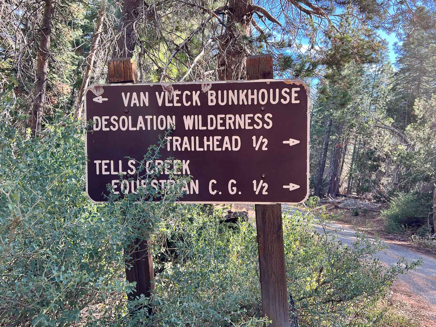
Matt drove and I wasn’t looking at a map so all I know is that we headed up Ice House Road and went beyond some of the other areas we have hiked in the past. The first stop was to look at the Van Vleck Bunkhouse, built in 1957, and now rented by recreational users from the Forest Service.

I had no idea that the Forest Service was in the vacation rental business. This might be a fun place to stay with a group of people. It sleeps six, has propane for cooking, but no electricity, and has running water during the summer.
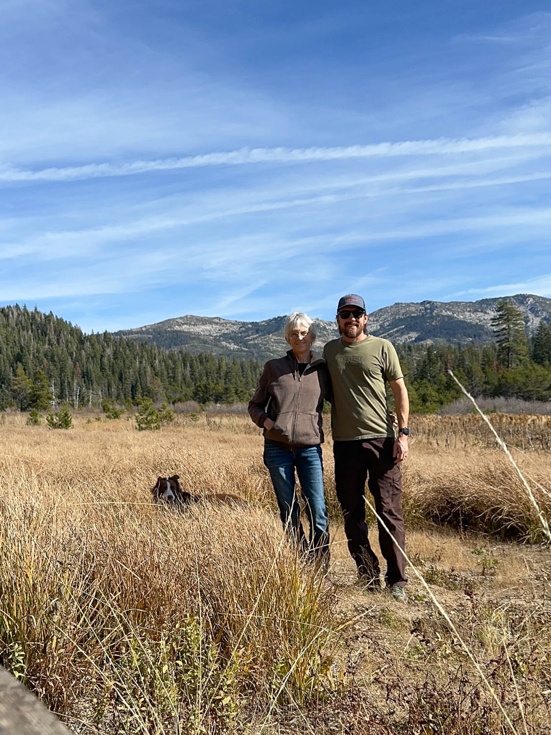
This is the meadow south of the bunkhouse with Desolation Wilderness in the background.
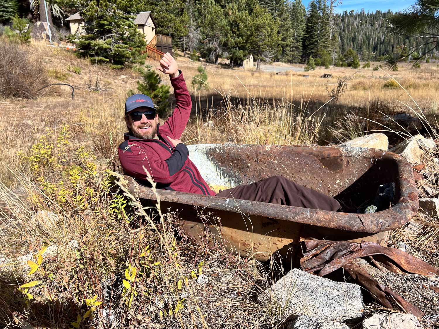
Matt didn’t care that there was no water. He tried out the bathtub at the edge of the meadow.

This is more of what was the meadow. Matt said that several years ago they did a prescribed burn here to maintain the meadow, but trees are encroaching again.

After leaving the meadow we drove further and then followed GPS coordinates to find the site of a plane crash in 1941. The info at that link tells of the air force pilot and crew that were flying a B-17, known as the Flying Fortress, from Salt Lake City to Sacramento. Due to weather and mechanical issues it went down on November 2, 1941. The pilot had ordered the passengers to put on parachutes. They all made it out but the pilot did not and two days later the crash site was discovered. We were here exactly 83 years later.
There is a trail of sorts to the site, but you’d still have to know where you’re going to find it.

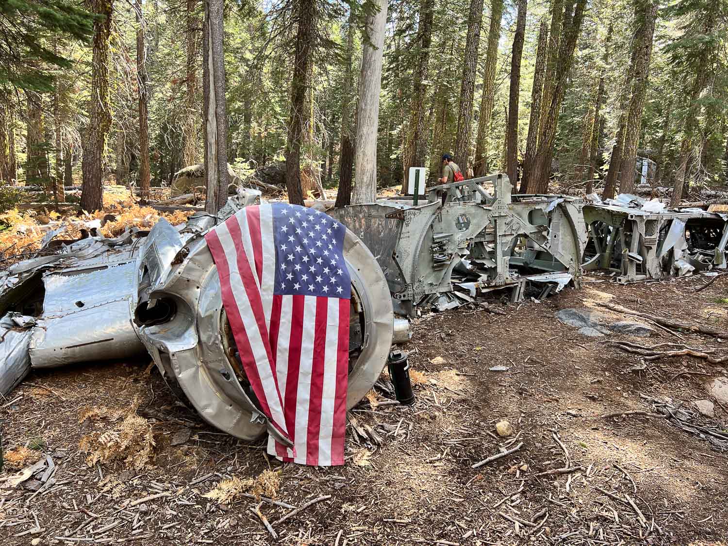
The wing stretches off to the right. The other wing is at a different location.

This is what the remaining wing looks like.


Matt had the coordinates of other parts including the wing, and we walked farther to find the site, but didn’t see it before we turned back.

As we walked back down the trail I turned and could see the plane from an angle where I hadn’t noticed it before.

There were several downed trees in the area. I was surprised to see so many down with the roots pulled out of the ground. I suppose the severe storms last winter were to blame. The root structure of this one is massive.
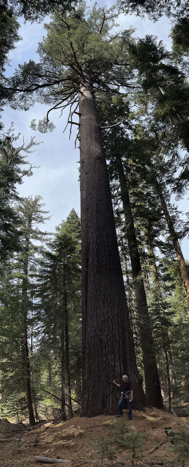
Check out the size of this tree.
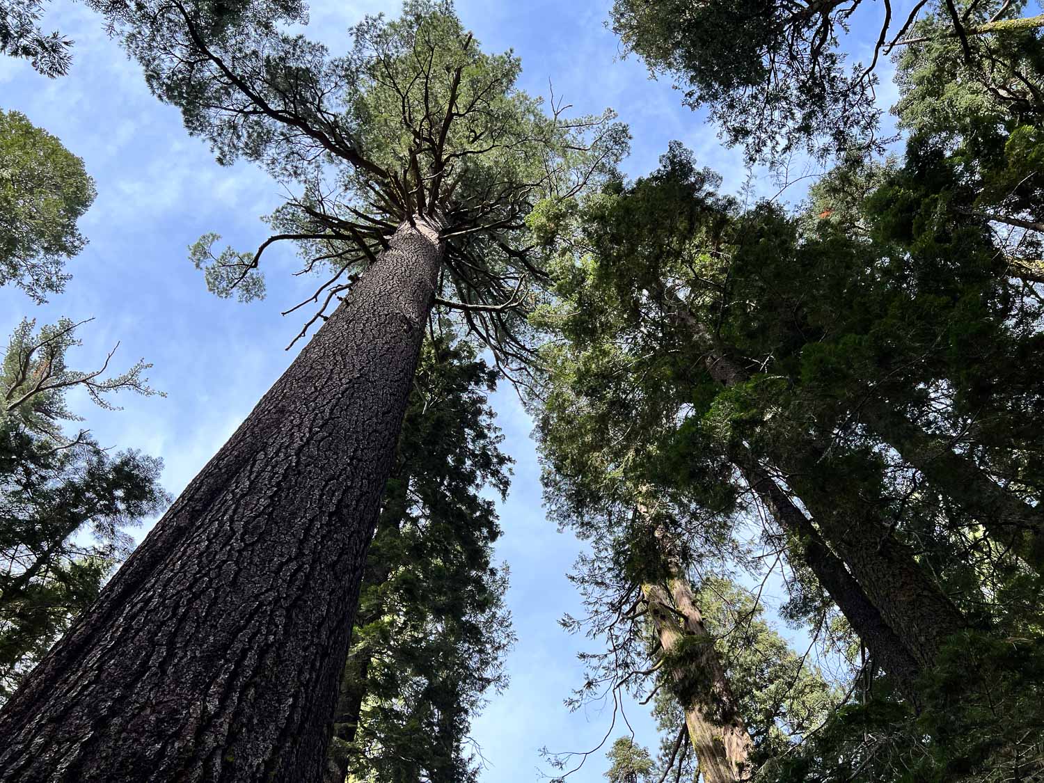
This was my view.

There were some big mushrooms too. You can’t tell from the photo but that one is bigger than my hand.

We drove back towards Matt’s house, but first turned up the road to Big Hill, the heliport where Matt used to work. This is the view of where we had been earlier with Desolation in the background.
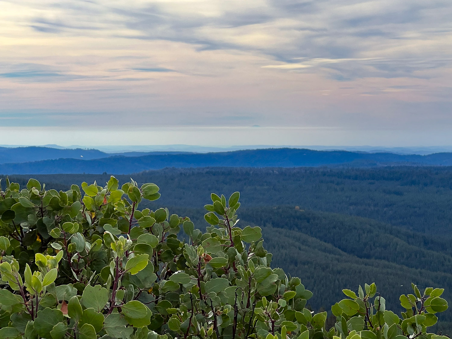
View to the west. I wish I could make an arrow on this photo. I’d point it to the mountain top that is Mt. Diablo, the mountain that I see due south when I walk Across the Road at my house. There is a strip of white above the mountains, below the blue-turning-pink part. Do you see a small dark bump just above that white strip, just to the right of center? That is the tip of Mt. Diablo. I think it’s interesting to see it from a totally different vantage point.

Great photos! California is so beautiful. Thanks for sharing 🙂
Thank you!