
Day One of our trip to the redwood forest is here. On the second day we drove north to spend time in the redwood parks that are north of Eureka. They are all managed together as part of the Redwood National and State Parks.
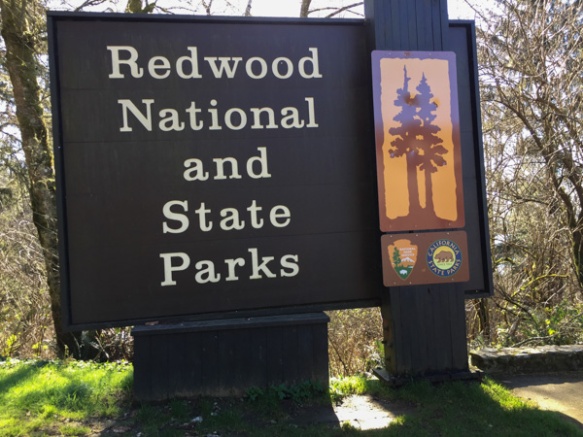 From Wikipedia: “… the four parks, together, protect 45% of all remaining coast redwood (Sequoia sempervirens) old-growth forests, totaling at least 38,982 acres. These trees are the tallest and one of the most massive tree species on Earth.”
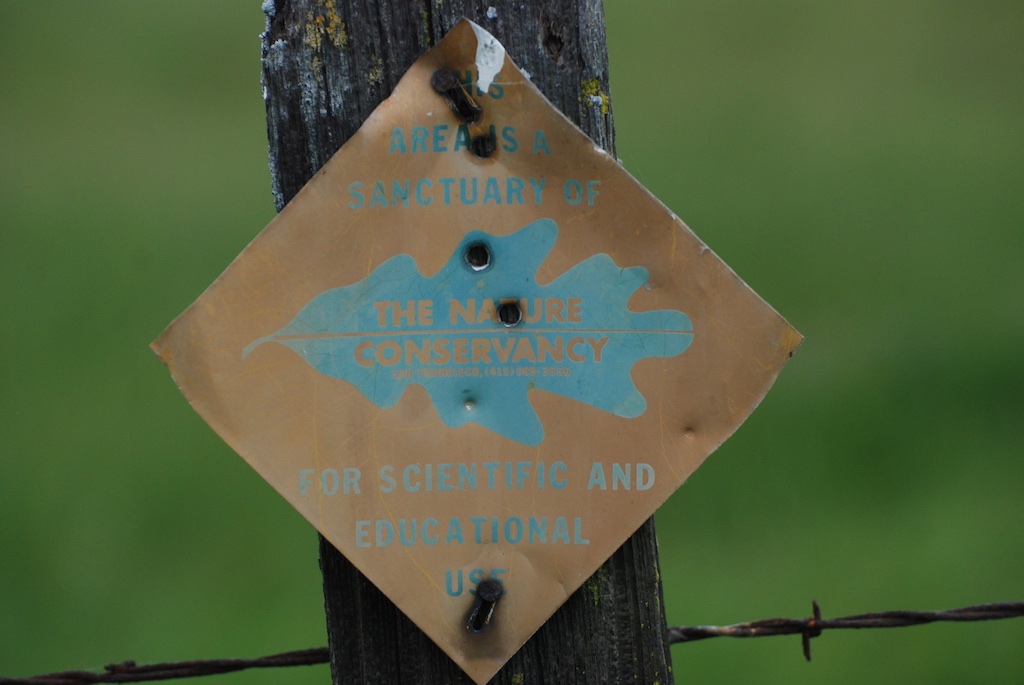
 In 1850 there were 2 million acres of redwood forest along the northern California coast. After years of unrestricted logging the Save-the-Redwood League, created in 1918, was successful in establishing three State Parks in the 1920’s.
 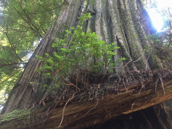 Redwood National Park was created in 1968 after 90% of the original redwood trees were gone. Now the State and Federal agencies cooperatively manage the forests and watersheds as a single unit.
 I’ll mention here that all these photos were taken with my iPhone because the previous night I dropped my camera (on the carpet in the motel) and the lens popped off. I couldn’t get it back on and knew that I wouldn’t be able to get it fixed until after I came back from Texas (where I was headed as soon as we returned from this trip).
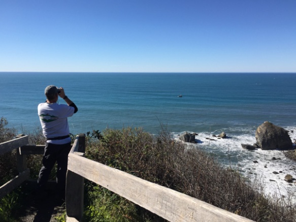 We took a side trip to the spot where the Klamath River flows into the ocean and walked down the steep trail to this overlook. That’s Dan looking across the ocean for Meryl (my DIL who is in Australia right now).
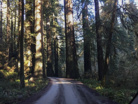 We drove farther north to the Stout Grove in the Jedediah Smith Redwoods State Park.
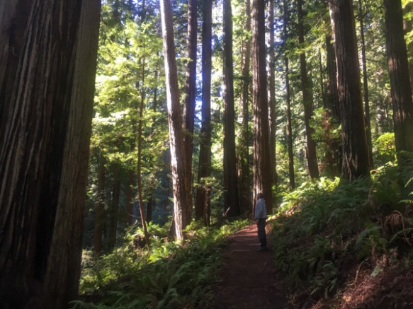
 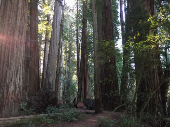 Every time we stopped we continued to be impressed with the grandeur of these trees and the forest.
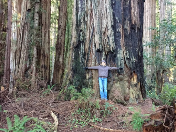
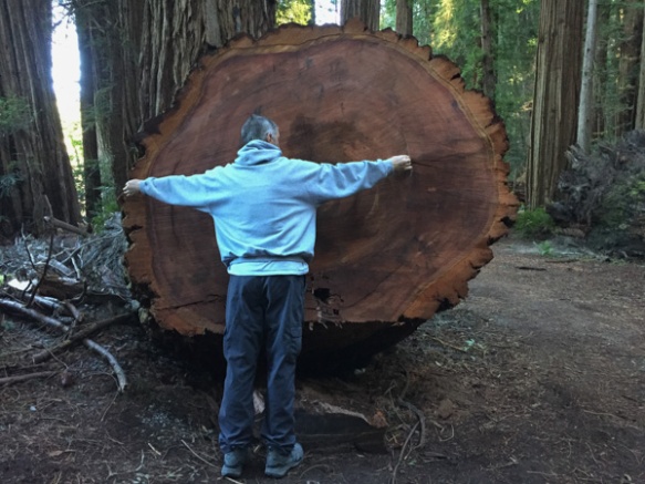 This tree had fallen and then was cut to clear the path.
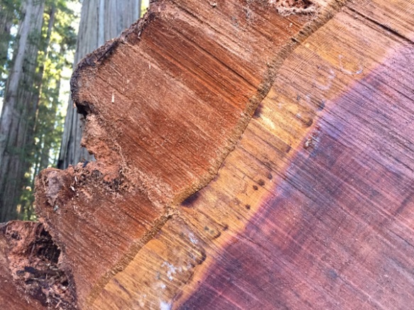 Look at that brilliant color.
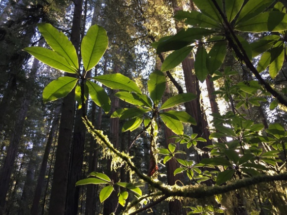
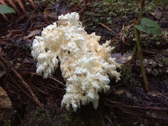 We were surprised that we didn’t see more mushrooms and fungus, but this one did catch my eye. Late in the afternoon we headed toward the coast at Crescent City.
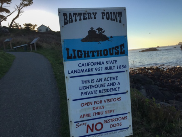 Our map book showed two lighthouses so we started with Point St. George. We found that lighthouse (manned from 1891 to 1975 and abandoned in 1995) but it was 6 miles offshore. The Battery Point Lighthouse is accessible at low tide so we were able to walk to it, but we were too late for a tour.
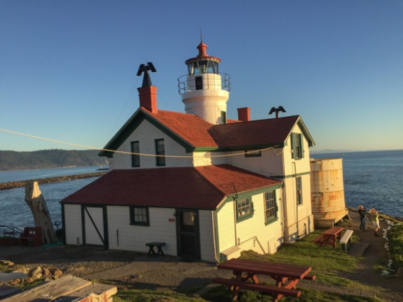
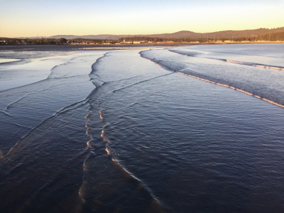 We walked along the breakwater (seen in the lighthouse photo) and then out on a pier. This is a view looking back toward Crescent City.
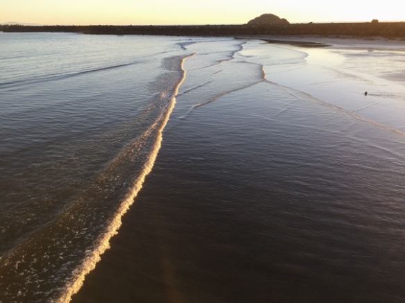 This is the view looking back toward the breakwater and the setting sun.
We headed home the next morning because I was leaving early the following day for Texas. This was a short trip (time-wise), but well worth it.
 Mini Road Trip!
 From the Central Valley you need to drive through the hills to the west. We turned onto Highway 20 at Williams. You can see a slight tinge of green if you look hard but this time of year they should be emerald green. That green is the grass that began to grow after our early January rain. We have had negligible rainfall since and there has been no more growth. This is the time of year that ranchers in the non-irrigated hills count on abundant forage for livestock. Very scary to think of another year of drought to this degree.
 This is a view getting closer to the hills. The almond trees are beautiful this time of year but I am disturbed at how many acres of land all over California have been put into almonds now. That’s a story for another time however. It seems I didn’t take more photos until we got to our first stop.
 From the Humboldt Redwoods State Park website: “In the early 1900s, loggers came to what is now Humboldt Redwoods State Park to cut down lofty ancient redwoods for grape stakes and shingles. The founders of Save the Redwoods League thought that was akin to ‘chopping up a grandfather clock for kindling.’ From the acquisition of a single grove in 1921, the League has raised millions of dollars to build and expand this park. Today Humboldt Redwoods spans 53,000 acres, an area almost twice the size of San Francisco. About one third, or 17,000 acres, of the park is old-growth redwood forest—the largest expanse of ancient redwoods left on the planet.”
 What is special about an old-growth forest?
 The size of the trees.
 The mix of tree sizes. Unlike a reforested clear cut, there are trees of all ages and sizes and this makes for an open forest instead of a monoculture of trees and brush that you can hardly walk through.
 The ecology. When old trees fall they open up space for light to reach the forest floor and opportunity for new growth of other species.
 The grandeur.

 We ended the day at the beach.
 The Robert Louis Stevenson State Park to the north of the highway is closed but the Table Rock trail is south of the highway.
 The trail starts out in groves of oak, madrone, and bay trees. This area was damp from recent rain and the trees looked as though they were covered with green fur.
 A new kind of
  Making things larger than life through the lens.
 As the trail descended the other side of the first ridge the vegetation seemed more typical of California chaparral. These are the seeds of the California Buckeye.
 The California buckeye is one of the first deciduous trees to leaf out in the spring, but it also goes dormant and loses it’s leaves in late summer. Although the “nuts” may seem similar to chestnuts, these are toxic.
 The trail leads to the western end of a formation called the Palisades, volcanic rock that towers over the northern end of the Napa Valley.
 That is the town of Calistoga down below.
  We sat on the rocks known as Table Rock for quite awhile, soaking up the sun and watching birds and the beautiful sky. The fire missed this area, but not Mt. St. Helena in the background and the lower area along the highway.
 As we sat on the rocks Dan noticed a Cal Fire plane flying around Mt. St. Helena and then saw it drop something–we wonder of that is seed to help stabilize the burned landscape.
 Mustard blooming.
 Mistletoe berries.
 Almonds just about ready to bloom.
 Looking west.
 Taken earlier in the day. One of our two almond trees is in full bloom and full of bees.
 January 22, 2015.
  February 5.
 February. Almonds are blooming.
 April 26, 2015. The field has been bedded, ready for tomatoes.
 May 3, 2015
 June 9, 2015
 July 22, 2015
 August 9, 2015
 August 30, 2015
 This is a photo taken across the road, from Across the Road. (That is my pasture looking west.)
 The alfalfa field that is the green triangle in the upper right in the aerial photo.
 Beans that were planted after the wheat harvest in the are shown in the triangle that is the upper center of the aerial photo.
 September 5, 2015.
 September 9, 2015. It took 4 days, working 24 hours/day to finish harvesting this field.
 September 23, 2015. Back to the beans. The dry plants have been put into windrows waiting for harvest.
 September 27, 2015.
 October 6, 2015. Field disked and bedded waiting for the next planting. I’m told that it will be planted to sunflowers this spring.
 November 29, 2015. If we have regular rain I can’t walk across here because it gets too muddy. There have been very few days that we haven’t been able to walk.
  December 1, 2015. View of our place, looking west across the field. We need to see more green on those hills.
 Beverly, who owns Jitterbug Rugs Studio (motto: Life’s Short – Cut a Rug!) is a pro.
 I spent two nights at Bonnie’s and Richard’s wonderful house about 7 miles north of Cedarville. This was the view from my window in the morning and I had to quickly get out with my camera.
 The sun rose over the Hays Mountains that are in Nevada.


 After stowing our gear we set off north to see what the town of Kelso looked like. Have you ever seen a sign with a flashing light that cautions you to watch for tortoises? I never had and I wish I had stopped for a photo. It was one of those things that I thought I’d do on the way back but we ended up making a loop through the preserve.


 This is Jenkinson Lake. There camping areas all around it and lots of people on this Memorial Day weekend. I had Ginny on the leash and she had a lot of lessons in good behavior when meeting kids, bikes, etc. Matt had told me that it was about 10 miles from their house, around the lake, and back. When I was standing here I though that maybe I’d do that instead of just an out-and-back walk. I would continue to the left in this photo, go around the dam in the center of the photo and back to their place.
 After walking some more I came to this part of the lake and decided that maybe an around-the-lake walk wasn’t going to work for today. This is a finger of the lake that juts back up the valley and I would have to walk all the way around this part and the main part of the lake in the other photo. So I went a little further up the west side here and then turned around but took a higher trail back that avoided some of the crowds that were nearer the lake.
 This is Ginny sitting on the dock. She didn’t seem to care that the ground under her was rocking.
 That low growing shrub is mountain misery and here are some close-ups.
 Mountain misery is unique to the western slope of the Sierras and there is a lot of it. It has a pungent oily sap and can play a role in preventing erosion to hillsides in the years following major fires. On the other hand those same deep far-reaching roots use up a lot of moisture and may prevent other plants from becoming established.
  I don’t live in the mountains so don’t deal with it as a “weed” and I like the fragrance–it reminds me of the forest after a rain.
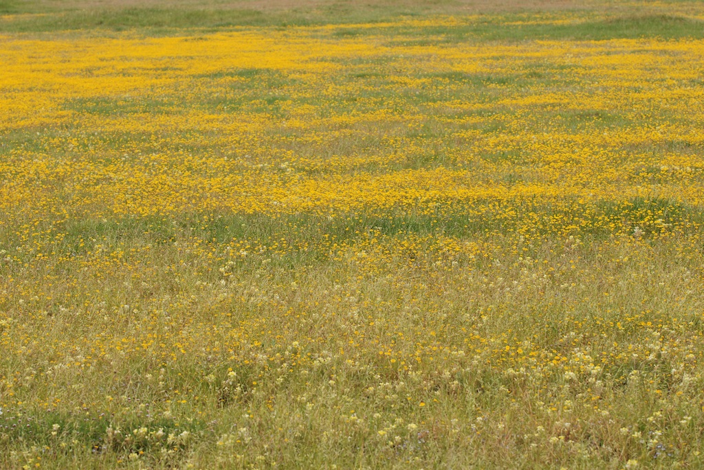
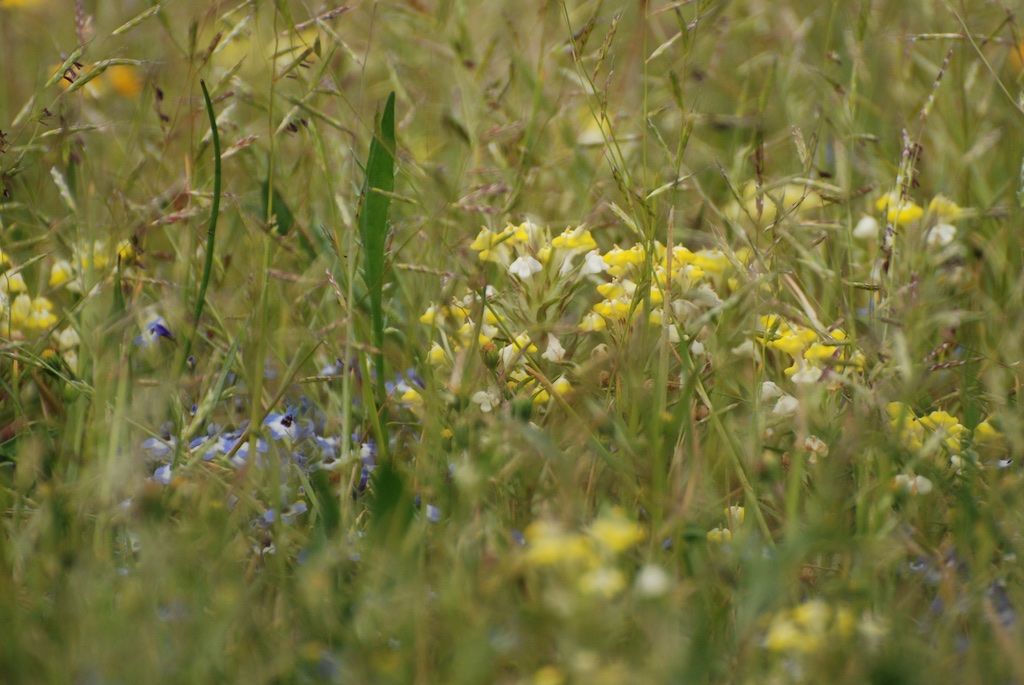
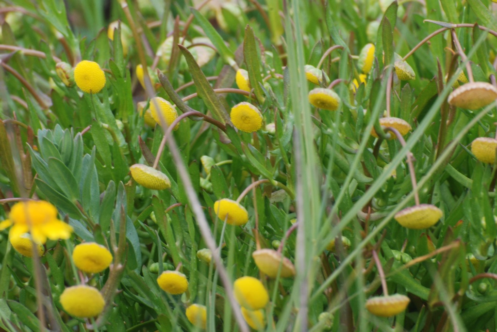
 I came across a small area of striking yellow on a south facing slope. I didn’t identify these flowers but in their midst I found some…
 …monkey flowers. At least I’m pretty sure they are Mimulus but I don’t know which species.What I noticed first about them were the seed pods.
 What I noticed first about them were the seed pods.


 Don’t tell Rusty and Maggie where we were. I feel guilty leaving them home. This was fun for Ginny and me and Ginny got about 6 miles of on-leash work on manners.


 …but looked them up and found that “coots have strong legs and can walk and run vigorously. They tend to have short, rounded wings and are weak fliers”
 This bird is an avocet. I will admit that although I know the Canada goose, I didn’t know the other birds. I ran into a docent in the preserve and asked him. Maybe I’ll remember these two.