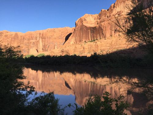
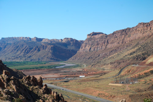
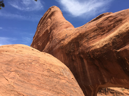
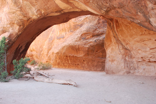
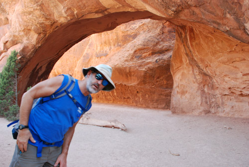
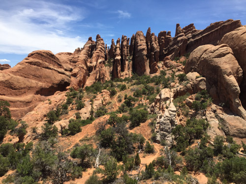
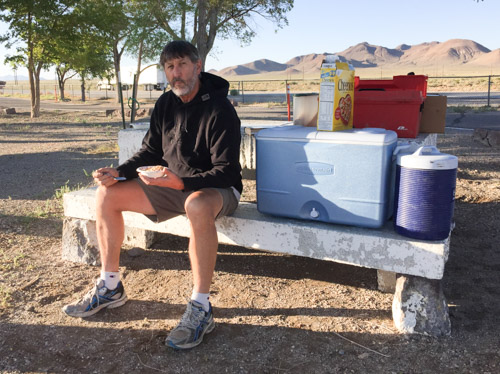
I’m finally back to my photos of our Road Trip. I left off at the blog post about hiking in Arches National Park on our third day out. After a full day of hiking we headed northwest from Moab on Highway 128 that follows the Colorado River. Just after dark we found the Lower Onion Campsite just above the river. We enjoyed the mosquito-less evening while eating a hasty meal of beans and salad and went to bed planning on an early start the next day.

Here is a view of our camping spot in the morning…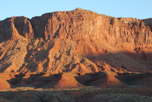
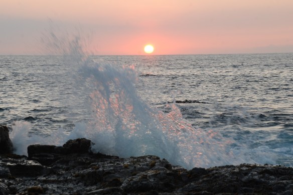
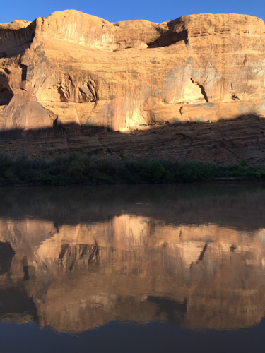
…and the cliffs beyond the river as the sun came up.

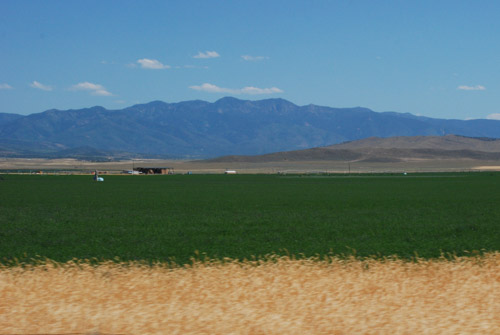
The red rock landscape of Moab changed to more typical desert as we headed north to I-70. We spotted our first prairie dogs along this stretch of road…

…followed by pronghorn. Not a desolate road at all if you pay attention.

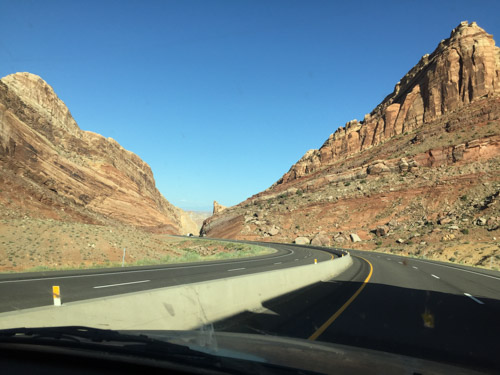
Our goal was to get to Leadville, CO by noon to meet up with Dan’s sister, brother, and their spouses, so we didn’t stop much along the way, but I took photos from the truck. I marveled at the engineering of this stretch of highway between Glenwood Springs and Vail.

The eastbound lanes are just above the Colorado River and the westbound lanes are elevated to fit within the canyon walls, sometimes overlapping the lower eastbound roadway. There is also a paved bike/running path right at the river’s edge. 
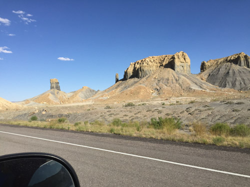
At this point the highway is at about 8000′ elevation. We turned south on Highway 24 that would take us to Leadville at over 10,000′. As we climbed into the mountains we had to stop at top of one of the switchbacks to take a look.

Farther up we came to the Camp Hale Memorial. This meadow is the site of a U.S. Army training facility built in the 1942 and decommissioned in 1945. According to Wikipedia “Soldiers were trained in mountain climbing, Alpine and Nordic skiing, cold-weather survival as well as various weapons and ordnance. When it was in full operation, approximately 15,000 soldiers were housed there.”
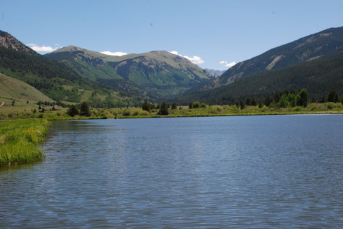
This is a view from that meadow looking east up the canyon to Sheep Mountain.
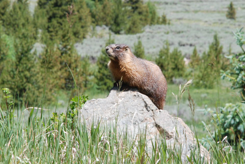
A marmot posed for me while reading the roadside memorial signs…
…and this bee flew into this columbine just as I was taking a photo.
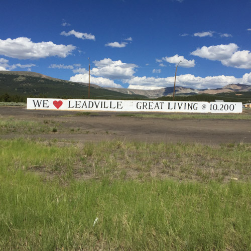
Entering Leadville.

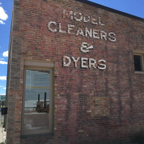
We wandered around the downtown for awhile…
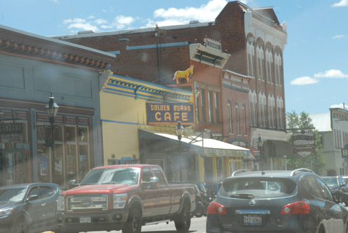
…and then met Sally and John for lunch at the Golden Burro Cafe.
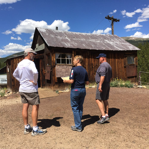
After lunch we took a self-guided tour of the Matchless Mine. “The Mathcless Mine, a historic silver mine purchased in 1879 by H.A.W. Tabor, was estimated to have produced 7.5 million dollars during its peak operating years. Once fabulously wealthy, the silver market crash of 1893 devastated the Matchless Mine and the Tabor Family. Upon Tabor’s death his widow, Elizabeth “Baby Doe” Tabor, returned to the Matchless where she remained in isolation for until her death in March of 1935.” This is the cabin where “Baby Doe” lived until her death.
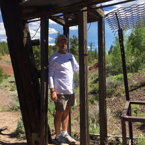
Dan is standing in the phone-booth size structure that would lower miners hundreds of feet below ground. We watched a video that shows a 3-D image all the tunnels and shafts below us. I don’t remember the stats but the distances are staggering to think about.
After the mine tour we met up with Rob (Dan’s brother) and Renee and we all went to the Leadville Cemetery.

My father-in-law’s grandparents are buried here and following his death just this spring, this was an meaningful stop for the family. We spent some time here before returning to our motel, eating pizza, and making plans for the early morning start of the Leadville 50–an ultra run that Rob was had entered.

This was our one “civilized night” and I spent a little time trying to catch up with e-mail and thinking that I’d start my blog posts. Nope. We were tired and I wasn’t motivated enough to interrupt the vacation!


 View to the southeast with early morning sun.
 View to the northwest.
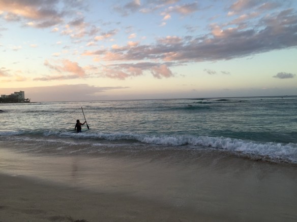 Not too many people in the water yet…
 …but there were people on the beach…
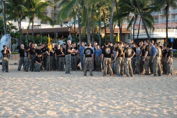 …working out…
 …and getting ready for business.
 The beaches are protected (created?) by rock walls built out into the ocean. When walking along one I realized that it was like looking down into an aquarium tank. There were fish everywhere. I took lots of photos but in most the wave action obscures the fish. There are a few that aren’t bad for my first time trying to photograph fish. The only ones that I later identified are these needlefish.
 I wish that I’d had my new GoPro with me and a long stick to reach into the water.
 I sort of like this photo because the ships looks pixelated, but it’s just the containers.
 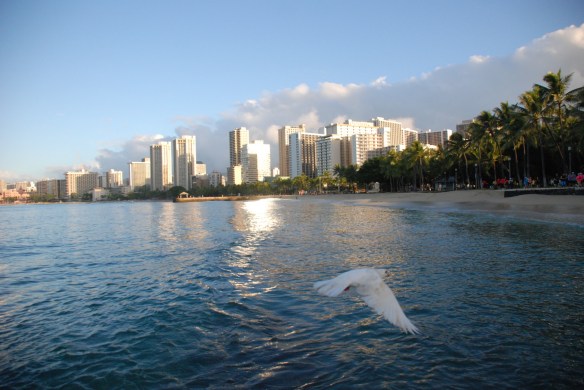 Still on the wall, the sun was getting higher.
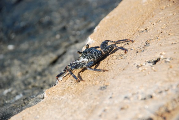

 Here is an activity of which I was unaware–feeding bread to fish –these tourists brought an entire loaf and threw crumbs into the water.
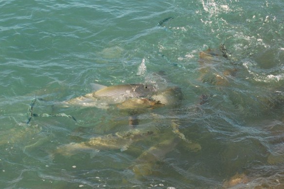 It’s a great way to bring fish (and pigeons) to you, but I can’t imagine that it is an approved method of watching wildlife. I was seeing plenty of fish without bribing them.
 As the sunlight hit the water the fish were easier to photograph…
 …especially these almost luminescent needlefish.
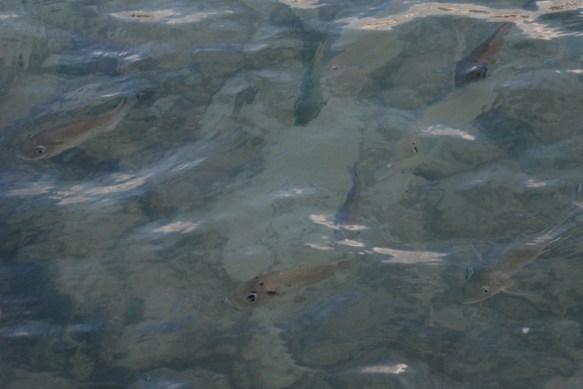
 As I walked back to the hotel, the beach was waking up.
 Many more people out and about.
 By the way, this was not my hotel. Mine was a few block off the beach in the low(er) rent district.
 Unfortunately this is a blurry photo but I like the image. I sat in the row in front of Kirby on this short flight. We picked up a rental car (had to upgrade to carry all of Kirby’s luggage) and drove to Pearl Harbor.
 The monument includes several memorials and museums and it would be easy to spend a full day immersed in this history …but not with a toddler on board. We chose to tour the U.S.S. Missouri while waiting for our assigned time to see the U.S.S. Arizona Memorial. (Unfortunately all boat rides to the Arizona were cancelled due to windy conditions.)
 The USS Missouri was the last battleship built by the U.S. and was the site of the Japanese surrender, ending WWII. The ship also served in the Korean War and, after being modernized in 1984, in Desert Storm.
 The Missouri is now a permanent museum in Pearl Harbor.
 There were a couple of photo opps before entering the ship.
 A lot of the ship is accessible and there is a wealth of information covering the three eras when the ship was in use. It would be easy to spend several hours taking time to absorb everything. I have included just a few photos here.
 There is a display about the Japanese pilots who died in kamikaze attacks near the end of WWII. It is a moving exhibit but I don’t understand what can drive a young man to this end during that era any better than today’s suicide attackers (although I thing there is probably a world of difference in their reasoning).
  So sad…as are all parts of war.

 The living spaces for 1600 enlisted men were spread throughout the ship.
 Part of the modernization in the 1980’s.
 Back on the main deck we looked up and saw…
 Katie, Kurtis, and Kirby.
 A disappointment was not being able to go to the U.S.S. Arizona Memorial. This memorial is directly above the Arizona that still holds many of the 1177 men who were killed during the bombing that sunk the ship.
  During the day my thoughts kept going back to the National Museum of the Pacific War, the moving exhibit in Fredericksburg, Texas (birthplace of Admiral Nimitz) that we saw in July (
 Toddlers don’t care about this stuff. Chasing birds and picking up flowers from the lawn are more their style. (If I chose to make this blog more commentary and opinion this would be the point to discuss innocence and when/how does it change.)
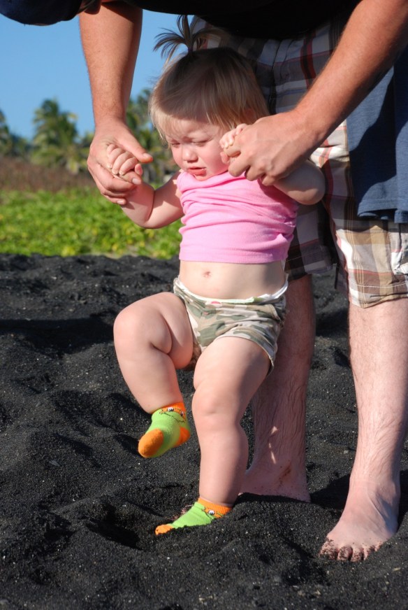 However, that didn’t help Kirby want to step down into beach sand today anymore than the last three days.
  The Punalulu’u Black Sand Beach is well-known to host the endangered Hawaiian Green Sea Turtle.
 We weren’t disappointed.
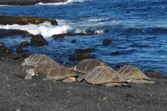 We found several turtles basking in the sand while onlookers watched from outside the stone “corral” that prevented them from coming too close.
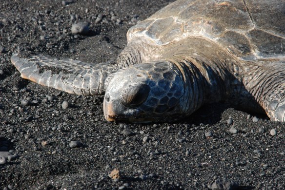 The population of these turtles was in steep decline during the 1970’s due to harvesting of turtles and eggs, but numbers have increased since protection by the Endangered Species Act. The adults weigh 200-500 pounds and they are thought to live 60-70 years.
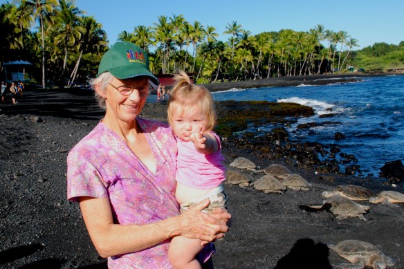 The turtles weren’t moving so I don’t think that Kirby really noticed them.
 Matt found a little more action.
 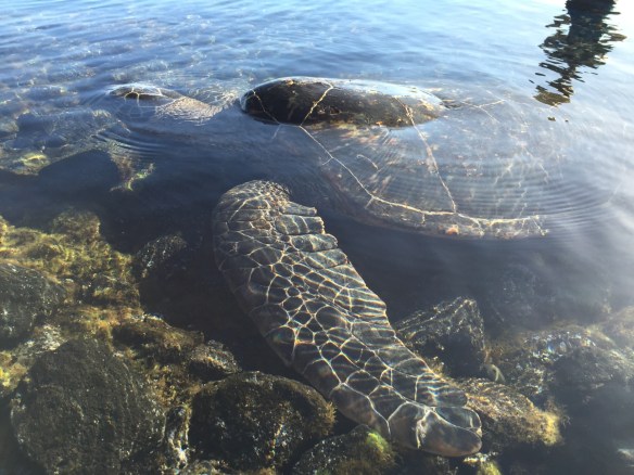 There were a few turtles swimming and eating in this pool.
 I took a video of this one as he (she?) approached me, blowing bubbles.
 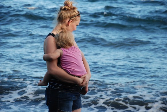 Even if Kirby had been a fan of the beach, she would have probably been too tired to enjoy it here.
  It’s better to be in Mama’s arms…
 …or better yet, sitting on a towel next to Daddy.
 Beautiful water, whether it’s in blue…
 …or shades of gray.


 We spent a little time in the visitor center and museum but mostly drove through the park, getting out to look at points of interest…
 …and take photos…
 …a lot of which, unlike most of my exploring/hiking trips were of family.
  I’m not sure that even amazing, steaming volcanoes can compete with beautiful family pictures…that is, pictures of beautiful family.
 However there were plenty of other arms to hold Kirby on this adventure so I did try to get some photos of our surroundings, especially of the area of rain-forest where we walked.
  While much of the Park is more desert like this part of the trail is through lush rainforest.


 This had already been a long day for Kirby but she did well in her backpack.
 This is on the wall to the entrance to the lava tube.
 Lava tubes are formed as slow moving lava cools to form walls, but the inner hot lava continues to flow.
 Leaving the lava tube.
 Seen in the parking lot. Should I decide to move to Hawaii, do I have a job waiting for me?
 Catching a nap before Part 2 of the Blog.
 While the big kids swam and paddle boarded and snorkeled Kirby and I walked on the beach. Or I should say I walked on the beach and carried Kirby. She still didn’t like the sand or the waves. At one end of the beach we found lounge chairs and buckets. As long as there was no sand she was happy. Another first for me. I went snorkeling with my kids and there is video to prove it somewhere. Very cool.
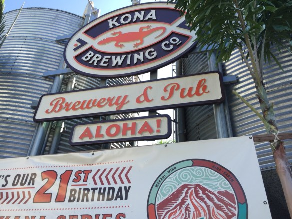 Dan had to get back to work and was leaving this morning so we cut the beach visit short. After he left we drove to Kona and had lunch at the Kona Brewing Company.
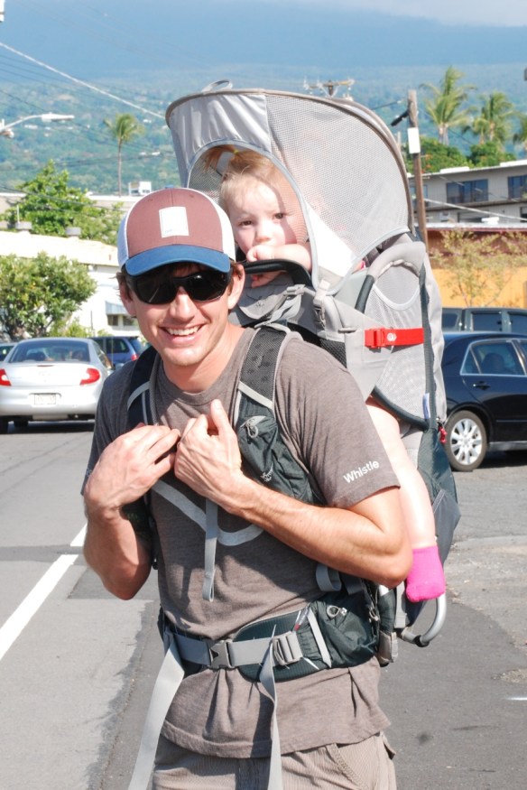 Then we loaded Kirby into her new backpack and went walking around Kona.
  This is the dock overlooking the start area of the Ironman triathlon. My father-in-law (who lives in Hawaii and is why we were all here) has completed the Kona Ironman twice and for many years volunteered here. Chris has plans to someday qualify for entry in Kona.
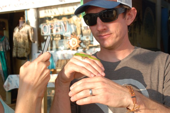 Some of the local wildlife…
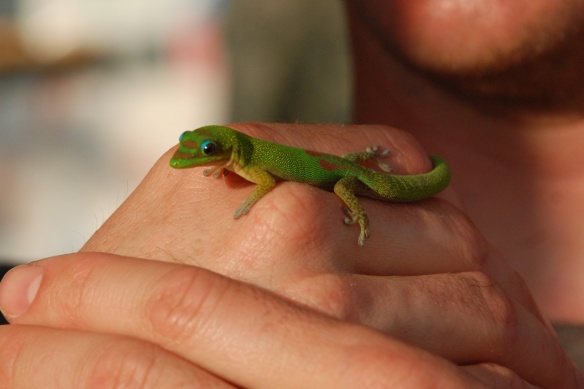
 …and color.
 While the kids were looking in other shops I found a basket weaver and bought a few of his things.
 On the way back to our house we stopped north of Kona to catch the sunset.