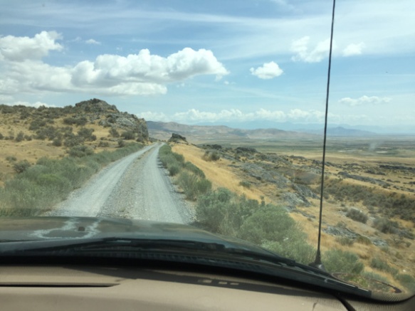
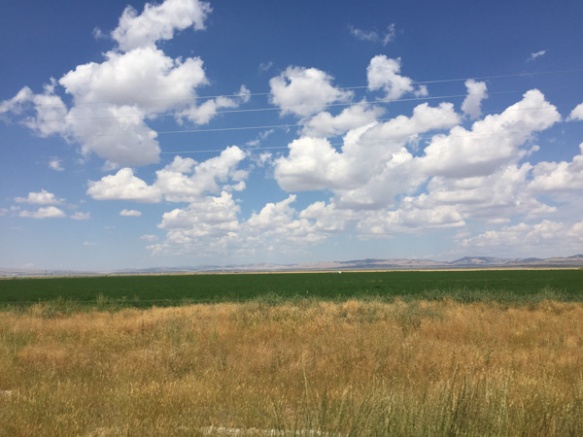
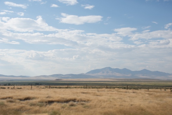
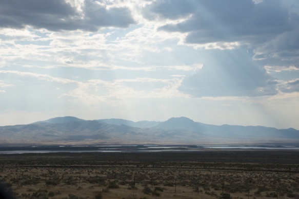
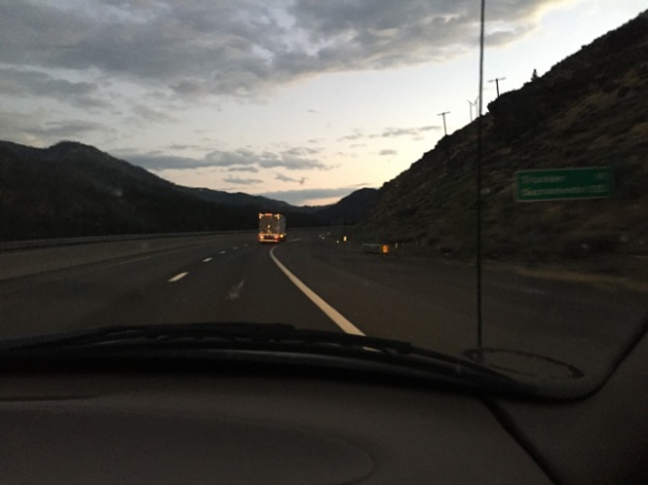
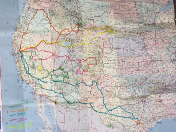
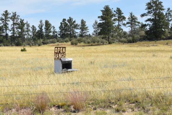
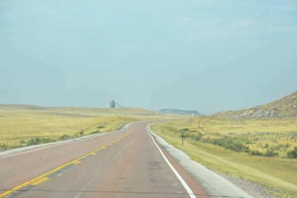
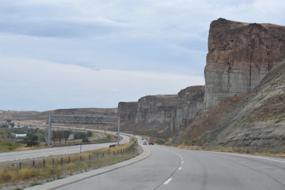
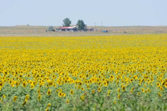
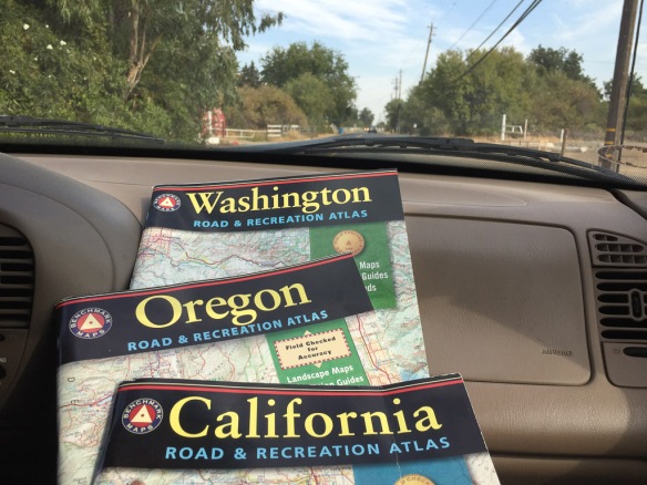
The first day of this series of blog posts was rather boring–just driving north to get to where we were going. It will get better, at least for those of you who like scenery of our fabulous country.
We arrived in the dark at Doug and Karen’s place in Newberg, Oregon. They have bide a wee farm and raise Jacob and Navajo-churro sheep. I have known them for years and have some of their sheep but have never been to their farm. The next morning we followed them around as they did chores.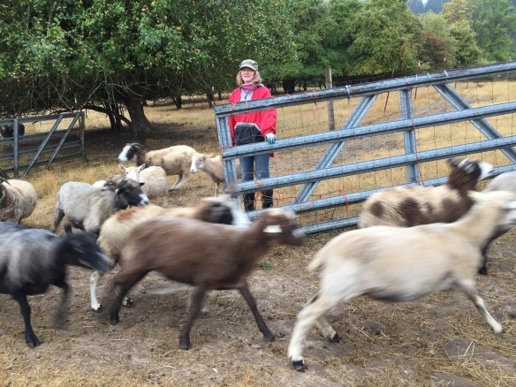 Karen lets the ewes out into the pasture where some of them race to see who will be first to find the pears that may have dropped since the day before.
 Some sheep stayed behind but this group checked out the pear snack department and then traipsed back to the barn for the morning hay.
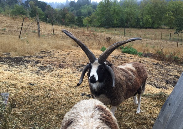 Nearby we met Windy Acres Lightning, who happens to be Buster’s sire.
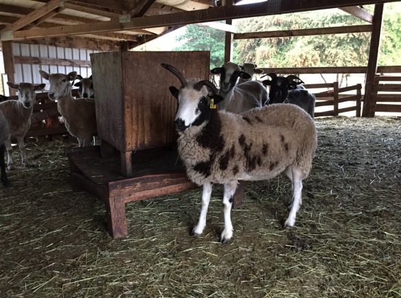 This is inside the barn. There are a couple of Meridian ewes here but I don’t think this is one because she has a bideawee ear tag. I like these feeders and think that we should try making some.
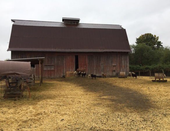 This is another barn on the property. Those are some of the ewe lambs and their guard llama.
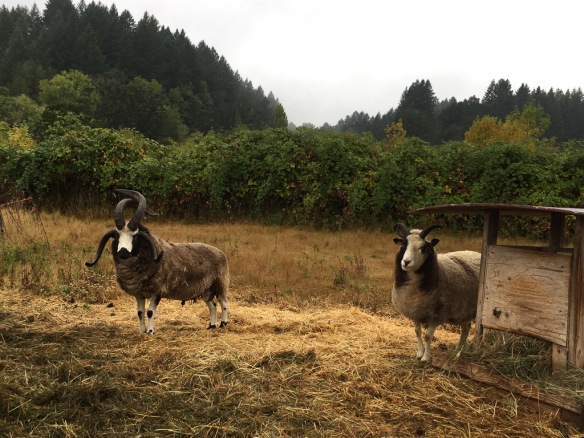 Across the road (the property is split into 4 pieces by the country roads) there are more rams. This is Hunters Glen Roy Rogers and his wether buddy. I sure which that I could get some of these horns like Lightning and Roy Rogers on my sheep.
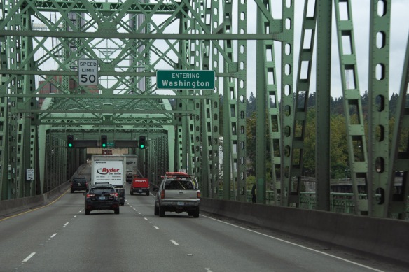 After breakfast we got on the road to our real destination.
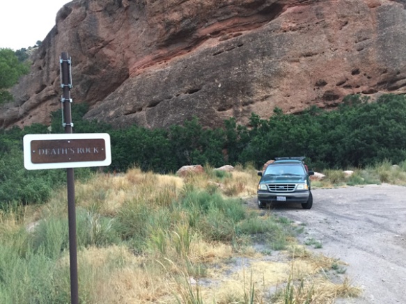
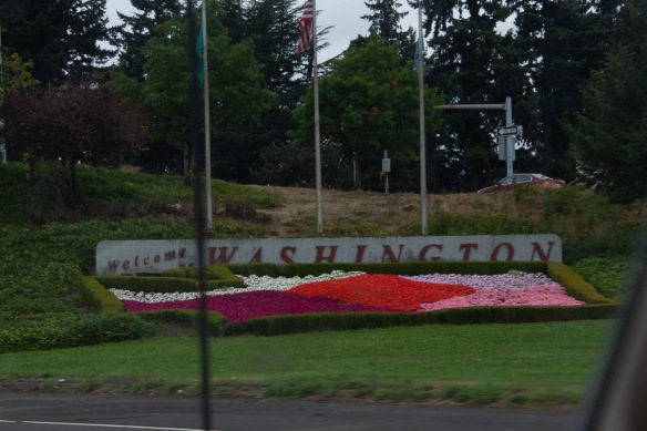 Here is a more welcoming sign along with pretty flowers.
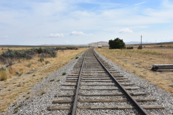
 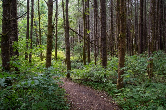 We were headed to Mt. St. Helens National Volcanic Monument for our first stop. We followed State Route 504 along the Toutle River and stopped before entering the NVM at this site where the sign said Sediment Retention Structure. We followed a trail through the beautiful woods.
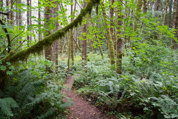
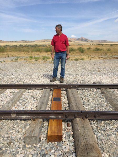
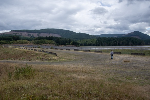 After a short walk we reached the dam. A sign told us: “As the North Fork Toutle River re-formed and carved new channels in the deposits [after the eruption in 1980], it became one of the world’s most sediment-laden rivers. The U.S. Army Corp of Engineers build the Sediment Retention Structure to trap sediments before they are carried further downstream. Sediment clogs river channels, worsening floods, and degrades water quality and aquatic habitat.” It is hard to tell the scale from my photos but this is a massive structure.
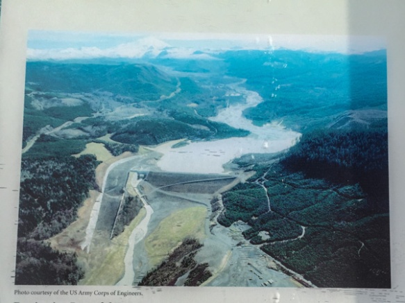 Here is an aerial view on the sign.
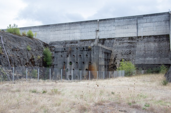 This part of the structure is on the aerial photo but is the “little” part at the left end of the horizontal part of the retention structure and to the right of the spillway.
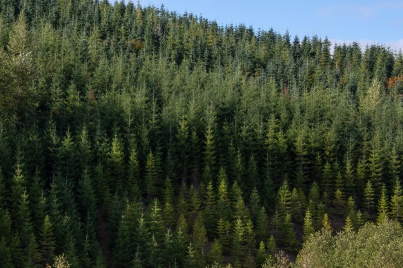 We continued on to the NVM. There are plenty of interpretive sites before you get there, some put out by the state and some by Weyerhaeuser. From their site: “Weyerhaeuser Company began more than 100 years ago with 900,000 acres of timberland, three employees and a small office in Tacoma, Washington. Founded in 1900 by Frederick Weyerhaeuser, we’ve grown to become one of the largest sustainable forest products companies in the world.” I was interested in the divergent viewpoints about the response to the destruction caused by the 1980 eruption. Weyerhaeuser began to reforest as soon as they could, planting millions of seedlings. Their sign shows a contrast between their now almost 40-year-old forests and the vegetation across the boundary where the response was to let nature take its course. Both arguments are convincing and I am not bashing a giant lumber company. After all I live in a wood house. The film that we saw in the Mt. St. Helens NVM Visitor Center, however, describes how quickly the communities begin to recover, starting with gophers, of all things, that survived in their burrows under ash-covered areas and moved soil and seeds to the surface. The film points out that the communities are now at their most diverse and as the natural sequence of forestation continues there will eventually be less diversity as one sees in a mature forest.
I took the photo above because I wanted to share the scene as we traveled through this particular part of the forest. I think these are noble firs and you can sort of tell what I was trying to portray here. It was almost like you couldn’t focus on them. The right angle nature of the branches gives the effect of horizontal lines throughout. It was striking as we drove through.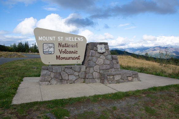 It isn’t possible to see all of the NVM in one day. No road goes all the way through and it is a lot of driving to get to other entrances. We chose this northwest entrance and realize that we’ll have to come back some day.
 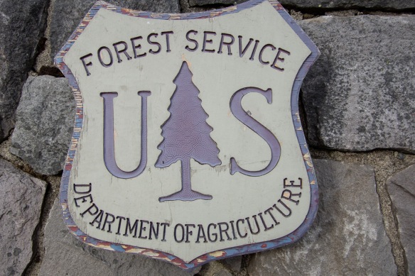 I liked this closeup of the USFS sign–see the detail in the tree? Someone had to think of that.
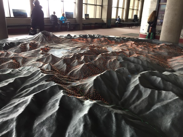 We started at the Visitors’ Center called Johnston Ridge Observatory. Here is a model of the terrain and as the story is told different color lights come on to show lava flows, ash deposition, etc.
 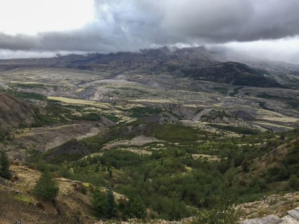 View of the mountain. We never got a clear look at it because of the clouds. It is amazing to think that the whole area in this photo was impacted by the blast and that everything in the middle part of the photo is deposits from the volcano.
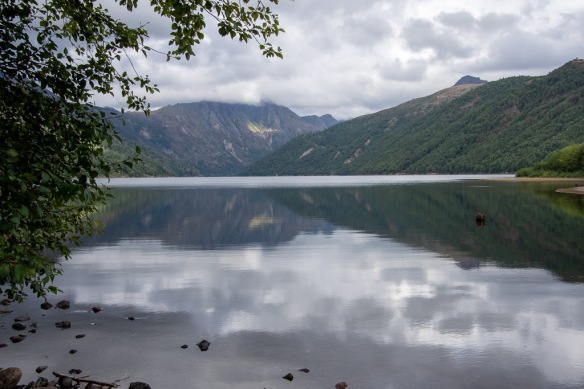 Coldwater Lake was formed when volcanic debris blocked Coldwater Creek.
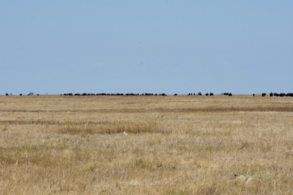
 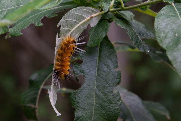 A wildlife shot!
 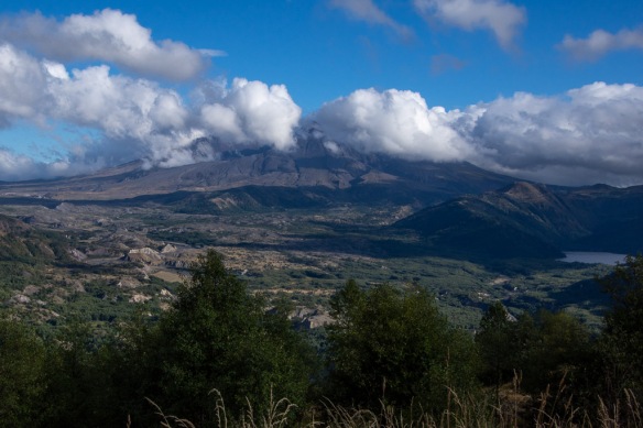 We stopped at an overlook before leaving the area and watched as the clouds moved past the mountain. The eruption of Mt. St. Helens was mostly from the side and it created a valley that faces mostly north (the cloud filled part on the left of the photo).
 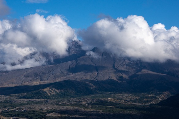 We caught a few views of what is left of the mountain.
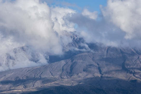 This definitely warrants a return trip.
We headed north for our next destination and found a place to camp but it was almost dark and I guess I didn’t get any photos there. Stay tuned!
 Here we go!
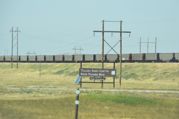
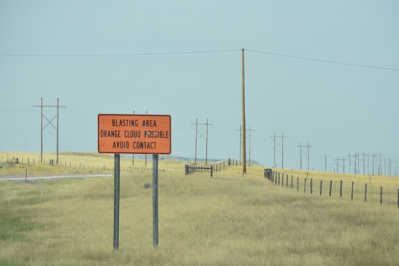
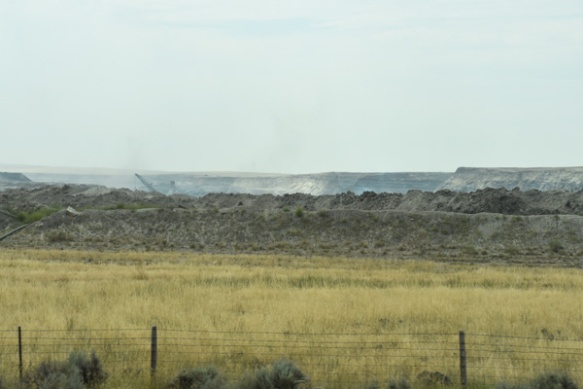
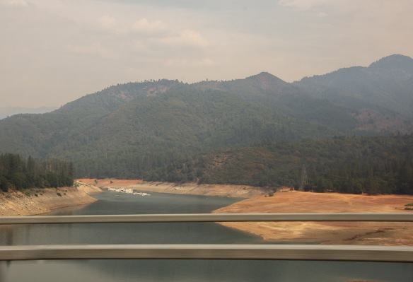 All of these photos are “drive-by”, taken with my camera or my phone while in a moving car. They are hazy and the sky is ugly. But that’s how it looked as we drove up the valley. We have been living for most of the summer with smoke-filled skies. Now we were smelling smoke too. This is Shasta Lake and it is evident how low the water level is. A reservoir can be an ugly place when the water is low (in my opinion).
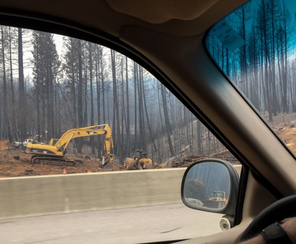
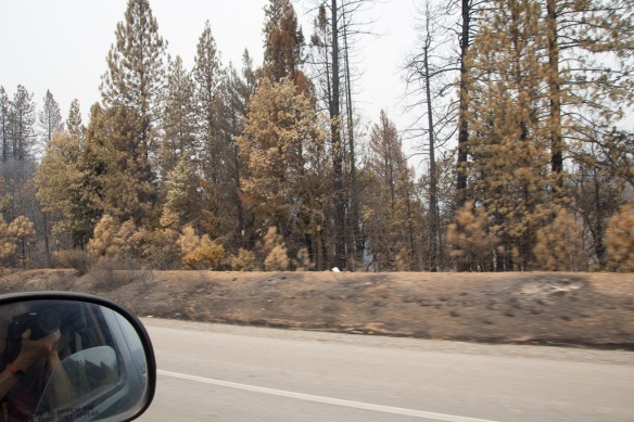 We began to see signs of the Carr Fire which had caused the closure of I-5 in both directions for 5 or 6 days just the week before we left.
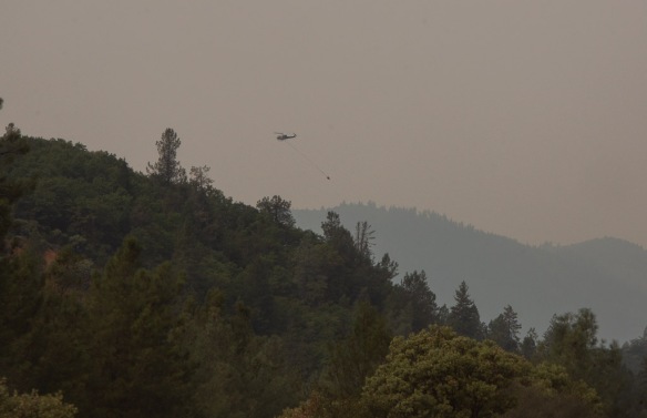 One of my son’s manages a USFS helicopter and his crew was on this fire, but that wasn’t the his helicopter.
 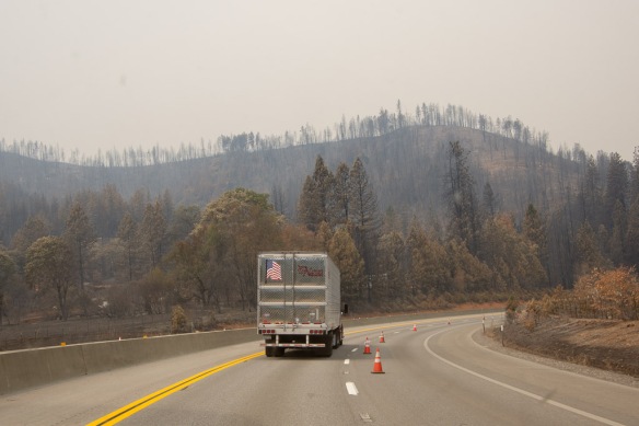 The fire had burned right up to the road and had actually burned vehicles that couldn’t get away in time.
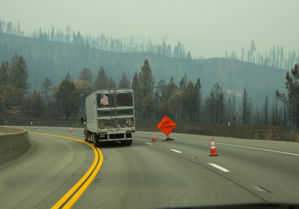
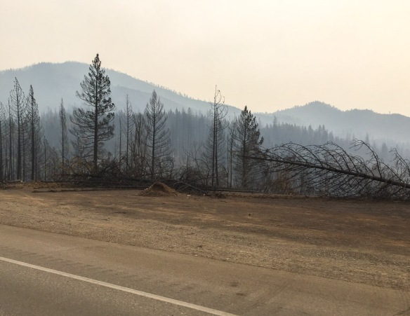
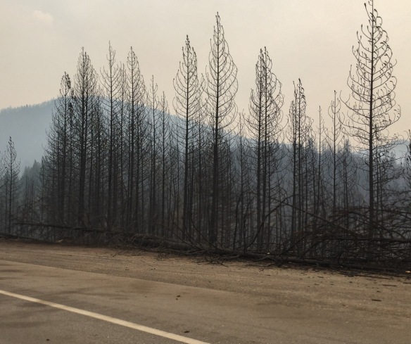
 Trees that are near the highway are being removed for miles.
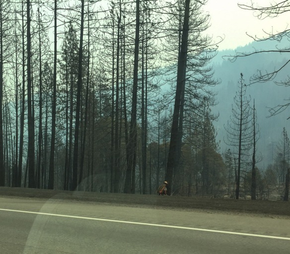 And it’s not over yet!
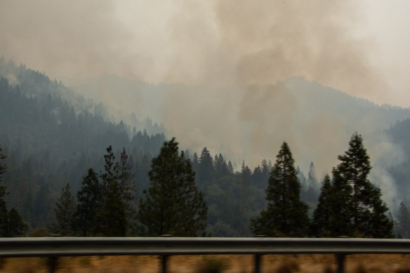 There were active smokes along several miles.
 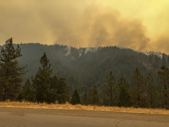 My two sons and a daughter-in-law all fight wildland forest fires. This is a scary year.
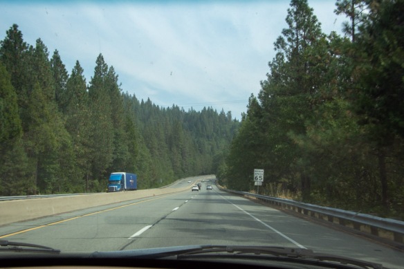 As we drove further north the skies cleared and the forest again hugged the sides of the freeway.
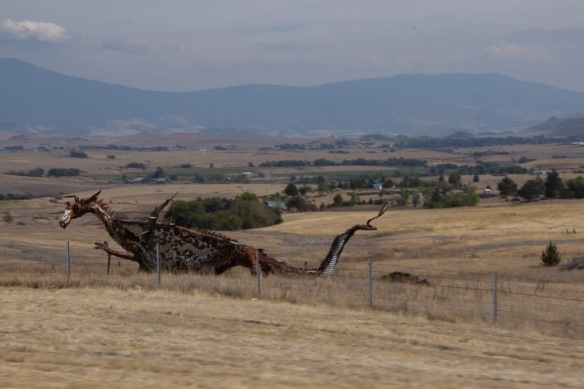 This isn’t a great photo, but I am usually driving when I see this dragon.There is a metal cow and calf a few miles back that missed. But I got at least one photo of the dragon.
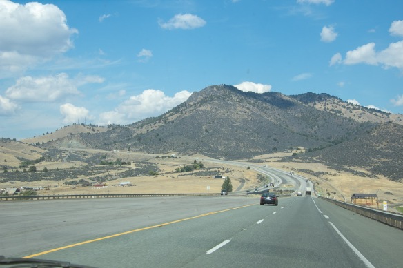 Heading to the Shasta Valley in northern California.
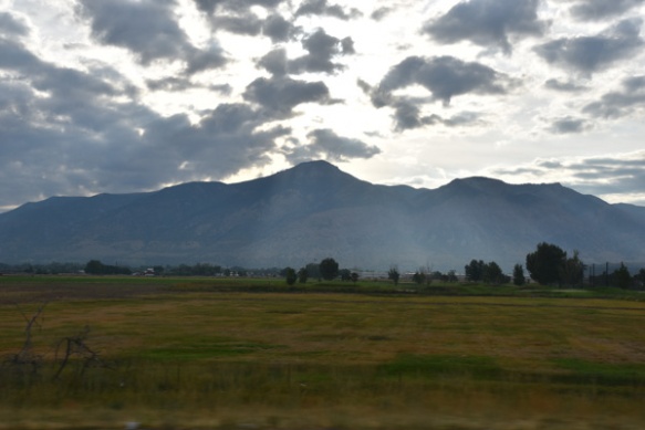
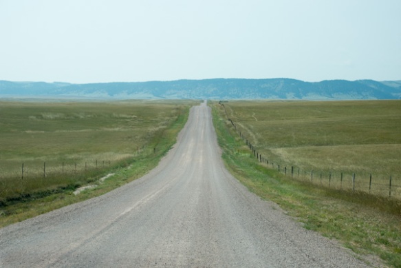
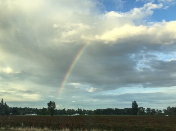 Somewhere in Oregon. It seems like a long time since we’ve had rain here.
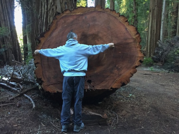
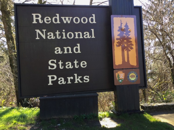 From Wikipedia: “… the four parks, together, protect 45% of all remaining coast redwood (Sequoia sempervirens) old-growth forests, totaling at least 38,982 acres. These trees are the tallest and one of the most massive tree species on Earth.”
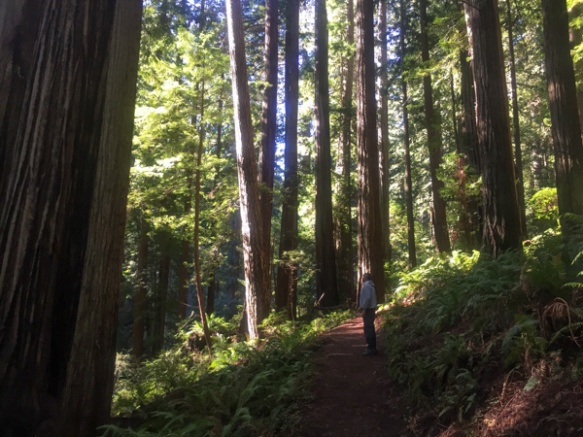 In 1850 there were 2 million acres of redwood forest along the northern California coast. After years of unrestricted logging the Save-the-Redwood League, created in 1918, was successful in establishing three State Parks in the 1920’s.
 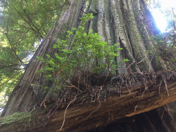 Redwood National Park was created in 1968 after 90% of the original redwood trees were gone. Now the State and Federal agencies cooperatively manage the forests and watersheds as a single unit.
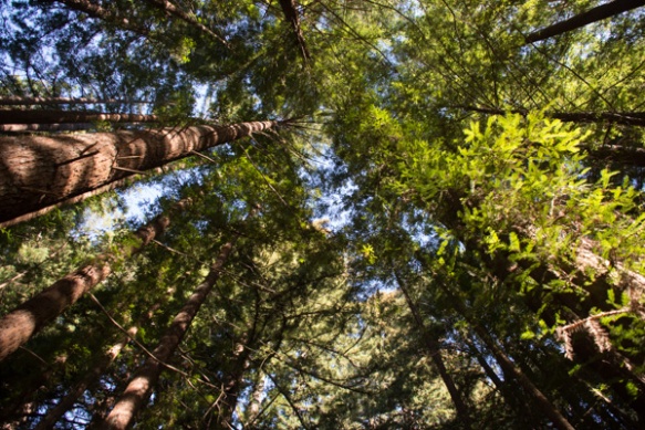 I’ll mention here that all these photos were taken with my iPhone because the previous night I dropped my camera (on the carpet in the motel) and the lens popped off. I couldn’t get it back on and knew that I wouldn’t be able to get it fixed until after I came back from Texas (where I was headed as soon as we returned from this trip).
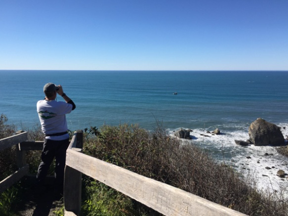 We took a side trip to the spot where the Klamath River flows into the ocean and walked down the steep trail to this overlook. That’s Dan looking across the ocean for Meryl (my DIL who is in Australia right now).
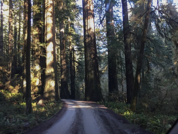 We drove farther north to the Stout Grove in the Jedediah Smith Redwoods State Park.
 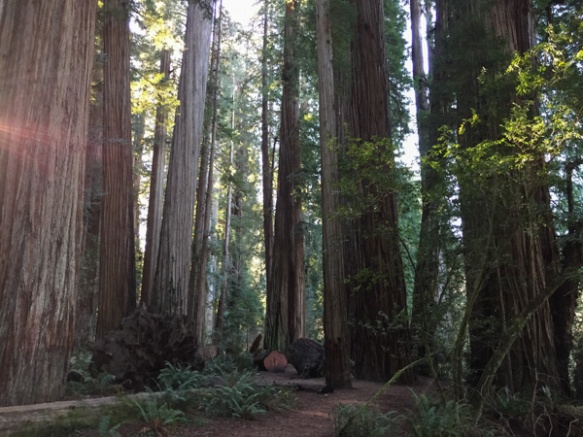 Every time we stopped we continued to be impressed with the grandeur of these trees and the forest.
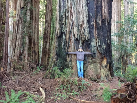
 This tree had fallen and then was cut to clear the path.
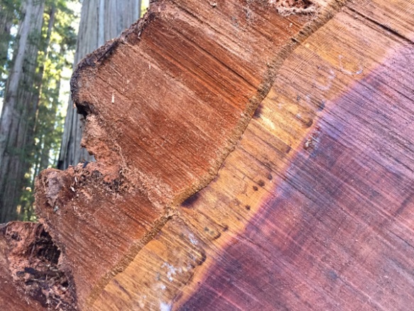 Look at that brilliant color.
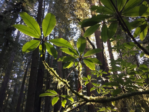
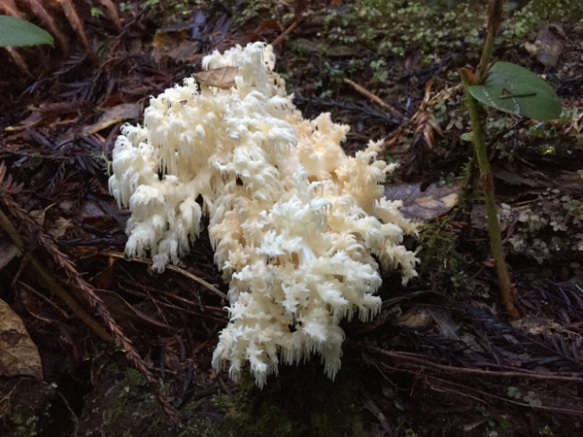 We were surprised that we didn’t see more mushrooms and fungus, but this one did catch my eye. Late in the afternoon we headed toward the coast at Crescent City.
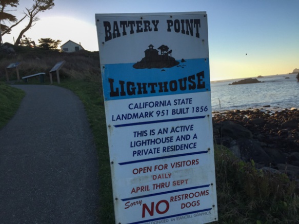 Our map book showed two lighthouses so we started with Point St. George. We found that lighthouse (manned from 1891 to 1975 and abandoned in 1995) but it was 6 miles offshore. The Battery Point Lighthouse is accessible at low tide so we were able to walk to it, but we were too late for a tour.
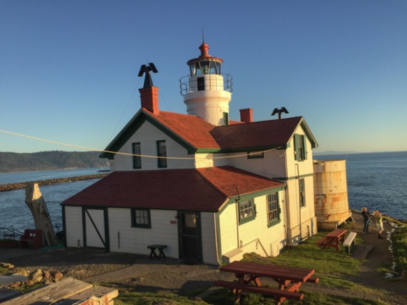
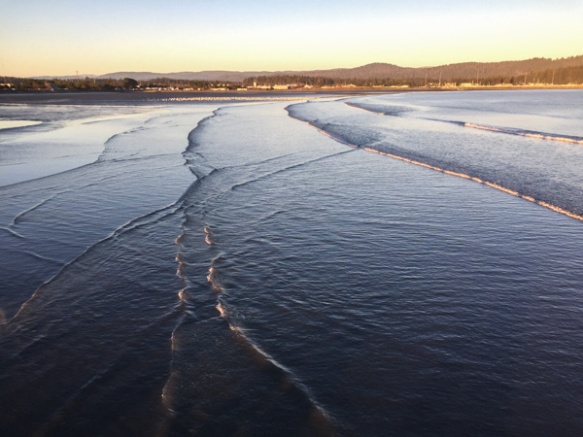 We walked along the breakwater (seen in the lighthouse photo) and then out on a pier. This is a view looking back toward Crescent City.
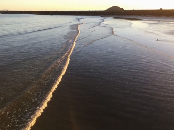 This is the view looking back toward the breakwater and the setting sun.
 Mini Road Trip!
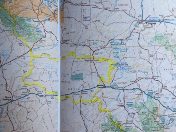
 From the Central Valley you need to drive through the hills to the west. We turned onto Highway 20 at Williams. You can see a slight tinge of green if you look hard but this time of year they should be emerald green. That green is the grass that began to grow after our early January rain. We have had negligible rainfall since and there has been no more growth. This is the time of year that ranchers in the non-irrigated hills count on abundant forage for livestock. Very scary to think of another year of drought to this degree.
 This is a view getting closer to the hills. The almond trees are beautiful this time of year but I am disturbed at how many acres of land all over California have been put into almonds now. That’s a story for another time however. It seems I didn’t take more photos until we got to our first stop.
 From the Humboldt Redwoods State Park website: “In the early 1900s, loggers came to what is now Humboldt Redwoods State Park to cut down lofty ancient redwoods for grape stakes and shingles. The founders of Save the Redwoods League thought that was akin to ‘chopping up a grandfather clock for kindling.’ From the acquisition of a single grove in 1921, the League has raised millions of dollars to build and expand this park. Today Humboldt Redwoods spans 53,000 acres, an area almost twice the size of San Francisco. About one third, or 17,000 acres, of the park is old-growth redwood forest—the largest expanse of ancient redwoods left on the planet.”
 What is special about an old-growth forest?
 The size of the trees.
 The mix of tree sizes. Unlike a reforested clear cut, there are trees of all ages and sizes and this makes for an open forest instead of a monoculture of trees and brush that you can hardly walk through.
 The ecology. When old trees fall they open up space for light to reach the forest floor and opportunity for new growth of other species.
 The grandeur.

 We ended the day at the beach.
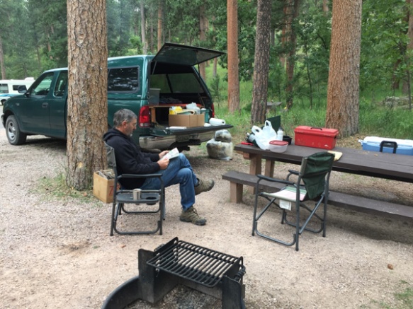
 This is the area where we camped. I got up when I saw the sunrise to explore near the river. We had heard rapids but couldn’t see the river from the campground.
  After all the signs at the previous day’s stops I did start thinking about mountain lions as I walked along deer trails though those willows and brush to reach the river. So I made plenty of noise, but I also decided to move to higher ground where there was no cover.
 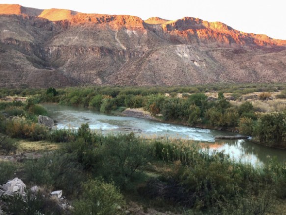 I was also glad when Matt showed up with the same idea (early morning photography) in mind.
 Logs and rocks in the river were enough to create the sound of rapids that we heard from camp.
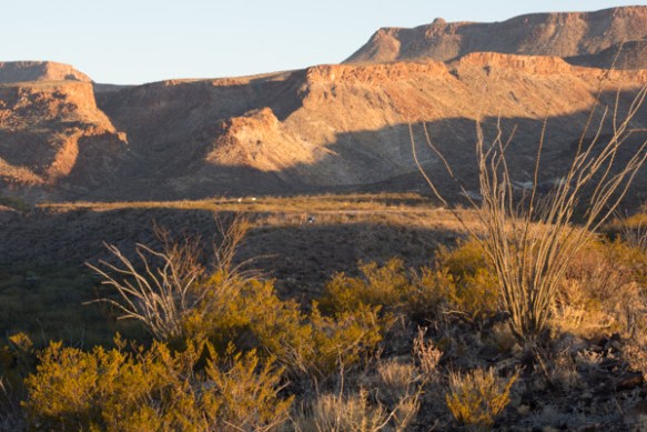 This is the view back to the camping area. That green speck in the middle is the truck.

 We looked at the map to see where we might hike in this park and found Closed Canyon.
 This is a canyon that leads to the Rio Grande.
 Absolutely stunning! The photos don’t do it justice.
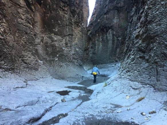

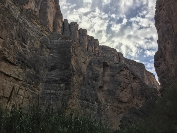
 You can walk in about 7/10 of a mile before you can’t go farther.
 If you’re a mountain goat you can try to go farther … or if you want to get wet.
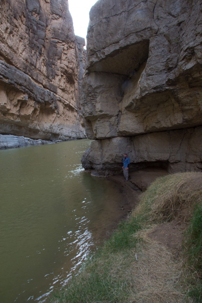
 Matt went around the bend and came back. The map shows that it is a relatively short way to the river.
 You wouldn’t want to walk here in the flash flood season.
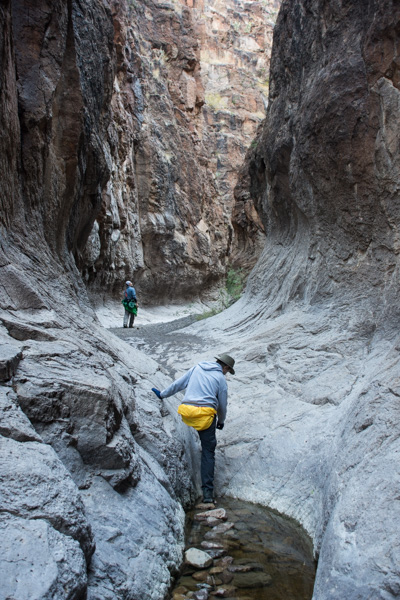
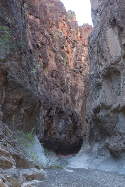
 That slot in the shadow is the entrance to this incredible canyon.
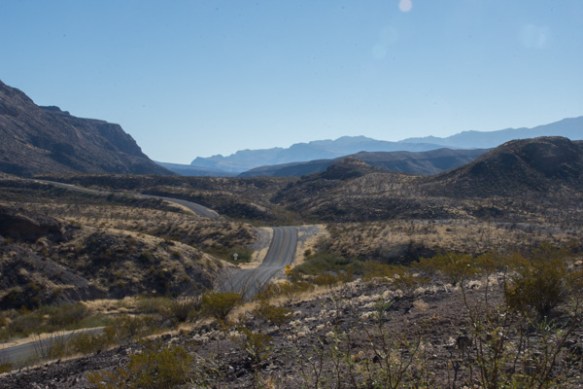 On the road again.
 The next stop was the HooDoos Trail.
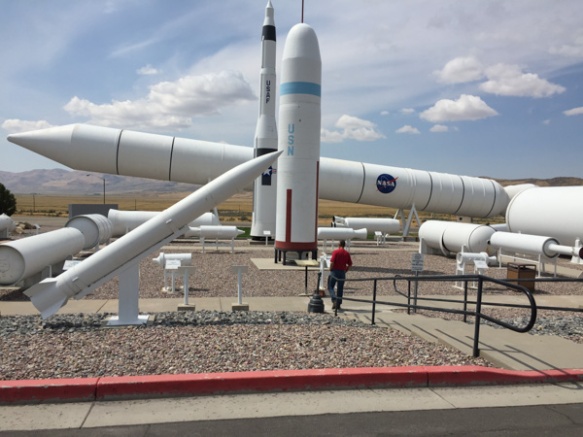
 Hoodoos refers to these eroded formations.
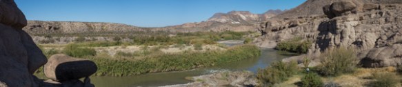 Matt showed me how to do photos with my camera that you can later turn into panoramas. This isn’t distorted like the pano shots on the phone.
 More spikey things.
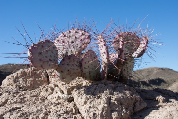 We left the park and were on our way to El Paso where we would spend the night and Matt and I would take an early flight home the next morning.
 We entered the town of Marfa and Matt found on Trip Advisor that visitors could check out the dome of the city hall.
 That was a good excuse to get out of the truck and stretch. This small West Texas town may be worth a second visit someday to investigate it’s art venues and to find out more about the Marfa Lights (google that).
 Entering El Paso.
 Flying over southern California where the fires were (are) still burning.
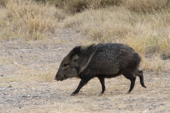 Our first stop at the river was at raft/canoe take-out. Wildlife! I wish this was a sharper photo but I’m going to say that the javelina’s coloring makes it look blurry. I just looked up javelina and learned something. Javelinas (collared peccary) are not in the same family as the pig. There are a multitude of physical differences including the type of stomach (complex versus simple), gestation length (5 months versus 3+ months), and structure of the leg and foot.
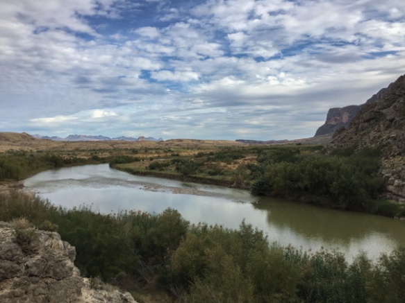
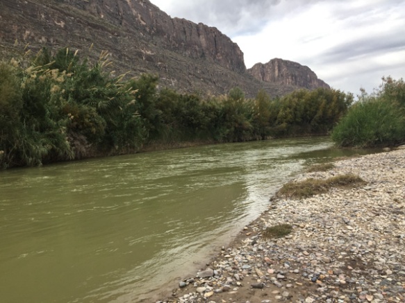 Here is a look at the river. Mexico is on the other side.
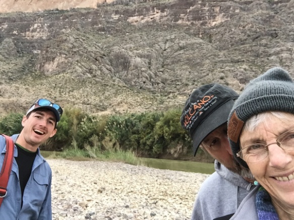
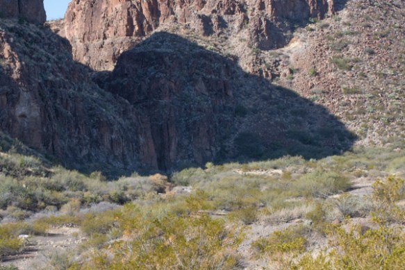
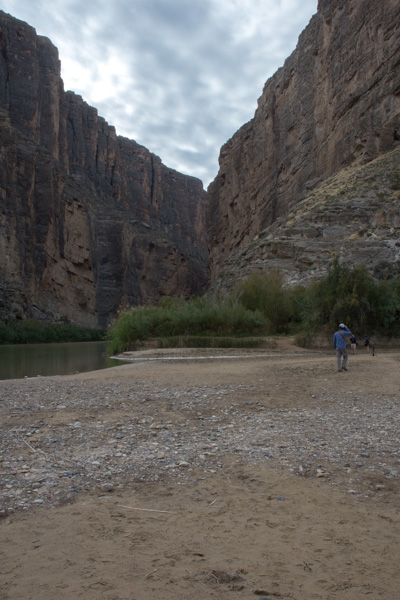
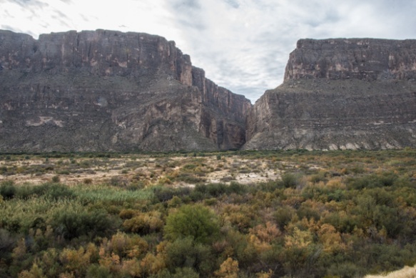 We drove on to find the entrance to Santa Elena Canyon. This is that slot seen from a distance in the previous post. It is hard to imagine from this view what it looks like in that canyon.
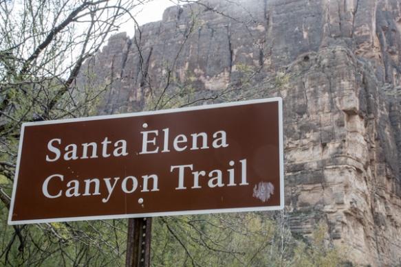
 The 3/4 mile trail into the canyon begins with rock stairs built at the lower part of the cliff.
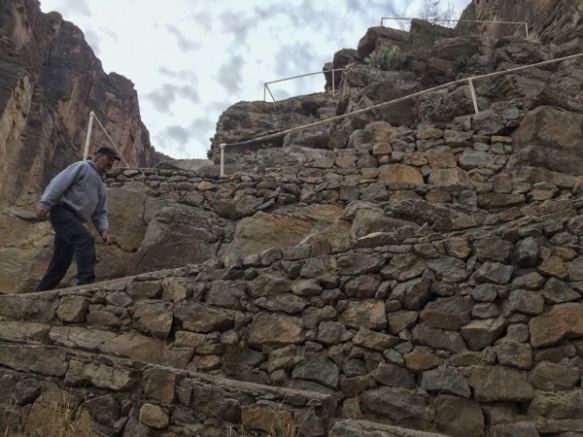
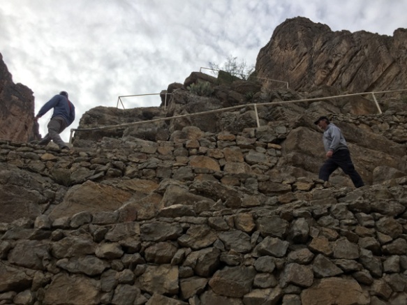
 The view looking back from the stairs.
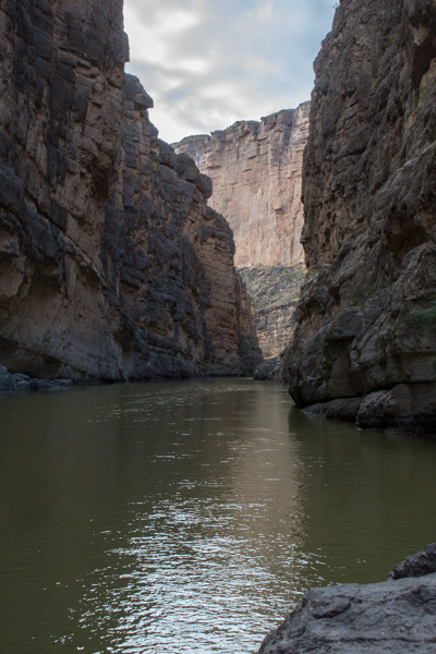
 The trail ends where the cliff walls go right to the water.
 At some points the cliffs rise 1500′ from the water.
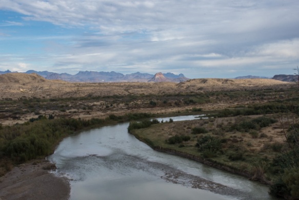 Coming back out of the canyon. In this view of the Rio Grande, Mexico is on the right. In the photos walking up the canyon, it is U.S. on the right and Mexico on the left.
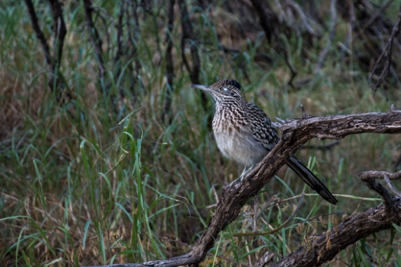 Roadrunner seen near the parking lot. We left Santa Elena Canyon and continued on a loop road that traverses the western edge of the park.
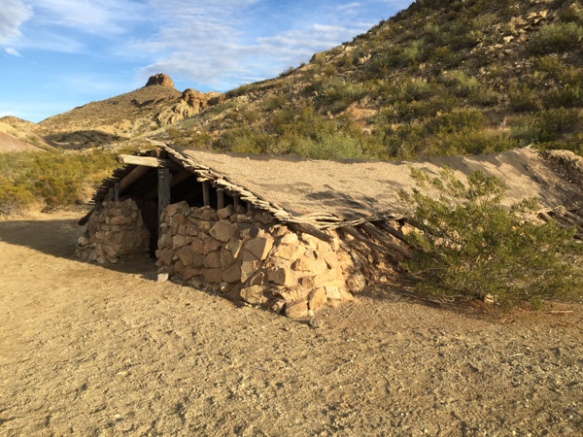 We stopped at Luna’s Jacal (Jacal: “a hut in Mexico and southwestern U.S. with a thatched roof and walls made of upright poles or sticks covered and chinked with mud or clay”), where Gilberto Luna raised “a large family”…
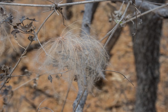
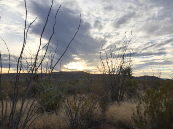 …and later when I spotted ocotillo that looked as though they had recently bloomed.
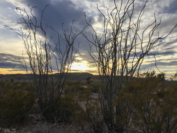 There were remnants of the red blossoms that grow at the end of the branches when there is moisture. Same with the leaves that cover the stalks for a few weeks after rainfall.
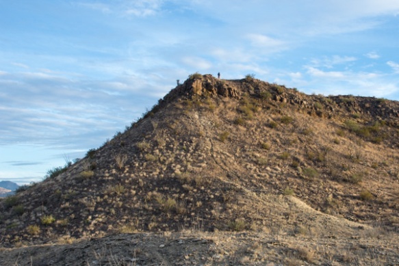 We weren’t able to find an open campsite to reserve, at least according to the person working the computer at the last visitor center (whom we had reason to doubt, but what could we do?)…
 …so we ended our day at Big Bend and drove on to finding somewhere else to camp for the Next Adventure.
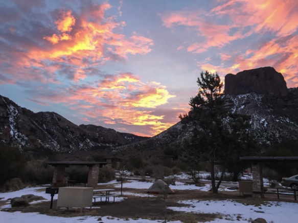 Sunrise from the campsite in the morning. I wouldn’t have seen that from a motel room.
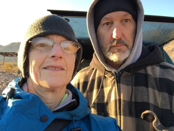
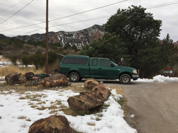 We spent the night in the back of the truck. Notice Matt’s cot and sleeping bag. Fortunately no one was bothered by bears.
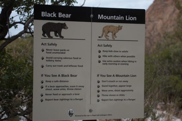 …although we saw this sign at the trailhead right near our camp.
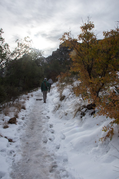 We left camp early and went for a hike up the Lost Mine Trail. I was glad that I had a walking stick with me because much of the trail was icy and slippery.
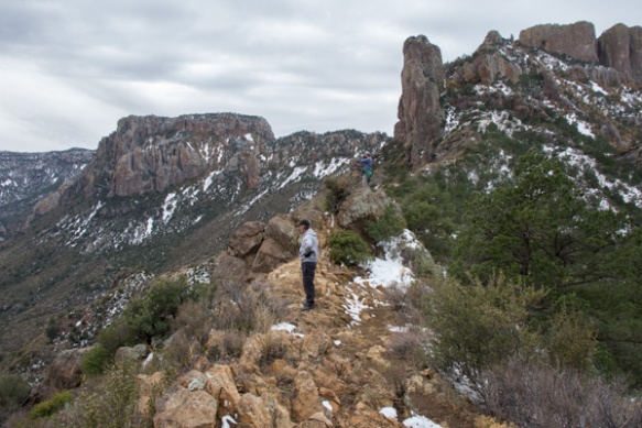
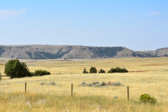
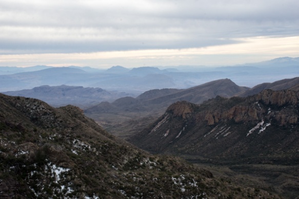 This is the view to the south from where we were standing in the last photo. The southern border of the park is the Rio Grande but I’m not sure which of these mountain ridges border the river.
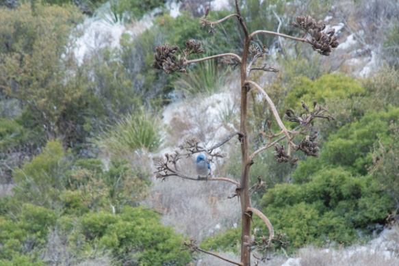
 We had only a day and a half to spend in this area so we didn’t plan to do any long hikes, but instead see as much of the Park as we could and get out where there were signs and shorter trails.
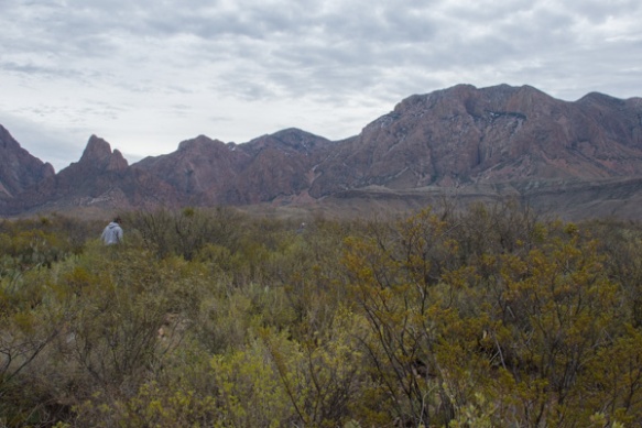 This stop was at the Sam Nail Ranch where there is a short trail to the remnants of an adobe dwelling built around 1909 when the Nail family lived here.
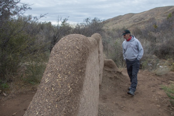 The family planted fruit trees and raised livestock, living here until the 1940’s.
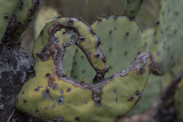
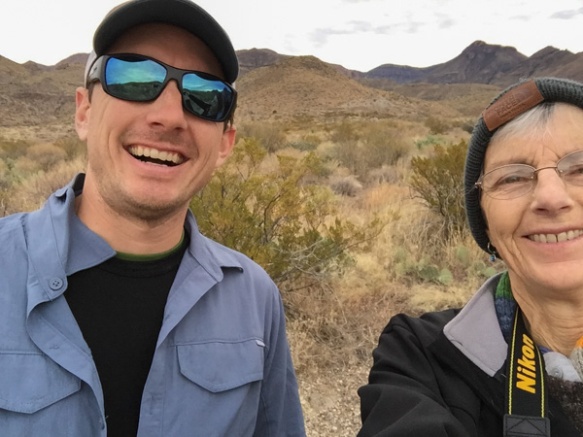 “Matt, hold still.”
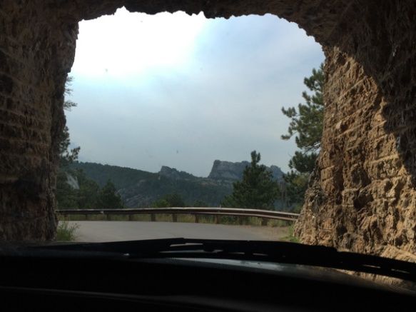
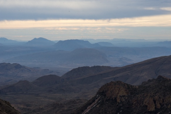
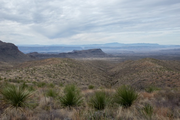 View from Sotol Vista. Do you see that slot in the middle ridge, just left of the photo’s center? That is Santa Elena Canyon, about 12 miles southwest of this point, where the Rio Grande slices through the mountain, forming a narrow canyon with 1500′ walls. That will be for the next post.
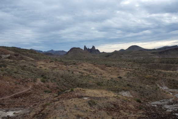 The Mule Ears View Point was the next stop.
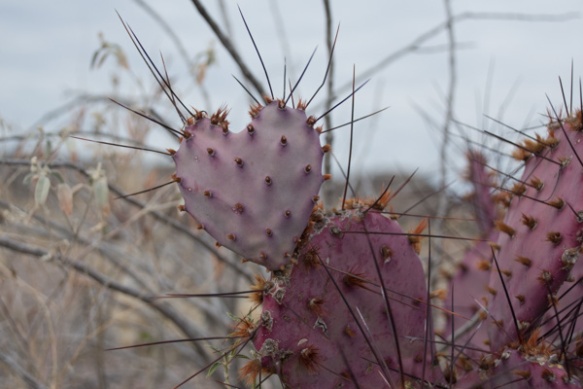
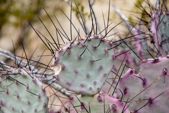 I didn’t identify all the different kinds of cactus, but noticed some that were distinctly purple.
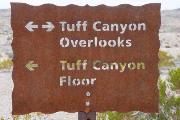
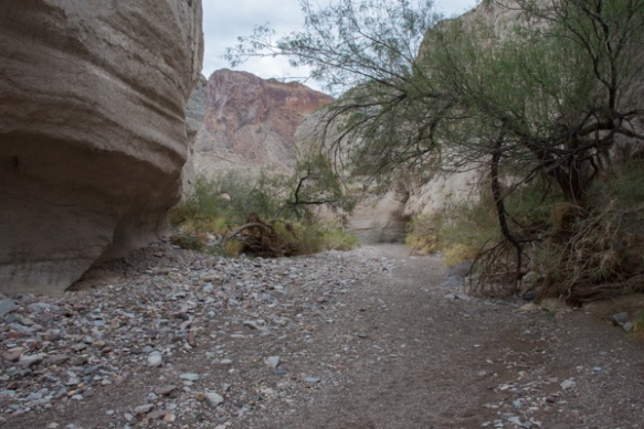 We walked into Tuff Canyon, so named for it’s volcanic origins.
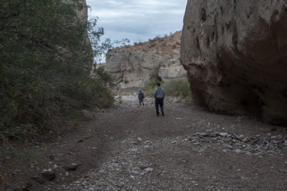
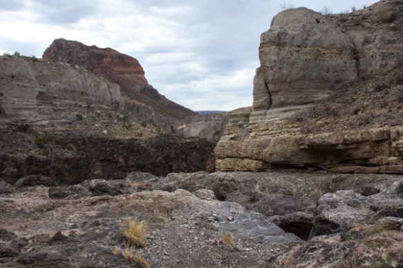 Spectacular!
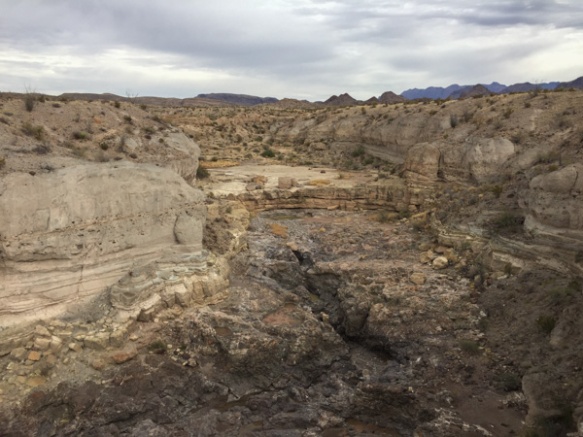
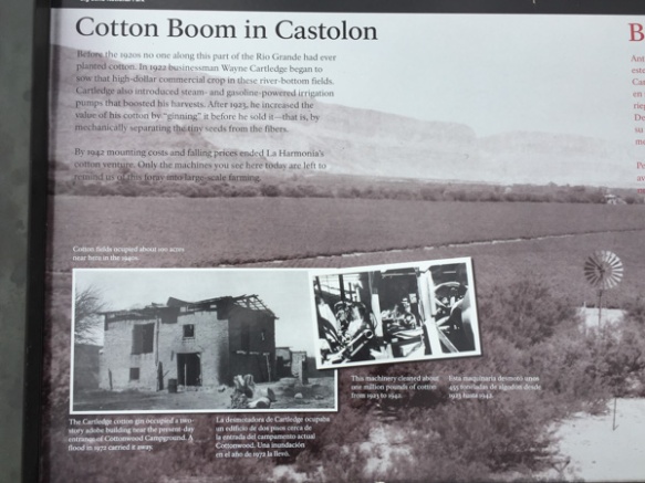 There were a lot of interpretive signs at this point. Castolon was first settled in 1901 and became a destination for refugees fleeing the Mexican Revolution. Barracks were built but never used by the army and in the 1920’s the La Harmonia Company established a trading post and started growing and ginning cotton. That venture ended in the 1940’s.
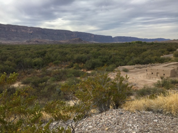 This is the modern day view of that same landscape.
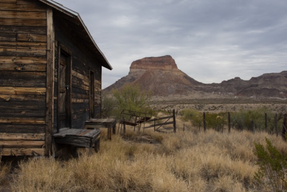 One of the old building that still remains at Castolon.
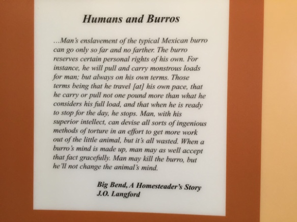 I think this statement is true.
 We stopped at the Dorgan House Trail, where there were more ruins.
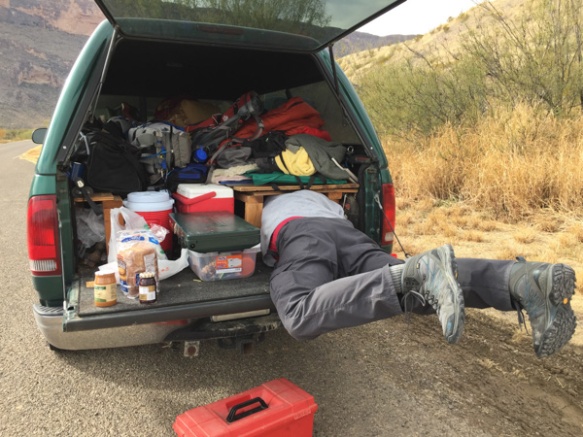 It felt like lunch time. Dan couldn’t fit all the way in where he had stashed the box with my granola. Eventually I squeezed in there and he pulled me out by my feet because I was laughing too hard to get out myself.