The second day of the trip began at the fairgrounds where I met up with Andy who had hauled my sheep from California.
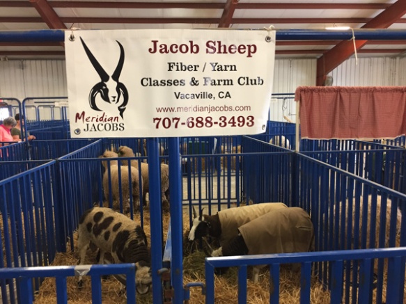 I got them situated near the other Jacob sheep and hung my newly made sign (that includes my location). I delivered my entries in the fiber and photo contests (a whole suitcase full–it’s a good thing that Southwest allows two free bags). Then I went exploring.
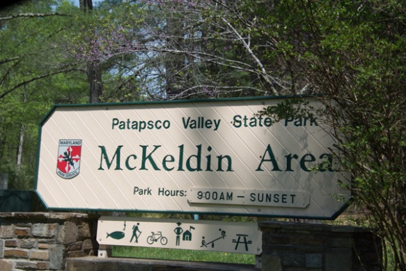
I was looking for somewhere that I could do some hiking and get a feel for the country. I found a destination on the map called Soldiers Delight Natural Environmental Area. It was about a half hour away. On the way there I saw a sign for Patapsco Valley State Park so I stopped there first.
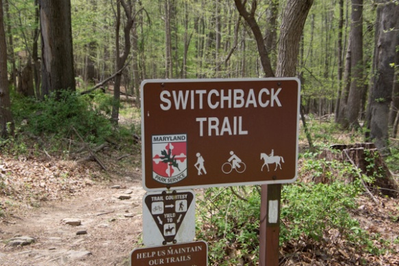
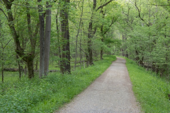
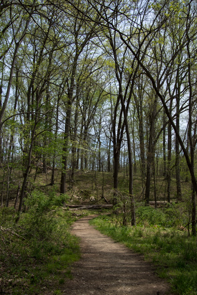 This was a pretty area. It was “mixed use” including developed playground and lawn areas, but I stuck to the trails. I was not dressed for the weather. According to the news it was 90 degrees on this day and we haven’t been that hot at home yet. Too bad I hadn’t brought shorts…although the ticks that I found later made me think that maybe jeans were better anyway.
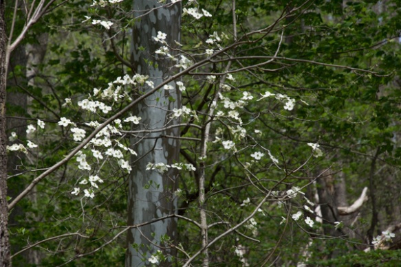 Dogwood. That’s one flower that I knew.
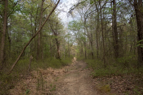
There were flowers (and a bird*) that I didn’t identify, but I’m not obsessing over that. *ID by a blog reader: Chipping Sparrow / ID by another reader: lower flowers look like Summer Snowflake, Leucojum aestivum, a naturalized species native to Europe.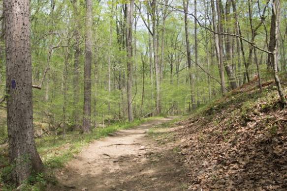 More of the trail.
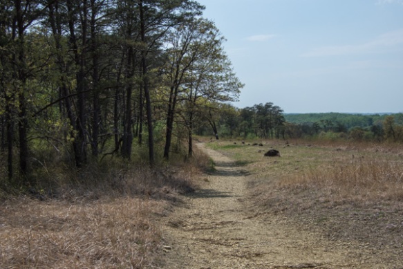
After leaving that area I drove on to the original destination.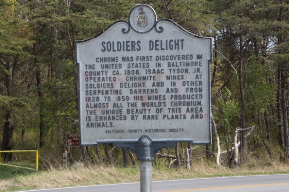 No one knows for sure why this place is called Soldiers Delight but the purpose for preserving it is the unique geology and ecosystem.
 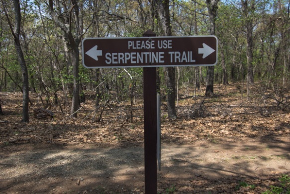 From Wikipedia: “The site is designated both a Maryland Wildland (1,526 acres) and a Natural Environmental Area(1,900 acres) … The site’s protected status is due to the presence of serpentine soil and over 39 rare, threatened, or endangered plant species along with rare insects, rocks and minerals.”
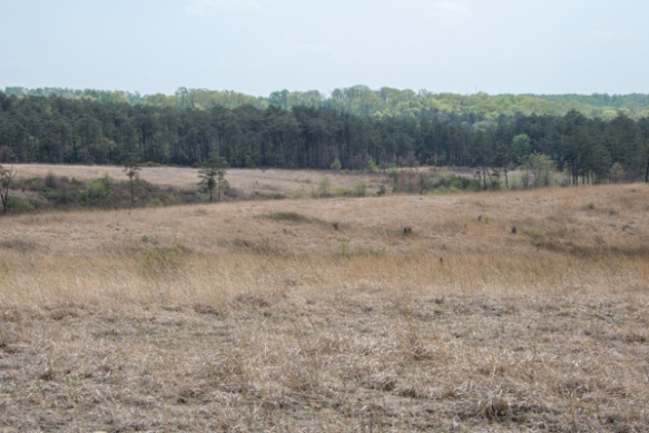 “Weathered serpentinite is dissolved rock, transformed into thin, sand and clay poor soil which is easily eroded. This creates a land surface which is stony, unfertile and sparsely vegetated and is the reason that the term “serpentine barren” is used to describe these areas.
 Signs explained that “the serpentine grasslands and oak savanna systems are now imperiled due mainly to the lack of American Indian and lightning fires which are critical to this fire-dependent ecosystem…The oak savanna ecosystem is one of the rarest communities in Maryland.” Over 90% of the less than 1000 remaining acres lies within Soldier’s Delight NEA.
The white flower is the endangered Serpentine Chickweed. I think the purple one is a Phlox species.
Blackjack oaks, post oaks, and black oaks are here.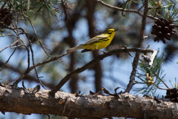 Praire warbler.
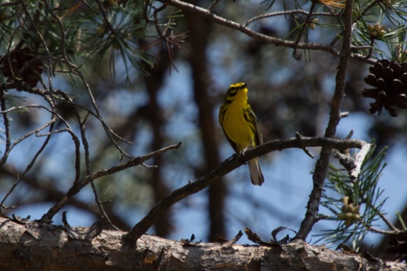
 I hiked the 2-1/2 mile trail around the grassland area and came back up to the main road. I decided to take another trail that went to the chromite mines. Half way through this one I started to think that maybe I should have brought water…and food. I realized how hungry and thirsty I was. It was already about 3:30. Did I say that it was very hot? I started to have visions of having to be rescued. Or not–how would anyone know where I was? I also found a tick on my hand. Then I started to feel like there must be ticks everywhere. Forget those mind games. I was still enjoying the new landscapes.
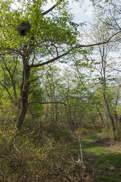 I happened to look up and saw this.
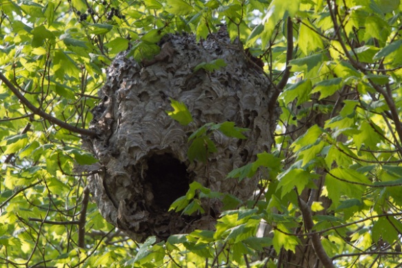 Here is a closer view.
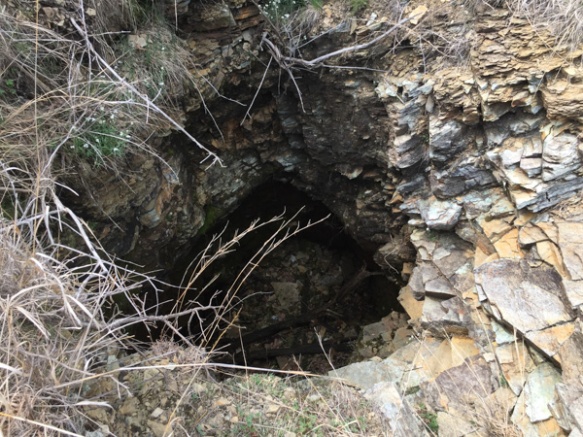 Along the way I found the Choate mine that operated from 1818 to 1888 and for a brief period during WWI. I had expected something bigger when I read the sign pointing to a pit mine (picture the massive mines I’ve seen in the west). It’s hard to imagine that it was a few holes like this produced the world’s supply of chromium.
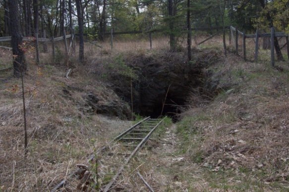 This is one of the other mines. I did make it back to civilization without mishap (and only one other tick).
I got back to the fairgrounds in time to meet up with friends and go to dinner in Frederick. Stay tuned for the main event!


 The kids will be in California for about 2-1/2 weeks.
 I shared photos of other parts of the canal in
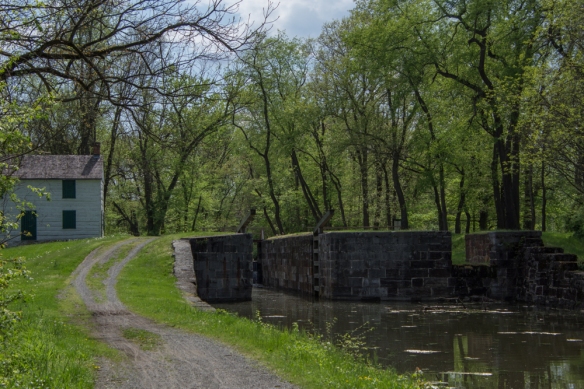
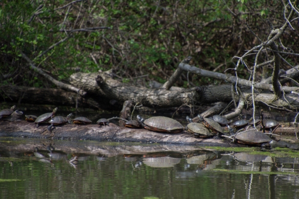 Turtles sunning themselves in the canal near Lock 75.
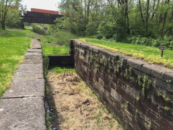 I drove along some of the roads in this area looking for more places to explore and found Locks 73 and 74.
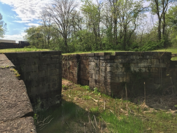 Notice the railroad over the canal in the previous two photos. The railroad and the canal were competitors for business during the era of the canal. Repeated flooding and competition from the railroad were the reasons for the demise of the canal system in 1924.
 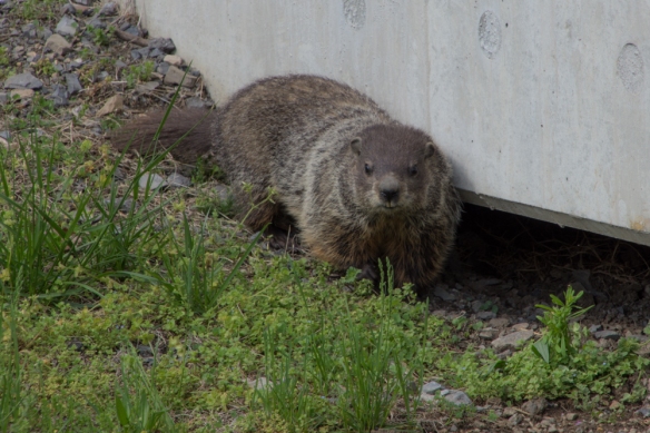 I saw a flash of this animal as he ran under the bridge. This is the first groundhog that I’ve seen.
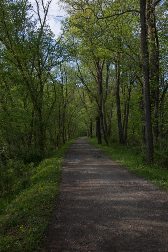 I had read on line that the tunnel was closed but thought that I’d be able to see the canal and walk along the towpath. This photo seems typical of much of the length of the towpath–a beautiful hardwood forest and a broad path to walk. One thing that I noticed everywhere was the number of birds. I didn’t see all of them–but there was quite a chorus in the woods.
 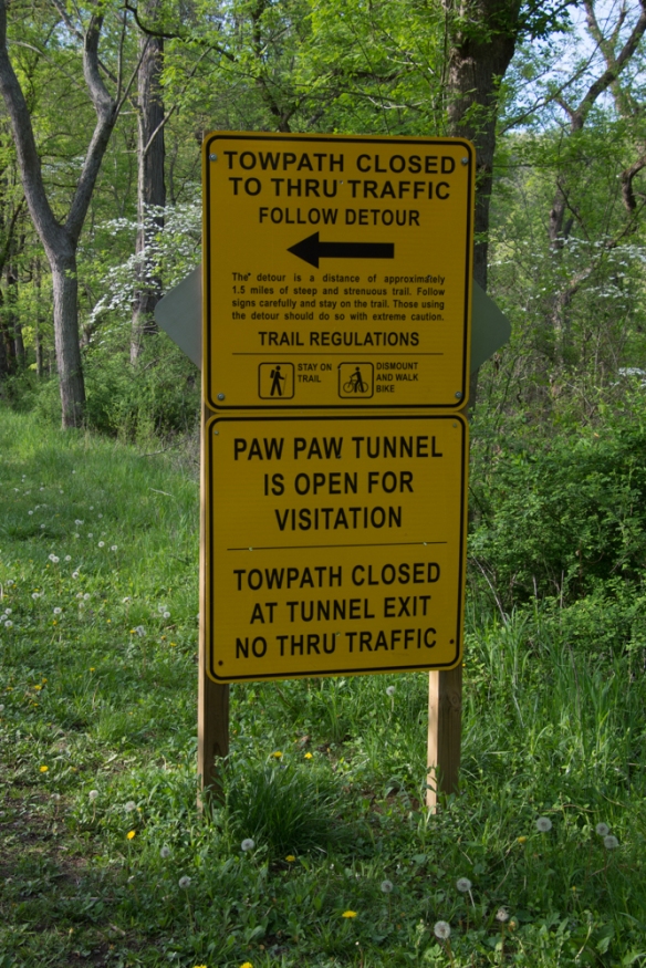 So I got to this sign and decided to take the detour.
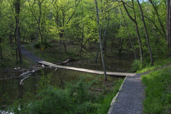 Wooden planks crossed the canal.
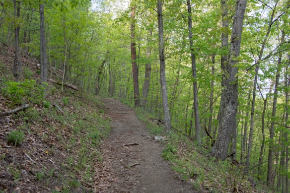 The trail wound up into the woods.
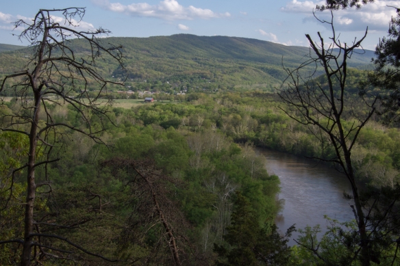 This overlooks the town of Paw Paw, West Virginia.
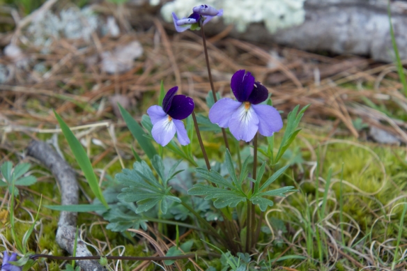 Viola pedata, Birdsfoot Violet.
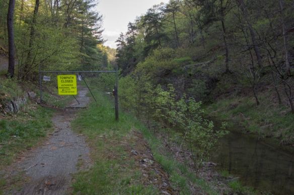 After hiking what seemed quite far into the woods I came back down to the canal and the towpath and saw this sign. From the looks of the terrain I assumed that is where the tunnel is even though the first sign had said it was open.
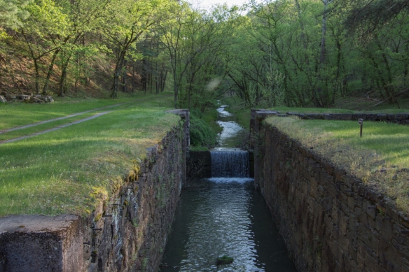 I walked the other direction, and saw this lock. The path continued around a bend.
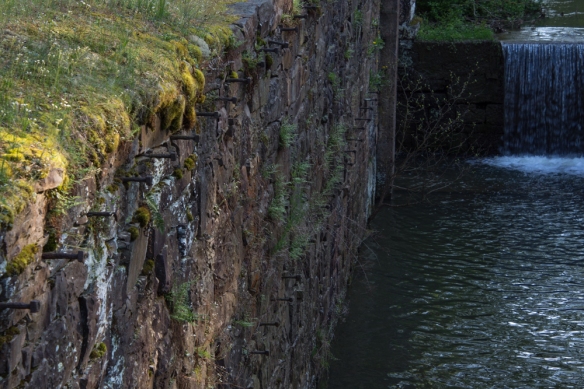 This was confusing. I assumed that there was a reason to make a detour and wasn’t sure if I continued to walk along here (towards where the detour sign had been) that I wouldn’t come to an impassable spot. Why else would there have been that sign? Or was I completely turned around? It was getting late in the day and my mind started to play tricks. Are there bears in these woods? I’m all by myself and no one knows where I am or will know if I don’t return. My phone battery is almost dead. There was no cell service, but I wouldn’t even have a flashlight.
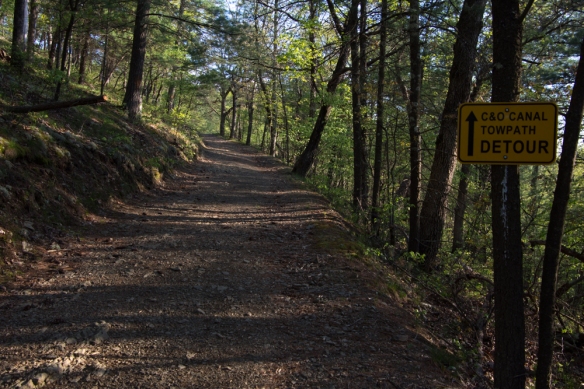 So I decided to turn around and go back the way I had come.
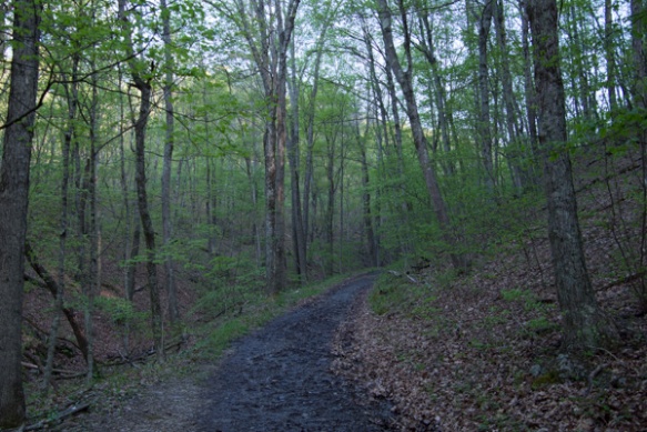
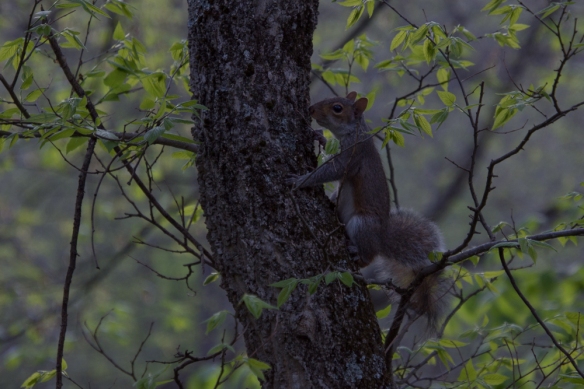 No bears, but there were a lot of squirrels.
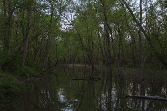 Crossing the canal.
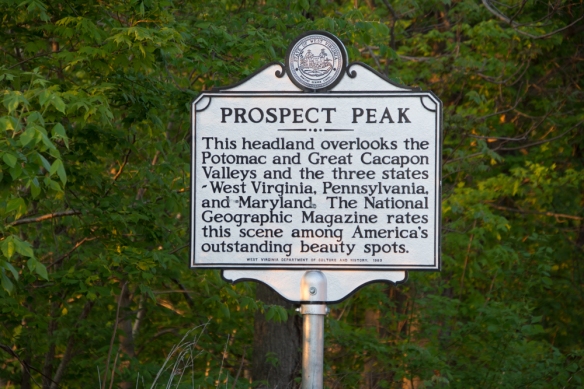 I hit this point at dusk.
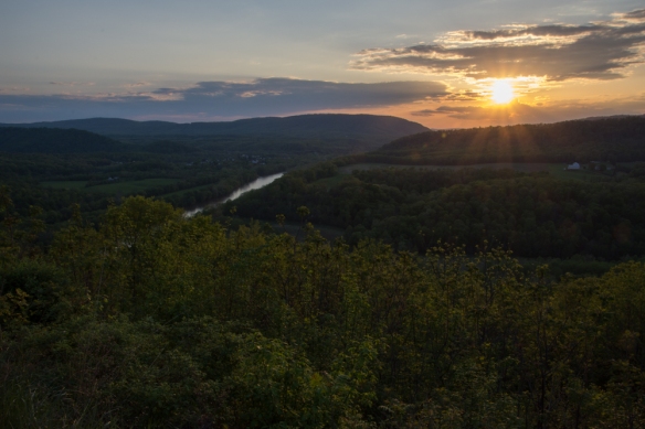 It was dark by the time I got to the freeway and I got back to Frederick at about 9:30 after a long day. That was it. I flew home the next day.
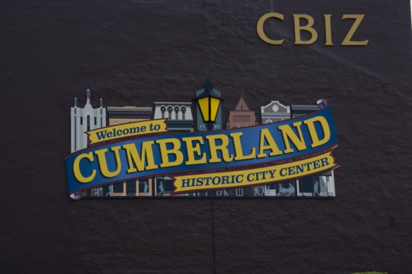 …to Cumberland where I finally found parking away from the touristy city center and I walked …
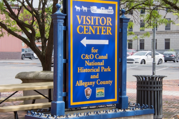 …to the Visitor Center. At the Visitor Center I asked about walking on the towpath. The person there told me that I would find more attractive areas away from town but while I was in town I might want to walk do a self-guided tour of the Victorian Historic District on Washington Street. So I headed out of the Center and started my walk, first seeing a few more of points of interest near the river.
 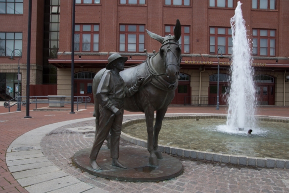 Mules played a big role in the history of the canal. In the last post I mentioned 3000 mules on the canal. Each boat had a small stable for the mules at one end and the living quarters for the boat operator and his family at the other. The rest was cargo (lots of coal). Two mules worked on the towpath while the other two were in the stable.
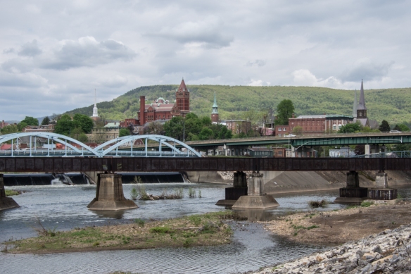 The beginning of the canal system contrasts with modern transportation routes and the old buildings of the city.
 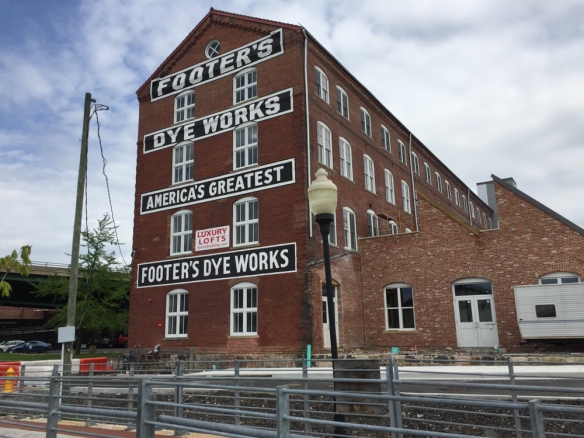 This is the last remaining structure of what was once the largest cleaning and dyeing establishment in the U.S. and a major employer in Cumberland. I think that it is now apartments.
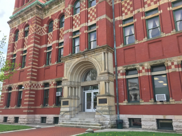
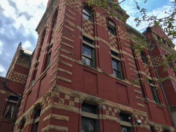 This is the Allegany County Court House build in 1893-94.
 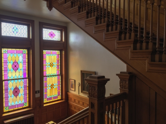 Here is a view inside the Courthouse.
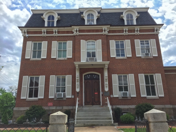 This building has housed the Board of Education since 1936 but was built in the 1860’s for William Walsh who served two terms in the House of Representatives.
 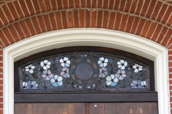 This is the stained glass above the door.
 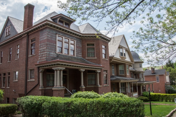 The rest of these photos are in no particular order, but I walked several blocks and over forty of the houses are listed in the Self-Guided Walk Into History. The house above was built for an attorney in the late 1890’s.
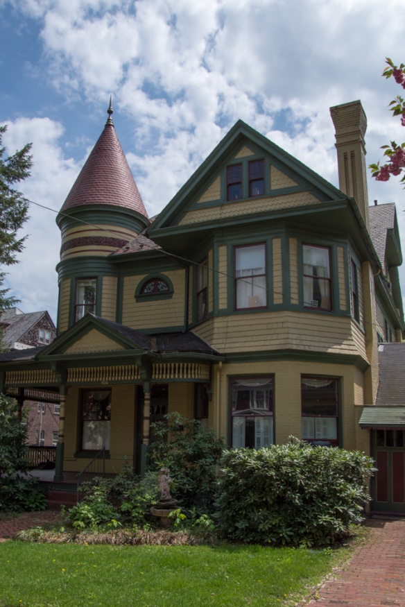 Built around 1890.
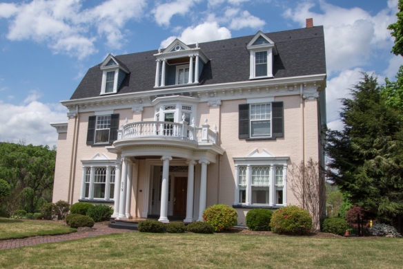 This one was built in 1890.
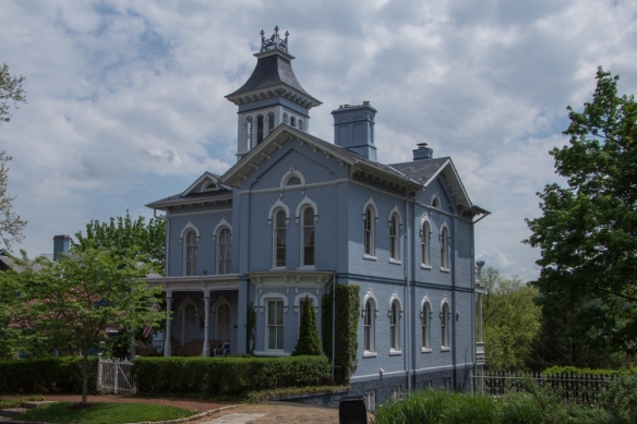 Some of these houses weren’t listed on the Tour Guide or I just don’t remember which they are.
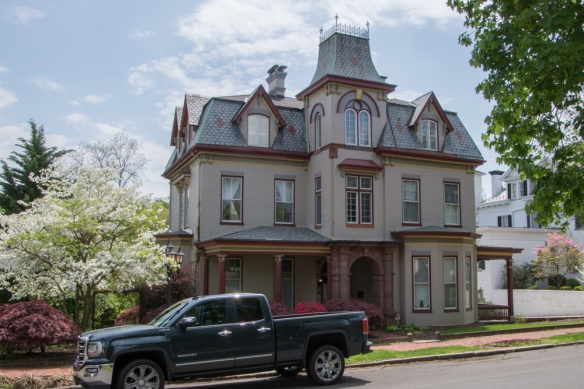
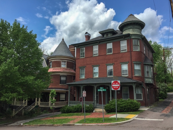
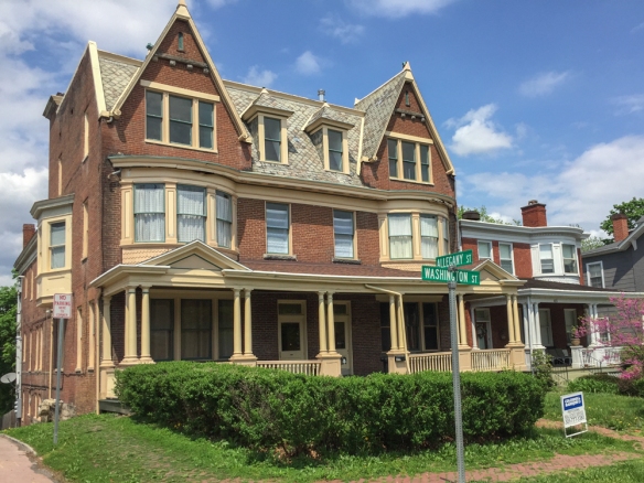 1880.
1880.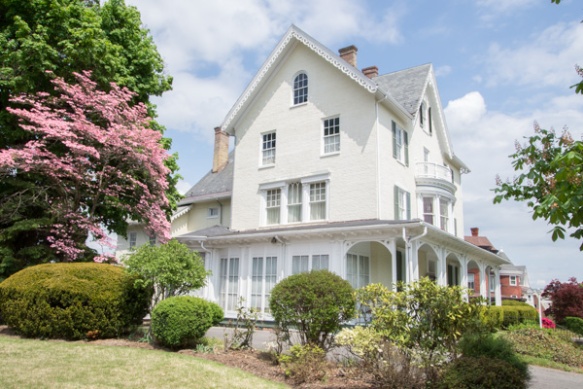 Built in 1855, now the Woman’s Civic Club House.
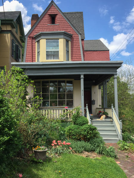 This house was built in the early 1880’s and known as “The Little House because is is the smallest house on Washington Street. The brochure says that this house “features a beautifully curved staircase and a Colonial Revival fireplace with a bullrush design in cast iron”.
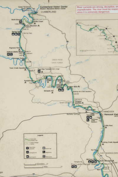 This map shows just the western half of the canal and it really should be turned 90 degrees because the canal runs east-west. I was staying in Frederick which is about a half hour from the Potomac River and the canal. I headed for the canal at a place called Four Locks.
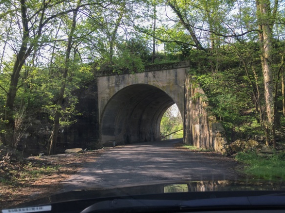 In this area the roads cross back and forth under the railroad which also follows the river. In fact a lot of the story of the canal is about the competition between people who thought the canal would serve as the best way to transport coal to the west and those who supported the railroad.
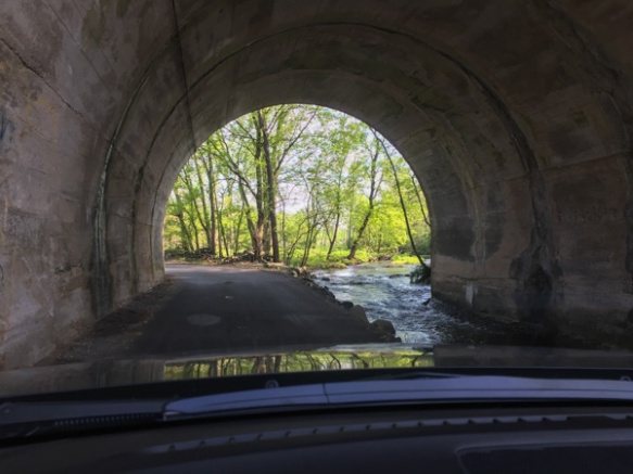 The railroad goes over the road here and the creek runs through the tunnel.
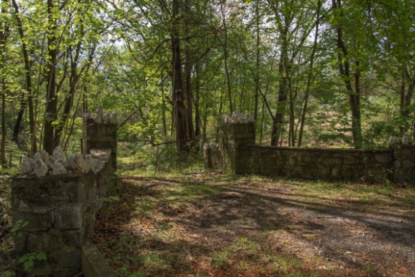 I followed my phone directions and found myself turning off the main road onto other narrow roads that wound through the woods.
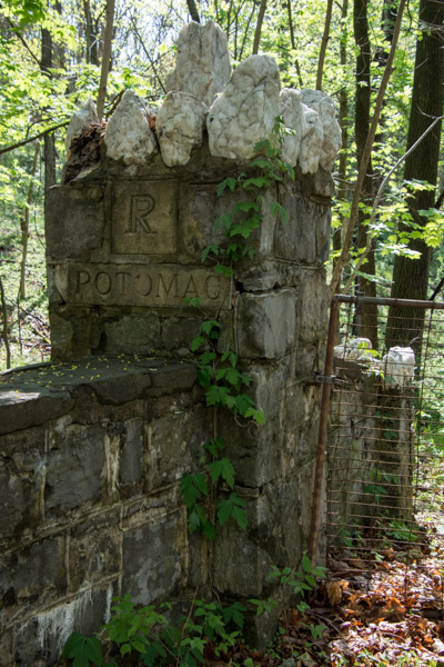 This is a detail of the stone fence in the previous photo…
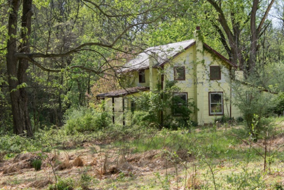 …and this is the abandoned house at the end of that driveway.
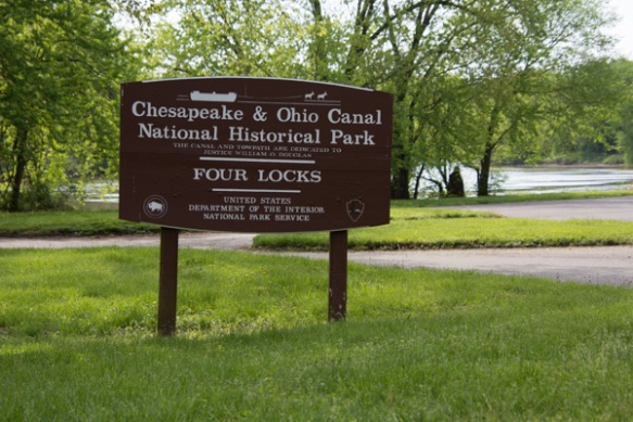 I found Four Locks, so named because the Potomac River makes a large loop here.
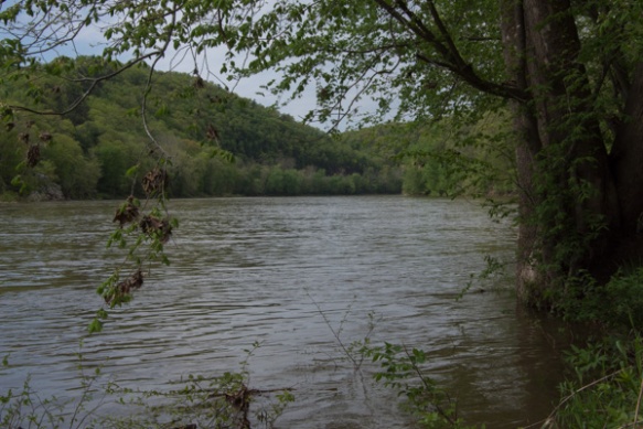 View of the Potomac River.
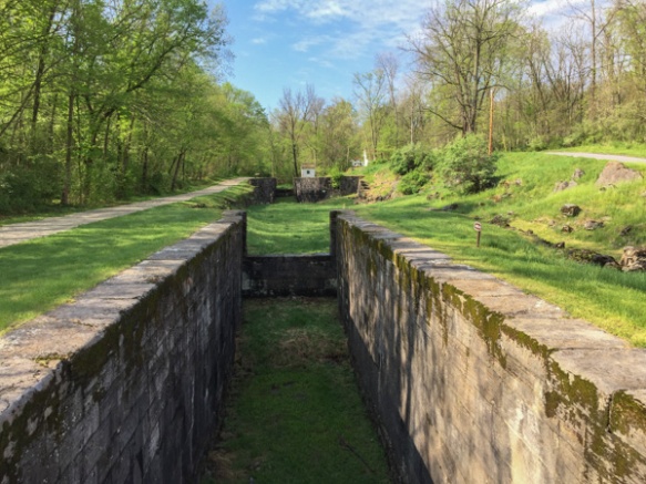 Rather than build a canal the length of the loop, the canal makes a short cut, necessitating four locks (#47-50) all within a half mile.
 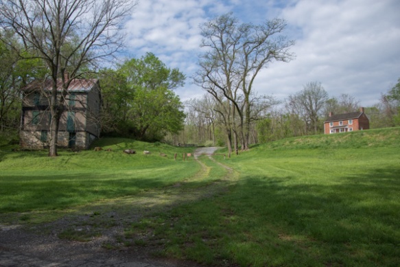 The locks were built in 1836-1838 and until the canal closed in 1924 there were two general stores, two warehouses, a dry dock, mule barn, post office, school, farms, and houses in this community.
 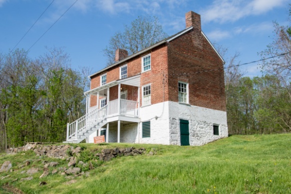 The lockhouse at this location is available to rent for overnight stays.
 That is the mule barn in back. I read that there were 3000 mules working on the canals moving boats between the locks. I found it fascinating to imagine the effort that went into this endeavor–not only the construction but also moving boats up and down the canals. I hadn’t made it to the Visitor Center yet so didn’t yet have the full story.
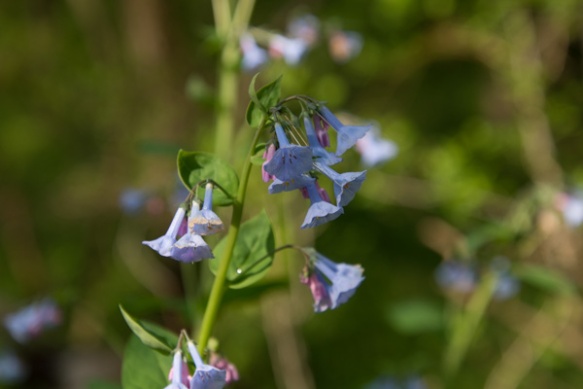 Virginia bluebells.
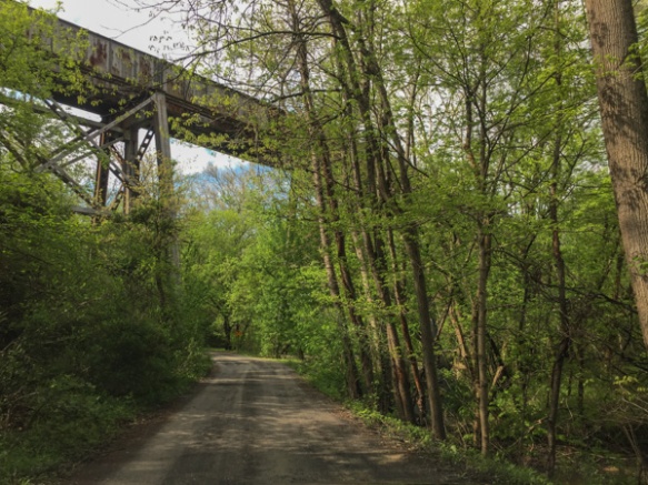 After walking around Four Locks I wound a few more backroads to find McCoys Ferry, a crossing on the Potomac. That is the railroad passing overhead. Then I got back to the freeway to head to Cumberland.
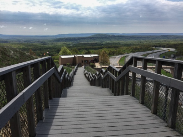 This is Sideling Hill Visitors Center, a rest stop along the highway with a great view over the pass and interesting geology in the road cut.
 Stacy’s face was split open to the bone. I called my vet and she said that if I wanted her to come it would be a couple of hours, but I could fix it myself. She told me what to do.
 I thought that the hardest part might be getting the old goat clippers to work. I found them in the tool box and after oiling they worked fine. That showed that the wound was longer than it appeared with hair over it.
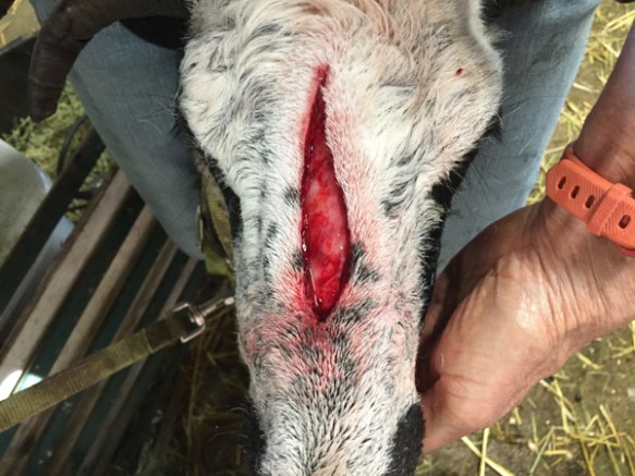 Then I scrubbed with betadyne.
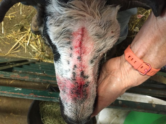 Fortunately I had bought the staple gun (meant for this purpose) a long time ago. I had forgotten about it until the vet suggested using staples. She barely flinched throughout this.
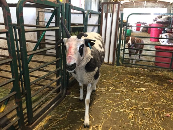 Nancy also suggested putting some kind of cover over this for a few days just to protect it. Since I haven’t worn pantyhose in more years than I can remember so it was lucky that there were some in the back of a drawer.
 The most stylish sheep are doing it!
 While I’m at the barn, here is a photo of the long-awaited work on the southwest corner where a lot of the wood is rotten.
 And speaking of veterinary issues, these are foxtails I pulled out of Rusty’s chest this morning. You can see on a couple of those how they had worked their way into the skin.


 The Fiber Friends’ sign said that they were “Celebrating the Royal Wedding with a Royal Shawl”.


 These are two of the JSBA inspectors that I communicate with via email a lot. Royal on the left, is the person who bought the sheep I brought.
  Here is a photo of showing Serrano that Royal just sent me.
 As things were winding down on Sunday afternoon I helped Royal load the sheep for his drive to Pennsylvania. That’s my two with their new friends.
 Serrano in the trailer.
 As I left the fairgrounds I took a few photos of the gorgeous countryside.
 I love seeing the farms and these old barns.
 …I laid out my winnings.
 Stay tuned for one more day of Maryland adventures!
 Saturday morning I met up with a Ravelry friend and her crew for their annual tailgate breakfast before the show opened. They went to get in line and get organized for the day and I went in the back gate to take care of sheep.
 The number of people at this show is amazing. This was probably an hour after the gates opened and people were still pouring in. (I can’t help but think about the fool who, when I was involved with organization of Lambtown in Dixon, insisted that the beer booth would be the big money maker and didn’t give much importance to the activities for “ladies with the quilts” [did he even say ‘old ladies’?] )
 The main street. Food on the right. Sheep and vendors on the left. More vendors behind me and more in the distance.
 My first stop was the Fiber Arts show. I was surprised to see this award for Best Woven Article on the shawl I entered in the commercial yarn division. This is
  I had high hopes for the handspun V-shawl that I finished just in time for the show. It got second, but there was stiff competition…
  …very worthy of a win in this class. (There is a connection for some of you to this shawl if you read the card by kbdoolin.)
 I had also entered photos. (I had a whole suitcase devoted to the weaving and photo entries–good thing that Southwest allows two checked bags.) Another surprise!
 The main exhibit hall was packed with people. It’s hard to even get around.
 This is where the t-shirts, caps, etc. are sold. The line zigzags a couple of times with those barriers keeping ordered. I didn’t even try to go in there on Saturday. Writing this post reminds me that I did go back on Sunday and bought a t-shirt. There were only a few left from this year’s festival. I must have left the bag somewhere because it didn’t come home with me. 😦
 Outside the t-shirt building.
 The fleece show.


 Jacob horn necklaces.
  In the parking lot.
 Unique “flower” arrangement.
 Speaking of friends, another great thing about this trip was meeting up with people who also raise Jacob sheep. Some I had met before and others were just names from Facebook. Now I have met them in person.
 Scottish Blackface.
 Lincoln Longwool.
 Kerry Hill.
 Leicester Longwool.
 Tunis.
 Herdwick.
 Hog Island.
 Clun Forest.
 Shropshire.
 Border Leicester.
 And of course, Jacob. This is not my ram. This one had never been shorn.
 My sheep were shorn in February which put them at a disadvantage at this show.
 This is Jolene and Saffron waiting for the show.
 Andy, who drove the sheep filled trailer out here, offered to show one of the ewes.
 He is an experienced showman, but I’ll bet this is the first Jacob he has shown.
 My sheep place in the middle. The ram, Serrano, placed 4th out of 7 or 8. Jolene was 3rd and Saffron was 7th in a class of about 10.
 I hung around the Fine Natural Colored Wool show in case Andy needed help. This is one of Terri M’s fleeces. Color like a Jacob, but much finer.
 Look who was also on display. Making their debut, these are 50% Valais Black Nose sheep, the first generation in a breed-up program with the goal of producing almost 100% purebred sheep.
 Elegant and cute at the same time!
 Seen in the parking lot!


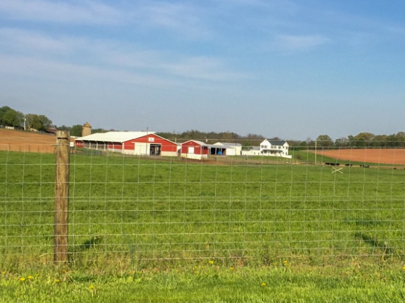 I didn’t want to take the main highways because I love seeing the farm country.
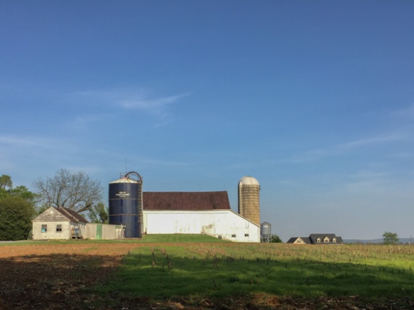 I pulled over in a couple of places just long enough to get photos with my phone.
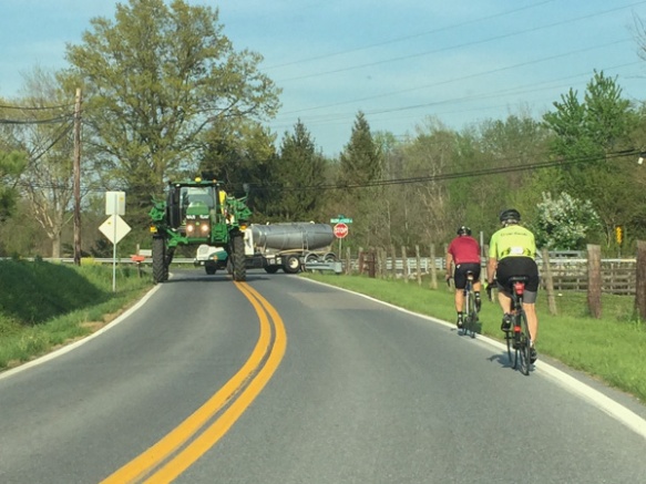 You can’t tell from this photos but that tractor is big enough that the car I’m driving could have almost gone right under it. I don’t know what crop that is for.
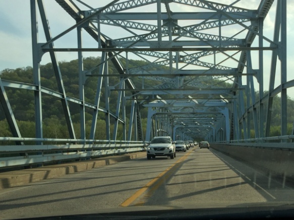 Crossing the Potomac River. I crossed a couple of times before I found the parking area for the National Historical Park at a place called Point of Rocks. (Actually I parked elsewhere and finally found this when I started walking toward the river.)
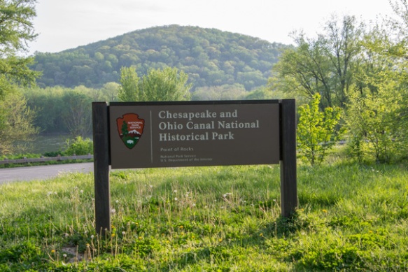 The C & O Canal follows the Potomac River for 184 miles and was used for about 100 years as a way of transporting lumber, coal, and agricultural products.
 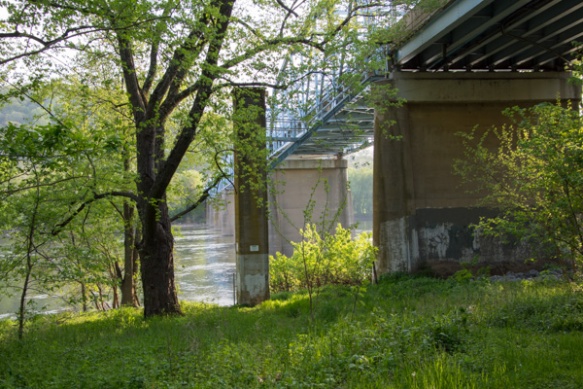 The bridge from below.
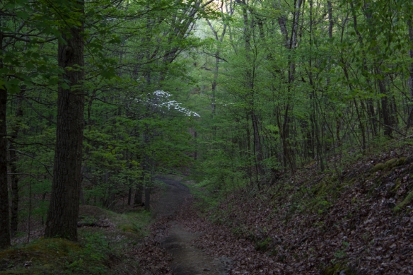
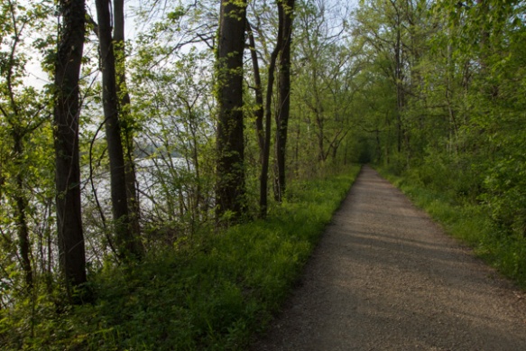 I walked along the towpath for an hour or so.
 Here is a tree I haven’t seen before. Flowers on the pawpaw tree.
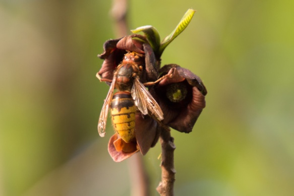 I don’t know what kind of insect this is but it is a big one.
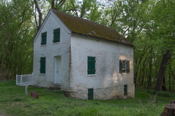 There are some lock houses still standing along the canal. These were houses provided to the locktenders who would be available to operate that lock 24 hours a day. This house, built in 1837, has been fixed up and is available for rent.
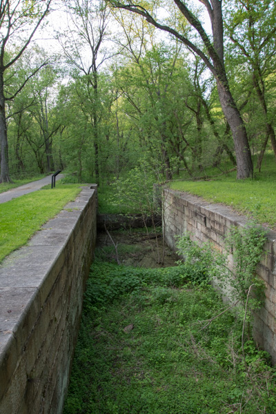 A view of the lock.
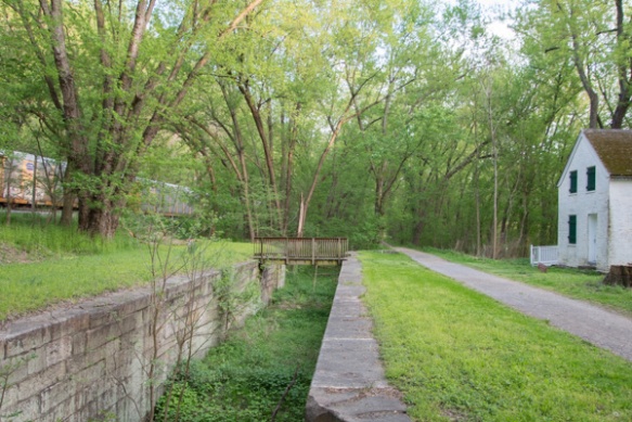 This photos shows the scale and proximity of the house, the canal and the railroad. Point of Rocks is famous because it is where the battle for the transportation rights played out. The mountain on one side and the river on the other left a narrow strip of land. “Both the C&O and B&O [railroad] fought in court for primary access to this “point of rocks.” The C&O won but the two companies compromised, sharing the narrow passage from here to Harpers Ferry.