New York Adventure – Day 3

I talked about Day 2 here. Now that I’m numbering the days I see that I have it wrong. Day 1 was really a travel day. We left Sacramento on Tuesday at 11:45 and got to Albany well after dark. That’s why I didn’t count it. I’ll stick with the current numbering system that forgets the travel day.

Kathleen and I both entered handwoven items at the show and needed to deliver them on Friday. That was the first stop of the day.

After delivering our items we drove back to Hyde Park so we could tour the Vanderbilt Mansion. This family tree starts with Cornelius, born in 1794. At age 16 he bought a sailing barge using $100 borrowed from his parents. He started his own shipping business and eventually was involved in railroads. In 1871 he opened the largest strain station in North America, which would eventually be called Grand Central Station. The bulk of Cornelius’ estate went to the firstborn son, William. Wlliam doubled the Vanderbilt fortune and each of his 8 children built extravagant mansions, shown on the chart above. The estate on the far right is the one I toured last summer in Asheville, North Carolina, known as “America’s Largest Home”. Notice on the family tree there are no heirs for Frederick’s home, third from right.

Frederick and his wife, Louise, had no children. They left the estate to Louise’s niece but she didn’t need it, having plenty of her own money and a mansion, after marrying into another rich family. She tried to sell the property but there were no buyers. Her neighbor, President Franklin D. Roosevelt, suggested that she donate the estate to the National Park Service, and the Vanderbilt Mansion National Historic Site opened in 1940.

The entrance hall was used for seating and conversation as well as having doorways into all the other first floor rooms. The green marble pilasters were imported from Italy. (From Wikipedia: “In classical architecture, a pilaster is an architectural element used to give the appearance of a supporting column and to articulate an extent of wall, with only an ornamental function.“) We were told that many of the home’s features and furniture were imported from Europe.

Reception Room. The National Historic Site website says: “Eighteenth-century-style French salons were a typical feature of Gilded Age mansions. Though infrequently occupied or used, they nonetheless were essential in the display of wealth and worldliness.

I took this photo of the ceiling in one of the rooms. I think it was the Reception Room.

This is on the second floor where you can look down to the first …

…or up to the skylight.

Mrs. Vanderbilt’s bedroom modeled after those of 18th century French royalty. The railing around the bed was typical of royal bed chambers. I don’t remember if this was determined to be true, but the tour guide told us one theory that there may be observers when a Queen gives birth so there is no question about who is the true heir. I just found this on the National Historic Site website: “The railing around Mrs. Vanderbilt’s bed is an architectural convention borrowed from many European royal palaces. In the 17th and 18th centuries, it served both practical and symbolic purposes related to royal births and ceremonies that occured daily when the king or queen woke up. At Hyde Park, the railing serves no purpose other than to reference the architecture of Europe’s finest royal houses.”

I don’t remember what this room is but looking at the map I think it is probably the Boudoir.

We took the stairway to the Servant’s Basement.

This is the view from below. There are four floors (including the basement), 54 rooms and 21 fireplaces. The third floor is closed to visitors and we were told that it is not as it originally was, being used to house Secret Service agents at some point in the history of Hyde Park. There is much more information to be found on the referenced website.

Change of scene… We stopped at the Eveready Diner in Hyde Park for lunch and met up with California friend, Siobhan, here. I didn’t drive during this whole trip and kept losing track of which town we were near. We stayed outside Tivoli, New York and drove to Rhinebeck, only 11 miles south. Hyde Park is only another 10 miles south of Rhinebeck. So we were back and forth on that same corridor for the whole trip.

On the way home (to our AirB&B) we took a side road to see some of the countryside.

Fall colors in evidence.

To be continued…

New York Adventure – Day 2

I thought that It would be great to come home all caught up with my blog posts. That didn’t happen–partly because it’s not as easy to work on the iPad as on my computer and partly because I spent time with my friends every evening and didn’t focus on other things.

On the second day in New York we drove to Hyde Park where there are three National Historic Sites we intended to visit. We started at this one.

We signed up for a tour of FDR’s house. This is the stable where we gathered.

FDR was born in this house in 1882. After he was married and the family grew there were additions to the house There are also adaptations for wheelchair access since he was unable to walk unaided after contracting polio in 1921. I was surprised to learn the extent to which that fact was hidden from the public throughout his life.

There is a ramp to this room, but when Roosevelt was alive the ramp would be concealed once he was in the room and awaiting his guests.

I took this photo because that desk is almost identical to the one that I used while I was a kid and through high school. It belonged to my grandmother who had lived in New York. I always liked the “secret” cubbyholes that were those fancy columns on either side of the door at the center of the upright part. My granddaughter has this desk now.

We had started at the FDR Presidential Library but had only a half hour before our tour of the house. There was so much to see here that we came back. I thought that a Presidential LIbrary would be full of books, but this is a museum. It is very well presented and there is an overwhelming amount of information here. This is the first Presidential Library and I assume that maybe others are modeled after this one. This one opened in 1941, and of course it would have been very different than what it is today.

I knew the bare basics of this era but this exhibit pulls it all together in a very informative and organized way. The exhibits are all set up in order so that you move through Roosevelt’s story from before he became President to his death during his fourth term.

It starts with the Depression when Hoover was President.

When Roosevelt was elected he jumped right in and tackled the major problems facing the country.

I am of course familiar with all of these programs now because they are part of our way of life, but I have never thought about the time when they were developed.

Eleanor is included in this museum as well. There is another National Historic Site at her home but we didn’t have time to go there. This letter is of interest to me because she recognized, way back in 1939, that California’s redwood forests were worthy of protection (second paragraph). There was a lot here about Eleanor’s influence and political activist. The FBI had quite a large file on her activities!

This is a working office used by Roosevelt during his presidency as is told in the photo below.

There was so much to see at this library that I could easily go back if I ever get to this part of the country again.

We drove to the Vanderbilt home only a few miles away. We would have had to wait a couple of hours for space in a tour so we decided to come back the next day.

We wandered through the gardens before we left to go “home”.

I don’t have many photos of the AirB&B where we stayed. This is from the driveway.

I stayed in this bedroom.

The bathroom that was shared by two bedrooms. The third upstairs bedroom had it’s own bathroom in a totally different style. We figured out with Google and other clues in the home that the owner is an architect with an office in Brooklyn.

This living room and the kitchen are where we spent most of the time. As much as we looked forward to exploring this part of the country and going to the fiber show, some of the most enjoyable time was spent sitting here and around the kitchen table.

Under the Golden Gate Bridge

We decided to take Kirby to the beach and check out some of the Golden Gate National Recreation Area. There is so much to see and it is so close to home, but I have never taken time to explore it.

We had some good advice from a friend who works in San Francisco and started at Ocean Beach.

After the 105+ days we’ve had at home, the overcast windy beach was a welcome change.

We chose the beach at Fort Funston for our second stopping point. Dan and Kirby are sitting on an old gun mount.

I was surprised at the old military structures that have fallen from eroded cliffs and are left in place. Usually I expect to see signs–either informational and educational signs (because this is part of the National Recreation Area) or warnings. But there is none of that–just remnants of what used to be there.

The hike up from the beach.

After a couple of hours at the beaches we drove to a parking lot between the Golden Gate entrance and Fort Point. We followed the trail that took us down to the Bay and to Fort Point.

The Fort itself is just under the bridge, but of course there was no bridge there when it was built in the 1850s.

That’s a huge cargo ship sailing to the Pacific.

I am fascinated by the history here and amazed that I’ve lived most of my life nearby (and was born in SF) and knew nothing about any of this.

According to the info on the NPS site a special arch was designed so that the bridge could be built without destroying Fort Point.

We climbed the spiral staircase to access the second and third floors.

Some of the rooms are open with historical displays.

The spiral staircase goes all the way to the top of the fort. It interesting to be right under the Golden Gate Bridge. It was also extremely windy and cold. (I thought about how we looked as grandparents supervising a child wearing shorts and flipflops.)

There was originally a lighthouse in use, but after the bridge was built it was no longer necessary.

View of the bridge on the way home. This was the first time since we’d been in San Francisco that the towers weren’t shrouded in fog.

MJ Adventure Team Goes to MD – Day 5 – Gettysburg

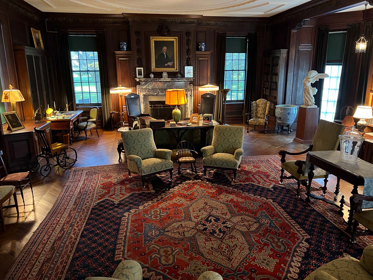
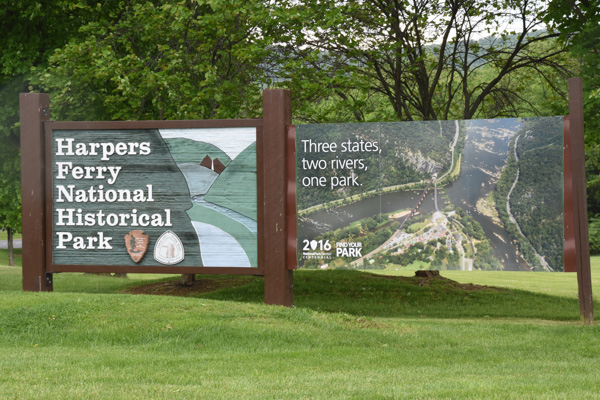
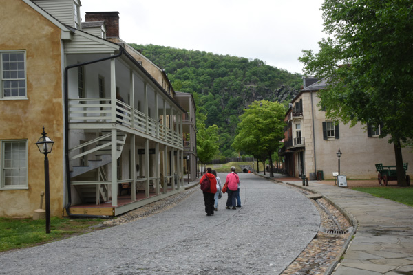
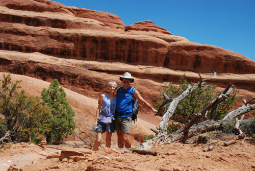
After a fabulous time at MDSW the fun wasn’t over for three of us.

IMG_9411

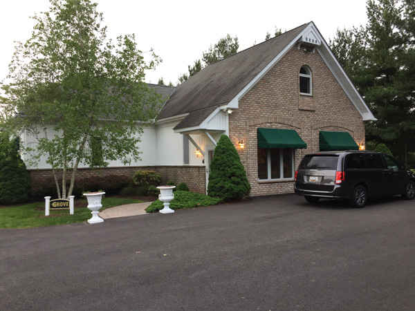
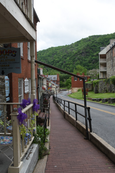
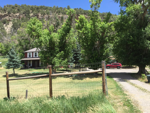
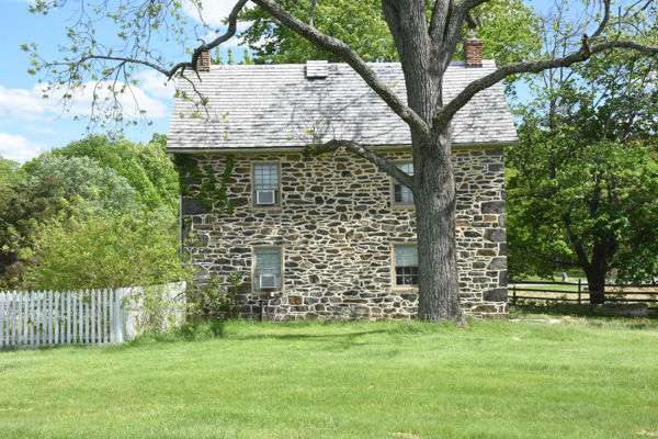
This is the house where we’d stayed for the last 3 nights.

DSC_0721

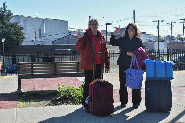
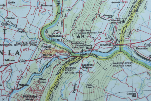
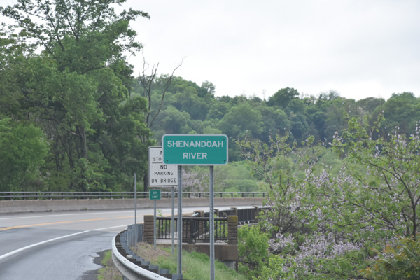
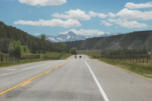
We left Dona and Mary at the bus station in Frederick where they would take a shuttle to the airport, and Chris, Kathleen, and I drove on to continue the adventure.

DSC_0723

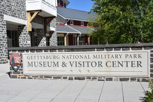
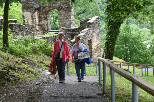
Today’s plan was to see Gettysburg National Military Park.

IMG_9518

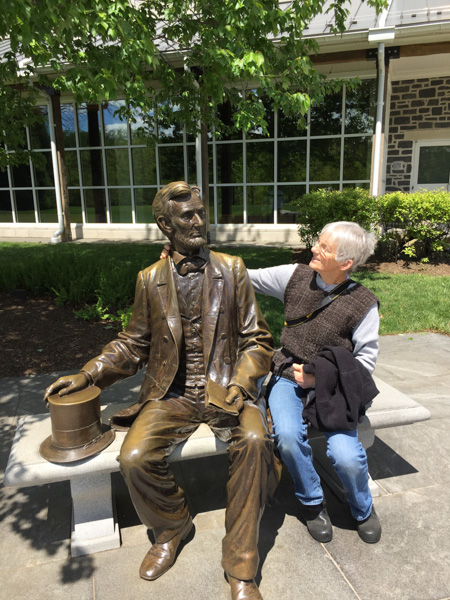
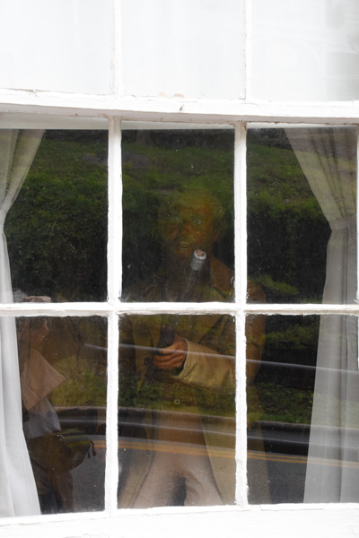
A chat with Abe outside the Visitor Center.

DSC_0725

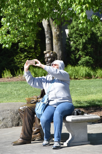
Chris took a selfie with him.

IMG_9516

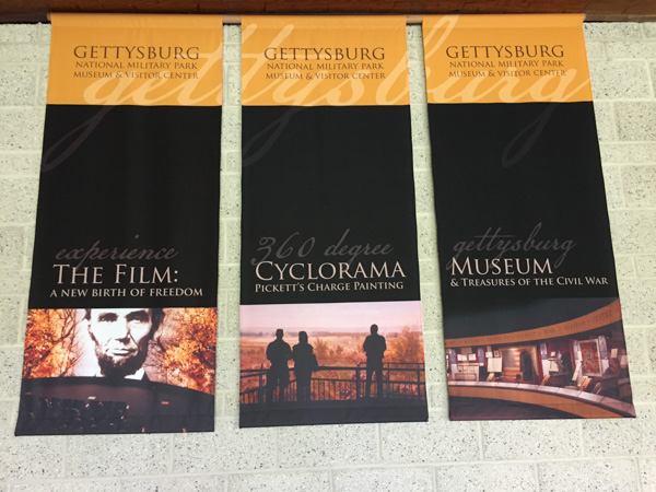
We spent a short time in the museum before entering the theater at our ticketed time for the presentation of a film about Gettysburg. This was a powerful film narrated by Morgan Freeman.

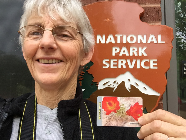
I must say here that I continue to be impressed with the modern visitor centers in our National Parks and Monuments. The presentation of history, natural history, collections of artifacts, etc is superb.  If you take the time to absorb all that is presented there is a lot to learn.

IMG_9515

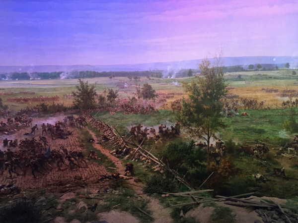
After the film we were ushered into a circular room to see the Cyclorama. . It is a painting depicting Pickett’s Charge that was completed in 1884 and is 42 feet by 377 feet! The overhead lights go dim and you watch the sky lighten as dawn comes. Then you hear the story while different portions of the painting are illuminated, changing as the day (July 3, 1863) goes on and ends in carnage.

Here’s a refresher for those of you who remember as few details of U.S. history as I do.

The Civil War began in 1861 and the Battle of Gettysburg, fought from July 1-3, 1863, is considered the most important engagement. Troops commanded by General Robert E. Lee battled the Union Army, led by General George G. Meade. The two armies were on parallel ridges about a mile apart and on July 3 12,000 Confederate soldiers were sent across the open fields in an attack known as Pickett’s Charge. Over 5000 soldiers were killed within an hour and Lee retreated towards Virginia. This marked a turning point in the war and was (I think) the northernmost point reached by the Confederate Army.

DSC_0734

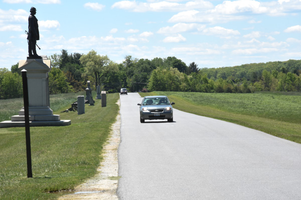
The Park encompasses the land upon which the battle was fought, located around the town of Gettysburg and there are signs that point out all the critical places that armies occupied and where battles were fought.  There is a 24-mile Self-guiding Auto Tour with opportunities to stop all along the way.

DSC_0776

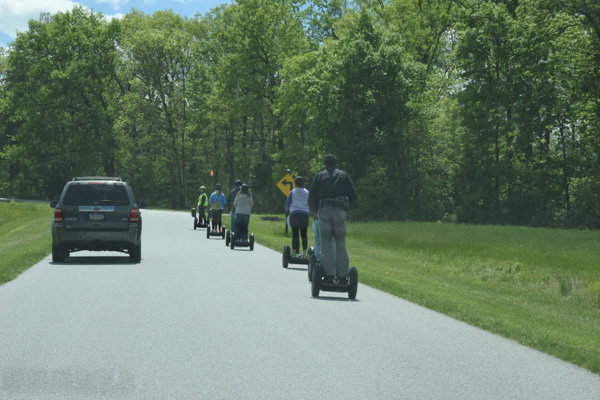
You don’t have to have an Auto to take the Auto Tour.

DSC_0735

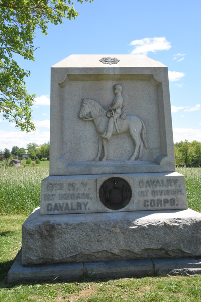
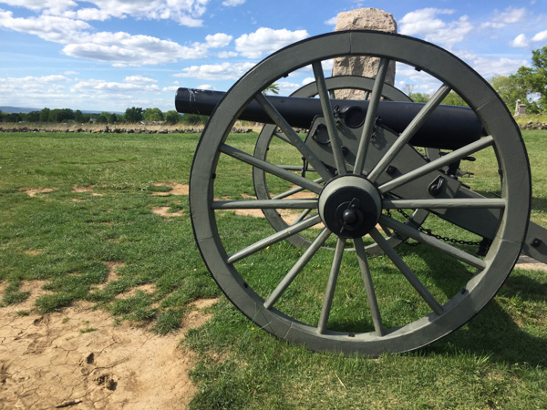
At first i took photos of all the statues we came across but I soon learned that there are over 1300 monuments and statues in the Park. Each regiment has their own and there are many markers that explain  the significance of some of the sites.DSC_0737

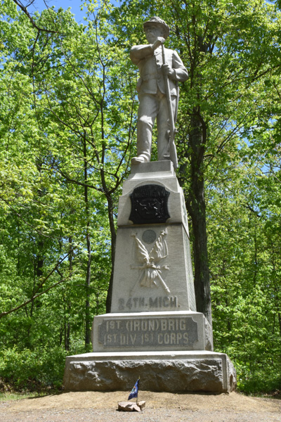
We looked specifically for this one because Chris has an ancestor who was represented here.

DSC_0744

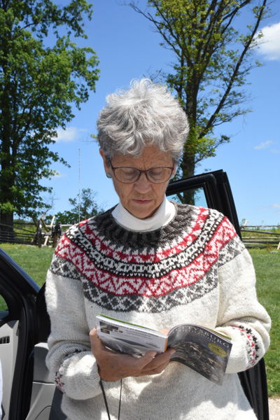
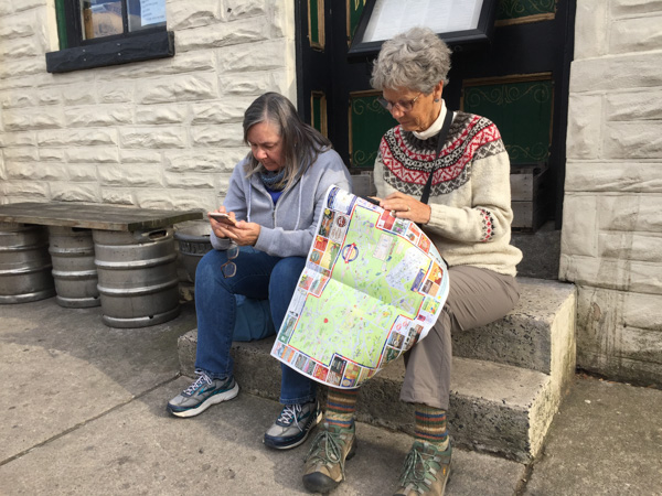
We had bought an audio guide to be downloaded on a phone and listened to while we drove through the area. We couldn’t make it work and Kathleen did a great job of narrating the tour using the accompanying book. Kathleen is wearing her MDSW awarding-winning handspun Jacob sweater that I mentioned in one of the previous posts.

Virginia Mem.-Gen.Lee
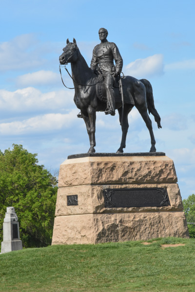
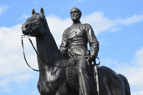
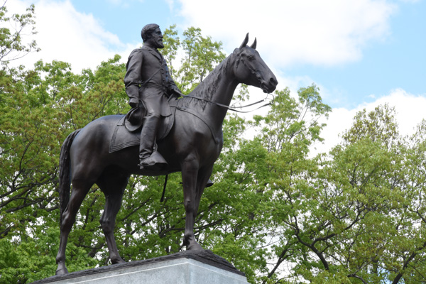
This is the Virginia Memorial, including a statue of Robert E. Lee, at one of our first stops. I love horse statues.

IMG_9528
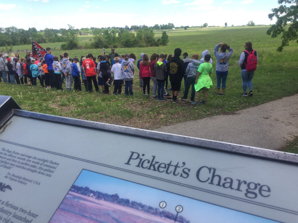
At this site we saw a couple of groups of school kids having a lesson in Civil War history. We listened awhile to the guide who explained things that I never thought about (importance of flags and drummers as a way to signal, for instance) and then had the kids line up in formation and “right face, left face, etc” It was cute to see most of them turn together but there were always a few that went the opposite way. Watching them reminded me of when my oldest son was in middle school and his history teacher, who was a film buff in addition to teaching history, led the kids in making a film of Pickett’s Charge. The kids were dressed in home-made or scrounged clothing to look the part and carrying home-made weapons (that wooden rifle is still around here somewhere I think). The school band participated as well as some of the kids who owned horses. They played out the event and made the film out in a field owned by a local farmer. I took a photo of these kids to send Matt as a fun reminder about that, but it became less “cute” and more sobering the more we read and the more we delved into the history of what actually happened here. DSC_0754
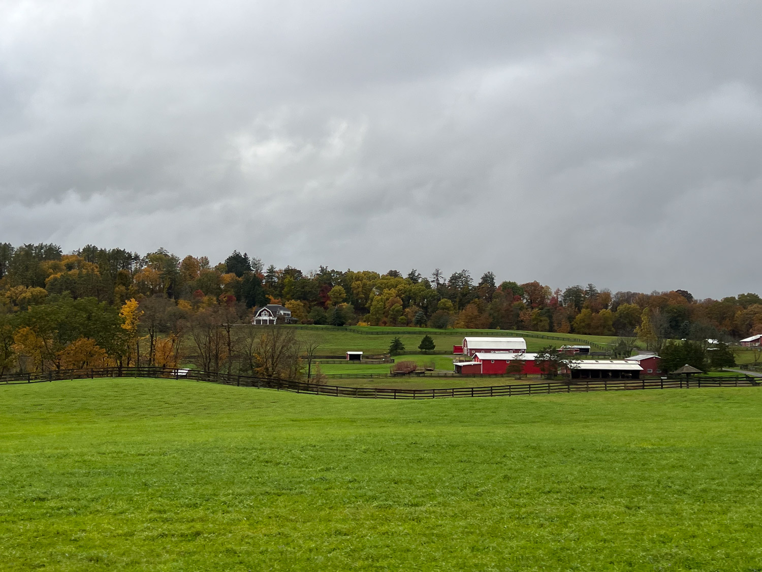
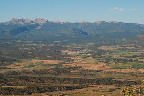
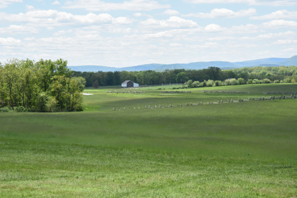
This is a view from where the kids are standing and where the Confederate troops were positioned on Seminary Ridge. Union troops were across the valley on Cemetery Ridge. This is part of a Valley that extends a couple of miles and there are significant points to the Battle of Gettysburg throughout. It is incongruous in this beauty to think of thousands of dead and dying men. And no one ever says anything about the dead and wounded horses. Add that in to the scene.

DSC_0771
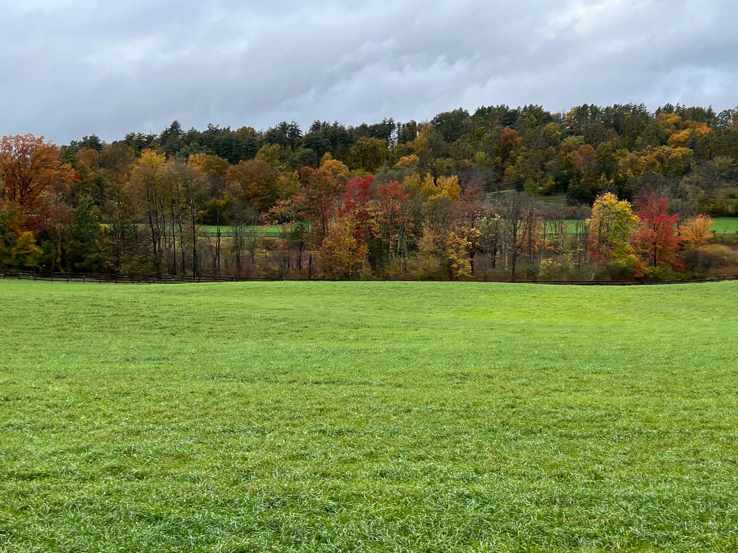
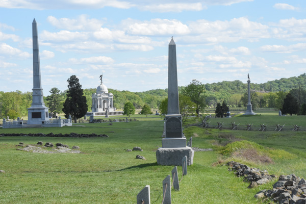
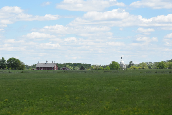
In this idyllic view you can see the Pennsylvania Memorial across the field and to the right. There are places along the route where you read (in the guidebook) about what the aftermath of a battle looks like–the biology of death–blood, flies, bloated bodies, etc.  I think that people need to hear that–does it help if we (they) are given mental pictures to try and  internalize the horror of war?  If kids hear that? What it really looks like? In person? Does it sink in at all what it means to kill another person? To be a bully in the most final sense?  This kind of atrocity is being played out in other parts of the world now. Do kids realize how lucky we are to live here? How about us adults too?

Traveling through history in such a vivid, visual way brings this out in me I guess. It seems that most historical events have to do with someone winning, someone losing, someone conquering. Kind of  like the newspaper. There isn’t much to say about normal people just living their lives. Off the soapbox now.

DSC_0752

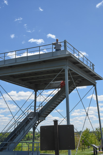
There were observation towers at a few places that allowed us to get an overview of the whole area and visualize the events that played out.

DSC_0779
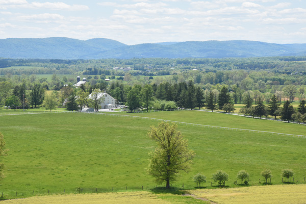
This is a view from the tower that includes, in the foreground, the Eisenhower National Historic Site, the home and farm of Eisenhower that he bought in 1950. We ran out of time to visit that.

DSC_0789
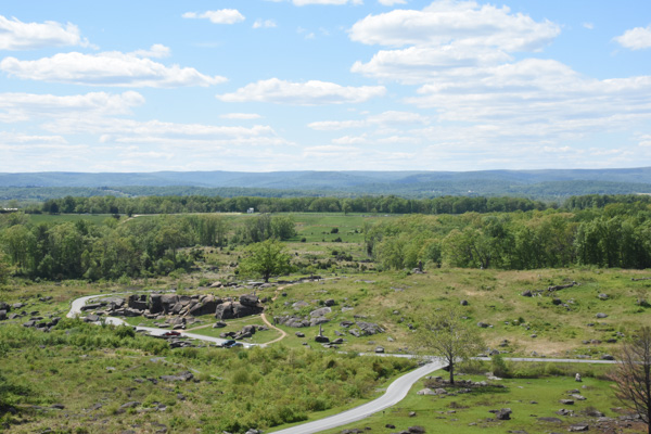
This view is from Little Round Top, a point controlled by Union soldiers. The rock formation below is known as Devil’s Den and the foreground is Slaughter Pen. There was fierce fighting as Confederate soldiers in a line a mile long approached from the far ridge and the Union soldiers tried to defend it. That description is too simplistic; there is detailed documentation about each battle site and each battle.

DSC_0804
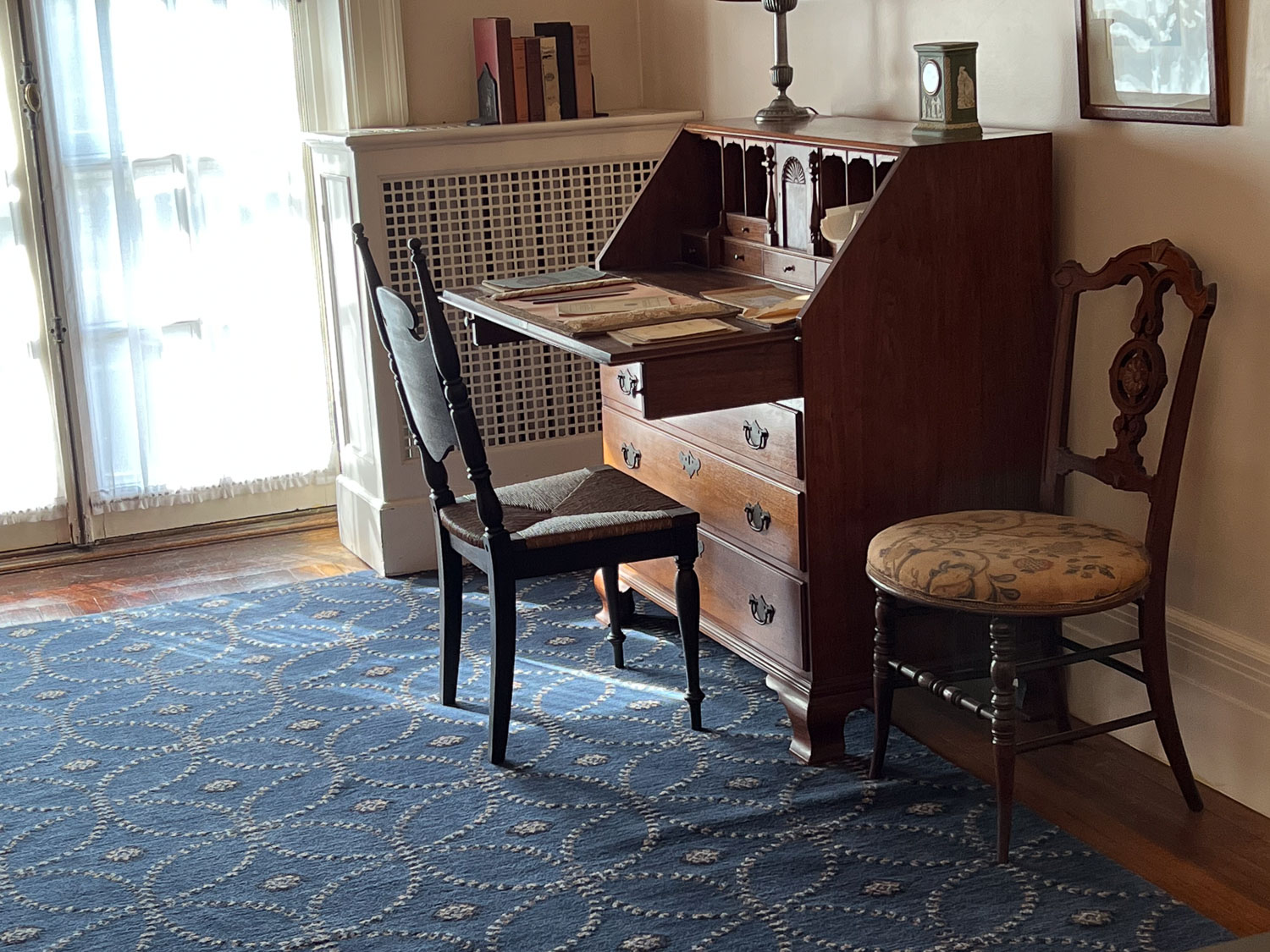
I don’t remember details of this house but it is along the tour route.

DSC_0830Near the end of the tour we were at what is known as the High Water Mark, the farthest point reached by Confederate soldiers during the Battle of Gettysburg.

IMG_9534From the Park brochure: “July 3…Some 12,000 Confederates advanced across open fields toward the Federal center in an attack known as ‘Pickett’s Charge’. The attack failed and cost Lee over 5,000 soldiers in one hour. The Battle of Gettysburg was over.”

DSC_0808
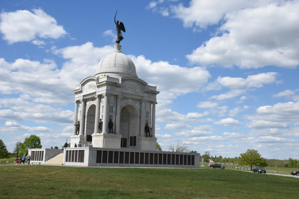
Completed in 1914, the Pennsylvania Memorial is the largest State Memorial in the Park and is near the High Water Mark.

DSC_0835

Union General Meade’s statue is nearby.

DSC_0838The auto tour was almost over. Instead of the 2-1/2 to 3 hours described in the brochure I think we were there for about 5 hours.

DSC_0846
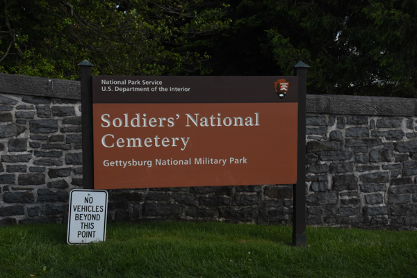
The tour ended at the Soldier’s National Cemetery, created after the battle, and where 3500 Union soldiers were later buried. Remains of 3,320 Confederate soldiers were removed from the battlefield to cemeteries in the South. Veterans from 1898 War with Spain to the Vietnam War are also buried here.

DSC_0852

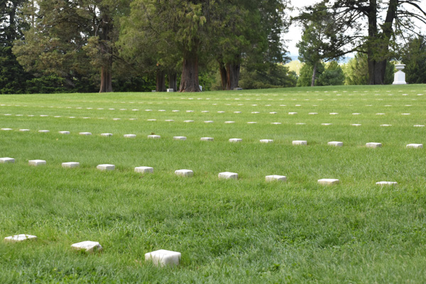
Graves of unidentified Civil War soldiers.

DSC_0729

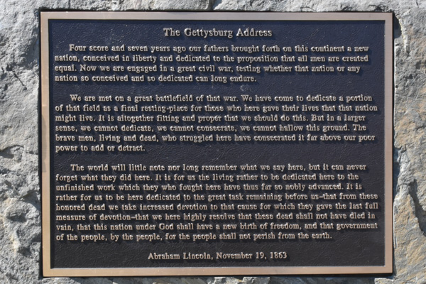
This cemetery is also the site where Lincoln gave his famous speech, taking two minutes  to speak these profound words, following a 2-hour speech  by Edward Everett, a well-known politician and orator from Massachusetts.

DSC_0863

Whew! This was a sobering day. It was also very windy and tiring and we were ready to find a hot dinner and warm bed.

IMG_9553

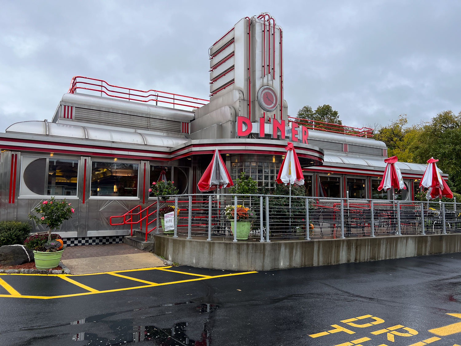
Dinner first. We tried one place that looked good but there was a 45 minute wait. Chris and Kathleen found another and we eventually had hot showers and warm beds.

Next post: Ft. McHenry and Harriet Tubman’s Underground Railroad.

MJ Adventure Team Goes to MD – Day 2 – Harpers Ferry

Here is Day 1–getting to Maryland. On Day 2 we woke up early with places to go, things to see. Our plan today was to take our fiber entries to the fairgrounds and then go to Harpers Ferry to explore some of the Civil War history of this area.QPAC4753

Chris drove and I got into my usual Road Trip mode–Map Book and phone.

DSC_0090

Here is the destination. Harpers Ferry is situated at the confluence of the Potomac and  Shenandoah Rivers, where Maryland, Virginia, and West Virginia meet. It is the easternmost town in West Virginia.

DSC_0116

We were driving through the Blue Ridge Mountains and every time I said the name Shenandoah I felt like breaking into song (John Denver style).  Wikipedia says: “The Blue Ridge Mountains are noted for having a bluish color when seen from a distance. Trees put the “blue” in Blue Ridge, from the isoprene released into the atmosphere, thereby contributing to the characteristic haze on the mountains and their distinctive color.”

Also from Wikipedia: “Isoprene is produced and emitted by many species of trees (major producers are oaks, poplars, eucalyptus, and some legumes.”

Harpers Ferry

We were looking for Harpers Ferry National Historical Park.

DSC_0122

The whole town is in a National Historic District, but it is the lower part that is the National Historic Park.

DSC_0200

The Park is spread out in non-contiguous sections and we did cross state lines a number of times.

West Virginia

DSC_0214

IMG_9311

We finally found the headquarters and Visitors’ Center where I got my lifetime pass to all the parks, monuments, etc in the National Park System. (That’s the only good thing about the last birthday.) Kathleen and I bought the National Parks Passport book that shows all the parks and historical sites region by region and has places to include commemorative stickers and “postmark” stamps. We took a shuttle to Lower Harpers Ferry where there many restored old buildings, some preserved as museums and others with modern shops inside.

DSC_0128

One of the buildings on Shenandoah Street houses a bookstore and the others are set up as they would have been in the 1800’s or as museums.

DSC_0143

We climbed the path past the ruins of the Episcopal Church…

DSC_0138

…and the Catholic Church that was built in 1833.

DSC_0149

This route happens to be part of the Appalachian trail so we were able to stamp our  passport books with the Appalachian Trail stamp!

DSC_0156

The shops on the left in this photo are all occupied with modern businesses, mostly souvenir shops or cafes.

DSC_0160

I saw this in one of the windows. As creepy as it is, it’s not nearly as bad as a doll in another window that looked like a crime victim or a participant in a horror movie. I took a photo but am creeped out enough by it to not want it in my blog post. Some of the people in this part of town have an interesting sense of humor.DSC_0157

IMG_9315

This is a detail of the stone wall in the photo above.

DSC_0129

DSC_0164

The town became an industrial center between 1801 and 1861 with the construction of  the U.S. Armory and Arsenal. Below is a detail of the sign in the foreground.

DSC_0163-2

Just below (in relation to this photo) is where the Shenandoah and Potomac Rivers meet, the Potomac cutting through a slot in the Blue Ridge Mountains.

DSC_0173

This is the confluence. There is a railroad bridge here and now a foot bridge that across the Shenandoah River.  The foot bridge is part of a system of trails including the Appalachian Trail, the north-south route along the crest of the Appalachians, and the 184-mile C & O Canal trail.   From the Chesapeake & Ohio Canal NHP site: “Preserving America’s early transportation history, the C&O Canal began as a dream of passage to Western wealth. Operating for nearly 100 years the canal was a lifeline for communities along the Potomac River as coal, lumber and agricultural products floated down the waterway to market. Today it endures as a pathway for discovering historical, natural and recreational treasures!”IMG_9324

This is the view from the western end of the bridge showing the old towpath and here is a link from a bicycling guide which states “the canal’s towpath remains a favorite of hikers, joggers, and bicyclists”.

IMG_9332

The overlook from the eastern side.

DSC_0183

Mary and Chris are not checking their stock portfolios here. We have a group of friends back home who want to travel with us vicariously. We all have been sharing photos and updates.

DSC_0196

We drove to another part of the park to see the Civil War battlefields and another view of the town.

Tulip poplar

I noticed this flowering tree.

Tulip poplar-2

Green flowers are so unusual. This is a tulip poplar which is actually more closely related to a magnolia than a poplar.

We spent only a few hours at this park where you could spend days exploring. But we made this trip for the FIBER. Next stop was a yarn shop in the town of Frederick where there was a sale promoting some well-known yarn dyers.

DSC_0215

IMG_9339

Mary  found one of her favorite indie-dyers there…

IMG_9340

…who dyed these yarns. While she stood in line (a very long line) to make her purchases the rest of us walked around the area.

IMG_9342

I enjoyed this window scene more than a couple of those in Harpers Ferry.

DSC_0086

Preview of the next day.

Road Trip to CO – Mesa Verde

It has been a few weeks since we finished our road trip and there have been plenty of distractions since I’ve been back that have kept me from sharing the story. Now that the Olympics are on  TV I am trying to multi-task. But it’s hard to pull my eyes away from the TV at times.*  However I’m close to finishing–we are still in Colorado but once we headed for home we didn’t stop for much.

After we left Black Canyon of the Gunnison  National Park we looked at our trusty Benchmark map book for Colorado and saw that we could probably get to Mesa Verde National Park in time to spend the night there. So after driving through the marvelous San Juan Mountains it was a relatively short drive from Durango to Mesa Verde. We got there about 6 p.m. and found that there were plenty of open campsites.

DSC_1323

We looked at the Park maps and saw a couple of 2-mile trails that we would have time for before dark. First we hiked up to Point Lookout at 8427′ elevation. This view is to the northwest with the San Juan Mountains in the background and the town of Mancos in the center.

DSC_1295

Squirreltail…

DSC_1313

…and Indian rice grass along the trail.

DSC_1311

DSC_1321

DSC_1326

After getting hiking this trail we drove to the the Knife Edge Trail which follows a section of the precarious road built in 1914 which was part of the original main access into the park.

IMG_2869

IMG_0407

Dan took this photo of me with the booklet that described the plants and other features along this trail.

IMG_2866

IMG_2874IMG_2875

This is a popular place for park visitors to watch the sunset. We walked back to the car at dusk and it was dark when we found a campsite. With the dark it got cold and we didn’t have a working stove. We ate tuna sandwiches and went to bed. DSC_1358

This is what camp looked like in the morning.

DSC_1354-2.jpg

There were deer around the camp in the night and at dawn when I got up.

DSC_1366

Seen on my early morning walk.

IMG_2876

We had learned when we paid for our campsite that the way to see the features for which the park is best known (the cliff dwellings)  is to sign up for one of the tours. We showed up the next morning for the Balcony House tour.

IMG_2877

We were directed to follow the trail to the end where we would find a ladder and to wait there.

IMG_2881

This tour is listed as the “most adventurous cliff dwelling tour” and we were warned that we would “climb a 32′ ladder, crawl through an 18″ wide by 12′ long tunnel, and climb up a 60′ open cliff face with stone steps and two 10′ ladders”. Not quite an Indiana Jones adventure but it did seem challenging for some of the tour participants.

IMG_2882

Can you imagine what this was like when people really lived here?

IMG_2902

I can see the challenge of being a mother of a toddler.

The Ancestral Pueblo people lived in the Mesa Verde area for about 700 years from about AD 550 to the 1200’s, first living in pit houses, then above-ground pole and adobe structures. The people built the cliff dwellings from the 1190’s to 1270’s and lived there for less than 100 years. It is unknown why, in the span of a generation or two, the people left the area.

IMG_2910

Ranger Spenser was glad to answer questions and discuss his passion for the earlier residents of these dwellings.

IMG_2908

Each village or homesite has a kiva built below ground or in the case of the cliff dwellings, into the rock floor.

DSC_1386

This is the view across the canyon from Balcony House.

DSC_1384

This is the same view with a longer lens. It was remarkable that when you really started to look (or got out the binoculars) that you could see dwellings in many of the cliff walls.

DSC_1376

Here is another that we saw later in the day…

DSC_1378

…and here’s the close up. This is known as Square Tower House, a 4-story building.

IMG_2920

Remember the part about the 18″ x 12′ passage. Here it is…

IMG_2923

…followed by the ladders…

IMG_2924

…and steps up the cliff wall.

We drove through more of Mesa Verde, looking at some of the other sites, but knew that we needed to get on the road if we were to get home some time the next day.

Next post: Four Corners and Monument Valley.

*I still didn’t get this finished and now its the next day.

Road Trip to CO – Gunnison to Durango

We left home on Wednesday and planned to get home on the following Wednesday. This was Monday. We had driven the road north of the Gunnison River the day before and camped near the Blue Mesa Dam.

IMG_2788

This campsite was essentially a parking lot for RV’s, but we just needed a place to eat and sleep so it worked.

DSC_1131

The Black Canyon of the Gunnison became a National Monument in 1933 and was made a National Park in 1999, over twenty three years after I spent a summer in the area. It contains 14 miles of the canyon’s total 48 mile length.

IMG_2795

I guess they’ll take anyone as a Park Ranger.

DSC_1132

The canyon is so deep and narrow due to the power of the Gunnison River as it drops an average of 96 feet per mile.  The Gunnison loses more elevation in the 48 miles of the canyon than he Mississippi River loses in 1500 miles.

DSC_1194

It is a sobering thought that the power of this river is forever harnessed due to up-river dams that lessen seasonal flooding. Therefore, build up of sandbars and more vegetation has changed the ecology of the canyon.

DSC_1200

The Painted Wall was created over a billion years ago when molten rock flowed into fissures in the dark wall.

DSC_1177

That molten rock cooled into crystals of mica, quartz, and feldspar. Amazing patterns were revealed as the river cut through the rock, forming the canyon.

DSC_1166

Breakfast with a view.

DSC_1218

I enjoyed the signs along some of the trails to help with plant ID.DSC_1151

I recognized this bush with it’s remarkable fuzzy seed dispersal method, but couldn’t quite find the name in the recesses of my brain. Mountain Mahogany.

DSC_1206

I also recognized this as in the Mariposa Lily family. It’s called Gunnison Sego Lily.

We spent half the day exploring the canyon from the rim. There are no trails to the river in the Park. We saw a couple of trails when we drove along the north rim east of the Park, but they are not for the feint of heart or casual hiker. The rim views are spectacular enough. But we had limited time and needed to get on the road.

In the summer and fall of 1976 I worked  for the BLM in Montrose, Colorado. I had fond memories of renting a bunk house on property between Montrose and Ridgeway and spending weekends exploring the old mines and alpine meadows in the beautiful San Juan Mountains. I had never been back, but wanted to use this opportunity to drive through that country.

IMG_2812

As we were driving down Hwy. 550 I wondered if I would recognize the place. The highway followed the Uncompahgre River but was on the wrong side of the river. Surely I would have remembered living right next to a major river like that. My memory was that the bunkhouse was up against a bluff and just south of the big house. We got to a point where the river shifted course for a brief period to the west side of the highway and there it was. I’m glad to see that they place hasn’t been torn down and, in fact, looks as though it has been fixed up. The bunkhouse is just behind the red truck and, yep, there is a bluff behind it.

DSC_1239

The view heading south from the house. Not a bad place to spend a summer…or a life (if you can deal with snow).

DSC_1245

We drove south into the San Juan Mountains.

IMG_2814

I have memories of driving to Ouray and heading out from there towards Telluride to explore the mountains. I don’t think that these towns had the tourist appeal then that they do now.

IMG_2834

This is one of the most gorgeous places I can imagine. It’s hard to get photos that do it justice.

From dangerousroads.org “In the state of Colorado…there’s a special highway built in the late 1880’s: the Million Dollar Highway, part of the San Juan Skyway. It’s one of the nation’s most spectacular drives…The road’s winding design, providing stunning panoramic views, is very curvy and fun for a leisurely ride, so it pays to take it slow. Offering breathtaking mountain, valley and gorge views, the Million Dollar Highway is one of the most beloved roads in the country. This classic stretch of two-lane blacktop snakes its way through the San Juan Mountains, the wildest and most rugged peaks in the Rockies.”

From another website: “Originally built in 1883 by Otto Mears as a toll way from Ouray to the now abandoned town of Ironton, this two lane highway offers spectacular views of the San Juan Mountain Range, and Uncompaghre Gorge. The road was extended to connect Silverton and Ironton over Red Mountain pass, and operated as a toll road until the early 1920’s when it was rebuilt and became part of the present day US Highway 550.”

IMG_2829

Can you imagine the road when it was first built?

IMG_2828

Here a a panoramic view of the modern day bridge over Bear Creek Falls.

DSC_1249

Originally the road connected Ouray with the Red Mountain Mining District to the south.DSC_0239

There are signs overlooking the site of the Yankee Girl Mine, one of the richest concentrations of silver ore found in the U.S. It started in 1882 and produced ore valued in today’s market at over one hundred million dollars, but lasted only about 16 years.

DSC_1261

Just more pretty scenery.

IMG_2861

This is taken from Molas Pass (10, 910′), the second of three passes on this highway going towards to Durango.

IMG_2858

Loving the mountains.

IMG_2857

Fortunately I don’t have to carry my camera gear the way William Henry Jackson did when he documented the West.

Onward to Mesa Verde where we would spend the night.

Road Trip to CO – Arches #2

We had only one day to spend in Arches National Park, but we took advantage of it all, hiking/walking/driving. I posted a lot of photos here, but there are more.

DSC_0876

We spent the first half of the day hiking a 7-mile trail. After that we drove to various points of interest or overlooks where there were shorter trails to more arches.

DSC_0879

We ended up hiking about 12 miles that day.DSC_0883

The scenery was all spectacular. DSC_0886

This is looking back at the parking area from the trail to Delicate Arch.

DSC_0888

Much of the trail is walking across the slickrock.

IMG_2668

Then the trail becomes almost a shelf that winds around the side of a cliff.

DSC_0904

When you get the first view around the corner of that cliff you’re almost blown away (literally as well as figuratively). What a site! It’s absolutely amazing. I mean we saw a lot of arches and cool rocks and cliffs earlier in the day, but there was something about this one that is stunning. Maybe it’s because you see it suddenly as you turn the corner. Maybe because it stand alone with no other features near it.DSC_0898

Maybe it’s because of it’s size. In this photo there are people. Do you see how small they look?

.DSC_0907

In fact, there were a lot of people. It took some patience to get a photo of the arch with no people. That’s Dan sitting on the rock while others venture towards the arch. At this location the wind was so strong that it felt as though you could be blown backwards off the cliff.

IMG_2670

Wind effect in my hair. It’s not standing up just from the sweat and 2 days of camping!

DSC_0919

As is the case with most hikes, the trip back to the truck took a lot less time. At the bottom there are petroglyphs. These images of a horse and rider, bighorn sheep, and dogs were carved between 1650 to 1850.

DSC_0922

We continued on the road through the park. This is an overlook across the canyon from Delicate Arch. You can see it right there in the center of the photo. The trail we took came from around the rocky cliffs at the left.

DSC_0929

It was getting dusk when we got to the trails to see the last arches. These were relatively close to the parking lot so there were lots of people there. If you look closely you will see people on the rocks under the arches and on the trail. That gives you a sense of scale.

IMG_2674

DSC_0935

IMG_2667

We followed another trail at this location…IMG_2675

…to get a different perspective…IMG_2680

…as the sun was going down.

IMG_2682

Interesting manmade patterns.

IMG_2690

We stopped at the visitor center to clean up and fill water jugs. I got in a bit of sheep showing practice before we left to find our camping spot for the night.

Road Trip to Colorado – Arches N.P.

The mosquitoes that had been relentless the night before (this post) were slightly less so in the morning.

IMG_2631

However the surroundings were beautiful as the sun reached the west side of the canyon.

IMG_2628

But we didn’t linger around camp. We packed up and drove just north of Moab to the entrance of Arches National Park.

DSC_0801

The cliffs on the left side of the photo are part of Arches and that’s the Colorado River flowing our of the canyon in the center of the photo.

IMG_2632

I had been here once or twice before but that was almost forty years ago. (Oh yeah, I was going to find my old slides and see if I have photos from back then.)

I don’t remember the names of all the arches. Besides sometimes I don’t want to know what names other people have used for formations. I like to enjoy them without always having to see or think of something that is not a rock. I’ll make up my own name if something comes to me.

IMG_2636

We had one day to see the park and, knowing that it was going to be a hot day, we decided to start with one of the longer trails. Out and back on the more traveled trail would have been about 5 miles. We ended up taking the “primitive” route to come back and that was 7 miles.

IMG_2648

I thought about giving up taking photos because it seem so hard to capture the grandeur, the color, the textures.

IMG_2655

But of course I continued to shoot photos and I am sharing some of my favorites.

DSC_0816DSC_0818

IMG_2663

Distances are so deceptive in this country. We had seen these rock walls in the distance and I had thought, “it’s a good thing we’re not going there”. The “primitive route” took us around those and beyond.

DSC_0852

Cairns are important in finding the trails over slickrock and through washes. Seeing those little rock towers kept us on track in places where the trail wasn’t obvious.

DSC_0854

DSC_0857

DSC_0838

More from Arches National Park in the next post.

Hawaii, Day 6

After spending five days on the Big Island, my daughter’s family,  my older son and his wife, and I flew to Honolulu with the main goal of seeing Pearl Harbor together. Katie and her family would fly home that night, Matt & Kaleena were staying a few more days north of there, and I was flying home the next day. DSC_3662Unfortunately this is a blurry photo but I like the image. I sat in the row in front of Kirby on this short flight. We picked up a rental car (had to upgrade to carry all of Kirby’s luggage) and drove to Pearl Harbor.DSC_3673 The monument includes several memorials and museums and it would be easy to spend a full day immersed in this history …but not with a toddler on board. We chose to tour the U.S.S. Missouri while waiting for our assigned time to see the U.S.S. Arizona Memorial. (Unfortunately all boat rides to the Arizona were cancelled due to windy conditions.)IMG_7842The USS Missouri was the last battleship built by the U.S. and was the site of the Japanese surrender, ending WWII. The ship also served in the Korean War and, after being modernized in 1984, in Desert Storm.DSC_3701The Missouri is now a permanent museum in Pearl Harbor.DSC_3693There were a couple of photo opps before entering the ship.USS Missouri

DSC_3704A lot of the ship is accessible and there is a wealth of information  covering the three eras when the ship was in use. It would be easy to spend several hours taking time to absorb everything. I have included just a few photos here.IMG_7862There is a display about the Japanese pilots who died in kamikaze attacks near the end of WWII. It is a moving exhibit but I don’t understand what can drive a young man to this end during that era any better than today’s suicide attackers (although I thing there is probably a world of difference in their reasoning). IMG_7864So sad…as are all parts of war.

There is a warren of passages below the main deck where people worked, ate, and slept. IMG_7868

IMG_7867

IMG_7873The living spaces for 1600 enlisted men were spread throughout the ship.IMG_7876Part of the modernization in the 1980’s.DSC_3731Back on the main deck we looked up and saw…DSC_3732Katie, Kurtis, and Kirby.DSC_3738A disappointment was not being able to go to the U.S.S. Arizona Memorial. This memorial is directly above the Arizona that still holds many of the 1177 men who were killed during the bombing that sunk the ship. DSC_3686During the day my thoughts kept going back to the National Museum of the Pacific War, the moving exhibit in Fredericksburg, Texas (birthplace of Admiral Nimitz) that we saw in July (blog post here). It’s well worth your time if you’re traveling in that area.DSC_3746Toddlers don’t care about this stuff.  Chasing birds and picking up flowers from the lawn are more their style. (If I chose to make this blog more commentary and opinion this would be the point to discuss innocence and when/how does it change.)

After spending much of the day at Pearl Harbor, we found my hotel in Waikiki. Katie, Kurtis, and Kirby relaxed there while waiting to catch the red-eye back to California. I had one more day of exploring.