We were on the way home after the stop inTrinidad Friday and Saturday. We spent Saturday night with Dan’s brother and SIL in Colorado Springs.
We had brunch with Dan’s sister, also in Colorado Springs. This is Dan and his two Colorado based siblings, Rob and Sally.
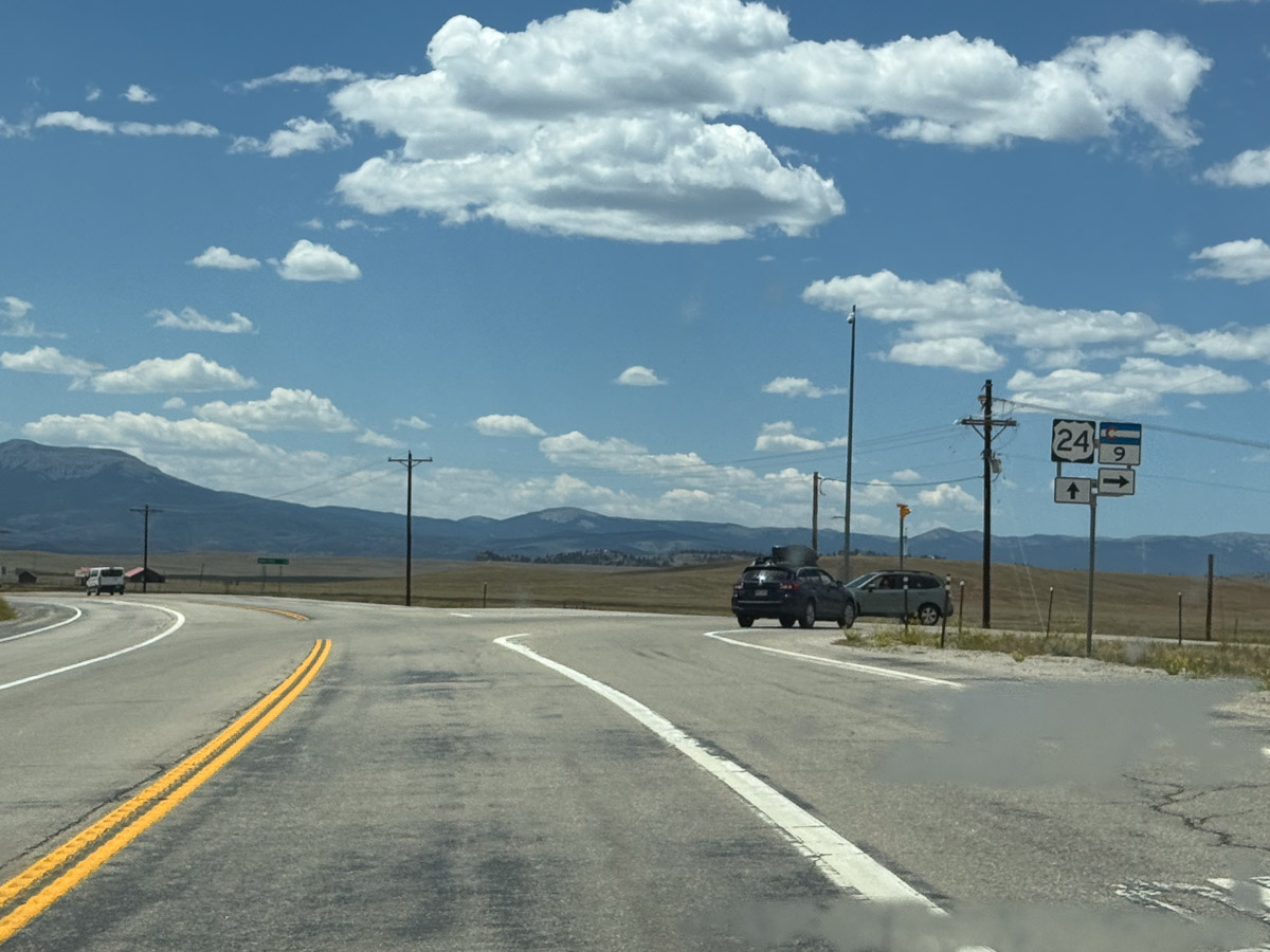
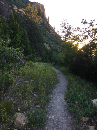
We headed west and planned to turn north to go through Leadville. We had thought about this on last year’s trip, but this intersection (or was it the next?) was blocked due to a fatal accident and we made a big detour. No such problem this time.
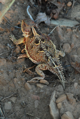
Somewhere along the road we stopped at this sign. I am interested that bighorn sheep horns are classified based on where the tip of the horn is in relation to the ear and the eye. I wonder if that could apply to Jacob sheep.
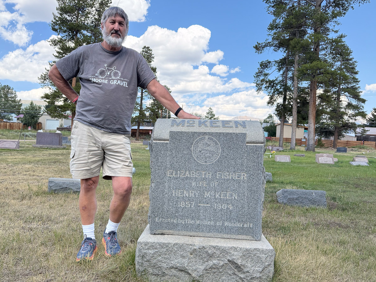
When we got to Leadville we stopped at the cemetery to look up Dan’s relatives. This is the headstone for Dan’s great grandparents on his dad’s side.
There was a detour driving into Leadville due to an event and we decided to see what was going on. It was the Boom Days Pack Burro Race!
I have decided that I missed out on an activity that I could have really enjoyed had I been able to start years ago. If you’re going to go on a long run why not take a burro? I would have loved to do this.
We got here as the last few competitors were finishing the course. This burro and his handler, in his late 70s according to the announcer, finished the 15 mile course. Remember, Leadville is at an elevation of over 10,000′.
This mammoth donkey and his handler finished the 22 mile course. I looked up the rules. Burros must carry the pack saddle with some basic equipment–a pick, shovel, and gold pan. The rules state that the burro must be on a 15′ lead and “the runner may lead, drive, push, pull, or carry the burro…may not ride the burro…”
This burro seemed to enjoy being petted after the race.
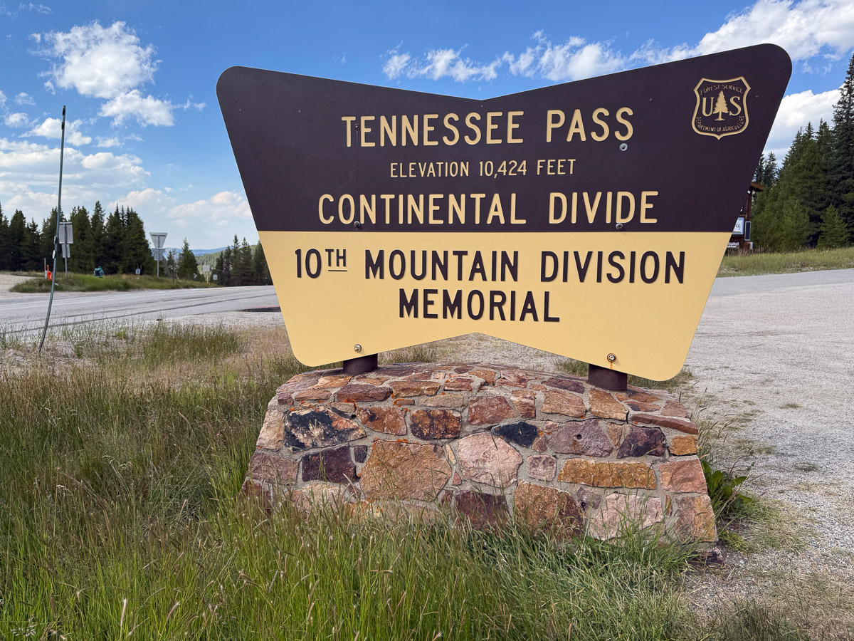
We continued west on Hwy. 24 and stopped at the points of interest.
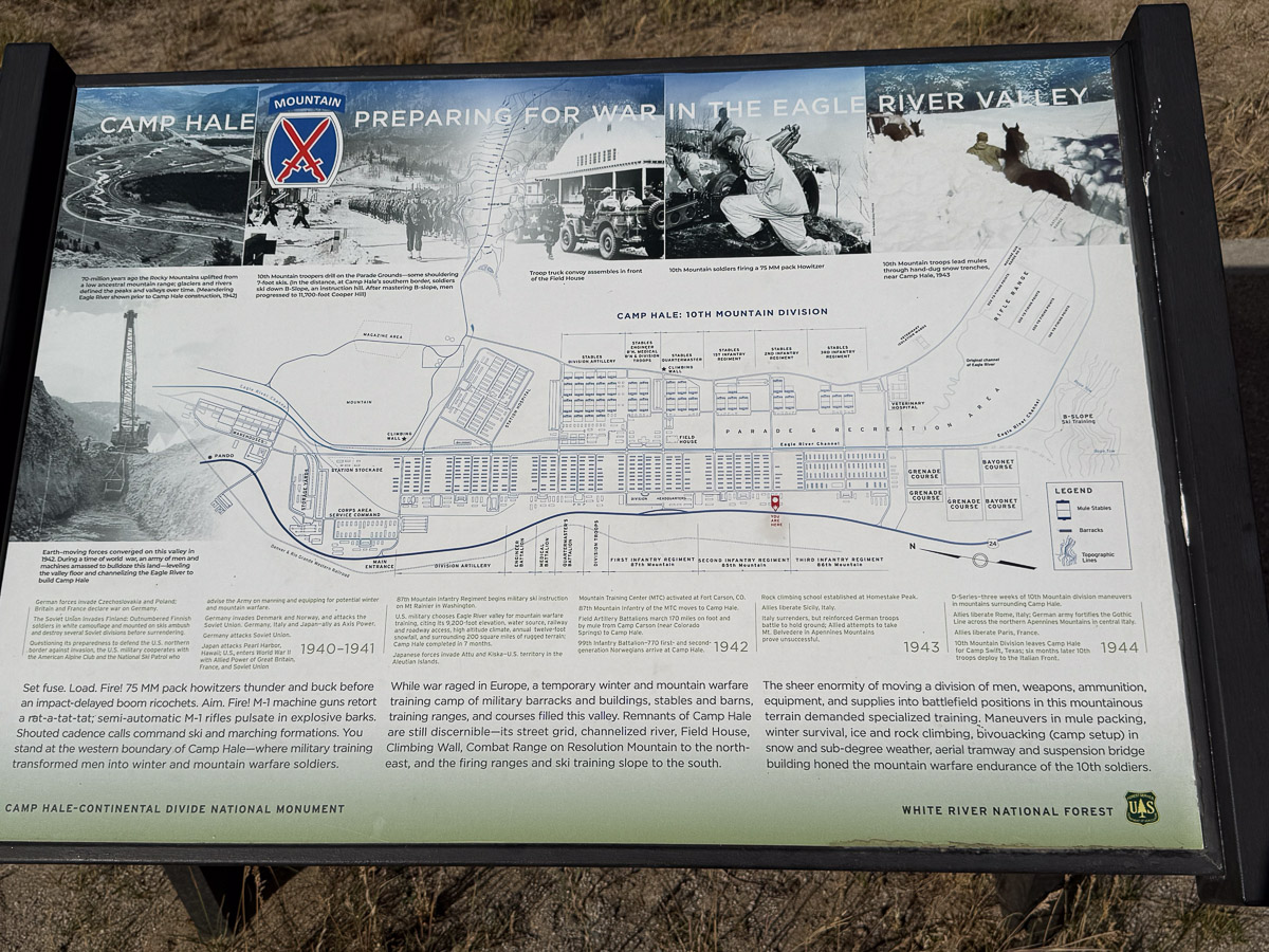
The story of the 10th Mountain Division and their impact in WW2 is fascinating. It is also interesting that well known ski resorts in Vail and Aspen were started by veterans of this regiment and many were also involved in manufacturing of ski equipment and clothing, trail development, and developing skiing for the disabled.
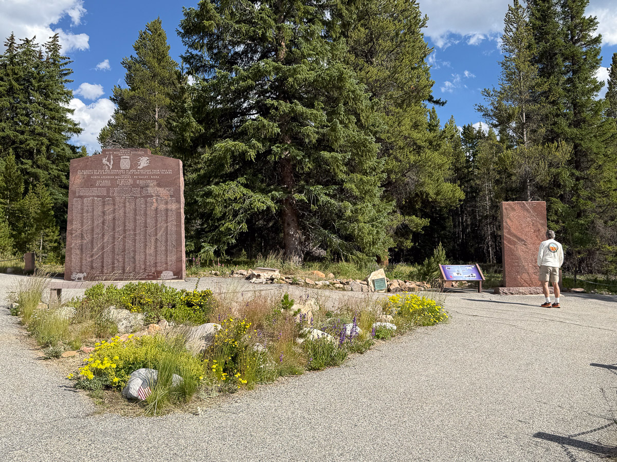
The memorial for the 10th Mountain Division.
Camp Hale is 7 miles beyond the Memorial site. I’d like to return to explore the trails of this National Monument .
There were several signs to explain and point out the remnants of Camp Hale. It is hard to imagine 15000 soldiers and 5000 pack mules and horses in this valley. We read the signs and pondered the impact of this Camp. Then it was time to move on.
We drove through some beautiful scenery, eventually making it to Green River, Utah where we spent the night.
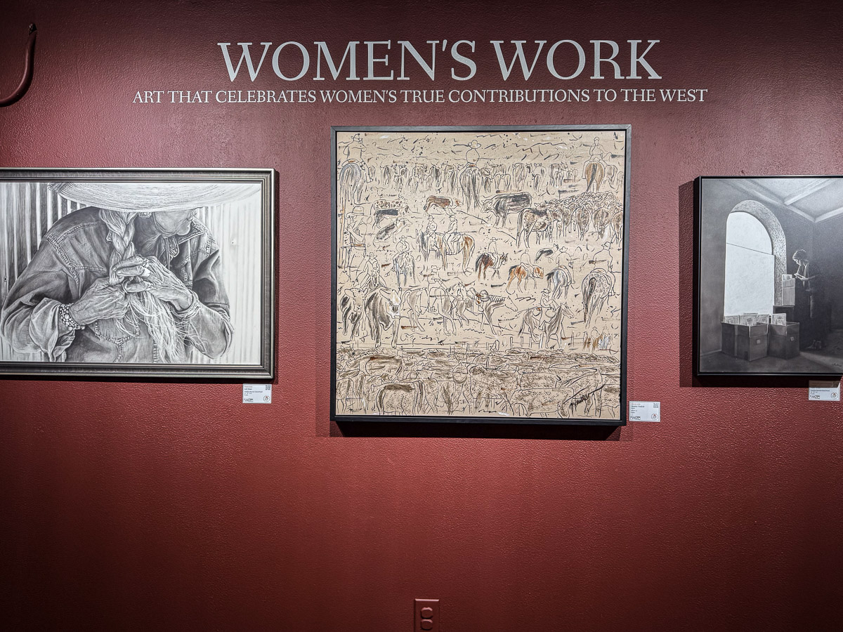
In 2024 we attended the opening of this show because I was a “farm partner”. The explanation and story is in this blog post from 2024. I think I did a better job of photographing last year’s show and sharing artist info in my blog. I took this quote from last year’s blog post, after copying it from the Cowgirl Artists’ website. From the website: “Celebrating the true contributions of Women in the American West…Much Western art is an ode to the work and contributions of men, while often limiting women to a single sphere, or pretty face. “Women’s Work,” a groundbreaking exhibition that teams artists up with women on working ranches, turns that notion on its head. By showcasing Western women as multi-faceted contributors to the Western way of life. Furthermore, Women’s Work aims to provide a platform for Indigenous women to authentically share their own stories, rooted in their intimate connections to culture and heritage. Traditional and fine artists are included, with all work on the theme of “Women’s Work.”
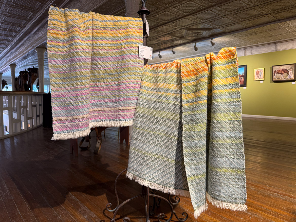
After seeing the show and talking to the organizer I decided to submit an entry for this year. Entries were due in the fall and, if accepted, work was to be completed in the spring 2025. I entered Year to Remember blankets using locally produced wool, and naturally dyed by me with plants grown on the farm. I could serve as my own “ranch partner”. I was accepted! Work was shipped to the show to arrive by mid-July.
The catalog of the show is at this link. There you can see all the pieces and details about work.
The Women’s Work show is upstairs in this building. The second floor is in a horseshoe shape over the lower floor. When I went upstairs I was immediately drawn to this display. Four artists worked together to put together the display.
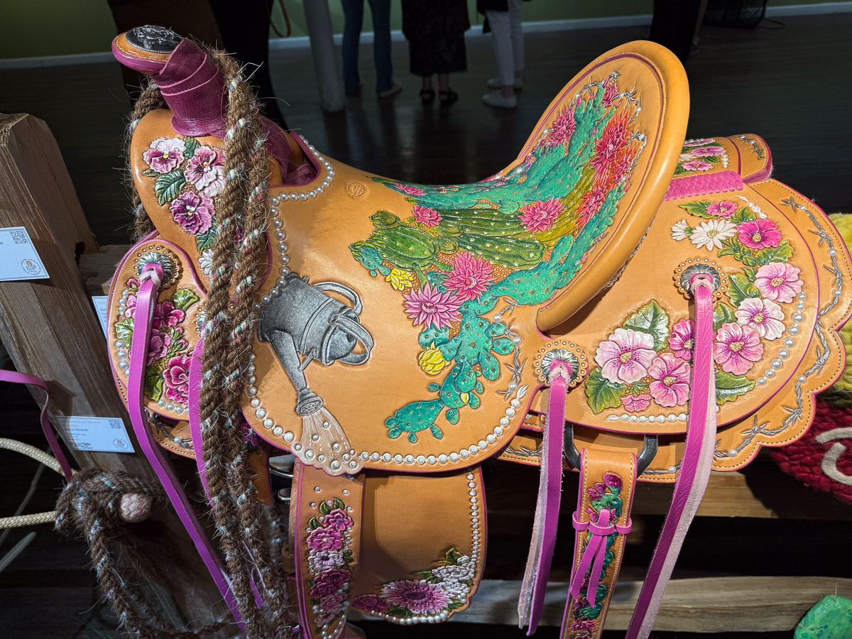
There is amazing detail on this saddle called She Who Made Me by Kari McCluey
This painting, CowGirl II – Securing a Win, is by Megan Wimberley, the woman behind Cowgirl Artists of America.
Bluebird Let Me Tag Along by Lisa Sorrell.
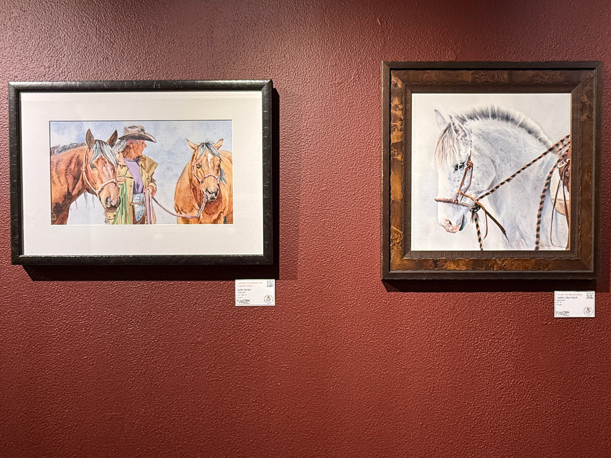
There are details about each piece in the catalog at the link above. There was by far more wall art than 3-D work, but it was difficult to get good photos of those. That’s why I recommend looking at the link.
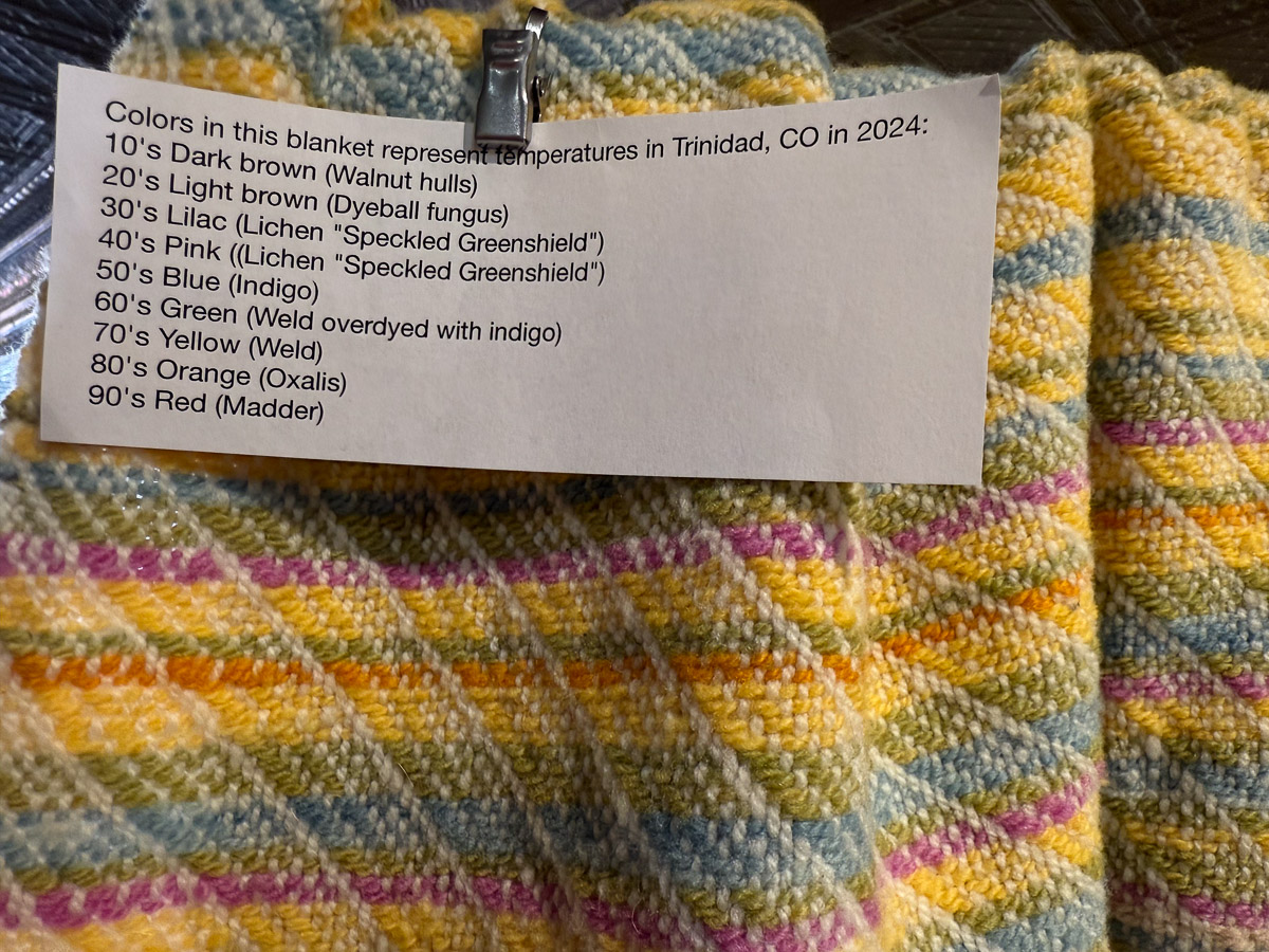
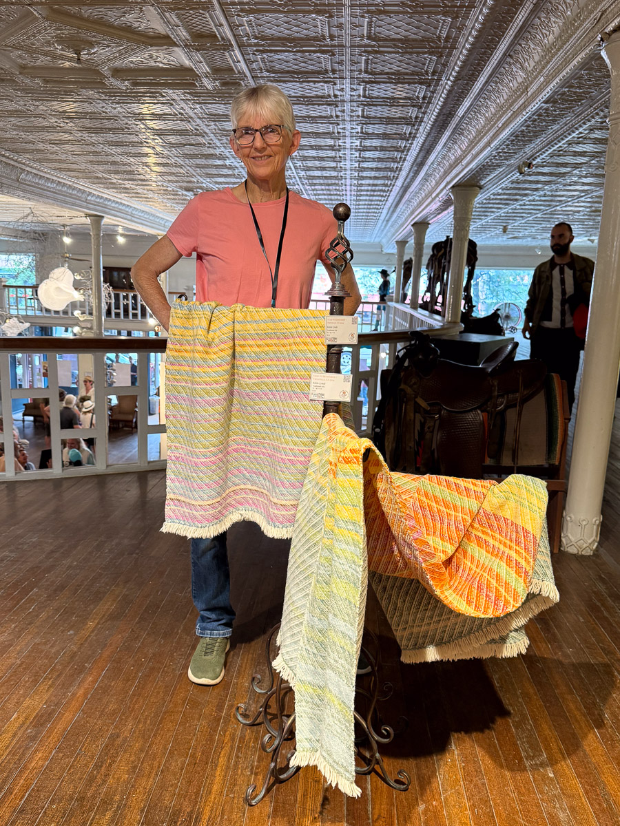
These are my two blankets. Later I rearranged them so that the more colorful side is the one that shows. The blanket on the left indicates high temperatures for Trinidad, Colorado for 2024 and the one on the right is for Vacaville. The full year is portrayed following the stripes from one end to the other.
On Saturday I came prepared to include the info about the Year to Remember idea with color coding. I thought it would make the blankets more interesting (and more saleable). However, this is an art show and the person in charge wanted to keep the signage at a minimum. This info is in the catalog, so I took it off the blankets. I’m including it here as explanation…and because this is a plug for your custom Year to Remember blanket. I have a blanket warp on the loom now and can weave one. If these blankets don’t sell in this show they will be on my website after I get them back.
Dan took this photo.
The A.R. Mitchelll Museum has a large display about Mitchell and his friends as well as contemporary western art for sale. From the Museum website: “During the 1870s and 1880s Trinidad was the headquarters of the largest cattle and sheep operation in the state of Colorado. A booming cow town filled with cowboys, cowhands and ranchers, Trinidad’s streets and neighboring towns were home to the horses, cattle and beloved cowboys and cowgirls that A.R. Mitchell would paint and immortalize throughout his career.”
I am already over my self-imposed limit of 10 photos, but I want to continue the story so I can blog about things at home.
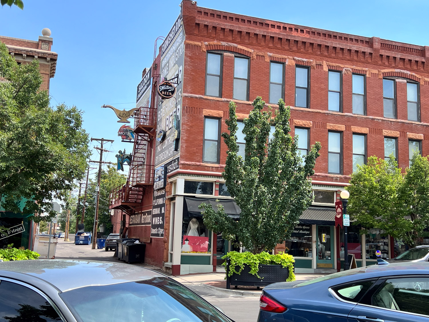
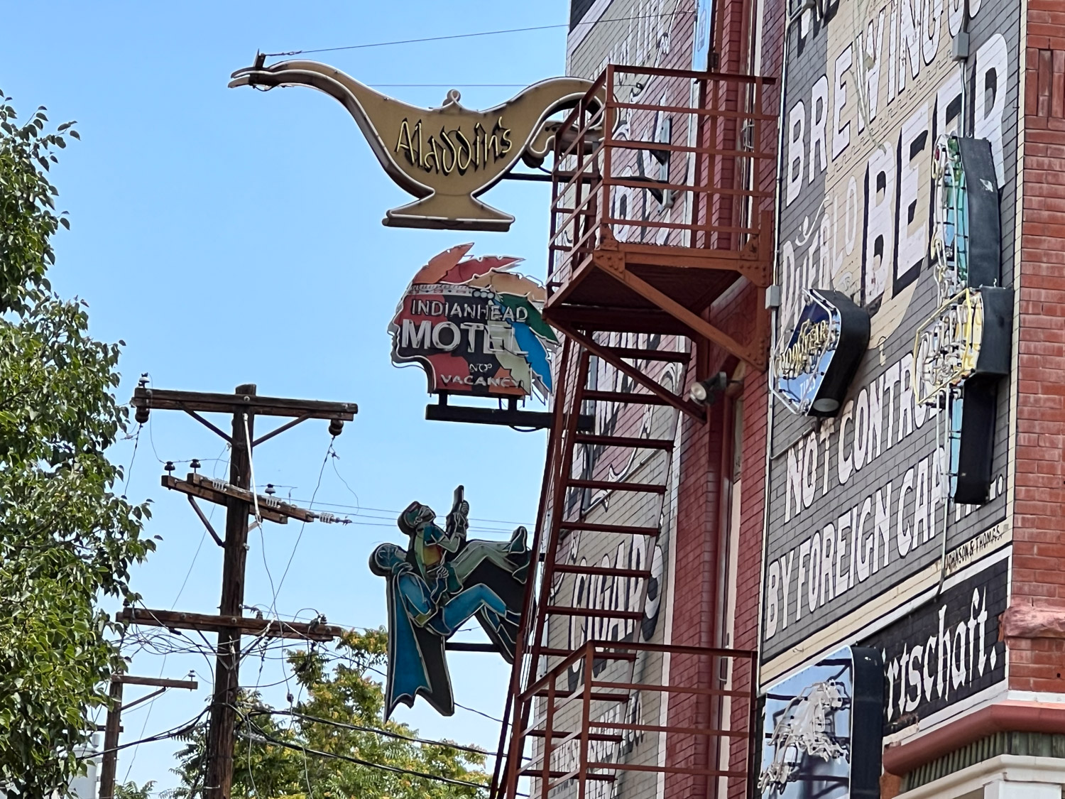
On Saturday there was a luncheon provided by CGA to be followed by an artists’ talk. I had been asked to be one of the panel. Before the luncheon we wandered around this block of Trinidad.
I got a kick out of this design. That’s a real truck, not painted.
We stopped in the Corazon Gallery across the street from the A.R. Mitchell Museum. I was interested in this because it is an artists’ coop as is The Artery where I sell in Davis, California. Here’s a “small world” experience. We wandered through the gallery and I noticed a landscape photograph with the photographer’s name Joe Coca. I knew that name. Having subscribed to Handwoven magazine since the first issue in fall, 1979 I was very familiar with photography by Joe Coca. I wondered if he might be the same person because Handwoven magazine was based in Colorado. We started up a conversation with the person staffing the store on that day. I assume it is like The Artery where all of us artists take turns being shopkeepers when the store is open. I said we were in town for the show across the street and I had entered handwoven pieces. It turns out that I was talked with Joe Coca! We talked awhile longer. He worked with Interweave Press for years and has been all over the world as a photographer. Joe’s website states that he is semi-retired, but it is worth looking at the website to see some stunning photography.
Back to the show!
After the luncheon awards were announced. There was a winner and an honorable mention in the 2-D and 3-D categories. I was so surprised to get the 3-D Honorable Mention!
The people selected for the panel discussion were all artists who were able to fill the role of their own “ranch partner”. Megan, left, had prepared questions for all of us to answer. It was a fun experience and I was very interested to hear the stories of the other women. The other women are all cattle ranchers. Megan asked questions about how we got started, how we integrate artwork with our daily lives as ranchers (I call myself a farmer, but that’s another story– what is the difference between a farmer and a rancher?), do we have issues with gender expectations, recommendations for young people just starting, etc. One difference that I thought about later is that although we all talked about seasonality of ranching/farming, I think I am the only one who direct markets. In other words, I don’t load all my lambs on a truck and send them off to market and I don’t take my fiber, yarn, and handwoven to a retail store and it’s gone. I have interaction with all the customers whether I’m selling lambs for meat or for breeding flocks or selling all the fiber products. I spend time at the computer on social media letting the world know I’m here (including this blog–please share!), time (not enough) working my website, teaching fiber arts, working at The Artery, and attending fiber shows. That doesn’t mean any of us have more or less work than the other. It’s just different. A theme in the discussion was that there is Never enough time for all of it.
Dan had my camera and recorded some of the comments. I haven’t had time to listen yet.
After this discussion we got on the road and headed north to Colorado Springs where Dan’s brother and sister live.
In the last blog post I shared photos of a brief stop at a corner of Black Canyon of the Gunnison National Park. Then we were on the road to Trinidad. We had time for one more stop.
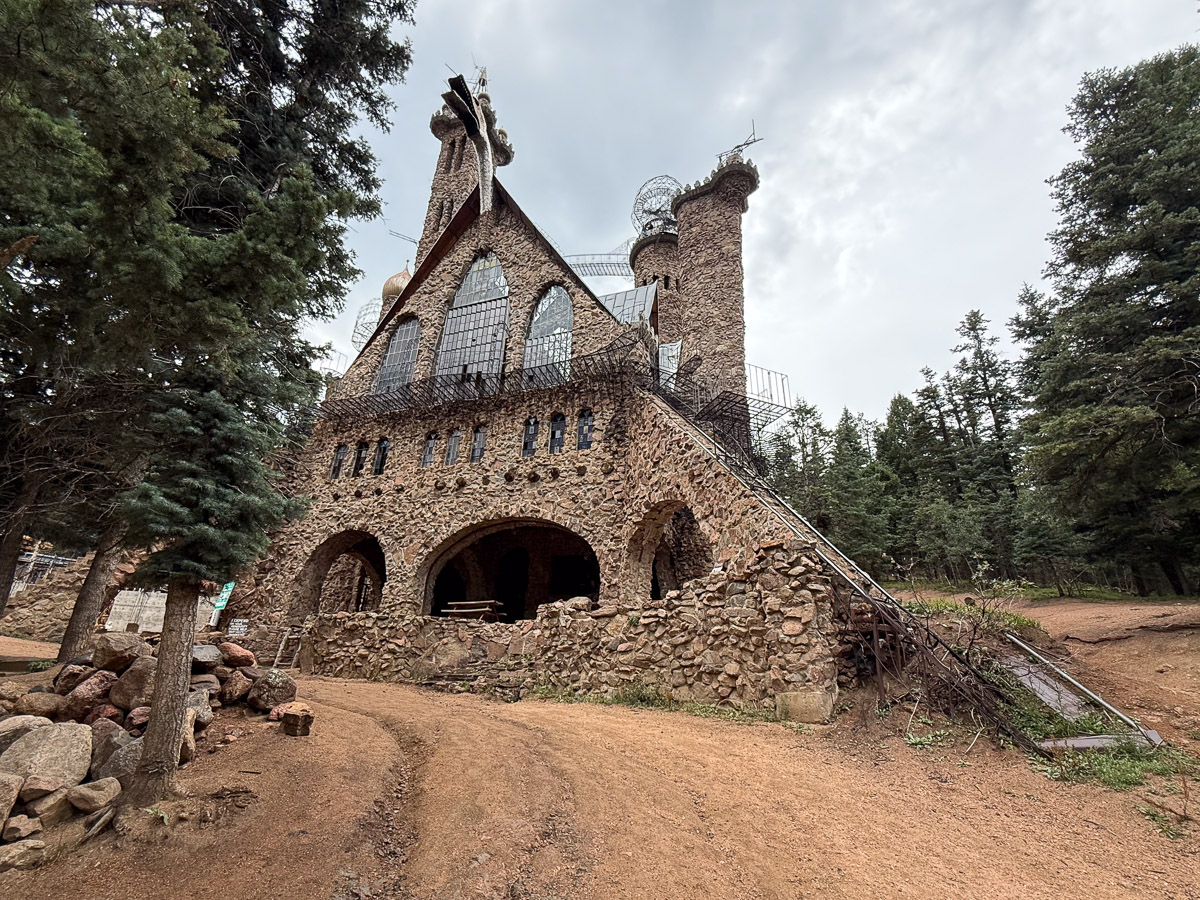
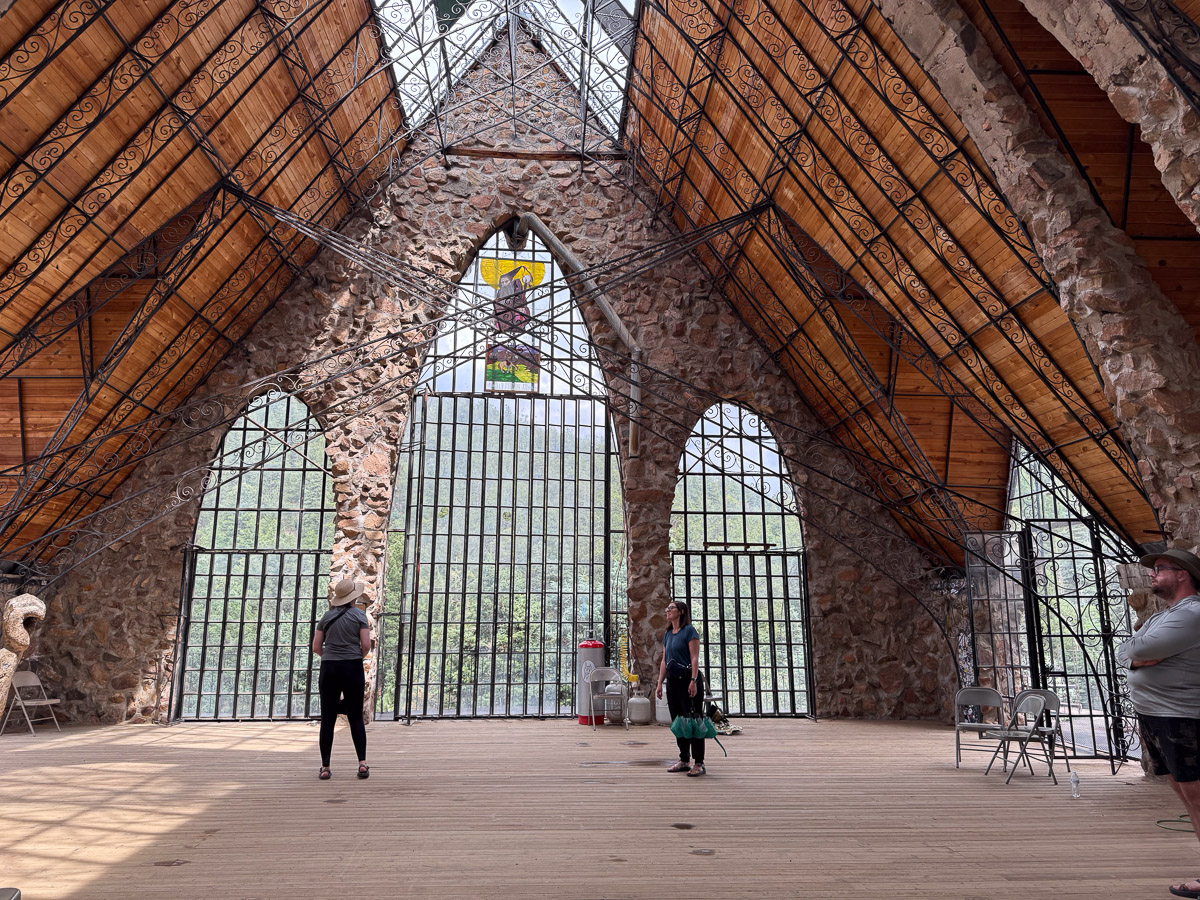
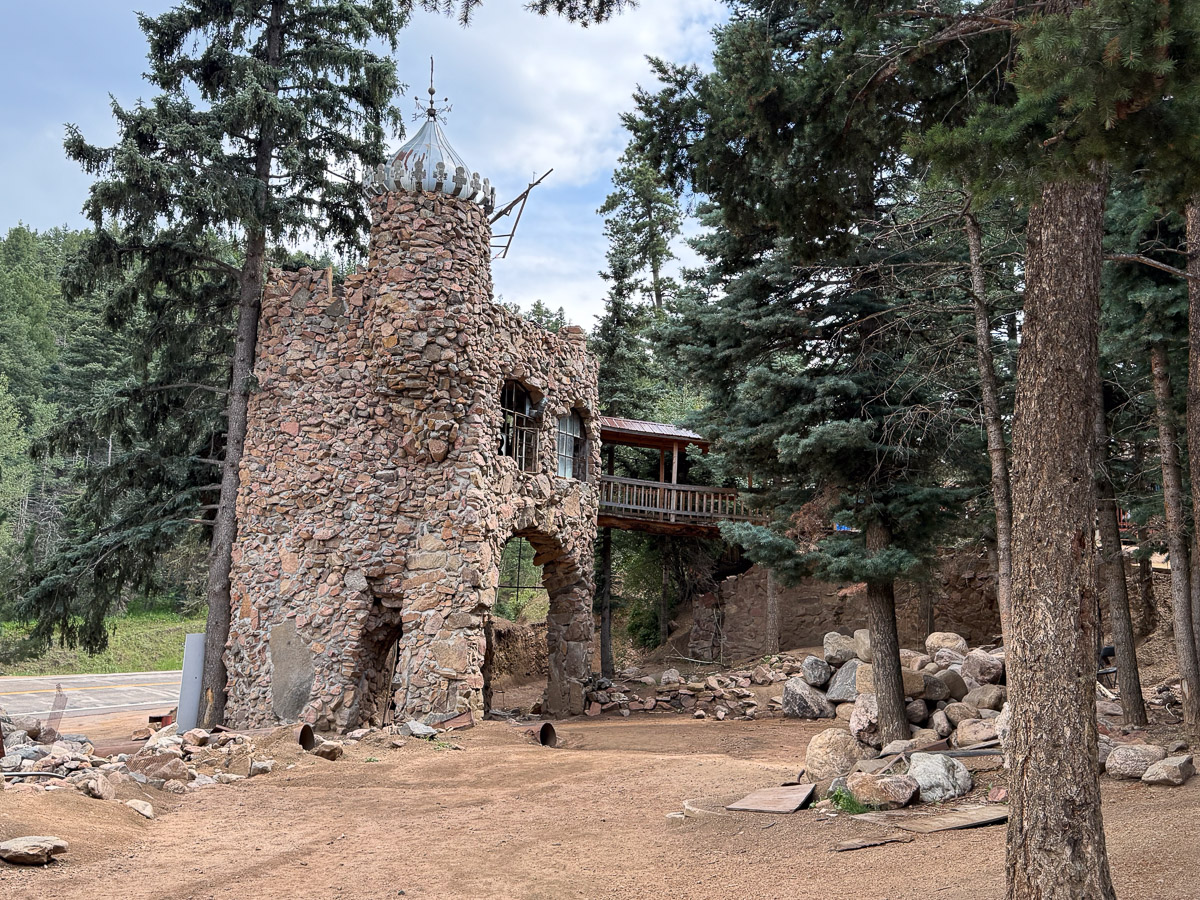
We turned south off of I-50 on Hwy. 69, east on Hwy. 96, and south on 165 to find Bishop Castle. We had never heard of Bishop Castle, but the campground host at Bryce Canyon suggested a stop here.
We parked along the road and walked past other cars on the road to this entrance. This is not part of the castle, but the entryway to the property.
This sign is at the right of the entryway. I guess this is enough to limit any liability claimed by visitors.
View of one portion of the castle. This project was started by Jim Bishop in 1969 and was a work in progress until he died in 2024. Wikipedia says: “James Roland “Jim” Bishop was born in Honolulu in 1944.[6] He moved to Colorado with his wife, where they raised four children, including a son named Dan.[6] Bishop bought the land for the site for $450 when he was 15, and construction on what was originally intended to be a family project to build a cottage[7]started in 1969.[8] After Bishop surrounded the cottage with rocks, several neighbors noted that the structure looked something like a castle. Bishop took this into consideration and soon began building his castle.“
View from another corner. It’s hard to get the whole thing in one shot. The tower is 160 feet tall.
The property is owned by the family and, despite the warning posted, they seem to welcome visitors. There is a gift shop on site as well as a food truck.
We did not take the winding stairs on the outside or the inside all the way to the top, but we stopped here.
I saw on Instagram that the dragon breathed fire on July 4th and on Halloween.
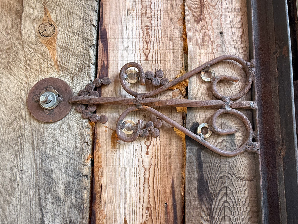
Interesting detail.
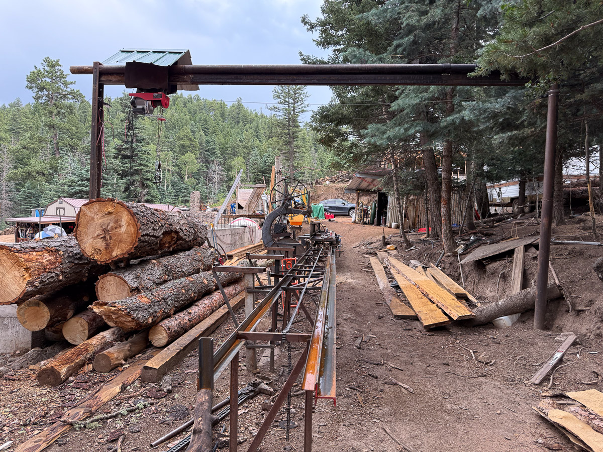
Near the castle are the workspaces where lumber is milled and metal worked.
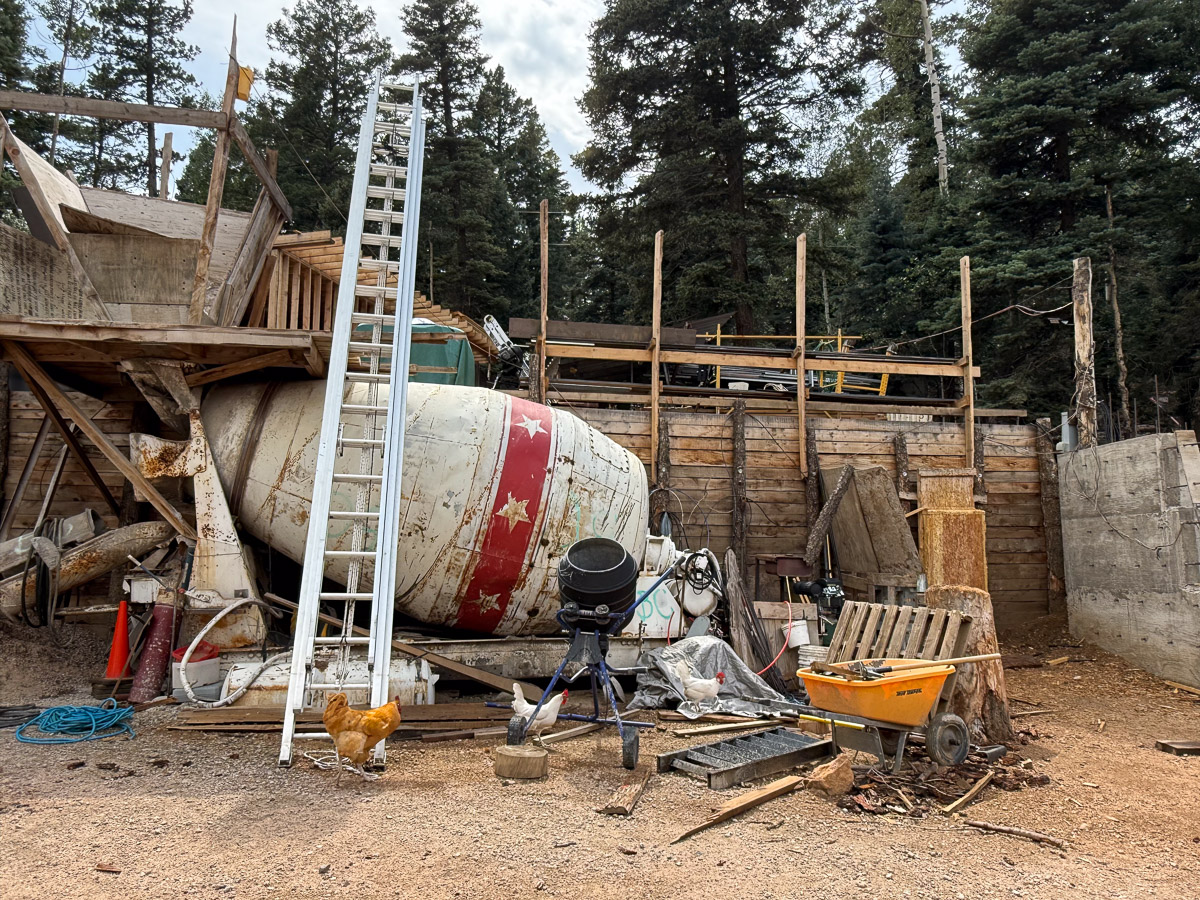
There is also a small cement mixer.
This is the backside of the entrance in the first photo. Bishop Castle is an interesting place to visit. Dan came home with ideas!
This was Friday and the goal was to be in Trinidad, Colorado by the late afternoon. We had time to do a bit of exploring along the way from Montrose to Trinidad. Black Canyon of the Gunnison National Park is very close to Montrose and we thought it would be worth a look. We were there in 2016 but only to camp nearby and drive above the canyon, as described here and here. However the Park was closed due to recent wildfires. We continued on Highway 50 and I realized that a small corner of the Park was accessible about 20 miles from Montrose.
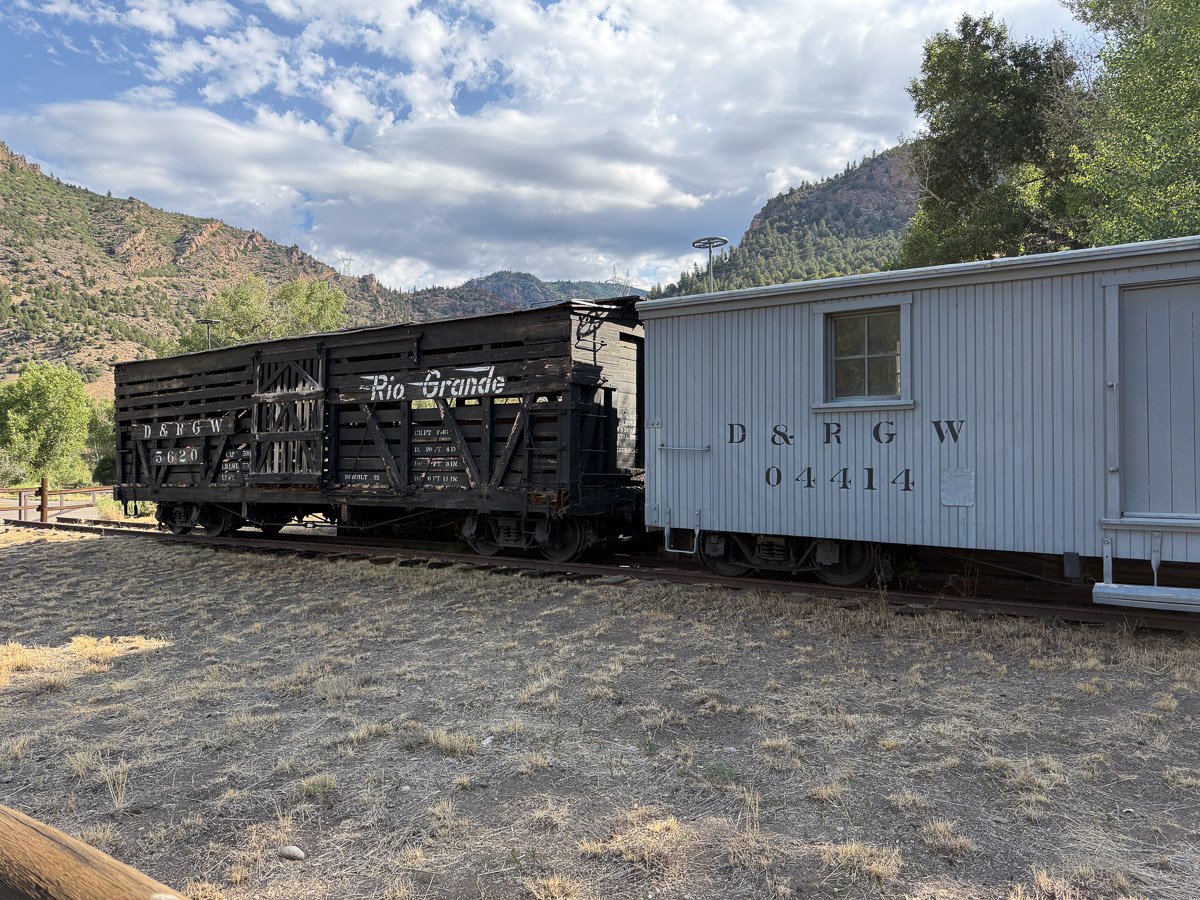
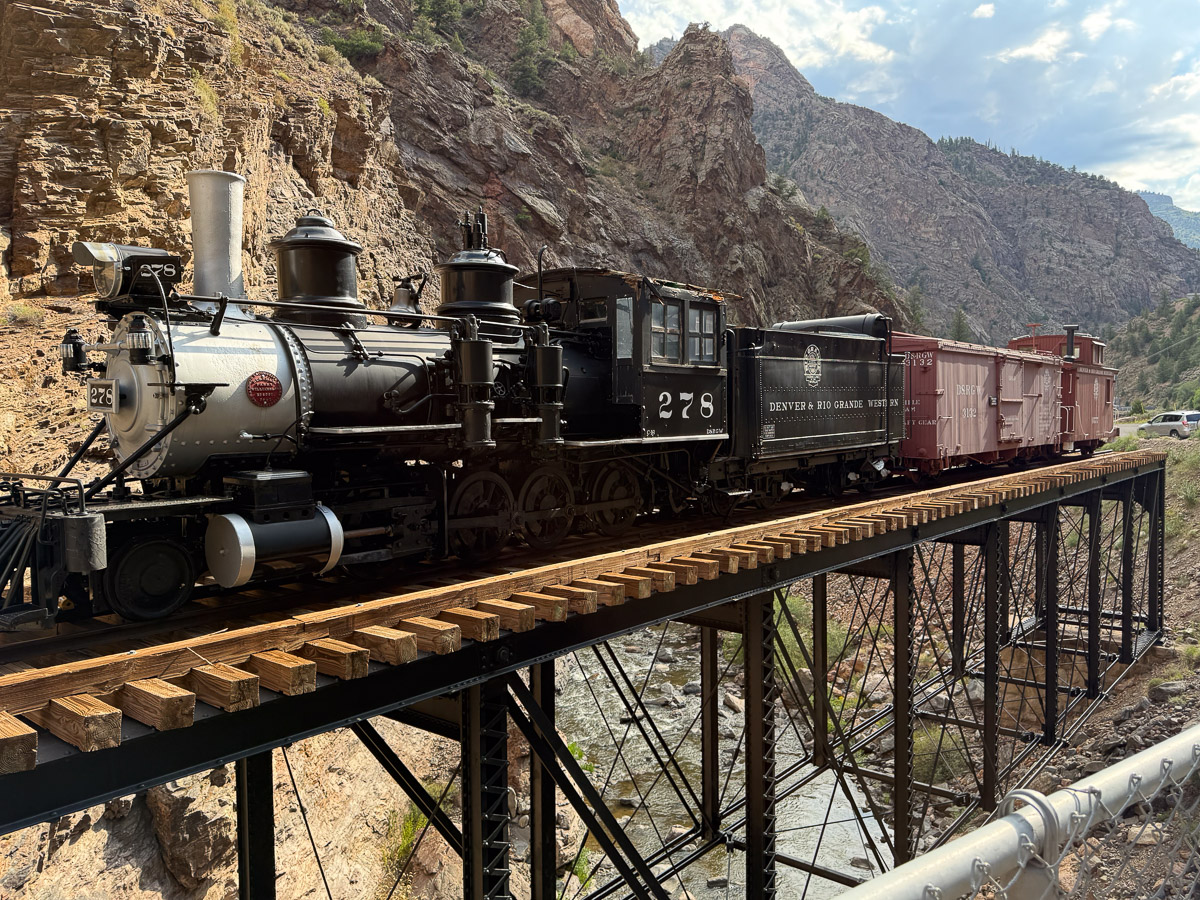
The location known as Cimarron used to be a major hub for sheep and cattle transportation and, later, for tourists. There is a Visitor Center here but it wasn’t open.
We looked around outside and read about the train cars that are here.
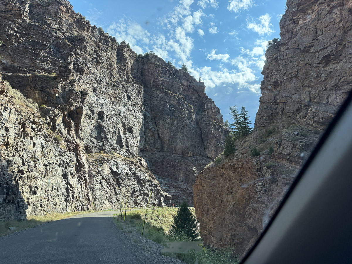
We took a short drive from that location to the canyon.
There is a restored engine and cars on a bridge over the Cimarron River which runs into the Gunnison just around the corner.
I had not realized that one of the important aspects of the narrow gauge railroad is that the cars are much more maneuverably around bends in the track.
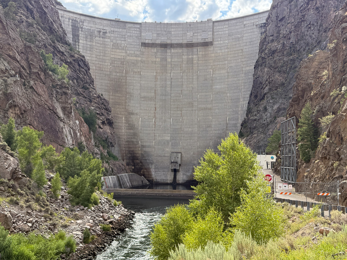
When you look east from the location of the train this is the view. This is the 468-foot tall Morrow Point Dam.
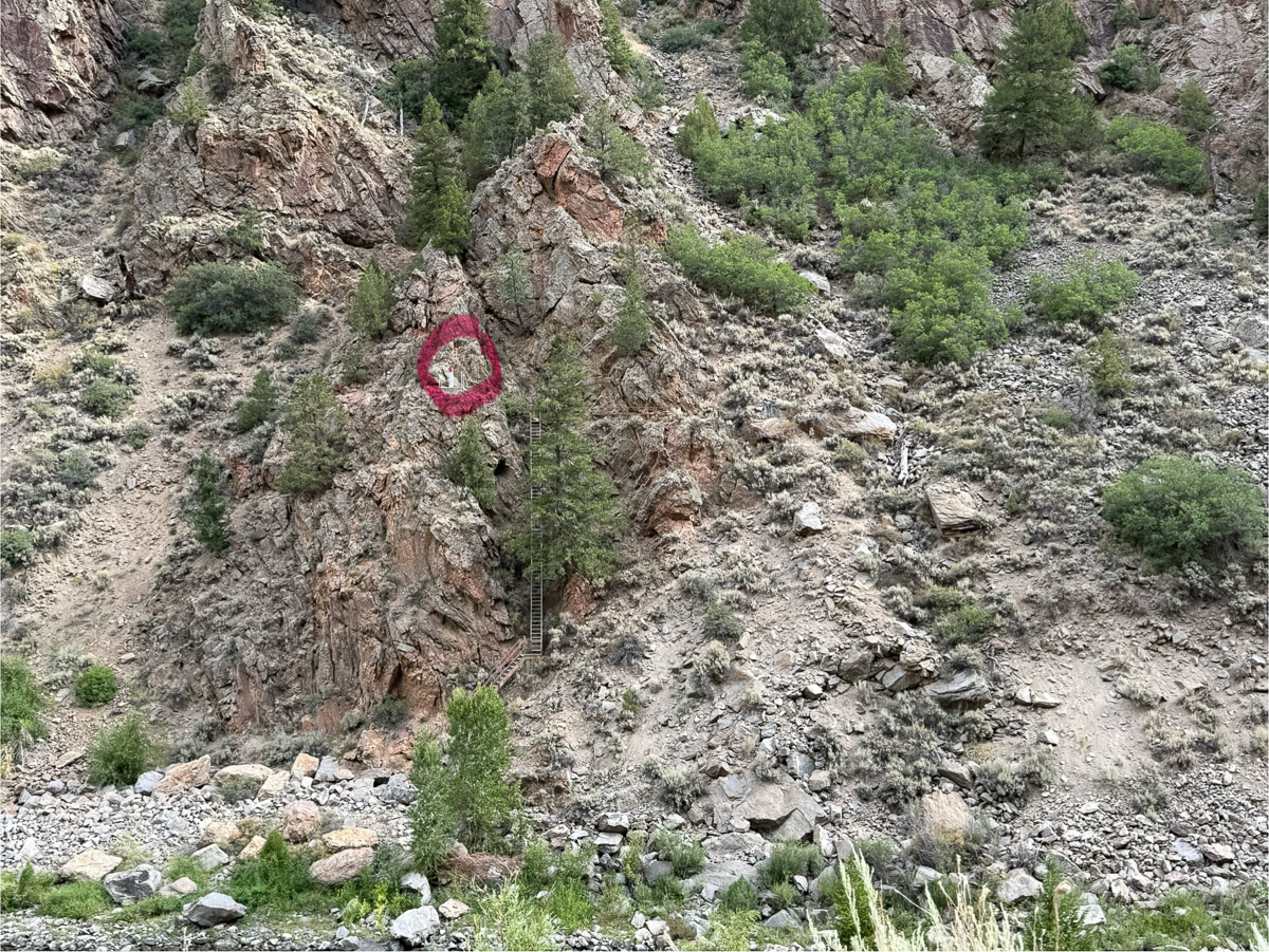
This photo is a view of the north side of the river below the dam. If you enlarge it you will see a ladder that is right next to the large tree in the center. Just to the left of the ladder, circled in red, is an instrument used to measure movements in the earth. It is described below.
We walked over the bridge to a trail on the north side of the river.
There were plenty of interesting plants to photograph, but I have shared only one here. This is poison ivy.
View of the Gunnison River just downstream from the Dam.
UhOh. I can tell already that Day 4 is a three blog post day. Enjoy!
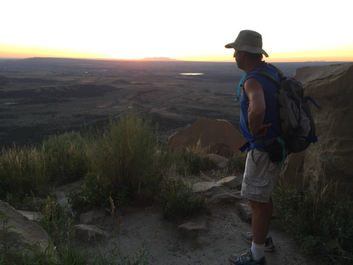
We are winding down this adventure and the stories about it. Yesterday’s part was Day 6. We made it to Colorado National Monument at dusk and found a campsite.
I woke up early and wanted to explore the area.
I walked to the nearby Visitor Center (closed at that hour), picked up a brochure and map, and started walking the Canyon Rim Trail.
This is a view of Monument Canyon as the sun comes up.
A view of the valley we’d driven through to get here. The towns of Fruita and Grand Junction are along the Colorado River. The road switchbacks its way along the canyon walls. It’s amazing to read the stories of how this road was built in the early 1900’s with one man, John Otto, the instigator and tireless promoter of this monument. After walking this trail I went back to the truck to see if Dan was up.
He and I walked the same trail later that morning.
Views of the canyon. Click to see them larger (I think).
Here is a panoramic view of he same landscape. There was more spectacular scenery as we drove the road that winds through the monument. We came in from the Fruita side on the east and left going to Grand Junction. This monument was designated in 1911 and I had never heard of it. I only found it by seeing it on our maps. It is well worth the visit. Maybe someday we’ll have the chance to go back and walk some of the trails.
While we were driving through the monument Dan noticed that the battery warning light was blinking. We thought we had dealt with that with the alternator replacement less than 24 hours ago.
We drove into Grand Junction and found another O’Reilly’s. They tested the alternator and battery and declared them both OK. When you have the hood of the car up in front of an auto part store, other people (guys working on their own cars) come to see what’s going on and offer advice. There were a few who had opinions about the problem. One of them recommended that we go to Sparky’s to have it checked out. Sparky wasn’t there and the UPS driver, who was also looking for Sparky, sent us to ASAP, who sent us to Big O. That Big O send us to a different Big O that would have the equipment to check electronic stuff. They tested the alternator and some other electrical things and declared everything OK. That put us about three hours behind our plan for the day.
We got on the road, thinking it might be possible to make it home by early morning if we slept a few hours in a rest stop.
We were still driving through beautiful country. This is east of Green River.
North of Helper Utah on Hwy 6.
At Green River we drove north towards Price, planning to take I-80 as the fastest way home. About half way to Salt Lake City there is a small town called Helper. If this wasn’t already Day 7 of a seven day trip I would have stopped at a museum there. I was intrigued by the name as well as the scenery through this canyon. I found out that Helper was a hub for coal mining and the railroad. From the Helper website: “Helper is named for the extra engines historically required to help trains up the steep mountain grade to Soldier Summit.” I may not have made it to the museum, but now I have spend some time on the website and found this video, Helper, UT, Where Coal Meets Canvas, that tells about the modern revival of a town that was on a steep decline with the end of the coal mining era. It is an 11 minute video that is an uplifting story.
North of Helper Utah on Hwy 6.
That plan of driving almost straight through was short lived.
When we were between Provo and Salt Lake City the warning light came on again and the battery gauge showed that we were losing charge quickly. Dan pulled off the freeway at a shopping center in Draper and we called AAA. This was about 8:30 p.m. The tow truck driver recommended a mechanic who he said would fit us in first thing in the morning and he dropped us off at a motel that was near enough for us to walk to the mechanic.
I wrote the previous post about this trip a week ago. Now I have to look at the map to figure out where we were for some of this. There was beautiful scenery throughout the trip, but there were a few days where the main memory is of things that happened on the road. This is one of those days.
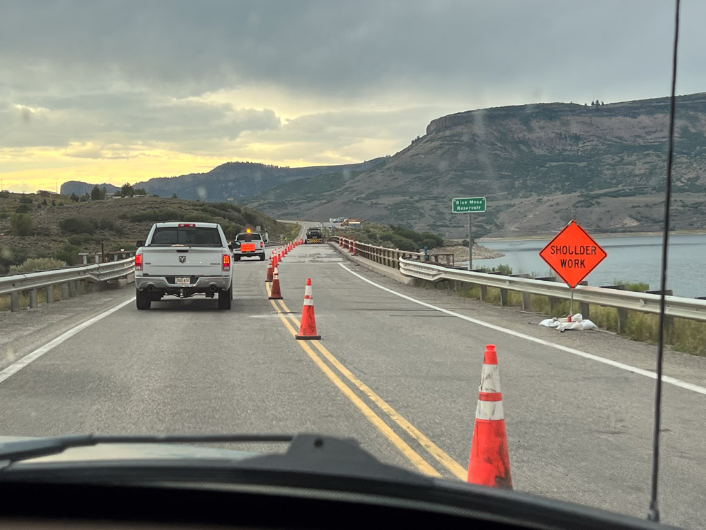
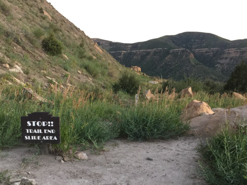
Reminiscent of Day 3 with the highway backup west of Green River, traffic came to a stop on Hwy 24, just west of Hartsel, Colorado. The plan was to get to Colorado National Monument on the western border of the state so we could explore and camp there. We were planning to turn north at the upcoming junction (where there are cars to the right in the photo) or the next one, taking us through Leadville.
It turns out that neither choice was going to be possible, at least not for hours. The accident that had stopped traffic involve a fatality. As we waited, we could see that CPR was underway…until it wasn’t. At that point we were told that cars would have to turn back. Our only option for continuing west was to head back southeast to Cañon City and catch Hwy. 50 going west.
We saw beautiful country, I found it interesting that we were following the Arkansas River, the river I had walked along every morning while in Wichita only the month before.
I noticed the unnatural look to this part of the forest and thought maybe it had to do with logging. Now I wonder if those are all ski runs because this is home to Monarch Mountain ski resort.
Monarch Pass, Hwy 50
The pass is at 11,312′. Our truck that is used to living at almost sea level was not happy about these high mountain highways.
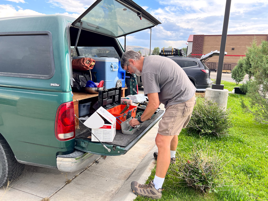
More gorgeous country along the way. At some point Dan saw that the truck’s battery gauge indicated a problem. He had replaced the battery just two weeks before this. We made it to Gunnison and knew that we needed to figure out what was wrong before going farther west. This was a Sunday afternoon–not a lot of options in a small town if we needed a mechanic. I found the address of a towing business and we saw the owner washing his truck, He agreed with Dan’s opinion that it might be a bad alternator. He directed us to Ace Hardware and O’Reilly’s which were both open. We started with Ace, looking for a tester of some kind. When we told them the problem and that we were heading west they alerted us to bridge work being done between Gunnison and Grand Junction. Road crews were replacing welds on some of the older bridges and there were road closures in effect. Hwy. 50 uses two bridges to cross Blue Mesa Reservoir. The Ace employee looked on his computer to find the schedule and showed us that there was a two hour window from 4:30 to 6:30 to get across those bridges if we were to continue the trip that evening.
It was about 4:15 when we got to O’Reilly’s where an employee tested the alternator and found it to be the problem. They had one that would work for this truck and told us we could park in the back to install it. Notice the black car behind Dan. That was someone replacing a radiator so he could continue on to Texas.
Dan bought one tool and borrowed another and was able to replace the alternator.
We made it to the first bridge just after 6:00…
…and to the second about 6:15.
The cliffs in this photo are part of Colorado National Monument, and we made it there as it was getting dark.
I’ve been at the computer a lot, but haven’t had time to finish this story. I usually start with a photo of our campsite, but we stayed in a motel in Trinidad after seeing the Cowgirl Artists show. This day we were headed to Colorado Springs to visit Dan’s brother.
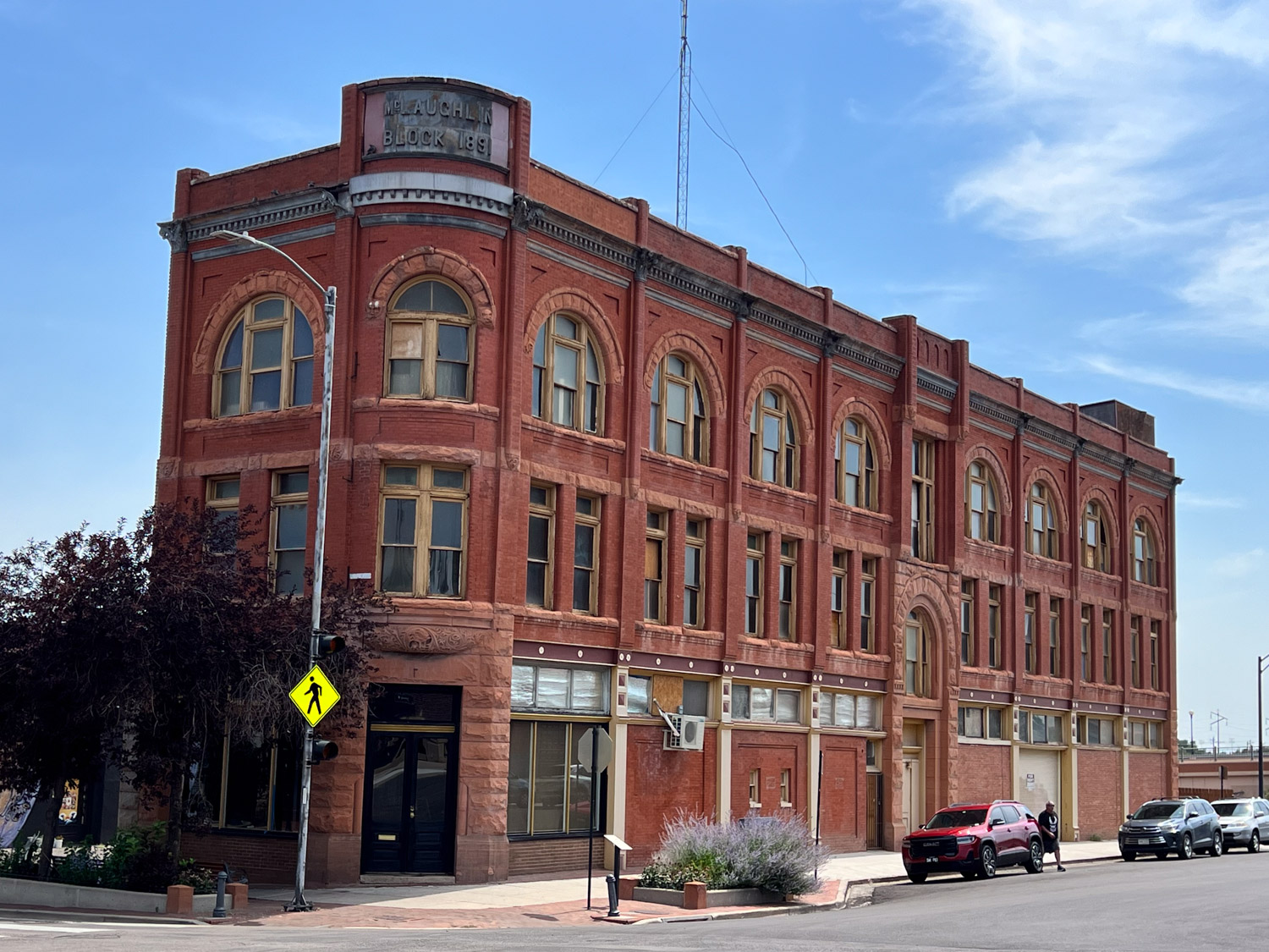
We stopped in Pueblo along the way just to get out of the truck and wander around a bit.
We found a shady place to park and walked into the old downtown. This bike was one of many that we saw painted in bright colors. I didn’t notice if they all have the same message. I suspect that they are all different. This one: “Life is like riding a bicycle. To keep your balance you must keep moving.”
This is the old train station. Notice the blue bicycle leaning on the lamppost.
There were lots of brick buildings. I took this photo for a reason.
Did you notice who is climbing up the side? I got a kick out of seeing Batman and Robin from the old TV series on the wall.
Another interesting building. We drove onto Colorado Springs.
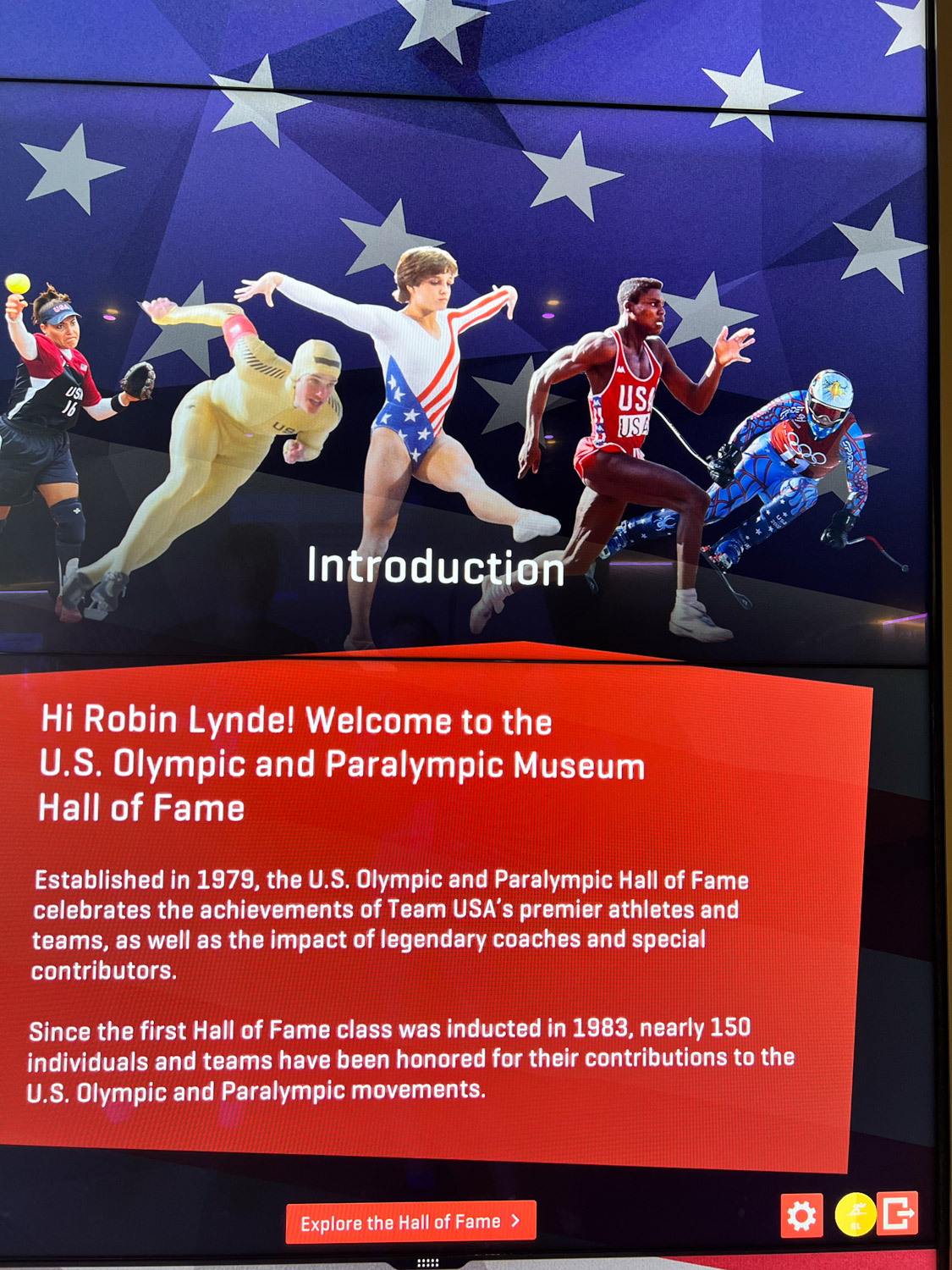
We stopped near a park where we thought we might walk along the river, but then we saw that the Olympic & Paralympic Museum was right across the street. There is access from these stairs that go up to a walkway and down the other side.
The walkway comes out near the main entrance of the museum and since we were in the middle of the 2024 Olympics it was fun to watch a portion of it on the large screen that was set up outside the museum. They were broadcasting swimming at this time.
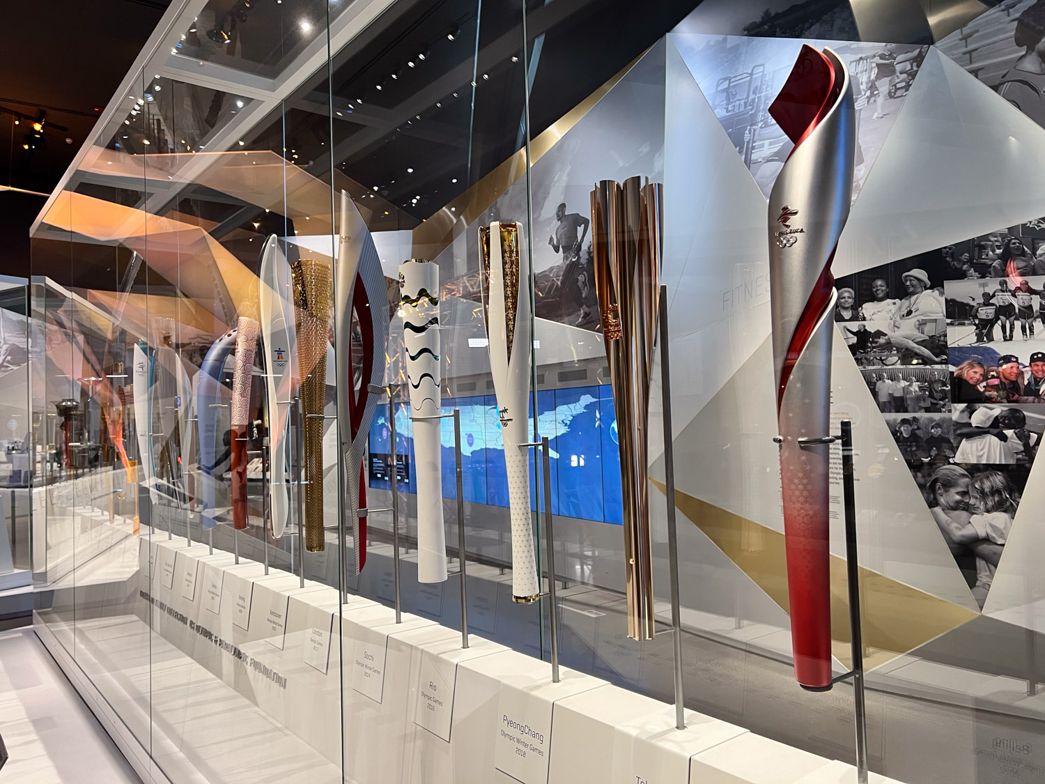
This was a difficult place to take photos. It’s also difficult to describe. You enter on the bottom level. After you pay you get a badge on a lanyard. You can use that to sign in to computerized presentations, many of which are interactive, throughout the museum.
After the initial check in you take the elevator to the top floor. The museum is set up so that you spiral down through many different exhibits. This case held Olympic torches from many of the Games. I hadn’t realized that all the torches are different.
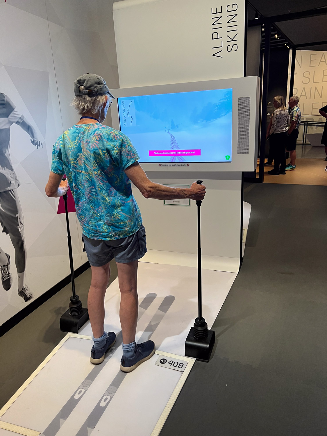
There were a few opportunities to try out sports via video. I chose skiing over archery.
As you follow the path through the layers of the building there are dozens of different displays about everything from the professional staff that is required to support all the athletes (did you know there is a Team Mom?) to highlights of specific games, stories of individual athletes, and information about gear and clothing.
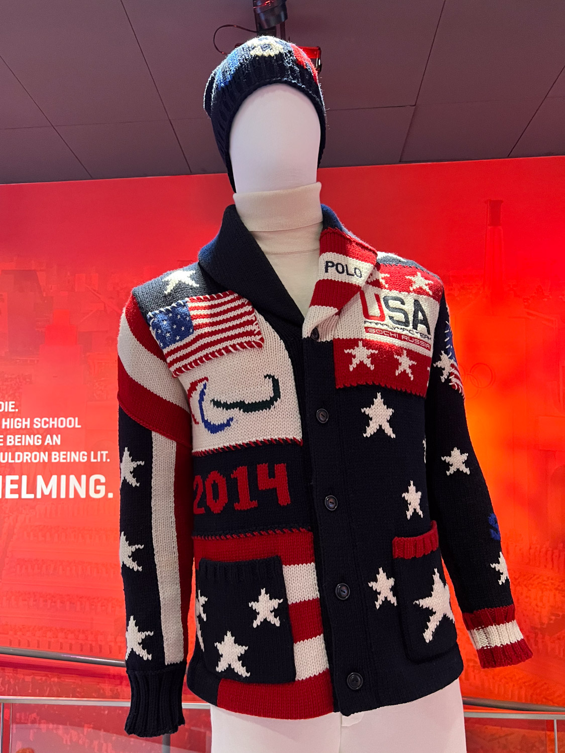
I’ll end this post with a sweater that I recognized. This was the sweater worn by the athletes at the opening ceremony of the Winter 2014 Games. It was designed by Ralph Lauren and knit from wool grown in Oregon. The whole process supported U.S. businesses. I remember writing a blog post about this yarn when I used it in an Artery show and there I found this link to a video about the ranch and the creation of this sweater. It was worth another watch.
We drove to my brother and sister-in-law’s house and spent the night there.
I just looked at when I wrote about Day 3 of our trip. At this pace it will take me 3 more weeks to finish the story. I need to speed this up. There are more stories to tell after this.
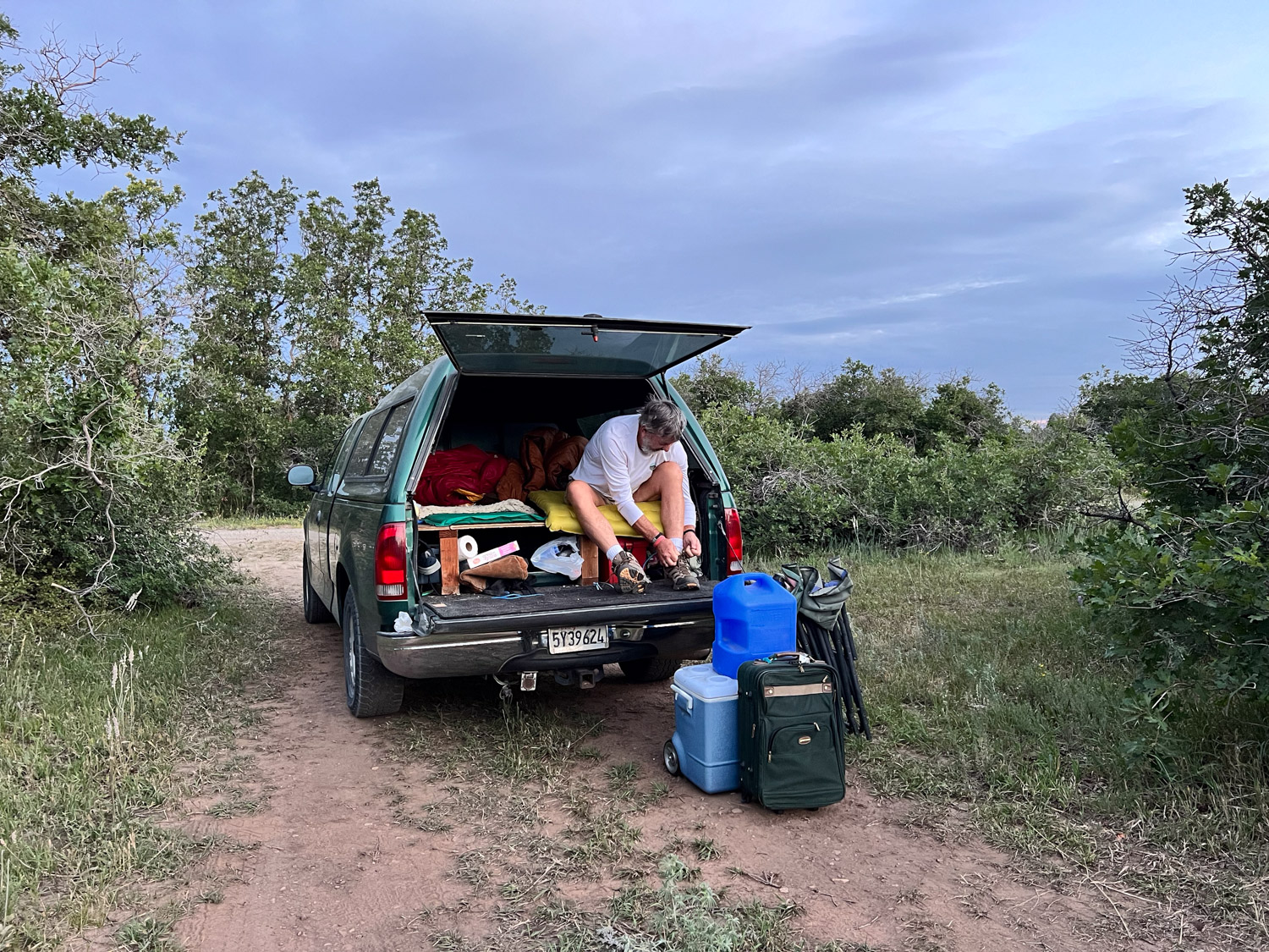
As told in the last post, we found a road on USFS land and pulled off to the side to park. It was dark by then so we could only see what the headlights of the truck showed. Looking back now at the GPS data on my photos I see we were not too far east of Mancos on the San Juan National Forest. In the morning we got on the road and headed east on Hwy. 160.
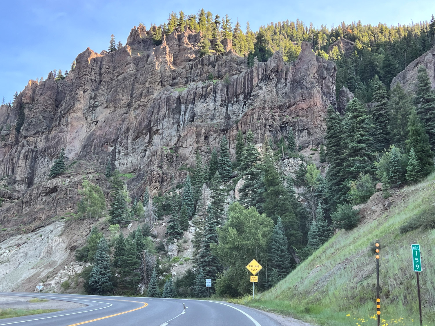
We drove through beautiful country heading northeast from Pagosa Springs towards Wolf Creek Pass. The scenery was markedly greener than during the previous days.
The old green truck that is used to living at 30′ elevation wasn’t happy about the climb to 10,000+ elevation.
Standing with one foot on each side of the Continental Divide.
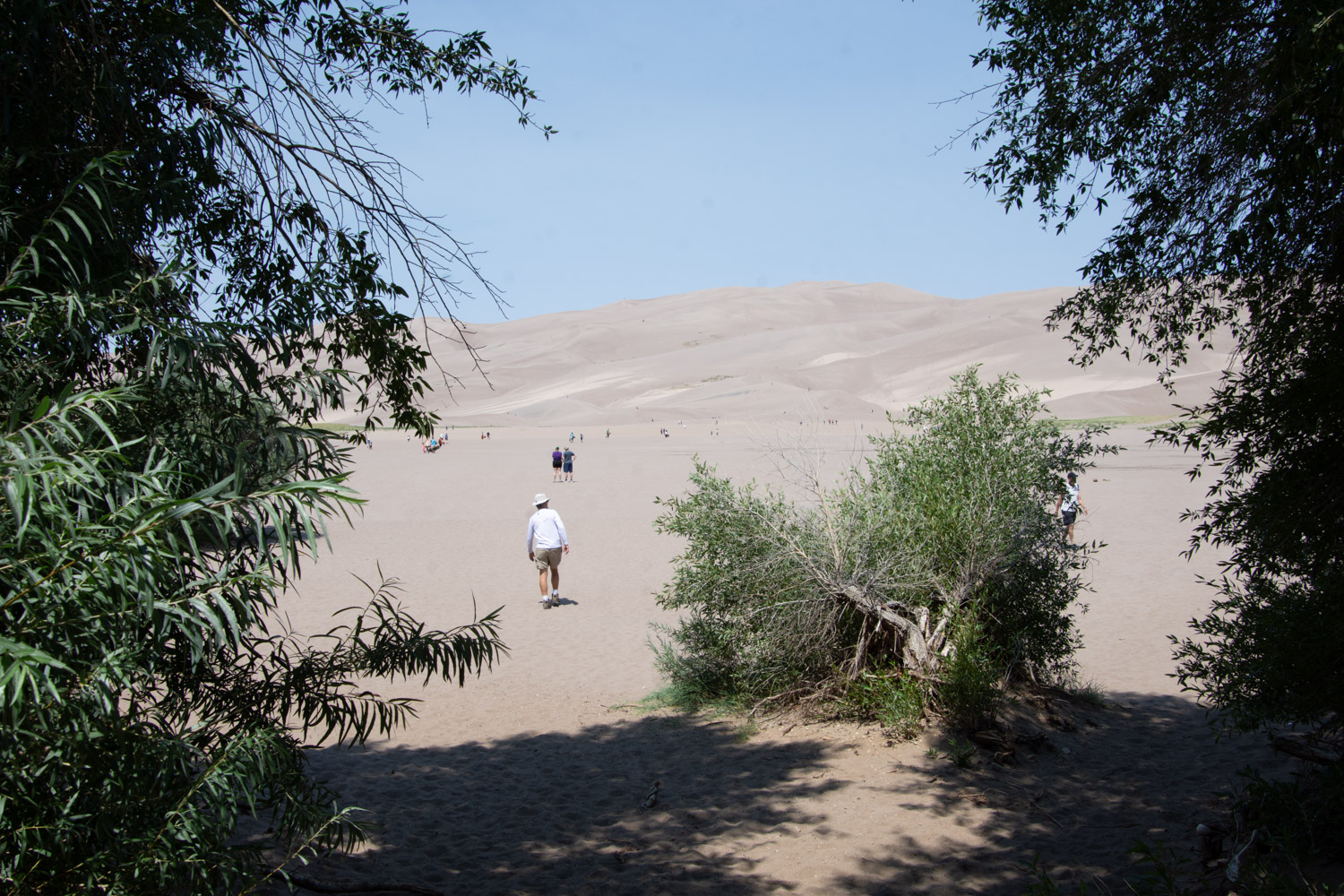
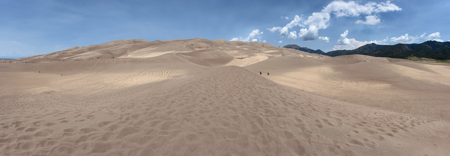
From the pass it was about two hours to Great Sand Dunes National Park.
After spending some time in the Visitor Center and learning about how these dunes were created we walked to the dunes.
This is another place that I could come back to.
You could spend a whole day exploring this landscape. There are 30 square miles of dunes! There are no trails through them but you can walk anywhere.
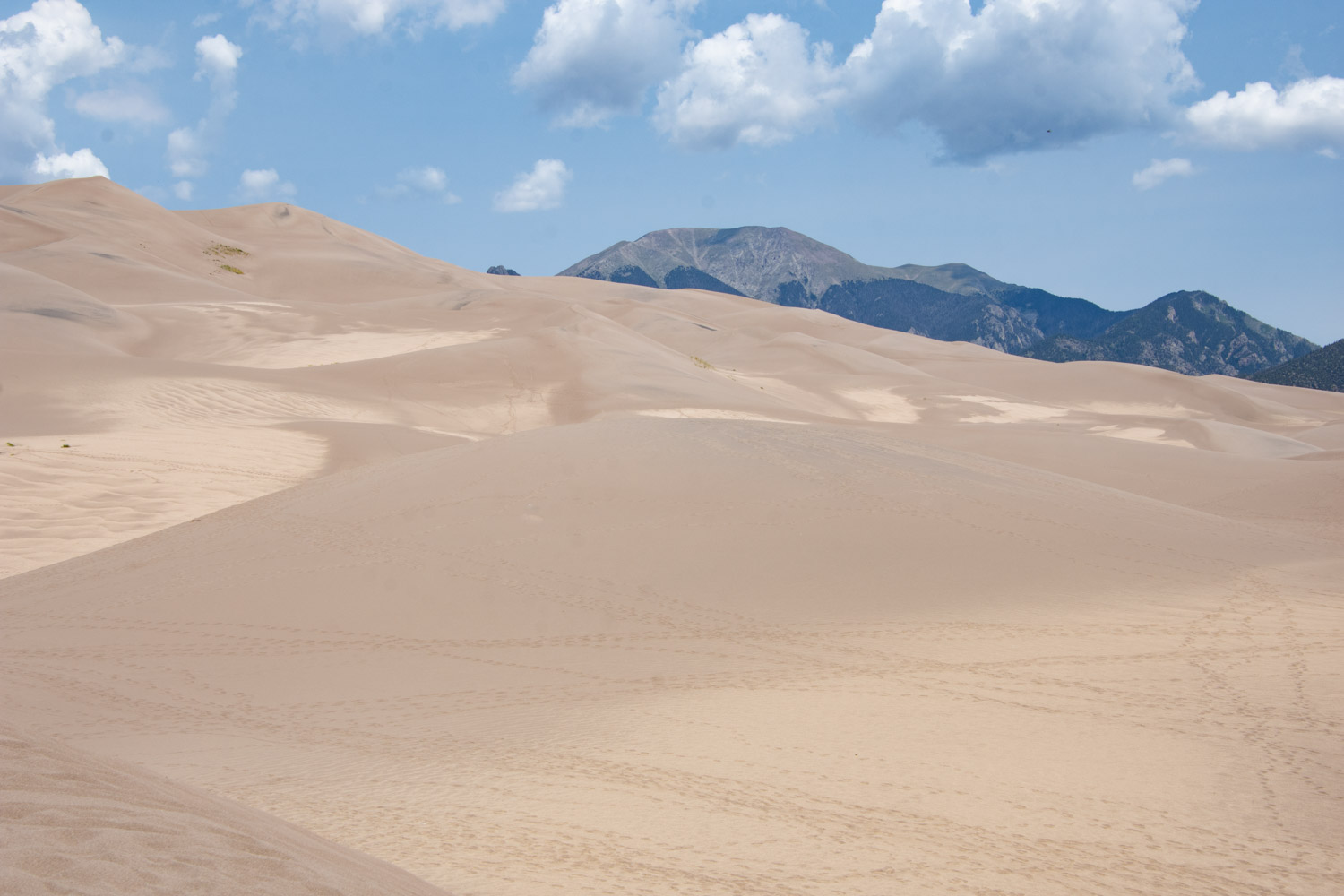
This is a panoramic shot of the closest dune field and shows the mountains at over 13,000′ where you can find alpine lakes if you’re willing to hike. Most of the park is not accessible by vehicle.
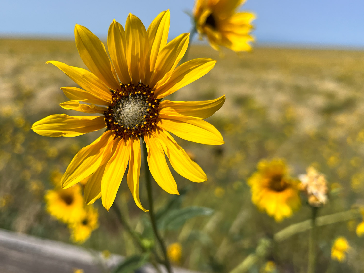
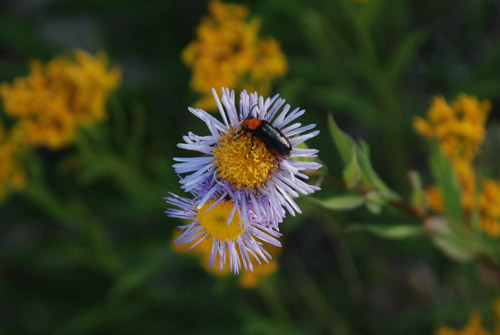
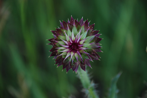
There were plenty of wildflowers on the surrounding land. Prairie Sunflower.
We drove half a day to get to Estes Park from Wyoming. The previous day’s photos took us from California to Wyoming where we pulled in a rest stop about 2 a.m.
We left the rest stop about 5:30 a.m. I didn’t keep track of where we were or where this photo was taken. It’s obvious that someone needs to clean the windshield at the next gas stop.
Wyoming landscape with a train.
Wyoming landscape with snow fences.
There are several Wyoming landscape photos. It was beautifully green with lots of flowers . Too bad this was a trip where we couldn’t stop.
Stopping at a rest stop doesn’t count, although this one had a telescopic viewer set up so you could zoom in on the hills to the west.
While driving (Dan driving) I kept amused by teaching myself some crochet stitches. Too bad I hadn’t read the directions more carefully on this. I learned to do double crochet and did quite a bit before I noticed the H that stood for Half Double Crochet, which is what I was supposed to be doing all along. I persevered, thinking that it will all work itself out. I’m trying to develop a new product using some of my yarn. I continued this on the return trip and I think I will probably be ripping it all out, but that will be another story.
More gorgeous scenery. Green grass, yellow and white flowers, blue sky with clouds. Cows at the base of the hills.
I think we’re finally in Colorado.
I took several photos of pronghorn, but they most were too far away for the iPhone camera.
We pulled into Estes Park in the early afternoon. I didn’t want to do anything but get the sheep out of the trailer and on firm ground and give them water and hay.
It didn’t take long to get the sheep fed and watered and settled in.
The first event of the JSBA part of Estes Park Wool Market was the Jacob wool show. We were able to enter fleeces and sheep in both the JSBA show and the Wool Market show so some of us had double events.
I entered five fleeces and I really don’t remember how they placed. I guess there is a record of it somewhere. These same fleeces also showed on Sunday at the Wool Market show.
We had a JSBA sponsored dinner at the fairgrounds Friday evening and then went to a cabin I had reserved for two nights that was about 3 miles out of town.
It has been a few weeks since we finished our road trip and there have been plenty of distractions since I’ve been back that have kept me from sharing the story. Now that the Olympics are on TV I am trying to multi-task. But it’s hard to pull my eyes away from the TV at times.* However I’m close to finishing–we are still in Colorado but once we headed for home we didn’t stop for much.
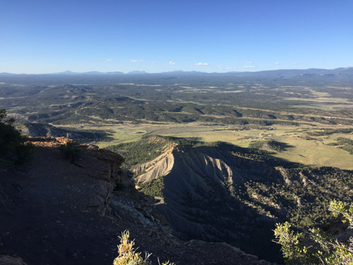
After we left Black Canyon of the Gunnison National Park we looked at our trusty Benchmark map book for Colorado and saw that we could probably get to Mesa Verde National Park in time to spend the night there. So after driving through the marvelous San Juan Mountains it was a relatively short drive from Durango to Mesa Verde. We got there about 6 p.m. and found that there were plenty of open campsites.
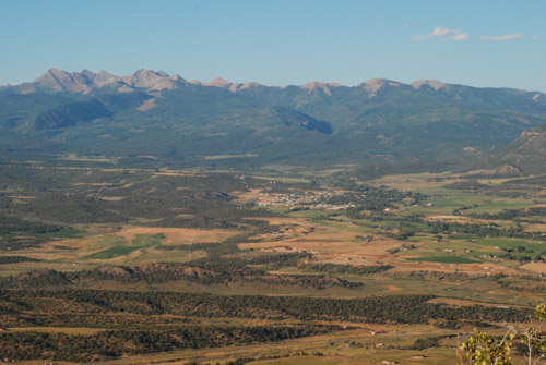
We looked at the Park maps and saw a couple of 2-mile trails that we would have time for before dark. First we hiked up to Point Lookout at 8427′ elevation. This view is to the northwest with the San Juan Mountains in the background and the town of Mancos in the center.
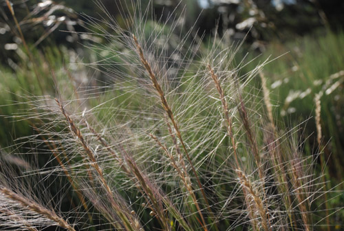
Squirreltail…
…and Indian rice grass along the trail.
After getting hiking this trail we drove to the the Knife Edge Trail which follows a section of the precarious road built in 1914 which was part of the original main access into the park.
Dan took this photo of me with the booklet that described the plants and other features along this trail.
This is a popular place for park visitors to watch the sunset. We walked back to the car at dusk and it was dark when we found a campsite. With the dark it got cold and we didn’t have a working stove. We ate tuna sandwiches and went to bed.
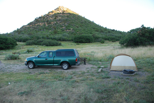
This is what camp looked like in the morning.
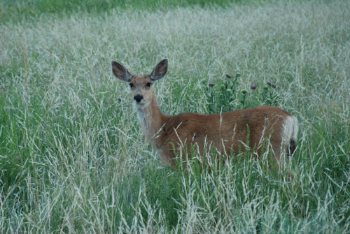
There were deer around the camp in the night and at dawn when I got up.
Seen on my early morning walk.
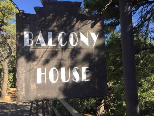
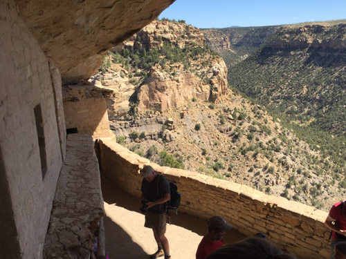
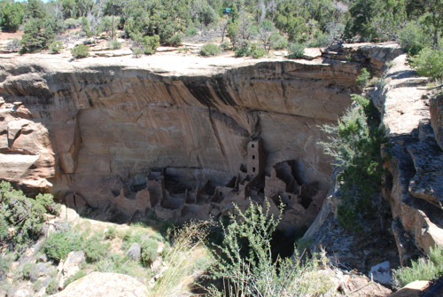
We had learned when we paid for our campsite that the way to see the features for which the park is best known (the cliff dwellings) is to sign up for one of the tours. We showed up the next morning for the Balcony House tour.
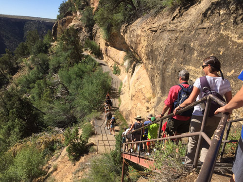
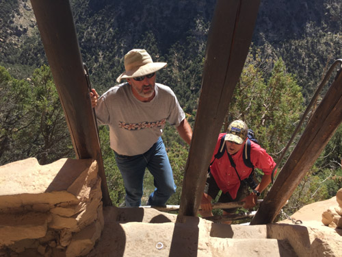
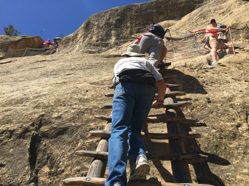
We were directed to follow the trail to the end where we would find a ladder and to wait there.
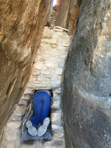
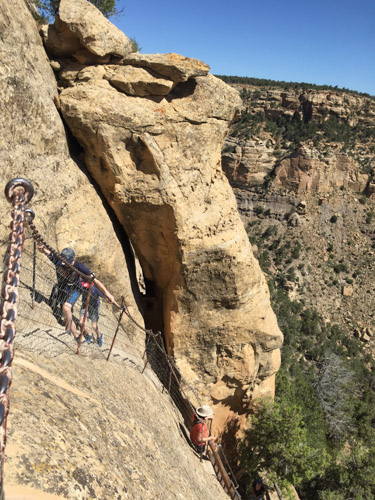
This tour is listed as the “most adventurous cliff dwelling tour” and we were warned that we would “climb a 32′ ladder, crawl through an 18″ wide by 12′ long tunnel, and climb up a 60′ open cliff face with stone steps and two 10′ ladders”. Not quite an Indiana Jones adventure but it did seem challenging for some of the tour participants.
Can you imagine what this was like when people really lived here?
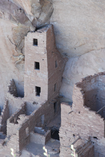
I can see the challenge of being a mother of a toddler.
The Ancestral Pueblo people lived in the Mesa Verde area for about 700 years from about AD 550 to the 1200’s, first living in pit houses, then above-ground pole and adobe structures. The people built the cliff dwellings from the 1190’s to 1270’s and lived there for less than 100 years. It is unknown why, in the span of a generation or two, the people left the area.
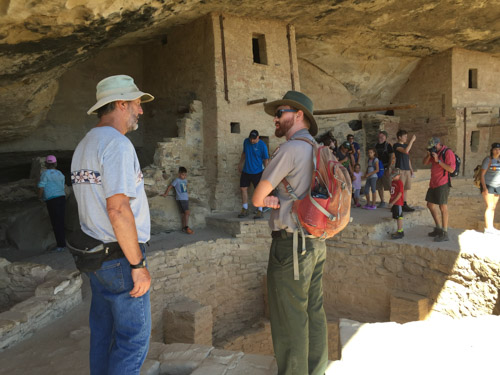
Ranger Spenser was glad to answer questions and discuss his passion for the earlier residents of these dwellings.
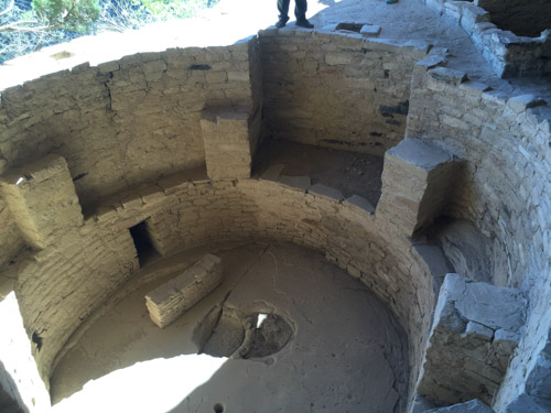
Each village or homesite has a kiva built below ground or in the case of the cliff dwellings, into the rock floor.
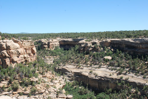
This is the view across the canyon from Balcony House.
This is the same view with a longer lens. It was remarkable that when you really started to look (or got out the binoculars) that you could see dwellings in many of the cliff walls.
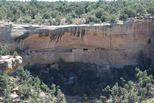
Here is another that we saw later in the day…
…and here’s the close up. This is known as Square Tower House, a 4-story building.
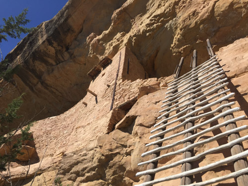
Remember the part about the 18″ x 12′ passage. Here it is…
…followed by the ladders…
…and steps up the cliff wall.
We drove through more of Mesa Verde, looking at some of the other sites, but knew that we needed to get on the road if we were to get home some time the next day.
Next post: Four Corners and Monument Valley.
*I still didn’t get this finished and now its the next day.