Road Trip – Day 3 – Grand Tetons

Morning of the third day.IMG_0055This is the Snake River near where we camped. We were on the road to Primary Destination #1, Grand Teton National Park. Leaving Jackson, WY DSC_4264 Moose is the headquarters and main visitor center for the Park. We found a campsite and chose a place to hike.supplies including bear sprayWe purchased the necessary supplies. That’s Bear Spray on the right. Yikes!bear warning sign These warnings were everywhere you look – at trailheads, in restrooms, on brochures. OK. I believe…But it won’t happen to me? Right? (Read the fine print on this–that’s scary.)DSC_4267 We chose the Hermitage Point trail, about 9.5 miles. Here’s a view across Jackson Lake. The hardest thing about writing this blog is choosing only a few photos.Arrowleaf balsamroot
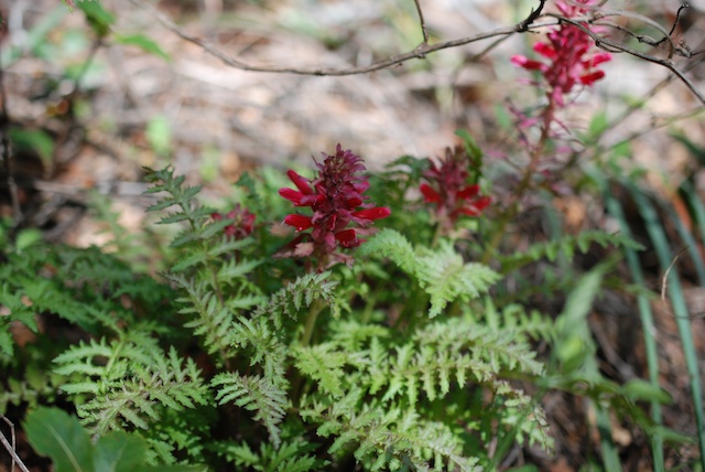
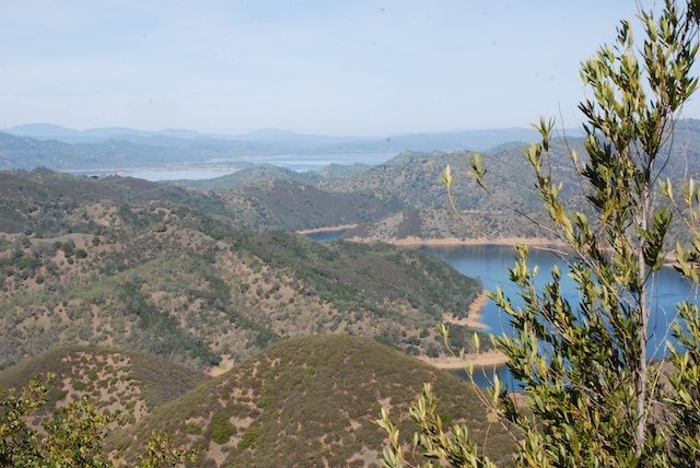
The stunning Arrowleaf Balsamroot was everywhere.DSC_4316On the trail.DSC_4291I don’t think National Geographic will be calling me anytime soon, but it was fun to try and get wildlife photos. I think I do better with flowers because I can get closer and they don’t move. But maybe this isn’t bad considering that my longest lens is only 135 mm. DSC_4323Ruffed grouse, according to my bird book.Tent caterpillars These tent caterpillars were everywhere. They eat all the leaves in the area of their tents and can be quite devastating when in large quantities.DSC_4318 Swan Lake DSC_4338I didn’t see any swans in Swan Lake, but there were plenty of geese…sandhill crane …and a sandhill crane.DSC_4334  

We were less than a mile from the end of our hike and nearing dusk when we came upon this in the trail.DSC_4346OK. Time for 2 photos and then retreat.DSC_4346 - Version 2 This is an enhanced closeup of the photo above. The signs all say that the bear is supposed to go away. She didn’t. We backed up and Dan fumbled with the bear spray. I had read the instructions while he was driving but I don’t think he paid attention. “Flip off the orange safety catch with your thumb and then position it in spray position. No, point it at the bear, not us…” Did you know that you have only 4 seconds of spray in one of those cans? Not like the wasp spray we have around here. The bear approached a little more and we retreated more. We were less than a mile to the end of the trail and I really didn’t want to go back. Then we saw other people coming up the trail towards us. These were 3 kids (well, college age) who we had seen on the trail before. It turns out that they didn’t have a map with them and had taken a wrong turn to a dead-end trail, backtracked, and were running to make up time back to headquarters. They were thankful that we stopped them or they would have been running straight at the bear. When we saw a cub come out from behind a log and it was evident that this mama bear was not going to retreat we turned around and started walking the other way. It added only about another two miles to the hike for an 11.5 mile day. (Is this over-dramatic to those of you who live in bear country? I’m sure that I have hiked in bear country before, but I’ve never seen them. The difference is that these animals are not as wary of people as they would be other places–which is great if you want a deer or grouse photo, but not so much an animal with big teeth and claws.)DSC_4357 Sunset over Jackson Lake.

Road Trip – Day 2- Craters of the Moon

NOTE: As I was writing this I realized that I am back-tracking over yesterday’s post. Oh well. Just like the book that I read on the trip–jumping around from generation to generation.

On Day 2 we awoke at the rest stop to trucks rumbling out and millions (it seemed) of moths folded up in the truck. We shooed out as many as we could and packed up. As we followed the California Trail east we pulled off at the CA Trail Interpretive Center about 10 miles west of Elko. This looks like a brand new facility and is probably worth a stop on another trip, but it was closed at that hour.

At the town of Wells, NV (population about 1300) we turned north towards Twin Falls, ID and there we saw a marker for a CA Trail historical site. It showed a view of the route of the pioneers–dry, desolate, rough terrain, sagebrush. The town wasn’t much. There were many abandoned old brick buildings but there was one in use and it showed a sign for the Wells Society for the Preservation of Western Heritage. Their CA Trail Museum was open. We were shown around by a young woman who grew up in Wells and told us that most of those abandoned brick buildings were in use until 2008 when the town was devastated by a 6.0 magnitude earthquake. DSC_4192 - Version 3DSC_4192 - Version 2DSC_4193

Now we catch up to the photos of lunch and “Welcome to Idaho” in the previous post. Driving past Twin Falls to Shoshone and beyond we were awed by the green landscape. I am used to California’s huge agricultural landscape but there was something different about this. Maybe because of the miles of wheat with huge pivot irrigation systems. DSC_4202Unfortunately I didn’t take many photos and although this photo shows the huge pivot it doesn’t give the feel of the landscape. Deep, deep green over rolling hills to the distant horizon. We read later that this area is fed from aquifers that are a result of the volcanic landscape north of us. And of course there is the Snake River and the dams up the river, including the 15-mile long Jackson Lake in Grand Teton National Park which was dammed in 1911 for irrigation in Idaho.

But Idaho isn’t all green landscape. We stopped at Craters of the Moon National Monument. DSC_0420There was a short trail to the top of Inferno Cone.DSC_4215Can you tell it was windy? So windy that Dan’s sunglasses blew off and he had to chase them down the slope. We gave up on wearing hats.DSC_4218This is the view from the top of Inferno Cone. The Visitor’s Center is just right of center. Notice the plume of smoke on the horizon at the left. That continued to grow and drift across the whole landscape through the afternoon.DSC_0437 This is on the trail around Broken Top, a cinder cone. Still windy.IMG_9929There are caves to explore. This is the path to three caves.DSC_0446 Getting out of the wind to the quiet of the cave was a relief. This is Indian Tunnel, a cave with areas in which the roof has collapsed.IMG_9936Most of the time it’s too dark in a cave for photos. The beauty of this area is in texture, color, and shape. (Hey, weavers, substitute  structure for shape and we’re describing cloth.)DSC_0451      DSC_4233DSC_4234DSC_4235DSC_4254 Craters was not our primary destination so after seeing what we wanted to see (and being tired of the wind) we got back on the road. The evening was spent driving through more beautiful ag land in Idaho, following the Snake River. DSC_0454At dusk we found an almost empty campground along the Snake River. After a meal of beans and popcorn we went to bed. No moths. No wind. Perfect.

Next installment: Grand Tetons.

Backpacking at the Lost Coast – Day 2

The goal for this morning was to hike south to Miller Flat where we would spend the night. IMG_9531IMG_9538IMG_9543DSC_2472After we set up camp I did some more exploring. Walking another mile or so was no problem once I was able to ditch the pack. The scenery and flowers were spectacular.DSC_2454DSC_2443DSC_2468Wild iris.DSC_2475As I’ve said in other posts the poison oak can be very pretty although its definitely best to avoid it.

Back at camp there was no shortage of wildlife, although I wasn’t able to do much about photographing sea lions or a river otter with my 40mm lens. (I tried, but won’t bore you with those photos where you have to know which speck is the subject animal.) DSC_2404DSC_2428 Kaleena was photographing one of her favorite flowers right next to camp and was about to step over a log when she saw this:DSC_2430DSC_2436 It eventually slithered under the log. Maybe the beach is a safer trek.DSC_2311My kids could be active-wear models.DSC_2521This made me nervous. Matt wanted to get photos of the surf as it rolled in under his camera.IMG_9570Another great dinner. This time it was mac and cheese with fresh veggies followed by s’mores with your choice of graham crackers or fresh apple slices or both.Trail mixOf course there was always trail mix for snacking.DSC_2517  

Sunset on the beach.DSC_2542 The  colors of the sky and ocean changed to pinks and greens as the sun went down.        DSC_2563 My tent at dusk. (Rainfly necessary this night.)


Backpacking at the Lost Coast – Day 1

My son and DIL invited me to join them and a couple of their friends on a backpacking trip to one of their favorite spots. According to Wikipedia, “the steepness and related geo-technical challenges of the coastal mountains made this stretch of coastline too costly for state highway or county road builders to establish routes through the area, leaving it the most undeveloped and remote portion of the California coast”. Since Matt and Kaleena did all the planning, food prep, etc all I had to do was gather up or borrow the right clothes and gear. DSC_2191 We drove about 5 hours north to a campsite outside of the town of Honeydew in Humboldt County where we spent the night. The next morning we drove to the the Kinsey Ridge Trailhead to begin the hike. DSC_2194 I borrowed  backpack since I couldn’t find mine (and the last time I had used it was about 30 years ago so this one was probably a little better).IMG_9481 There was a four mile trek down the mountain to get to the beach. After that the trail is along the beach or through meadows just above.IMG_9483 IMG_9548DSC_2232 Every mile or so there is another river running out of the mountains into the ocean. This was where we camped the first night.DSC_2210Time to unpack the dogs and relax a bit.DSC_2247 First order of business was to secure our site by setting up the tents. There were not very many people hiking the area, but Matt and Kaleena have their favorite spots and you can’t exactly reserve a site. View from my tent This is the view of the ocean from inside my tent. No rain fly needed the first night.DSC_2230Matt and Kaleena’s friends didn’t bring tents but constructed a temporary shelter from the wind with rocks and driftwood. DSC_2255Next it was time to explore the area and wash the poison oak off the dogs.DSC_2214

DSC_2220The chef Matt was the chef. IMG_9499He and Kaleena had prepared enough veggies to last us for 3 dinners.DSC_2302After watching the sun set over the ocean…IMG_9512…we enjoyed s’mores back at camp before turning in for the night.

Pinnacles National Park, Part 2

Does a 2-day camping trip warrant 2 blog posts? For me it does because we don’t do this very often. And I took lots of photos.

We discovered that we did sleep relatively all right in the truck, although I was told that I had more than my share of the “mattress”. Huh!

The next morning we checked the map and chose the hike for the day.DSC_1127 This was the first leg of a 5.5 mile hike. Notice the word Condor. I took my binoculars on this hike, determined to identify a condor this day. Pinnacles is one of the few remaining areas where the endangered California Condors live and nest.DSC_1130

This trail winds up the mountain and behind those peaks in the distance.DSC_1134Getting closer to the peaks. At this point we talked to a wildlife biologist who was using an antennae to try and pick up a signal of the condors who are banded with transponders. She said that they do nest in these cliffs but today she hadn’t found any. They don’t always stay in the park area. We saw plenty of soaring birds but they kept turning out to be buzzards.DSC_1131  More of the trail.  DSC_1173 This is coming around the west side of those peaks. The vegetation was somewhat different than that of yesterday’s hike except for one plant.DSC_1164There was plenty of poison oak, although these trails are wider than those on our Stebbins Cold Canyon hike so it’s easier to avoid. I was struck by the beautiful shades of green in the poison oak.DSC_1190 Color abounds.

DSC_1193 This was an interesting trail. Notice that railing under the overhanging rock.DSC_1200The Park Service (or maybe it was the CCC years ago) thoughtfully provided steps (and, thankfully, railings) so that hikers could get over these rocks.DSC_1215 The views are worth the climb.CA GiliaWhat would a hike for me be without a few flower photos? Believe me, I took many more than this even though, due to the dry conditions in Northern California, there was not the abundance of wildflowers that I think there would normally be at this time of year. I think I have identified this as a patch of California Gilia (Gilia achilleifolia).DSC_1243 CA GDSC_1272 I think that this plant is Wild Cucumber or California Manroot (Marah macrocarpa). What we noticed on this hike is that the spiralling tendrils that look like a telephone cord (yes, that dates me) start out straight. When the straight tendril touches something it coils and hangs on. Amazing. 

As usual I tried my hand at wildlife photography. Those bee photos are the only ones I’ll show. The bunny, the crow, and the lizard weren’t all that great. The condor look-alike perched on a branch turned out to be a buzzard when I looked at the photo close-up. DSC_1296

This looks like condor country to me…DSC_1748…but this was the closest I got to a condor.  Good trip anyway.


Pinnacles National Park

Last week was Dan’s spring break and we took two days to go camping while my son was in charge of all the sheep including the last few ewes left to lamb.

We got to Pinnacles in the middle of the afternoon, secured a campsite, and went on a hike.DSC_1020 We didn’t have a plan other than to start with the trail that goes through one of the caves at the park.

DSC_1022These caves are sometimes closed when the bats are raising babies, but they were open at this time. DSC_1024This cave is not one big chamber but a series of smaller chambers connected by narrow passages under overhanging rocks, following waterways, or up stairs.

DSC_1031This is the exit of the cave. These photos don’t do justice to the scenery. In fact I was disappointed in my photos from this trip because they all seem so washed out. I think I’m regressing as an amateur photographer. (You’ll be glad that I didn’t include my wildlife photos in this blog! I don’t think National Geographic will be calling me anytime soon.)

DSC_1033This view is that exit but looking back down the stairs. We came out of the cave to this small lake.

DSC_1035We looked at the map and decided to hike the trail that went southwest to North Chalone Peak. It was getting late in the day but since we were camping there it didn’t matter when we got back as long as it was still light.DSC_1049 This is the view from part way up the trail looking back down to where the cave entrance. Do you see that small lake at the bottom center of the photo?

DSC_1091 We didn’t know what to expect at the end of the trail until we came around another corner and saw what looked like a fire lookout in the distance.

DSC_1079 Here is what it is like close up.DSC_1090And this is one of the views from the peak.  This turned out to be an 8.5 mile hike so we both felt glad to get back to camp and put our feet up. DSC_1126We used this one-night camping trip as a trial run to see how we liked sleeping in the old green truck because we are thinking about a road trip during the summer. It wasn’t like home, but was much better than sleeping in the back of the Explorer at the Grand Canyon a few years ago.

To be continued…

Hiking Close to Home

Dan suggested hiking today. The closest place for a hike is to go to Stebbins Cold Canyon Preserve in the Blue Ridge Mountains southeast of Lake Berryessa. There is a five-mile loop trail that has enough elevation change to make you feel as though you had a workout, especially for us flat-landers.DSC_0064Do you see those switchbacks on the map? The rest of that isn’t exactly flat. This was perfect timing to hike in this area. We finally had enough rain for grass and wildflowers to grow (although not nearly enough rain to make up the deficit).DSC_0031Dan walks. I keep stopping to take photos and then I catch up. This is the lower part of the area in Cold Canyon where there is a lot of greenery. It is a completely different ecosystem than what you find up on the ridge.Poison oakIt is good to stay on the trail because there is poison oak everywhere. Even if dogs were allowed on this part of the hike I wouldn’t bring them because they would be covered with it.Dutchman's pipe The interesting flower of CA Dutchman’s Pipe or CA Pipevine (Aristolochia californica).CA Bay California Bay Laurel (Umbellularia californica)DSC_9997Shooting Star (Dodecatheon)Wild cucumber or Manroot Wild cucumber or California Manroot or California Bigroot (Marah macrocarpa). The flower books say that the root of this deciduous vine may weigh 50-100 pounds.Indian WarriorIndian Warrior (Pedicularis densiflora) is parasitic, attaching to the roots of other plants.Digger pineAs you leave the canyon and start climbing through the chaparral the vegetation changes. This is a beautiful big digger pine.Poison oak  Did I mention the poison oak?DSC_0043 View of part of Lake Berryessa.DSC_0045More climbing to do before we start the downhill.DSC_0051 We didn’t get enough rain this year for the grass to grow up through last year’s old dead grass. Those hills are faintly green, but not enough.Dan saving my lens cap.  Dan recovered my lens cap after it rolled several feet down slope. Most of that is not poison oak, but “most” isn’t “all”. My hero.


Wish I Was There

It was 107 degrees today and the weather people are predicting 6 days of 105 degrees or over. After a few days of this already I am thinking about a hike we took a few weeks ago.DSC_3093 This is a trail in the El Dorado National Forest from Wright’s Lake to Twin Lakes in Desolation Wilderness. We went with my son, Matt, my brother and nephew (who were going to continue into Desolation for a backpacking trip) and, of course, the four dogs.

With my 40 mm lens I get views both …DSC_3118… grand and …DSC_3102 …close.DSC_3115  It’s dry in the valley and foothills now, but at 6000+ feet there are still plenty of wildflowers.DSC_3124

DSC_3210


DSC_3175I love the granite boulders and huge views in the Sierras. That distant mountain is Big Hill, where there is a fire lookout and where Matt sometimes works.DSC_3202Dave and Jack were to continue hiking and discussed the options with Matt who knows this area well.DSC_3192 It’s not always easy to get a group photo of all four dogs. DSC_3217We are so fortunate to live in an area where we can get to the mountains in just a couple of hours and that we are able to enjoy it by hiking.

But this is what I’m thinking about today as the temperature soared.DSC_3165Silver Creek cascades over granite and forms beautiful waterfalls and refreshing pools along its length.DSC_3150 DSC_3152     That’s Matt with Sam and Kirin. I took a dip too and I would relish that now.DSC_3223 Rusty and Maggie like their water a little more shallow.DSC_3251We hiked about 8 miles I think. Toward the end Maggie didn’t want to leave the pools. I think the water felt good on her feet.IMG_6650This is one of Twin Lakes in Desolation Wilderness.


Getting to the Mountains

I am fortunate that I if I wanted a guided tour somewhere in the El Dorado National Forest and surrounding area I only need to ask my son and daughter-in-law (as long as fire season hasn’t started). They live in Pollock Pines, work for the Forest Service, and spend a lot of their off-time enjoying the mountains so they know all the best places. Last week we took a short hike to Bassi Falls. This is an easy hike to take with dogs because you are never far from water.  I took my 44 mm lens–and I have to get used to it again when I switch. DSC_2001

DSC_2071DSC_2005


DSC_2029


DSC_2077


DSC_2000DSC_2022 This is Sam and Kirin, my grand-puppies.DSC_2041 Here they are with Matt & Kaleena.DSC_2043 Sam and Kirin pose better than Rusty and Maggie. By the way, Maggie did so well on this hike. It was only a couple of months ago when I got her that I wondered if I’d ever be able to take her somewhere off leash. This is probably the first time that she has ever had a chance to go for a walk in the mountains. She got along well with Sam and Kirin, who each tower over her.DSC_2056  Here is the only photo I got of all four dogs–like herding cats. Sam and Kirin go for the water, Maggie still tries to move away from the camera and Rusty comes towards the camera to watch shadows and sparkles.DSC_2090 Sitting in a tree?DSC_2096On the way home we drove to Big Hill, where there is a heli-spot and fire lookout. That light spot surrounded by shadows in the middle of this photo is Bassi Falls.

A day in the mountains and a day with my kids. I need to do this more often.

Wildflowers in the hills

Dan and I went for a hike today not too far from here. The loop is about 4.5-5 miles with spectacular views.DSC_0093It’s been dry this spring, and the greenery won’t last long, but there are a lot of wild flowers right now.DSC_0027

Also a lot (A LOT) of poison oak.DSC_0014 I love the effect of my new lens with the shallow depth of field, but it’s sometimes hard to work with, especially when I’m trying to snap photos quickly.

DSC_0070DSC_0057


“I’ll catch up…Just taking photos.”DSC_0028 DSC_0044 DSC_0047  DSC_0065  DSC_0079 DSC_0081 DSC_0088 DSC_0092Western Redbud is one of my favorites.