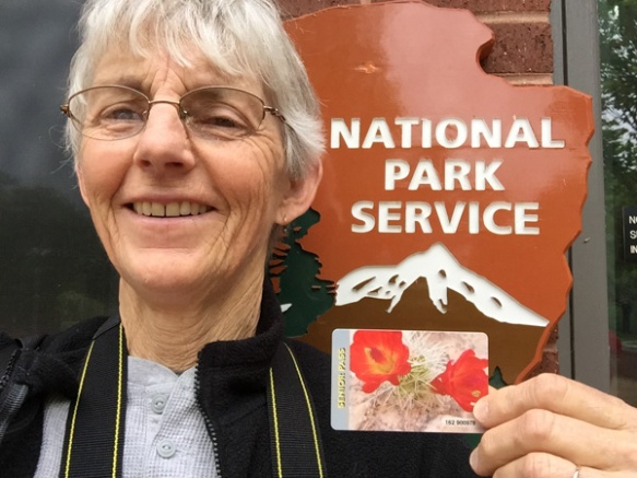
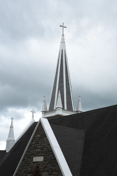
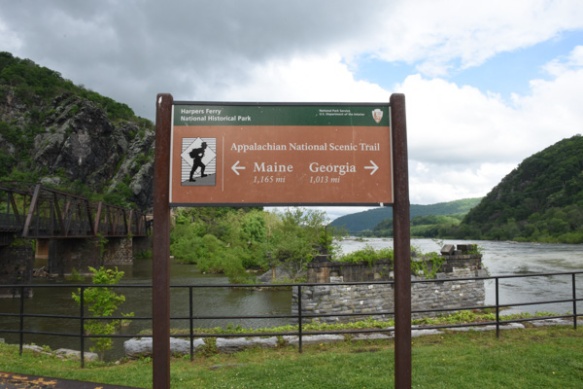
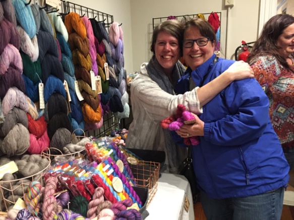
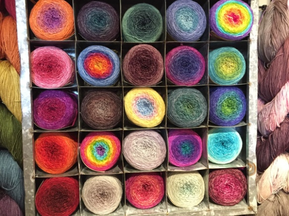
After a fabulous time at MDSW the fun wasn’t over for three of us.
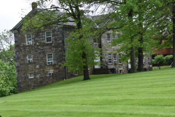
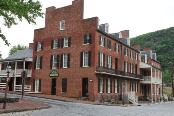
This is the house where we’d stayed for the last 3 nights.
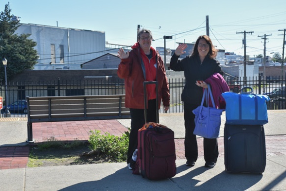
We left Dona and Mary at the bus station in Frederick where they would take a shuttle to the airport, and Chris, Kathleen, and I drove on to continue the adventure.
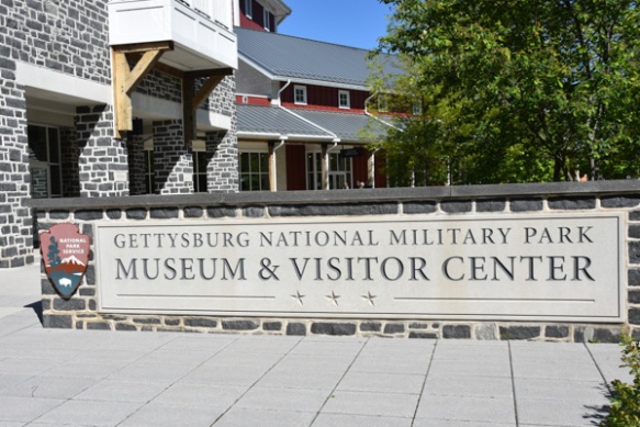
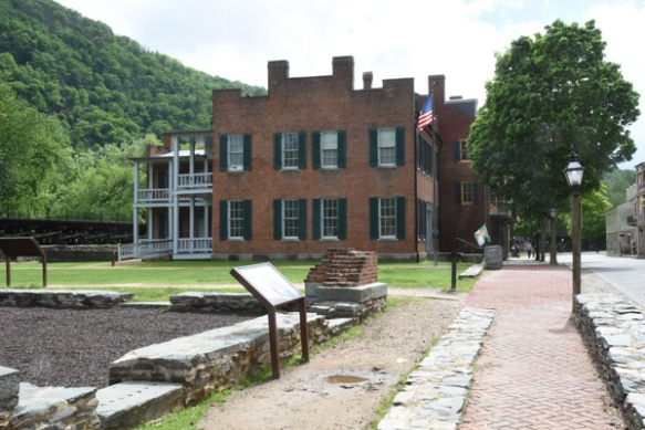
Today’s plan was to see Gettysburg National Military Park.
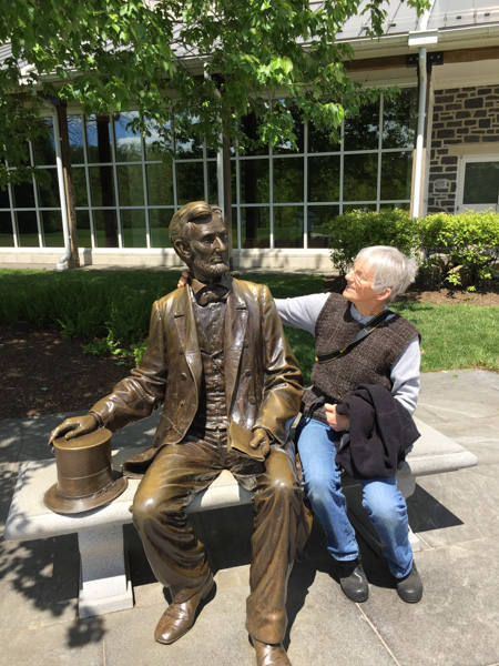
A chat with Abe outside the Visitor Center.
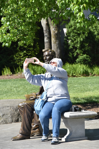
Chris took a selfie with him.
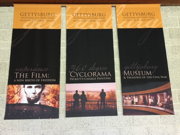
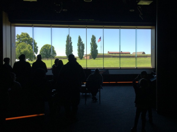
We spent a short time in the museum before entering the theater at our ticketed time for the presentation of a film about Gettysburg. This was a powerful film narrated by Morgan Freeman.
I must say here that I continue to be impressed with the modern visitor centers in our National Parks and Monuments. The presentation of history, natural history, collections of artifacts, etc is superb. If you take the time to absorb all that is presented there is a lot to learn.
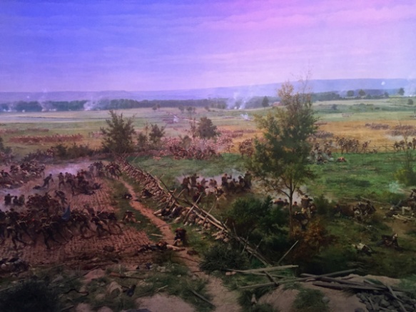
After the film we were ushered into a circular room to see the Cyclorama. . It is a painting depicting Pickett’s Charge that was completed in 1884 and is 42 feet by 377 feet! The overhead lights go dim and you watch the sky lighten as dawn comes. Then you hear the story while different portions of the painting are illuminated, changing as the day (July 3, 1863) goes on and ends in carnage.
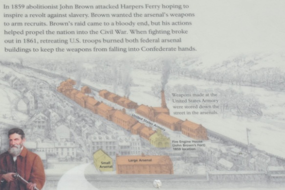
Here’s a refresher for those of you who remember as few details of U.S. history as I do.
The Civil War began in 1861 and the Battle of Gettysburg, fought from July 1-3, 1863, is considered the most important engagement. Troops commanded by General Robert E. Lee battled the Union Army, led by General George G. Meade. The two armies were on parallel ridges about a mile apart and on July 3 12,000 Confederate soldiers were sent across the open fields in an attack known as Pickett’s Charge. Over 5000 soldiers were killed within an hour and Lee retreated towards Virginia. This marked a turning point in the war and was (I think) the northernmost point reached by the Confederate Army.
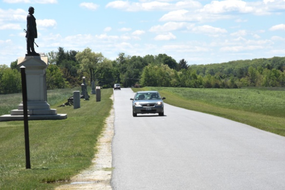
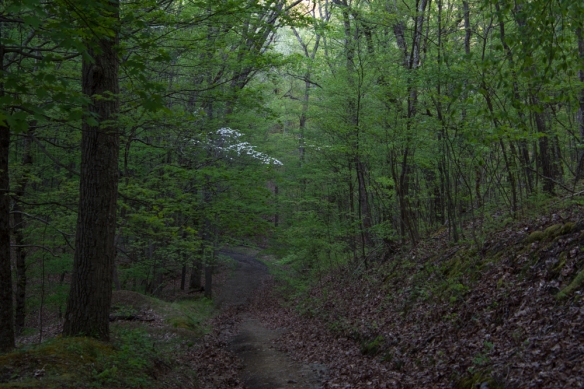
The Park encompasses the land upon which the battle was fought, located around the town of Gettysburg and there are signs that point out all the critical places that armies occupied and where battles were fought. There is a 24-mile Self-guiding Auto Tour with opportunities to stop all along the way.
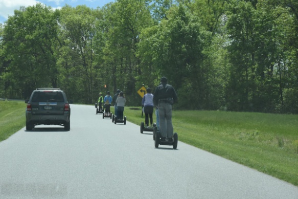
You don’t have to have an Auto to take the Auto Tour.
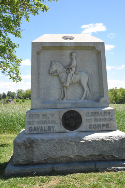
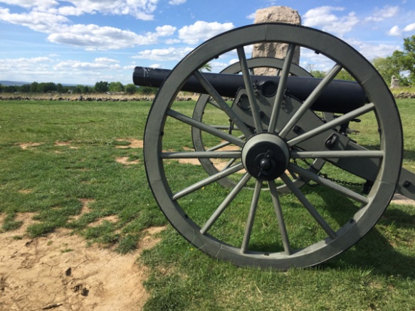
At first i took photos of all the statues we came across but I soon learned that there are over 1300 monuments and statues in the Park. Each regiment has their own and there are many markers that explain the significance of some of the sites.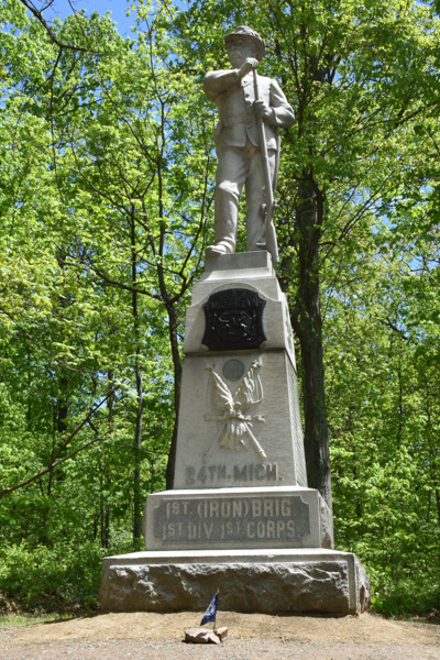
We looked specifically for this one because Chris has an ancestor who was represented here.
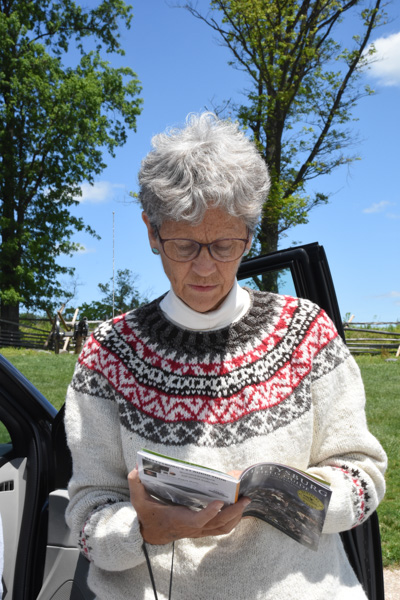
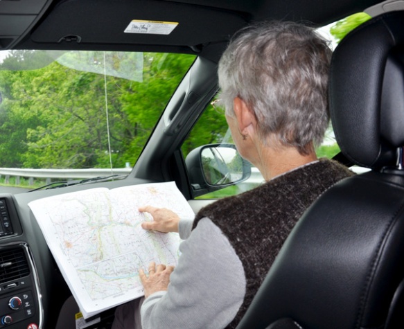
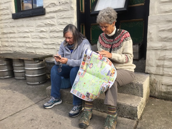
We had bought an audio guide to be downloaded on a phone and listened to while we drove through the area. We couldn’t make it work and Kathleen did a great job of narrating the tour using the accompanying book. Kathleen is wearing her MDSW awarding-winning handspun Jacob sweater that I mentioned in one of the previous posts.
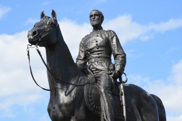
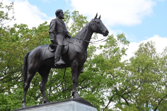 This is the Virginia Memorial, including a statue of Robert E. Lee, at one of our first stops. I love horse statues.
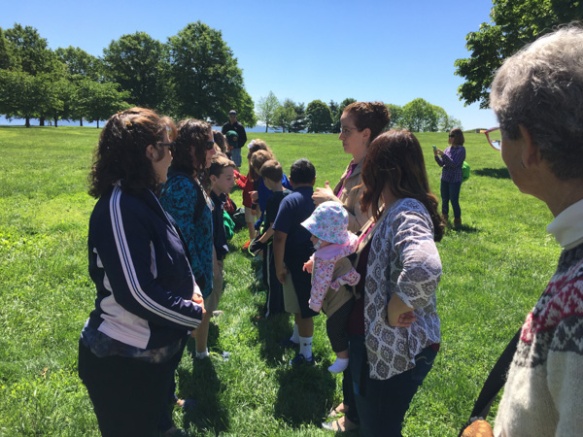
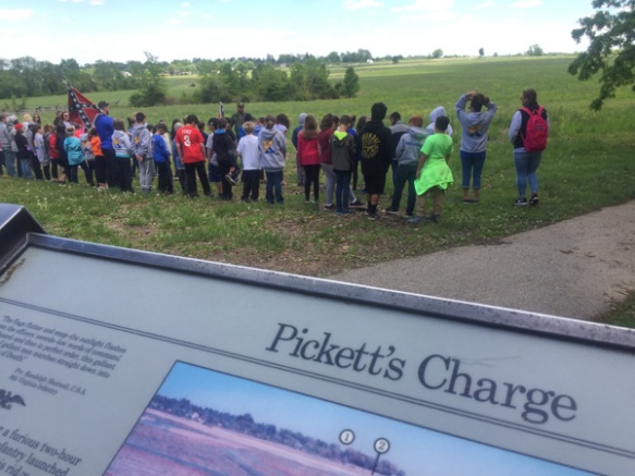 At this site we saw a couple of groups of school kids having a lesson in Civil War history. We listened awhile to the guide who explained things that I never thought about (importance of flags and drummers as a way to signal, for instance) and then had the kids line up in formation and “right face, left face, etc” It was cute to see most of them turn together but there were always a few that went the opposite way. Watching them reminded me of when my oldest son was in middle school and his history teacher, who was a film buff in addition to teaching history, led the kids in making a film of Pickett’s Charge. The kids were dressed in home-made or scrounged clothing to look the part and carrying home-made weapons (that wooden rifle is still around here somewhere I think). The school band participated as well as some of the kids who owned horses. They played out the event and made the film out in a field owned by a local farmer. I took a photo of these kids to send Matt as a fun reminder about that, but it became less “cute” and more sobering the more we read and the more we delved into the history of what actually happened here.
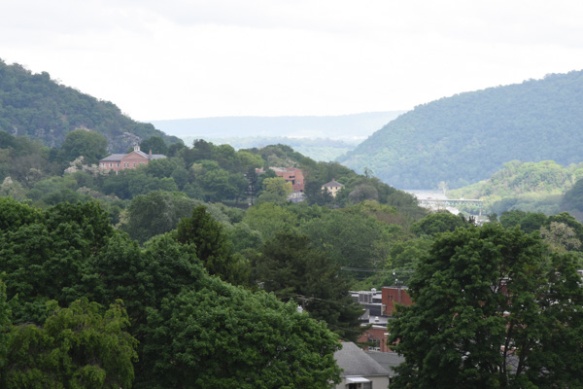
 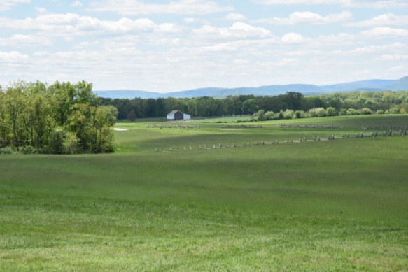 This is a view from where the kids are standing and where the Confederate troops were positioned on Seminary Ridge. Union troops were across the valley on Cemetery Ridge. This is part of a Valley that extends a couple of miles and there are significant points to the Battle of Gettysburg throughout. It is incongruous in this beauty to think of thousands of dead and dying men. And no one ever says anything about the dead and wounded horses. Add that in to the scene.
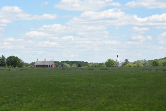 In this idyllic view you can see the Pennsylvania Memorial across the field and to the right. There are places along the route where you read (in the guidebook) about what the aftermath of a battle looks like–the biology of death–blood, flies, bloated bodies, etc. I think that people need to hear that–does it help if we (they) are given mental pictures to try and internalize the horror of war? If kids hear that? What it really looks like? In person? Does it sink in at all what it means to kill another person? To be a bully in the most final sense? This kind of atrocity is being played out in other parts of the world now. Do kids realize how lucky we are to live here? How about us adults too?
Traveling through history in such a vivid, visual way brings this out in me I guess. It seems that most historical events have to do with someone winning, someone losing, someone conquering. Kind of like the newspaper. There isn’t much to say about normal people just living their lives. Off the soapbox now.
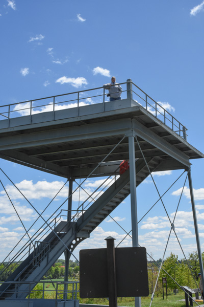
There were observation towers at a few places that allowed us to get an overview of the whole area and visualize the events that played out.
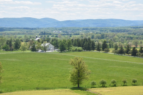 This is a view from the tower that includes, in the foreground, the Eisenhower National Historic Site, the home and farm of Eisenhower that he bought in 1950. We ran out of time to visit that.
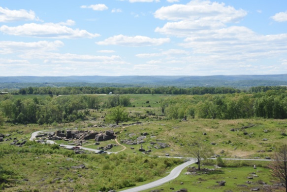 This view is from Little Round Top, a point controlled by Union soldiers. The rock formation below is known as Devil’s Den and the foreground is Slaughter Pen. There was fierce fighting as Confederate soldiers in a line a mile long approached from the far ridge and the Union soldiers tried to defend it. That description is too simplistic; there is detailed documentation about each battle site and each battle.
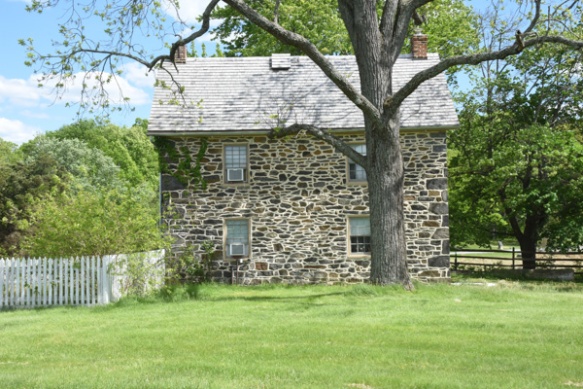 I don’t remember details of this house but it is along the tour route.
 Near the end of the tour we were at what is known as the High Water Mark, the farthest point reached by Confederate soldiers during the Battle of Gettysburg.
 From the Park brochure: “July 3…Some 12,000 Confederates advanced across open fields toward the Federal center in an attack known as ‘Pickett’s Charge’. The attack failed and cost Lee over 5,000 soldiers in one hour. The Battle of Gettysburg was over.”
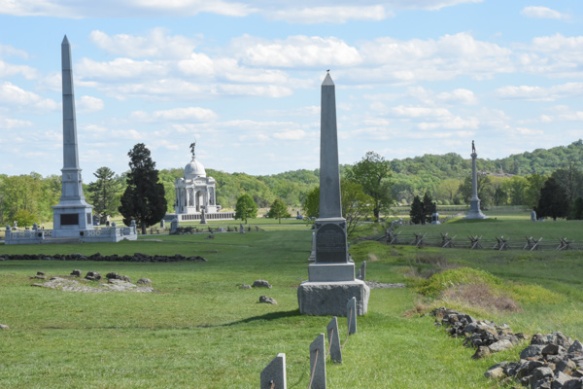
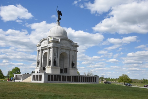 Completed in 1914, the Pennsylvania Memorial is the largest State Memorial in the Park and is near the High Water Mark.
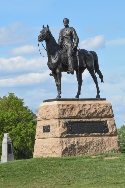
Union General Meade’s statue is nearby.
 The auto tour was almost over. Instead of the 2-1/2 to 3 hours described in the brochure I think we were there for about 5 hours.
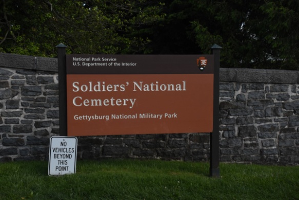 The tour ended at the Soldier’s National Cemetery, created after the battle, and where 3500 Union soldiers were later buried. Remains of 3,320 Confederate soldiers were removed from the battlefield to cemeteries in the South. Veterans from 1898 War with Spain to the Vietnam War are also buried here.
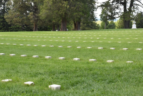
Graves of unidentified Civil War soldiers.
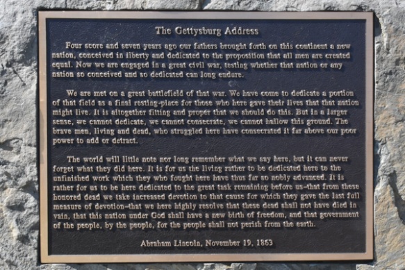
This cemetery is also the site where Lincoln gave his famous speech, taking two minutes to speak these profound words, following a 2-hour speech by Edward Everett, a well-known politician and orator from Massachusetts.
Whew! This was a sobering day. It was also very windy and tiring and we were ready to find a hot dinner and warm bed.
Dinner first. We tried one place that looked good but there was a 45 minute wait. Chris and Kathleen found another and we eventually had hot showers and warm beds.
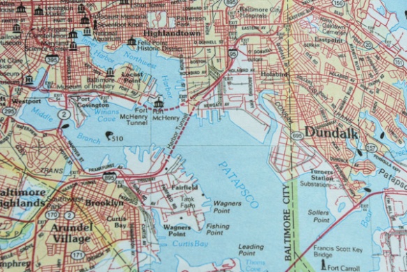
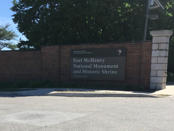
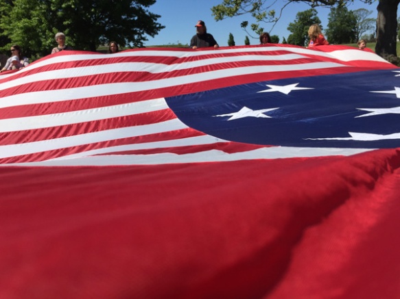
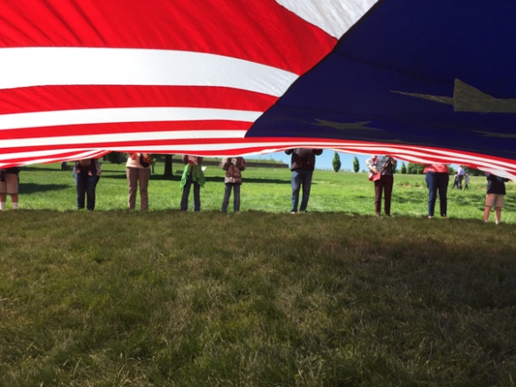
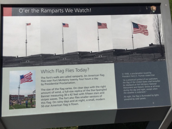
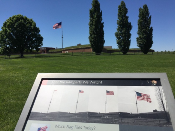
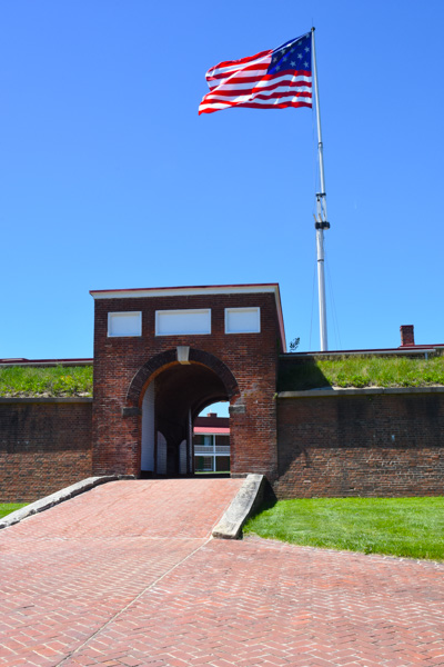
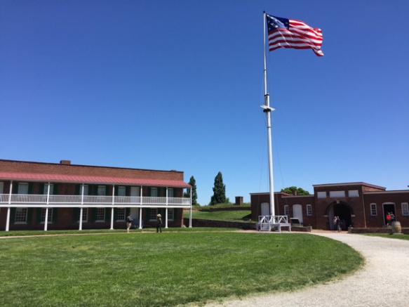
Next post: Ft. McHenry and Harriet Tubman’s Underground Railroad.

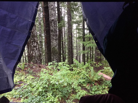 View from the sleeping bag.
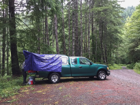 This is where we stayed. We didn’t have a good look at it the night before when it was raining and dark.
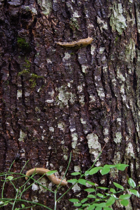 More of my slow-moving wildlife subjects.
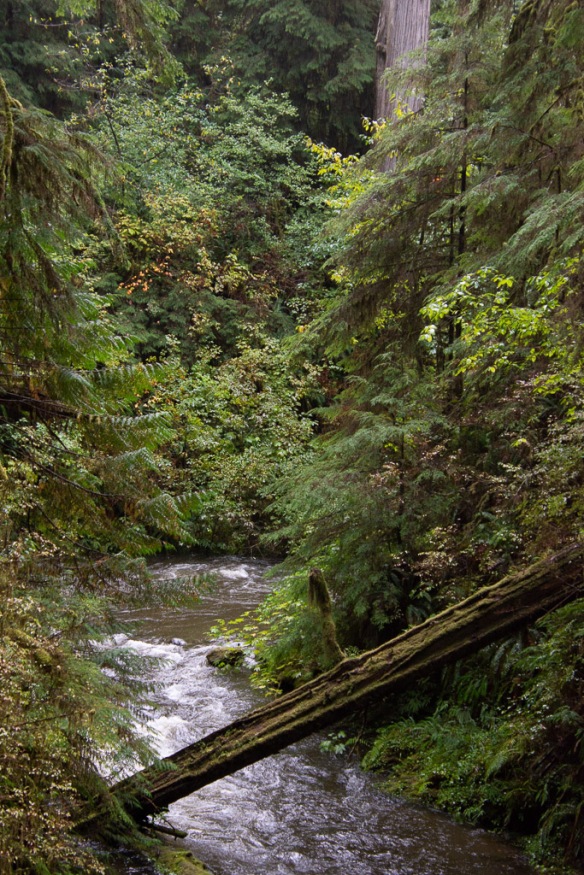
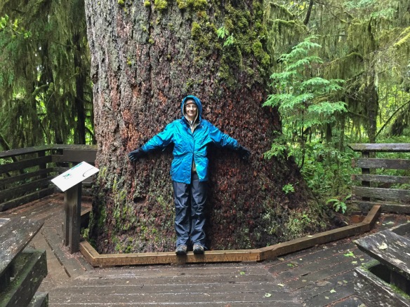 We started with the Rain Forest Nature Trail that leads to Willaby Creek Falls, one of the points on the Waterfall Trail we were following.
 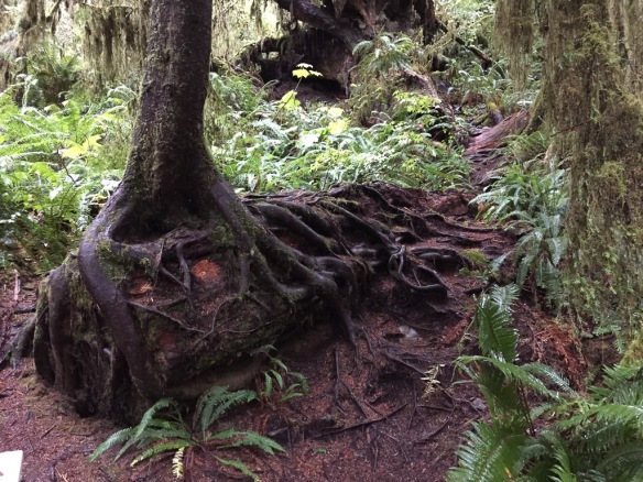 Everywhere you look there are trees rooted over fallen trees. Every surface seems covered with something growing.
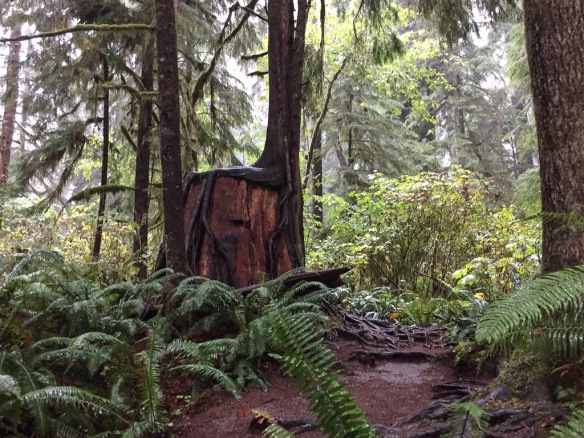 The park protects the largest old-growth forest in the Pacific Northwest. Rainfall varies from 12 feet (!) in the temperate rain forests on the west side to 40″ on the east side.
 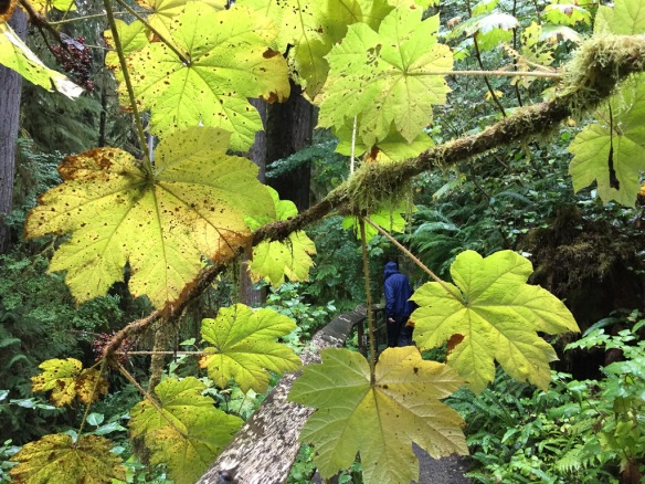 More of the Devils Club with a good view of he spines on the leaves.
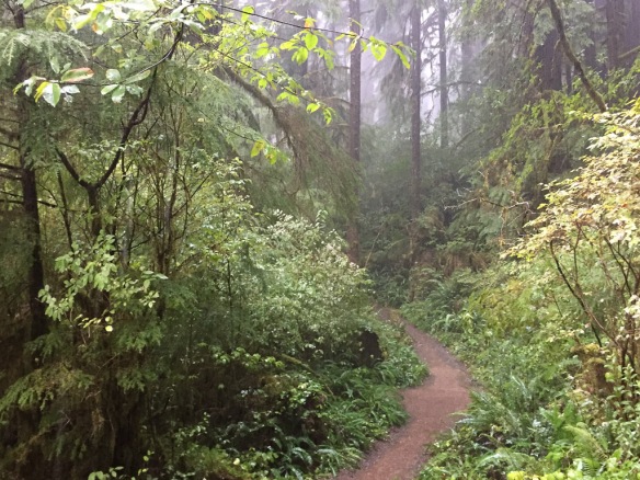 Did I mention that this was a walk through the rain forest? And rain it did. We stood for awhile under the umbrella because is was raining so hard. On our way back this path was filled with water.
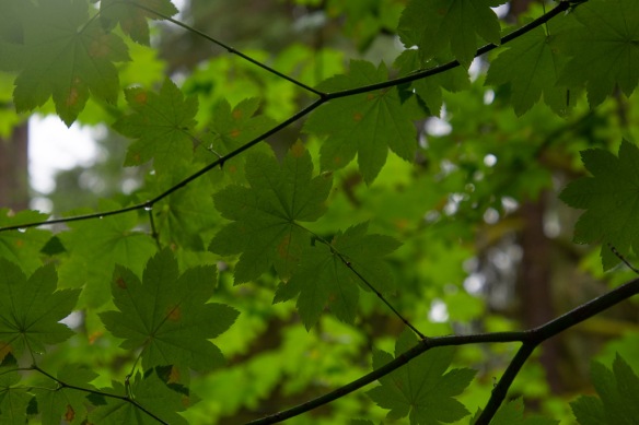
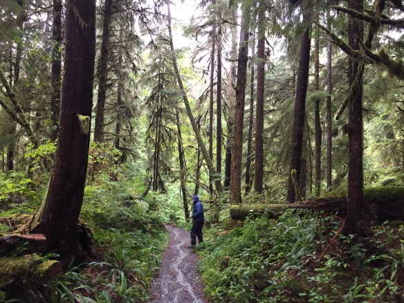 The forest was just beautiful.
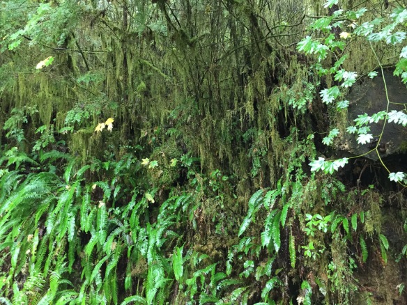
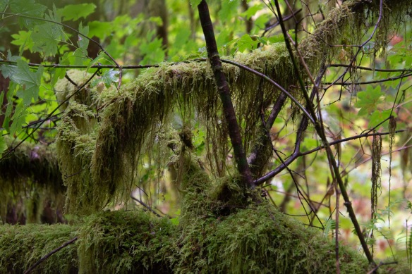
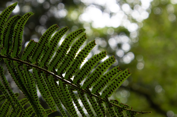
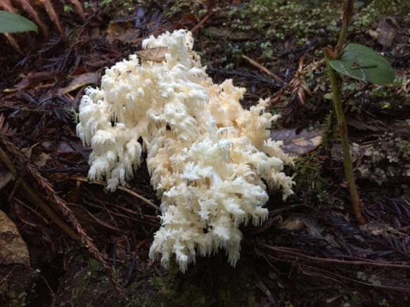
 Lots of fungus in addition to the ferns, shrubs, and trees.


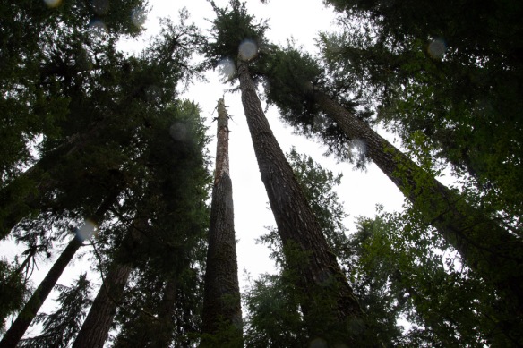
 Some of these photos were taken on the trails to Falls Creek and Gatton Creek waterfalls on creeks that flow into the lake. The next stop was at the World’s Largest Spruce Tree.
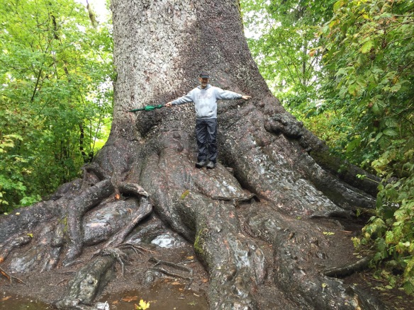 This Stika spruce is 58′, 11″ in circumference and 1000 years old.
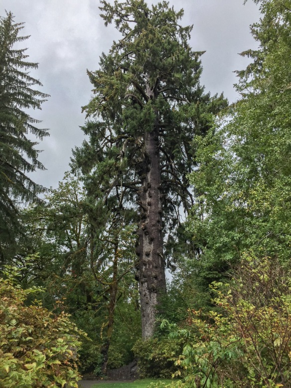 It is 191′ tall and is one of six record breaking trees in the Park.
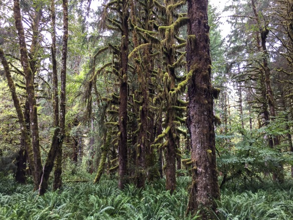 Sulightn was coming through the clouds as we drove down the road on the north side of the Quinault River.
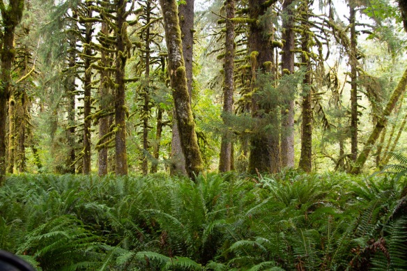 It gave a special glow to the moss covered trees in the flatland along the river.
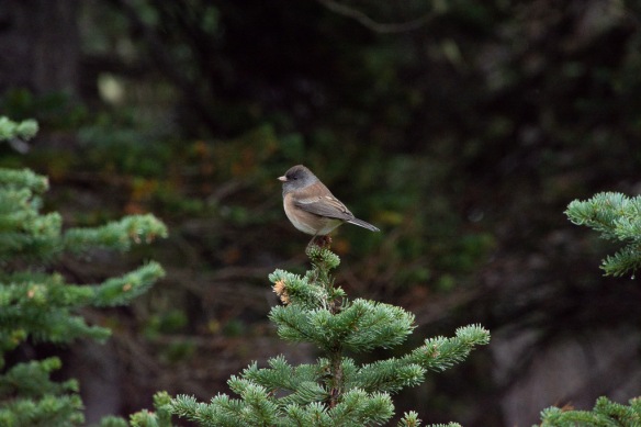
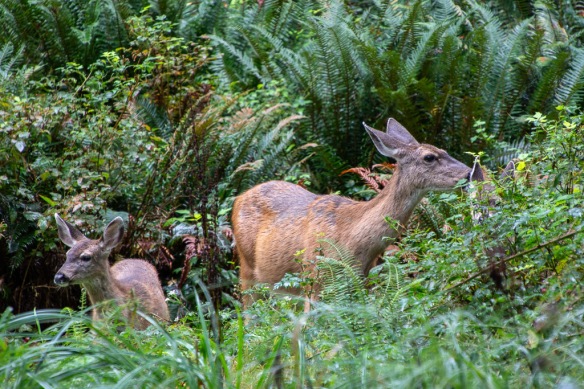 A wildlife shot of something other than a banana slug! Can you see the second fawn? I didn’t even see it until I was looking through my photos.
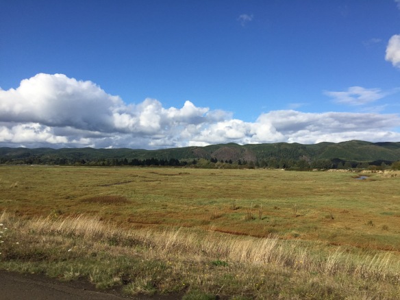 We left the rain forest and the Park and headed for the southwest corner of Washington and Cape Disappointment State Park where we hoped to spend the night.
 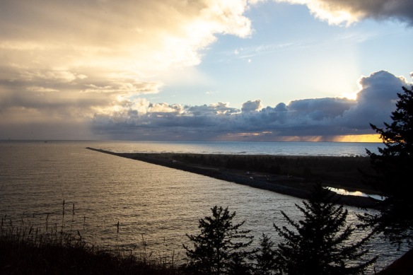 There were campsites available so we reserved one and then walked took one of the Park trails that follows the coastline to one of two lighthouses in the Park. This is the breakwater constructed on the north of where the Columbia River flows into the Pacific.
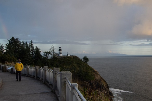 Looking south from the Lewis & Clark Interpretive Center you can see the Cape Disappointment Lighthouse and the Oregon coast in the distance, across the mouth of the Columbia River.
 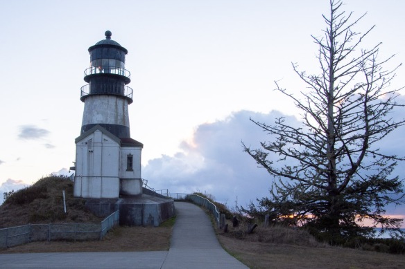 The Cape Disappointment Lighthouse was built in the 1850’s. There is a Coast Guard Station nearby. According to Wikipedia: “The lighthouse had several shortcomings. The fog bell was sometimes inaudible due to the roar of ocean waves. It was discontinued in 1881 and moved … Also, the light was not visible to ships approaching from the north. This problem was corrected by building a lighthouse at North Head, two miles from Cape Disappointment. The first-order lens was moved to North Head … The lighthouse was electrified in 1937. In 1956, the Coast Guard intended to close the station, but retained the light when the Columbia River bar pilots protested. The light was automated in 1973. An observation deck has been built for the Coast Guard to monitor traffic and bar conditions.”
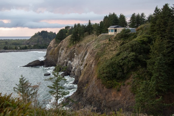 This is the view looking back north to the Interpretive Center (which we visited the next day). Also visible is the small cove called Waikiki Beach. The campsites were beyond that. We got back to camp about dark, our usual M.O., and ate an unexciting dinner, and went to bed.
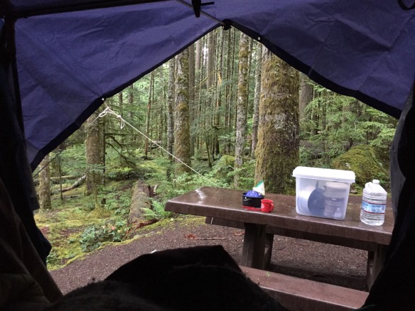 Here is the view from my sleeping bag the next morning.
 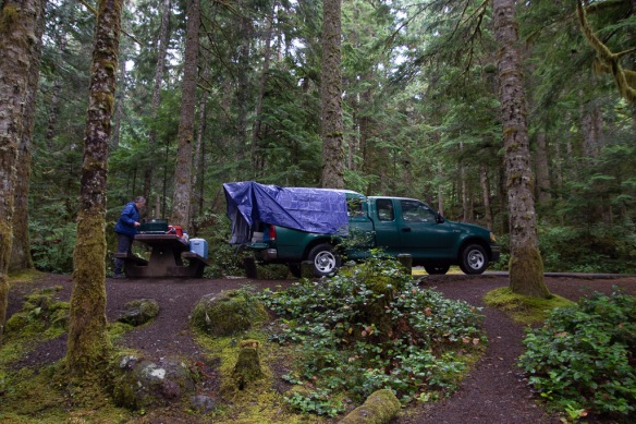 Later we wondered why we didn’t buy a bigger tarp since then we could have covered the whole camper, although I wouldn’t have liked not seeing out the side window. As it is there is some leakage around where the camper joins the truck bed and we had to make sure that our sleeping bags, clothes, etc didn’t touch the edges or they’d soak up water.
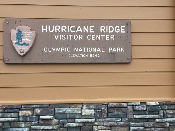 The name was a clue to the weather on the ridge.
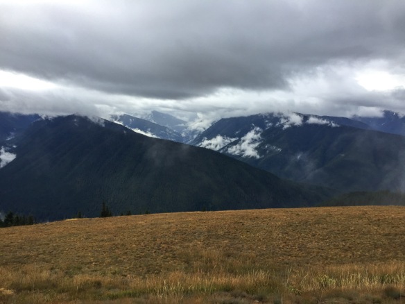 It was a wee bit
 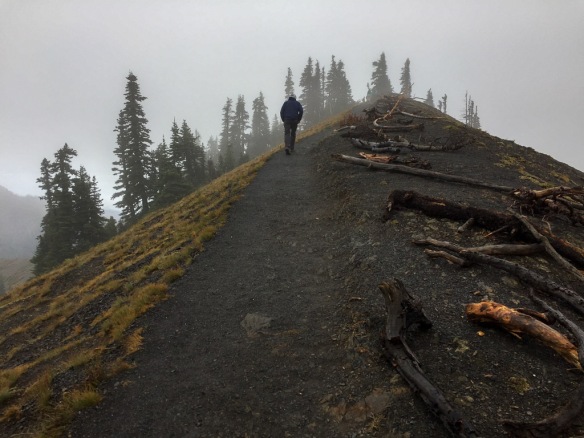 There is a trail from the Visitor Center to the top of the nearby ridge.
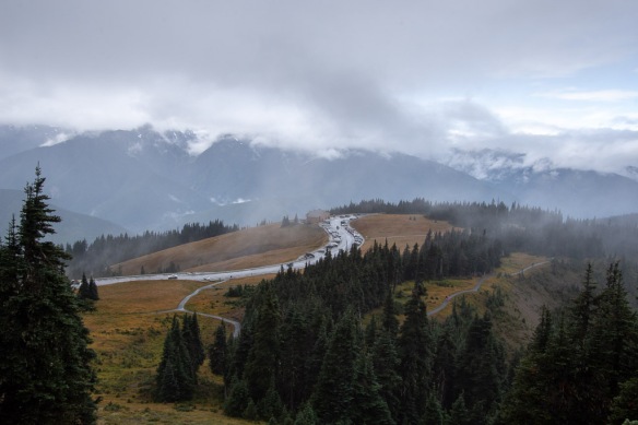 View looking down on the Visitor Center and Mt. Olympus in the clouds.
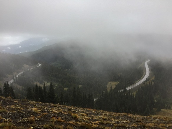 View to the other direction and the road to the Visitor Center.
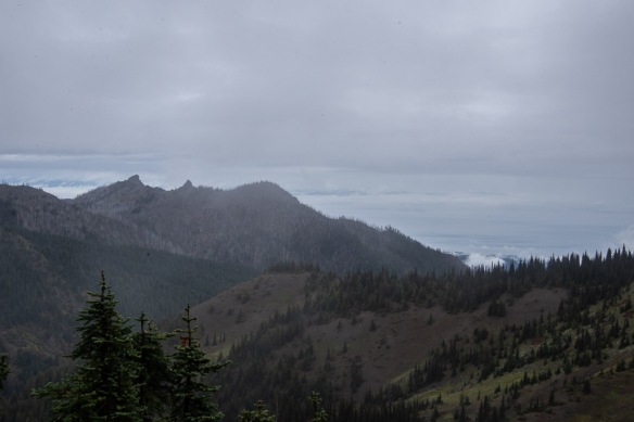 Walking along the ridge we tried to get a view of Canada. It’s out there across the Strait of Juan de Fuca, but mostly in the clouds.
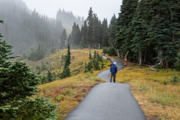 More views along the trail.
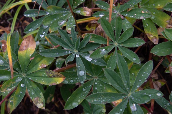
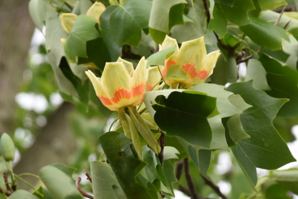
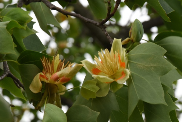
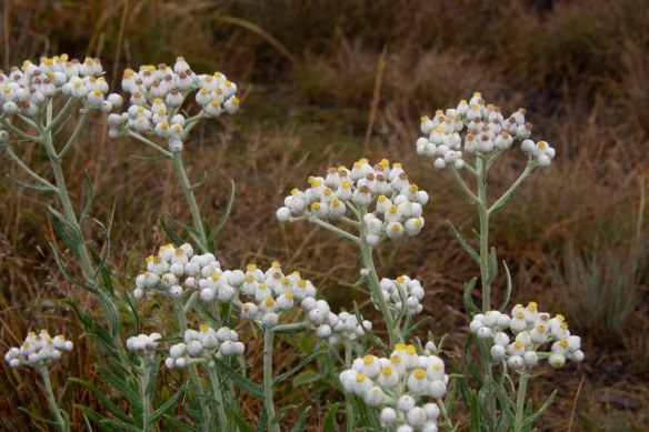 I admired these flowers blooming so late in the season. They are in the sunflower family: Pearly Everlasting.
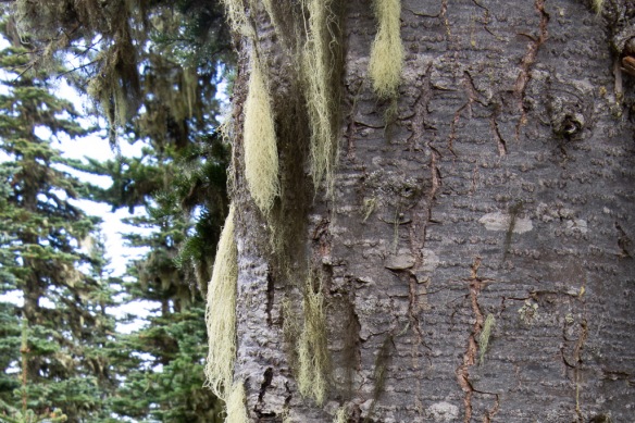 Goat’s Beard lichen.
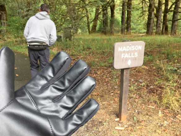 We both bought gloves. Next stop was Madison Falls at the edge of the Park near another road that follows the Elwha River.
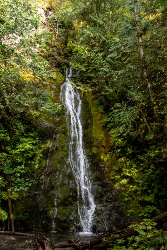 It is a short walk on a paved trail to see the falls.
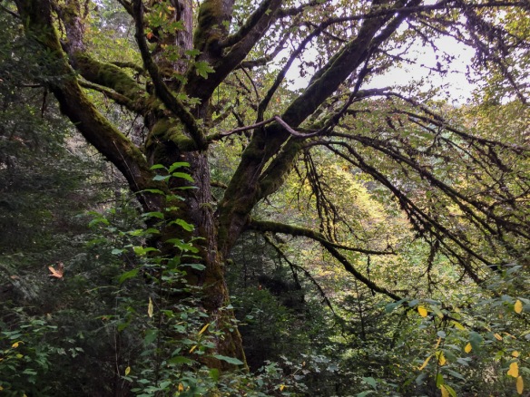
 At this point we were thinking about where we would stay that night. As on all of our trips there is always more to see than we have time for. This was Saturday and we needed to get home on Tuesday. That left Sunday and Monday for more time in the park with a long drive on Tuesday. The bulk of the Park takes up the northern part of the Olympic Peninsula but there is also private and tribal land along the northern coast, the far northwest corner of the state, and the western portion. I wanted to go to that farthest most point of the continental U.S. but we were going to run out of time to do that and spend time in the rainforest. There is a narrow sliver of land all along the Pacific coastline that is also part of the Olympic NP so we decided that we would camp there for the night. That decided, we stopped at the next waterfall on our Waterfall Map.
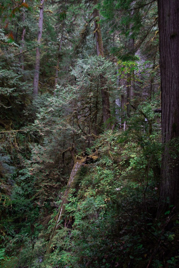 The trail to Marymere Falls was also within the Park.
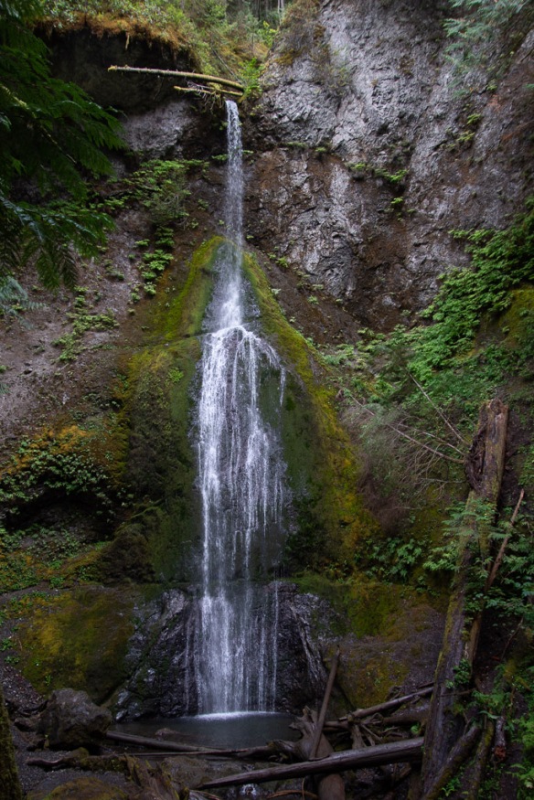 This waterfall is on Falls Creek and drops 90 feet. Take a look at the log at the top of the falls.
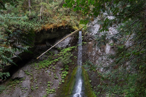 It made me think about the amount of water that must flow in this creek at times. That is a whole tree that is stuck at the top.
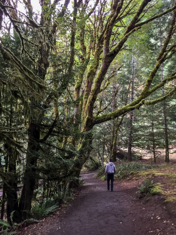 Magnificent trees.
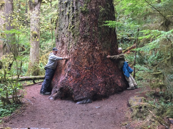 We were walking by this tree and I saw a young woman trying to prop her phone on the ground so that she and her friend could both be in a photo of this huge tree. I offered to take the photo and then she reciprocated.
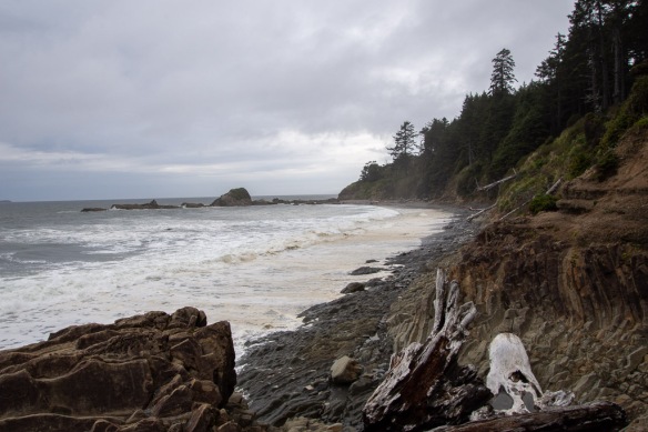 This was the first beach where we stopped. We drove south to find that the first campground was full. There was plenty of space in the other campgrounds where we stayed so we hadn’t anticipated this. The beach. RV camping. Saturday night. None of the four beach campgrounds had campsites left.
 Saturday night lodging.
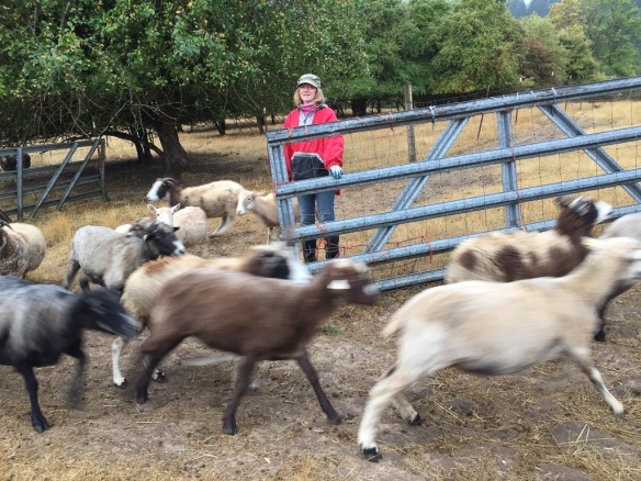 Karen lets the ewes out into the pasture where some of them race to see who will be first to find the pears that may have dropped since the day before.
 Some sheep stayed behind but this group checked out the pear snack department and then traipsed back to the barn for the morning hay.
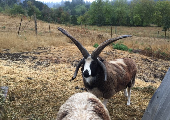 Nearby we met Windy Acres Lightning, who happens to be Buster’s sire.
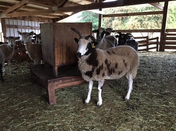 This is inside the barn. There are a couple of Meridian ewes here but I don’t think this is one because she has a bideawee ear tag. I like these feeders and think that we should try making some.
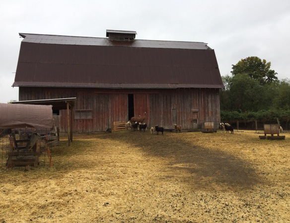 This is another barn on the property. Those are some of the ewe lambs and their guard llama.
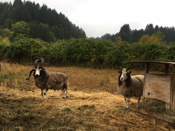 Across the road (the property is split into 4 pieces by the country roads) there are more rams. This is Hunters Glen Roy Rogers and his wether buddy. I sure which that I could get some of these horns like Lightning and Roy Rogers on my sheep.
 After breakfast we got on the road to our real destination.
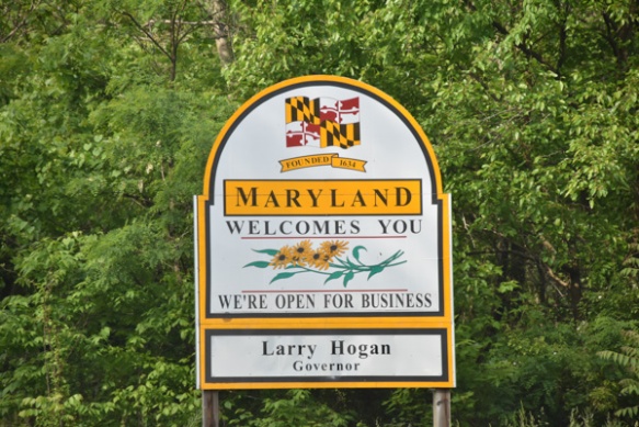
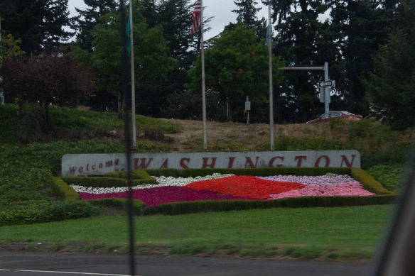 Here is a more welcoming sign along with pretty flowers.
 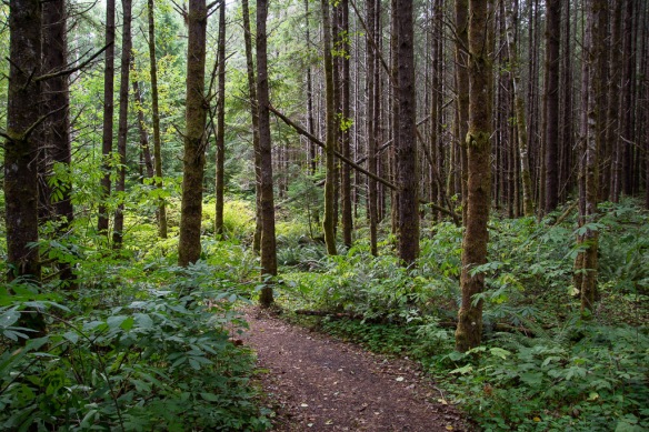 We were headed to Mt. St. Helens National Volcanic Monument for our first stop. We followed State Route 504 along the Toutle River and stopped before entering the NVM at this site where the sign said Sediment Retention Structure. We followed a trail through the beautiful woods.
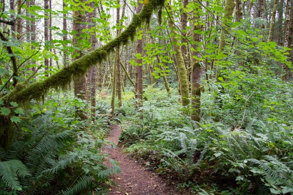
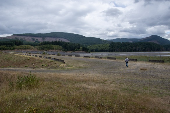 After a short walk we reached the dam. A sign told us: “As the North Fork Toutle River re-formed and carved new channels in the deposits [after the eruption in 1980], it became one of the world’s most sediment-laden rivers. The U.S. Army Corp of Engineers build the Sediment Retention Structure to trap sediments before they are carried further downstream. Sediment clogs river channels, worsening floods, and degrades water quality and aquatic habitat.” It is hard to tell the scale from my photos but this is a massive structure.
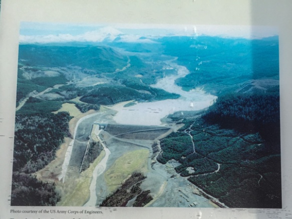 Here is an aerial view on the sign.
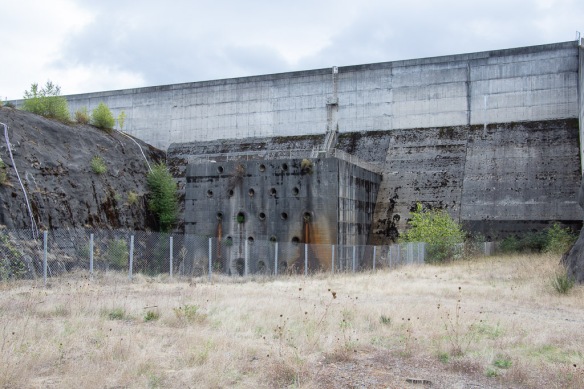 This part of the structure is on the aerial photo but is the “little” part at the left end of the horizontal part of the retention structure and to the right of the spillway.
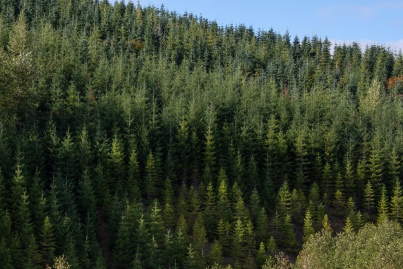 We continued on to the NVM. There are plenty of interpretive sites before you get there, some put out by the state and some by Weyerhaeuser. From their site: “Weyerhaeuser Company began more than 100 years ago with 900,000 acres of timberland, three employees and a small office in Tacoma, Washington. Founded in 1900 by Frederick Weyerhaeuser, we’ve grown to become one of the largest sustainable forest products companies in the world.” I was interested in the divergent viewpoints about the response to the destruction caused by the 1980 eruption. Weyerhaeuser began to reforest as soon as they could, planting millions of seedlings. Their sign shows a contrast between their now almost 40-year-old forests and the vegetation across the boundary where the response was to let nature take its course. Both arguments are convincing and I am not bashing a giant lumber company. After all I live in a wood house. The film that we saw in the Mt. St. Helens NVM Visitor Center, however, describes how quickly the communities begin to recover, starting with gophers, of all things, that survived in their burrows under ash-covered areas and moved soil and seeds to the surface. The film points out that the communities are now at their most diverse and as the natural sequence of forestation continues there will eventually be less diversity as one sees in a mature forest.
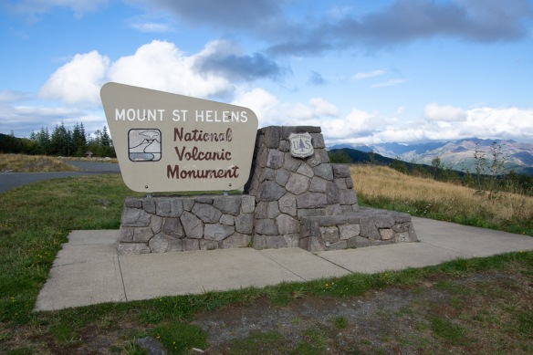 It isn’t possible to see all of the NVM in one day. No road goes all the way through and it is a lot of driving to get to other entrances. We chose this northwest entrance and realize that we’ll have to come back some day.
 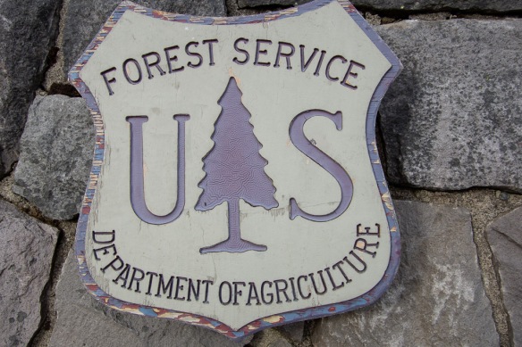 I liked this closeup of the USFS sign–see the detail in the tree? Someone had to think of that.
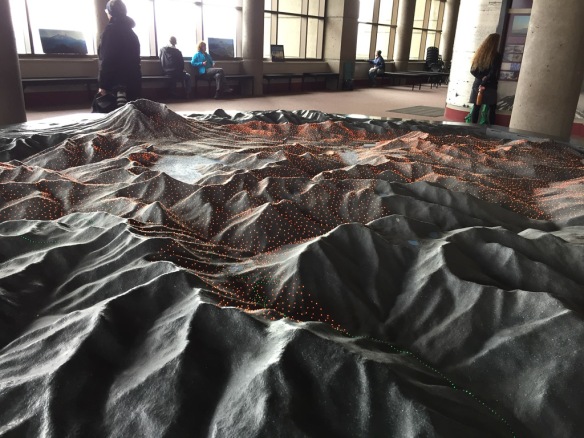 We started at the Visitors’ Center called Johnston Ridge Observatory. Here is a model of the terrain and as the story is told different color lights come on to show lava flows, ash deposition, etc.
 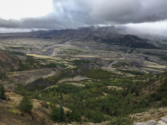 View of the mountain. We never got a clear look at it because of the clouds. It is amazing to think that the whole area in this photo was impacted by the blast and that everything in the middle part of the photo is deposits from the volcano.
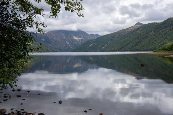 Coldwater Lake was formed when volcanic debris blocked Coldwater Creek.
 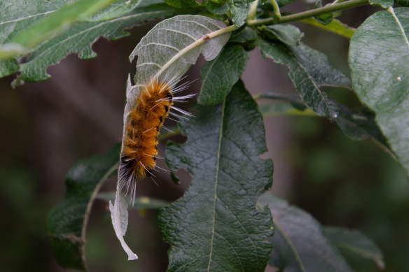 A wildlife shot!
 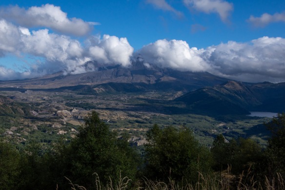 We stopped at an overlook before leaving the area and watched as the clouds moved past the mountain. The eruption of Mt. St. Helens was mostly from the side and it created a valley that faces mostly north (the cloud filled part on the left of the photo).
 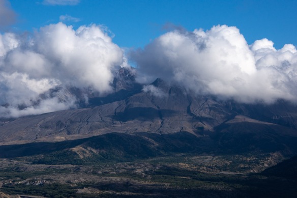 We caught a few views of what is left of the mountain.
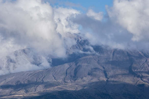 This definitely warrants a return trip.
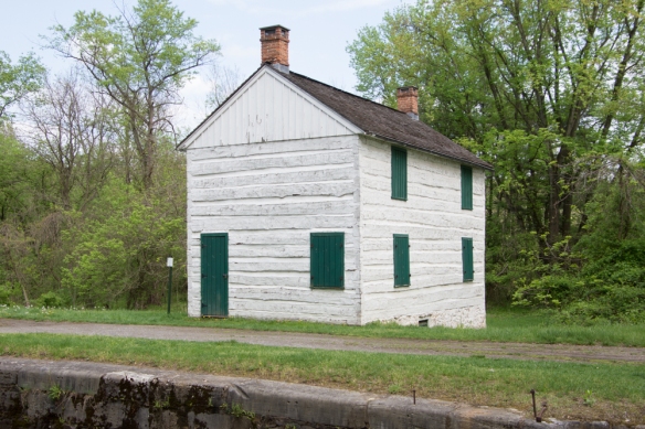 I shared photos of other parts of the canal in
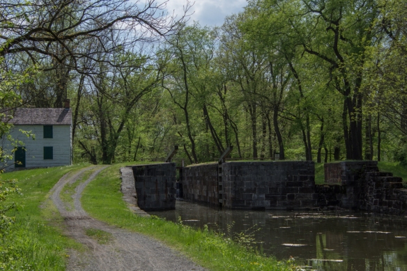
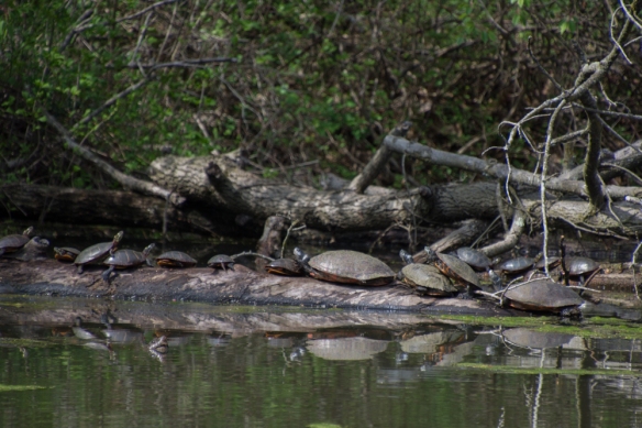 Turtles sunning themselves in the canal near Lock 75.
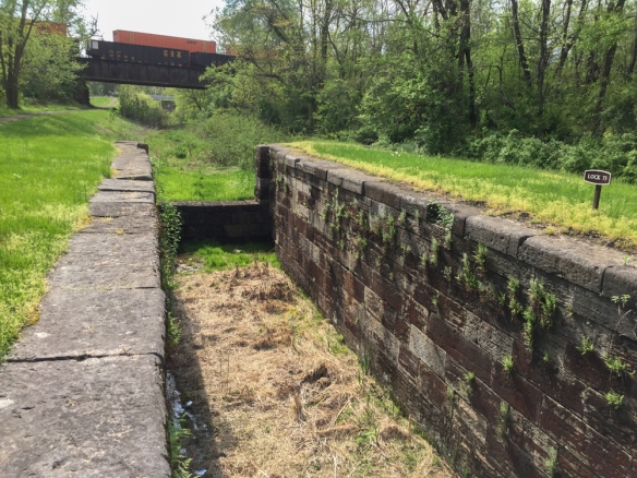 I drove along some of the roads in this area looking for more places to explore and found Locks 73 and 74.
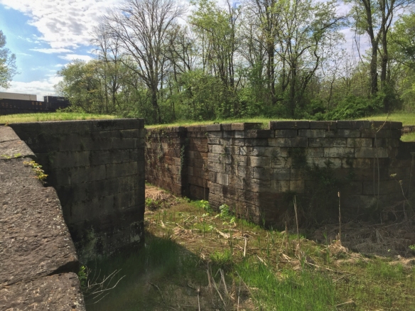 Notice the railroad over the canal in the previous two photos. The railroad and the canal were competitors for business during the era of the canal. Repeated flooding and competition from the railroad were the reasons for the demise of the canal system in 1924.
 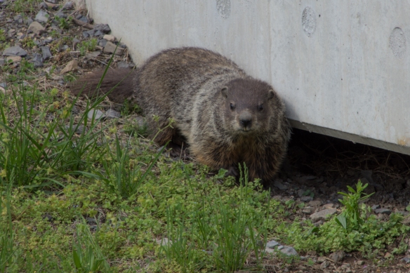 I saw a flash of this animal as he ran under the bridge. This is the first groundhog that I’ve seen.
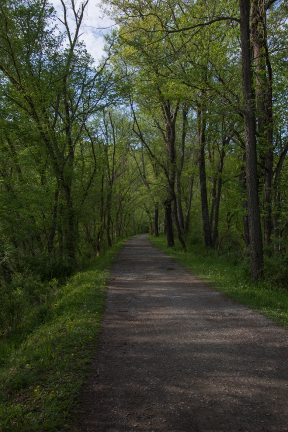 I had read on line that the tunnel was closed but thought that I’d be able to see the canal and walk along the towpath. This photo seems typical of much of the length of the towpath–a beautiful hardwood forest and a broad path to walk. One thing that I noticed everywhere was the number of birds. I didn’t see all of them–but there was quite a chorus in the woods.
 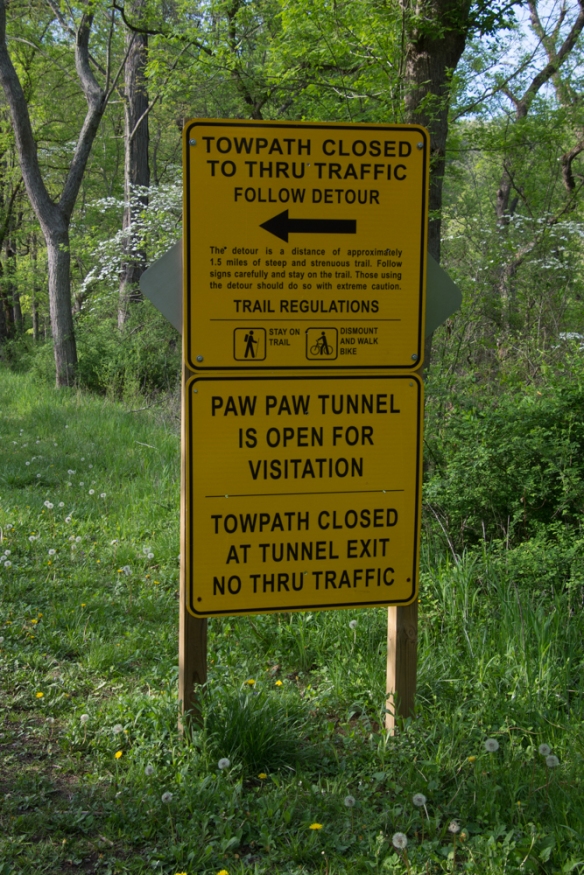 So I got to this sign and decided to take the detour.
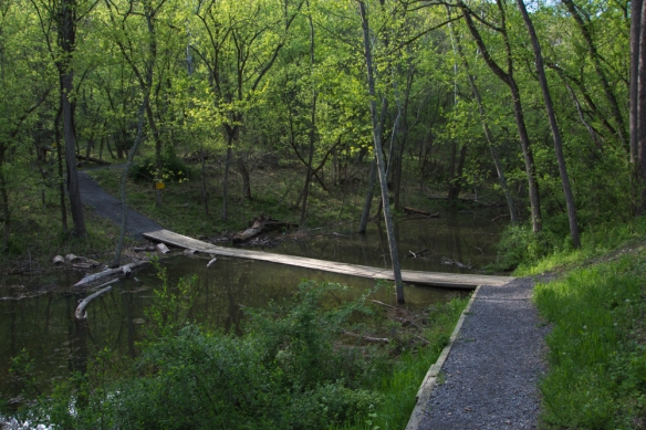 Wooden planks crossed the canal.
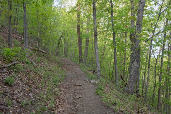 The trail wound up into the woods.
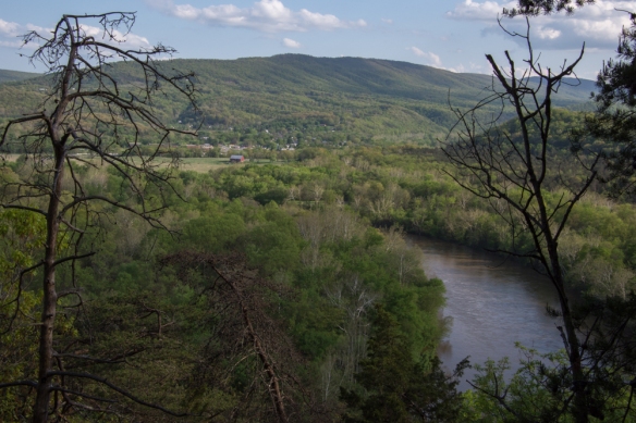 This overlooks the town of Paw Paw, West Virginia.
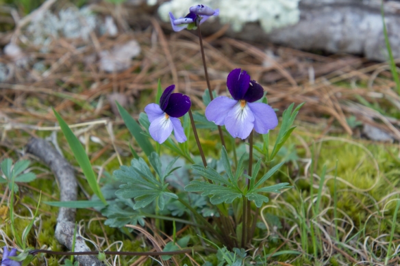 Viola pedata, Birdsfoot Violet.
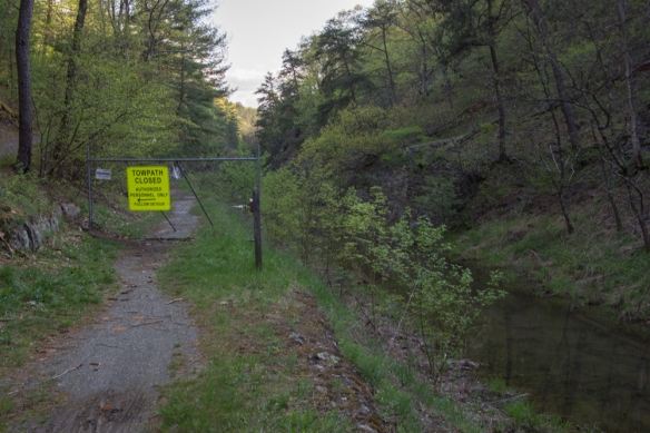 After hiking what seemed quite far into the woods I came back down to the canal and the towpath and saw this sign. From the looks of the terrain I assumed that is where the tunnel is even though the first sign had said it was open.
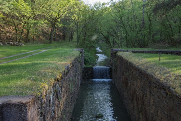 I walked the other direction, and saw this lock. The path continued around a bend.
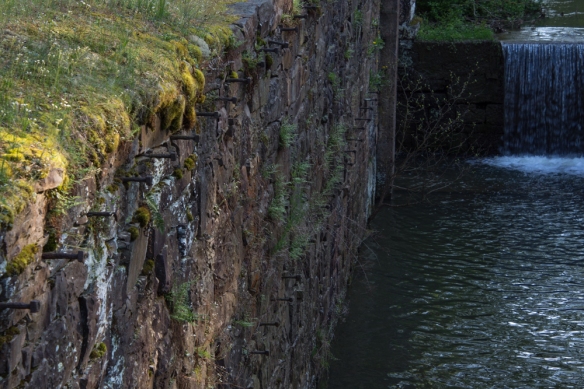 This was confusing. I assumed that there was a reason to make a detour and wasn’t sure if I continued to walk along here (towards where the detour sign had been) that I wouldn’t come to an impassable spot. Why else would there have been that sign? Or was I completely turned around? It was getting late in the day and my mind started to play tricks. Are there bears in these woods? I’m all by myself and no one knows where I am or will know if I don’t return. My phone battery is almost dead. There was no cell service, but I wouldn’t even have a flashlight.
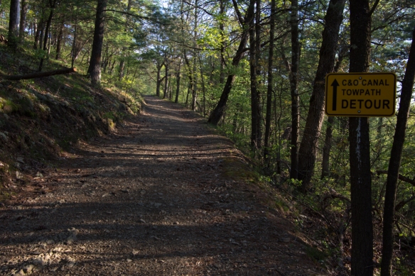 So I decided to turn around and go back the way I had come.
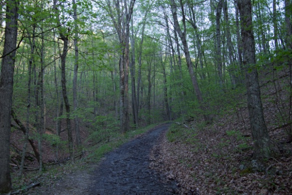
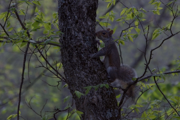 No bears, but there were a lot of squirrels.
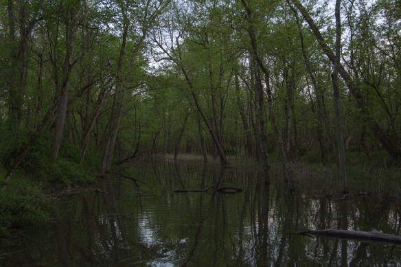 Crossing the canal.
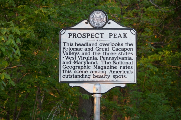 I hit this point at dusk.
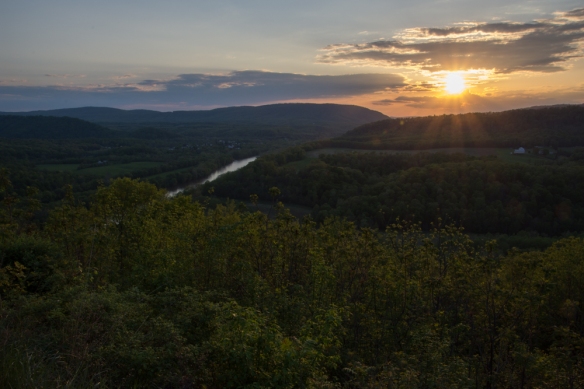 It was dark by the time I got to the freeway and I got back to Frederick at about 9:30 after a long day. That was it. I flew home the next day.
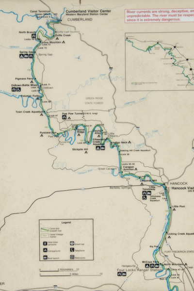 This map shows just the western half of the canal and it really should be turned 90 degrees because the canal runs east-west. I was staying in Frederick which is about a half hour from the Potomac River and the canal. I headed for the canal at a place called Four Locks.
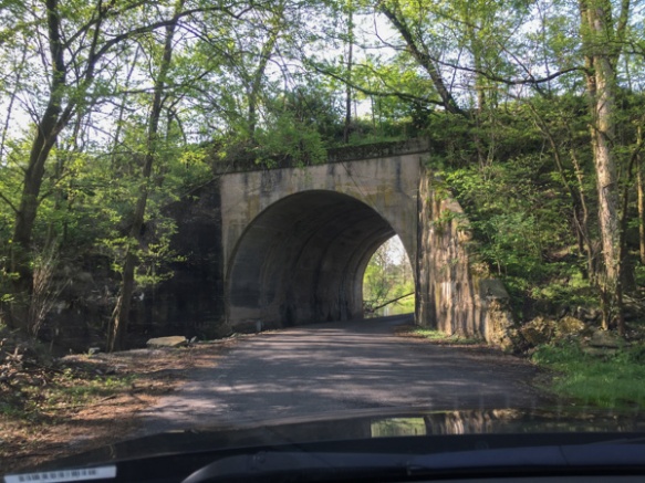 In this area the roads cross back and forth under the railroad which also follows the river. In fact a lot of the story of the canal is about the competition between people who thought the canal would serve as the best way to transport coal to the west and those who supported the railroad.
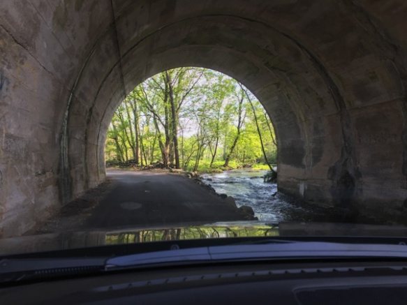 The railroad goes over the road here and the creek runs through the tunnel.
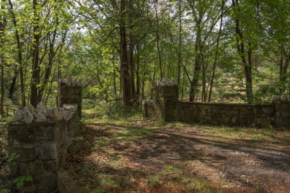 I followed my phone directions and found myself turning off the main road onto other narrow roads that wound through the woods.
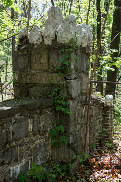 This is a detail of the stone fence in the previous photo…
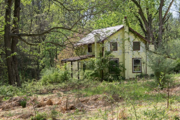 …and this is the abandoned house at the end of that driveway.
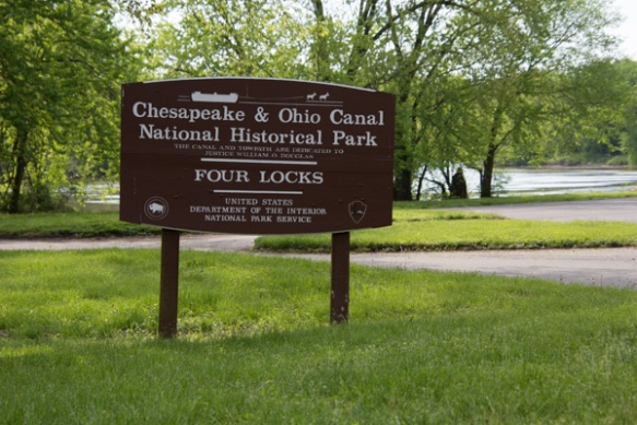 I found Four Locks, so named because the Potomac River makes a large loop here.
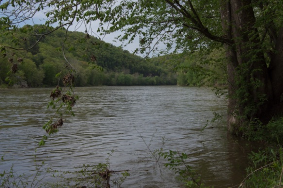 View of the Potomac River.
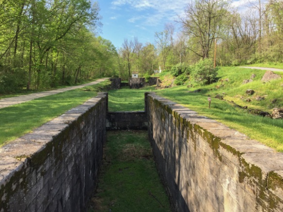 Rather than build a canal the length of the loop, the canal makes a short cut, necessitating four locks (#47-50) all within a half mile.
 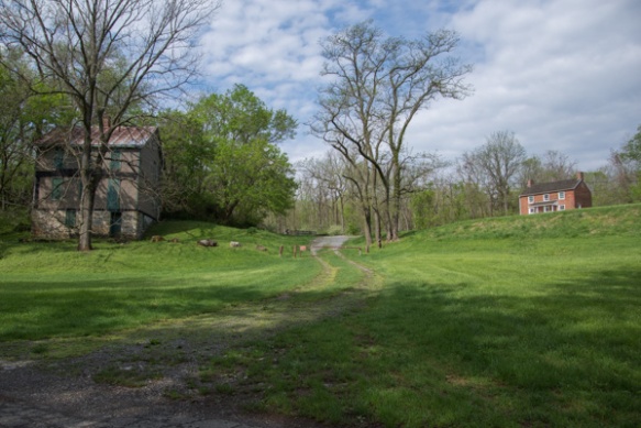 The locks were built in 1836-1838 and until the canal closed in 1924 there were two general stores, two warehouses, a dry dock, mule barn, post office, school, farms, and houses in this community.
 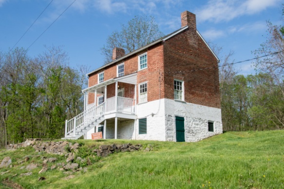 The lockhouse at this location is available to rent for overnight stays.
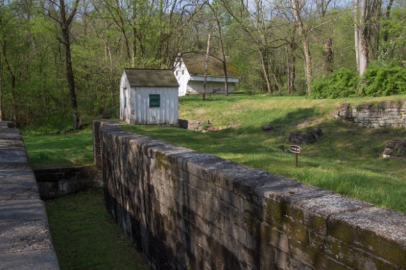 That is the mule barn in back. I read that there were 3000 mules working on the canals moving boats between the locks. I found it fascinating to imagine the effort that went into this endeavor–not only the construction but also moving boats up and down the canals. I hadn’t made it to the Visitor Center yet so didn’t yet have the full story.
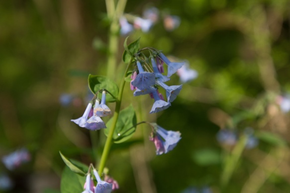 Virginia bluebells.
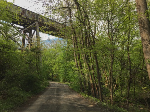 After walking around Four Locks I wound a few more backroads to find McCoys Ferry, a crossing on the Potomac. That is the railroad passing overhead. Then I got back to the freeway to head to Cumberland.
 This is Sideling Hill Visitors Center, a rest stop along the highway with a great view over the pass and interesting geology in the road cut.
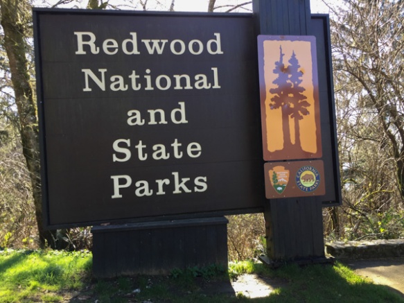 From Wikipedia: “… the four parks, together, protect 45% of all remaining coast redwood (Sequoia sempervirens) old-growth forests, totaling at least 38,982 acres. These trees are the tallest and one of the most massive tree species on Earth.”
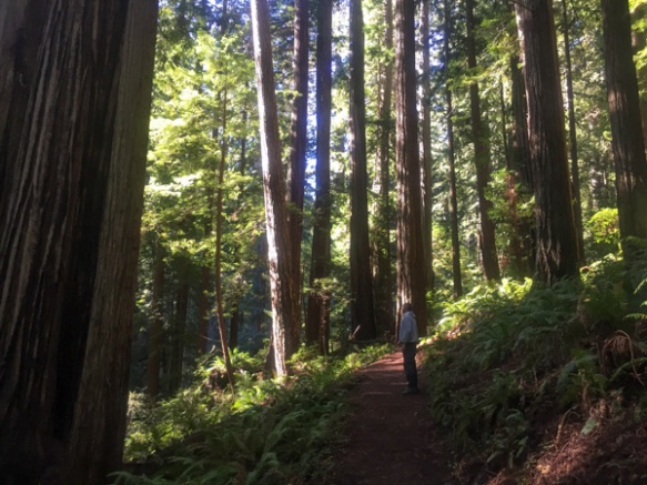 In 1850 there were 2 million acres of redwood forest along the northern California coast. After years of unrestricted logging the Save-the-Redwood League, created in 1918, was successful in establishing three State Parks in the 1920’s.
 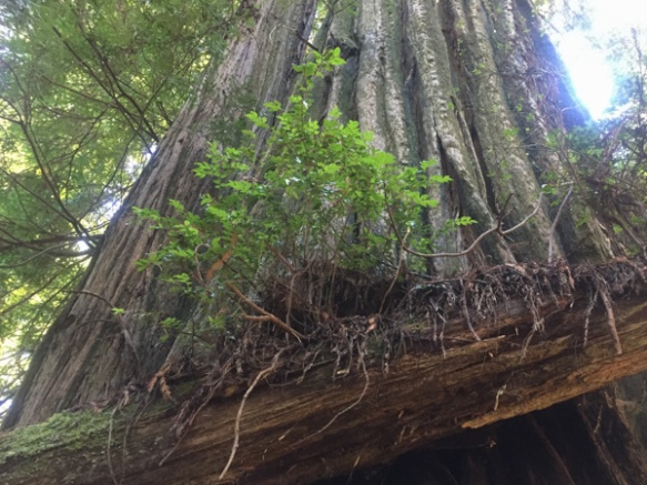 Redwood National Park was created in 1968 after 90% of the original redwood trees were gone. Now the State and Federal agencies cooperatively manage the forests and watersheds as a single unit.
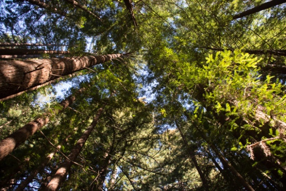 I’ll mention here that all these photos were taken with my iPhone because the previous night I dropped my camera (on the carpet in the motel) and the lens popped off. I couldn’t get it back on and knew that I wouldn’t be able to get it fixed until after I came back from Texas (where I was headed as soon as we returned from this trip).
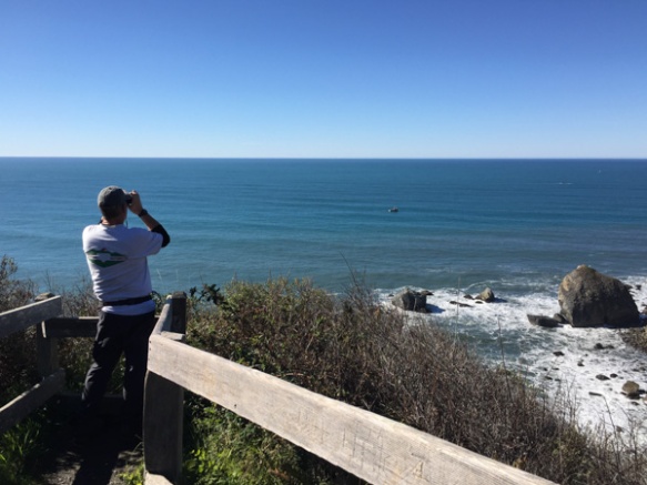 We took a side trip to the spot where the Klamath River flows into the ocean and walked down the steep trail to this overlook. That’s Dan looking across the ocean for Meryl (my DIL who is in Australia right now).
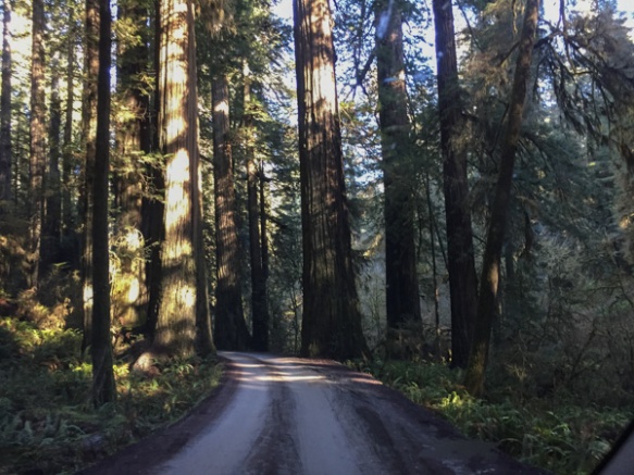 We drove farther north to the Stout Grove in the Jedediah Smith Redwoods State Park.
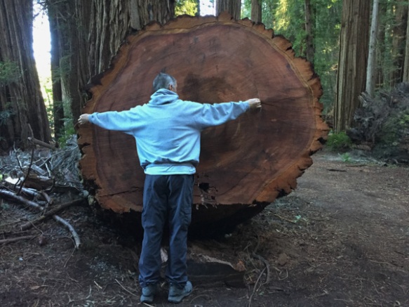
 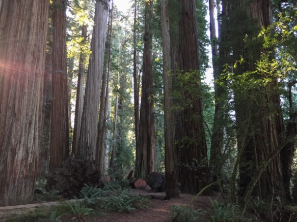 Every time we stopped we continued to be impressed with the grandeur of these trees and the forest.
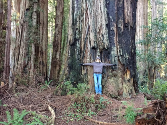
 This tree had fallen and then was cut to clear the path.
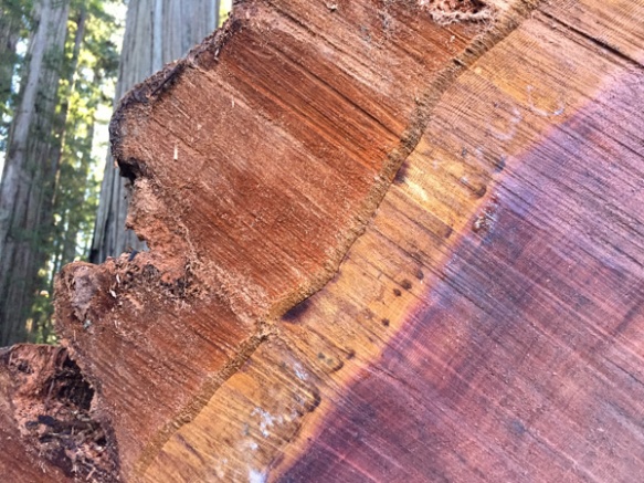 Look at that brilliant color.
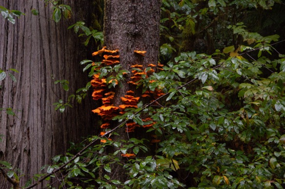
 We were surprised that we didn’t see more mushrooms and fungus, but this one did catch my eye. Late in the afternoon we headed toward the coast at Crescent City.
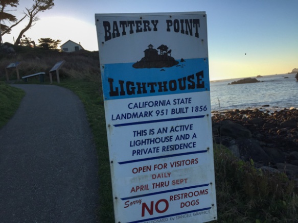 Our map book showed two lighthouses so we started with Point St. George. We found that lighthouse (manned from 1891 to 1975 and abandoned in 1995) but it was 6 miles offshore. The Battery Point Lighthouse is accessible at low tide so we were able to walk to it, but we were too late for a tour.
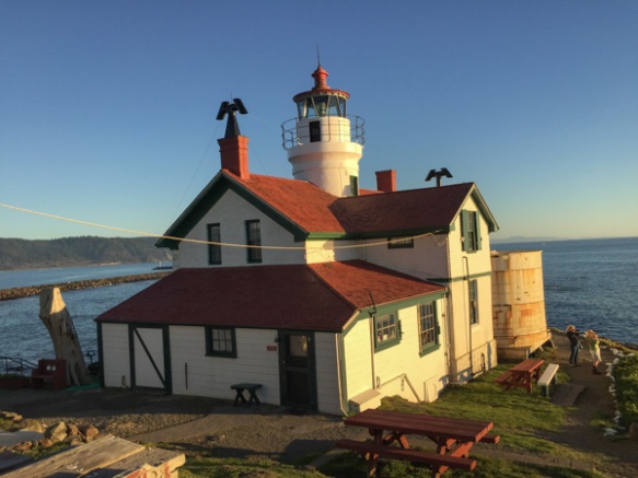
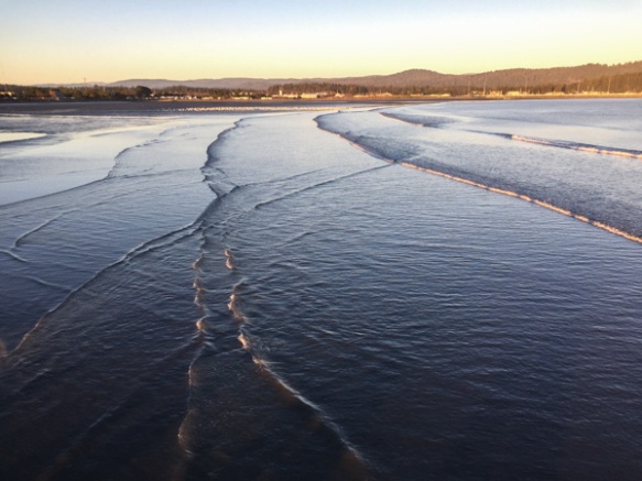 We walked along the breakwater (seen in the lighthouse photo) and then out on a pier. This is a view looking back toward Crescent City.
 This is the view looking back toward the breakwater and the setting sun.
 Sunrise from the campsite in the morning. I wouldn’t have seen that from a motel room.
 We spent the night in the back of the truck. Notice Matt’s cot and sleeping bag. Fortunately no one was bothered by bears.
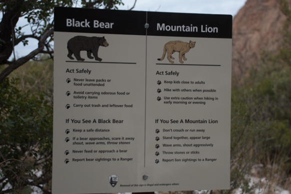 …although we saw this sign at the trailhead right near our camp.
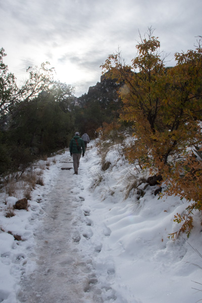 We left camp early and went for a hike up the Lost Mine Trail. I was glad that I had a walking stick with me because much of the trail was icy and slippery.
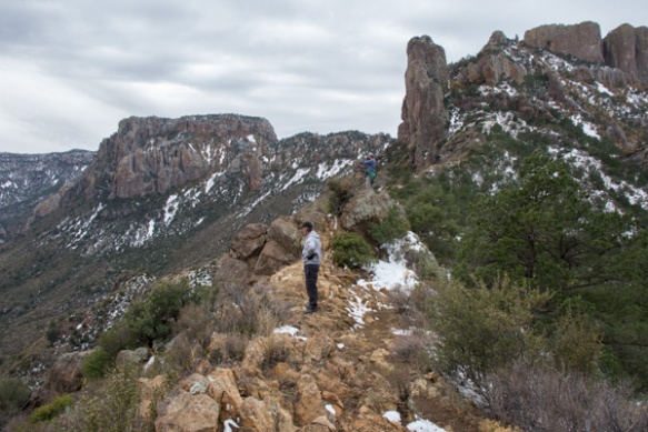
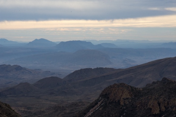
 This is the view to the south from where we were standing in the last photo. The southern border of the park is the Rio Grande but I’m not sure which of these mountain ridges border the river.
 We had only a day and a half to spend in this area so we didn’t plan to do any long hikes, but instead see as much of the Park as we could and get out where there were signs and shorter trails.
 This stop was at the Sam Nail Ranch where there is a short trail to the remnants of an adobe dwelling built around 1909 when the Nail family lived here.
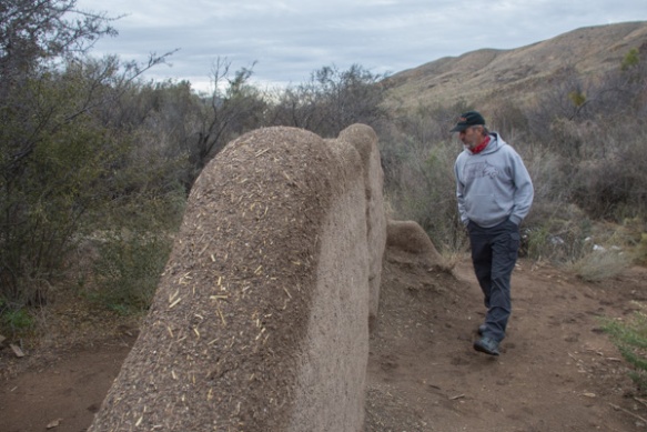 The family planted fruit trees and raised livestock, living here until the 1940’s.
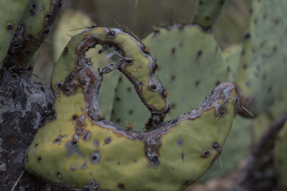
 “Matt, hold still.”
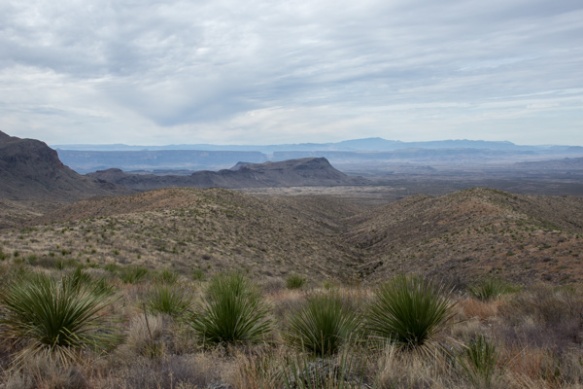 View from Sotol Vista. Do you see that slot in the middle ridge, just left of the photo’s center? That is Santa Elena Canyon, about 12 miles southwest of this point, where the Rio Grande slices through the mountain, forming a narrow canyon with 1500′ walls. That will be for the next post.
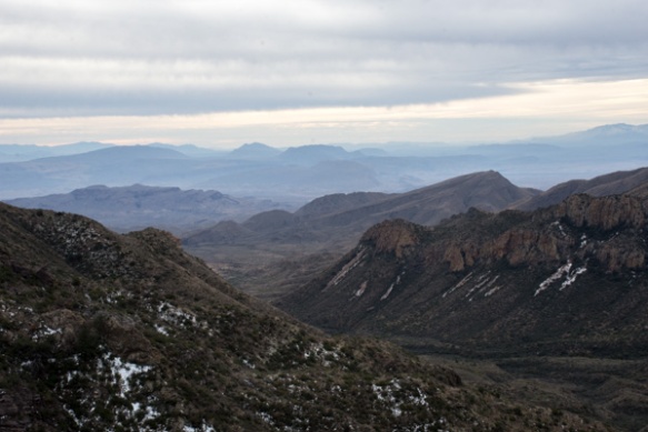
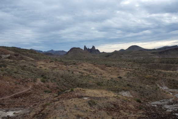 The Mule Ears View Point was the next stop.
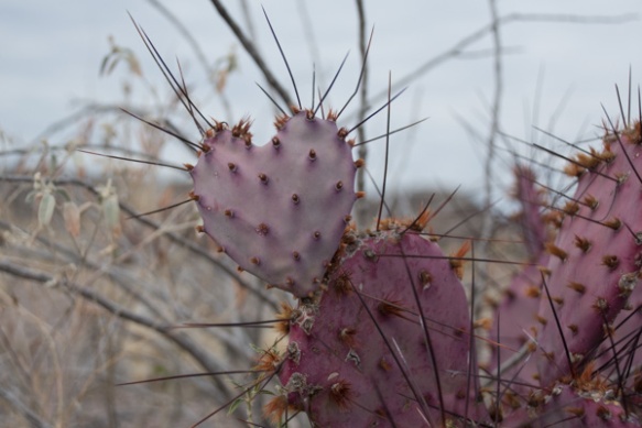
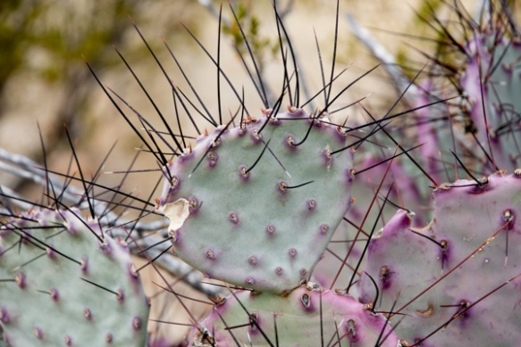 I didn’t identify all the different kinds of cactus, but noticed some that were distinctly purple.
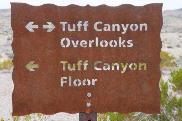
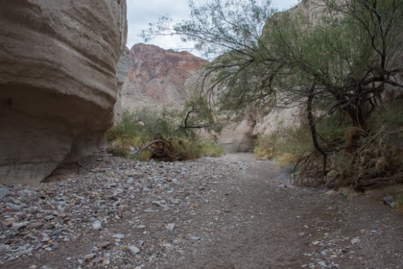 We walked into Tuff Canyon, so named for it’s volcanic origins.
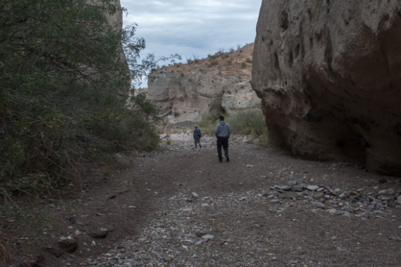
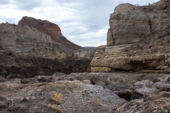 Spectacular!
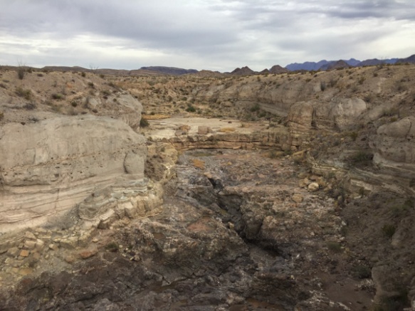
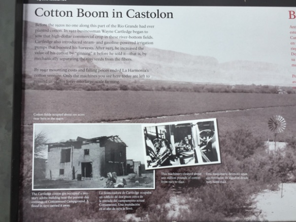 There were a lot of interpretive signs at this point. Castolon was first settled in 1901 and became a destination for refugees fleeing the Mexican Revolution. Barracks were built but never used by the army and in the 1920’s the La Harmonia Company established a trading post and started growing and ginning cotton. That venture ended in the 1940’s.
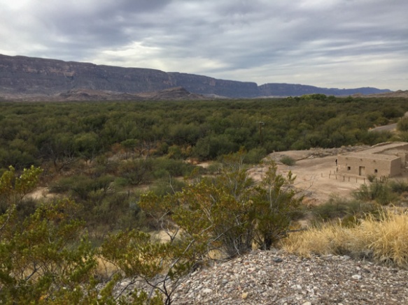 This is the modern day view of that same landscape.
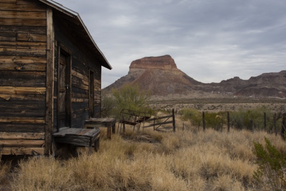 One of the old building that still remains at Castolon.
 I think this statement is true.
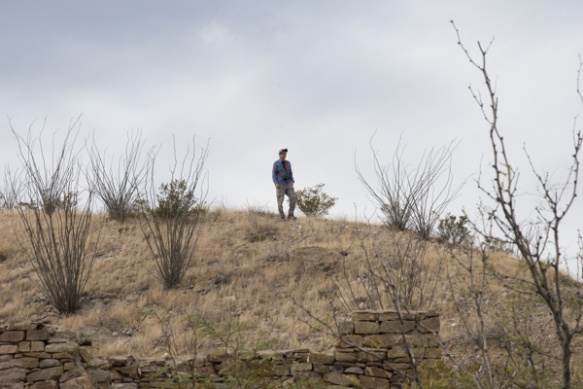 We stopped at the Dorgan House Trail, where there were more ruins.
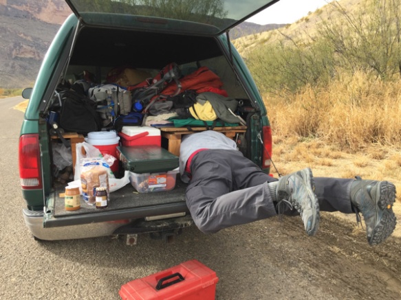 It felt like lunch time. Dan couldn’t fit all the way in where he had stashed the box with my granola. Eventually I squeezed in there and he pulled me out by my feet because I was laughing too hard to get out myself.