I just looked at when I wrote about Day 3 of our trip. At this pace it will take me 3 more weeks to finish the story. I need to speed this up. There are more stories to tell after this.
As told in the last post, we found a road on USFS land and pulled off to the side to park. It was dark by then so we could only see what the headlights of the truck showed. Looking back now at the GPS data on my photos I see we were not too far east of Mancos on the San Juan National Forest. In the morning we got on the road and headed east on Hwy. 160.
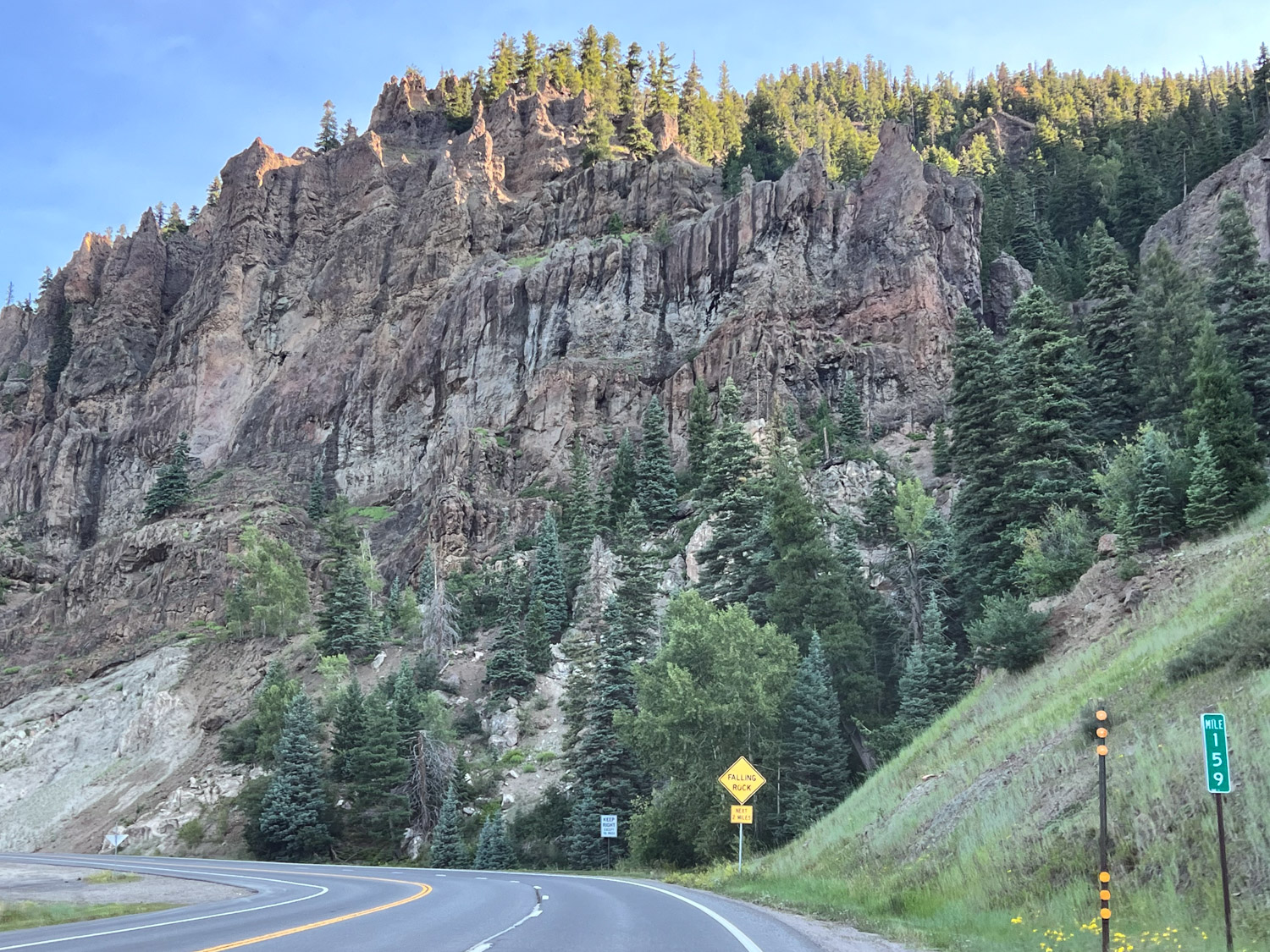
We drove through beautiful country heading northeast from Pagosa Springs towards Wolf Creek Pass. The scenery was markedly greener than during the previous days.
The old green truck that is used to living at 30′ elevation wasn’t happy about the climb to 10,000+ elevation.
Standing with one foot on each side of the Continental Divide.
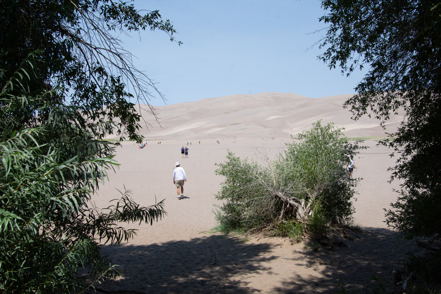
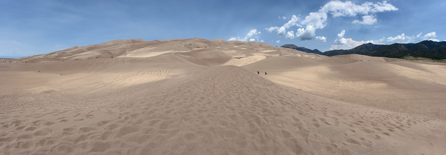
From the pass it was about two hours to Great Sand Dunes National Park.
After spending some time in the Visitor Center and learning about how these dunes were created we walked to the dunes.
This is another place that I could come back to.
You could spend a whole day exploring this landscape. There are 30 square miles of dunes! There are no trails through them but you can walk anywhere.
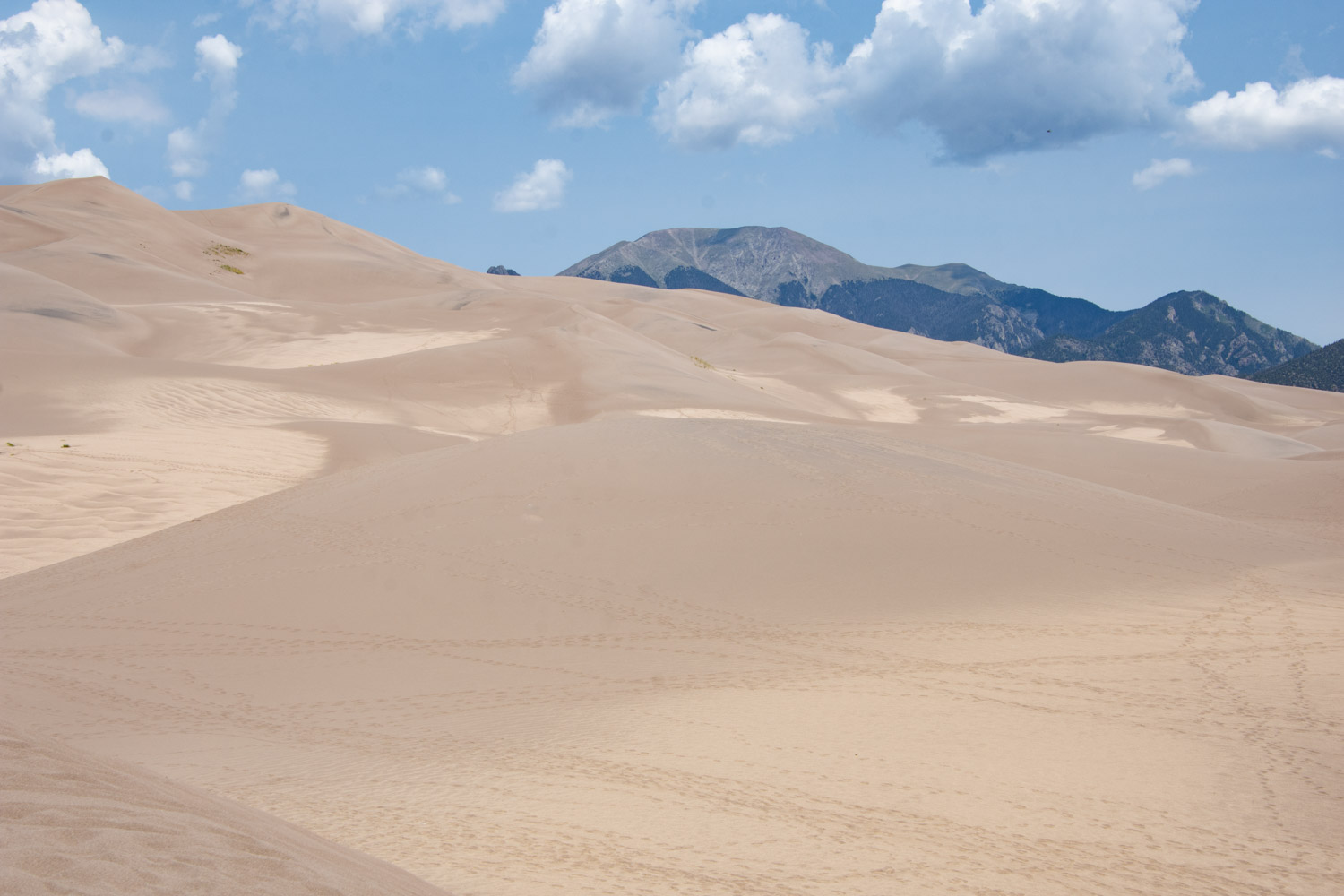
This is a panoramic shot of the closest dune field and shows the mountains at over 13,000′ where you can find alpine lakes if you’re willing to hike. Most of the park is not accessible by vehicle.
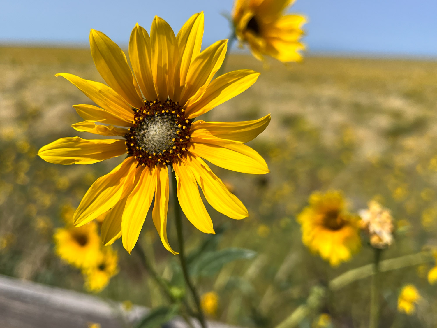
There were plenty of wildflowers on the surrounding land. Prairie Sunflower.
If you’re just tuning in you can see Days 1 and 2 here.
I woke up in time to see the sunrise at Great Basin National Park.
Here is another view of our campsite.
The only paved road in the park winds up to the trailhead to Wheeler Peak (13,063′ elevation). We didn’t plan on hiking all the way to the peak but hiked to the lakes at the base. The hiking is all above 10,000′.
Stella Lake is the first of two lakes along this trail.
This doe posed nicely for the camera.
This sign indicates that we were about a mile from the trailhead where we started on this loop trail. However, there were signs that said the area was closed due to ongoing work. In fact, the road had been blocked before we got to the end and we’d parked lower than we first planned. Law-abiding citizens that we are, we didn’t take this trail back but took another fork and ended up back-tracking over most of the way we had already walked.
That just meant that we got to spend more time in this gorgeous area and put in about 6 miles that morning.
I’m always the one taking photos. Dan took this one so that I could prove I was there. Funny story, and maybe an example of things to come on this trip–there were two large trucks in this parking lot waiting to get past the gate that is just to the left of those porta-potties. They were full of rock or gravel or whatever they were using for the road surface. However the gate was locked and no one had a key. The drivers were trying to find the right tools to take the gate apart. I figured that one of the trucks could have just rammed the gate (being just a pipe) and driven through, but I wasn’t going to suggest that. We were able to move our truck around to get between the two big ones, but then the traffic was stopped on the way down until the pilot car that was with these trucks could make it down the mountain. So these was the first delay of the trip.
We planned to go to the visitor center and maybe see the Lehman Caves.
We spent a little time at the Visitor Center and I made a point of finding these Tempestry panels, knit by my friend, Lisa. They depict the daily high temperature for a given year and location, in this case 1916 and 2016 here at the park. You can find out more about the Tempestry Project here. This is the same idea I use in my Year to Remember blankets
This was Thursday afternoon and we needed to be in Trinidad Colorado by Friday afternoon. We didn’t have time to take a cave tour, so we’ll have to go back.
We took Highway 50 across Utah. This highway is known as “The Loneliest Road in America”, at least in Nevada. It gets a bad rap because it can be desolate, but this area in Utah known as the San Rafael Swell is stunning. (Click on one of the photos to enlarge and scan through them.)
We were somewhere west of Green River when the traffic stopped. We spent about two hours in stop and go traffic, mostly stopped, with no where to pull off. A friend (the afore-mentioned Lisa) and I were texting at the time and she found a a clue to what was going on–there had been a police chase that ended in a fatality.
Later I searched for myself and found a local news report that confirmed a chase that followed an attempt at a traffic stop. The driver passed into the median and eventually wrecked the car killing himself and another person. By the time we got to this area where we’d be able to get to an offramp our truck indicators showed that it was overheating.
We finally got to the exit and were able to let the truck cool down. Fortunately it hadn’t caused damage.
We headed south towards Moab as the sun was setting.
Not long after we turned south two sheriff trucks passed with lights and sirens. One of them weaved back and forth, stopping traffic. We were the first vehicle behind the trucks. The deputy told us that there was a pursuit in progress and, if the vehicle being pursued hit their trucks, then we should “get out of here”. That was a little nerve wracking, especially after the last episode and seeing these cops with guns drawn. Eventually the car drove past in the northbound lane with at least a dozen cop cars following. The car was being driven on rims–there must have been a spike strip that the driver ignored. All those vehicles went by and then these two turned around and followed It seems as though for the next hour we continued to see law enforcement vehicles going that direction. I never did find out what that chase was about.
These stories are not the most significant ones of our trip, but the situations pop to the top when we think about the day.
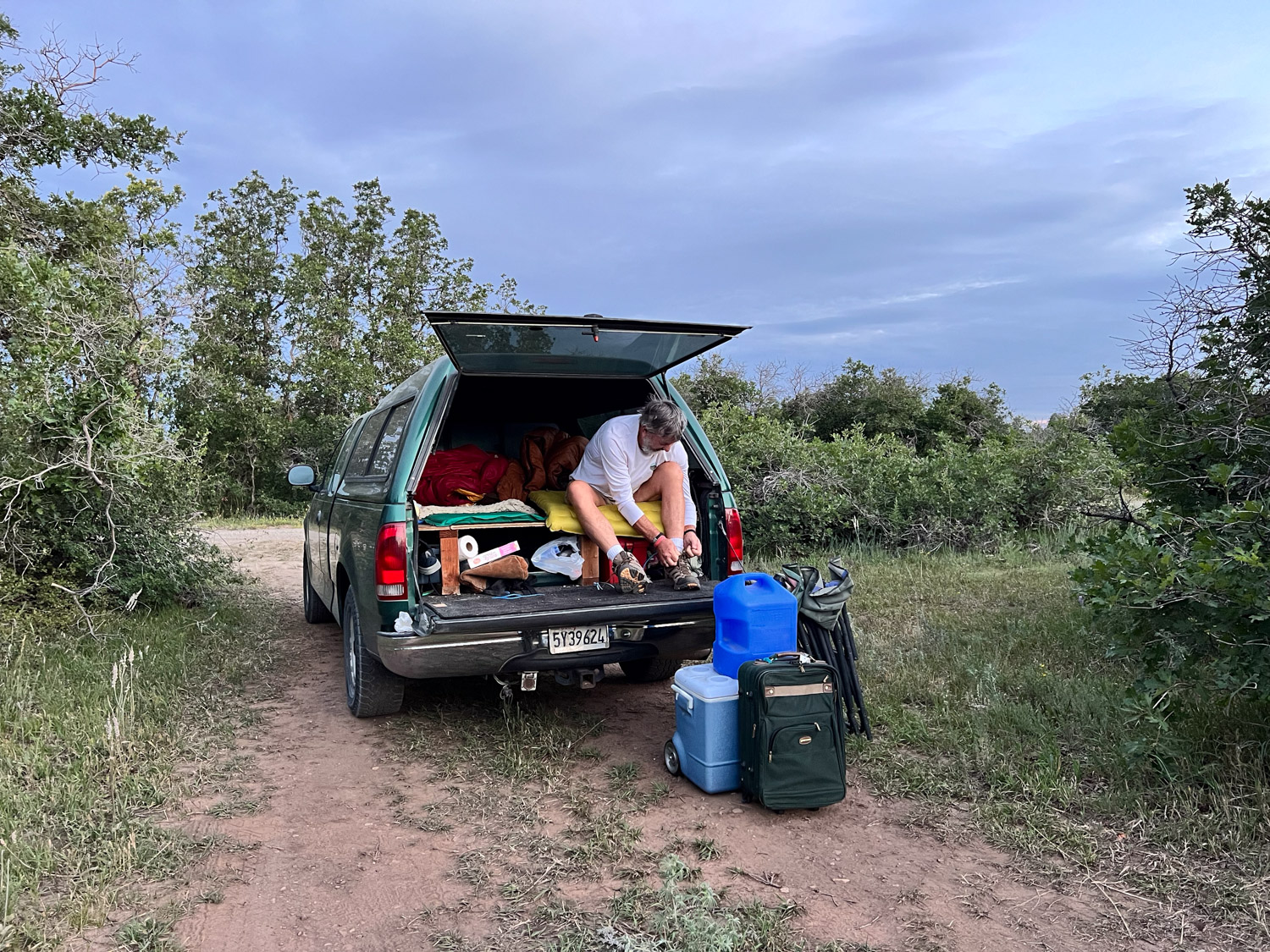
We drove south on Hwy. 491 and into Colorado and then turned east on 160. I followed the big map book and found where the highway was bordered on both sides by USFS land. There were some roads shown on the map where we could get off of the main highway. We didn’t need a campground as long as we had a safe place to pull off. We were in the San Juan National Forest and found a road that turned north. We found a spot where we could pull off that road. I think we were still eating bagels and bagged salad that we brought from home. That was dinner. We rolled out the sleeping bags in the truck and went to bed.
Finally…another Road Trip. The last real trip Dan and I made was in 2019. Yes, we drove to Estes Park last year, but it’s not the same when you have a trailer full of sheep and can’t stop to play along the way. This trip was planned to coincide with the opening night of an art show in Trinidad, Colorado, but I’ll get to that in a later post.
I drove my granddaughter to the airport Tuesday morning (July 30), and we were finally packed and ready to go by about 5:30 that evening. How do we get away when there are all these sheep to take care of? Thanks go to Farm Club members who were able to spend two to three days each to take care of sheep, the garden, and of course, Ginny.
We have our phones, but I sure like to follow along with real maps. We can find a lot of interesting details along the way, figure out USFS lands where we can camp, and get a broader overview of an area. Then I use my phone to look up odd place names and read background info as we travel.
Some of my photos will be “drive-by” where there are plenty of windshield splotches visible. I haven’t been in the higher Sierras lately. I don’t think I’d seen this devastation from some of the fires over the last couple years. I think this was from the 2021 Caldor Fire that burned in the El Dorado National Forest and beyond. There were miles of devestation.
We drove east on Hwy. 50 and turned south towards Markleeville and then Hwy 395 on the east side of the Sierras. It was dark by the time we were near Mono Lake where we decided to spend the night. We got gas ($6+/gallon) as the last station was closing in the nearest town. Then we found a place to park the truck and camp.
This photo is from the next morning. Our style of camping is to bed down on the platform Dan made in the back of the truck. I sleep on a foam pad and a sheepskin and am almost as comfortable as in a real bed.
It’s hard to imagine that this was once part of the lake. The sign in the next photo says that in 1994 the State Water Resources Control Board set a target level of 6392′ which is 25′ below the lake level in 1941.That decision decreased diversions by Los Angeles from four Mono Lake tributaries.
I don’t know how much progress has been made but there is still a long way to go, The mandated level of the lake will be at the base of these signs
We walked down the board walk to the lake edge.
From The Geology and History of Mono Lake: “Along the southern shoreline of Mono Lake, large tufa towers or pinnacles rise above the water’s surface. These iconic pillars, comprised of precipitated calcium carbonate, formed over thousands of years by the interaction of freshwater springs and the highly alkaline waters of Mono Lake.” This website also says that when the water diversions were stopped in 1994 the lake was at about half the water volume and twice the salinity of what it was before the water diversions began.
Mono LakeMono Lake
After exploring a bit of the lake edge we got on the road. We planned to camp at Great Basin National Park, on the eastern edge of Nevada, Wednesday night.
We have always wondered about the Clown Motel which we discovered on a trip through Tonapah when we made a decision to NOT stay there and try another. It is even more clown-themed now than I remember it from before. I just looked it up and found that in 2019 it was purchased by someone who embraced that theme and has modernized the motel. I read more and found that there is a history to the clown theme. You can see that here if it intrigues you.
We made it to Great Basin National Park by about 5 p.m.
I needed to get out of the truck and get some exercise. After we chose a campsite I followed a trail along the nearby stream about a mile and a half. We didn’t see any warnings about bears, but I started thinking about them and wondered if hiking by myself near dusk was a good idea, especially with the recent fatality in CA by a mountain lion. The only bear encounters we have had were at Grand Tetons and Yellowstone, but maybe it’s the older I get the more I know that sometimes things go wrong. I decided to turn around. I still enjoyed the beautiful scenery.