Visiting Texas – More of Day 6

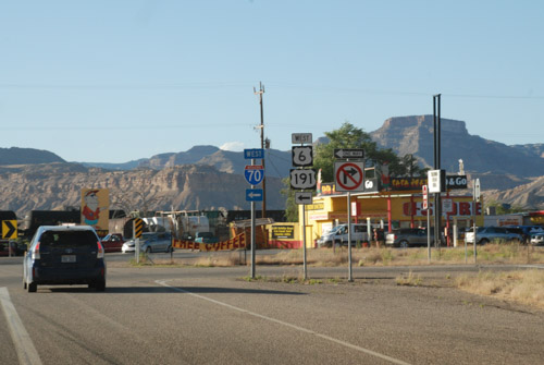
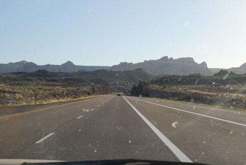
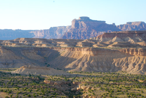
There were too many photos from our day spent in Big Bend National Park that I split this into two posts. There is a photo in the middle of the last post (View from Sotol Vista) where I pointed out a slot in the ridge that indicated Santa Elena Canyon along the Rio Grande. The river defines the Park boundary for 118 miles and creates a riparian corridor in an otherwise desert landscape. We were headed to Santa Elena Canyon.

2017-12-TX-413                 
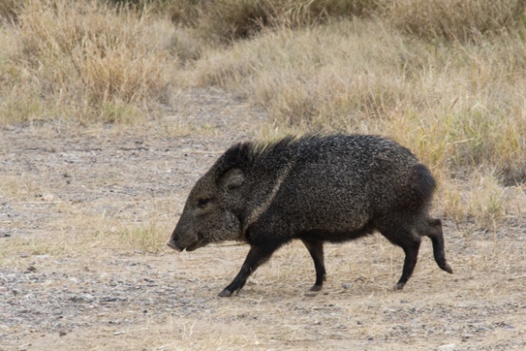
Our first stop at the river was at raft/canoe take-out. Wildlife! I wish this was a sharper photo but I’m going to say that the javelina’s coloring makes it look blurry. I just looked up javelina and learned something. Javelinas (collared peccary) are not in the same family as the pig. There are a multitude of physical differences including the type of stomach (complex versus simple), gestation length (5 months versus 3+ months), and structure of the leg and foot.2017-12-TX-419                
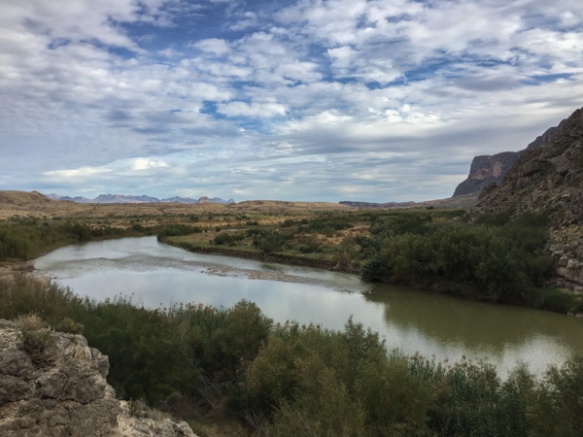
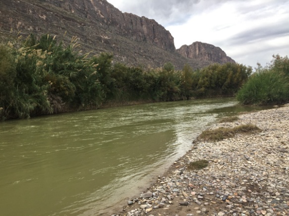
Here is a look at the river. Mexico is on the other side.2017-12-TX-422

2017-12-TX-427              
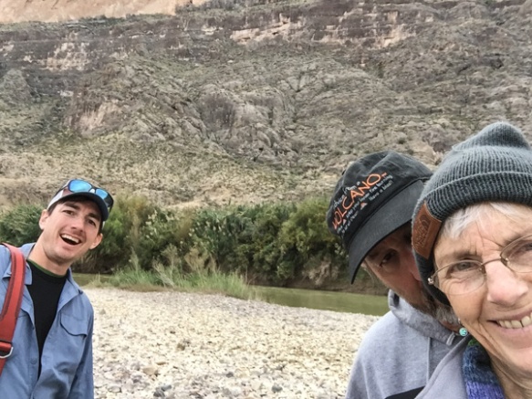
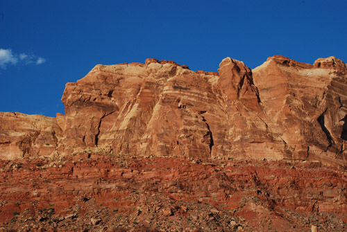
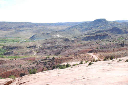
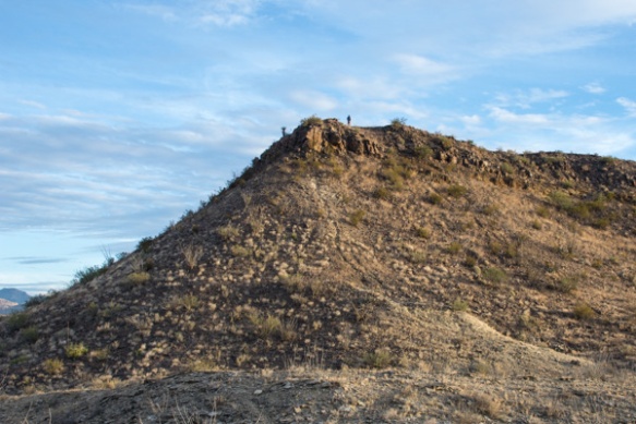
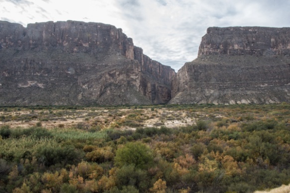
We drove on to find the entrance to Santa Elena Canyon. This is that slot seen from a distance in the previous post. It is hard to imagine from this view what it looks like in that canyon.

2017-12-TX-429

2017-12-TX-431                                                             
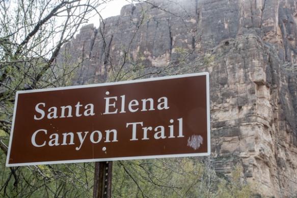
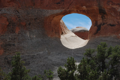
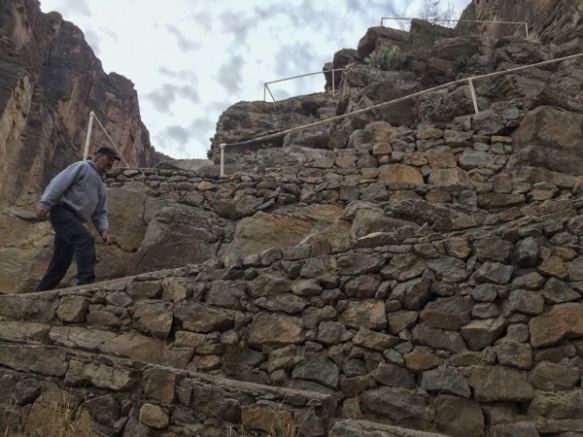
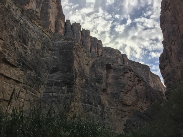
The 3/4 mile trail into the canyon begins with rock stairs built at the lower part of the cliff.

2017-12-TX-433

2017-12-TX-437

2017-12-TX-440             
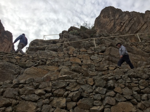
The view looking back from the stairs.

2017-12-TX-465

2017-12-TX-4672017-12-TX-454                                                             
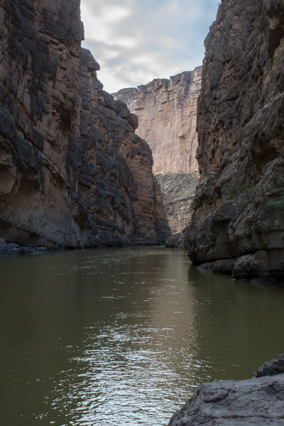
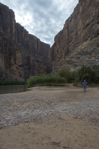
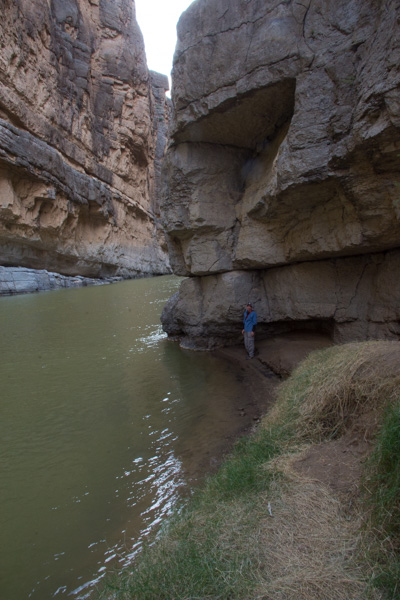
The trail ends where the cliff walls go right to the water.

2017-12-TX-477                
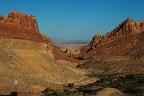
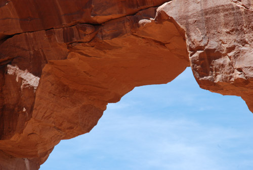
At some points the cliffs rise 1500′ from the water.2017-12-TX-473          
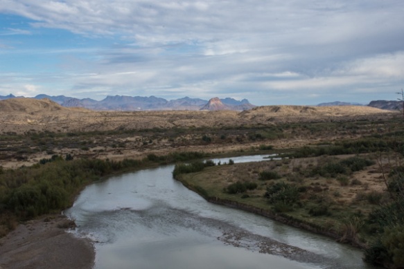
Coming back out of the canyon. In this view of the Rio Grande, Mexico is on the right. In the photos walking up the canyon, it is U.S. on the right and Mexico on the left.

I usually avoid politics in my blog (and would like to avoid politics in life) but I have to make a statement here. We spent the whole day exploring this park and the next couple of days driving in the same desert landscape. I don’t have the answers to immigration issues but a WALL? Where are you putting that Wall? Look at these photos. Social issues set aside, can you imagine the environmental consequences of building the proposed Wall? I only hope we can get through the next few years without the permanent loss and/or destruction of the remaining wild places that are left in our country.

Stepping down now…2017-12-TX-482          
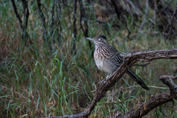
Roadrunner seen near the parking lot. We left Santa Elena Canyon and continued on a loop road that traverses the western edge of the park.

2017-12-TX-490                
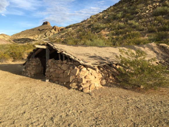
We stopped at Luna’s Jacal (Jacal: “a hut in Mexico and southwestern U.S. with a thatched roof and walls made of upright poles or sticks covered and chinked with mud or clay”), where Gilberto Luna raised “a large family”…

2017-12-TX-494            
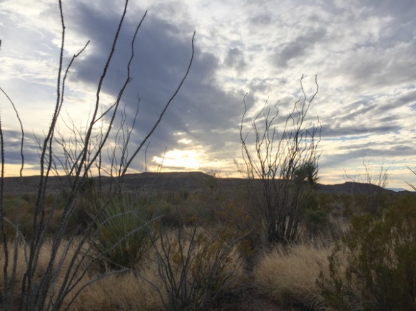
…and later when I spotted ocotillo that looked as though they had recently bloomed.

2017-12-TX-498-2         
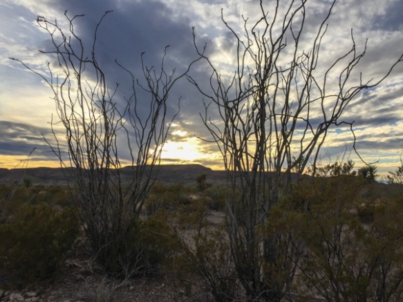
There were remnants of the red blossoms that grow at the end of the branches when there is moisture. Same with the leaves that cover the stalks for a few weeks after rainfall.

2017-12-TX-522                     We weren’t able to find an open campsite to reserve, at least according to the person working the computer at the last visitor center (whom we had reason to doubt, but what could we do?)…2017-12-TX-501              …so we ended our day at Big Bend and drove on to finding somewhere else to camp for the Next Adventure.

Road Trip to CO – Four Corners to Dark

Our 8 day road trip was almost over. We spent Monday night and Tuesday morning in Mesa Verde National Park but needed to be home on Wednesday. We decided to drive through Four Corners and Monument Valley–it wasn’t much out of the way and Dan had never seen the area (and I had been there just once).

DSC_1391

Most of the photos in this post were taken from the truck window at 70 mph. I found that I could sometimes roll the window down (yes, roll, there are no push buttons in this truck), sometimes remove the lens cap, and sometimes turn the camera on, but not always all three of those things.

DSC_1395

Four Corners is notable for being the only place in the United States where four states meet. It is also marks a boundary between the Navajo Nation and the Ute Mountain Ute Tribe Reservation. The Navajo Nation runs the Four Corners Monument as a tourist attraction.

IMG_2938

This is not the actual monument, but part of a sign about the surveying that began in the 1860’s. Wikipedia says, “the origins of the state boundaries marked by the monument occurred just prior to, and during, the American Civil War, when the United States Congress acted to form governments in the area to combat the spread of slavery to the region.”

IMG_2940

The marker itself is in the center of this courtyard. Notice the line of people to the right. They are all waiting to take their photos over the marker. We didn’t join them, but walked around the outside where there are stalls in which Navajo and Ute members sell souvenirs. Then we got back on the road.

DSC_1414

We took Highway 160 southwest to Kayenta where we turned north on Highway 163 to head back to Moab, but drive through part of Monument Valley. Wikipedia: “Monument Valley is a region of the Colorado Plateau characterized by a cluster of vast sandstone buttes, the largest reaching 1,000 ft above the valley floor…Director John Ford used the location for a number of his best-known films, and thus, in the words of critic Keith Phipps, ‘its five square miles have defined what decades of moviegoers think of when they imagine the American West.’ “DSC_1416

DSC_1419

DSC_1424

DSC_1435

DSC_1439

DSC_1446

Spectacular country for it’s rock formations. A tough place to live on the land.

DSC_1459

This rock formation kept us entertained for many miles as we drove closer and closer to it. I think it is just north of Bluff, Utah. I have googled a variety of words to describe this near both Bluff and Mexican Hat, Utah, but I don’t see any photos like this.

DSC_1473

I do know the highway roughly followed the course of the San Juan River between those two towns. The rock formations that show up on-line are the Mexican Hat for which the small town is named and…

DSC_1474

…Navajo Twin Rocks near the town of Bluff.

IMG_2943

We continued to see red rock formations as we drove north toward Moab.DSC_1477

DSC_1486

DSC_1488

DSC_1499

We hadn’t started the trip in Moab, but we’d been there just four or five days ago. I checked to see how long it would take to get home. I couldn’t get the phone to show me the route that we planned to take. We were headed to Highway 50 to cut straight across Nevada.

DSC_1494

We passed Arches National Monument where we’d spent a day hiking

DSC_1507

…and picked up Highway 50 at Crescent Junction.

DSC_1521

The plan was to drive west until we needed to stop.

DSC_1530

We’d seen some of this spectacular country but it looks different going the other direction.

DSC_1532

DSC_1533

We drove until it was took dark to take photos and then we kept driving.

To be continued…


Road Trip to CO – Arches #2

We had only one day to spend in Arches National Park, but we took advantage of it all, hiking/walking/driving. I posted a lot of photos here, but there are more.

DSC_0876

We spent the first half of the day hiking a 7-mile trail. After that we drove to various points of interest or overlooks where there were shorter trails to more arches.

DSC_0879

We ended up hiking about 12 miles that day.DSC_0883

The scenery was all spectacular. DSC_0886

This is looking back at the parking area from the trail to Delicate Arch.

DSC_0888

Much of the trail is walking across the slickrock.

IMG_2668

Then the trail becomes almost a shelf that winds around the side of a cliff.

DSC_0904

When you get the first view around the corner of that cliff you’re almost blown away (literally as well as figuratively). What a site! It’s absolutely amazing. I mean we saw a lot of arches and cool rocks and cliffs earlier in the day, but there was something about this one that is stunning. Maybe it’s because you see it suddenly as you turn the corner. Maybe because it stand alone with no other features near it.DSC_0898

Maybe it’s because of it’s size. In this photo there are people. Do you see how small they look?

.DSC_0907

In fact, there were a lot of people. It took some patience to get a photo of the arch with no people. That’s Dan sitting on the rock while others venture towards the arch. At this location the wind was so strong that it felt as though you could be blown backwards off the cliff.

IMG_2670

Wind effect in my hair. It’s not standing up just from the sweat and 2 days of camping!

DSC_0919

As is the case with most hikes, the trip back to the truck took a lot less time. At the bottom there are petroglyphs. These images of a horse and rider, bighorn sheep, and dogs were carved between 1650 to 1850.

DSC_0922

We continued on the road through the park. This is an overlook across the canyon from Delicate Arch. You can see it right there in the center of the photo. The trail we took came from around the rocky cliffs at the left.

DSC_0929

It was getting dusk when we got to the trails to see the last arches. These were relatively close to the parking lot so there were lots of people there. If you look closely you will see people on the rocks under the arches and on the trail. That gives you a sense of scale.

IMG_2674

DSC_0935

IMG_2667

We followed another trail at this location…IMG_2675

…to get a different perspective…IMG_2680

…as the sun was going down.

IMG_2682

Interesting manmade patterns.

IMG_2690

We stopped at the visitor center to clean up and fill water jugs. I got in a bit of sheep showing practice before we left to find our camping spot for the night.

Road Trip to Colorado – Arches N.P.

The mosquitoes that had been relentless the night before (this post) were slightly less so in the morning.

IMG_2631

However the surroundings were beautiful as the sun reached the west side of the canyon.

IMG_2628

But we didn’t linger around camp. We packed up and drove just north of Moab to the entrance of Arches National Park.

DSC_0801

The cliffs on the left side of the photo are part of Arches and that’s the Colorado River flowing our of the canyon in the center of the photo.

IMG_2632

I had been here once or twice before but that was almost forty years ago. (Oh yeah, I was going to find my old slides and see if I have photos from back then.)

I don’t remember the names of all the arches. Besides sometimes I don’t want to know what names other people have used for formations. I like to enjoy them without always having to see or think of something that is not a rock. I’ll make up my own name if something comes to me.

IMG_2636

We had one day to see the park and, knowing that it was going to be a hot day, we decided to start with one of the longer trails. Out and back on the more traveled trail would have been about 5 miles. We ended up taking the “primitive” route to come back and that was 7 miles.

IMG_2648

I thought about giving up taking photos because it seem so hard to capture the grandeur, the color, the textures.

IMG_2655

But of course I continued to shoot photos and I am sharing some of my favorites.

DSC_0816DSC_0818

IMG_2663

Distances are so deceptive in this country. We had seen these rock walls in the distance and I had thought, “it’s a good thing we’re not going there”. The “primitive route” took us around those and beyond.

DSC_0852

Cairns are important in finding the trails over slickrock and through washes. Seeing those little rock towers kept us on track in places where the trail wasn’t obvious.

DSC_0854

DSC_0857

DSC_0838

More from Arches National Park in the next post.

My Spring Vacation–Part 1

My husband is a teacher so we can plan a vacation during his spring break and before my son goes off to work on the USFS hotshot fire crew.  Chris held down the fort here  (with 12 lambs born) while we were gone.

Meet the Sheep was Saturday and I didn’t have time to prepare for this trip until Sunday.  We packed Sunday morning and headed south. The only plan we had was to get to Hoover Dam for a tour on Monday.

Driving on I-15 east of Tehachapi. We got to Las Vegas at midnight and spent the night there. The next morning we drove to Hoover Dam.

This is a view of the new bridge just below the dam. All the cross-country traffic used to have to follow a winding, tourist-packed road that crossed the dam. That must have been a nightmare for truck-drivers and anyone else that just wanted to get to where they were going.

Here is the dam from the bridge. We took a tour inside the dam. Hopefully some of my videos will come out well, but I haven’t even downloaded them to the computer yet.

After sleeping in the Explorer that night (note to self–get an air mattress. The 20 year old foam pad doesn’t work anymore) we spent the day at the Grand Canyon. My photography  left something to be desired, but it was just not possible for me to capture the Grand part of the Grand Canyon.  We chose the Kaibab trail and hiked about 3.5 miles into the canyon.

Another few miles would have taken us to the bottom but had not planned an overnight trip and didn’t think it would be smart to try it in a day.

If we had the help of mules we could have done it, although even the mules are making overnight stops in the bottom.

See that zig-zaggy trail going up the wall. That’s the last leg of the hike back up.

Leaving the canyon late in the day and looking west toward the setting sun.

Stay tuned for Part 2.