Road Trip to CO – Four Corners to Dark

Our 8 day road trip was almost over. We spent Monday night and Tuesday morning in Mesa Verde National Park but needed to be home on Wednesday. We decided to drive through Four Corners and Monument Valley–it wasn’t much out of the way and Dan had never seen the area (and I had been there just once).

DSC_1391

Most of the photos in this post were taken from the truck window at 70 mph. I found that I could sometimes roll the window down (yes, roll, there are no push buttons in this truck), sometimes remove the lens cap, and sometimes turn the camera on, but not always all three of those things.

DSC_1395

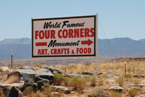
Four Corners is notable for being the only place in the United States where four states meet. It is also marks a boundary between the Navajo Nation and the Ute Mountain Ute Tribe Reservation. The Navajo Nation runs the Four Corners Monument as a tourist attraction.

IMG_2938

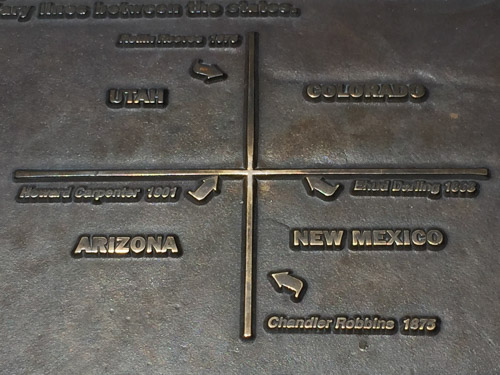
This is not the actual monument, but part of a sign about the surveying that began in the 1860’s. Wikipedia says, “the origins of the state boundaries marked by the monument occurred just prior to, and during, the American Civil War, when the United States Congress acted to form governments in the area to combat the spread of slavery to the region.”

IMG_2940

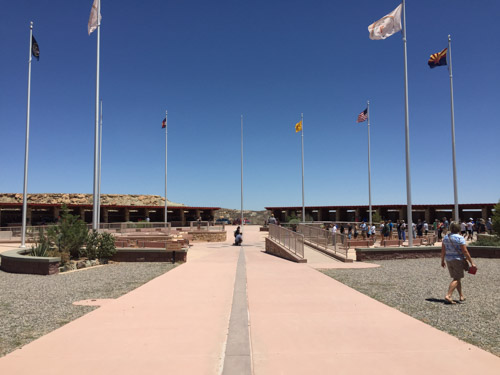
The marker itself is in the center of this courtyard. Notice the line of people to the right. They are all waiting to take their photos over the marker. We didn’t join them, but walked around the outside where there are stalls in which Navajo and Ute members sell souvenirs. Then we got back on the road.

DSC_1414

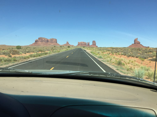
We took Highway 160 southwest to Kayenta where we turned north on Highway 163 to head back to Moab, but drive through part of Monument Valley. Wikipedia: “Monument Valley is a region of the Colorado Plateau characterized by a cluster of vast sandstone buttes, the largest reaching 1,000 ft above the valley floor…Director John Ford used the location for a number of his best-known films, and thus, in the words of critic Keith Phipps, ‘its five square miles have defined what decades of moviegoers think of when they imagine the American West.’ “DSC_1416

DSC_1419

DSC_1424

DSC_1435

DSC_1439

DSC_1446

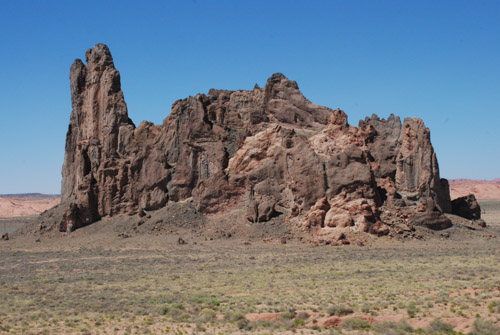
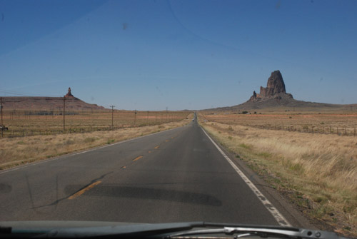
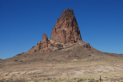
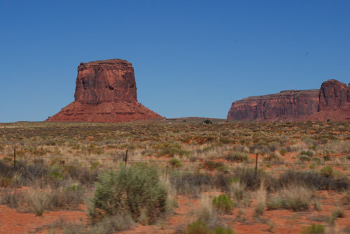
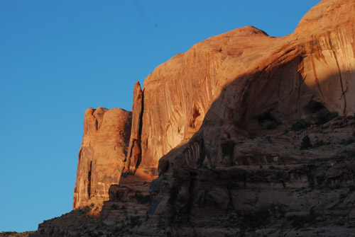
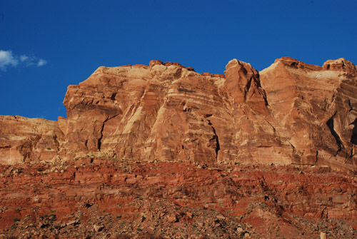
Spectacular country for it’s rock formations. A tough place to live on the land.

DSC_1459

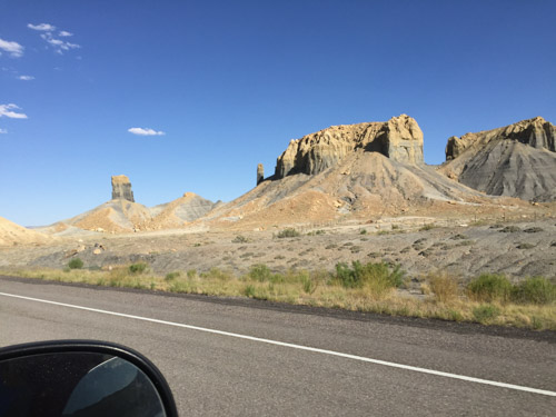
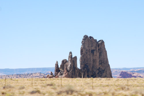
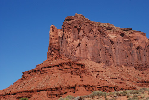
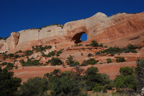
This rock formation kept us entertained for many miles as we drove closer and closer to it. I think it is just north of Bluff, Utah. I have googled a variety of words to describe this near both Bluff and Mexican Hat, Utah, but I don’t see any photos like this.

DSC_1473

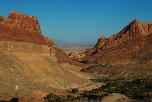
I do know the highway roughly followed the course of the San Juan River between those two towns. The rock formations that show up on-line are the Mexican Hat for which the small town is named and…

DSC_1474

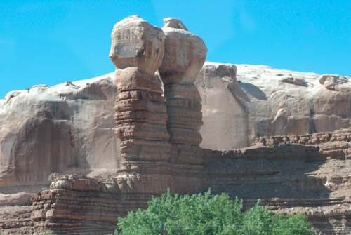
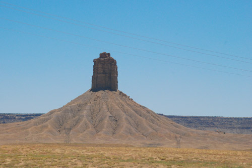
…Navajo Twin Rocks near the town of Bluff.

IMG_2943

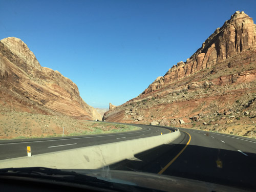
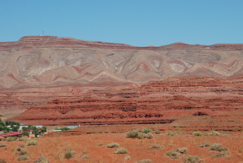
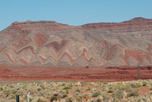
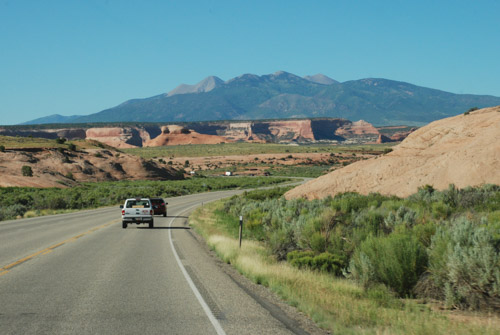
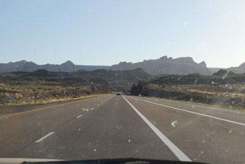
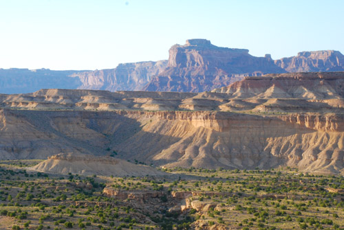
We continued to see red rock formations as we drove north toward Moab.DSC_1477

DSC_1486

DSC_1488

DSC_1499

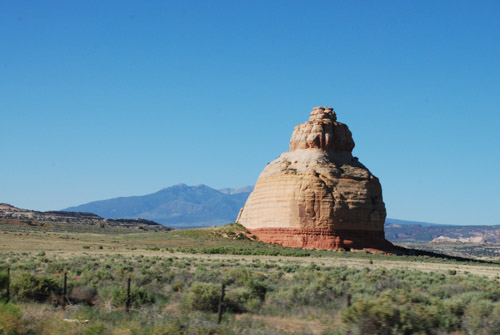
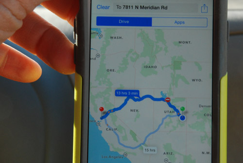
We hadn’t started the trip in Moab, but we’d been there just four or five days ago. I checked to see how long it would take to get home. I couldn’t get the phone to show me the route that we planned to take. We were headed to Highway 50 to cut straight across Nevada.

DSC_1494

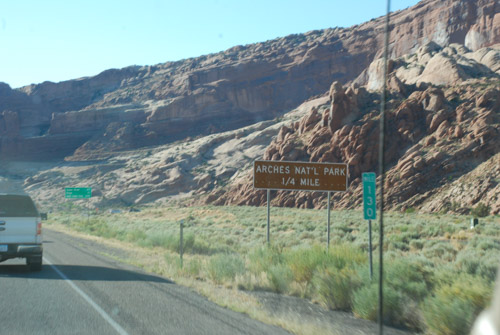
We passed Arches National Monument where we’d spent a day hiking

DSC_1507

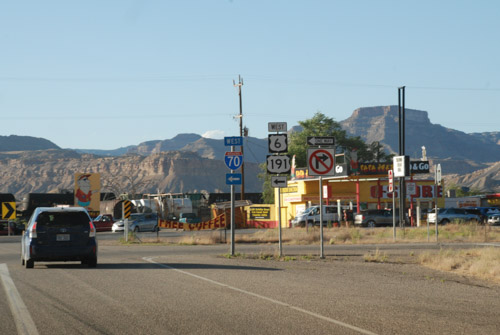
…and picked up Highway 50 at Crescent Junction.

DSC_1521

The plan was to drive west until we needed to stop.

DSC_1530

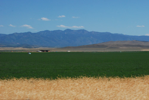
We’d seen some of this spectacular country but it looks different going the other direction.

DSC_1532

DSC_1533

We drove until it was took dark to take photos and then we kept driving.

To be continued…


Road Trip to Colorado–Tonopah to Moab

After the tire problem the night before (this blog post) we knew that before we drove farther we needed to buy new tires.

Tonpah rest stop

We had driven to a rest stop just west of Tonapah, Nevada, where we spent the first night of this trip.

Tonopah NV

We drove through town looking for a tire store and I remembered this motel from a previous trip through Tonopah when we were looking for a motel late at night. We chose something that did not advertise clowns. Sorry, Clown Motel.

Most of the rest of these photos are DBP (drive-by photography). The goal was to get to Arches National Park or close to it so that we would have all of Friday to spend at the park.

UT-0778 Hwy 50

Dan likes to drive and that’s fine with me. I keep myself amused with following along on the map or with the phone (if there is service…which there wasn’t for a lot of this trip) and by taking photos.

UT-0780 Hwy 50

UT-0780-cosmic ray

We saw these “things” regularly spaced on both sides of the highway for several miles in Millard County, Utah. All we could make out was what looked like solar panels on a framework and we speculated as to what they were–we decided that they were to monitor or measure something, but what? As we drove into Delta, Utah we just happened to see several of them in what looked like a parking lot beside a building that said Cosmic Ray Center. I googled “cosmic ray delta utah” and found a lot of references to the Telescope Array Project: “The Telescope Array project is a collaboration between universities and institutions in the United States, Japan, Korea, Russia, and Belgium. The experiment is designed to observe air showers induced by cosmic rays with extremely high energy. It does this using a combination of ground array and air-fluorescence techniques. The array of scintillator surface detectors samples the footprint of the air shower when it reaches the Earth’s surface…” OK, you lost me. At first I wondered if this was for real (thinking of driving through Roswell, NM last year with it’s focus on Aliens) but I guess it is. Who knew what we’d learn on the road?

UT-0782-shoe tree-

I also learned from googling, that “Shoe Trees” are a real thing, although of less lofty impact. There will be more about this in a future blog post.

UT-0785-Delta

Where there is water the desert is held at bay. There were plenty of alfalfa fields throughout this valley in Utah.

UT-0791

Towards the east the patterns and rock formations were impressive…

IMG_2612

IMG_2620

…and we began to see “red rock country”.

IMG_2619

This is U.S. 50 in central Utah, which is known as the “Loneliest Road in America”. I just looked this up and now I understand why there is a sign in Sacramento for Ocean City, Maryland (see my first blog post for this trip). U.S. 50 is also one of the longest highways in America, going between Sacramento and Ocean City. I always thought that it was just because someone in the Sacramento Highway Department has a sense of humor.

We drove U.S. 50 to Highway 191 where we turned south to Moab. Arches National Park is just east of the highway and north of Moab and seeing the spectaular scenery whetted our appetites for the next day’s adventures.

It was late though and we needed to stay somewhere. Arches N.P. has very few campsites, but there are several in the Moab area. We found a BLM campsite on the Colorado River right outside of Moab.

DSC_0792

The sun was going down, giving intensity to the red rock cliffs.IMG_2621

The campsite was right next to the river. River + Dusk = Mosquitoes. They were relentless. IMG_2623

We quickly set up our tent and retreated until after dark when we ventured outside to heat up a couple of cans of chili.