Road Trip to SD – Day 4 – Belle Fourche and Jewel Cave NM

We started Day 4 of our adventure after a restful night in the Black Hills National Forest in Wyoming. (Here is the campsite in Day 3.) I was up before Dan and walked off with my camera. Wildlife!

DSC_3067

So what if it’s just chipmunks! They were close enough for me to get decent photos.

DSC_3062

And they were fun to watch as they ran in one side of the cattle guard rail and out the other.

IMG_1462

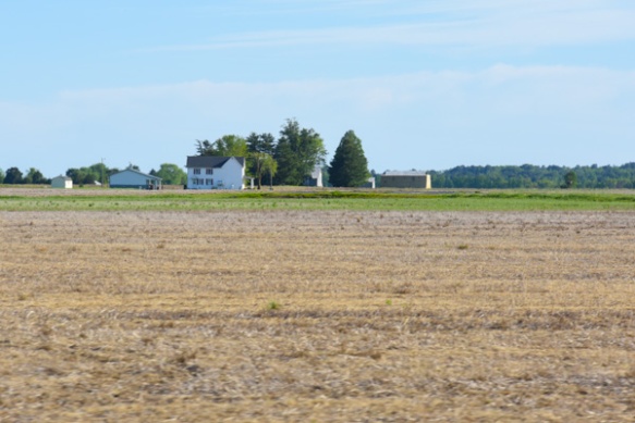
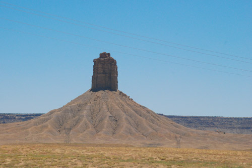
This is a view of some of the forest outside the campground.

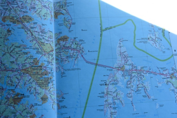
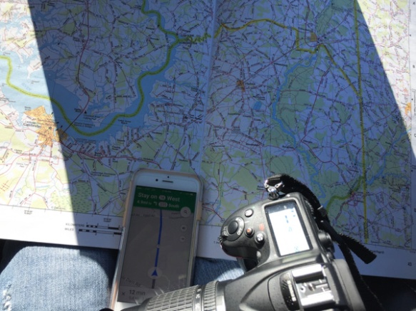
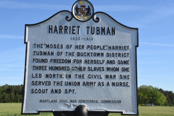
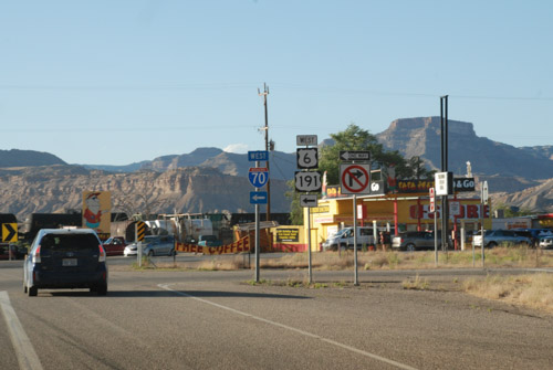
We got on the road and looked at where to go. Now I’ll tell you why I had originally chosen South Dakota as our destination for this year’s trip. Months ago I was reading a sheep magazine and saw a reference to a Sheep History exhibit in South Dakota. I looked it up and it was in an Ag Heritage Museum in Brooking, SD. There was a lot to see along the way so I suggested that as our turn-around point. However, Brooking is on the far eastern side of SD. After the first two days of driving and looking at all the things we wanted to see where we were now and our limited time I pulled the plug on driving clear across the state to see that one place. It seemed kind of silly to add another two days of driving to the trip just for a few hours in a museum (or to not add two days and be driving for that long a stretch).

So, back to the map. There was plenty to see in western SD: Mt. Rushmore NM, Jewel Cave NM, Wind Cave NP, Buffalo Gap National Grassland, Badlands NP. Dan still wanted to avoid Sturgis with all the crazy motorcycle stuff. So we looked for a road around it. I saw on the map “Geographical Center of the United State”. Really? I looked at the U.S. map. That didn’t look right. I googled it.

IMG_1466

If you include Alaska and Hawaii, yes, there is a place, not too far over the border of SD, that is the Geographical Center of the U.S.

DSC_3075

It turns out that the real center is in a privately owned pasture 20 miles north of the town of Belle Fourche.

DSC_3079

The town decided that there should be a more memorable and accessible monument for something as cool as being the Georaphical Center of the U.S. …

IMG_1478

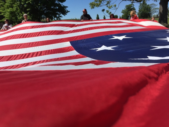
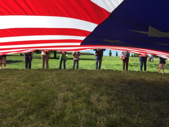
…so this was created in 2008. It is at the Belle Fourche Visitor Center and Museum.

IMG_1467

The museum turned out to be very interesting (and maybe a smaller scale of the one that we were going to miss in Brooking) and we spent some time there. There were exhibits about the cattle drives from Mexico to Canada, the importance of the railroad station in Belle Fourche (4500 train carloads of cattle per month in 1895), the Old West in  movies and TV, early settlers, rodeo history, wartime, and old-time bad guys. There was also an exhibit about the importance of the sheep industry in South Dakota. DSC_3074

This is a sheepherder wagon that is outside the museum. There were a lot of photos of the sheep history of the area.

IMG_1473

South Dakota is currently fifth in the U.S. for sheep production…

IMG_1474

…and the sheep industry is an important part of South Dakota’s agricultural economy.

IMG_1468

This isn’t a very big museum but there was a lot to see in the small spaces. In the area that showed something about life in “the old days” there was this device used to do something to women’s hair. An early perm?

IMG_1471

it’s kind of hard to see this bicycle but I thought it was interesting in that the handlebars, seat, and wheel rims are made of wood.

DSC_3087

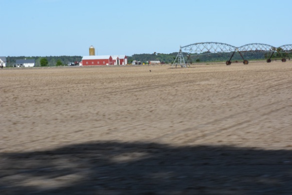
After a few hours we decided that we’d better get on the road again. This is a view before we left town.

DSC_3088

What do you think of this one? It was kind of scary to have this view on the highway   but that truck was going the same direction that were are because it was being towed behind another.

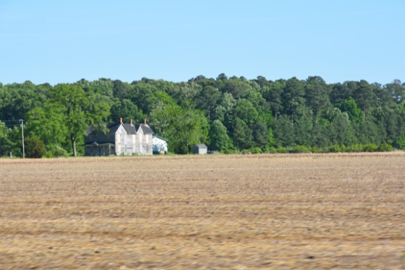
South Dakota was not what I expected.

DSC_3090

We had camped in the Black Hills National Forest in Wyoming but it continues in South Dakota.

DSC_3093

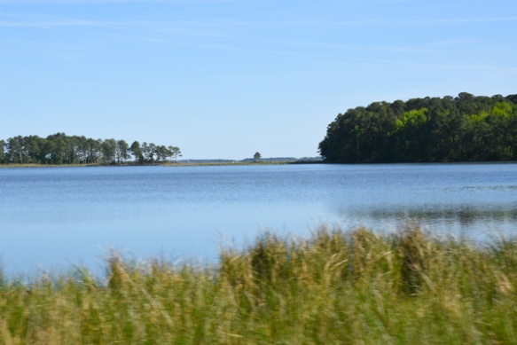
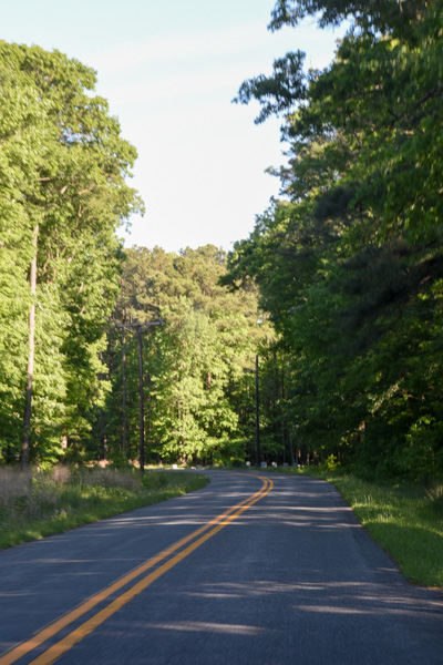
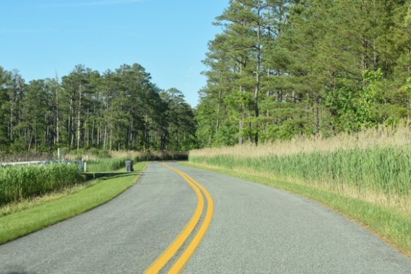
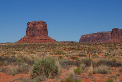
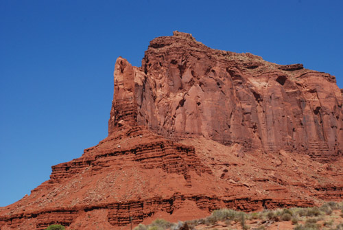
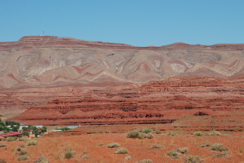
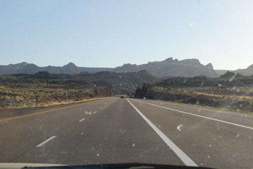
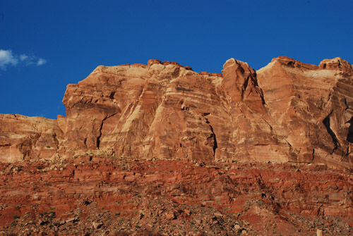
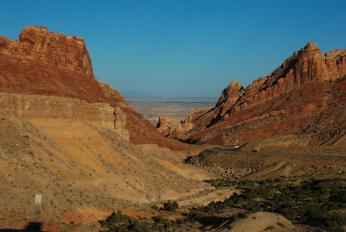
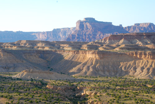
We were headed now to Jewel Cave National Monument and took a road designated a “scenic drive” and it was. Beautiful country. This is an area known as Spearfish Canyon.

DSC_3101

This National Monument as well as many of the others we planned to visit are all within this area of the Black Hills National Forest.

DSC_3098

IMG_1487

I continued to find the scenery breathtaking. Too bad the drive-by photos can’t really show that.

IMG_1493

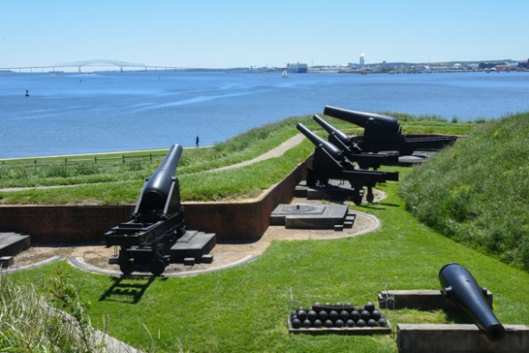
We signed up for a cave tour but had some time in the Vistor’s Center first. Jewel Cave was discovered by two prospectors in 1900. Only a mile of it had been documented when it was made a National Monument in 1908. Now it is known to be the third longest cave in the world with over 180 miles of passages that have been mapped and more that have not. The cave extends beneath about four square miles of land but there is only one known entrance. The areas in yellow are closest to the surface and the redder the color, the deeper the passage. The deepest point is 749 feet below ground.

Thirty of us gathered with our Ranger and rode an elevator down to a double set of doors that created an airlock when entering the cave. I am not a big fan of dank, underground place, preferring wide open spaces and sun. Nevertheless, this was a cool (no pun intended although it was sweatshirt weather below ground) tour.

IMG_1498

It was OK to take photos. I can’t tell you what any of these formations are because (although once, for a very brief period, I thought I might be a geologist) I don’t ever remember rocks and geologic time.IMG_1499

I can admire them however.

IMG_1500

There were lights placed strategically along the mile-long tour route and lots of walkways and stairs.

IMG_1503

At one point the Ranger turned off all lights and that is very eerie. I think of Tom Sawyer and Becky in the cave and running out of candles. Yes, I prefer wide-open spaces and sunlight. (By the way, no photos of lights-out in the cave.)

IMG_1505

This one reminds me of an ocean scene.

IMG_1513

IMG_1515

Here is an example of the one of the walkways. The tour was about an hour. After that I bought my patch at the gift store and we spent a little more time in the Visitor Center.

IMG_1490

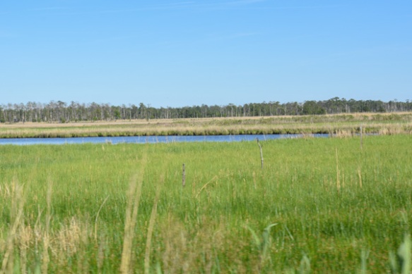
We read about the ecosystems we were traveling through. I have lived most of my life in California, have traveled in many of the western states, including the desert southwest (where I lived for a couple of years) but have never been in the prairie. This sign and others explained a bit about the difference between the Short Grass Prairie and the Tallgrass Prairie, where we’d be traveling next. The Black Hills are in between.

DSC_3106

Bison grazing.


IMG_1519

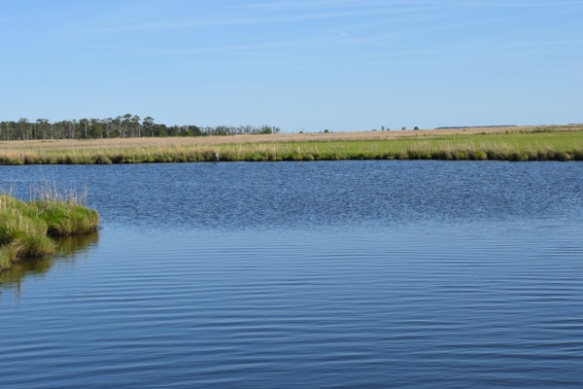
We planned to visit Badlands National Park the next day. We knew that it might be tough to find a camping spot on a weekend without a reservation in the National Park but we thought that we’d be able to find a place to pull over and sleep somewhere in the National Grassland that surrounds the Park. We had been told by a couple of people that (as we know is true in the National Forest) if it’s public land you can stay there. This sign indicated that we were in Buffalo Gap National Grasslands…

IMG_1520

…complete with buffalo.

My big mistake was not getting the map book for South Dakota before we left. I realized too late that we didn’t have it and thought that we might be able to find one on our trip. Since neither of us like to spend time driving through cities even if its to a bookstore, we never got one, and instead had to rely on a road map of the state. That was totally inadequate for the way we are used to traveling. We couldn’t tell where there was private land and public land and we had no idea where the little dirt roads went. Later I saw a map that would have been even better than the map book for our purposes. There is a map available of the Grassland that shows land ownership. No wonder we couldn’t figure it out–it’s all a big checkerboard of private and public land. We’ll know for next time.

So we drove through the Grassland as it was becoming dusk. We couldn’t identify anywhere that looked like we could stay. It is after all, grass, and all fenced. We’re used to driving through the forest or even the desert and being able to drive off on a dirt road away from the main road and camp. Eventually it got dark and we continued driving into the Badlands NP. As we thought the campground was full. We continued on, entering  the Grassland again. We pulled off on one possible road that was clearly marked as a trailhead on public land. But law-abiding citizens that we are, we left when we saw the sign that said “No Overnight Camping”. I was feeling less law-abiding than Dan, but I was not the driver. We tried another road that was still part of the Grassland and passed another place, Minuteman Missile National Historic Site, that would be interesting to visit in daylight hours. This gravel road was on our map and continued for a few miles. However, every time we turned on what looked like a possible side road, there was a gate, or an obviously cultivated field. We finally went back to the highway and drove east.

You might be wondering, why don’t they just get a motel room? The first answer is that there were none around. However, eventually we got to the highway, and, yes there would be motel rooms. But, this was a camping trip and we had comfy sleeping bags and I had a sheepskin to sleep on and we could sleep in our truck. All we needed was a place to park. We saw a rest area on the map so we went there.

To Be Continued.


Road Trip to SD – Day 3 – Devils Tower

After a morning spent touring Mountain Meadow Wool we headed east toward Devils Tower National Monument.

Coal mine-Gillette, WY

This is part of a coal facility near the town of Gillette, home to 12 coal mines which provide 1/10 of the jobs in the area. Up to 100 trains loaded with coal leave the town every day. We noticed that the sky over much of our trip was not as blue as we expected and that is evident in my photos. I am used to the Sacramento Valley haze in the summer, a result of dust, smoke from wildfires, and probably smog, but I didn’t expect this in Wyoming. I wonder if these hazy skies are from all the coal mines.

DSC_2955

Artwork seem when driving through one of the towns.

North of Moorcroft, WY

I wouldn’t call this artwork, but someone has a sense of humor. Am I the only one that sees these logs as weird animals?

North of Moorcroft, WY

As expected there were lots of cattle. This is north of the town of Moorcroft, where we turned off  of I-90 to head north to Devils Tower.

DSC_2978

First view of Devils Tower. The Tower rises 867 feet from the base and 1267 feet above the Belle Fourche River. The diameter at the base is 1000 feet and the area on top is 1-1/2 acre.

IMG_1447

There is a trail all the way around the Tower and it looks different on each “side”.

DSC_3000

This is looking at its southeast face. Do you see the column that is much shorter and tipped a bit just inside the part that is in shadow and that looks like it is just above the tree in the photo? Then do you see the column that rises up about twice as high as the shorter broken one?

DSC_3002

This is a close-up of that taller column. There is a climber! Look above the next column over (about an inch on my screen). That gives you some perspective about the size of this huge rock.

DSC_3010

This is a detail of the outer third of the Tower from that first photo (where, due to camera perspective, it looks more tipped than it really is).

DSC_3011

Tisis a closer view of the middle of the photo above. Those things that look like sticks? Those are the outer edge of a ladder that was used to get up the first 350 feet in the 1890’s. The ladder is anchored in the crack between the columns. Can you imagine? The lower part has since been removed and some of the upper restored by the Park Service in the 1970s.

DSC_3012

This is another view that includes the area of those close-ups just to give some perspective.

DSC_3019

The trail around the Tower is paved the whole way to accommodate the thousands of visitors  that come each year. Hot in the sun, it was very pleasant under the canopy of trees.

DSC_3023

Speaking of trees, these are pretty substantial trees at the base of the cliffs. Another measure of perspective.

DSC_3021

Look at those trees in this view.

DSC_3024

There were beautiful colors and patterns in the rock.IMG_1452

We were at the Tower for about two hours or so. Before leaving the National Monument we had to stop at the prairie dog town.

DSC_3034

These are certainly well-fed prairie dogs.

DSC_3047

But I didn’t realize the damage that they do to the landscape. There are prairie dog mounds throughout this photo. I have some very severe photos to share later on in these blogs.

DSC_3055

We drove north and then east from the Monument…IMG_1456

…and found a campground in the Bear Lodge Mountains, part of the Black Hills National Forest. Again, we needn’t have worried about the campground being over-run by motorcycles from Sturgis. Maybe the riders are not big campers. There was only one other person in this campground.

IMG_1455

This is a rare scene–not Dan reading a newspaper–but that we actually had time to relax and enjoy the evening in camp. Point #1: we got there early enough that there was still evening left before we needed to eat or get to sleep. Point #2: There were NO mosquitoes, it wan’t cold, and there was no rain. So Dan read his newspaper and I read The Shepherd’s Life by James Rebanks. I found that some of the author’s points resonated with me on this trip. More about that later. IMG_1461

An after-dinner fire. This reminds me of the disembodied head of Oz.


Road Trip to SD – Day 3 – Wool Mill

We camped at the Lost Cabin campground in the Bighorn Mountains. We needn’t have been concerned about being crowded out by hoards of motorcycle riders. There were only one or two other campers. It was hard, living and working outside in the Central Valley, to imagine needing wool gloves, hats, etc. I’m glad that I had brought those and that before we left I had grabbed my heavy chore coat off the hook where it had been since the spring. The night was cold camping at 9400 feet elevation. (I know, that’s all relative, and some of you laugh at what I think is cold. But nevertheless I was cold.) It was almost dusk by the time we finished eating and cleaned up dishes and I was ready to get in a sleeping bag. I was warm enough, but spent a lot of time reading in the middle of the night when I couldn’t sleep.

Lost Cabin, Bighorn NF

We meant to get an early start, but it was already well into the morning when I woke up. Hey, it’s vacation time! And there is a time zone difference too. Dan made his coffee and we got on the road to Buffalo.

DSC_2945

This was our destination.

DSC_2943

Mountain Meadow Wool is the company that spun this year’s yarn and I was excited to meet the people there and see the mill.

IMG_1441

Here is the entrance.

IMG_1442

It opens into a showroom and sales area.

IMG_1438

There are well-made videos showing of local sheep ranches where the wool is sourced and the mill in production.

IMG_1392

Ben took us into the mill. He showed us this wall where bales and bags are piled waiting to be processed. This wool will be used for Mountain Meadow’s own line of yarn. It was interesting that the wool stacked here is this year’s production for the Mountain Meadow lines of yarn whereas for the “big” companies that might amount to only one days’ production.

IMG_1393

The scouring line starts here.

IMG_1396

First, is the skirting table, very similar to mine with the PVC cross-pieces. One person checks all the wool as it comes through. He will pull out fiber that looks too short, too full of VM, or contaminated with paint marking.

IMG_1397

This was nice fiber, but Ben said that the paint wouldn’t wash out so it is discarded. The fiber pulled out here goes into the baler that is behind the skirting table (photo above this one). I don’t remember where Ben said that this goes, but there is a market for it when they get a large amount.

IMG_1399

The wool goes up this belt…

IMG_1401

…and through the bale opener before it goes through the scouring line, which Ben and his team have spent years developing to work for a mill of this size.

IMG_1402

Nearby there were several large plastic barrels (30-50 gallons?) connected by pipes and tubing that is Ben’s work-in-progress to biologically manage the solids that become waste products of the scouring process. This includes lanolin and a lot of dirt. He is still working to perfect the system that includes lanolin-consuming bacteria (if I remember correctly). This jar is full of some of the waste products.

IMG_1406

The carder is right in the middle of this room but I didn’t get any photos of it. After carding the wool goes through the pin drafter–5 times!

IMG_1403

This comb in the pin drafter helps remove short pieces and debris to create a smoother product.

IMG_1407

Spinning is next.

IMG_1408

It takes about 6 hours to spin up the fiber in each box unless they are spinning very fine yarn. Then it can take 2-1/2 days! No wonder it costs more to have fine yarn spun.IMG_1416

Combing is an additional process…

IMG_1413

…which creates a product called “top”, that has no short pieces or cross fibers in it.

IMG_1420

There can be a lot of waste after combing but Mountain Meadow Wool uses that waste to create dryer balls. My dryer balls are here.

IMG_1421

Yarn is then wound on cones and/or skeined.

IMG_1426

Mountain Meadow Wool also has a dye kitchen for the yarn that they market.

IMG_1429

Ben took us into a room with finished goods, experimental products, R&D. Mountain Meadow Wool offers some pieces for sale and also the option to have some items made with a producers own wool. I admired the blankets being woven.

IMG_1432

People have sent fibers to see how the mill can handle them. The fiber above is a coarse plant fiber. I can’t remember what it is–something like agave, or at least it reminded me of that plant family.

Bear hair

This one I remember. Someone sent Ben bear fiber to spin.

I appreciate Ben taking time out of his day, and at the end of a week when they have been short-handed, to show us around. It helped me to discuss with him fiber prep  and fiber quality. Quality control of the yarn begins at the producer’s skirting table. I love the yarn they are producing at this mill and it’s nice to know the family.

Where to next? It was about 1:00. We at lunch at a local sandwich place and looked at our maps. It wasn’t far to Devil’s Tower National Monument–only about two pages away in the map book. Onward!

Road Trip to SD – Day 2 – Wyoming

We left Day 1 in the middle of the night in the middle of Utah.

Aragonite rest stop, UT

Several years ago Dan built a sleeping shelf in the truck (that comes out when we’re not using it). That way we can put gear underneath and leave sleeping bags, etc on the shelf. So it was easy enough to pull into the rest area near Aragonite and sleep. Just to be accurate the map book shows two spelling for this: Argonite and Aragonite, about a mile apart, and both with the symbol for abandoned settlement or railroad siding (and both on a railroad). Aragonite Incinerator is shown as a Point of Interest. It turns out that it is a hazardous waste facility. All of these points are a mile or more from the highway and the rest area.

Aragonite rest stop, UT

This is a view, looking north to the rest area and all the trucks parked there. There is a trail from the rest area to a rocky hill and a sign that says something about wild horses–so of course I needed to climb the hill. It’s not really as far as it looks–that’s just the perspective of my phone camera.

Aragonite rest stop, UT

Some of the rocks on that hill.

Great Salt Lake

After my walk we got in the truck and started driving. There is one point where the highway crosses  the southernmost part of the Great Salt Lake. Notice the salt built up around those fence posts.

Wyoming

The highway goes over most of Salt Lake City and then heads northeast to Wyoming. We got there mid-morning.

Sheep west of Lyman, WY

Remember these are all drive-by photos, some with my camera and some with my phone. This is not sharp but a photo of range sheep along I-80 west of Lyman.

Pronghorn east of Lyman, WY

Where there were alfalfa fields there were often pronghorn.

Pronghorn east of Lyman, WY

I just looked up “pronghorn”. I didn’t know that they are not really an antelope and the closest living relative is the giraffe.

Green River, WY

At about noon we stopped at a Visitor’s Center in the city of Green River. This is a view of the Green River from that point.

Joy Drill-Green River, WY

There was an outdoor exhibit about Trona. If you’re like me you’d say, “Huh?” From the brochure that calls Sweetwater County the Trona Capital of the World: “a naturally occurring mineral …is a much-needed industrial material because it yields soda ash. Soda ash is used to make glass, paper, laundry detergents and many other products. It is also used in the manufacturing of other chemicals…baking soda and sodium phosphates.” Trona occurs in other parts of the world, but not in deposits of mineable quantities.

There is a plaque with information about the equipment in the photo above. This is a Face Drill and the plaque tells about a Joseph Francis Joy, who at age 12 in the 1890s, went to work in the coal mines as had his father and brother. I assume that he went on to create this company or to inspire the more sophisticated equipment, but the sign doesn’t explain that. However any machine with this many levers seems interesting.IMG_1372

I found the Visitor’s Center to be informative and interesting–a good way to break up our drive. I was curious about a reference to the Intergalactic Spaceport and looked that up later. Wikipedia: “On July 5, 1994 Resolution R94-23 of the Green River city council designated this landing field [the airport at Green River] as the “Greater Green River Intergalactic Spaceport”, for inhabitants of Jupiter who might wish to take sanctuary in Green River in the event their planet is threatened by collisions from comets or meteors, in apparent reference to the contemporary Comet-Shoemaker-Levy9 impact”. Evidently there is a sense of humor in this town.

Green River, WY

Back outside, there were two horses from the BLM’s Wild Horse & Burro program.

IMG_1375

This is the code used for the freeze branding.

Rock Springs, WY

Speaking of wild horses, I saw on the map the BLM Wild Horse Corrals just north of Rock Springs. That is where we were turning north to head up Hwy. 191 so we stopped to look. You can request tours, but we hadn’t made any plans, so satisfied ourselves with looking from the overview. The facility can hold up to 800 horses and is the only off-range holding facility in Wyoming. It also is a rest stop for horses being transported from the West to points farther east.

DSC_2851

Heading north. It looks like all the hay that is baled around here is put into round bales. I googled “weight of round bales”. It can vary from 450 to 1700 pounds depending on size of bale, density of bale, moisture content, etc. So don’t ask me how much a round bale weighs.

Rock Spring to Eden, WY

Between Rock Springs and Eden.Rock Spring to Eden, WY

More Wide Open Spaces.

East of Eden, WY

East of Eden, WY. Isn’t that a book by John Steinbeck?

In case you are wondering about what we were doing meandering northeast through Wyoming, our first destination was to be Mountain Meadow Wool in Buffalo. We didn’t decide the order of our trip until we were actually on the road and I talked to someone at Mountain Meadow to ask about the best time to visit. This was all pretty last minute although I had the time blocked out on my calendar for months.

DSC_2862

As you know if you’ve followed our road trips in other years (search back in WordPress) we tend to stop at the historical markers we find along the way. Most of the main roads through the West were originally traveled by the Pioneers.

False Parting of the Ways, WY

A Wyoming History website says about the Parting of the Ways: “This may well be one of the most subtly dramatic sites remaining on the emigrant trails. Here, in the middle of an open, sagebrush plain, the trails diverge. Emigrants had to decide whether to stay on the main route and head southwest towards Fort Bridger or veer right and cross the Little Colorado Desert on the Greenwood or Sublette Cutoff. The cutoff, opened in 1844, saved about 46 miles but included some fifty waterless miles.” This site, however, is the False Parting of the Ways, wrongly identified in 1956 and marked with the tall marker in the background. The correct site was identified about 30 years later and the flat plaque was installed here. The sentiment remains the same though–this is part of the Oregon Trail and the country looks pretty much the same.

Oregon Trail, WY

It is so hard to imagine traveling this “road” and covering 10 to 20 miles per day.

DSC_2870

Rabbitbrush near the trail.

Hwy 28, WY, South Pass

About 7 or 8 miles away we came to the South Pass Overlook and Interpretive Site. “South Pass is the lowest point on the Continental Divide between the Central andSouthern Rocky Mountains. The passes furnish a natural crossing point of the Rockies. The historic pass became the route for emigrants on the Oregon, California, and Mormon trails to the West during the 19th century. It has been designated as a U.S. National Historic Monument.” Remember, we are following the trails backwards. The pioneers would have crossed this and then come to the Parting of the Ways and the deserts beyond.

Hwy 28, WY, South Pass

Our modern marker for South Pass.

Thermopolis, WY

After traveling north for another couple of hours it was hard to miss this sign on the mountain. We thought “sure, anyone can say they have the world’s largest anything”.

Thermopolis, WY

Then we saw it and thought they might be correct. This is in Thermopolis, population about 3000 in 2010. Back to Google and Wikipedia. “The springs are open to the public for free as part of an 1896 treaty signed with the Shoshone and Arapaho Indian tribes.”

Thermopolis, WY

This is the landscape just north of Thermopolis. Beautiful green alfalfa contrasts with the red rock.

Thermopolis, WY

The landscape reminds me of southern Utah.

Kirby, WY

Look at what I saw on the map coming up! A town named Kirby, which happens to be the name of the cutest granddaughter ever. I should get a hat or a shirt or something there.

Kirby, WY

The Kirby Bar and Grill looks promising.

IMG_1383

Kirby is not a big town.

Kirby, WY

This is pretty much it, except for a few gravel roads with houses. That’s the Bar and Grill to the left. There were people there, but no “Kirby” items to buy. We wondered about the big building at the end of the road. It seemed odd to be in this tiny town. This is Wyoming Whiskey, a distillery started and owned by a Kirby cattle ranching family. They give tours but it was closed when we were there.

DSC_2911

More landscape in the Bighorn Basin.

DSC_2916

Bighorn NF, WY

It was evening when we got to the Bighorn National Forest, part of the Bighorn Mountains. We hoped to find an open campsite. We had blocked out two weeks in which to take this trip and then chose the first week so that we would miss the hoards of people traveling to this area on Eclipse Weekend. What we didn’t realize was that this was Sturgis Weekend, a motorcycle rally that draws 500,000 motorcycles, mostly (it seems) Harleys, to the small town of Sturgis, South Dakota, just over the border from Wyoming. The national parks and towns surrounding Sturgis gear up for the onslaught of people, but evidently, those people weren’t interested in camping in the Bighorn National Forest.

Bighorn NF, WY

It was getting close to dusk and we saw people parked on a pullout along the road. Our Yellowstone experience taught us that where there are people standing and pointing there might be something to see. Two Moose!

Bighorn NF, WY

Check back for Day 3. At this point I am so jealous of my friends whose wildlife photography is outstanding in its clarity. Photographer or lens? Probably both.

MJ Adventure Team Goes to MD – Day 7 Continued – The End

That last post was really long but I have so many photos that I wanted to include. The day wasn’t over when we left Assateague Island. We had a mission ahead of us.

IMG_6536_medium

Dona took this photo before we left California. You pass this sign on Highway 50 entering Sacramento from the west. We figured that if there was a sign for Maryland at this end of Highway 50 then there would be a sign at the other end too, so we drove to Ocean City.

DSC_1379

We parked and started walking to find our sign. The beach and the Atlantic Ocean are just past the Boardwalk, so we have to go the other direction.

DSC_1376

We were on the right track. We hadn’t seen any sign coming into town, but it didn’t take us too long to realize that we’d been facing the wrong direction to notice a sign meant for west-bound travelers.

DSC_1375

A sign of interest, but not the one we were looking for.

IMG_9657

A gorgeous old building.

DSC_1357

We found it!

DSC_1369

Mission accomplished.

DSC_1381

We still had time in the parking meter so walked back to the Boardwalk. Do you remember the photo in the last post of this area 10 miles to the north of the Assateague National Seashore? What a far cry from the beach and the dunes. The beach here is just to the right of those light poles.

DSC_1380

We stopped at a memorial to fire fighters…IMG_9662

…and reflected on the world. Then it was time for ice cream.

IMG_9665

We found Dumser’s Dairyland. It was late in the day and we didn’t need to eat another meal out. We had plenty of food to use up back at the house because we weren’t going to be able to take it with us. But before heading to the house we drove a few miles south to the town of Snow Hill. Kathleen had heard that it was an interesting place to see. Snow Hill was founded in 1642 (you can’t say that on the West Coast) on the Pocomoke River. Although there was a disastrous fire in 1893 there are still pre-Revolutionary War structures in the town. We did not search out the various buildings but did a random, meandering tour through the old part of town and I found references to some of the ones I photographed later.

IMG_9667

The Governor John Walter Smith House, a Queen Anne Victorian, built about 1889.

IMG_9668

IMG_9669

IMG_9671

United Presbyterian Church, build in 1889.

IMG_9672

IMG_9673

River House Inn, built in the 1860’s.

That was it for adventure. Back to our house, clean up, pack up, and get ready to leave for home in the morning.

IMG_9677

This is the house were we stayed the last couple of nights in Maryland.

IMG_9681

We got on the road and I was navigating. Oops! Delaware? Right, I hadn’t paid attention that we’d be entering another state. I don’t think you get to count it as a visit unless you actually get out of the car though.

IMG_9683

The rest of this is rather anti-climactic after this fabulous trip. Just photos taken while driving riding. Beautiful rural countryside.

IMG_9685

Big round bales. You don’t see those around here.

IMG_9691

More big barns.

IMG_9688

There’s a Maryland sign that I don’t think I got when entering the first time…at least not from the plane.

That’s it. Back to California. We had an adventure to be remembered for a long time. We didn’t do any one thing that was all that adventurous, but Actually Doing It was the important thing. And spending this time with each other was a treasure.

MJ Adventure Team Goes to MD – Day 7 – Ponies!

It’s been almost a month since we  embarked on this trip so I guess I’ve had extended enjoyment while organizing photos and thinking about the blog posts.  I don’t know how many people really read my posts, but there have been some who have asked “what about the ponies?”

Day 6 was spent learning about Fort McHenry and exploring Harriet Tubman Underground Railroad. We spent a comfortable night at our AirB&B in Berlin and got on the road in time to get to the Assateague Island National Seashore…  DSC_1017

…when the Visitor Center opened. The area is managed jointly by the National Park Service and Maryland Park Service.

DSC_1019

Assateague Island is a barrier island that is 37 miles long and separated from the mainland by Chincoteague Bay and Sinepuxent Bay. The northern two thirds is in Maryland and the southern one third is part of Virginia. If you were a horse-crazy girl once then what you know about these islands is that there are wild ponies living there, made famous by Marguerite Henry’s book, Misty of Chincoteague.  We had come to find the ponies.

DSC_1025

Only part of  the island is accessible on a paved road that connects campgrounds and trails. We hadn’t gone far when we found them. Ponies!

DSC_1021

Just pretend that you don’t know that they were in a parking lot near the bathrooms. Signs everywhere warn people to leave the ponies alone and don’t offer food. It’s the same kind of warnings that you read in Yellowstone about not feeding bears and packing food away. People are kicked and bitten by ponies and the ponies are hit by cars when they get used to people offering food.

These ponies didn’t seem to be going anywhere soon…

DSC_1029

…so we walked to the beach.

IMG_9633

We had made it to the Atlantic.

DSC_1035

That is Ocean City, about 10 miles north. Can you see the ferris wheel and the amusement park in the middle of the photo? What a contrast when looking from the National Seashore.

DSC_1038

The barrier islands are “among the most dynamic landforms on earth”. There is constant change. Assateague Island is moving west, at an accelerated rate after jetties were constructed near Ocean City in the 1930s.  At one time Assateague Island was to be developed, and in the 1950s a 15-mile road was created on the Maryland side of the island. A hurricane in 1962 wiped out structures and covered the road, and legislation in 1965 created the National Seashore.

DSC_1070

The ponies are most likely descendants of horses that were brought to the island 300 years ago by farmers who took advantage of the natural “corral” made of water. Farmers were required to pay taxes on their livestock and by turning them loose on the island, they could avoid the tax. I usually try to be scientifically accurate about what I write, but there is some artistic license here. The documentation from the Park Service says that genetically these are HORSES, not PONIES. The small stature is a result of years of adaptation to a diet of abundant, but nutrient-poor salt-marsh grasses.

DSC_1064

Sorry. I will continue to call them ponies while I’m talking about our visit. They are used to paparazzi. We were lucky to be visiting in the off-season and on a weekday. There were very few people around. It would have been a very different scene if the parking lots and roads were full.

DSC_1044

The ponies wandered off and we drove on to find more.

DSC_1078

This looked like a very old pony at an empty campground. The Maryland ponies are managed as wildlife are. From the brochure, “While action may be taken to end the suffering of a gravely ill, seriously injured, or dying horse, no measure are taken to prolong the lives of Maryland’s wild horses. As with other species of Assateague wildlife, horses that are sick or weak do not survive.” The population is controlled using a non-hormonal, non-invasive vaccine, administered by a dart, to prevent pregnancy. With this method the birth rate has been lowered to fewer than ten foals each year which maintains the population at under 125 horses.

A fence that separates the Maryland and  Virginia herds. The Virginia herd is privately owned and produces 60-90 foals each year. The foals are sold at auction after the annual swim from Assateague Island to Chincoteague Island and the proceeds go to veterinary care, the fire department, and various charities. There are week-long festivities around this event and you can see videos at this link.

DSC_1103

There are three nature walk trails through the marsh, the forest, and the dunes. We started with the marsh trail.

DSC_1100

DSC_1088

We spotted this osprey that had caught a fish.

DSC_1107

We watched for quite awhile while it circled, still carrying it’s fish.

DSC_1116

Diamondback terrapins.

American Oystercatcher-Laughing Gull

Two laughing gulls and an American oystercatcher…

American Oystercatcher-Laughing Gull

…who was not welcome.

Short billed dowitcher

Short-billed dowitcher.

IMG_9649

DSC_1189

We drove down another road…

DSC_1190

…where we saw a group of people gathered. From my Yellowstone experience (people stopping in the road when wildlife is spotted), I figured that that meant Ponies!

DSC_1200

This group was a little more picturesque, being “in the wild” instead of “in the parking lot”.

DSC_1203

DSC_1210

DSC_1245-2

There was a Pony Patrol volunteer with that group of people answering questions and making sure that ponies aren’t harassed.

We drove to the next trail–the forest nature trail.

IMG_9650

Loblolly pines are the dominate forest species.

DSC_1301

DSC_1299

DSC_1297

Poison ivy.

IMG_9652

IMG_9645

IMG_9641

DSC_1275

At the end of that trail we saw the same group of ponies, but from a different view. Notice the paddle-boarders in the marsh. What a great way to see the marsh and the ponies.

One more interesting pony fact: “The Assateague horses drink over twice the amount of water that domesticated horses will due to their salty food supply. All that drinking combined with a high salt diet contributes to their bloated appearance.”

DSC_1307

We drove to the Dune Nature Trail.

IMG_9653

Chris needed some beach time so Kathleen and I walked the trail while Chris enjoyed the beach, albeit a bit cold and windy.

IMG_9655

DSC_1328

DSC_1332

Remember the road that I said was built in the 1950s? Part of it is still visible.

DSC_1341

DSC_1323

IMG_9630

IMG_9631

As we left the park we were faced with that age-old question.

DSC_1351

“Why does the pony cross the road?”

DSC_1352

Because the grass is greener?

This was another full day (and a very full blog post) but there is more Maryland scenery. That will be another post.

MJ Adventure Team Goes to MD – Day 6 – Harriet Tubman NHP

On Day 6 of our adventure we spent the first part of the day at Ft. McHenry National Monument. Then we headed for Harriet Tubman Underground Railroad in Dorchester County, Maryland. Maryland landscape-17

I commented in the last post that there is a lot of water in Maryland!

IMG_9606

At this time Chris was driving and we didn’t know until we got here that driving across bridges is not one of her favorite things.

Chesapeake Bay Bridge

This is a 4-mile bridge across Chesapeake Bay.

IMG_9611

Kathleen gave moral support from the back seat. Chris did just fine.

IMG_9612

I rode shotgun trying to figure out where we were going and not wanting to miss any photo ops. It turns out that our Visitor Center was not on this map because it is brand new.

Harriet Tubman NM

The Visitor Center is co-managed by the State of Maryland and the Park Service. To fully experience the Underground Railroad site you can follow a driving tour 223 miles through Maryland, Delaware, and Pennsylvania. There is written and digital documentation to explain the sites along the way. But we didn’t know that when we made this plan. So we ended up seeing only a fraction of what is actually part of the Underground Railroad Byway.

IMG_9616

The exhibits in the Visitor Center gave us a good understanding of Harriet Tubman’s life and the heroism that she showed in escaping slavery and then returning many times to rescue over 70 family members and friends.

IMG_9614

A chilling quote that describes some of the anguish inflicted by one person on another.

IMG_9617

At the last stop in the Visitor Center there is a video with modern era commentary about human rights and the fact that we still struggle.

Blackwater River

After leaving the Visitor Center we followed the Driving Tour map for a short way on our way to picking up Interstate 50. We drove through the Blackwater National Wildlife Refuge, largely unchanged from the time when Harriet Tubman lived in the area.

Maryland landscape-29

Maryland landscape-37

There are signs along the way.

Bucktown

This is the Bucktown Store, closed when we drove by. Harriet was in this store when the shopkeeper threw a 2-pound weight at a slave who was fleeing the store, but instead hit Harriet, nearly killing her.

Bestpitch Ferry Rd.

The one-lane, wooden Bestpitch Ferry Bridge at the site of a former ferry landing. Agricultural and timber products were transported on rafts.

Bestpitch Ferry Rd.

Harriet’s knowledge of the waterways and survival in the marshes aided her in escape and rescuing others.

Marsh-Dorchester Cty

Marsh-Dorchester Cty

Marsh-Dorchester Cty

We inadvertently left the documented byway and followed country roads toward the Nanticoke River where we would turn north to pick up I-50.

Marsh-Dorchester Cty

I wish I knew what that very tall grass was on the side of the road.

Bestpitch Ferry Rd.

Modern farming. We saw a lot of these huge long barns and decided that they were probably chicken houses. Agriculture is Maryland’s largest commercial industry and livestock, particularly broilers (5-12 week old chickens), followed by dairy, are the leading products.

Marsh-Dorchester Cty

Drive-by photography.

Marsh-Dorchester Cty

Vienna

This house is in the town of Vienna where we joined up with I-50.

IMG_9621

This “beachy” comfortable house near the town of Berlin was to be our headquarters for the next two nights. Look familiar? Chris and Kathleen figuring out where to go for dinner. They found a seafood restaurant and I had salmon, grits, and sweet potato fries. Southern dining. I hadn’t realized until this trip how close to “The South” Maryland is.

Our first day of site seeing took us to Harpers Ferry and  immersion in Civil War era politics and strife. We had a wonderful diversion at the Maryland Sheep and Wool Festival during the weekend. Then we saw Gettysburg and were immersed in Civil War history for a day. Fort McHenry took us back into history, focusing on another war and also learning about the Fort’s role during the Civil War as well. Learning about the Underground Railroad and Harriet Tubman emphasized this sobering and grim part of U.S. history known as slavery. Maybe it’s like reading the newspaper–most of what makes “news” is not happy. These episodes of history depict the desire for power  and the struggle of those being oppressed.

I was ready to see PONIES! That will be tomorrow.

MJ Adventure Team Goes to MD – Day 6 – Ft. McHenry

It is taking me a long time to tell the rest of the stories about this trip but I want to finish. One reason I do this is that it makes me sort through my photos and jot down some notes before I forget. I also do a little more research into the history part to solidify that in my brain, at least temporarily. That is also why I don’t get too it right away,  because I need the time. I left off in the last post seeing Gettysburg National Military Park and staying in the town of Gettysburg. We planned on two stops on Tuesday before getting to our final destination.

Ft. McHenry-1-2

The first was Fort McHenry National Monument. It’s on that point in the northwest quadrant of the map. Living on the West Coast I haven’t paid much attention to the geography of the East Coast. Until I started trying to figure out where we were going on a map I hadn’t realized how big Chesapeake Bay is and how much water is within the state of Maryland in the form of rivers and marshes.

IMG_9556

I was driving this morning so just got a few shots through the windshield. Seeing signs for Washington stood out for me.

IMG_9557

This is in Baltimore not far from Fort McHenry. I was surprised at how little traffic we had getting through this industrial area to the fort. In fact, we had little traffic and a relatively small number of people at all the national sites we visited. The wonders of off-season and mid-week travel!

IMG_9560

We got to the Visitor’s Center just in time for the 10 minute film about the Battle of 1812 and the writing of the Star Spangled Banner, originally called “Defense of Fort M’Henry”, in which Francis Scott Key described the his sighting of the American flag over the Fort after 25 hours of bombardment by British ships.

IMG_9590

The Star Spangled Banner was sung at the end of the film and people stood as the movie screen lifted, revealing the flag flying over the fort. My telling of this doesn’t invoke much emotion, but the film was so well done and the ending so dramatic that when Chris and I looked at each other we both had tears in our eyes.

After that one of the Park Volunteers invited everyone to come outside and participate in a flag ceremony.

IMG_9563

Everyone lined up in two rows facing each other.

IMG_9565

A flag was brought out of what looked like a large duffel bag and was carried down the line of people. When the entire length was being supported then we all stepped back.

IMG_9568

This revealed a replica of the 32′ x 40′ garrison flag constructed by Baltimore seamstress, Mary Pickersgill for Fort McHenry.

IMG_9578

Major George Armistead, who commissioned the flag, wanted it to be large enough “that the British will have no difficulty in seeing it from a distance.” IMG_9573

We learned that the original flag, which is in the Smithsonian, was made of dyed English wool, except for the stars which were cotton (and are 2′ across!). There were 15 stripes, each 24″, because in 1794 Congress had approved two additional stripes for Vermont and Kentucky be added to the original 13. It wasn’t until 1818 that the stripes were reduced back to 13 to represent the original colonies and a star was added for each new state.

IMG_9583

As the Park volunteer tested our new-found knowledge of the flag we rolled it back up stripe-by-stripe. We were then encouraged to learn more at the Fort.

IMG_9591

Mary Pickersgill made two flags, the large garrison flag and a smaller storm flag, 17′ x 25′.

IMG_9592

That was the one flying on this day. They use the larger flag on days with less wind.

Ft. McHenry-5

As we walked to the fort we saw this couple, an interesting contrast with the buildings in the background.

Ft. McHenry-9

IMG_9598

Inside the Fort, many of the rooms on the lower floor have more information and interpretive displays.

IMG_9599

I wonder what how you’d know!

IMG_9600

I thought it was interesting to get this perspective. The glass case encloses part of the original oak cross-brace that was underground and anchored the original flagpole. The replica cross-brace above gives perspective of the size and the depth of the lower section.Ft. McHenry-18

The fort is star-shaped. These cannons point down the Patapsco River where the British bomb ships were stationed and toward Chesapeake Bay beyond.

Ft. McHenry-16

We could easily have spent more time at the Fort, absorbing more of it’s history, and driven around Baltimore to see the other relevant sites, but that will have to be on the list for a future visit.

Places to go. More things to see. Stay tuned.

Road Trip to CO – Nevada to Home

In the last post I wrote that we drove until dark and then kept going. We didn’t have a plan about where we’d stop and Dan just kept driving. (By the way, when I say that “we” drove I mean that Dan drove and I rode. I used to offer to drive but I don’t bother anymore on our trips. Dan likes to do the driving and that’s fine with me, since I’d rather be watching the scenery and napping when I get tired.)

Eventually, somewhere in eastern Nevada, Dan got too sleepy and pulled over. We didn’t try to stretch out in the back of the truck but slept in the front. After an hour or two I got too cold and uncomfortable (and bothered by someone snoring) and switched places with Dan so I could drive. When I got too tired and pulled over we both slept awhile until he recovered enough to go on.

DSC_1540

The view when I woke up next.

DSC_1541

Have you noticed that the Open Range signs in many places have cattle that look like dairy cows? The Open Range signs in Nevada show what looks like bulls.

DSC_1544

Even along Highway 50 in Nevada there are Points of Interest.

DSC_1547

It’s hard to see in this photo but there are remnants of a stone building surrounded by cyclone fence. One of the signs at Cold Springs (between Austin and Fallon) described The Overland Stage Station: “Constructed using the volcanic lava rock found throughout the area, the Cold Springs Stage Station was built in 1861. The original Pony Express Station was built 1-1/2 miles to the east of here in 1860. When the stage station was erected the Pony Express moved its operation to this building…Life at Cold Springs was not for the timid. The 2 to 3 man station crew endured the barest, leanest forms of living. They ate, lived, and slept in this crude structure for months at a time. Floors, when dry, were dirt and when wet, they were mud. Sanitary facilities were primitive. The handmade furniture was crude and utilitarian at best. There were no luxuries, only the necessities of life: food, water, and a firearm for protection.”

IMG_2952

IMG_2956

IMG_2951

Additional signs explained the quick progression of communication and transportation milestones that occurred here between 1860 and 1927–the Pony Express in 1860, then the Overland Stage in 1861, telegraph in 1861, (dooming the Pony Express), and eventually the creation of Highway 50.

DSC_1549

Here is one more sign. This one is provided by Trails West whose “primary activity is installing, and maintaining, distinctive steel-rail “T” markers along the many emigrant trails leading to California and publishing guide books to enable anyone to follow these trails from beginning to end.” They have placed over 600 markers along 2000 miles of trails.

IMG_2948

Putting my iPhone in my pocket it took this photo.


DSC_1564

Way back in this post I mentioned a Shoe Tree. Here is another west of Cold Springs. This one is even marked in our map book and described in this internet article.

DSC_1566

Not to be a spoil-sport, but I’m not a big fan.  Sure, it is a curiosity and, in this case, a landmark, but I think I’d rather just admire a nice tree growing in the desert. To me it brings to mind the question is graffiti artwork or vandalism?

DSC_1574

Sand Mountain is a 2-mile long, 6oo’ high sand dune that is 20 miles east of Fallon and is the site of another Pony Express Station.

DSC_1577

DSC_1568

DSC_1579

Impressive house in Fallon…

DSC_1582

..and an auto repair shop featuring a NAVY jet out front (representing Fallon Naval Air Station).

DSC_1586

Seen on the highway and reminiscent of a twill pattern in weaving.

DSC_1588

Just past Fallon, we left Highway 50, as it headed southwest, to get on I-80 toward Reno…

DSC_1591

…and, eventually, home.

DSC_1593

California! Only about 2-1/2 hours to home.

IMG_2992

We drove about 2800 miles on this trip. It’s marked in pink. Our 2015 trip to Texas is in blue. Orange is to Grand Tetons and Yellowstone in 2014 and Green was to Grand Canyon and beyond in 2013. Where to next year?

Road Trip to CO – Four Corners to Dark

Our 8 day road trip was almost over. We spent Monday night and Tuesday morning in Mesa Verde National Park but needed to be home on Wednesday. We decided to drive through Four Corners and Monument Valley–it wasn’t much out of the way and Dan had never seen the area (and I had been there just once).

DSC_1391

Most of the photos in this post were taken from the truck window at 70 mph. I found that I could sometimes roll the window down (yes, roll, there are no push buttons in this truck), sometimes remove the lens cap, and sometimes turn the camera on, but not always all three of those things.

DSC_1395

Four Corners is notable for being the only place in the United States where four states meet. It is also marks a boundary between the Navajo Nation and the Ute Mountain Ute Tribe Reservation. The Navajo Nation runs the Four Corners Monument as a tourist attraction.

IMG_2938

This is not the actual monument, but part of a sign about the surveying that began in the 1860’s. Wikipedia says, “the origins of the state boundaries marked by the monument occurred just prior to, and during, the American Civil War, when the United States Congress acted to form governments in the area to combat the spread of slavery to the region.”

IMG_2940

The marker itself is in the center of this courtyard. Notice the line of people to the right. They are all waiting to take their photos over the marker. We didn’t join them, but walked around the outside where there are stalls in which Navajo and Ute members sell souvenirs. Then we got back on the road.

DSC_1414

We took Highway 160 southwest to Kayenta where we turned north on Highway 163 to head back to Moab, but drive through part of Monument Valley. Wikipedia: “Monument Valley is a region of the Colorado Plateau characterized by a cluster of vast sandstone buttes, the largest reaching 1,000 ft above the valley floor…Director John Ford used the location for a number of his best-known films, and thus, in the words of critic Keith Phipps, ‘its five square miles have defined what decades of moviegoers think of when they imagine the American West.’ “DSC_1416

DSC_1419

DSC_1424

DSC_1435

DSC_1439

DSC_1446

Spectacular country for it’s rock formations. A tough place to live on the land.

DSC_1459

This rock formation kept us entertained for many miles as we drove closer and closer to it. I think it is just north of Bluff, Utah. I have googled a variety of words to describe this near both Bluff and Mexican Hat, Utah, but I don’t see any photos like this.

DSC_1473

I do know the highway roughly followed the course of the San Juan River between those two towns. The rock formations that show up on-line are the Mexican Hat for which the small town is named and…

DSC_1474

…Navajo Twin Rocks near the town of Bluff.

IMG_2943

We continued to see red rock formations as we drove north toward Moab.DSC_1477

DSC_1486

DSC_1488

DSC_1499

We hadn’t started the trip in Moab, but we’d been there just four or five days ago. I checked to see how long it would take to get home. I couldn’t get the phone to show me the route that we planned to take. We were headed to Highway 50 to cut straight across Nevada.

DSC_1494

We passed Arches National Monument where we’d spent a day hiking

DSC_1507

…and picked up Highway 50 at Crescent Junction.

DSC_1521

The plan was to drive west until we needed to stop.

DSC_1530

We’d seen some of this spectacular country but it looks different going the other direction.

DSC_1532

DSC_1533

We drove until it was took dark to take photos and then we kept driving.

To be continued…