Except for some of the pandemic years we’ve taken a road trip each year since 2014. That’s when I see a trip to Yellowstone in my blog posts. There were a couple of years more recently where the road trip became a sheep themed trip. That’s different. It’s hard to stop for a hike when you have a trailer load of sheep. So this was planned to be a regular road trip. The major difference is that after last year’s trip the green truck is no longer an option for our travel. It was easy to crawl in the back of the truck for sleeping, but we’d need a tent this year if we were going to camp.
We began the trip on Tuesday, July 29.
The only part of the trip we had planned was to be in Trinidad, Colorado Friday night and Saturday for the opening of the art show sponsored by Cowgirl Artists of American. Other than that we were going to figure it out as we went along.
We were following Highway 50 and our first stop was along the Pony Express National Historical Trail. The Pony Express operated for only 18 months before being made obsolete in 1861 by the telegraph. But in that time young men traveled on horseback 1800 miles in about ten days. Stations were about 10 miles apart and there are remnants of some of these along the route.
This station probably started with two rooms but additional rooms added as the telegraph came in. The site had been completely covered with sand and was rediscovered in 1975.
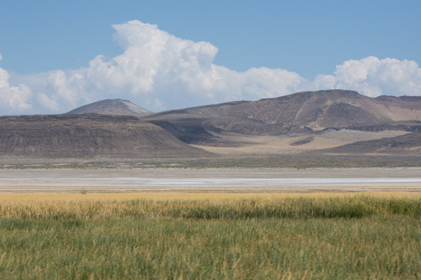
This site is part of the Sand Mountain Recreation area managed by BLM, featuring 3-1/2 mile long Sand Mountain.
This is a popular OHV destination.
Continuing on through Nevada.
We stopped at this Petroglyph site…
…and walked the trail to find some of the petroglyphs.
It was late in the day when we drove into Ely, Nevada. This open pit copper mine is west of Ely. We found a place to camp in the mountains just west of town.
If you’re just tuning in you can see Days 1 and 2 here.
I woke up in time to see the sunrise at Great Basin National Park.
Here is another view of our campsite.
The only paved road in the park winds up to the trailhead to Wheeler Peak (13,063′ elevation). We didn’t plan on hiking all the way to the peak but hiked to the lakes at the base. The hiking is all above 10,000′.
Stella Lake is the first of two lakes along this trail.
This doe posed nicely for the camera.
This sign indicates that we were about a mile from the trailhead where we started on this loop trail. However, there were signs that said the area was closed due to ongoing work. In fact, the road had been blocked before we got to the end and we’d parked lower than we first planned. Law-abiding citizens that we are, we didn’t take this trail back but took another fork and ended up back-tracking over most of the way we had already walked.
That just meant that we got to spend more time in this gorgeous area and put in about 6 miles that morning.
I’m always the one taking photos. Dan took this one so that I could prove I was there. Funny story, and maybe an example of things to come on this trip–there were two large trucks in this parking lot waiting to get past the gate that is just to the left of those porta-potties. They were full of rock or gravel or whatever they were using for the road surface. However the gate was locked and no one had a key. The drivers were trying to find the right tools to take the gate apart. I figured that one of the trucks could have just rammed the gate (being just a pipe) and driven through, but I wasn’t going to suggest that. We were able to move our truck around to get between the two big ones, but then the traffic was stopped on the way down until the pilot car that was with these trucks could make it down the mountain. So these was the first delay of the trip.
We planned to go to the visitor center and maybe see the Lehman Caves.
We spent a little time at the Visitor Center and I made a point of finding these Tempestry panels, knit by my friend, Lisa. They depict the daily high temperature for a given year and location, in this case 1916 and 2016 here at the park. You can find out more about the Tempestry Project here. This is the same idea I use in my Year to Remember blankets
This was Thursday afternoon and we needed to be in Trinidad Colorado by Friday afternoon. We didn’t have time to take a cave tour, so we’ll have to go back.
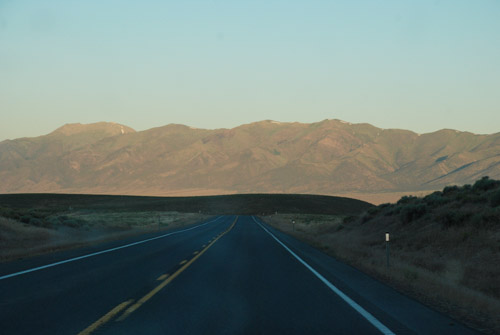
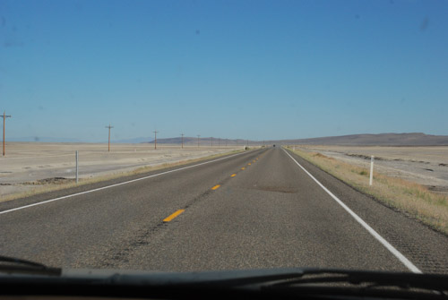
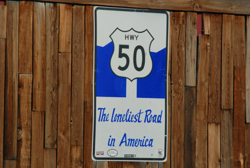
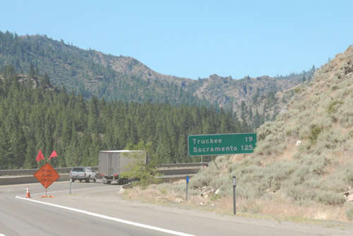
We took Highway 50 across Utah. This highway is known as “The Loneliest Road in America”, at least in Nevada. It gets a bad rap because it can be desolate, but this area in Utah known as the San Rafael Swell is stunning. (Click on one of the photos to enlarge and scan through them.)
We were somewhere west of Green River when the traffic stopped. We spent about two hours in stop and go traffic, mostly stopped, with no where to pull off. A friend (the afore-mentioned Lisa) and I were texting at the time and she found a a clue to what was going on–there had been a police chase that ended in a fatality.
Later I searched for myself and found a local news report that confirmed a chase that followed an attempt at a traffic stop. The driver passed into the median and eventually wrecked the car killing himself and another person. By the time we got to this area where we’d be able to get to an offramp our truck indicators showed that it was overheating.
We finally got to the exit and were able to let the truck cool down. Fortunately it hadn’t caused damage.
We headed south towards Moab as the sun was setting.
Not long after we turned south two sheriff trucks passed with lights and sirens. One of them weaved back and forth, stopping traffic. We were the first vehicle behind the trucks. The deputy told us that there was a pursuit in progress and, if the vehicle being pursued hit their trucks, then we should “get out of here”. That was a little nerve wracking, especially after the last episode and seeing these cops with guns drawn. Eventually the car drove past in the northbound lane with at least a dozen cop cars following. The car was being driven on rims–there must have been a spike strip that the driver ignored. All those vehicles went by and then these two turned around and followed It seems as though for the next hour we continued to see law enforcement vehicles going that direction. I never did find out what that chase was about.
These stories are not the most significant ones of our trip, but the situations pop to the top when we think about the day.
We drove south on Hwy. 491 and into Colorado and then turned east on 160. I followed the big map book and found where the highway was bordered on both sides by USFS land. There were some roads shown on the map where we could get off of the main highway. We didn’t need a campground as long as we had a safe place to pull off. We were in the San Juan National Forest and found a road that turned north. We found a spot where we could pull off that road. I think we were still eating bagels and bagged salad that we brought from home. That was dinner. We rolled out the sleeping bags in the truck and went to bed.
Finally…another Road Trip. The last real trip Dan and I made was in 2019. Yes, we drove to Estes Park last year, but it’s not the same when you have a trailer full of sheep and can’t stop to play along the way. This trip was planned to coincide with the opening night of an art show in Trinidad, Colorado, but I’ll get to that in a later post.
I drove my granddaughter to the airport Tuesday morning (July 30), and we were finally packed and ready to go by about 5:30 that evening. How do we get away when there are all these sheep to take care of? Thanks go to Farm Club members who were able to spend two to three days each to take care of sheep, the garden, and of course, Ginny.
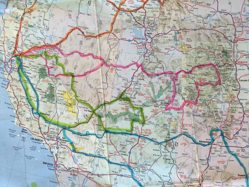
We have our phones, but I sure like to follow along with real maps. We can find a lot of interesting details along the way, figure out USFS lands where we can camp, and get a broader overview of an area. Then I use my phone to look up odd place names and read background info as we travel.
Some of my photos will be “drive-by” where there are plenty of windshield splotches visible. I haven’t been in the higher Sierras lately. I don’t think I’d seen this devastation from some of the fires over the last couple years. I think this was from the 2021 Caldor Fire that burned in the El Dorado National Forest and beyond. There were miles of devestation.
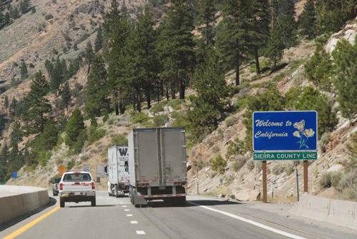
We drove east on Hwy. 50 and turned south towards Markleeville and then Hwy 395 on the east side of the Sierras. It was dark by the time we were near Mono Lake where we decided to spend the night. We got gas ($6+/gallon) as the last station was closing in the nearest town. Then we found a place to park the truck and camp.
This photo is from the next morning. Our style of camping is to bed down on the platform Dan made in the back of the truck. I sleep on a foam pad and a sheepskin and am almost as comfortable as in a real bed.
It’s hard to imagine that this was once part of the lake. The sign in the next photo says that in 1994 the State Water Resources Control Board set a target level of 6392′ which is 25′ below the lake level in 1941.That decision decreased diversions by Los Angeles from four Mono Lake tributaries.
I don’t know how much progress has been made but there is still a long way to go, The mandated level of the lake will be at the base of these signs
We walked down the board walk to the lake edge.
From The Geology and History of Mono Lake: “Along the southern shoreline of Mono Lake, large tufa towers or pinnacles rise above the water’s surface. These iconic pillars, comprised of precipitated calcium carbonate, formed over thousands of years by the interaction of freshwater springs and the highly alkaline waters of Mono Lake.” This website also says that when the water diversions were stopped in 1994 the lake was at about half the water volume and twice the salinity of what it was before the water diversions began.
Mono LakeMono Lake
After exploring a bit of the lake edge we got on the road. We planned to camp at Great Basin National Park, on the eastern edge of Nevada, Wednesday night.
We have always wondered about the Clown Motel which we discovered on a trip through Tonapah when we made a decision to NOT stay there and try another. It is even more clown-themed now than I remember it from before. I just looked it up and found that in 2019 it was purchased by someone who embraced that theme and has modernized the motel. I read more and found that there is a history to the clown theme. You can see that here if it intrigues you.
We made it to Great Basin National Park by about 5 p.m.
I needed to get out of the truck and get some exercise. After we chose a campsite I followed a trail along the nearby stream about a mile and a half. We didn’t see any warnings about bears, but I started thinking about them and wondered if hiking by myself near dusk was a good idea, especially with the recent fatality in CA by a mountain lion. The only bear encounters we have had were at Grand Tetons and Yellowstone, but maybe it’s the older I get the more I know that sometimes things go wrong. I decided to turn around. I still enjoyed the beautiful scenery.
A week ago today we started the drive to Colorado for the Estes Park Wool Market and the JSBA AGM (Jacob Sheep Breeders Association Annual General Meeting–that’s why it’s easier to use acronyms). I just looked up acronym and JSBA is one when we say it “Jazba”, but AGM is an initialism. Just thought you might want to know that.
We got on the road at 8:30 with a trailer full of sheep.
Turbo, the yearling ram, was up front. A yearling ewe, Quince, with a single lamb and a two-year-old ewe, Quora, and her twins were on the left. The right compartment held 3 ewe lambs and 3 ram lambs. They were bigger than the lambs on the left who were still nursing.
We always bring our map books along, but there wasn’t going to be any National Park time on this trip.
Dan did all the driving. He likes to drive. I entertained myself in a variety of ways, often with my phone. We’re still seeing snow in the Sierras.
I haven’t been through the Sierras on I-80 in years. I think the flumes that follow the canyon are so interesting. And look at the water pouring out of this one.
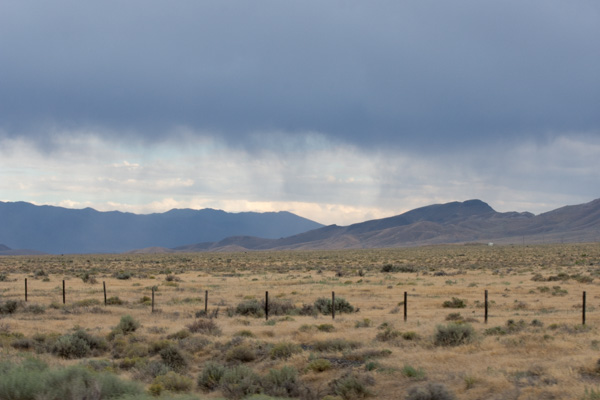
Nevada landscape. We were amazed at how green it was.
There are lots of “drive-by” scenery photos. As great as the iPhone is for photos, when zoomed in it can leave something to be desired. I left my regular camera home because I couldn’t find the battery charger and both batteries were almost dead.
More green landscape in Nevada. Amazing!
I think this is still Nevada, but I didn’t keep notes. Of course I assumed that I would remember. The photo info shows it was taken about 5:20. I guess I could do the math to figure out where we were.
I know this is Utah because that is the Great Salt Lake. At this point it was 7:20 p.m.
This was taken from a gas station in Lake Point, Utah, just past the Salt Lake.
It was at this gas station that I watered and fed the sheep. We stayed in one spot for about a half hour to give the sheep a chance to eat. Then back on the road.
I was keeping track of miles, mileage, etc. We were dismayed to calculate after this gas stop that we were only getting 10.2 mpg. We’d had 12.6 from home to Loveland and 11.6 from Loveland to Elko. Pulling a loaded trailer, at elevation, and up hills is bad enough, but fighting a headwind made the mileage worse.
We drove into Wyoming. I say “we”. Dan drove into Wyoming and eventually had to stop. We stopped at a rest stop abour 2 a.m. and I gave the sheep a little more hay. I can’t say that we stretched out in the cab of the truck because there really wasn’t room to stretch out, but we covered up with our wool blankets and slept as best we could. I got out my ipad and finished editing the minutes of Tuesday night’s Artery meeting so I could send it when I had wifi. Then I slept.
I frantically got ready for this trip that I had been thinking about for six months.
This is why we were able to take a road trip in mid-August. It is finally sinking in for Dan that he isn’t going back after a summer break.
We still weren’t ready on Wednesday, the day of departure. I had told Dan that we WERE LEAVING IN THE MORNING. We did, but it was almost noon before we drove out of the driveway. The plan was to drive as far as we could, not stopping at all of the California and Oregon trail markers like we usually do because we wanted more time at the other end of the trip. For that reason and because I was not the driver-in-charge I have a lot of “drive-by” photos. Many were deleted but some are OK and those are what I’ll share.
We were driving I-80. I love the scenery of the west, even in the Nevada desert. This is the Hot Springs Mountains that rise above the Fernley Sink.
According to Wikipedia, an irrigation system was constructed in the early to mid-1900s and “a drainage system was also constructed to carry away excess water and mineral salts from the farmlands. This system consists of channels (5 to 15 feet deep) dug adjacent to fields; it eventually terminates in the sink northeast of Fernley.”
We didn’t stop at all the roadside points of interest but this was at a rest stop. Throughout this trip we thought about the pioneer trails. They are well marked in the road atlases that we have for each state and along the highways. I can’t even imagine what it would have been like to pack up the family and head west in the way that the pioneers did. We drove through the 40-mile desert in a little over 1/2 hour.
The mountains east of Valmy, Nevada.
We remember Valmy for it’s rest stop where we slept on one of our road trips a couple of years ago when there was a tremendous moth invasion. We didn’t need to stop to sleep here this time. Still daylight.
Humboldt Range, southeast of Wells, Nevada.
These photos were looking back west as the sunset.
I had to lean over the seat and reach behind Dan while holding and pointing the phone and the camera in the general direction.
Even though it was getting dark we weren’t ready to stop. If we had left earlier in the day we would made it to Salt Lake City. So Dan kept driving. There is a distinct difference in the town of West Wendover (NV) and Wendover (UT). Bright flashing (gaudy) lights and Last Chance To Gamble on one side of the border and dark and “normal” on the other side. Dan kept driving. We passed through the Great Salt Lake Desert in the dark and finally stopped at a rest stop at the east side of the salt flats.
Those of you who read my blog know that I have written a sort of travel journal with photos each year for the past several years when we have made our annual road trips. I have no idea how many people actually read these, but I write these blog posts because they substitute for the old scrapbooks and photo albums that I was never able to keep up with. I also like reviewing the photos and looking up some of the information that I may have forgotten. It helps me keep it all organized in my brain. If you are one of the regular readers, I’d love to know about it. Stay tuned for Day 2.
In the last post I wrote that we drove until dark and then kept going. We didn’t have a plan about where we’d stop and Dan just kept driving. (By the way, when I say that “we” drove I mean that Dan drove and I rode. I used to offer to drive but I don’t bother anymore on our trips. Dan likes to do the driving and that’s fine with me, since I’d rather be watching the scenery and napping when I get tired.)
Eventually, somewhere in eastern Nevada, Dan got too sleepy and pulled over. We didn’t try to stretch out in the back of the truck but slept in the front. After an hour or two I got too cold and uncomfortable (and bothered by someone snoring) and switched places with Dan so I could drive. When I got too tired and pulled over we both slept awhile until he recovered enough to go on.
The view when I woke up next.
Have you noticed that the Open Range signs in many places have cattle that look like dairy cows? The Open Range signs in Nevada show what looks like bulls.
Even along Highway 50 in Nevada there are Points of Interest.
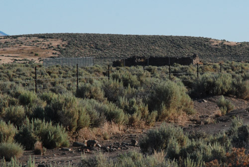
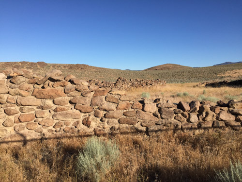
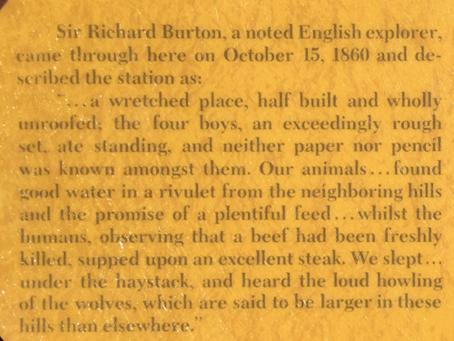
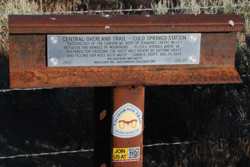
It’s hard to see in this photo but there are remnants of a stone building surrounded by cyclone fence. One of the signs at Cold Springs (between Austin and Fallon) described The Overland Stage Station: “Constructed using the volcanic lava rock found throughout the area, the Cold Springs Stage Station was built in 1861. The original Pony Express Station was built 1-1/2 miles to the east of here in 1860. When the stage station was erected the Pony Express moved its operation to this building…Life at Cold Springs was not for the timid. The 2 to 3 man station crew endured the barest, leanest forms of living. They ate, lived, and slept in this crude structure for months at a time. Floors, when dry, were dirt and when wet, they were mud. Sanitary facilities were primitive. The handmade furniture was crude and utilitarian at best. There were no luxuries, only the necessities of life: food, water, and a firearm for protection.”
Additional signs explained the quick progression of communication and transportation milestones that occurred here between 1860 and 1927–the Pony Express in 1860, then the Overland Stage in 1861, telegraph in 1861, (dooming the Pony Express), and eventually the creation of Highway 50.
Here is one more sign. This one is provided by Trails West whose “primary activity is installing, and maintaining, distinctive steel-rail “T” markers along the many emigrant trails leading to California and publishing guide books to enable anyone to follow these trails from beginning to end.” They have placed over 600 markers along 2000 miles of trails.
Putting my iPhone in my pocket it took this photo.
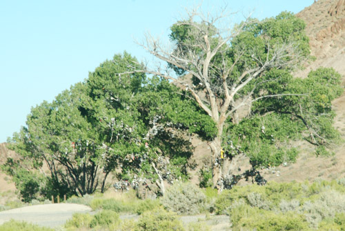
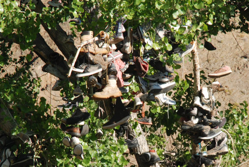
Way back in this post I mentioned a Shoe Tree. Here is another west of Cold Springs. This one is even marked in our map book and described in this internet article.
Not to be a spoil-sport, but I’m not a big fan. Sure, it is a curiosity and, in this case, a landmark, but I think I’d rather just admire a nice tree growing in the desert. To me it brings to mind the question is graffiti artwork or vandalism?
Sand Mountain is a 2-mile long, 6oo’ high sand dune that is 20 miles east of Fallon and is the site of another Pony Express Station.
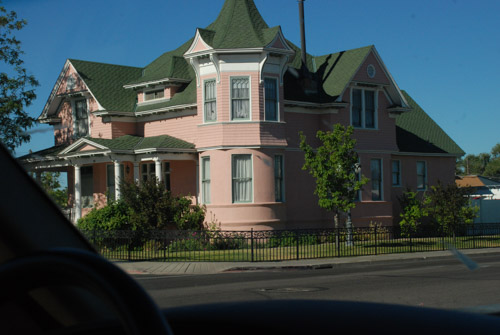
Impressive house in Fallon…
..and an auto repair shop featuring a NAVY jet out front (representing Fallon Naval Air Station).
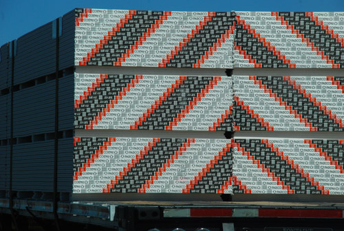
Seen on the highway and reminiscent of a twill pattern in weaving.
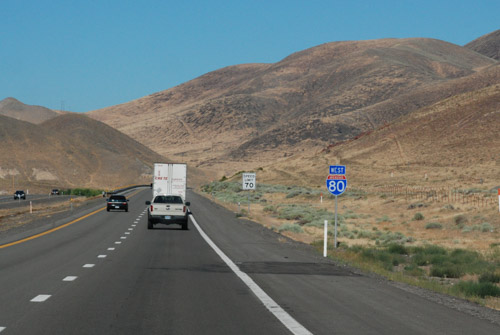
Just past Fallon, we left Highway 50, as it headed southwest, to get on I-80 toward Reno…