Irrigation, Part 2

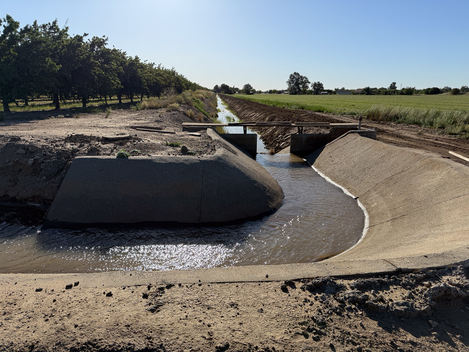
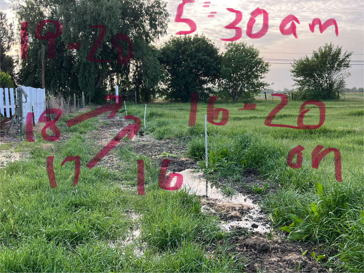
I left the last post knowing that the irrigation would not be finished by the time the water was shut off Tuesday afternoon. I was able to have the water start again at 6 a.m. I waited for the ditch and pipeline to fill again and went out about 7:30 a.m.

I could tell right away that there was more water flowing in–it had already progressed farther down the checks where the valves were still open than the previous day. The following are the notes I took on my phone that morning. The numbers refer to how far down the field the water is for each check.

7:45 a.m.
13 is 1/2, 14 and 15 are 2/3, 16 is 1/4, 17 and 18 are 2/3, 19 is 1/2
9:20 a.m. 13 and 14 almost finished. 15 over 3/4. 16 is 2/3. 17 and 18 are over 3/4. 19 is 3/4. 20 is 2/3
9:40 a.m. 13 finished. Closed. Opened 21 and 6-7-8
I had to go to Davis and didn’t get back until 12:30
12:30 p.m. 15-16-17-18-19-20 finished. 21 is close to end.
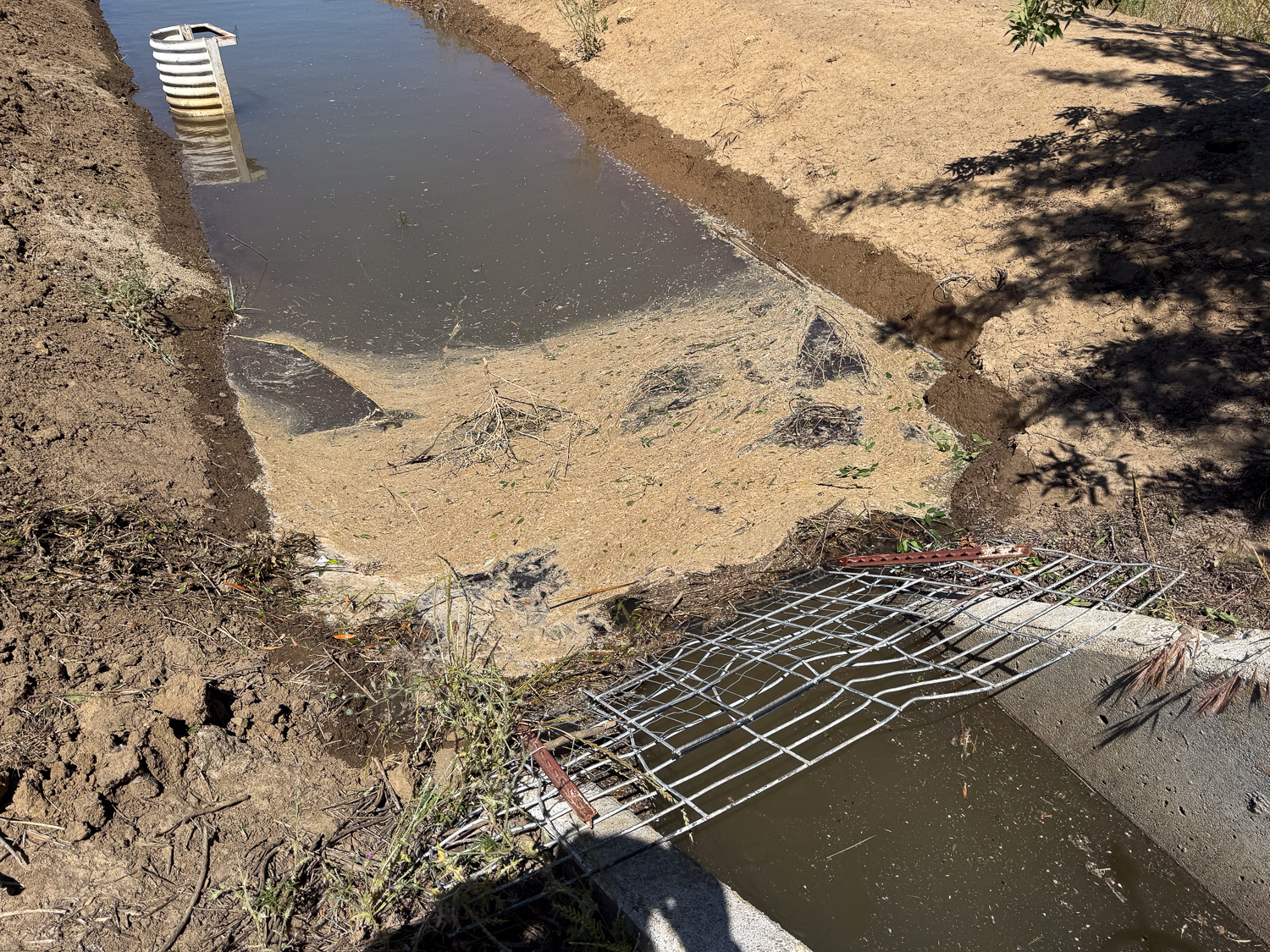
Now only 21 and 6-7-8 were on. Closed 8. 7 is 1/2. 6 is 3/4. Both of these were flowing backwards into the lane a lot. 

The last note is about 21, 6, 7, and 8. Valve 21 was the last one I opened. I had closed 6, 7, and 8 because the water wasn’t flowing enough there and I wanted to make sure all the rest got enough water. It was only after the water was flowing so well and everything else was finished I opened those again.

Close up of pasture clover and grasses with irrigation water on the field.

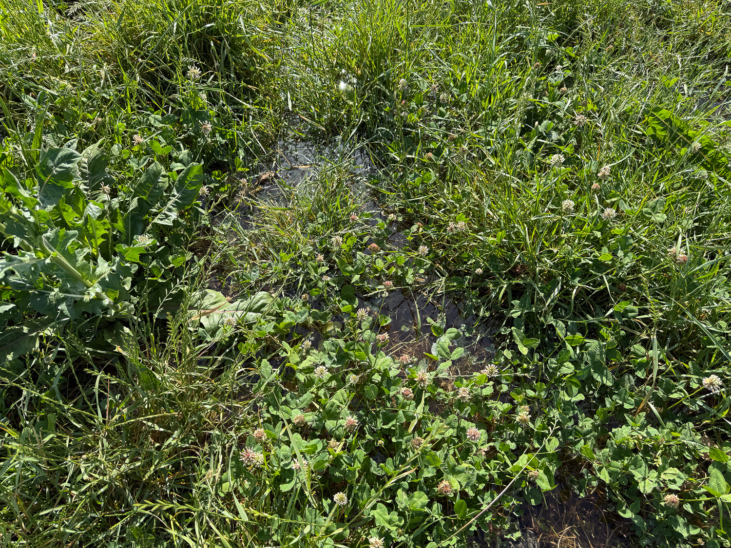
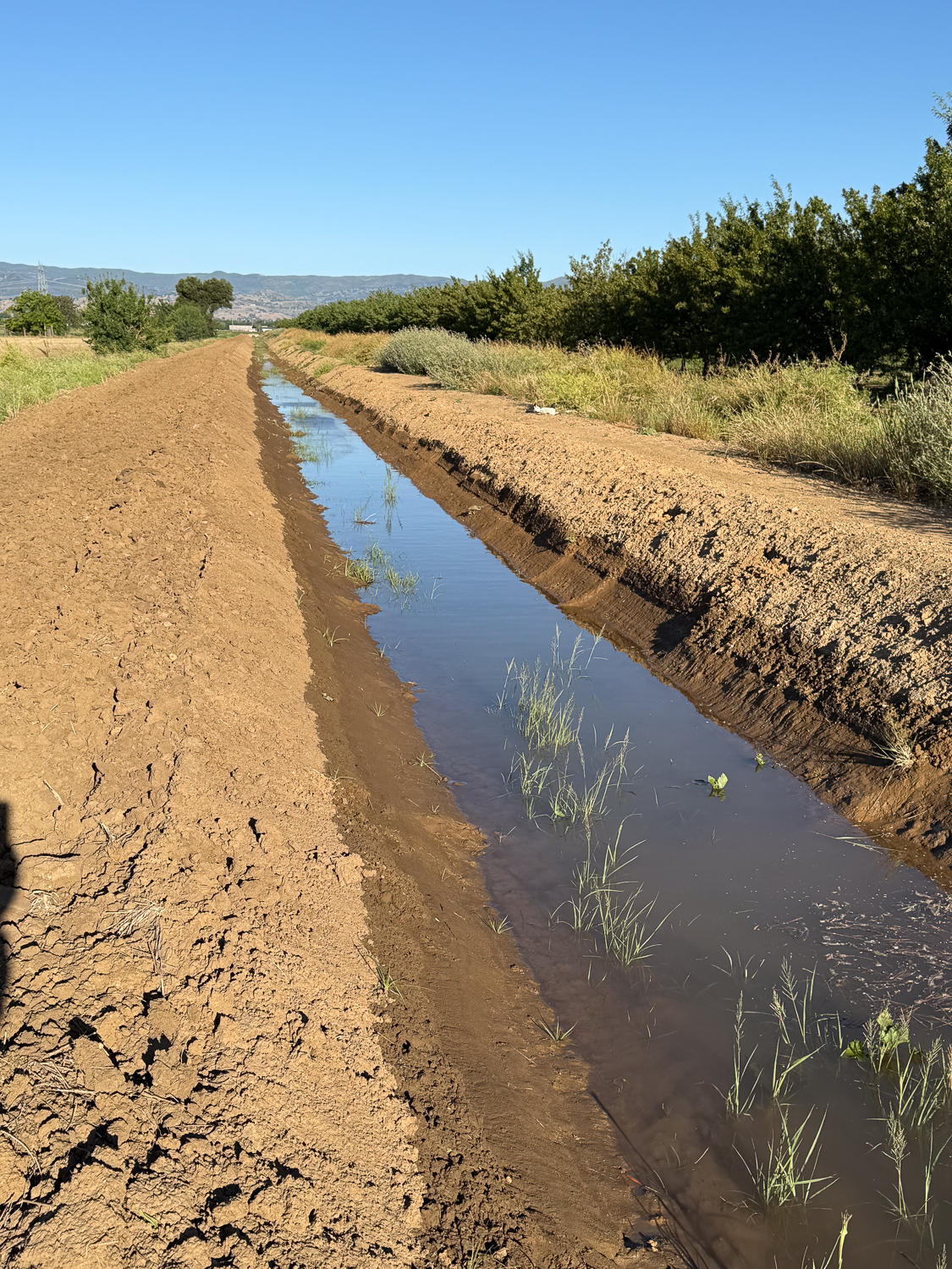
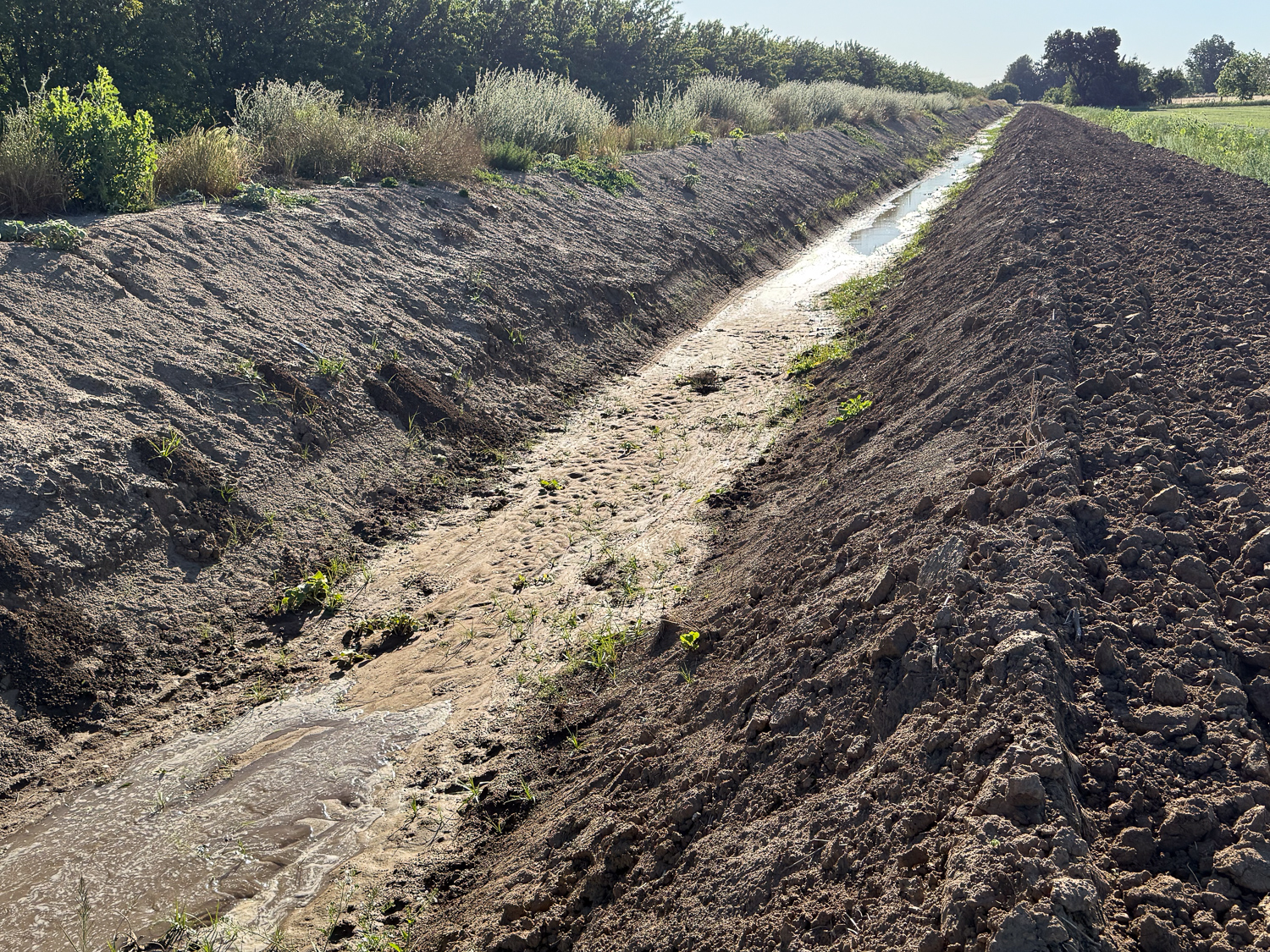
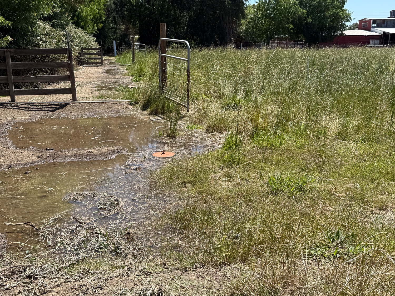
I took this photo in a place where I could actually see the water. Many times I can’t see it because the forage is so thick or tall. In that case I can tell if it’s wet because I can hear the water splashing where I’m walking. I recorded a video to share that, but I can’t upload it here.

Soil moisture monitor in the pasture.

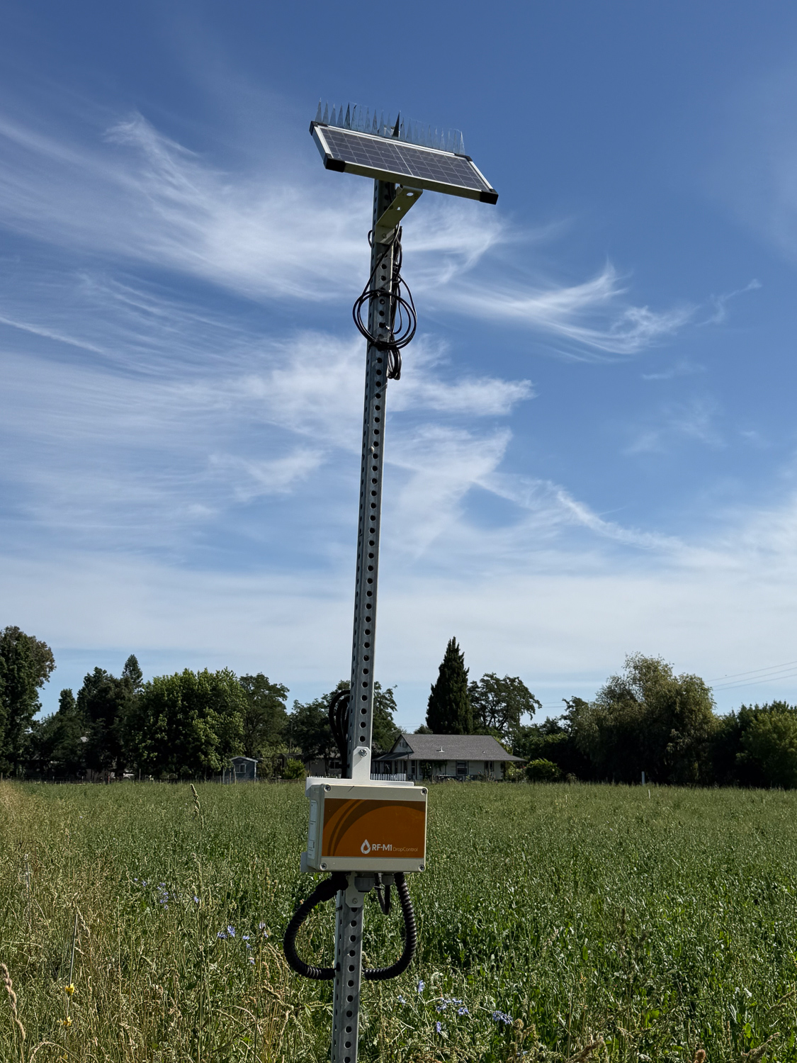
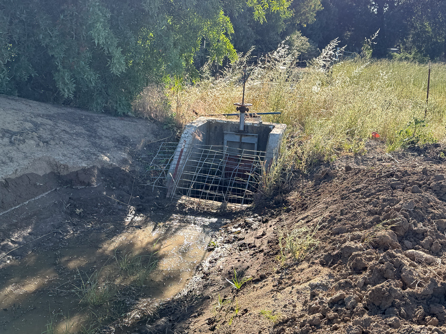
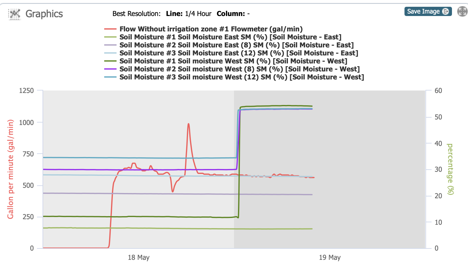
This is what the soil moisture sensor looks like. I get the graph on my computer or my phone.

Irrigation valve with water flowing down the lane behind it.

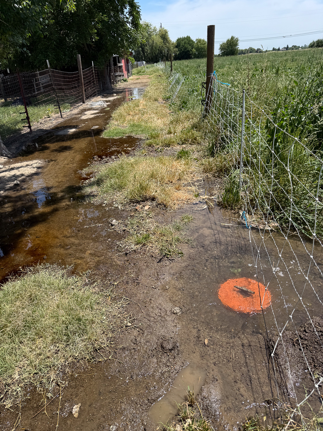
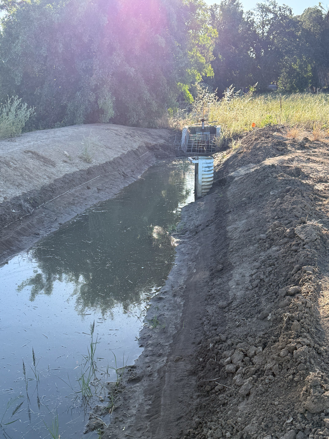
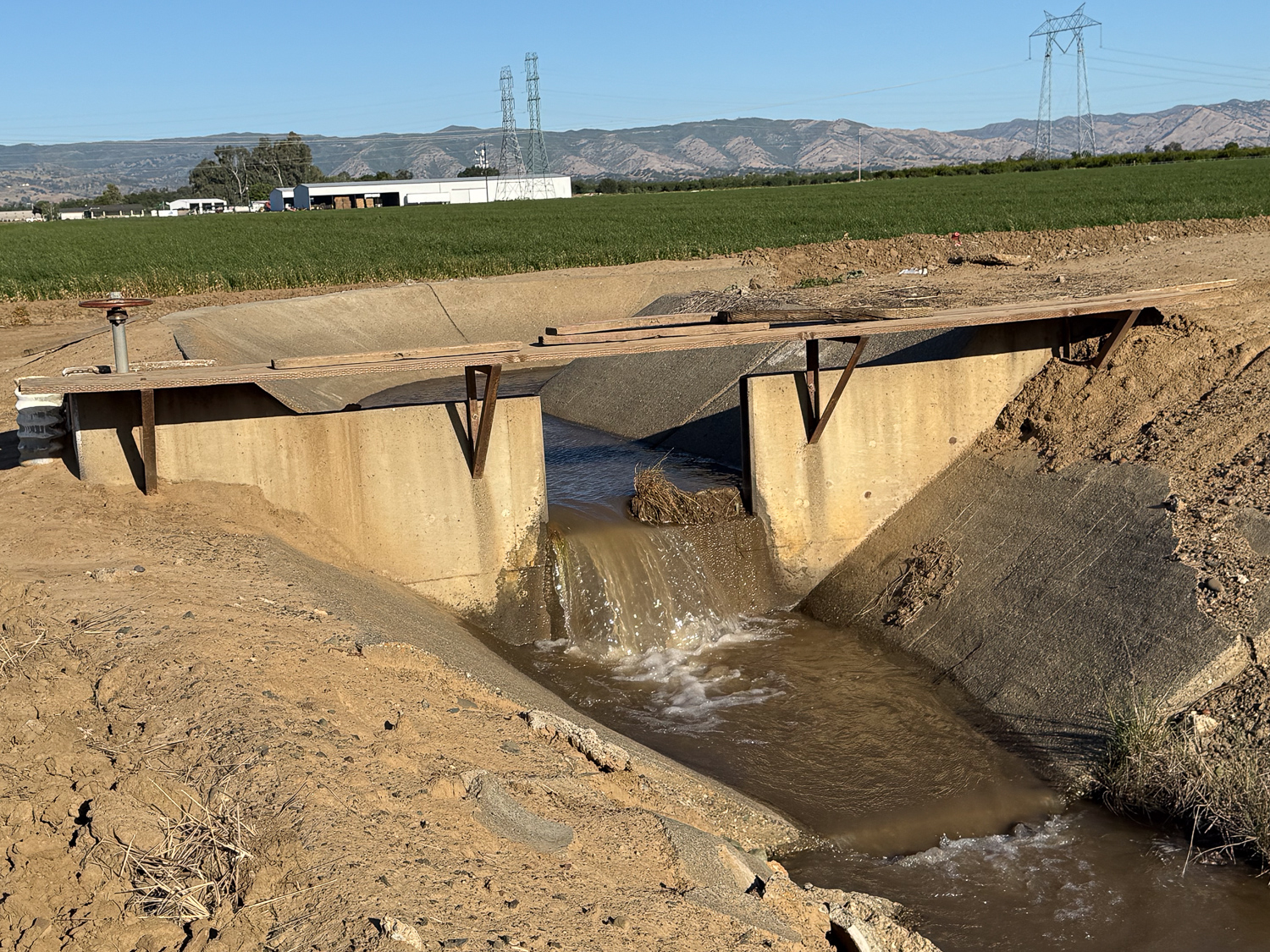
This is what I meant by #7 and #8 flowing backwards. It took only a couple of minutes for the lane to be flooded. Before we irrigate next time we’ll have to pile dirt around those valves.

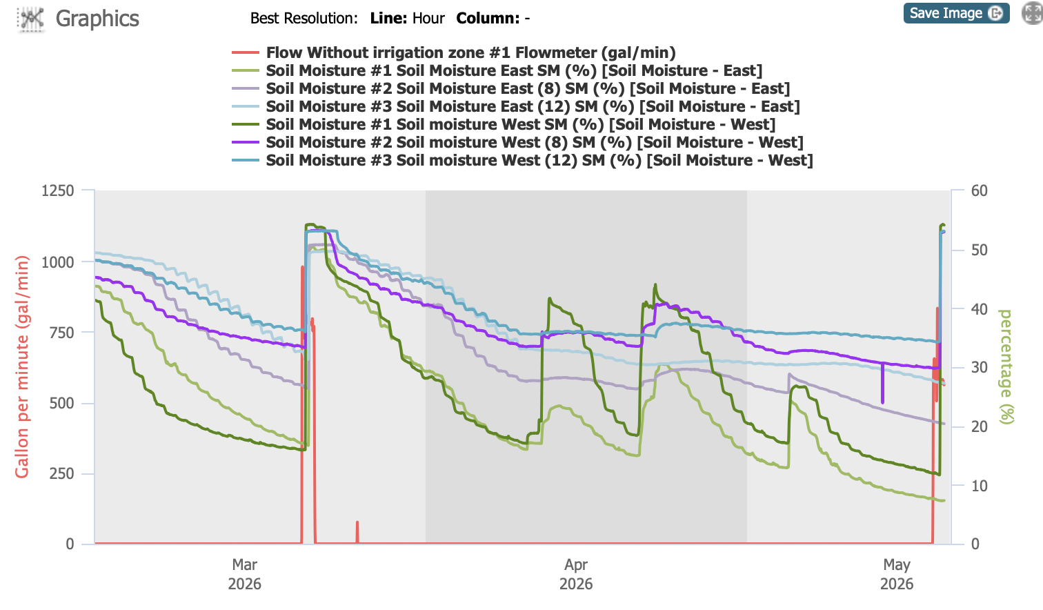
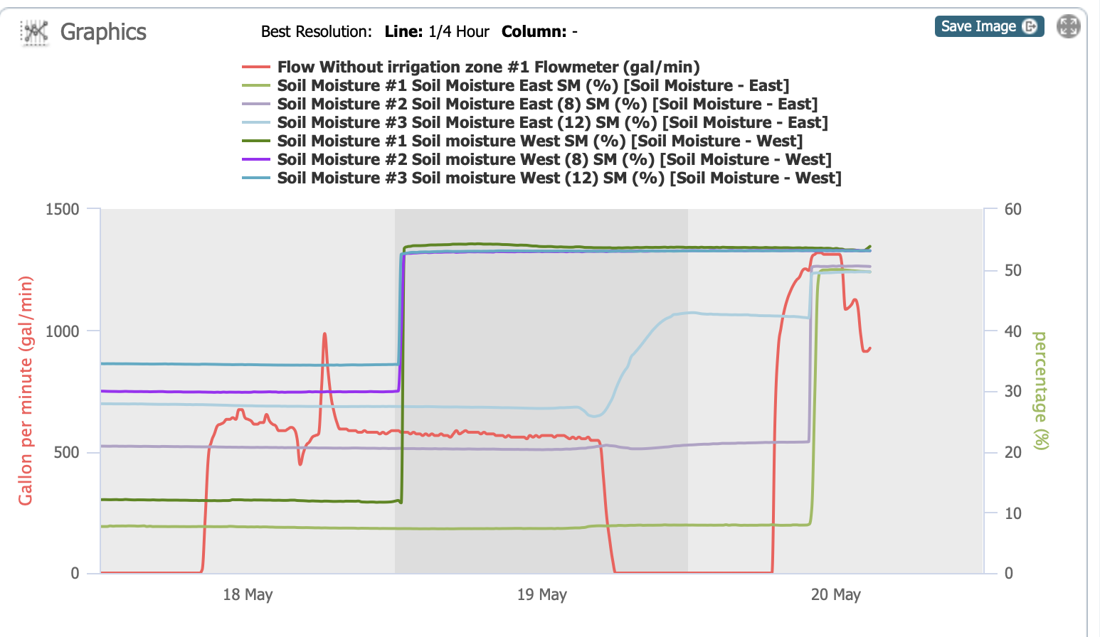
The red line on the graph below shows that the amount of water was more than twice what I had the previous day. It also shows that the other soil moisture sensor finally measured water. I see an anomaly–that faint blue line that rises as the water is shut off the first time. I think the timing is coincidence, but it shows underground flow that activates that 12″ deep sensor on the east. Flowing through gopher holes?

There is a lot to think about before the next irrigation.

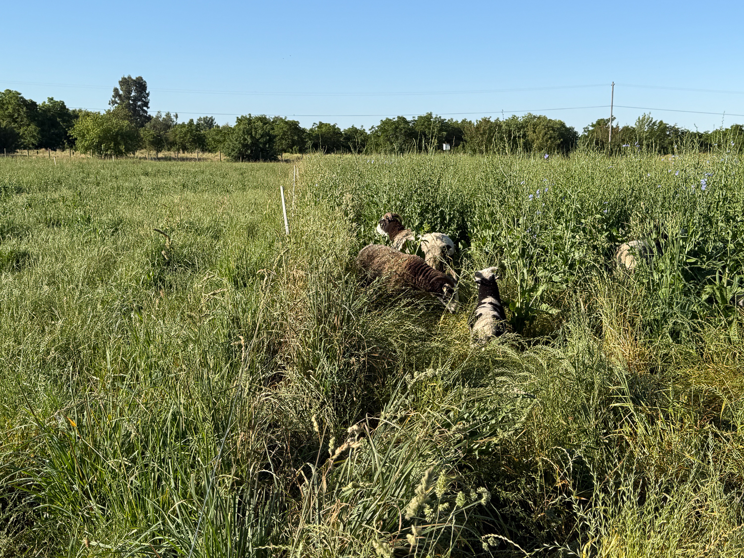
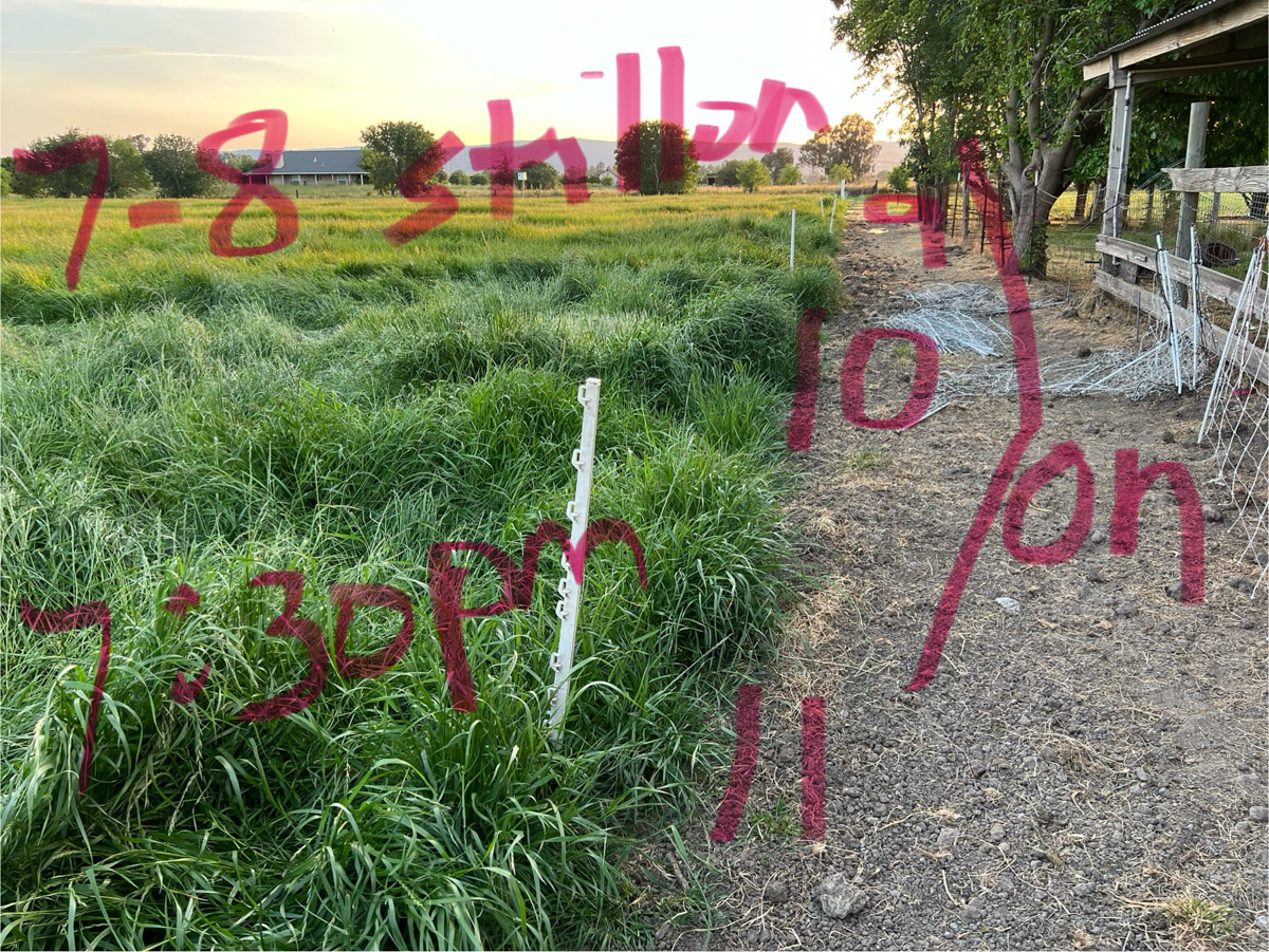
I turned the sheep out this morning. The paddock on the left was last grazed May 1. The sheep moved to the north paddocks after that and then moved from west to east. The one on the right hadn’t been grazed since March 29. The whole flock is out there, but you can’t see them because they are in a jungle of chicory.

Irrigating

In the Sacramento Valley it rains in the winter (hopefully) and is dry in the summer. Without irrigation the landscape would be brown. So irrigation is a necessary task throughout the summer. March was so dry this year that the irrigation district filled the canals and started the season earlier than usual. We irrigated March 20. There was some rain in April, but at this point in mid-May we were overdue for getting water on the field.

Graph that shows water levels in the pasture.

Part of the pasture renovation project (thanks to NRCS–search for Pasture Renovation here to see all the posts) was installation of two soil moisture sensors. This chart indicates measurements at 3 depths on a sensor in the south west (in bold colors) and one towards the east (lighter colors). They indicate soil moisture levels at 4″ (green), 8″ (purple) and 12″ (blue). The red line indicates flow through the irrigation system. All soil moisture levels were high after February precipitation, but you can see how the 4″ content drops fairly quickly and then responds to rain events. By this time in May it was very low and the 8″ readings were getting low as well.

The goal is to measure soil moisture in the root zone and use that to plan irrigation. We’re still learning to use it appropriately. If we irrigate too frequently we run the risk of running out of our water allotment by the end of the season, and who knows how long the dry season will last.

Irrigation ditch with trees on the right and dirt on the left.

This photo is the view looking west from just beyond the corner of our property. The water in the canal is leftover discharge from irrigation further up.

Irrigation ditch with some and trees and grass at the end.

Turning around, this is where the water enters our property. The half pipe on the right is an outlet for the discharge water so that it runs under the dirt road and into canal that goes south along the west edge of our pasture. When we irrigate we block that pipe off with boards to keep the water flowing west.

Cement-lined Irrigation canal.

I walked up that road to the west and then turned north to get to this point where the water is released from a bigger canal. The water goes south until it gets to a bend…

Cement-lined irrigation canal with water.

…where the canal turns east. This canal is mostly dirt, but the corners are concrete.

This is the other view of that canal

Dirt irrigation ditch with water beginning to flow.

Here is the water I asked for flowing down the canal (lower left) where it will meet up with the water that was already there but not flowing into our field.

When the water gets here it will start to fill our pipeline.

I came out a few times to clear debris away from the inlet. Before we put this screen up there were issues with larger weeds and branches impeding the flow into our system.

This shows the valves across the north pasture after the water started yesterday. I was out here many times yesterday to monitor how far the water had gone. It was much slower than the last time, probably because it is so dry and it takes more water to fully soak the soil. That March irrigation took only 24 hours for the whole place. We started yesterday about 8 a.m., and I didn’t finish this field until evening. I started the south pasture around 7 p.m. and went out to monitor it at 9 p.m., midnight, and 4 a.m. I already extended this as much as I could for today, but it won’t get everything irrigated.

Here’s the graph now showing that the moisture sensor on the west has been activated, but not the east one so far. This feels like a FAIL. We’ll need to get that water flowing again, but you can see it’s not as simple as turning on a faucet.

Grazing and Irrigation 6 – April 29-30

There were more photos for April 29, the first day of irrigation with the new system. I started this story this morning. To continue:

I needed a strategy to keep track of what I was doing. This was partly because the ryegrass was so tall I couldn’t even find the valves at first. Then I wanted to remember what I had opened and closed and be able to tell Dan how it was going. I decided to write on my photos. By the way, there are 7 valves across the north end of the north field near the blackberries. This photo shows the south end of that north field and the top of the lower pasture. There is a pipeline all the way across this one from west to east.

So this photo shows that at 5:30 p.m. there was water all the way down the north pasture and I had opened the first 6 earlier. At this time #1 on this field was finished and I turned #7 and #8 on.

At 7:30 p.m. this is the status. I opened 9, 10, and 11.

At 8 p.m. I opened 12, 13, 14, and 15.

I had been marking the valves with the white plastic stakes. Now I don’t remember if the sideways posts indicated On or Off.

At 5:30 a.m. the next morning I closed #7-15 and opened all the rest.

This shows the last valves, #16-20.

At 7:30 I noted that #20 was finished.

This is how I figured out that I could report back to Dan what was going on. I think I can make sense of this photo now. There was water 100′ from the south border in #17, 90′ in #18, and 50′ in #19.

I’ll be doing this all over again in the morning and I think maybe I should number these in the opposite direction. If I am at the house or barn and “read” from left to right then Check #1 should be on my left (the one next to the road). I guess I’ll figure that out tomorrow. Maybe I need to paint numbers on the south border posts so I can keep track of where I am.