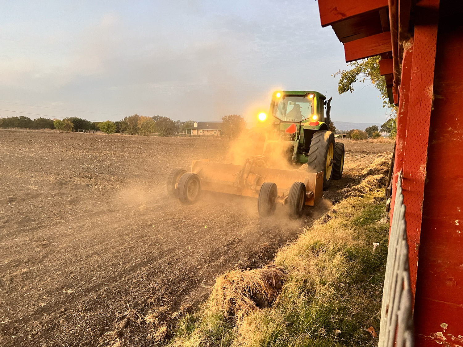
Today’s Random Farm Photos

This seems to be a recurrent theme now. There are a lot of moving parts. Maybe I should call this A Day on the Farm.

Truck dumping a load of sand.

Dan ordered a load of sand. It’s hard to imagine right now, but when we get a lot of rain all at once, the water gets ankle deep here. Dan is thinking ahead.

Water flowing out of orange valve in green pasture.

I am irrigating today. We asked for water for 24 hours so we need to get the whole pasture irrigated in that time. I am still figuring out the best way to manage this with the Goldilocks plan (not too much and not too little). Last time it worked and I hope I have it right this time as well. So my main task today is to continue to check water and open and close valves as necessary. There are 28 valves along the pipeline.

View into a green barrel with frothy liquid inside.

I am working on a variety of other things between checking the pasture. This is the look into a barrel that holds some heads from the latest harvest day about ten days ago. We’ve had some very hot weather and that should hasten the progress on these skulls. It’s very disgusting and, even more disgusting, those white things are maggots.

Two sheep skulls with horns that are not cleaned.

This is how the heads looked after I dumped the barrel. The horn sheaths on the smaller skull have loosened and are easy to get off. The big one went back in after I pulled off a lot of gunk. I can’t get those horn sheaths off yet, and I hope another week in the barrel will do the trick, but I sort of doubt it.

 Three sheep skulls with horns  and other small bones draining in a red tray.

These skulls just came out of a bucket with peroxide and water.

Bright white sheep skull with five horns.

This one has had further treatment. Now I have to get those horn sheaths back on. I wonder if I overdid the cleaning process because that seam has separated more than I’d like.

Plastic bin and green plastic tub containing white fabric folded into different shapes arranged to fill the tubs. Photo shows dye canisters with labels.

In between irrigating and working on skulls I prepared another batch of bandanas for ice dyeing. Results in 24 hours.

Two dozen skeins of blue or blue-green yarn on a brown wooden background.

I also finally organized the latest skeins dyed in indigo. The earlier ones (on the left) are more blue while the rest have a blue-green cast. I don’t know if it’s due to time in the indigo bath or stage of growth of the plants or some other variable.

I’m preparing yarn for dyeing tomorrow, but realized that to dye with wolf lichen I don’t need to mordant. I weighed the lichen that I gathered off fallen branches on our last visit to the mountains and the wound three ounces of yarn to match the weight of lichen. The yarn and the lichen are in the pot now.

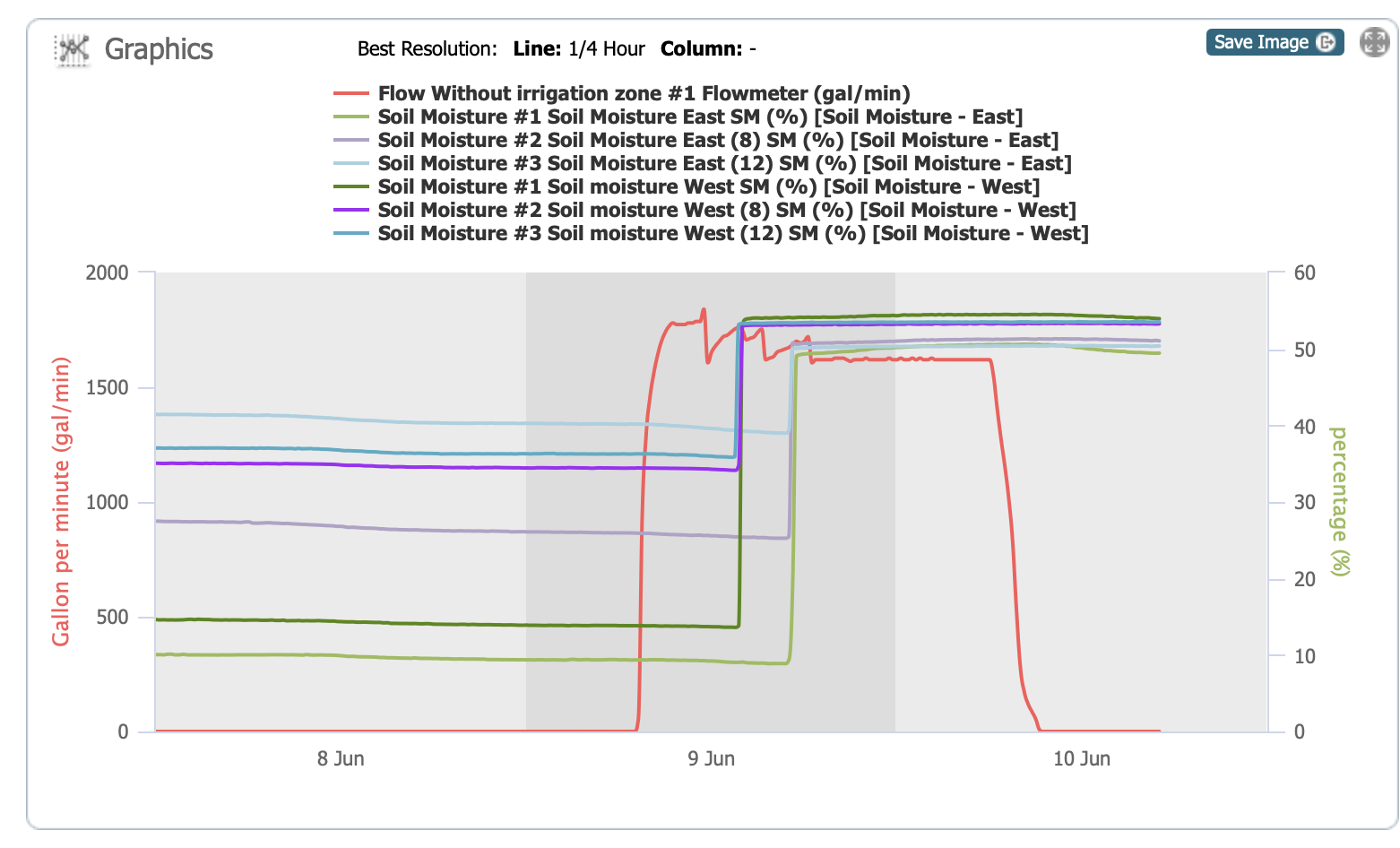
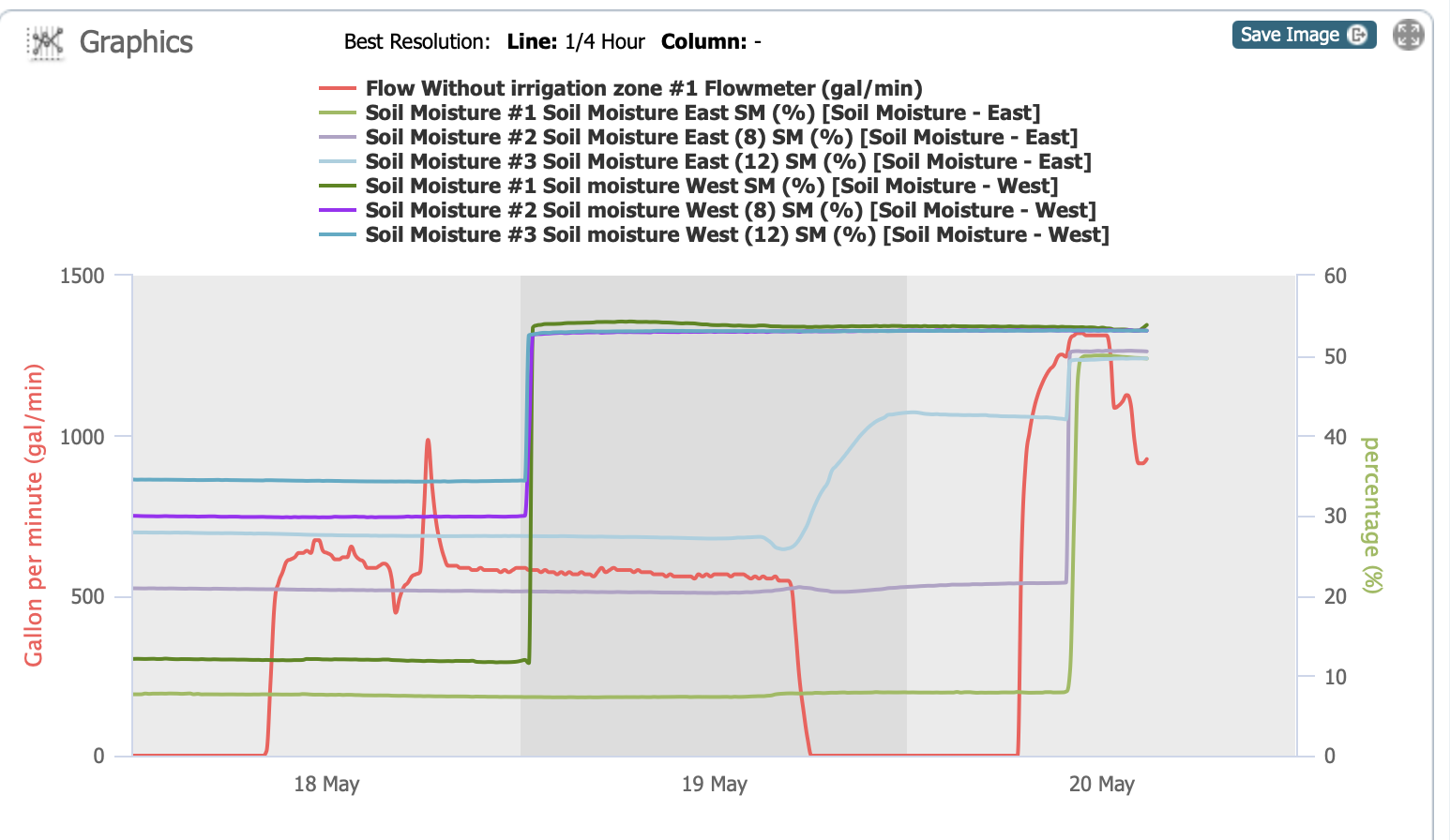
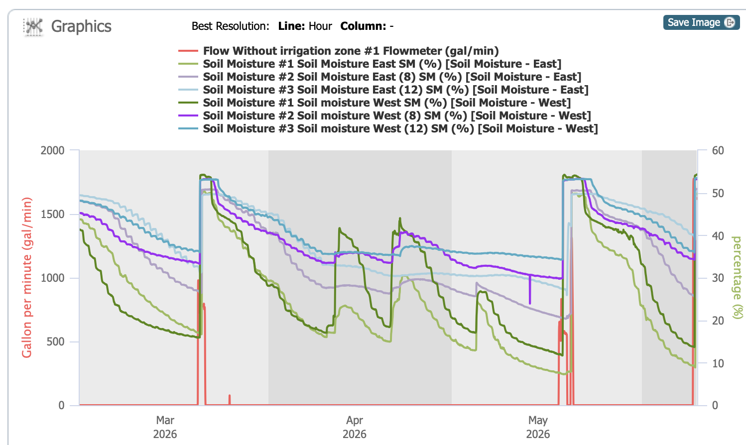
It’s 11:20 p.m. right now. I plan to check the water in about ten minutes, so I just looked at the readings from the soil moisture sensors. The red line shows the water flow onto our property. We were supposed to get it at about 10, but early in the morning I looked at the ditch that carries the water, and it was more full than when we order water. It was the “leftover” water from someone at the upper end of the canal and it runs out of an overflow pipe adjacent to our property. I wish I had known and could have opened our valves sooner. As it was I opened the valve at 6:30 a.m. and that’s when our meter picked it up. The water tender must have made a drastic change at 7 a.m. and we stopped getting that water, but the water we’re paying for followed at 11…so 12 hours ago. The blue, purple, and green lines are the soil moisture levels at 4″ (green), 8″ (purple), and 12″ (blue) at two different stations. The darker lines are from the west sensor and the lighter ones are the east sensor. This shows that it was about 5:30 when water reached the one on the west. It shows the east one is also wet, but it might be from the water accumulating at the south end of the field.

Time to go look at water and see what is really happening. Hopefully I can close some valves and open others and then not go back out until about 5 a.m.
Irrigating Again

It’s California’s Central Valley. If we don’t irrigate in the summer we have only dry grass. We used to try and irrigate every three weeks. Now we have the soil moisture sensors to help with the decision.

There are two sensors. The both show moisture at 4″(green), 8″(purple), and 12″ (blue) depths. The dark colors are the west sensor and the light colors are the one more towards the east. Red is water flow through the system when we irrigate. I’m showing three months for perspective. Notice the green lines rising (more on the west) in the middle of April. My records show 1″ of rain followed by 1.5″ about ten days later. I didn’t record the one in early May. So that amount of rain impacted the top layer of the soil, but doesn’t do much for the lowest level

It should rain in March, but it did not. When we irrigated in late March we had more water than we could use. We had asked for a certain time period and had to pay for that amount of water whether we needed it or not.

There are problems with too much water:
1. We are paying for what we don’t need.
2. Farms are given an allocation at the beginning of the season based on irrigated acreage. We don’t know what the weather will be like through the year. It was unusual for the irrigation district to fill the canals and offer water in March, but farmers needed the water. However, now that allocation has to last us until we get rain again.
3. Just as in your garden you don’t want plants to be underwater and flooded for too long.
4. Mosquitoes!

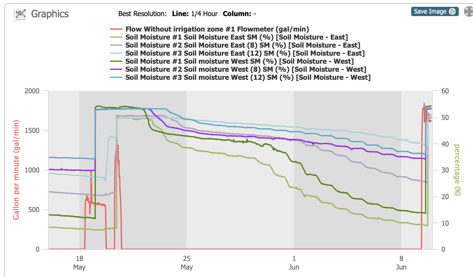
So when it came time to irrigate again, we had probably waited a little too long. We asked for the same amount of water (1-1/2 acre feet) but for less time. This is the story I told about that irrigation. Part 1.and Part 2. There was a big problem. It took all day to get across short checks on the north and we were able to get the water back in the pipeline two days later to finish and the water tender said he’d give us more. The graph below shows that sequence a little better. When you compare it to the graph above it looks as though the amount of water the sensor measures on May 18 is less than for the March irrigation, but I’m surprised that it made that much difference.

So here we are three weeks later. Look at the green lines on that graph. We asked for 2′ of water for about 28 hours.

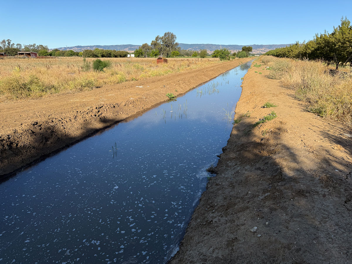
This is the canal that flows into our system.

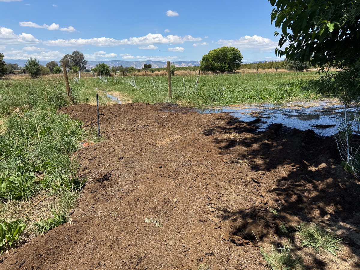
This is where Dan had added tractor loads of compost to the lane at the south end of #7 North. That has seemed to be a low spot, the water from the north stays there, and the valve for the south part (you can barely see it where the black plastic post is) flows backwards into the low spot.

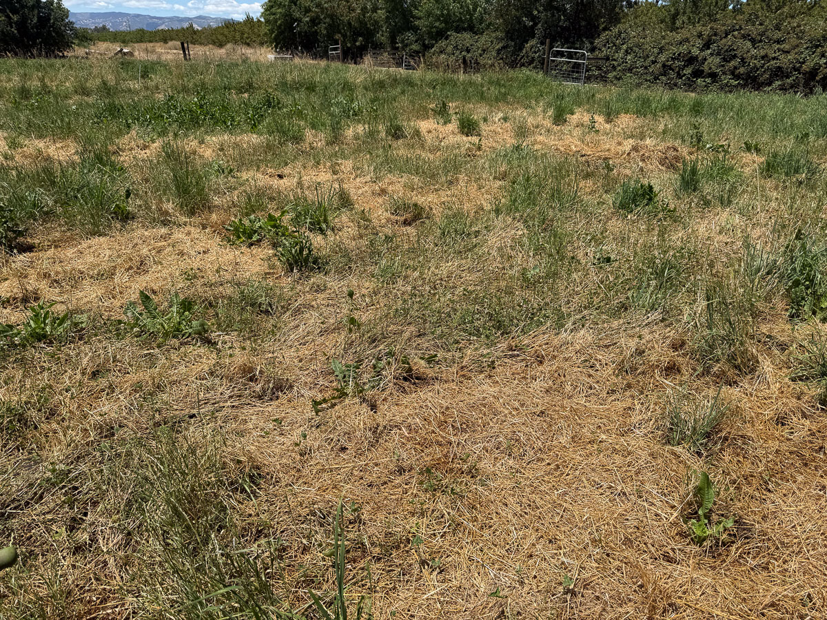
Those top seven checks were fully irrigated before noon and I was ready to open the valves to the south. Then I found myself wanting to deal with the dry grass that was serving as a mulch on those north paddocks. We don’t need the clover and trefoil covered ups with mulch.

This seems ridiculous but I took a large rake out there and attempted to rake the dried grass off the pasture. I know I did this last year. The grass was floating and I could rake piles. This time it was different. A although Dan had mowed, only a fraction of this is that superficial grass. A lot is still rooted. Not that it will grow again, but it’s more difficult to remove.

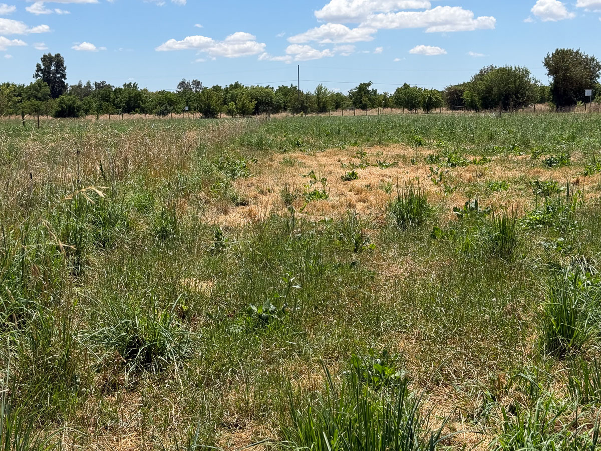
You can see the difference in upper part of the photo. It’s bothering me that so much of some of these paddocks are not as productive as they should be. This is the result of the ryegrass that took over last spring and again this spring. I need to be able to graze these before the grass gets so tall that it is trampled and flattened more than eaten .

I did rake some and made loads with the wheelbarrow before I decided that this was a dumb idea and I could never make much of an impact.

Moving to the south, there is a flooding issue at #8. One of the ways to control this is to have more valves open and lessen the water pressure. Remember, this was more water than. before. I’m learning as we go along. I used the wheelbarrow and took some of that fill that was near #7 and made a border here.

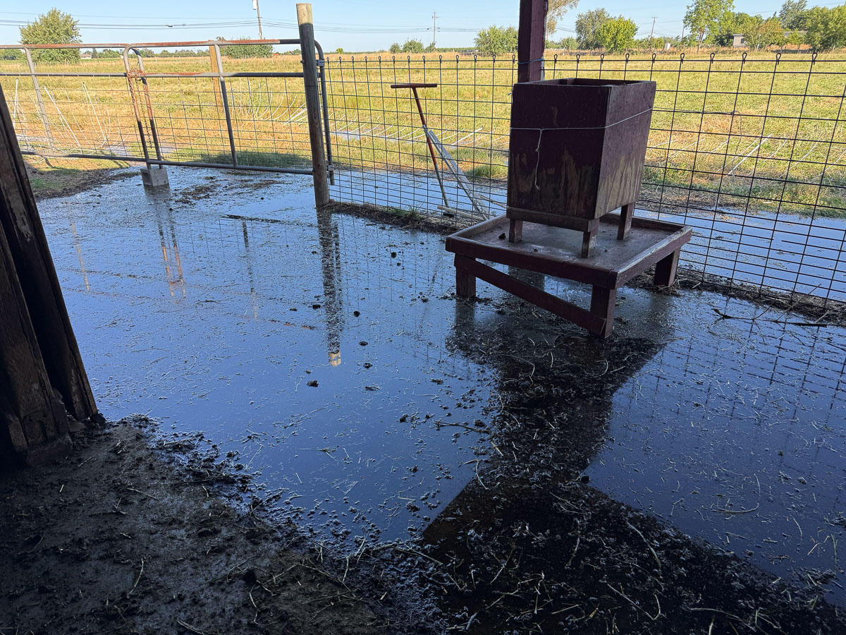
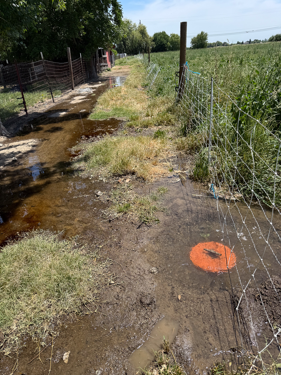
Later that evening I saw that with this much water #11 and #12 flood the lane at the barn.

Almost all the lower paddocks were finished by the evening. I opened the last three around 6 p.m. The water wouldn’t be turned off until the SID water tender was on site at 6 a.m. It still flows into our ditch for another hour after that.

Here’s a closer view of yesterday and today. We’ll need a better plan next time.

Irrigation, Part 2

I left the last post knowing that the irrigation would not be finished by the time the water was shut off Tuesday afternoon. I was able to have the water start again at 6 a.m. I waited for the ditch and pipeline to fill again and went out about 7:30 a.m.

I could tell right away that there was more water flowing in–it had already progressed farther down the checks where the valves were still open than the previous day. The following are the notes I took on my phone that morning. The numbers refer to how far down the field the water is for each check.

7:45 a.m.
13 is 1/2, 14 and 15 are 2/3, 16 is 1/4, 17 and 18 are 2/3, 19 is 1/2
9:20 a.m. 13 and 14 almost finished. 15 over 3/4. 16 is 2/3. 17 and 18 are over 3/4. 19 is 3/4. 20 is 2/3
9:40 a.m. 13 finished. Closed. Opened 21 and 6-7-8
I had to go to Davis and didn’t get back until 12:30
12:30 p.m. 15-16-17-18-19-20 finished. 21 is close to end.
Now only 21 and 6-7-8 were on. Closed 8. 7 is 1/2. 6 is 3/4. Both of these were flowing backwards into the lane a lot. 

The last note is about 21, 6, 7, and 8. Valve 21 was the last one I opened. I had closed 6, 7, and 8 because the water wasn’t flowing enough there and I wanted to make sure all the rest got enough water. It was only after the water was flowing so well and everything else was finished I opened those again.

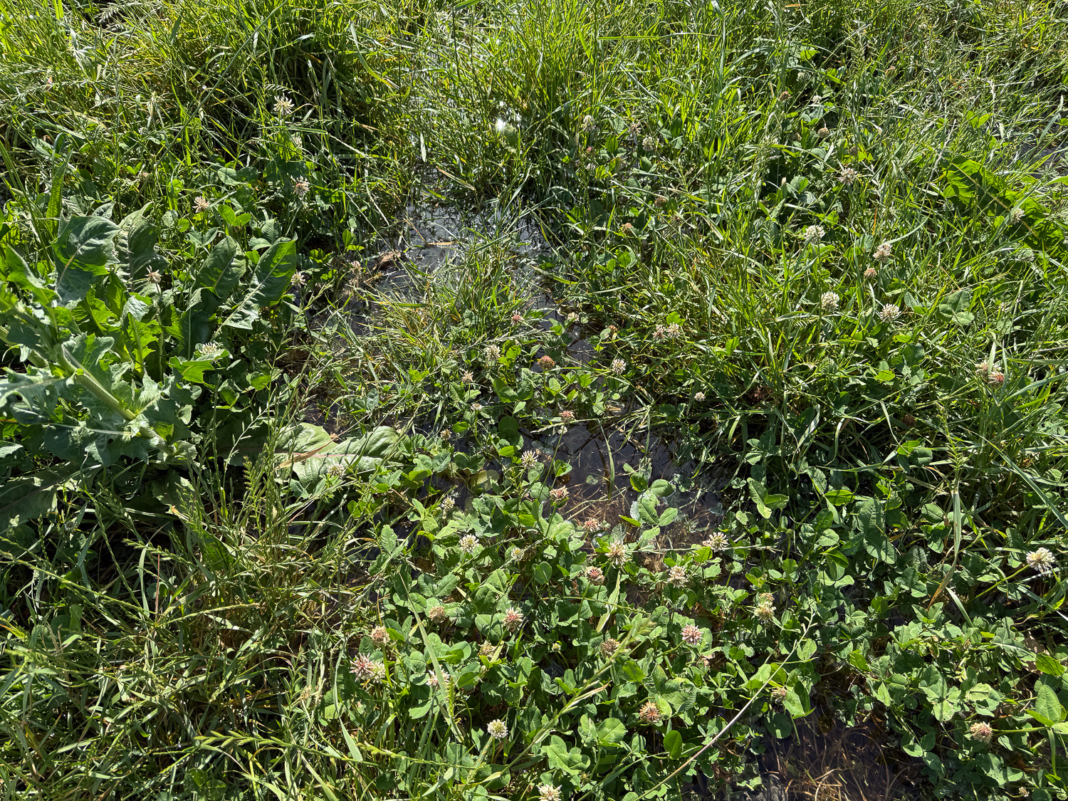
Close up of pasture clover and grasses with irrigation water on the field.

I took this photo in a place where I could actually see the water. Many times I can’t see it because the forage is so thick or tall. In that case I can tell if it’s wet because I can hear the water splashing where I’m walking. I recorded a video to share that, but I can’t upload it here.

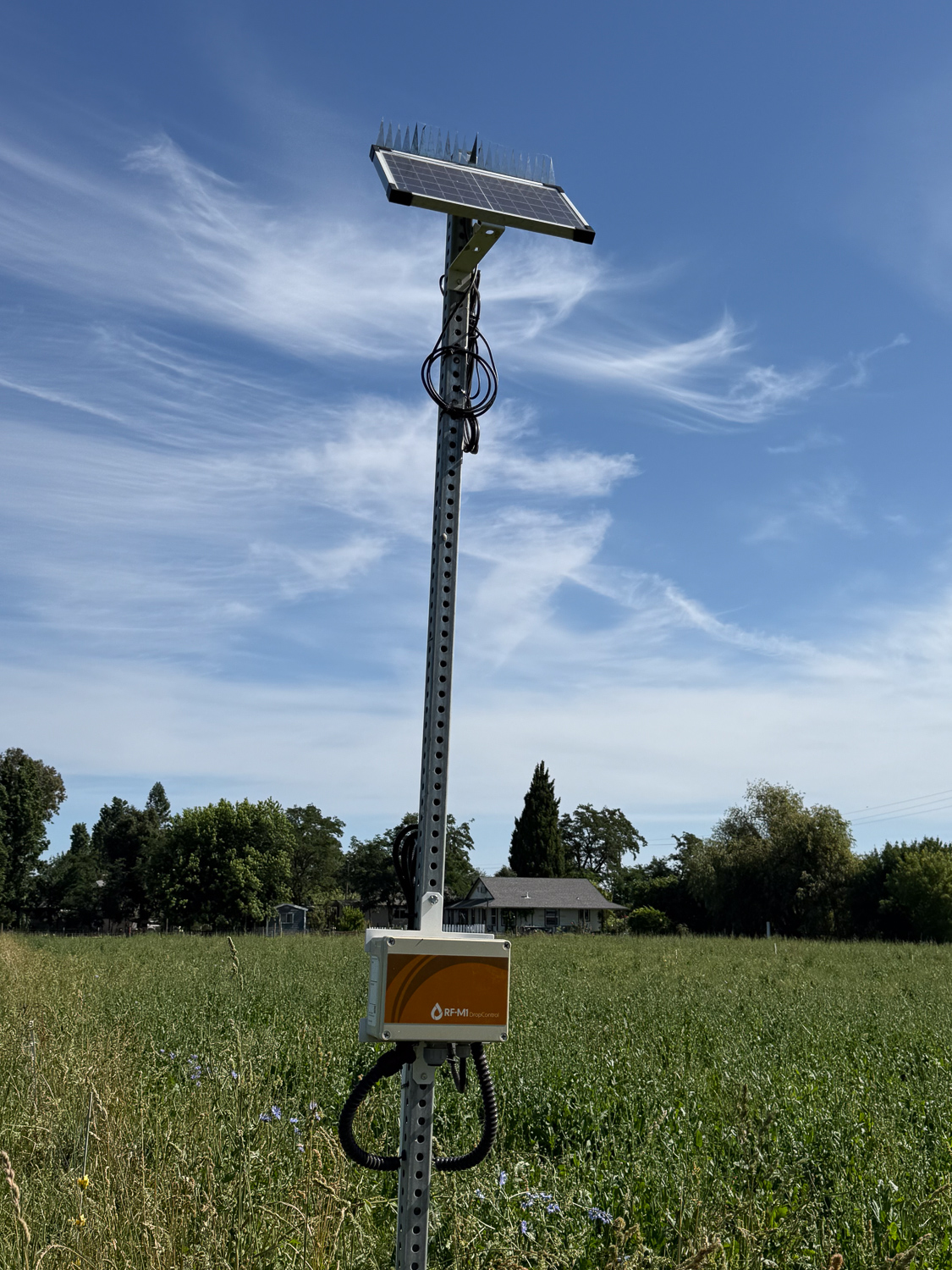
Soil moisture monitor in the pasture.

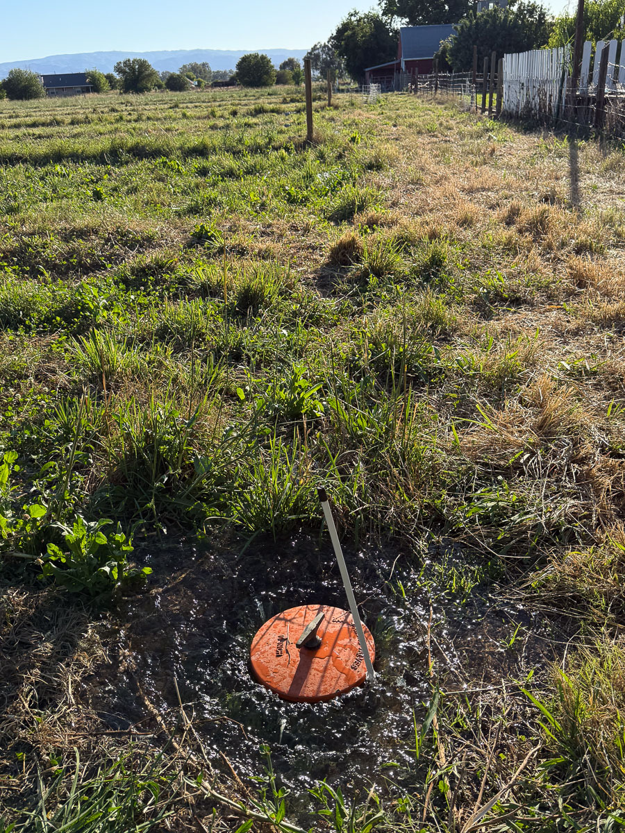
This is what the soil moisture sensor looks like. I get the graph on my computer or my phone.

Irrigation valve with water flowing down the lane behind it.

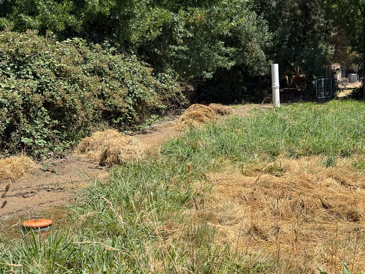
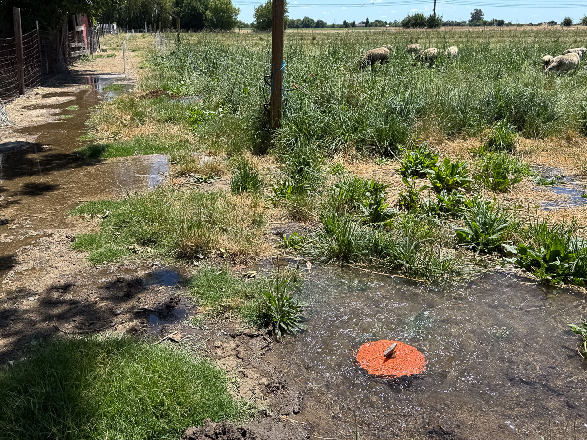
This is what I meant by #7 and #8 flowing backwards. It took only a couple of minutes for the lane to be flooded. Before we irrigate next time we’ll have to pile dirt around those valves.

The red line on the graph below shows that the amount of water was more than twice what I had the previous day. It also shows that the other soil moisture sensor finally measured water. I see an anomaly–that faint blue line that rises as the water is shut off the first time. I think the timing is coincidence, but it shows underground flow that activates that 12″ deep sensor on the east. Flowing through gopher holes?

There is a lot to think about before the next irrigation.

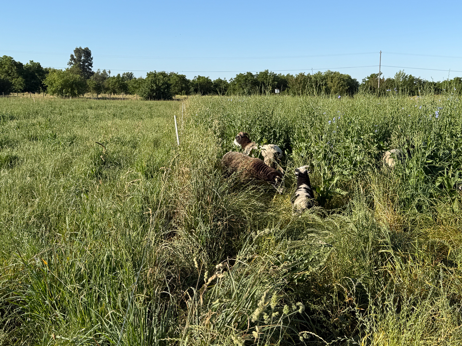
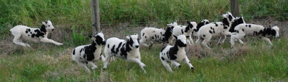
I turned the sheep out this morning. The paddock on the left was last grazed May 1. The sheep moved to the north paddocks after that and then moved from west to east. The one on the right hadn’t been grazed since March 29. The whole flock is out there, but you can’t see them because they are in a jungle of chicory.

Grazing and Irrigation 6 – April 29-30

There were more photos for April 29, the first day of irrigation with the new system. I started this story this morning. To continue:
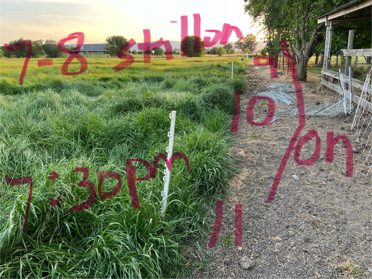
I needed a strategy to keep track of what I was doing. This was partly because the ryegrass was so tall I couldn’t even find the valves at first. Then I wanted to remember what I had opened and closed and be able to tell Dan how it was going. I decided to write on my photos. By the way, there are 7 valves across the north end of the north field near the blackberries. This photo shows the south end of that north field and the top of the lower pasture. There is a pipeline all the way across this one from west to east.

So this photo shows that at 5:30 p.m. there was water all the way down the north pasture and I had opened the first 6 earlier. At this time #1 on this field was finished and I turned #7 and #8 on.

At 7:30 p.m. this is the status. I opened 9, 10, and 11.

At 8 p.m. I opened 12, 13, 14, and 15.

I had been marking the valves with the white plastic stakes. Now I don’t remember if the sideways posts indicated On or Off.

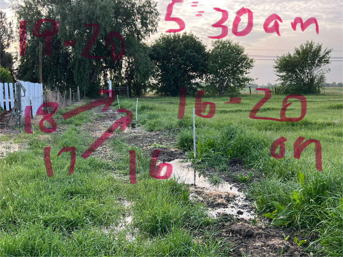
At 5:30 a.m. the next morning I closed #7-15 and opened all the rest.

This shows the last valves, #16-20.

At 7:30 I noted that #20 was finished.

This is how I figured out that I could report back to Dan what was going on. I think I can make sense of this photo now. There was water 100′ from the south border in #17, 90′ in #18, and 50′ in #19.

I’ll be doing this all over again in the morning and I think maybe I should number these in the opposite direction. If I am at the house or barn and “read” from left to right then Check #1 should be on my left (the one next to the road). I guess I’ll figure that out tomorrow. Maybe I need to paint numbers on the south border posts so I can keep track of where I am.

Grazing and Irrigation 5 – April 29

I started this series of posts to explain the outcome of our major pasture and irrigation renovation in the fall (another series of searchable posts). The most recent of this series is here.

It was time to try out our new irrigation pipeline. I didn’t know what to expect, never having irrigated from a pipeline before. Dan, only 3 weeks after knee replacement surgery was not going to be the irrigator.

Where do we get our water? If you look at the fifth photo in this post you see the hills. Lake Berryessa is in those hills and that is the water source for the Solano Irrigation District. There is a low spot in the center of the skyline and that marks the place where Putah Creek flows from the Lake.

This photo is northwest of our property and this is the main canal from which we get our water. This view is southwest. When the valve is opened water runs down the next canal, seen below.

This view is due south. That water will be getting to our pasture after it turns a corner at the edge of the orchard.

Here is that corner. View is southeast.

Just past the corner looking due west. Our property is at the end of this canal.

This is the same location as the previous photo but showing the view to the west. That barn is the Hendrix Hay barn that you see from our property.

Walking along the road before the water is visible in the ditch. That is our barn that you see in the photo.

The same ditch but looking west from the corner of our property. That opening on the left is where overflow from other properties or storms can exit this ditch and not flow into our property. When we irrigate lengths of 2 x 6 boards are slid into a channel to prevent most of the water from flowing out into that ditch.

The view as the water is getting to our place. The red handle opens the gate to let water into our property.

When this gate is open the water flows into that concrete box where there is a flow meter and then out into the pipeline. The concrete box is 8 feet deep and 4 feet square. See some of the details in this post.

Once water fills the pipeline we start opening valves.

It will take me awhile to learn how much to open each valve, how many to have open at one time and how long to leave them open. We’re irrigating again tomorrow (a month after the irrigation in this post) and I’ll experiment again. Do you remember the old way of irrigating? I just searched my posts for “irrigation” and found this one from 2010. Wow! It shows the same corner with the old standpipe, but what is amazing to me is that north fenceline. Where are the blackberries?

Pasture and Irrigation Renovation – Part 10

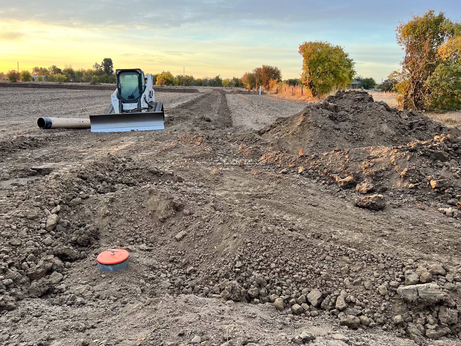
The last post I wrote about this project was on November 21, two weeks ago. At that point we had just come back from our Arizona trip The pipeline was put in while we were gone. We were anxious to get both the irrigation work and the field work finished before the real winter rain started. With it this late in the year it was certainly possible that there would have been significant rain before this time. I don’t know what we would have done if that had happened. I think the whole thing would have been put off if the ground was as wet as it is now.

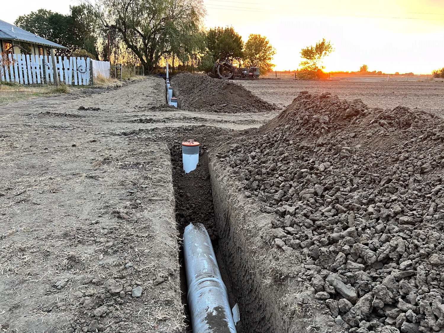
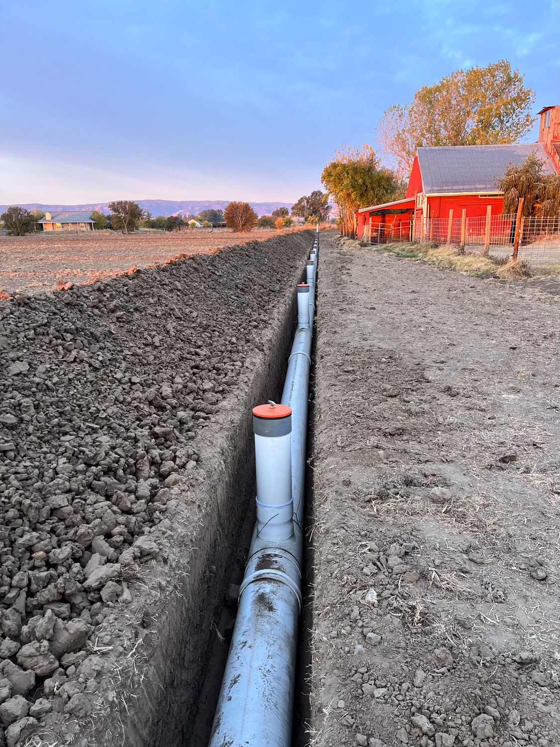
So in these photos the ground is dry. This is the view from the western edge to the east. The pipeline is 15″ and the valves are 30 feet apart

That is a pretty deep trench at this end. There has to be gravity flow so I assume the west side is a little higher than the east.

View to the west.

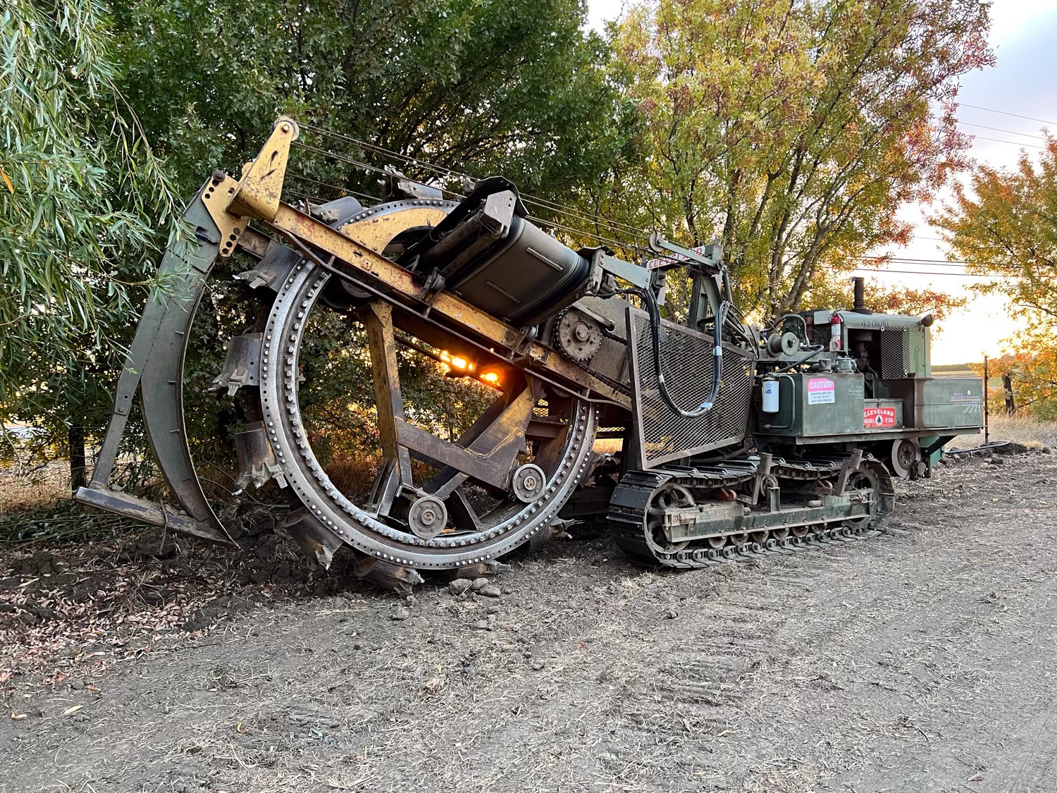
The is the trencher they used. I was interested in that conveyor that looks as though it is just stuck in that wheel to get it out of the way. But, of course that is not the case–it is supposed to be there. . As the wheel turns, the dirt is brought up to the top where it drops onto the conveyer which drops in a long ridge next to the ditch.

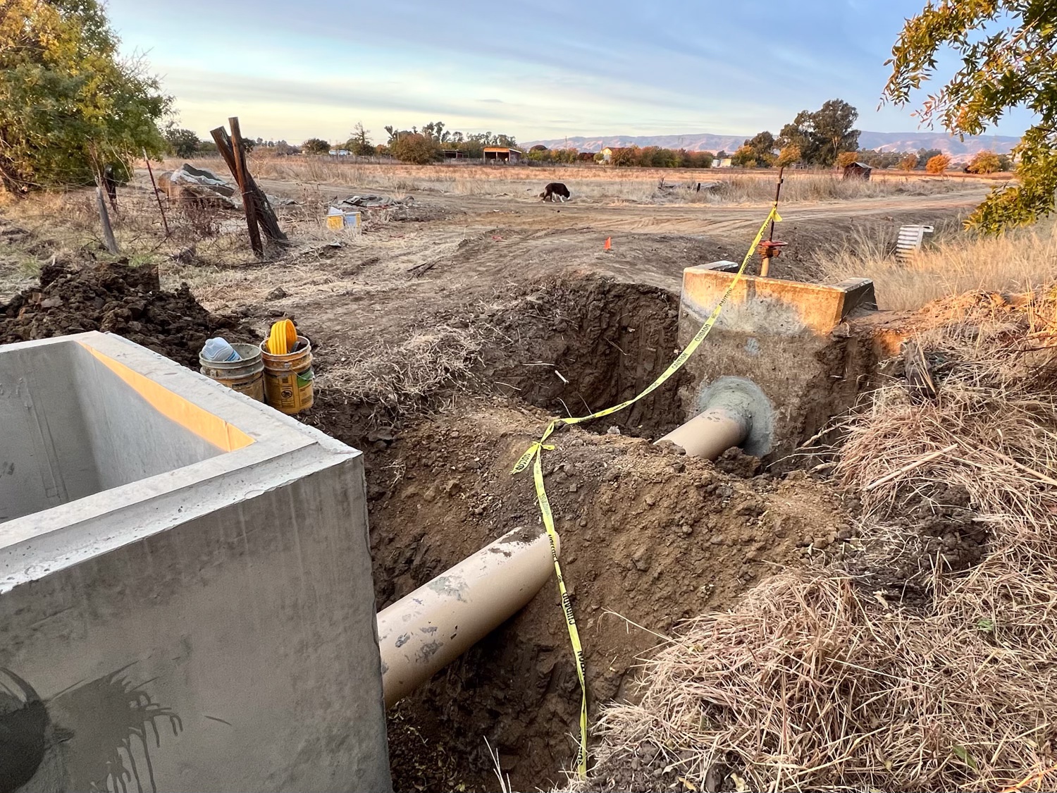
This view if from the corner where the water enters our property There is a north-south pipeline buried here.

This is the connection where we get the water from the SID canal.

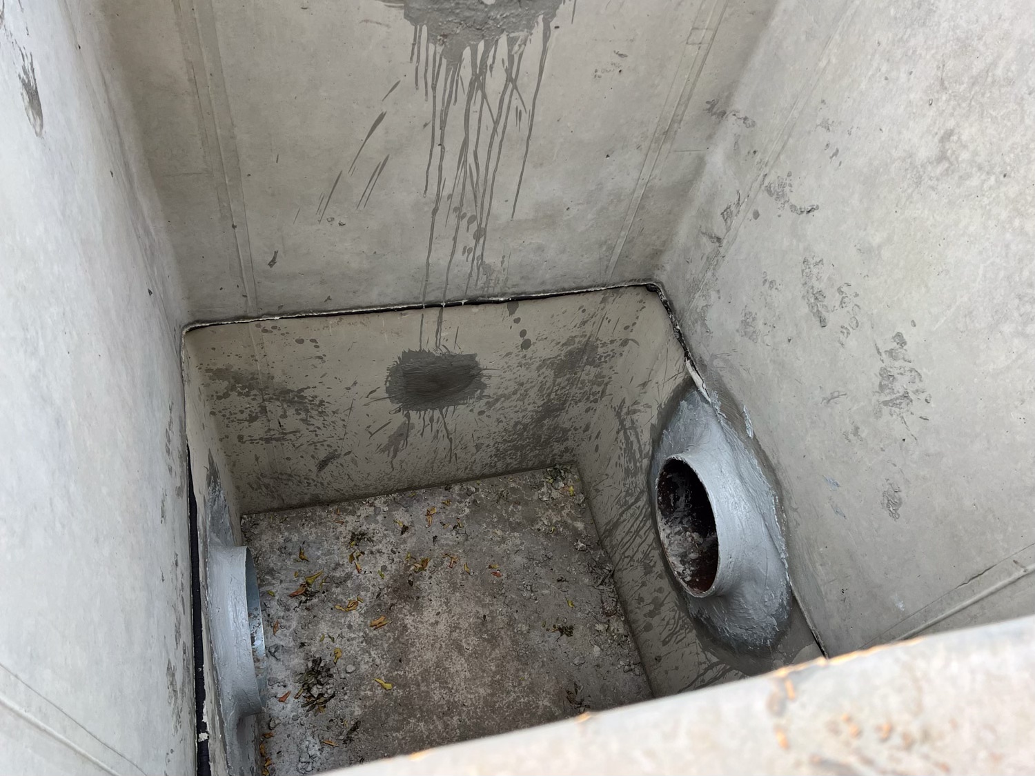
The concrete box is 8 feet deep. A flow meter will be placed in one of the pipes.

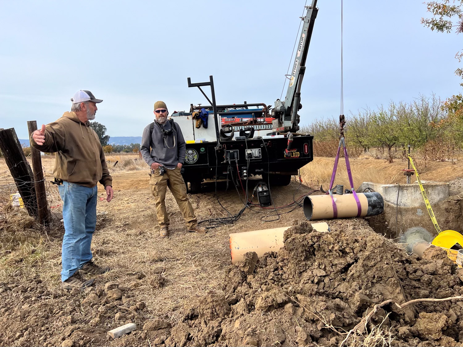
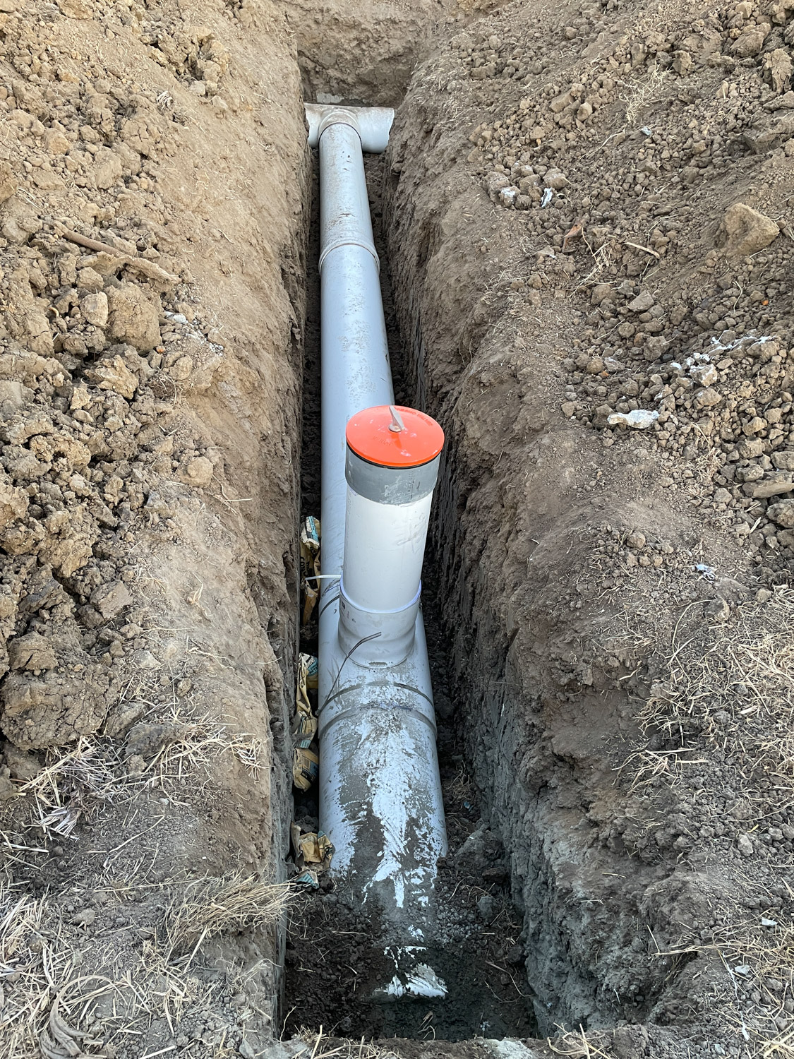
Another private contractor showed up this day. He is a welder and his job was to cut a hole in the horizontal pipe and shape and then weld an upright pipe onto the horizontal one. I think it is to allow air flow in the pipe so that the water will flow better.

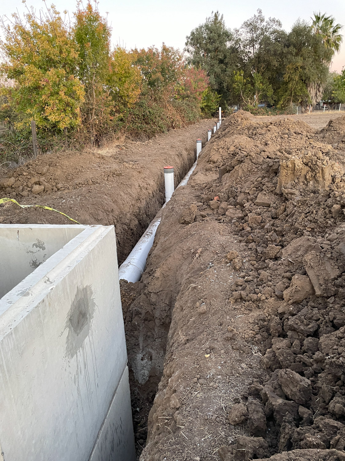
This is the row of valves after the trench has been mostly filled in.

This was all finished just in time before heavy rain was predicted to start. The other crucial task was to get the field seeded before rain made it impossible to drive a tractor across the field. Rain was due by sometime during the night.

To be continued because I’m too tired…

Pasture and Irrigation Renovation – Part 9

I wrote the last post about this project 9 days ago. The crew had removed the old standpipe at the northwest corner of the pasture and replaced it with a new concrete box. When we irrigate the box will fill with water and create pressure to force water into the rest of the system.

In the meantime we were concerned with getting seed on the pasture at the best time. Michael had finished putting up borders, even though the irrigation pipeline work would disturb the upper end of the field. We needed all of that work to be finished before seeding. I had ordered the seed mix from a company in Tracy, about an hour and a half from here. I said that we’d pick it up to save on shipping cost and to have it here when Michael was ready for it. This time of year farmers are trying to get the field work finished before it rains a lot and they can’t get on the fields at all.

The day after the irrigation work was done in the corner we drove to Tracy to pick up the seed we had ordered. This photo is the warehouse there. There was some kind of communication problem between the order desk and the warehouse. Our order was wrong. I had paid for 350 pounds of seed but there was only 64 pounds there. The people at the seed company said they’d get the seed to us on Wednesday of the next week. That was the day before we were to leave on a 5 day trip. (That will be in the next blog post.)

The next morning I took these photos (above and below) of Michael smoothing out the edges of the field.

Skip ahead five days. The irrigation crew planned to come out on the 15th. We left that morning for Arizona. I asked my friends who were going to farm sit to take photos of the progress for me.

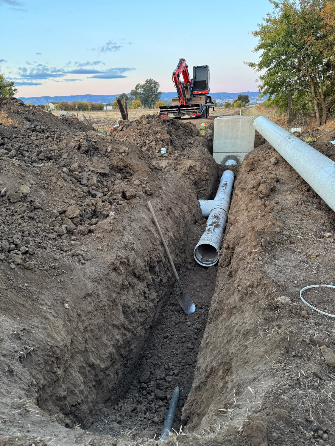
The crew spread the pipe out in the proper location. Then there was a lot of digging. They used this excavator at the northwest corner.They used a trencher for most of the lines.

The pipe that runs east-west in front of the blackberries has one T to send water south to the other east-west pipeline.

This is the rest of the pipeline at the north end in front of the blackberries.

This photo shows what the valves look like. They will be at ground level.

Here is that first east-west pipeline completed.

Pasture and Irrigation Renovation – Part 8

I wrote the last post about this ten days ago. This project is taking a lot longer than I’d hoped. The last field work was October 31 when Michael put up the borders. It wasn’t until November 6 that the irrigation part of the project started.

This is a photo taken in May when we were starting to irrigate. This is just outside of our fence line. The water is starting to flow down the ditch after SID (Solano Irrigation District) personnel opened a valve. The red wheel controls the position of the gate that lets water into a pipe at the base of that concrete structure.

The water goes through the pipe into the concrete standpipe in the northwest corner of the pasture. There is an opening that faces south and water flows into our ditch. We are replacing the ditch system on our property with a pipeline. We can’t pump because there is no power back here. Therefore the whole system has to work with gravity feed. Engineers from Pacific Southwest Irrigation proposed this system, approved by NRCS.The first step was to replace this standpipe and pipeline

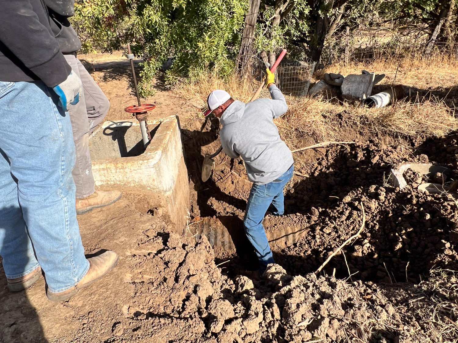
I was surprised at the finesse with which the excavator operator could work around the existing structure. It was important to not damage the concrete structure that has the red wheel control. They had to dig up the existing pipe that went into an opening at the base of that structure. In this view the top of that standpipe to be removed has already been knocked off.

A lot of dirt had to be moved and this pile was a lot bigger by the time they finished.

Some handwork (with a shovel) was necessary to break away the mortar.

They also used a handheld jack hammer to break more away without damaging the concrete box. The excavator loosened the old pipe without damage to the remaining structure.

Eventually they were able to remove the old pipe and the rest of the standpipe.

In the meantime Dan made a frame and poured concrete to extend the walkway behind the barn. The concrete chunks under the new concrete are the leftover parts of that foundation that we hauled out of the pasture after the initial work to remove it.

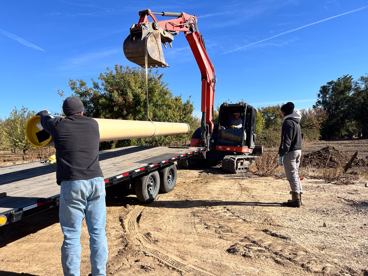
This is the new pipe.

It was lifted into position and then cut to fit.

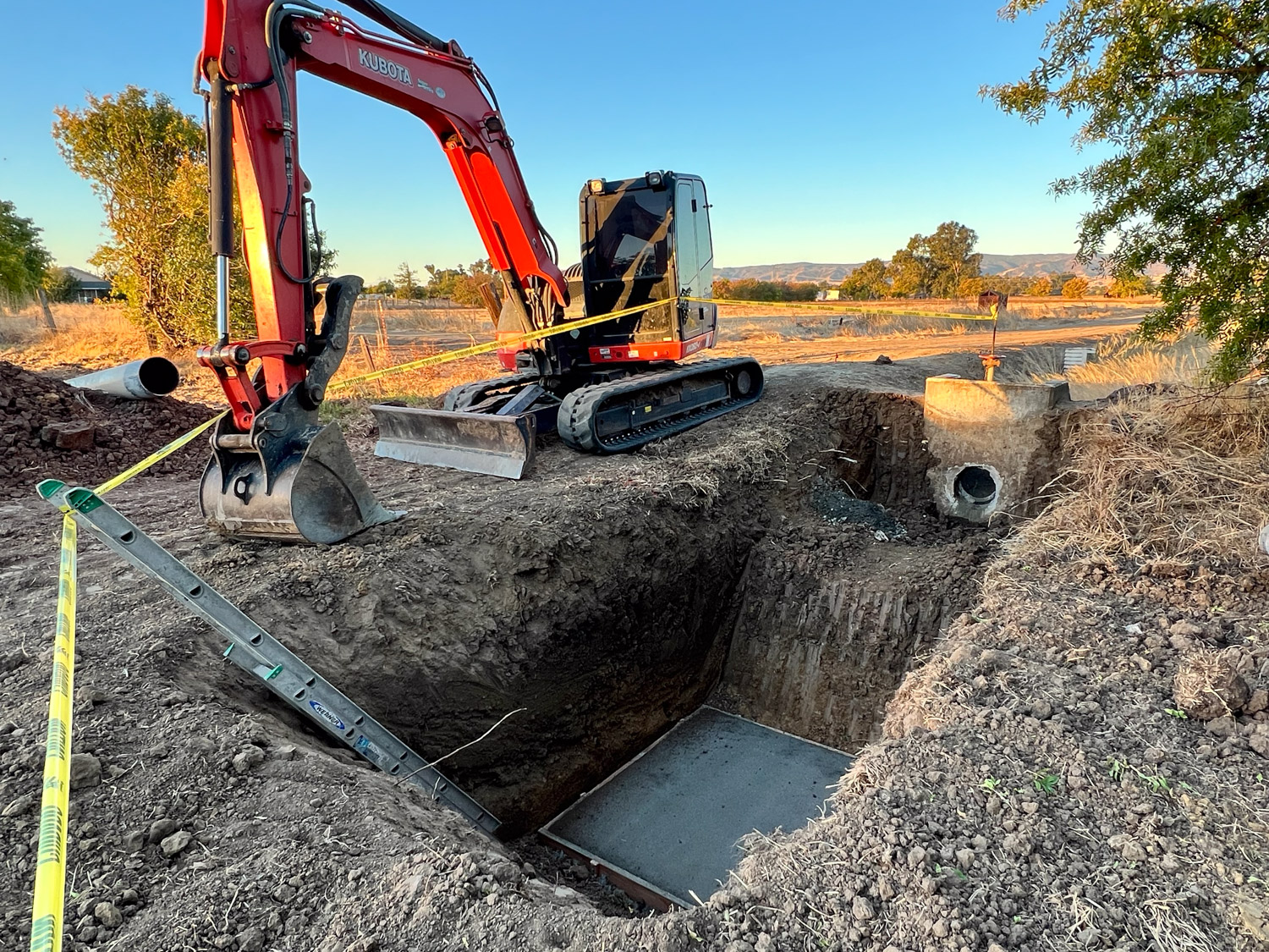
The crew dug a pit and made a concrete pad at the bottom.

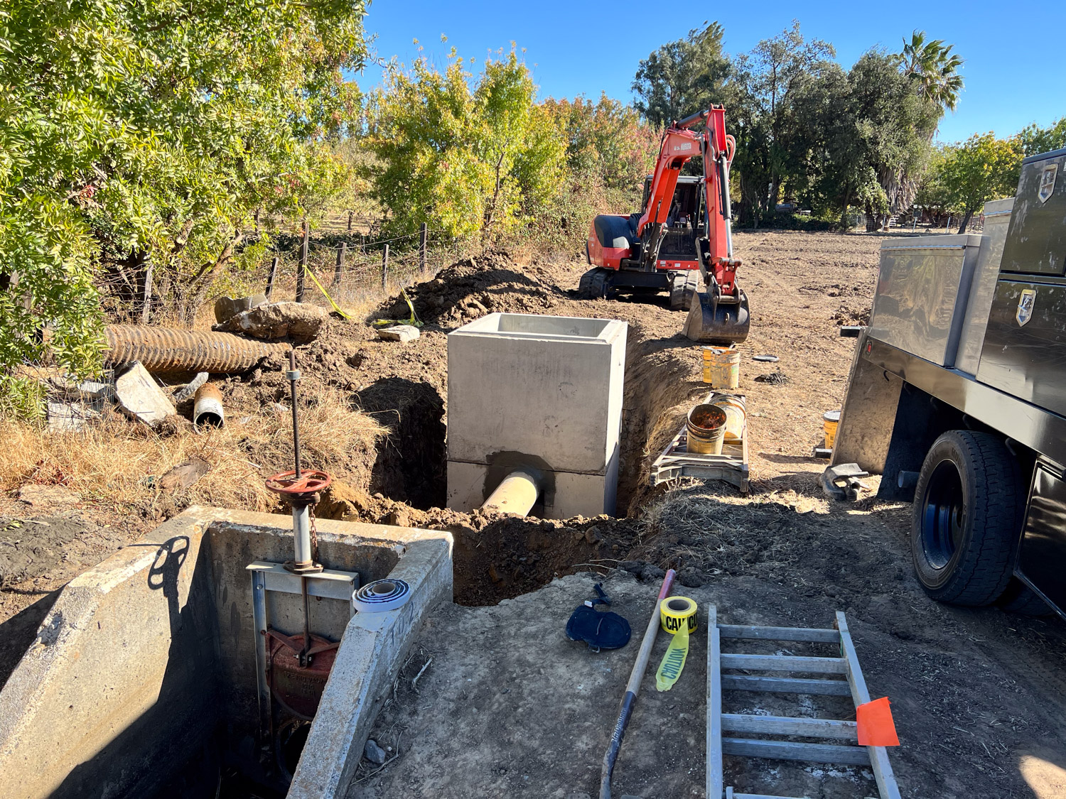
The next day they installed two concrete box structures with the pipe that connects the SID structure to this one. The view is to the west. That tree is right at the corner of the property.

The view east. This was last Friday. Another crew will be here this Thursday or Friday to work on the rest of the pipeline. We wlll be gone, but that is another story. I need to get my friends to take photos.

What’s in the Pasture?

The pasture is not a lawn. It is not a monoculture. My brother says it is more of a salad bar for sheep. Unless you walk around out there you don’t realize the number of plants that grow there. I am embarrassed that after 16 years of living here I don’t know the names of all of them. I have decided to change that. I am going to combine my enjoyment of photography and my recently dredged up college hobby (and class projects) of pressing plants and create a personalized herbarium of sorts. These photos are a start.DSC_9897I irrigated this weekend. The sheep were just moved off the paddock to the right and when it dries up enough they will go on the one to the left. Can you see the difference? It took only two days for them to eat that feed.Birdsfoot trefoil-2One of their favorite plants is Birdsfoot Trefoil.  It is a legume which means it is one of the plants that converts nitrogen in the air to a form that can be used by the plant. It is actually not the plant that does that but the bacteria that live in nodules on the roots of legumes.White cloverClovers are also legumes. This is a variety of white clover.DSC_9948This morning I noticed just a few of these flowers.  I can’t decide if this is a variant of the white clover or is a different species. The leaves are similar. I’ll have to do some more checking.Narrow-leaved milkweedDo you see how most of the other plants have been eaten and this one has not been touched? The sheep avoid plants that are toxic to them. This is Narrow-leaved Milkweed (Asclepias fascicularis). Not only is it a favored species for the monarch butterfly but according to a Plant Guide published by the NRCS “Zuni people utilize the silky seed fibers, which are spun on a hand-held wooden spindle, made into yarn, and woven into fabric (especially for dancers)…Milkweeds supply tough fibers for making cords and ropes, and for weaving a coarse cloth. Milkweeds stems are collected after the stalks dry in late fall to early winter. The dried stalks are split open to release the fibers. Milkweed fibers are sometimes mixed with fibers of Indian hemp, Apocynum cannabinum.” Sounds like a good challenge to my fiber-loving friends.
Narrow-leaved milkweed-3These are Narrow-leaved Milkweed flowers in various stages…Narrow-leaved milkweed-5…and a close-up.Field bindweedField bindweed (Convolvulaceae arvensis), also known as morning glory. It is, according to a  U.C. IPM website, “a perennial broadleaf, is considered one of the most problematic weeds in agricultural fields throughout temperate regions worldwide”.Soft bromeSoft Chess or Soft Brome, a non-native annual grass.Hare barley

Hare Barley. Also from the U.C. IPM site, “It is a useful livestock forage early in the season before the flower spikes develop. However, at maturity the spikelets have stiff, barbed, needle-like awns, and sharp bases that can injure the mouth, eyes, nasal passages, ears, and skin of animals.” Those are one of the many grass seeds we call foxtails and spend a fortune getting out of dogs ears and noses and agonize over when we find an otherwise beautiful fleece full of them.MedusaheadMedusahead as it is drying out. Medusahead covers thousands of acres of California foothills. It is not normally found in irrigated pasture, but it is in the easternmost paddock here which sometimes does not irrigate well. I have reclaimed part of that paddock, but I continually fight this plant. I find patches of it in other areas of the pasture and, although this is not an effective control technique, I pull it up by the handfuls as I walk by, coming back to the barn with it stuffed in the pockets of my overalls. It is a nasty plant that is “…among the worst weeds: not only does medusahead compete for resources with more desirable species, but it changes ecosystem function to favor its own survival at the expense of the entire ecosystem…Because grazing animals selectively avoid this plant, and because medusahead thatch tends to suppress desirable forage species, infestations often develop into near-monotypic stands.” From the U.C. Davis Medusahead Management Guide.

Blunt spikerush I have ID’d this one as Blunt Spikerush (Eleocharis obtusa), not a grass, but a sedge that is  found on poorly drained soil and marshy areas. That’s my pasture…poorly drained soil. There is a lot of this sedge in  the middle and south end of three or four of the paddocks. It looks like foot-tall grass, but that is why it is important to actually look at what is out there. This does not make good forage.Buckhorn plantain-3A rather artsy shot of Buckhorn Plantain, found throughout California…Buckhorn plantain-2.jpg…and a photo in which you will probably more easily recognize it.

Well, that’s nine species of plants in the pasture. There are dozens more to go.

Irrigation Season – Part 2

In the last post I showed photos I took while getting ready to irrigate the pasture.DSC_8185This is the ditch that runs north-south and brings the water from the upper ditch to the one that goes from west to east along the bigger pasture.DSC_8186This photo is looking the same direction but from a little bit west of the first one. You can see the same row of overgrown blackberries along the fence. The standpipe where the water comes in is in the upper left corner.  In the lower center of the photo is one of the cut-outs that lets the water flow from the ditch into the field.DSC_8188Looking to the east as the water is flooding the pasture from north to south. In this photo the water hasn’t gotten very far into the paddock where the sheep are.DSC_8189Here is that tarp I showed in the last post.DSC_8183There are things to see besides just water and grass. One of the first things I noticed after the water filled the ditch was buzzing. These insects were everywhere over the water. I tried to ID it on the internet but didn’t find it. Anyone know what this is? DSC_8192 Swainson's hawkThis is one of the pair of Swainson’s hawks that lives nearby and hunts in our pasture.DSC_8197 Swainson's hawkWe have enough gophers to feed an army of hawks.DSC_8205 Swainson's hawk

I was hoping to see the hawk catch something but it continued to soar higher and higher. When I saw the buzzard (upper right) it reminded me of watching airplanes that you know are in different flight paths, although they look as though they’ll fly right into each other.