New York Adventure – Day 2

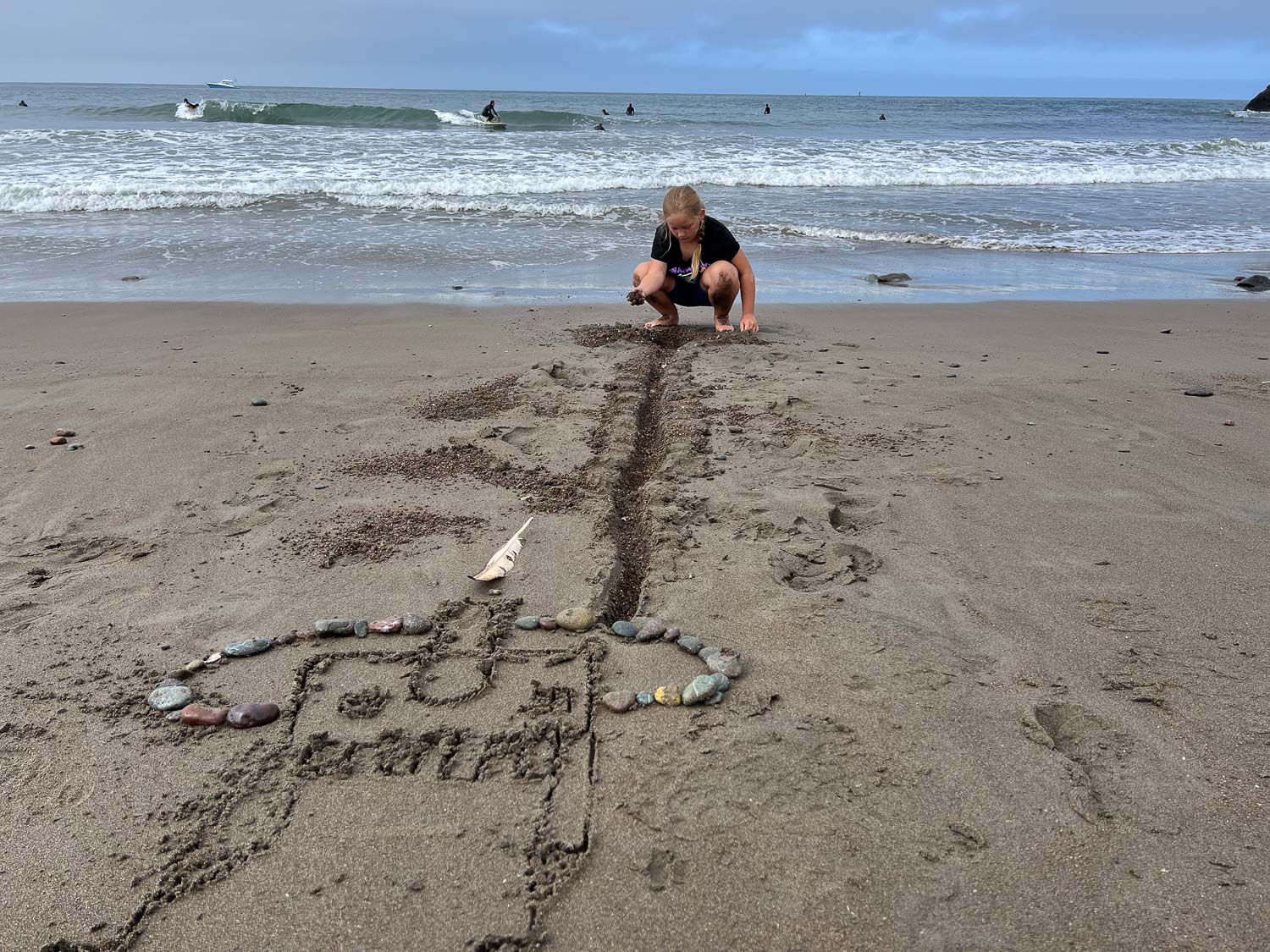
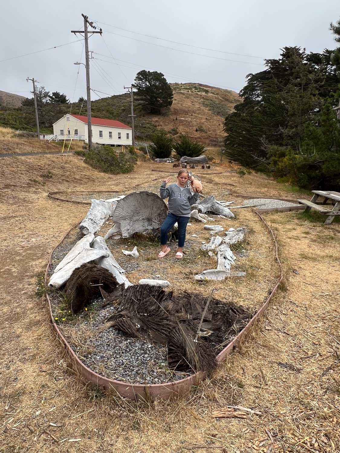
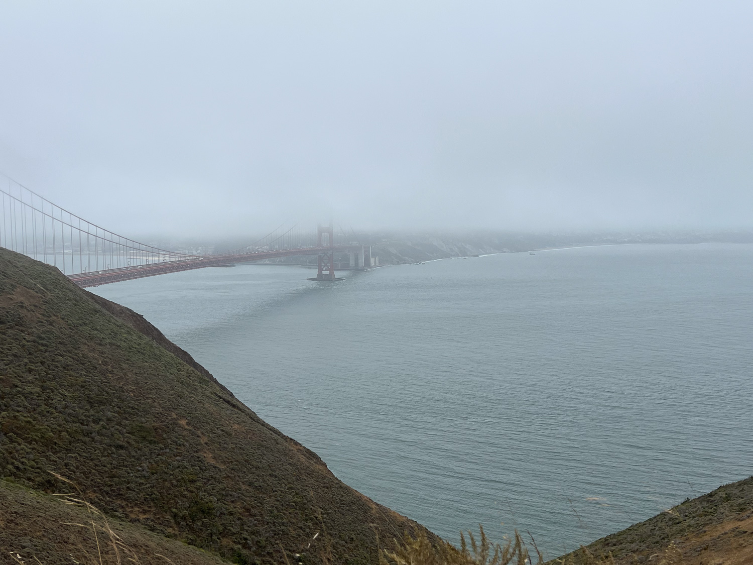
I thought that It would be great to come home all caught up with my blog posts. That didn’t happen–partly because it’s not as easy to work on the iPad as on my computer and partly because I spent time with my friends every evening and didn’t focus on other things.

On the second day in New York we drove to Hyde Park where there are three National Historic Sites we intended to visit. We started at this one.

We signed up for a tour of FDR’s house. This is the stable where we gathered.

FDR was born in this house in 1882. After he was married and the family grew there were additions to the house There are also adaptations for wheelchair access since he was unable to walk unaided after contracting polio in 1921. I was surprised to learn the extent to which that fact was hidden from the public throughout his life.

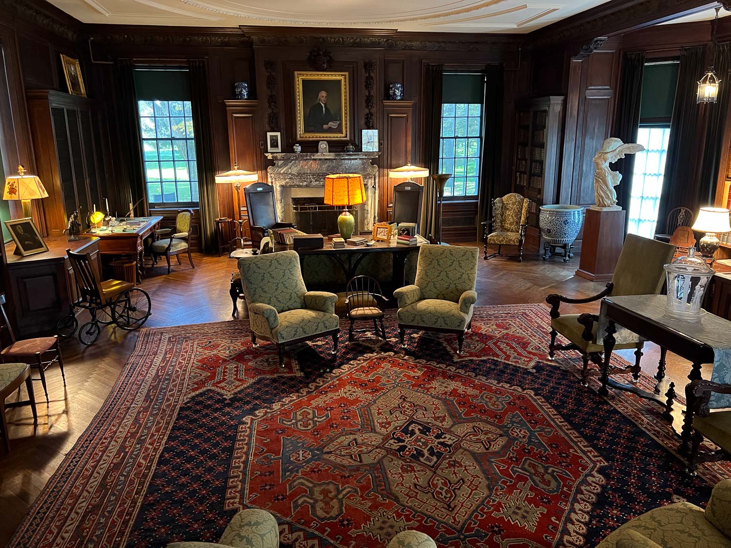
There is a ramp to this room, but when Roosevelt was alive the ramp would be concealed once he was in the room and awaiting his guests.

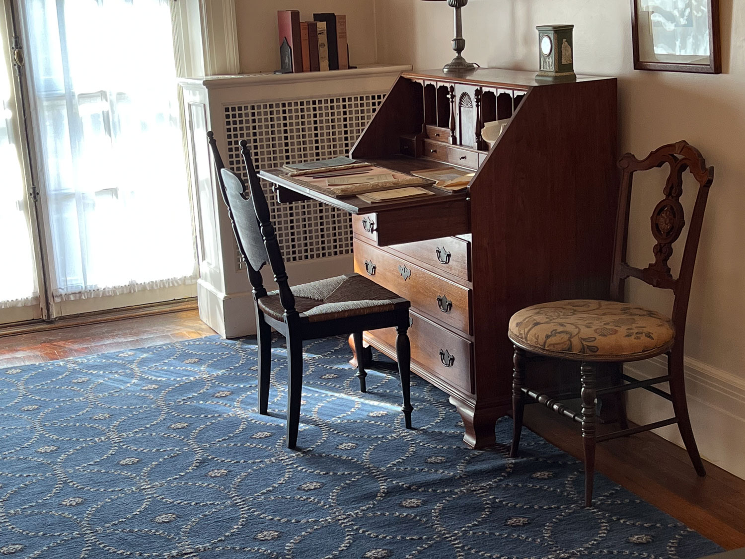
I took this photo because that desk is almost identical to the one that I used while I was a kid and through high school. It belonged to my grandmother who had lived in New York. I always liked the “secret” cubbyholes that were those fancy columns on either side of the door at the center of the upright part. My granddaughter has this desk now.

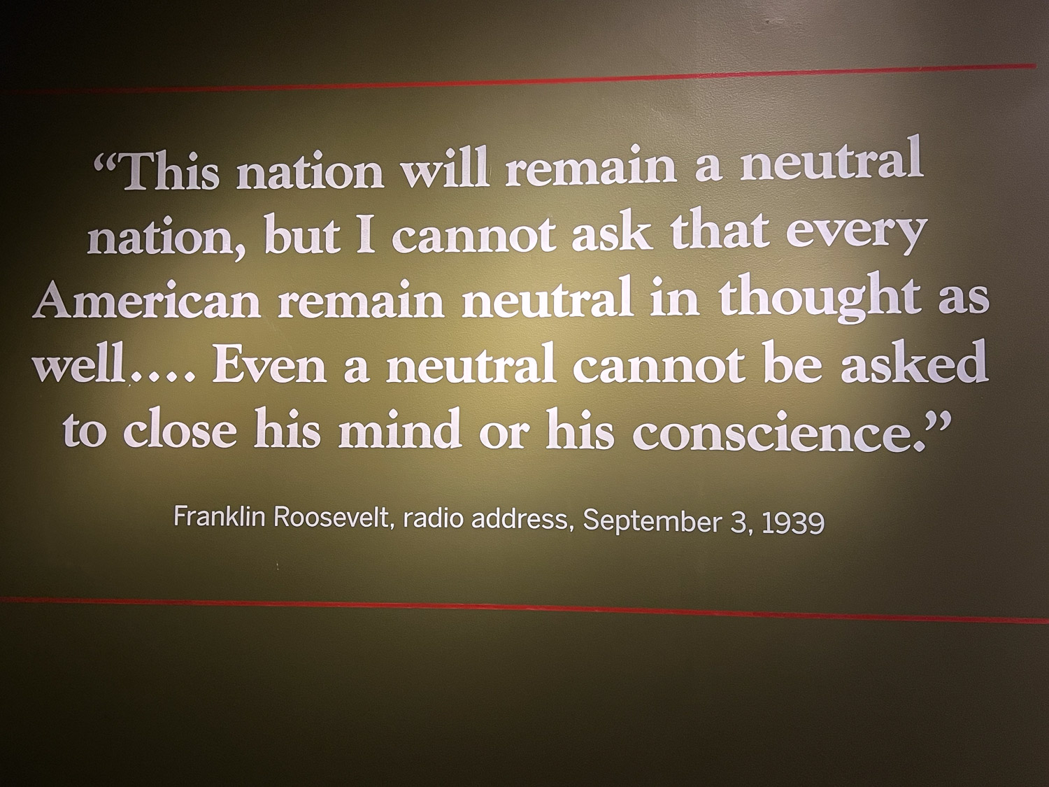
We had started at the FDR Presidential Library but had only a half hour before our tour of the house. There was so much to see here that we came back. I thought that a Presidential LIbrary would be full of books, but this is a museum. It is very well presented and there is an overwhelming amount of information here. This is the first Presidential Library and I assume that maybe others are modeled after this one. This one opened in 1941, and of course it would have been very different than what it is today.

I knew the bare basics of this era but this exhibit pulls it all together in a very informative and organized way. The exhibits are all set up in order so that you move through Roosevelt’s story from before he became President to his death during his fourth term.

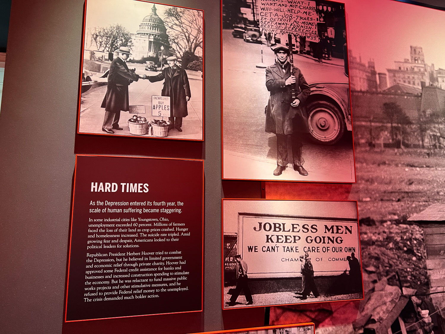
It starts with the Depression when Hoover was President.

When Roosevelt was elected he jumped right in and tackled the major problems facing the country.

I am of course familiar with all of these programs now because they are part of our way of life, but I have never thought about the time when they were developed.

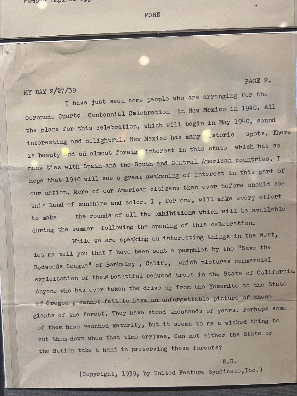
Eleanor is included in this museum as well. There is another National Historic Site at her home but we didn’t have time to go there. This letter is of interest to me because she recognized, way back in 1939, that California’s redwood forests were worthy of protection (second paragraph). There was a lot here about Eleanor’s influence and political activist. The FBI had quite a large file on her activities!

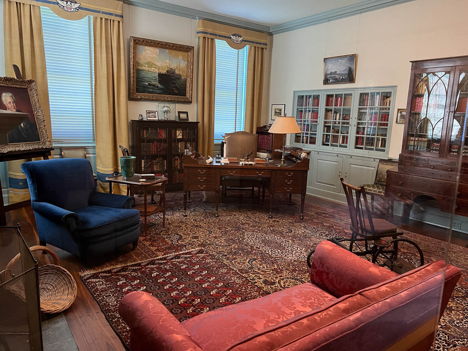
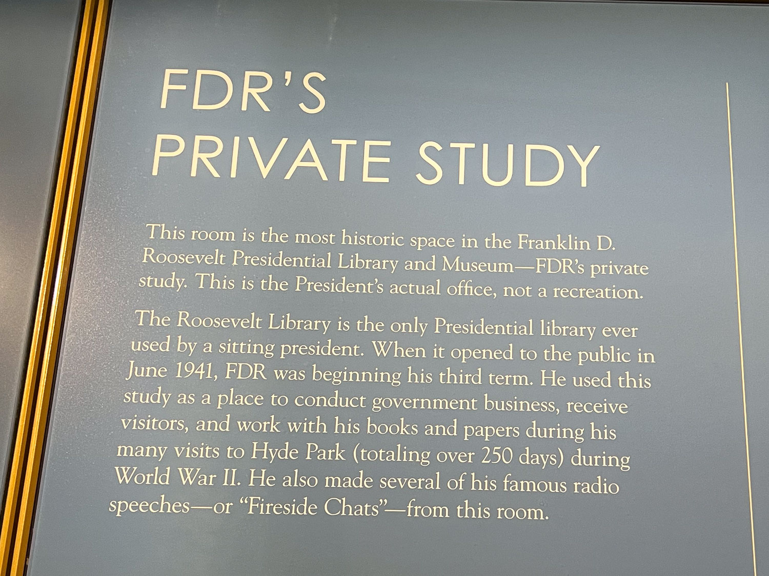
This is a working office used by Roosevelt during his presidency as is told in the photo below.

There was so much to see at this library that I could easily go back if I ever get to this part of the country again.

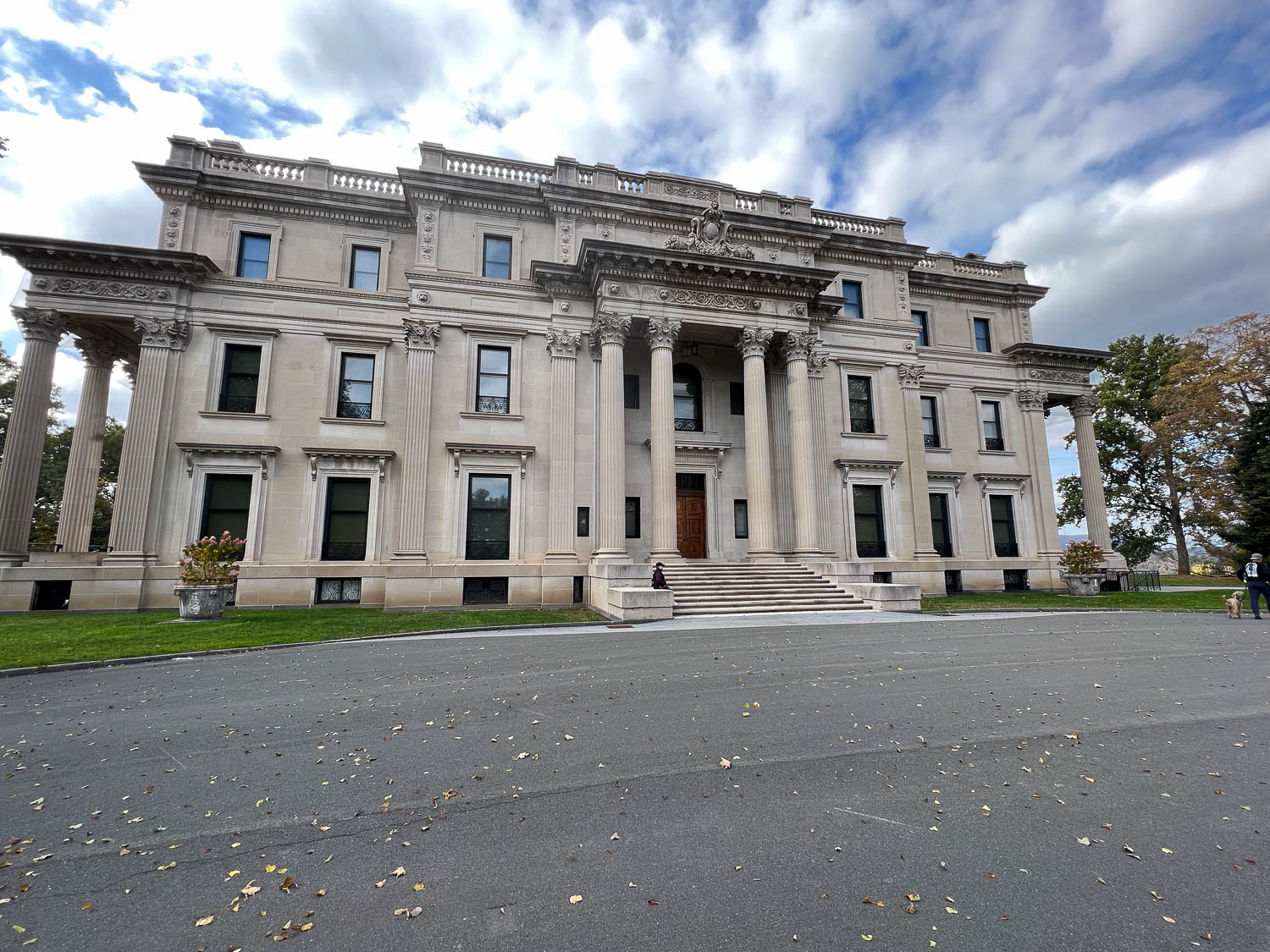
We drove to the Vanderbilt home only a few miles away. We would have had to wait a couple of hours for space in a tour so we decided to come back the next day.

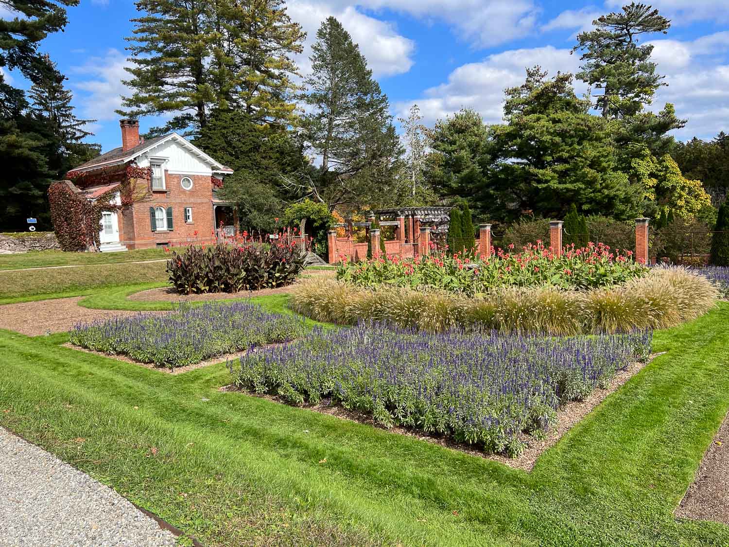
We wandered through the gardens before we left to go “home”.

I don’t have many photos of the AirB&B where we stayed. This is from the driveway.

I stayed in this bedroom.

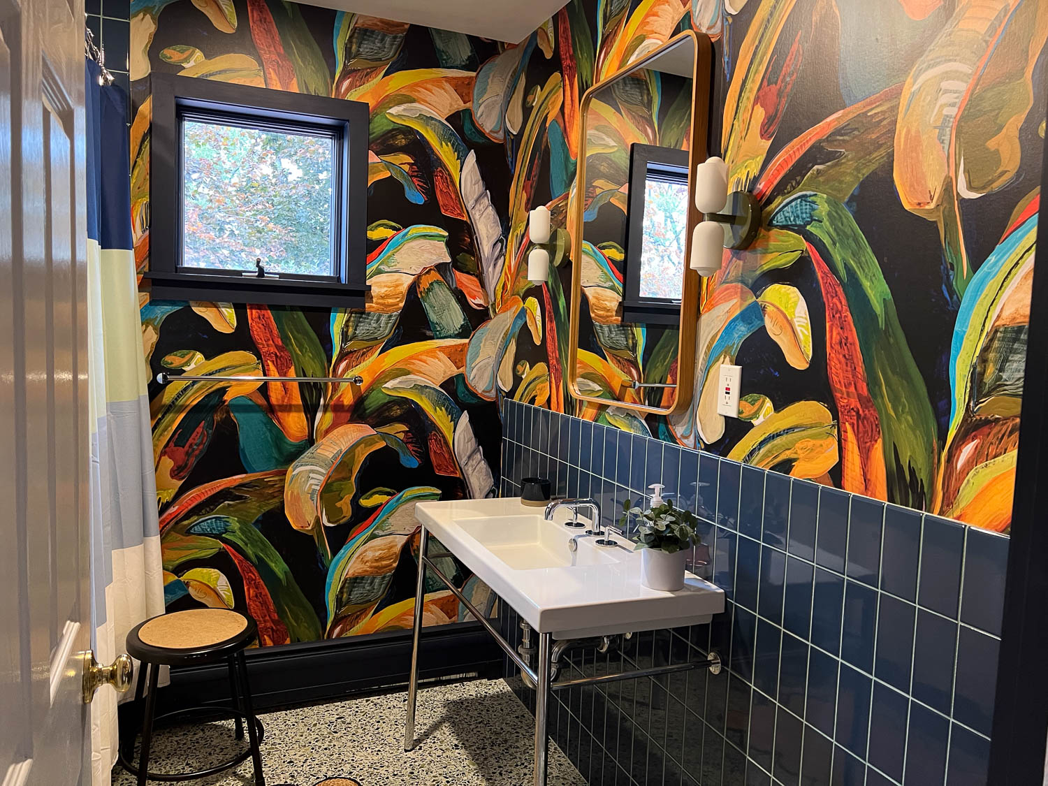
The bathroom that was shared by two bedrooms. The third upstairs bedroom had it’s own bathroom in a totally different style. We figured out with Google and other clues in the home that the owner is an architect with an office in Brooklyn.

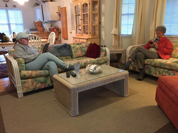
This living room and the kitchen are where we spent most of the time. As much as we looked forward to exploring this part of the country and going to the fiber show, some of the most enjoyable time was spent sitting here and around the kitchen table.

Visiting the Marine Mammal Center

I don’t like that my blog posts are all out of order now, but that’s my life…out of order. Before the fair (the last three blog posts) I took Kirby to the Marine Mammal Center on the Marin Headlands.

Girl digging channels in the sand at the beach with surfers in the waves in the background.

I had signed up for a tour at 11:00. We got there early enough to spend about an hour at Rodeo Beach before the tour. Notice all the surfers spending their Sunday morning in the water.

Model sea lion on the wall that says Marine Mammal Center.

I have been to the Marine Mammal Center only once before. I found my blog post from 2011 when a few Farm Club members visited.

Girl hugging life-size sea lion model.

This same sea lion is in that first blog post. This time I learned that sea lions have longer flippers than seals and that is how they are more mobile on land.

Girl in front of life size model of elephant seal.

The elephant seal was also there earlier.

On this visit I had signed up for a tour. It was well worth the modest amount that cost. We had a good tour guide who has been volunteering at the center for years. She described how the Center began–three friends wanted to help the mammals they found (sea lions?) and started the effort in 1975 with bathtubs enclosed by a fence.The Center is entirely privately funded and has rescued over 24,000 marine mammals. The Center’s goal is not to keep animals but to rescue and release them back to the wild.

Fenced pens with sea lions in the back of the Marine Mammal Center

We had a look behind the scenes at the enclosures where animals are monitored and rehabilitated. The people in the pen are using a PVC and net contraption to move a sea lion out of the water.

Fenced pens for sea lions and a handler moving a sea lion in a wheel barrow labeled seal barrow.

They are moving the sea lion to a scale at the end of the pens and using a SealBarrow for transport.

Girl in front of background of an ocean scene with sea lion and otter cut outs.

Kirby wrote her name on a sea otter cut out and put it up on this wall.

Remains of whale skeleton in an outline of the whole whale.

After our tour we sought out a whale skeleton I’d read about. A blue whale washed up on Ocean Beach in 1988. It was buried and after five years arranged in this outline of a whale. This has not been maintained and there is no sign although I saw one at this link for the Park Service. The part at the front that looks like wood is baleen–the filter-feeding system of this whale.

The Golden Gate bridge shrouded in fog.

On the way back I took the one way loop road that provides views of San Francisco and the Golden Gate when its not foggy. The dirt road in this photo was below the paved road and was closed to traffic. If we’d had more time and energy we could have walked a couple of miles to Kirby Cove at the water’s edge. I told Kirby that she’d have to plan for that on another visit.

It was just a few days before that we had been to Fort Point which you can barely see at the south end of the bridge.

We were able to park on the edge of the road to walk out the path to the overlook. It was extremely windy and cold. On the path I was surprised to see two vendors selling some kind of hot sandwich or wrap. We passed them, to Kirby’s annoyance.

From a Google Search: Fort Baker, the final “Post-to-Park” conversion in the Golden Gate National Parks, is a 335 acre former 1905 US Army post located immediately north of the Golden Gate Bridge. There are more than 30 historic army buildings, many clustered around a main parade ground.” I was surprised that there were so many buildings and remnants of buildings throughout this area and they are left wide open. There is a lot to explore in the Marin Headlands and I hope that Dan and I will make it back for more exploration.

Golden Gate Bridge in fog viewed from the north end.

A final view of the bridge. This is as clear as it got while we were there.

Kirby walking through barn with sheep following.

Back home. Kirby is always followed by Jade and Hazel and a couple of others.

Road Trip to Washington – Day 3

We certainly could have spent more time at Mt. St. Helens NVM (Day 2) or gone to see Mt. Rainier, or any number of other interesting places in Washington, but now we were on to our primary destination, Olympic National Park. We were concurrently following the Olympic Peninsula Waterfall Trail that Dan had read about.DSC_3635
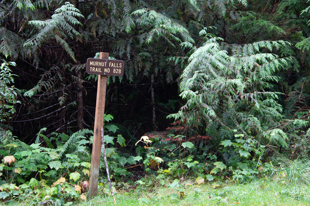
Our first waterfall on the trail, and before getting to the park, was Murhut Falls on the Duckabush River.DSC_3641
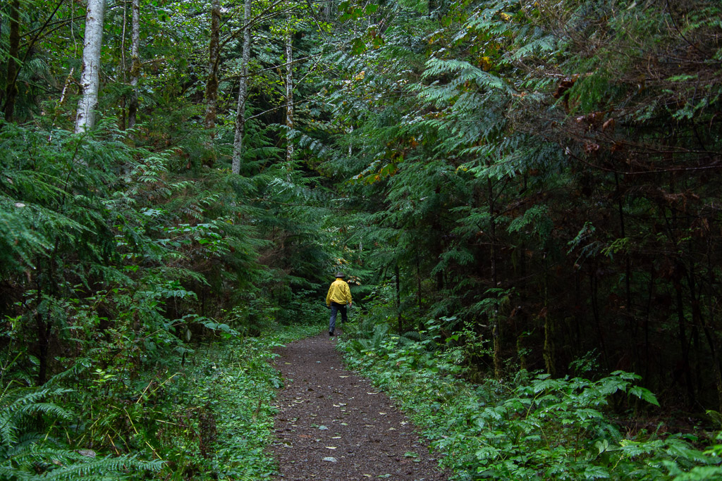
I first wondered about the name of the river. You have to duck under bushes if you don’t have a ready made trail? No, in a side trip to Google I found that it is an Indian word meaning red face, referring to reddish bluffs in the area. IMG_9663
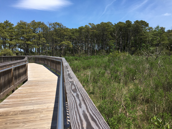
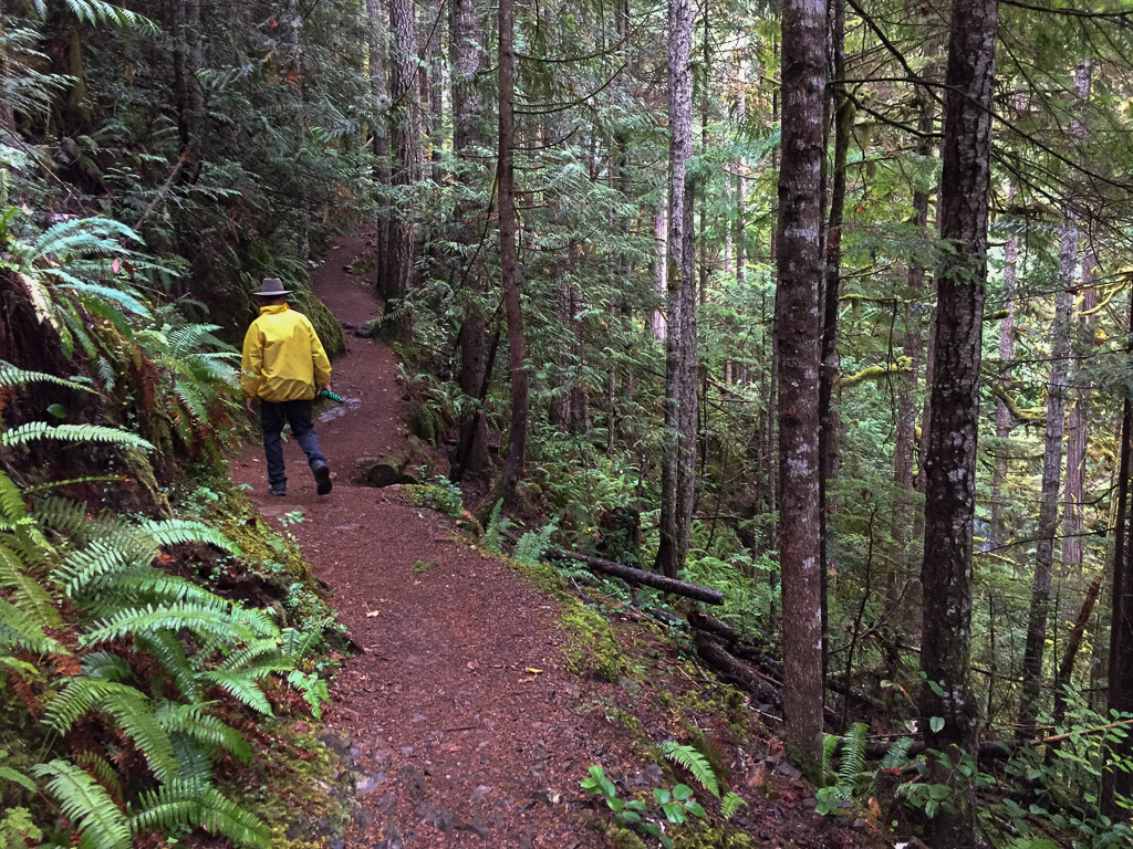
As we found in all our wanderings in this area, the forest is dense, damp, and spectacular.DSC_3636
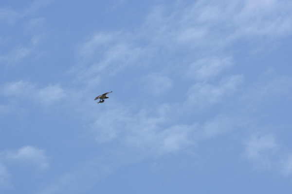
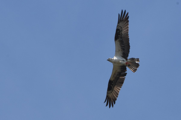
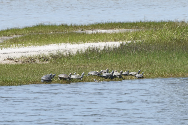
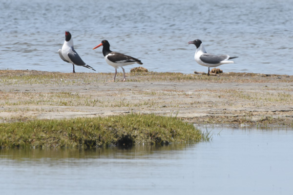
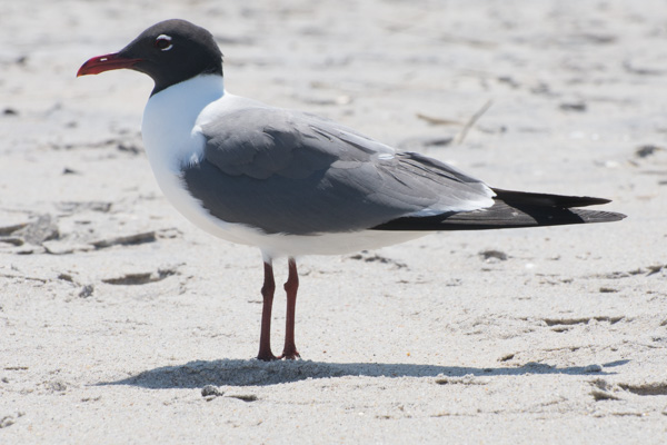
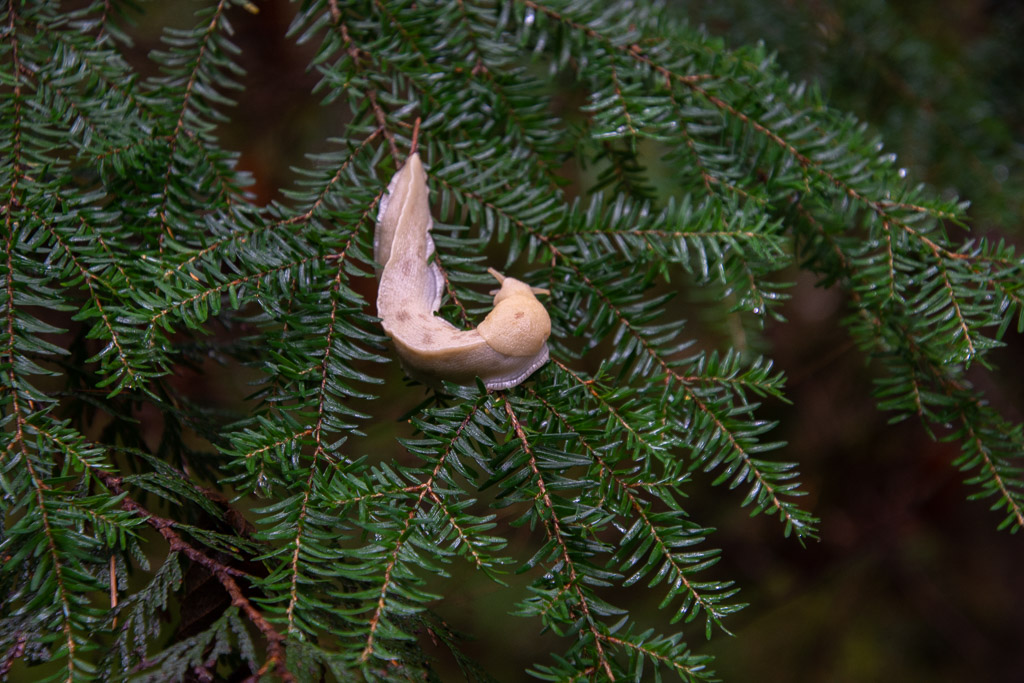
A wildlife shot along the way. So far the only wildlife I was photographing was slow moving.IMG_9665
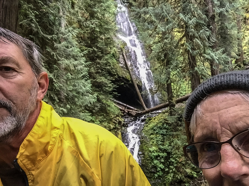
About 3/4 mile up the trail we found the falls.DSC_3643
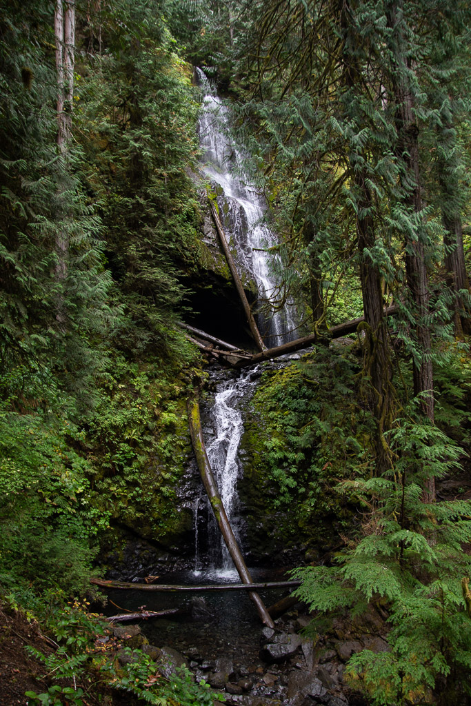
The waterfall trail guide says that this one is 120 feet with another 35 feet below this point. Photos don’t do any of the forest scenery justice.DSC_3644
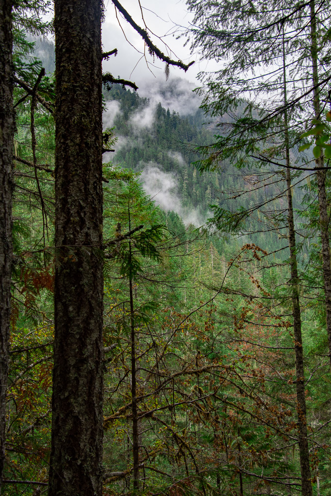
Weather continued to be damp and misty but not much real rain.

DSC_3647
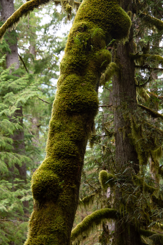
You can certainly tell that this is a wet climate as opposed to most of the places we find ourselves hiking and camping.DSC_3648

We continued north with the Hood Canal on our right and heading towards the Strait of Juan de Fuca, the body of water that separates the U.S. from Canada. I had thought that we’d have time to visit some of the nearby islands, but that will also have to be another trip.

We stopped at the Visitor Center in Port Angeles to pick up a map, but didn’t spend much time there because we were anxious to get to the Park and figure out where we were going to spend the night. We found that the Heart O’ the Hills Campground had spaces so we parked in one and then went hiking.IMG_9677
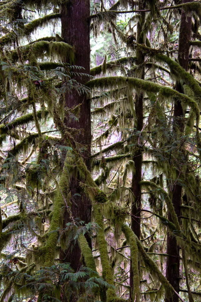
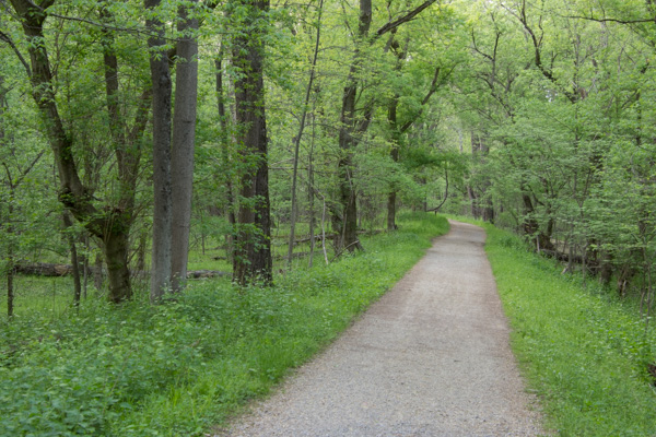
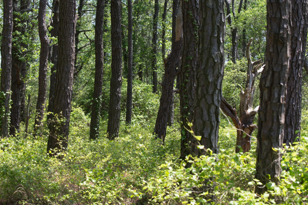
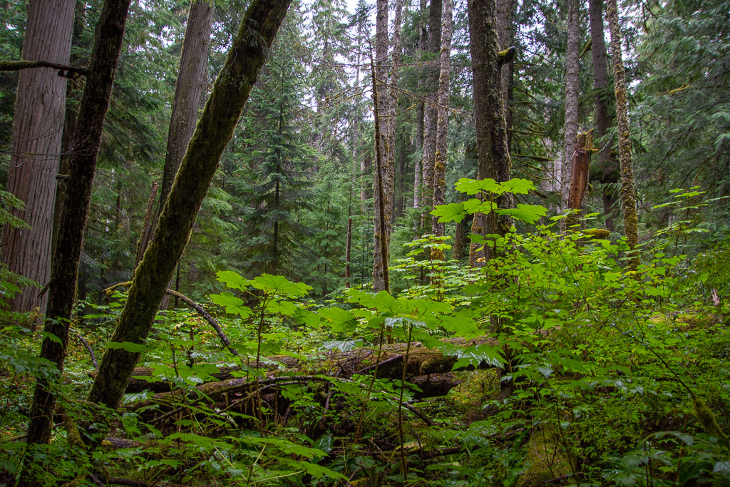
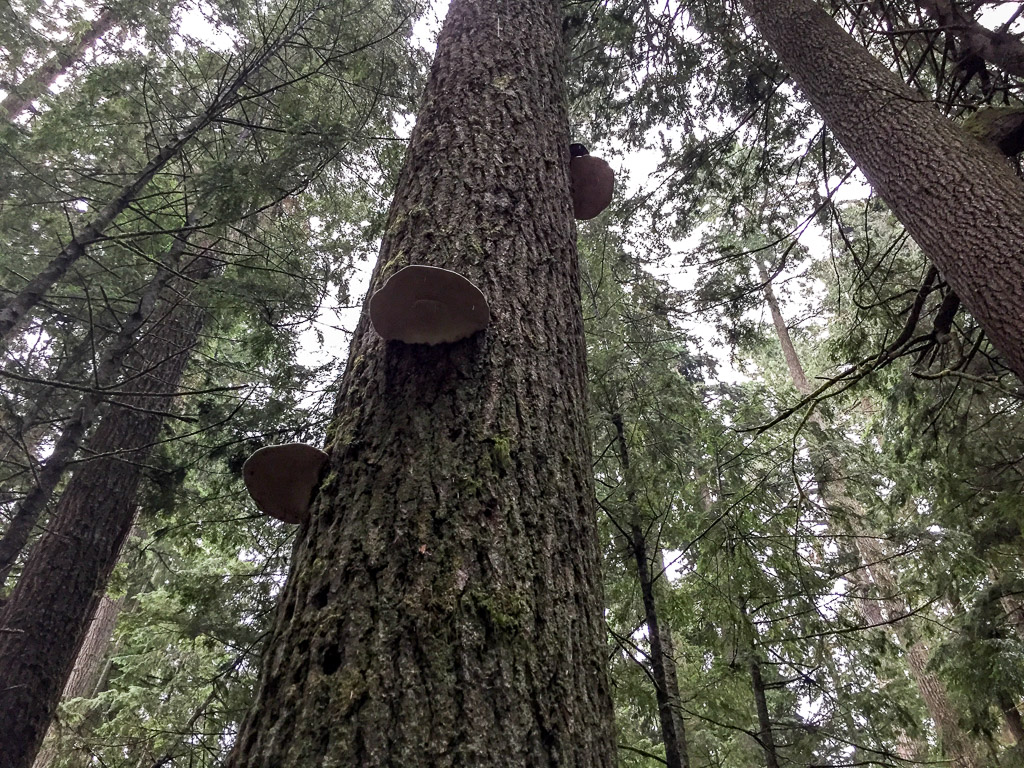
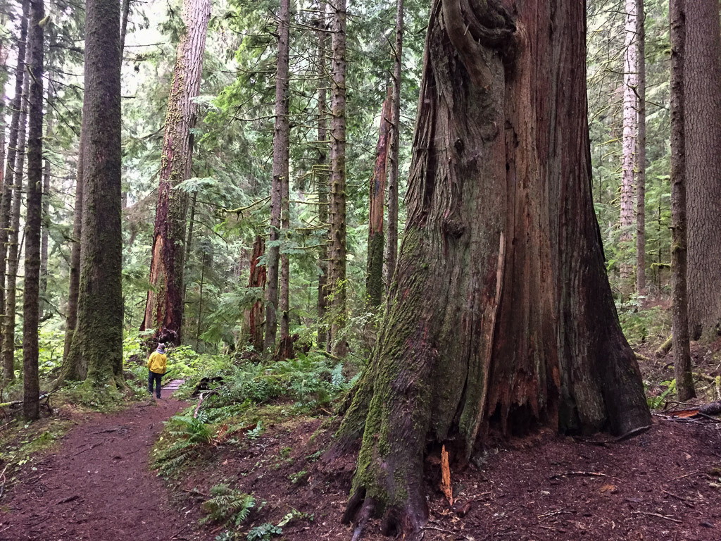
The forest was stunning. The trees were massive.DSC_3654
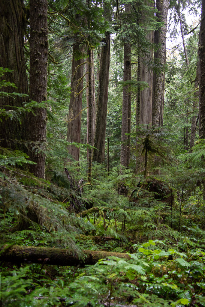
Vegetation is dense.

IMG_9672
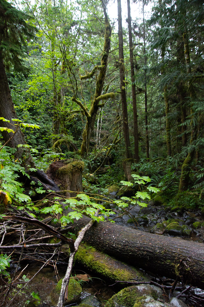
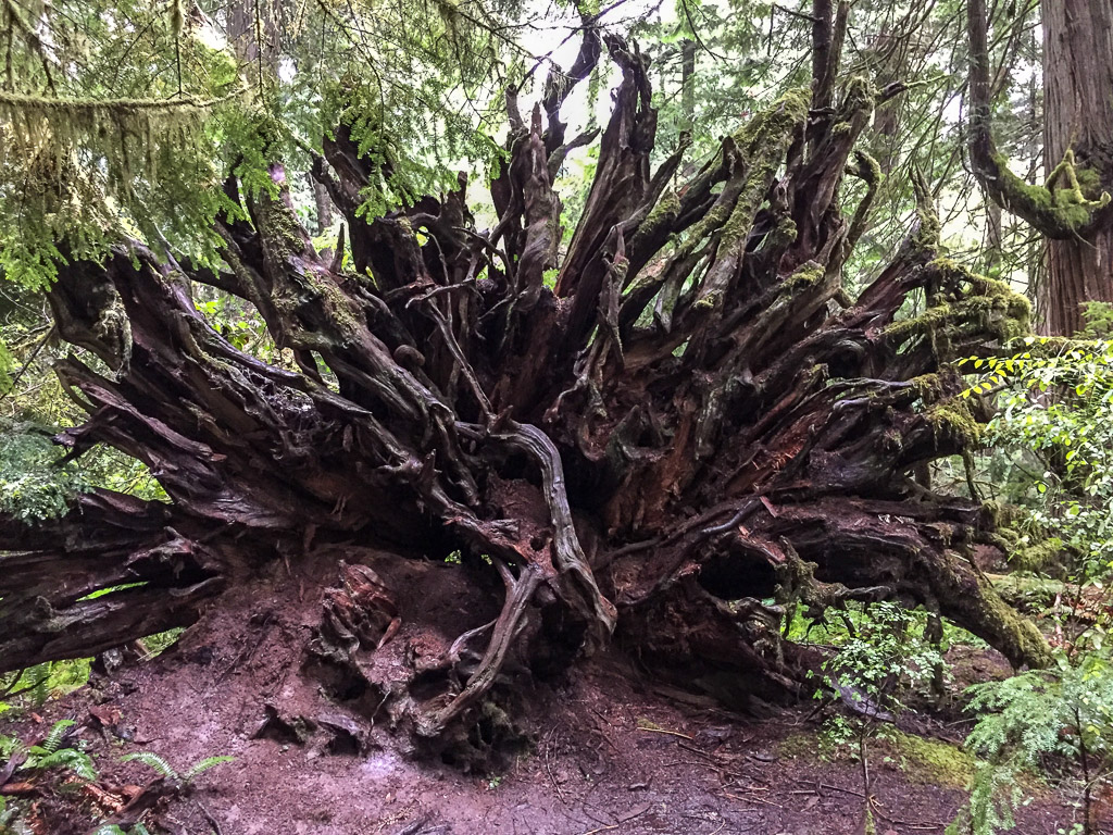
There were lots of trees down throughout this part of the forest, but it doesn’t take long before ferns and herbaceous plants are growing on the downed trees and the forest covers them over.IMG_9679

DSC_3651

IMG_9678
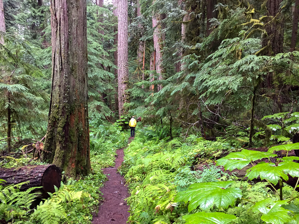
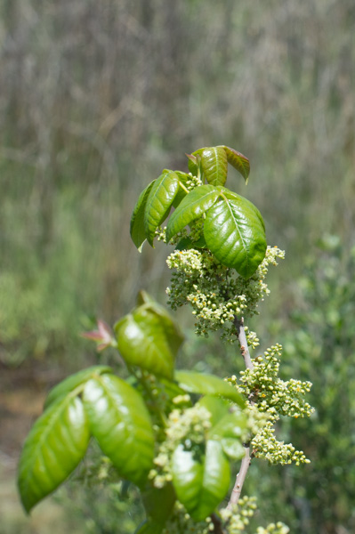
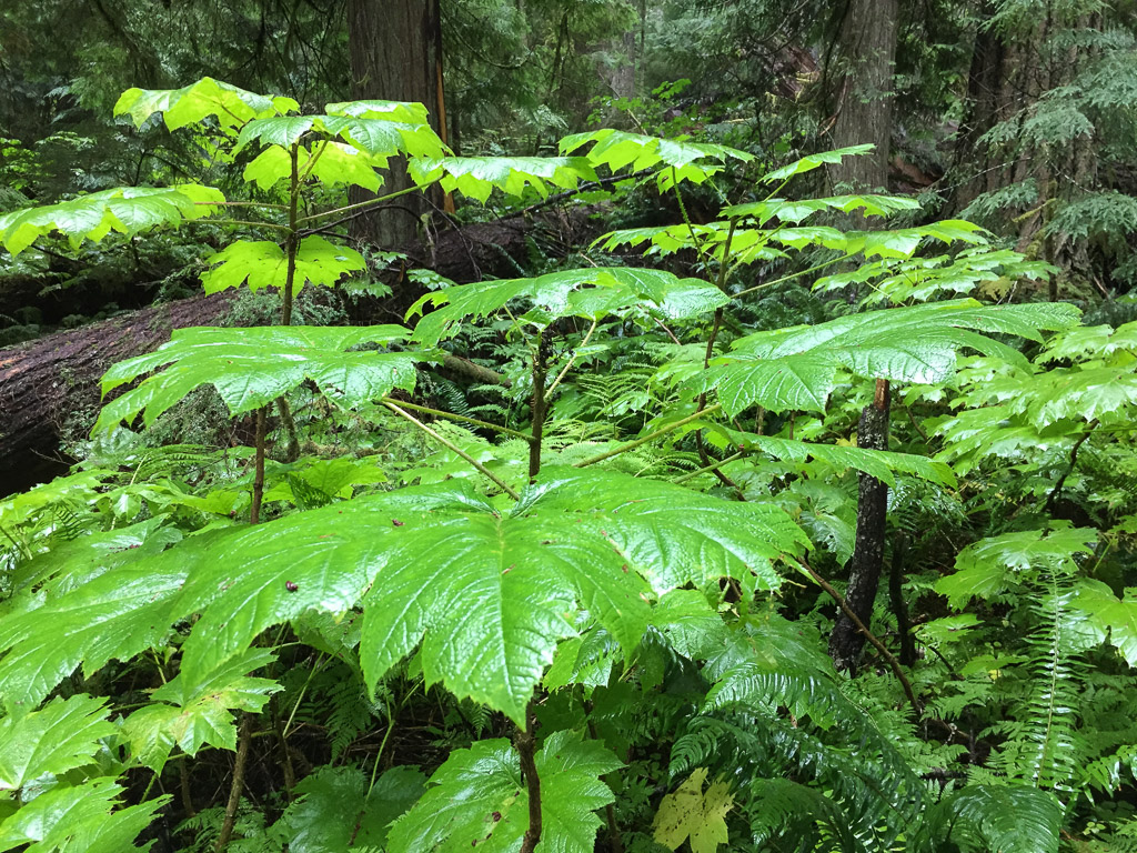
This plant with huge (up to 15″) leaves was everywhere in the understory (see the three photos above). It is called Devils Club (Oplopanax horridus) and is endemic to dense, moist, old-growth forests of the Pacific Northwest. It has a long list of uses by Native Americans from medicinals to face paint and is covered with irritating spines.DSC_3652
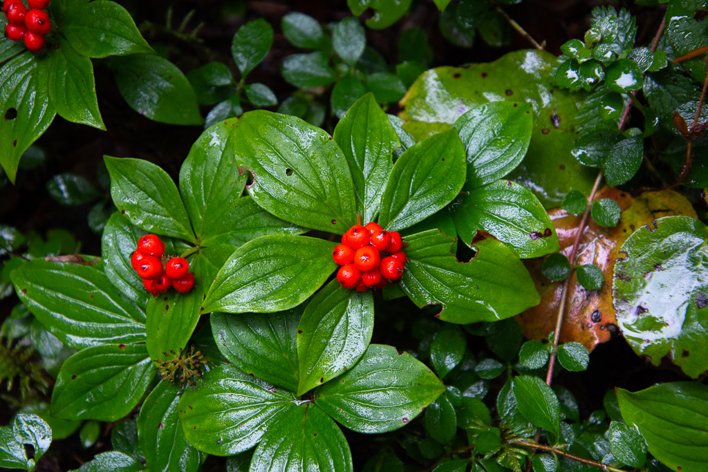
Dwarf Dogwood, Cornus candensis.IMG_9674 
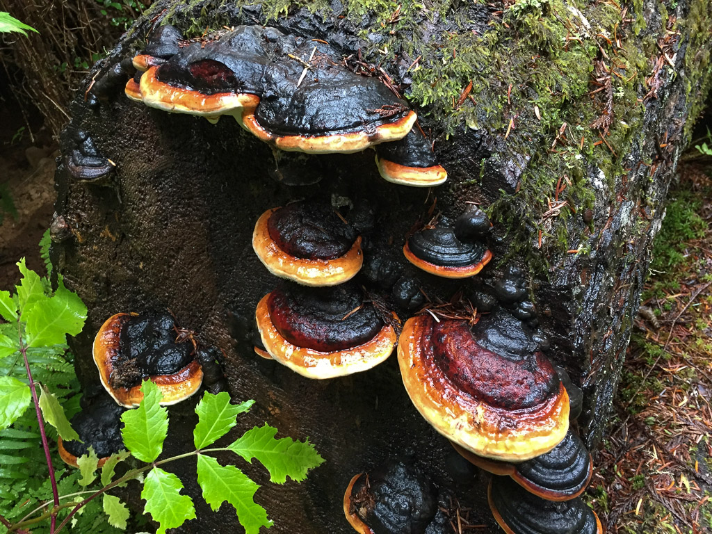
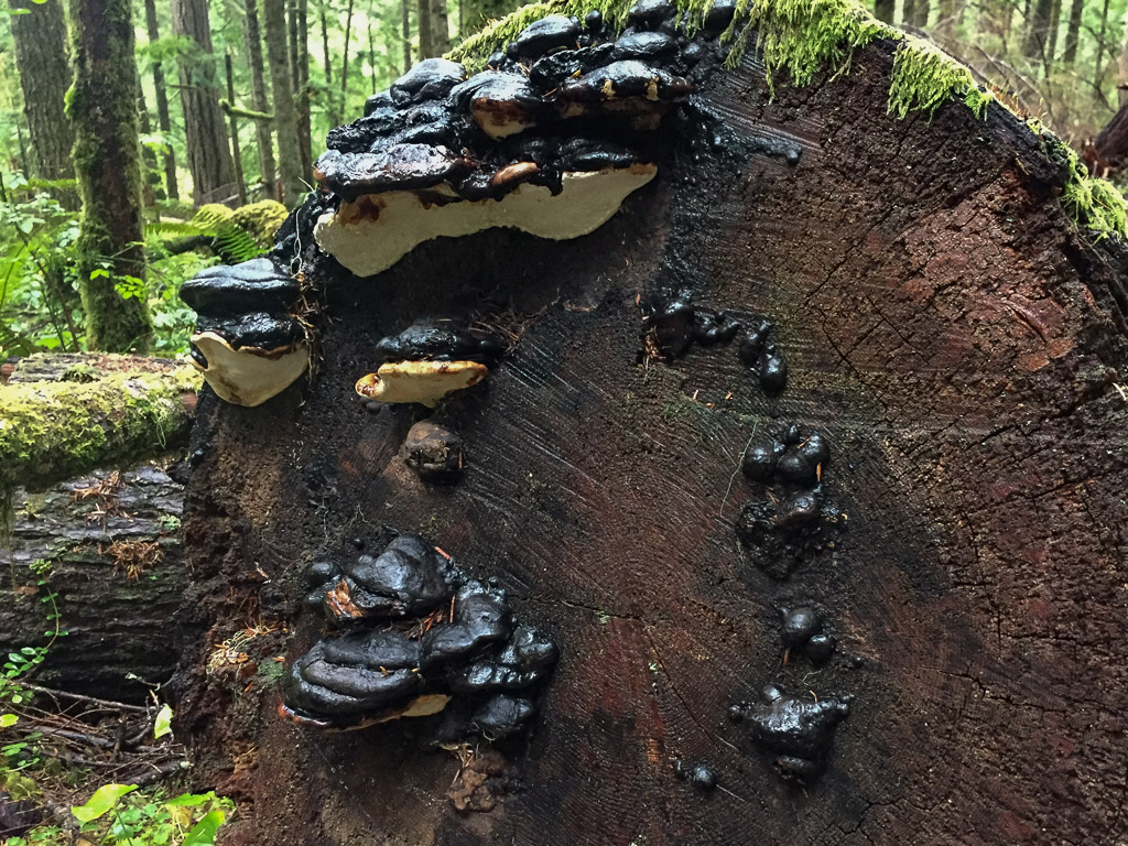
I didn’t even try to identify fungi, but took photos because I like to share these with a friend who dyes with mushrooms.DSC_3655

IMG_9680

IMG_9673

DSC_3659
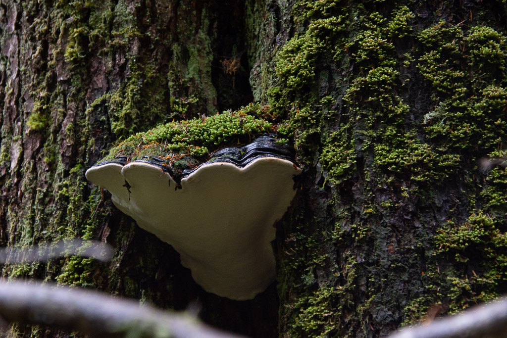
We walked until we reached the creek and were undecided how far the trail continued. But it was getting to be dusk and we decided that we’d better turn back.IMG_9682
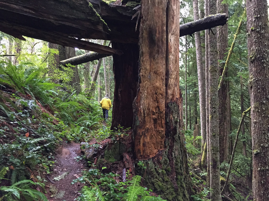
This forest would be pretty dark when the sun was down.

I’ve lost track of our camping meals because they are not exactly gourmet food. On this trip much of the time it was dark by the time we got the camp-stove out and we just dumped a couple of cans of chili in a pan and put hard-boiled eggs and cheese on a salad mix from Safeway. Our sleeping accommodations in the camper shell are just as fancy. We sleep on top of a platform that Dan made so that you can pack all the stuff underneath.IMG_9683
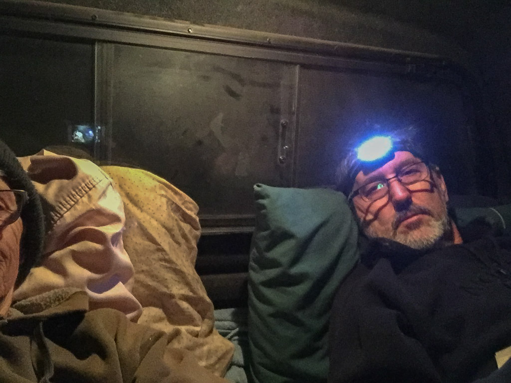
Fortunately it was warm enough with sleeping bag on top of my thick sheepskin. (Maybe it wasn’t that warm, seeing that I’m wearing my wool beanie and a sweatshirt.) IMG_9684 
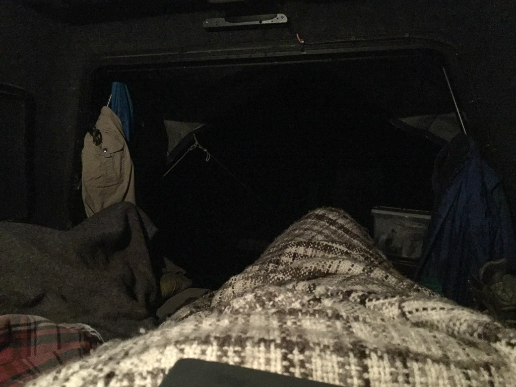
Oh, I have a wool blanket with me too (handspun Jacob by the way). This is the view out from my sleeping bag.

More tomorrow.

Maryland 2018 – Day 1

I left the house at 3:30 a.m. to get to the airport for a flight to Maryland. Yes! I was on my way to MSWF (Maryland Sheep & Wool Festival). Friends and I went to this event last year and ever since I wanted to go again. It was only at the last minute before sheep entries were due that I found that I could get a ride for my sheep (to be shown and are going to PA with a new owner) so I booked a flight for myself.

I got here on Thursday afternoon and wanted to make the most of my time to see some of the country. I checked into the hotel and then got back in the car heading toward the Potomac River and the C & O (Chesapeake and Ohio) Canal.

IMG_6675                  
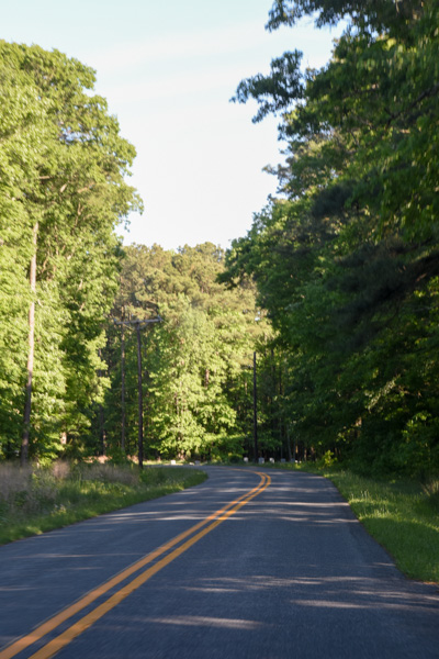
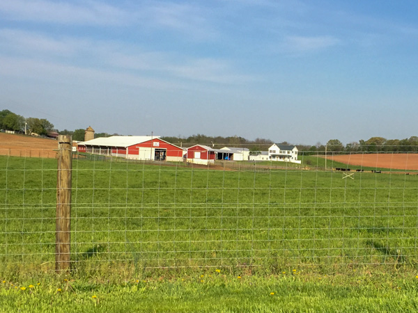
I didn’t want to take the main highways because I love seeing the farm country.IMG_6677                         
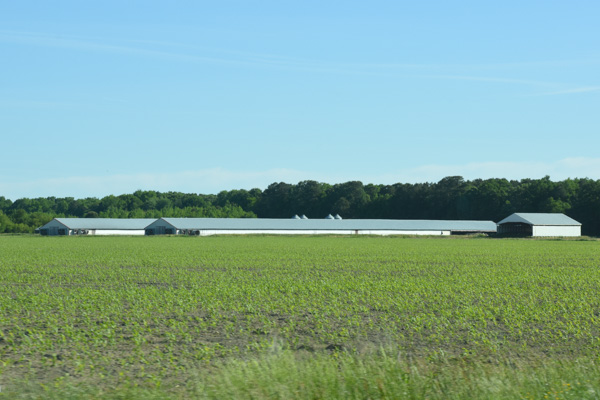
I pulled over in a couple of places just long enough to get photos with my phone.IMG_6678                 You can’t tell from this photos but that tractor is big enough that the car I’m driving could have almost gone right under it. I don’t know what crop that is for.IMG_6680            
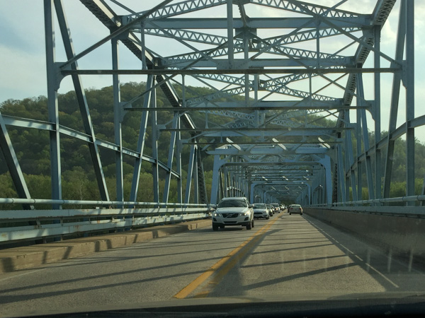
Crossing the Potomac River. I crossed a couple of times before I found the parking area for the National Historical Park at a place called Point of Rocks. (Actually I parked elsewhere and finally found this when I started walking toward the river.)DSC_0363             
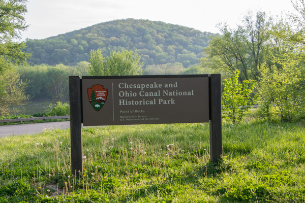
The C & O Canal follows the Potomac River for 184 miles and was used for about 100 years as a way of transporting lumber, coal, and agricultural products. DSC_0365                     
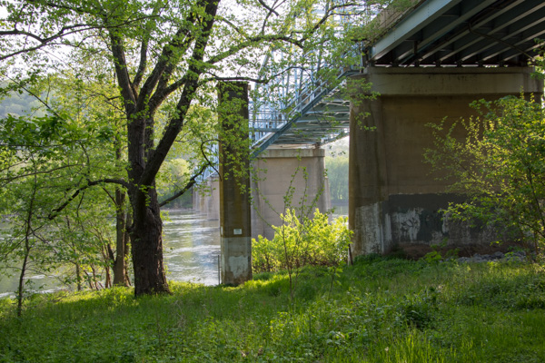
The bridge from below.DSC_0371                  
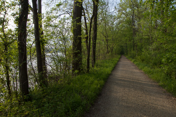
I walked along the towpath for an hour or so.Pawpaw              Here is a tree I haven’t seen before. Flowers on the pawpaw tree.DSC_0368                      
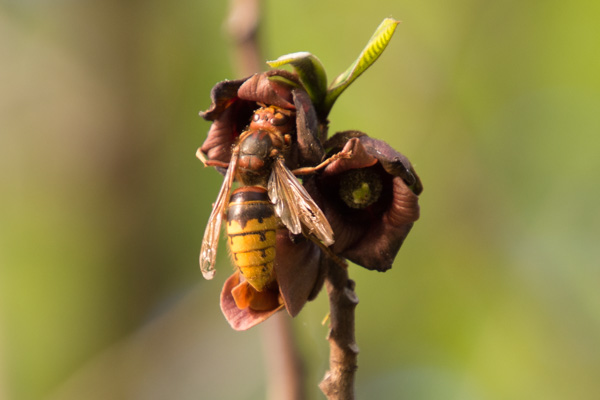
I don’t know what kind of insect this is but it is a big one.DSC_0380                      
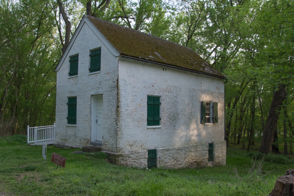
There are some lock houses still standing along the canal. These were houses provided to the locktenders who would be available to operate that lock 24 hours a day. This house, built in 1837,  has been fixed up and is available for rent.
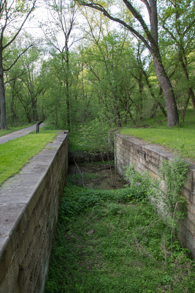
DSC_0377                                                                 A view of the lock.

DSC_0388                              
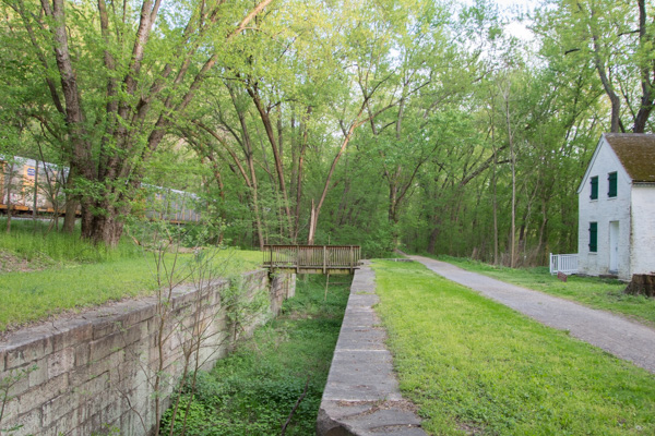
This photos shows the scale and proximity of the house, the canal and the railroad. Point of Rocks is famous because it is where the battle for the transportation rights played out. The mountain on one side and the river on the other left a narrow strip of land. “Both the C&O and B&O [railroad] fought in court for primary access to this “point of rocks.” The C&O won but the two companies compromised, sharing the narrow passage from here to Harpers Ferry.DSC_0390

There is plenty more history to learn and sites to see but I’m going to be spending the next couple of days with sheep. I will get back to this on Monday.

Road Trip to SD – Day 5 – Mt. Rushmore

After driving through the Badlands we decided to continue on the scenic roads rather than go to the highway. Some of them were a bit of a guess since all we had was a road map of the state.

DSC_3163

Not far out of the National Park we stopped to watch a herd of bison. This is not much of a photo but it give you an idea of the number in the herd.

DSC_3196.jpg

Then we headed west on a gravel road that went through another part of the Buffalo Gap National Grassland. Most of the National Grasslands are located in or around the Great Plains and they are managed in the same way as National Forests. Until I looked up this information I didn’t know that there is a National Grassland in California. In fact it is near the Klamath National Forest where I worked when I was in college–but it was designated as such until after that.

DSC_3183

As I had seen on a map in one of the Visitors Centers, the public lands are interspersed with private lands. We saw miles of one of my favorite crops.

Leaving the grassland we drove into the forest again. The engineering of the road to Mt. Rushmore is a marvel in itself. From Custer State Park you drive 17 miles on Iron Mountain Road to Mt. Rushmore. There are three pigtail bridges and three tunnels that were engineered to frame Mt. Rushmore.

IMG_1552

This very poor photo shows what I mean by framing the mountain. Each of the tunnels is aligned to present the view of the mountain.DSC_3209

I was surprised when we arrived to be directed to the roof of a parking garage built into the mountain. It makes sense–they have to do something with all the cars that come here.

IMG_1553

I knew what to expect of the mountain itself because I’ve seen pictures. But I didn’t know about the infrastructure built around this National Memorial.

DSC_3211

There is an amphitheater facing the mountain. From there you can walk on the Presidential Trail around the base of the mountain (or the rubble left from carving the sculptures) and then to the Sculptor’s Studio, where there is a plaster model and tools used by Gutzon Borglum, the sculptor of Mt. Rushmore. DSC_3212

This was an amazing feat in the 1930’s. It took 400 laborers to do this work. DSC_3213

Look at the detail on Lincoln’s face. The noses are about 20 feet long and the eyes are about 11 feet wide. Can you imagine what it would be like to be hanging in a basket here drilling holes for dynamite?

IMG_1555

Time for us to move on. It looked as though there were several campsites in the nearby forest and I didn’t want to have a repeat of the night before. We stopped at the first one that we saw and found a good spot. We had time that evening to relax and read.

I finished a book called A Shepherd’s Life by James Rebanks.

IMG_1843

The author grew up on the family sheep farm in the Lake District of England.  At the beginning of the book he describes how he felt as a boy when it was assumed by “outsiders” that he would (or should) want to do something better with his life, but all he ever wanted to do was to continue with the sheep farm. Also he was resentful with the interest that others (non-residents/city people) showed for the landscape but in a way that he didn’t understand–they didn’t respect the farms and the farming life but looked at the landscape as something with a “higher” purpose. I’m not explaining this very well, but as I was reading this book in the evenings on this trip I found similarities in his description of the visitors to their farm land and the fells above and to us in taking this trip and the others we’ve taken. We are grateful that there are National Parks and other public lands so that we can explore these landscapes that we’d never have a chance to see in depth otherwise. In this landscape we were the visitors, admiring the stunning views, the wildlife, and the agriculture. But we don’t live the life there, don’t have to deal with weather challenges, prairie dog invasions, etc. As an adult Rebanks learned to see the other side and understood the appreciation the “city people” had for the land, albeit without the understanding of the integral part that centuries of farming had played in those landscapes. He found a way in his career (second to shepherding) to promote the importance of farming and shepherding on this land while allowing tourism to benefit the communities as well.

I couldn’t help but find parallels in this book to the experiences that we were having during this week vacation.

Road Trip to SD – Day 5 – Badlands in the Morning

I wasn’t very complete in my description of Jewel Cave from Day 4 of this trip. I usually get out the brochure and re-read the info that is there. Those formations in some of the photos are called Dogtooth Spar, 6-sided calcite crystals formed completely underwater, and Draperies, formed as water trickles down, leaving deposits of calcite crystals. The brochure says that while the cave was forming it was completely submerged in groundwater that was rich in dissolved calcium carbonate. As conditions changed the calcium carbonate precipitated and formed calcite crystals off various depths and shapes on exposed surfaces.

IMG_1507

Here is one more photo from Jewel Cave. There is another cave nearby–Wind Cave National Park but we just didn’t have time for everything.

IMG_1521

I left off the last post with heading to a Rest Stop in the dark. That was not our best night but at least we slept. However we had chosen this plan after passing up the trailhead parking that said “No Overnight Camping”. We didn’t want to be federal criminals. I will admit here that we are now criminals in the State of South Dakota. The rest stop had a sign posted about a SD rule that you can’t stay more than three hours at a rest stop and there was video surveillance for our safety. I keep expecting to get a summons in the mail.  The photo above is what we woke up to. That weather system was in the west, where we were headed to see the Badlands.

IMG_1524

We first had to drive east to find a place to turn around. We commented that South Dakota has big raindrops.

IMG_1525

Now heading west.

IMG_1526

Eventually we drove through the storm, or it passed us over as it was heading east.  This was the first time that I’ve been “on the ground” in the Midwest and I found this side of South Dakota as beautiful as the Black Hills in western South Dakota, although very different.

DSC_3109

Change of pace. A bit of commercialism near the entrance to the National Park.

DSC_3110

Now there was someone at the entrance station (it had been closed the night before) but there were no maps. It seems they had run out with all the motorcycle traffic. (We were able to get one at the Visitor Center.)

DSC_3111

The first view of the Badlands, although we had a glimpse from the other side just before dark the night before.

IMG_1529

The previous night we had driven through the Buffalo Gap National Grasslands on that road south of the Badlands NP, through the eastern end of the Park and north to the highway. If we had more time we could have gone to the National Grasslands Visitor Center further west on Highway 90 in the town of Wall and the  Minuteman Missile National Historic Site just north of the Park. (Note to self: take another trip to SD and buy the Map Book first.) We planned to explore the trails here at the west end of the Park and then drive through the Park, starting our drive home.

DSC_3113

We stopped at an overlook. You can’t tell from this photo but the wind was blowing and it was cold. And what was weird is that this fog was rolling in. That sounds like something I would say standing over the San Francisco Bay. Fog rolling in here in the Badlands? In August?

IMG_1533

Maybe its not “rolling in”. But it sure settled fast.

IMG_1534

The distance view was gone within ten minutes. In fact these photos were taken ten minutes after the first one right after the National Park sign.

DSC_3116

We drove on. The formations were stunning but the surroundings did seem cold and gloomy.

DSC_3122

At the next stop we saw bighorn sheep! Yes! This was the clearest photo I had of them as the mist seemed to get thicker. “Sheep in Fog”. The sheep stayed around, in fact bedding down right there while we hiked on a short trail on the other side of the road.

Then we went to the Visitors Center to get warm, pick up a brochure and map, and see the exhibits.

IMG_1536

Did you know that my background is in Range and Wildlands Science? That’s what the UCD degree was called after it changed from Range Management before I graduated. I admit that I can’t identify most grasses anymore and certainly not these of the Great Plains, but I am interested. The grass is an extremely important part of an ecosystem, whether its these prairies or our irrigated pasture back home. This is a great exhibit.

IMG_1535

Remember the Dust Bowl? Well, most of us don’t remember it, but we know about it. This explains why, when you plow up the prairie you have set up the system for disaster. The Park brochure explains that “the Badlands prairie contains nearly 60 species of grass, the foundation for a complex community of plants and animals. The prairie once sprawled across one-third of North America.” Today there are only patchwork remnants of this prairie that “occurs in areas that are too dry to support trees but too wet to be deserts“.

DSC_3129

We drove on to the Fossil Exhibit Trail. This area went from being a under a shallow sea, to a jungle after the land lifted up, and then covered with sediment and volcanic ash that turned to soft rock. Eventually erosion exposed all the colorful layers and the fossils they hold, so the SD Badlands in known world-wide for it’s fossil record.

DSC_3139

From information found on this website: “Although by definition badlands contain very little vegetation, some plants, particularly prairie grasses, are found in South Dakota’s badlands regions.  Sod tables, remnants of the prairie that have resisted erosion, provide platforms for vegetation.

IMG_1538

You can see the layer of soil that held by the roots of the vegetation but that isn’t enough to prevent the sides of the sod table to continue to erode. In fact, the Badlands are retreating to the north in general as natural erosion occurs. Notice the holes at the top of this sod table. We thought that maybe birds used these holes.

DSC_3138

Then we saw that these are rodent tunnels that have opened as the erosion occurs. You can see that in this photo.

IMG_1539

Beautiful landscape. What would an early explorer have thought, having just ridden over miles of grassland?

IMG_1541

IMG_1542

IMG_1543

DSC_3154

Here is a different landscape.  I might not have known for sure what this was except for having visited Devils Tower NM two days before. (By the way, there is a pronghorn in the photo but I’m talking about the mounds and the lack of grass.)

DSC_3155

Here is the culprit. I can see how prairie dogs are considered a nuisance. The road took us past  acres and acres of this devastated landscape. As usual there are two (or more) sides to a story. I have to get on with other things right now and won’t try to research this one. Here is one article that gives various perspectives.

The day wasn’t over. We had another stop before camping for the night. That will be in the next post.


Road Trip to SD – Day 3 – Devils Tower

After a morning spent touring Mountain Meadow Wool we headed east toward Devils Tower National Monument.

Coal mine-Gillette, WY

This is part of a coal facility near the town of Gillette, home to 12 coal mines which provide 1/10 of the jobs in the area. Up to 100 trains loaded with coal leave the town every day. We noticed that the sky over much of our trip was not as blue as we expected and that is evident in my photos. I am used to the Sacramento Valley haze in the summer, a result of dust, smoke from wildfires, and probably smog, but I didn’t expect this in Wyoming. I wonder if these hazy skies are from all the coal mines.

DSC_2955

Artwork seem when driving through one of the towns.

North of Moorcroft, WY

I wouldn’t call this artwork, but someone has a sense of humor. Am I the only one that sees these logs as weird animals?

North of Moorcroft, WY

As expected there were lots of cattle. This is north of the town of Moorcroft, where we turned off  of I-90 to head north to Devils Tower.

DSC_2978

First view of Devils Tower. The Tower rises 867 feet from the base and 1267 feet above the Belle Fourche River. The diameter at the base is 1000 feet and the area on top is 1-1/2 acre.

IMG_1447

There is a trail all the way around the Tower and it looks different on each “side”.

DSC_3000

This is looking at its southeast face. Do you see the column that is much shorter and tipped a bit just inside the part that is in shadow and that looks like it is just above the tree in the photo? Then do you see the column that rises up about twice as high as the shorter broken one?

DSC_3002

This is a close-up of that taller column. There is a climber! Look above the next column over (about an inch on my screen). That gives you some perspective about the size of this huge rock.

DSC_3010

This is a detail of the outer third of the Tower from that first photo (where, due to camera perspective, it looks more tipped than it really is).

DSC_3011

Tisis a closer view of the middle of the photo above. Those things that look like sticks? Those are the outer edge of a ladder that was used to get up the first 350 feet in the 1890’s. The ladder is anchored in the crack between the columns. Can you imagine? The lower part has since been removed and some of the upper restored by the Park Service in the 1970s.

DSC_3012

This is another view that includes the area of those close-ups just to give some perspective.

DSC_3019

The trail around the Tower is paved the whole way to accommodate the thousands of visitors  that come each year. Hot in the sun, it was very pleasant under the canopy of trees.

DSC_3023

Speaking of trees, these are pretty substantial trees at the base of the cliffs. Another measure of perspective.

DSC_3021

Look at those trees in this view.

DSC_3024

There were beautiful colors and patterns in the rock.IMG_1452

We were at the Tower for about two hours or so. Before leaving the National Monument we had to stop at the prairie dog town.

DSC_3034

These are certainly well-fed prairie dogs.

DSC_3047

But I didn’t realize the damage that they do to the landscape. There are prairie dog mounds throughout this photo. I have some very severe photos to share later on in these blogs.

DSC_3055

We drove north and then east from the Monument…IMG_1456

…and found a campground in the Bear Lodge Mountains, part of the Black Hills National Forest. Again, we needn’t have worried about the campground being over-run by motorcycles from Sturgis. Maybe the riders are not big campers. There was only one other person in this campground.

IMG_1455

This is a rare scene–not Dan reading a newspaper–but that we actually had time to relax and enjoy the evening in camp. Point #1: we got there early enough that there was still evening left before we needed to eat or get to sleep. Point #2: There were NO mosquitoes, it wan’t cold, and there was no rain. So Dan read his newspaper and I read The Shepherd’s Life by James Rebanks. I found that some of the author’s points resonated with me on this trip. More about that later. IMG_1461

An after-dinner fire. This reminds me of the disembodied head of Oz.


MJ Adventure Team Goes to MD – Day 7 – Ponies!

It’s been almost a month since we  embarked on this trip so I guess I’ve had extended enjoyment while organizing photos and thinking about the blog posts.  I don’t know how many people really read my posts, but there have been some who have asked “what about the ponies?”

Day 6 was spent learning about Fort McHenry and exploring Harriet Tubman Underground Railroad. We spent a comfortable night at our AirB&B in Berlin and got on the road in time to get to the Assateague Island National Seashore…  DSC_1017

…when the Visitor Center opened. The area is managed jointly by the National Park Service and Maryland Park Service.

DSC_1019

Assateague Island is a barrier island that is 37 miles long and separated from the mainland by Chincoteague Bay and Sinepuxent Bay. The northern two thirds is in Maryland and the southern one third is part of Virginia. If you were a horse-crazy girl once then what you know about these islands is that there are wild ponies living there, made famous by Marguerite Henry’s book, Misty of Chincoteague.  We had come to find the ponies.

DSC_1025

Only part of  the island is accessible on a paved road that connects campgrounds and trails. We hadn’t gone far when we found them. Ponies!

DSC_1021

Just pretend that you don’t know that they were in a parking lot near the bathrooms. Signs everywhere warn people to leave the ponies alone and don’t offer food. It’s the same kind of warnings that you read in Yellowstone about not feeding bears and packing food away. People are kicked and bitten by ponies and the ponies are hit by cars when they get used to people offering food.

These ponies didn’t seem to be going anywhere soon…

DSC_1029

…so we walked to the beach.

IMG_9633

We had made it to the Atlantic.

DSC_1035

That is Ocean City, about 10 miles north. Can you see the ferris wheel and the amusement park in the middle of the photo? What a contrast when looking from the National Seashore.

DSC_1038

The barrier islands are “among the most dynamic landforms on earth”. There is constant change. Assateague Island is moving west, at an accelerated rate after jetties were constructed near Ocean City in the 1930s.  At one time Assateague Island was to be developed, and in the 1950s a 15-mile road was created on the Maryland side of the island. A hurricane in 1962 wiped out structures and covered the road, and legislation in 1965 created the National Seashore.

DSC_1070

The ponies are most likely descendants of horses that were brought to the island 300 years ago by farmers who took advantage of the natural “corral” made of water. Farmers were required to pay taxes on their livestock and by turning them loose on the island, they could avoid the tax. I usually try to be scientifically accurate about what I write, but there is some artistic license here. The documentation from the Park Service says that genetically these are HORSES, not PONIES. The small stature is a result of years of adaptation to a diet of abundant, but nutrient-poor salt-marsh grasses.

DSC_1064

Sorry. I will continue to call them ponies while I’m talking about our visit. They are used to paparazzi. We were lucky to be visiting in the off-season and on a weekday. There were very few people around. It would have been a very different scene if the parking lots and roads were full.

DSC_1044

The ponies wandered off and we drove on to find more.

DSC_1078

This looked like a very old pony at an empty campground. The Maryland ponies are managed as wildlife are. From the brochure, “While action may be taken to end the suffering of a gravely ill, seriously injured, or dying horse, no measure are taken to prolong the lives of Maryland’s wild horses. As with other species of Assateague wildlife, horses that are sick or weak do not survive.” The population is controlled using a non-hormonal, non-invasive vaccine, administered by a dart, to prevent pregnancy. With this method the birth rate has been lowered to fewer than ten foals each year which maintains the population at under 125 horses.

A fence that separates the Maryland and  Virginia herds. The Virginia herd is privately owned and produces 60-90 foals each year. The foals are sold at auction after the annual swim from Assateague Island to Chincoteague Island and the proceeds go to veterinary care, the fire department, and various charities. There are week-long festivities around this event and you can see videos at this link.

DSC_1103

There are three nature walk trails through the marsh, the forest, and the dunes. We started with the marsh trail.

DSC_1100

DSC_1088

We spotted this osprey that had caught a fish.

DSC_1107

We watched for quite awhile while it circled, still carrying it’s fish.

DSC_1116

Diamondback terrapins.

American Oystercatcher-Laughing Gull

Two laughing gulls and an American oystercatcher…

American Oystercatcher-Laughing Gull

…who was not welcome.

Short billed dowitcher

Short-billed dowitcher.

IMG_9649

DSC_1189

We drove down another road…

DSC_1190

…where we saw a group of people gathered. From my Yellowstone experience (people stopping in the road when wildlife is spotted), I figured that that meant Ponies!

DSC_1200

This group was a little more picturesque, being “in the wild” instead of “in the parking lot”.

DSC_1203

DSC_1210

DSC_1245-2

There was a Pony Patrol volunteer with that group of people answering questions and making sure that ponies aren’t harassed.

We drove to the next trail–the forest nature trail.

IMG_9650

Loblolly pines are the dominate forest species.

DSC_1301

DSC_1299

DSC_1297

Poison ivy.

IMG_9652

IMG_9645

IMG_9641

DSC_1275

At the end of that trail we saw the same group of ponies, but from a different view. Notice the paddle-boarders in the marsh. What a great way to see the marsh and the ponies.

One more interesting pony fact: “The Assateague horses drink over twice the amount of water that domesticated horses will due to their salty food supply. All that drinking combined with a high salt diet contributes to their bloated appearance.”

DSC_1307

We drove to the Dune Nature Trail.

IMG_9653

Chris needed some beach time so Kathleen and I walked the trail while Chris enjoyed the beach, albeit a bit cold and windy.

IMG_9655

DSC_1328

DSC_1332

Remember the road that I said was built in the 1950s? Part of it is still visible.

DSC_1341

DSC_1323

IMG_9630

IMG_9631

As we left the park we were faced with that age-old question.

DSC_1351

“Why does the pony cross the road?”

DSC_1352

Because the grass is greener?

This was another full day (and a very full blog post) but there is more Maryland scenery. That will be another post.

MJ Adventure Team Goes to MD – Day 6 – Harriet Tubman NHP

On Day 6 of our adventure we spent the first part of the day at Ft. McHenry National Monument. Then we headed for Harriet Tubman Underground Railroad in Dorchester County, Maryland. Maryland landscape-17

I commented in the last post that there is a lot of water in Maryland!

IMG_9606

At this time Chris was driving and we didn’t know until we got here that driving across bridges is not one of her favorite things.

Chesapeake Bay Bridge

This is a 4-mile bridge across Chesapeake Bay.

IMG_9611

Kathleen gave moral support from the back seat. Chris did just fine.

IMG_9612

I rode shotgun trying to figure out where we were going and not wanting to miss any photo ops. It turns out that our Visitor Center was not on this map because it is brand new.

Harriet Tubman NM

The Visitor Center is co-managed by the State of Maryland and the Park Service. To fully experience the Underground Railroad site you can follow a driving tour 223 miles through Maryland, Delaware, and Pennsylvania. There is written and digital documentation to explain the sites along the way. But we didn’t know that when we made this plan. So we ended up seeing only a fraction of what is actually part of the Underground Railroad Byway.

IMG_9616

The exhibits in the Visitor Center gave us a good understanding of Harriet Tubman’s life and the heroism that she showed in escaping slavery and then returning many times to rescue over 70 family members and friends.

IMG_9614

A chilling quote that describes some of the anguish inflicted by one person on another.

IMG_9617

At the last stop in the Visitor Center there is a video with modern era commentary about human rights and the fact that we still struggle.

Blackwater River

After leaving the Visitor Center we followed the Driving Tour map for a short way on our way to picking up Interstate 50. We drove through the Blackwater National Wildlife Refuge, largely unchanged from the time when Harriet Tubman lived in the area.

Maryland landscape-29

Maryland landscape-37

There are signs along the way.

Bucktown

This is the Bucktown Store, closed when we drove by. Harriet was in this store when the shopkeeper threw a 2-pound weight at a slave who was fleeing the store, but instead hit Harriet, nearly killing her.

Bestpitch Ferry Rd.

The one-lane, wooden Bestpitch Ferry Bridge at the site of a former ferry landing. Agricultural and timber products were transported on rafts.

Bestpitch Ferry Rd.

Harriet’s knowledge of the waterways and survival in the marshes aided her in escape and rescuing others.

Marsh-Dorchester Cty

Marsh-Dorchester Cty

Marsh-Dorchester Cty

We inadvertently left the documented byway and followed country roads toward the Nanticoke River where we would turn north to pick up I-50.

Marsh-Dorchester Cty

I wish I knew what that very tall grass was on the side of the road.

Bestpitch Ferry Rd.

Modern farming. We saw a lot of these huge long barns and decided that they were probably chicken houses. Agriculture is Maryland’s largest commercial industry and livestock, particularly broilers (5-12 week old chickens), followed by dairy, are the leading products.

Marsh-Dorchester Cty

Drive-by photography.

Marsh-Dorchester Cty

Vienna

This house is in the town of Vienna where we joined up with I-50.

IMG_9621

This “beachy” comfortable house near the town of Berlin was to be our headquarters for the next two nights. Look familiar? Chris and Kathleen figuring out where to go for dinner. They found a seafood restaurant and I had salmon, grits, and sweet potato fries. Southern dining. I hadn’t realized until this trip how close to “The South” Maryland is.

Our first day of site seeing took us to Harpers Ferry and  immersion in Civil War era politics and strife. We had a wonderful diversion at the Maryland Sheep and Wool Festival during the weekend. Then we saw Gettysburg and were immersed in Civil War history for a day. Fort McHenry took us back into history, focusing on another war and also learning about the Fort’s role during the Civil War as well. Learning about the Underground Railroad and Harriet Tubman emphasized this sobering and grim part of U.S. history known as slavery. Maybe it’s like reading the newspaper–most of what makes “news” is not happy. These episodes of history depict the desire for power  and the struggle of those being oppressed.

I was ready to see PONIES! That will be tomorrow.

Road Trip – Day 4 – More of the Grand Tetons

DSC_4359 It was cool in the mornings at Grand Teton National Park, but the main reason to suit-up was to keep the mosquitoes off. They were awful–not very conducive to hanging around camp in the morning. That was not our plan anyway — too many places to see, too little time. As soon as Dan had his coffee we were ready to go.DSC_4360 Look who came to the campground for breakfast.DSC_4366 Hiking near String LakeOur first hike for the second day in Grand Teton NP was around String Lake. DSC_4394 Yellow-bellied marmot.Avalanche chuteAt several places there was evidence of avalanches that took out all the trees in their paths and… avalanche chute …obliterated the trail in some places. DSC_4410DSC_4422 Crossing the river at Jenny Lake we saw our first moose.DSC_4428 This is another moose we saw in a meadow along the road on the way to our second stop of the day.

Lunch stop, "Solid 10 for style and effort"

We drove to trailheads at Lupine Meadows…DSC_0463…where we had lunch. You can’t tell from the photo but it was very windy here. Dan sprinted to chase down a plastic bag that blew quite a distance across the parking area.  One of the visitors later stopped at our truck and told him that he and his passengers gave him a “perfect 10 for style and execution”.DSC_4443 We were near the south end of the park and decided to backtrack a short way down the valley to see the National Museum of Wildlife Art. That will be a blog post by itself.DSC_4472 Back in the park we went for another hike, this time to Taggert Lake.DSC_4475 There are magnificent views though out the park.IMG_0062 

Signal Mtn trailAs the sun was going down we drove to the top of Signal Mountain. More spectacular views, but also an unbelievable number of mosquitoes.Signal Mtn trail from Signal Mtn.Late evening view from Signal Mountain.

Once again we got back to camp after dark, so we cooked our meal (spaghetti) and went to bed.