Have I been too focused on weather? Fog, Fog, Fog, and then Rain. The sun was out today–all day! And it felt wonderful!
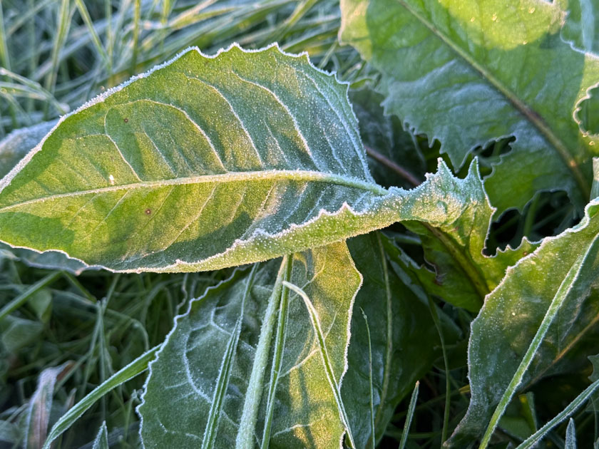
It was a chilly morning with frost. But it makes all the difference when the sun is out.
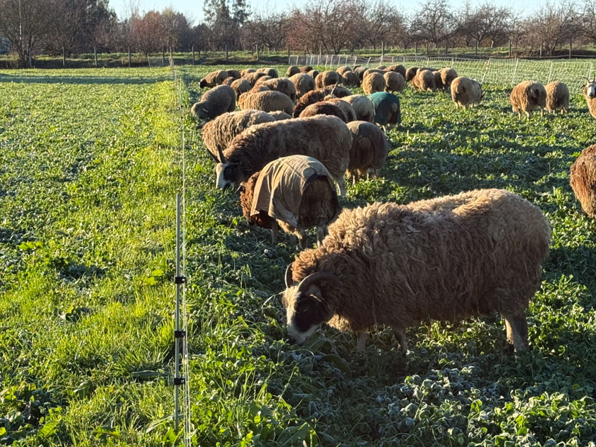
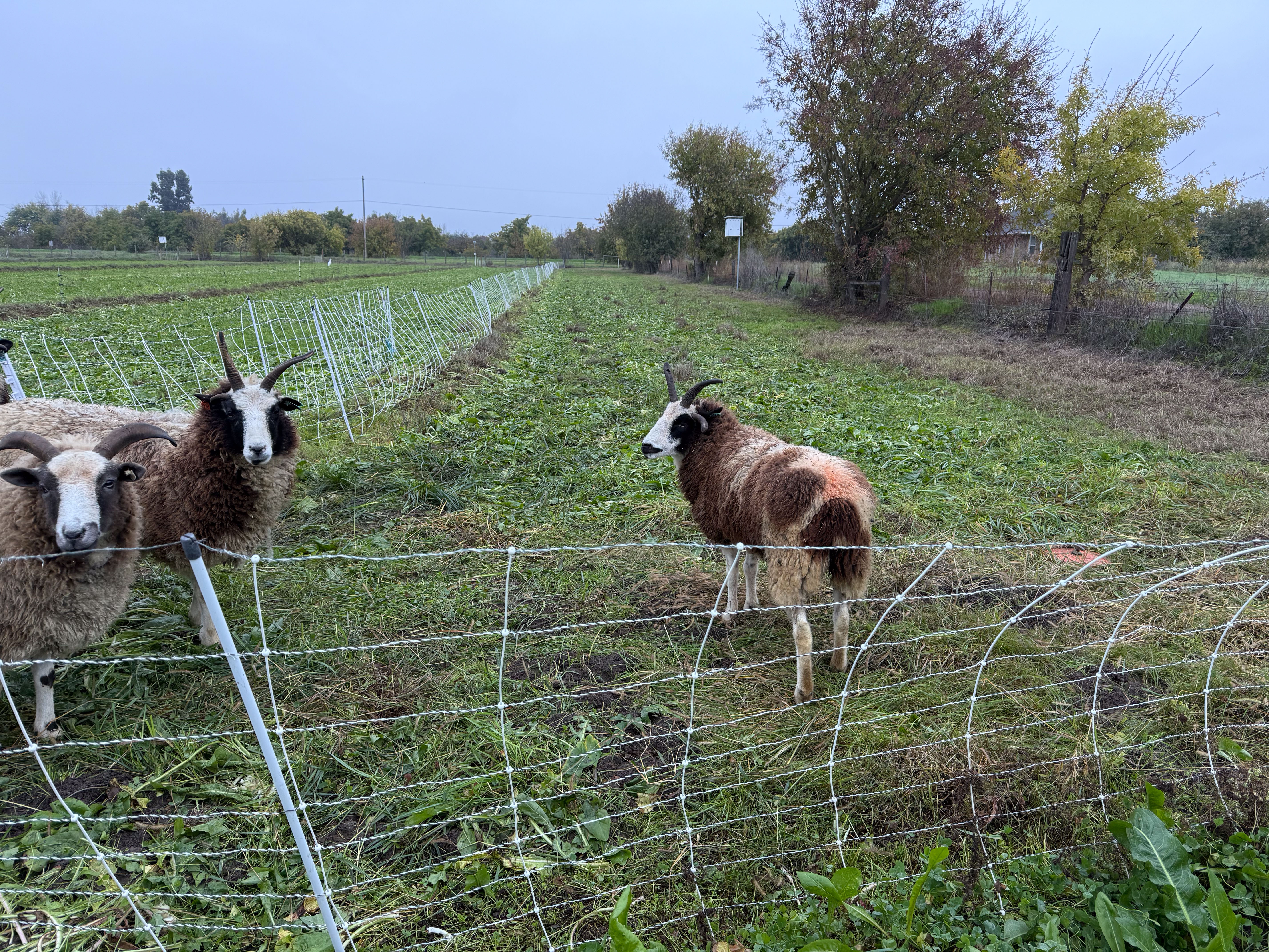
I moved the net fence (to the right in this photo) and let the sheep out to graze. In the last post I said that they were off the pasture while it was so wet, but today I thought that it had dried enough to minimize impact to the soil.
After chores and while I was still wearing all the layers I thought I’d take Ginny for a W-A-L-K (I have to spell it if she is near me) Across the Road. That’s Mt. Diablo in the distance (see the birthday hike post).
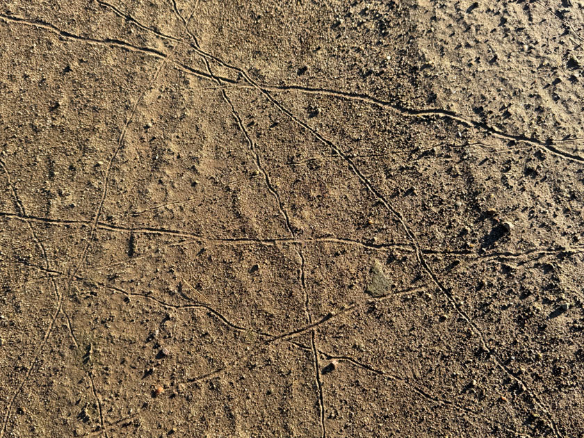
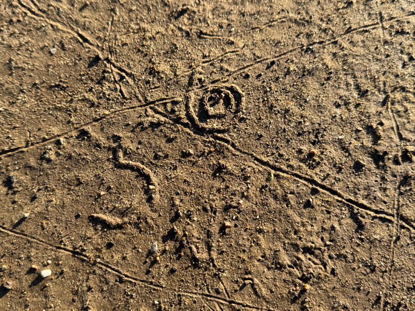
I’m always curious about what makes these patterns. Any suggestions?
Some of the patterns are from some kind of creature ON the soil. What about the others from a creature UNDER the soil?
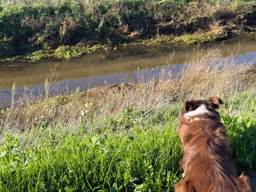
Towards the end of the walk Ginny saw something across the canal that looked familiar. I could see that it was an osage orange fruit, and not a tennis ball, but she was sure focused. I suggested that she go “get it”. Do you see the “ball” at the far side of the water, just about center in the photo?
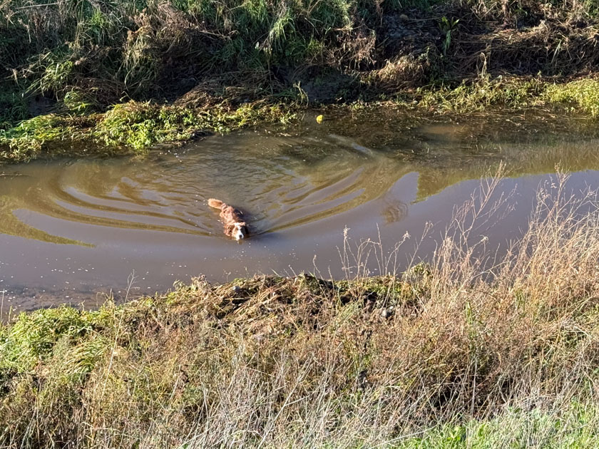
Ginny swam across the canal but was disappointed to find out that the yellow object was not a ball. That made me wonder about colors that dogs see. I didn’t think that they distinguish color. Here is what AI says: “Yes, dogs can see yellow, and it’s one of the primary colors they distinguish well, along with blue; they have dichromatic vision, meaning they see a spectrum dominated by blues and yellows, while reds and greens often appear as brownish or grayish shades. Their vision isn’t black and white, but it’s limited compared to humans, making yellow tennis balls stand out clearly against green grass for them.” Look at what you can learn when reading this blog.
Later in the morning, working in the sunny garden I spotted about 20 turkeys at the far end of the pasture. That’s the neighbor’s house in the background.
The title is significant. I don’t know that we have ever grazed into December. There wasn’t enough feed and the ground was too soggy. Now we have lots of green feed and need to keep the sheep eating it. The downside is that the rain seems to have stopped and we will need more.
This is Paddock #1 (west property line) after two days of grazing.
This is Paddock #1 North, just across that fence. Notice that my boot is under the bottom wire, but it’s pretty well buried in foliage. I walked along this stretch of fence to clear that bottom wire.
Happy sheep.
More happy sheep. The last time we grazed this paddock was three months ago on September 1.
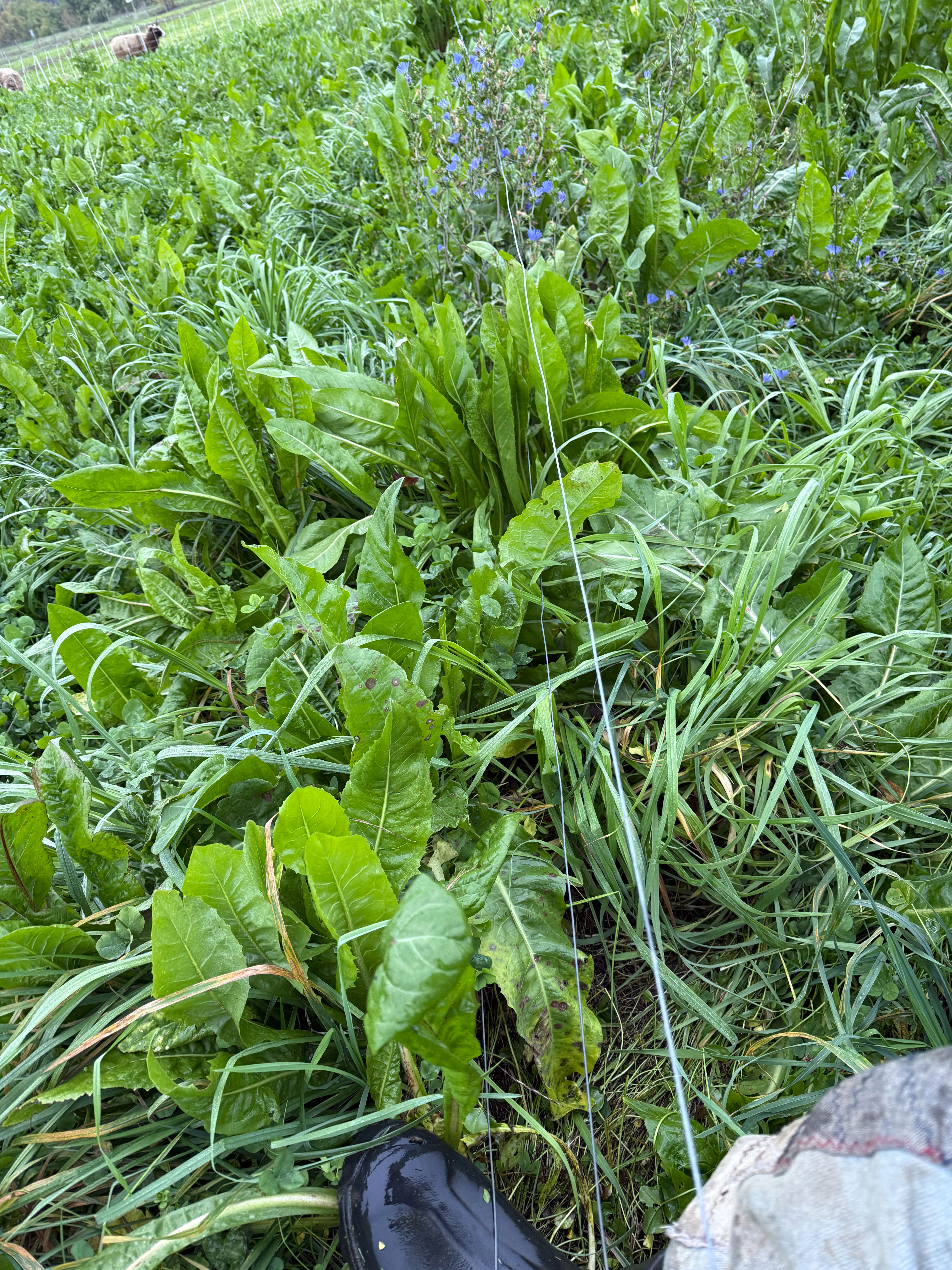
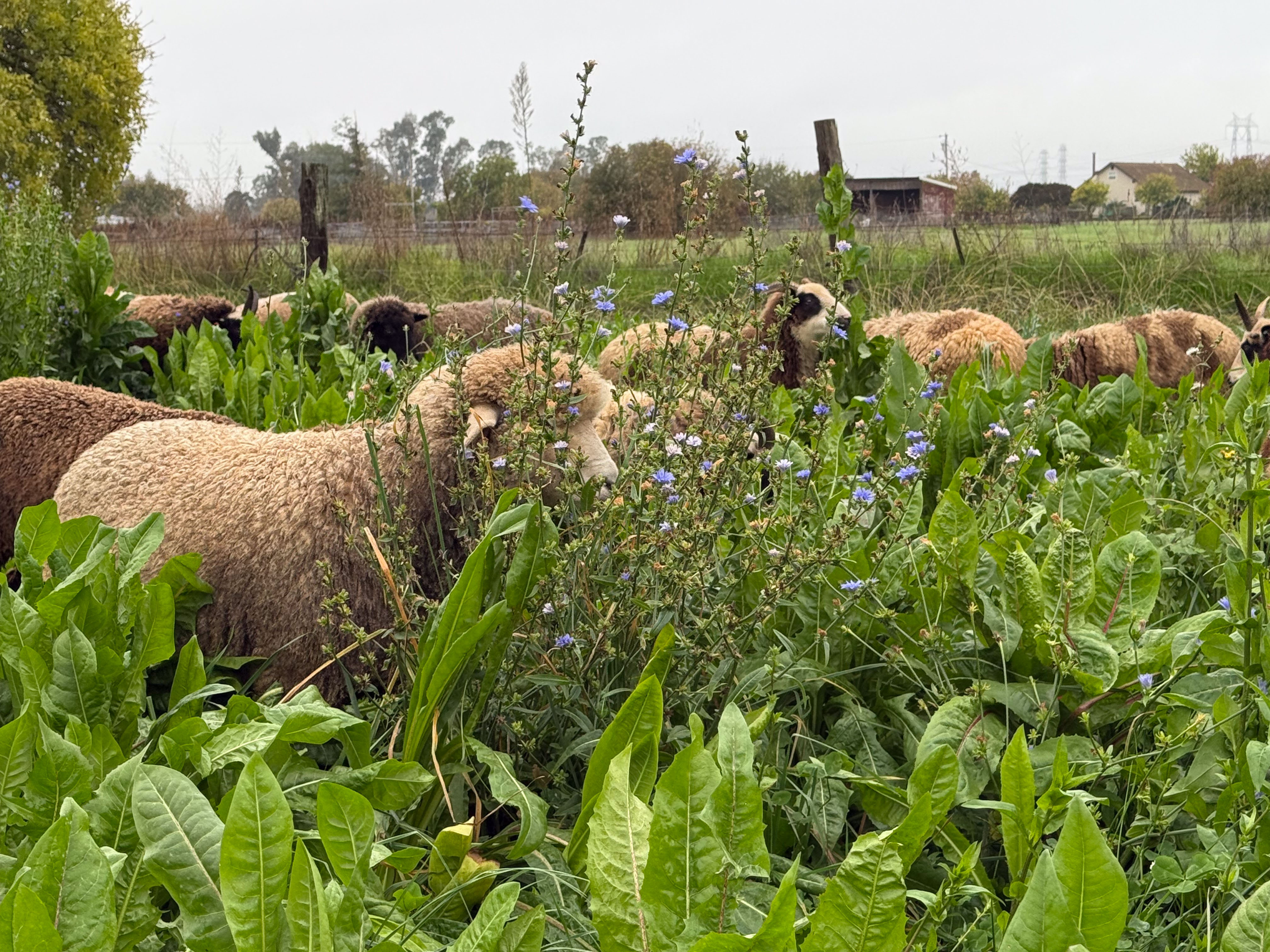
The big leafy plant is chicory and so is the one with blue flowers. It took me a long time to accept that they are the same plant.
After looking it up online I found: “Forage Chicory: Perennial broadleaf. Up to 18” (flower stalks up to 6′). Tap-rooted broadleaf perennial with bright blue flowers suited to well-drained moderately acidic soils. As annual or perennial forage: well-managed stands may persist 5 years or longer, but also valuable in annual stands for pasture or green chop. Very high digestibility and protein levels up to 50% higher than alfalfa. Digestibility is reduced if plants are allowed to bolt, but the flowers are very attractive! Research shows reduced parasite loads in animals fed or pastured on chicory. “
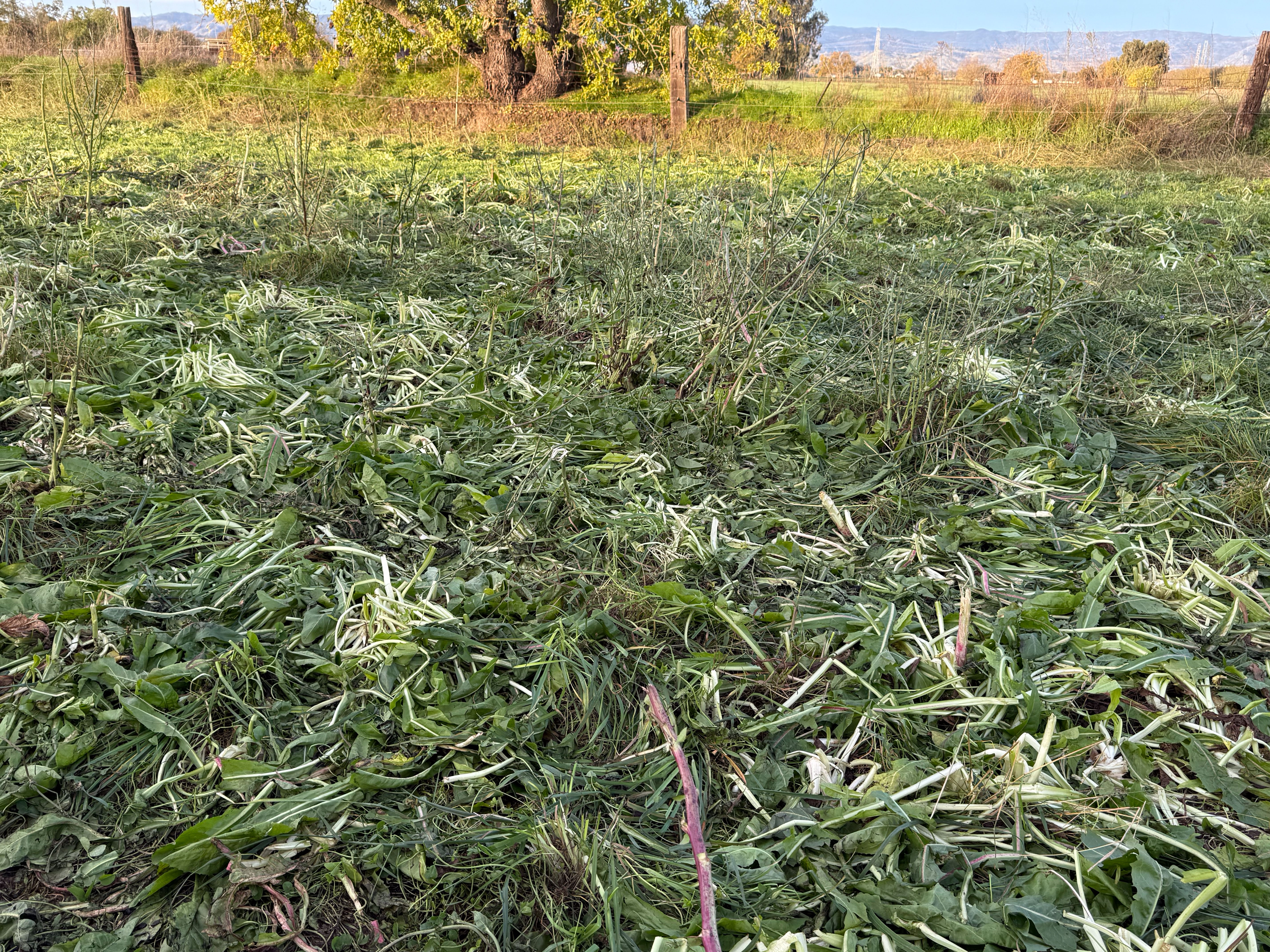
This photo is after grazing Paddock 1N for three days. A lot is trampled, but they were still eating out here this morning.
I opened the fence to let them into the next paddock. I have video and I just spent time on iMovie after not using it for a long time. Let’s see if I can share this on YouTube. Here is the link.
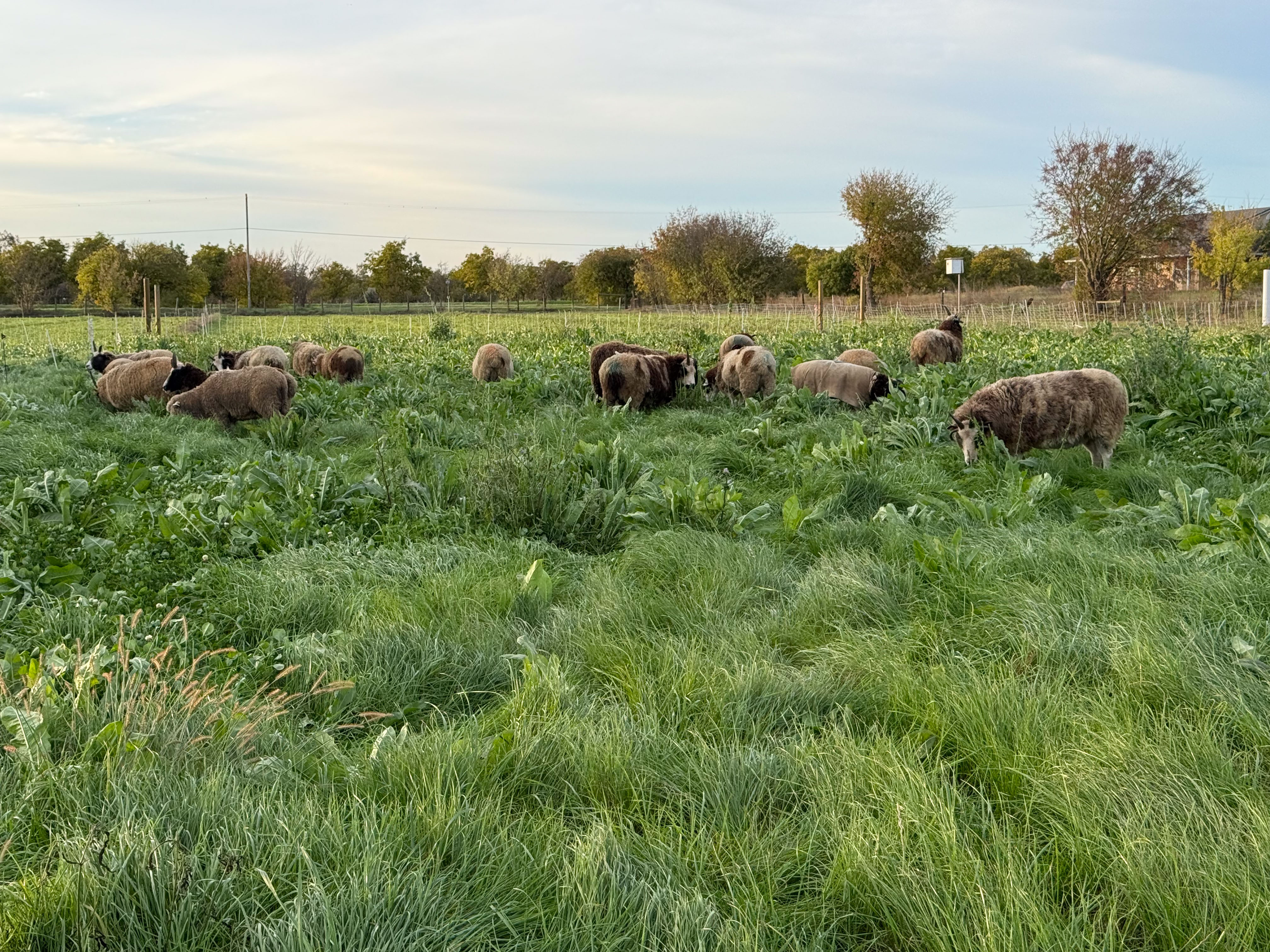
Back to regular blogging. More happy sheep.
This view is interesting to me because this is the area where ryegrass completely overwhelmed the clover last spring. This post is one of several I wrote about that situation. If you pursue the Grazing posts you’ll see the whole story. This is good feed here, but it is patchy, more so than in the rest of the paddocks.
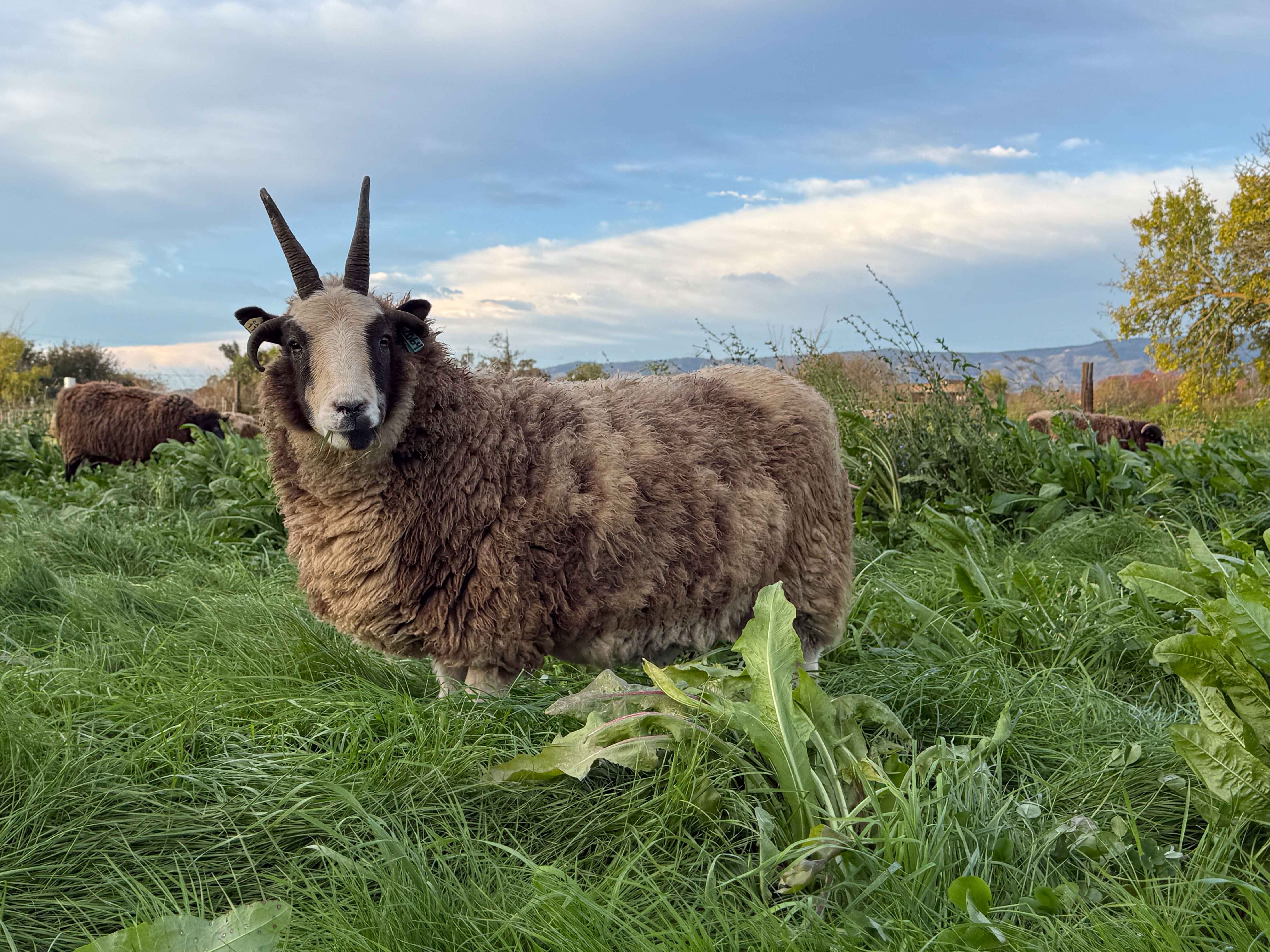
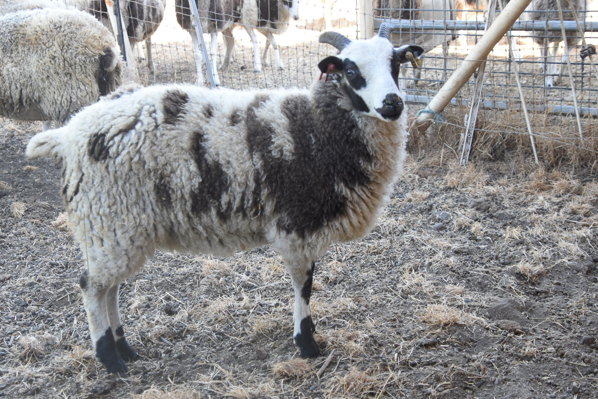
This ewe, Meridian Pecan, isn’t bothered by any of those details. She’s happy to have fresh green feed.
I introduced our hedgerow project in the previous post. That was Friday. Today, Sunday, one of the Farm Club members who had helped on Friday had offered to come back to help with the project. Even though the ground is moist from recent rains, the new plants would benefit from water right after planting. Also, we needed to add a cardboard layer to the mulch. Cardboard, covered by straw or other material would provide more of a light barrier which will help prevent or at least slow weed growth.
Raquel brought a barrel that she uses to catch rain water. There is a spigot on the bottom to fill containers. She thought it would be a good idea to fill this so that if more people came to help we wouldn’t all be waiting to fill buckets at one hose. It turned out to be just the two of us but her barrel idea was still helpful. We brought a hose from the other side of the fence to fill the barrel and could then work from that. Raquel’s idea was to use gallon milk jugs so they could be tipped over at each plant and direct the water to the base, while we were also working on the cardboard part.
This morning started out super foggy. This is a view of the paddock that I opened for the sheep yesterday. They have eaten or trampled most but will have one more day here.
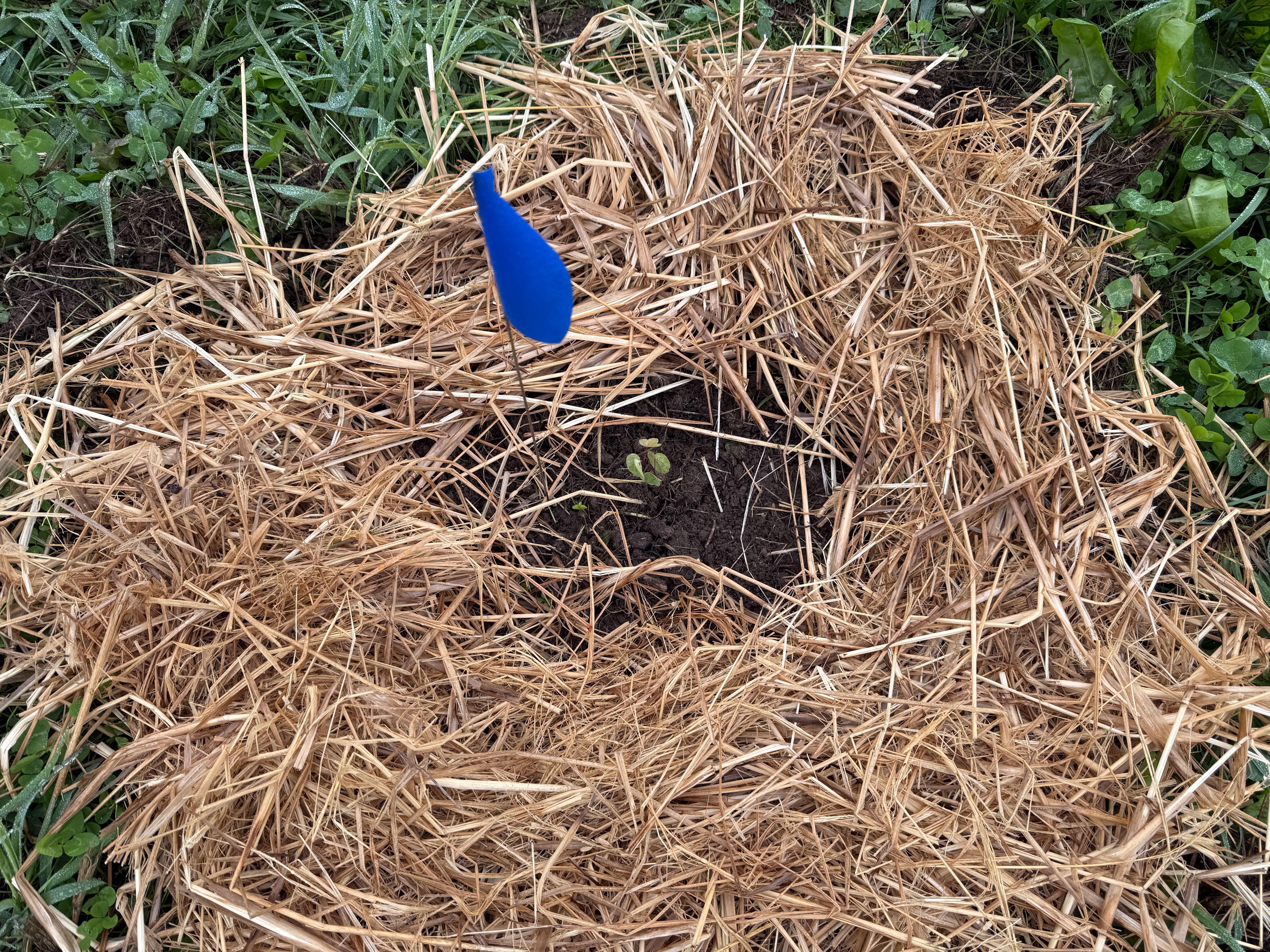
This is one of smallest plants we put in Friday. It is a Western Redbud, which is not a small plant when it has grown up, but right now it’s only a couple of inches.
This is another redbud, marked with the blue flag, yarrow, and deer grass.
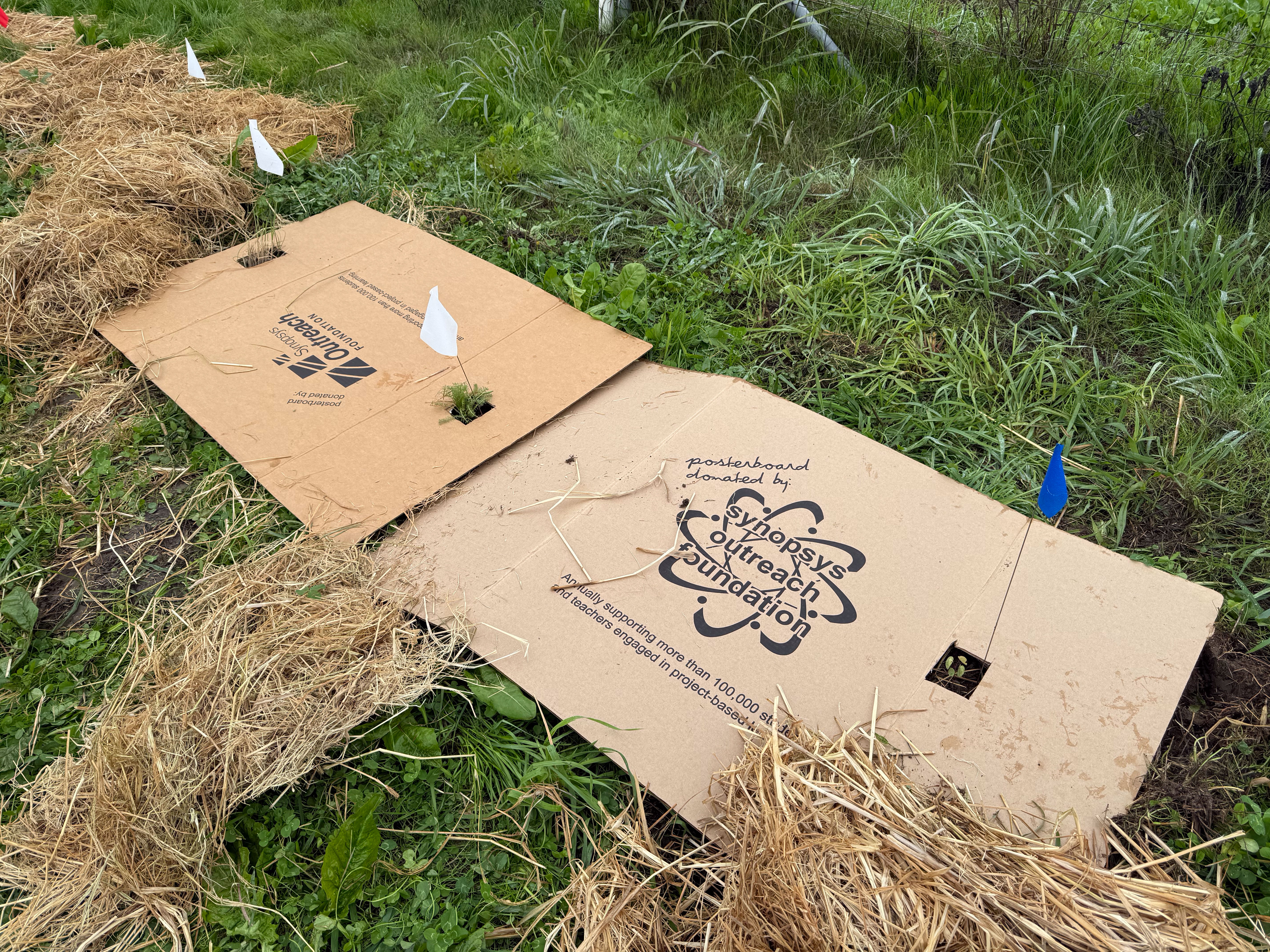
Some of the cardboard was cut in strips and positioned in a triangle around individual plants. These three were close enough that I cut holes in two larger pieces to provide the first layer of mulch. We had put straw around all the plants on Friday, but today we moved that to add the cardboard.
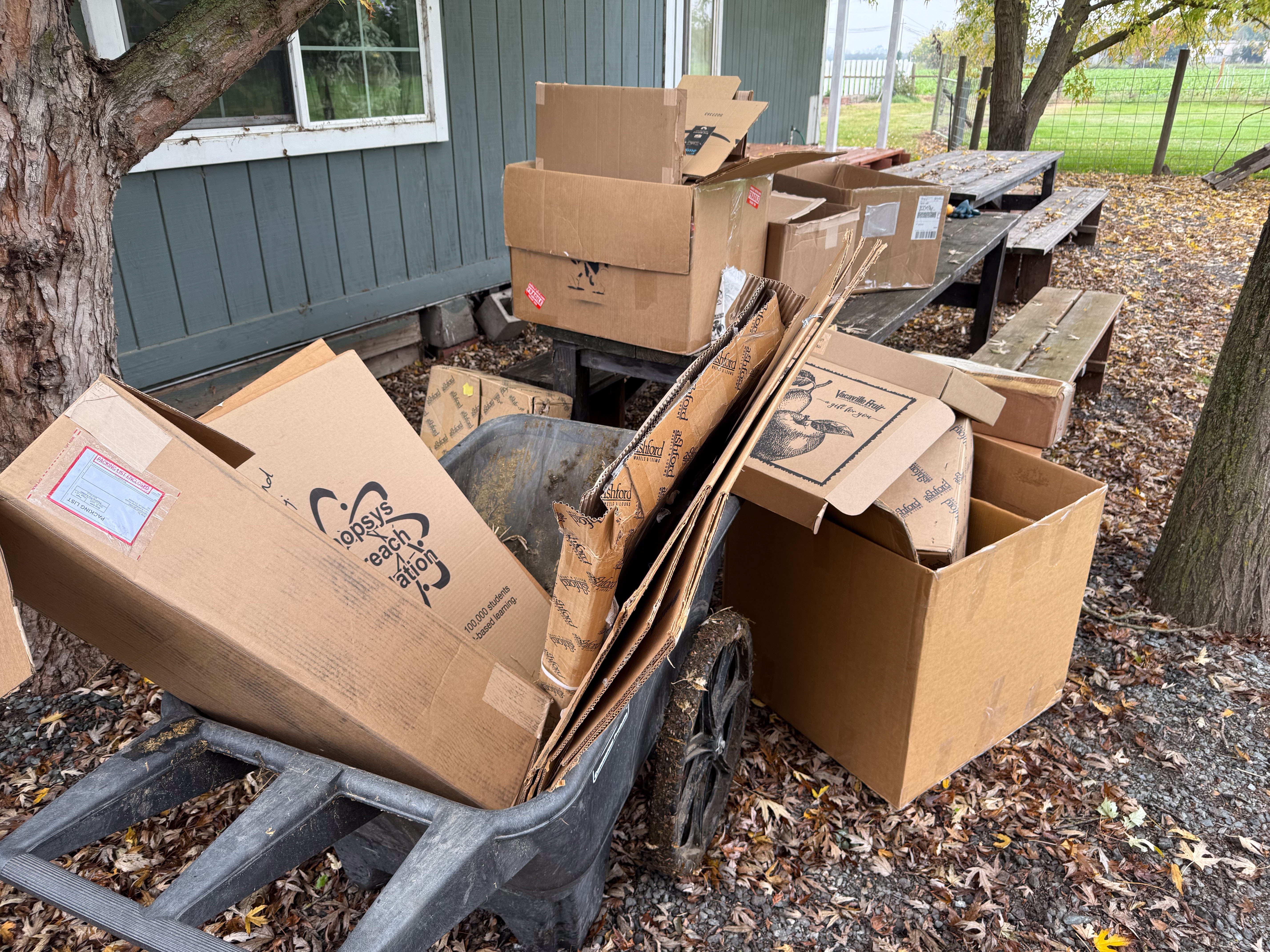
Where did we find enough cardboard? I thought that I might have to buy some. There was a box of science fair boards left over from Dan’s years teaching seventh grade science. And there are a lot of boxes I have saved because you never know when you’ll need a box! I do use a lot of boxes for shipping wool, etc, but I don’t think I’ll need any of these larger boxes or odd shaped ones for the rest of the year. Raquel and I cut them apart and stripped off all the tape and plastic labels.
We used the cardboard strips around the plants or cut holes in larger pieces. That blue barrel is what we filled with water from the hose near the house.
Raquel made trips with jugs of water. We let them drip while we continued with cardboard.
Almost finished!
We covered all the cardboard with more straw. The project is still not finished. You can’t tell from the photo but there are 19 plants without cardboard and about that many that didn’t get water today. That will be tomorrow’s project for me.
Our pasture and irrigation project that began last fall included a plan for a hedgerow. This project was included in a block grant from CDFA administered by Fibershed. So when the time came to implement the hedgerow plan, people from Fibershed volunteered their time to help make it happen, along with the RCD (Resource Conservation District) representatives.
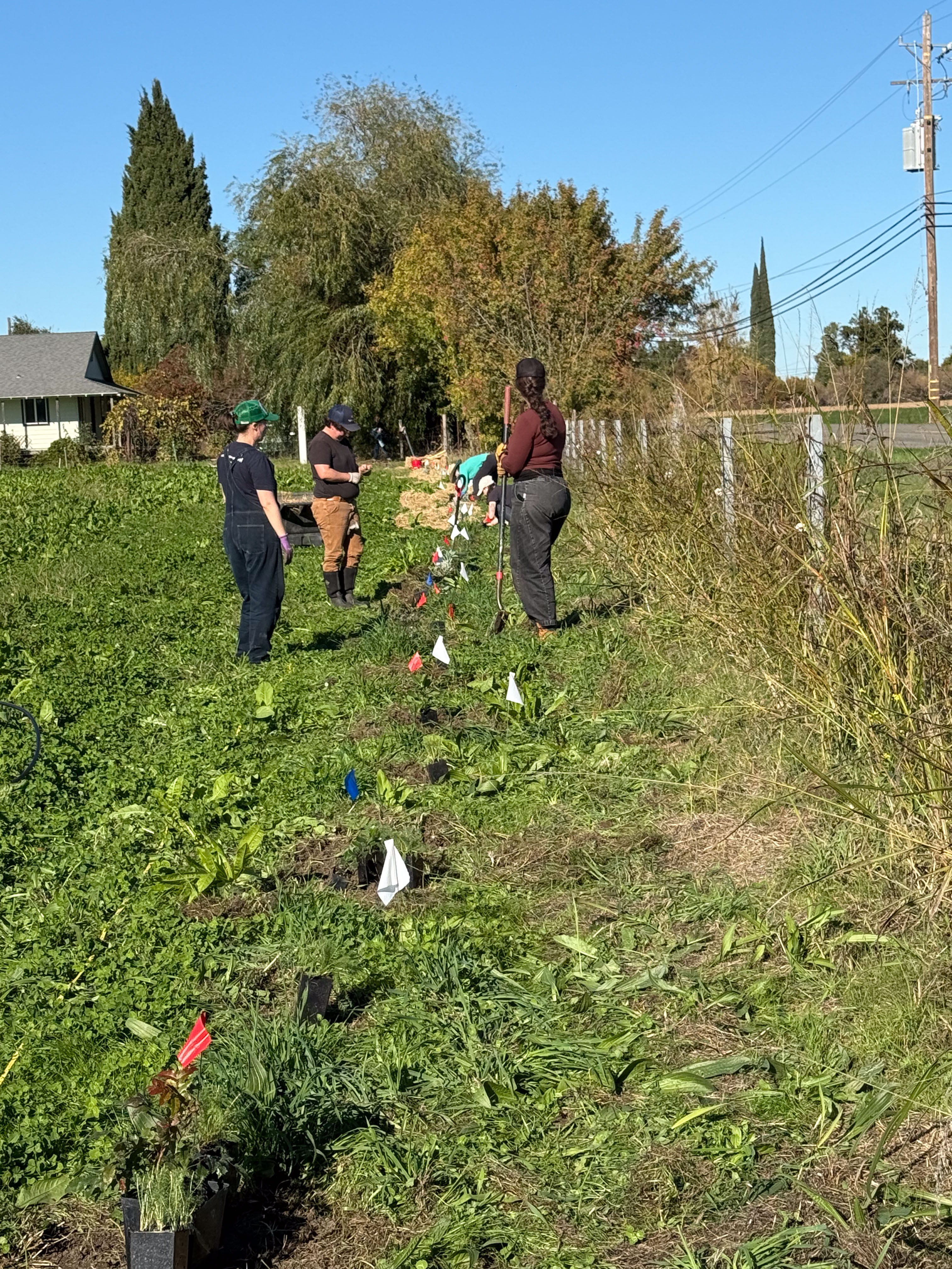
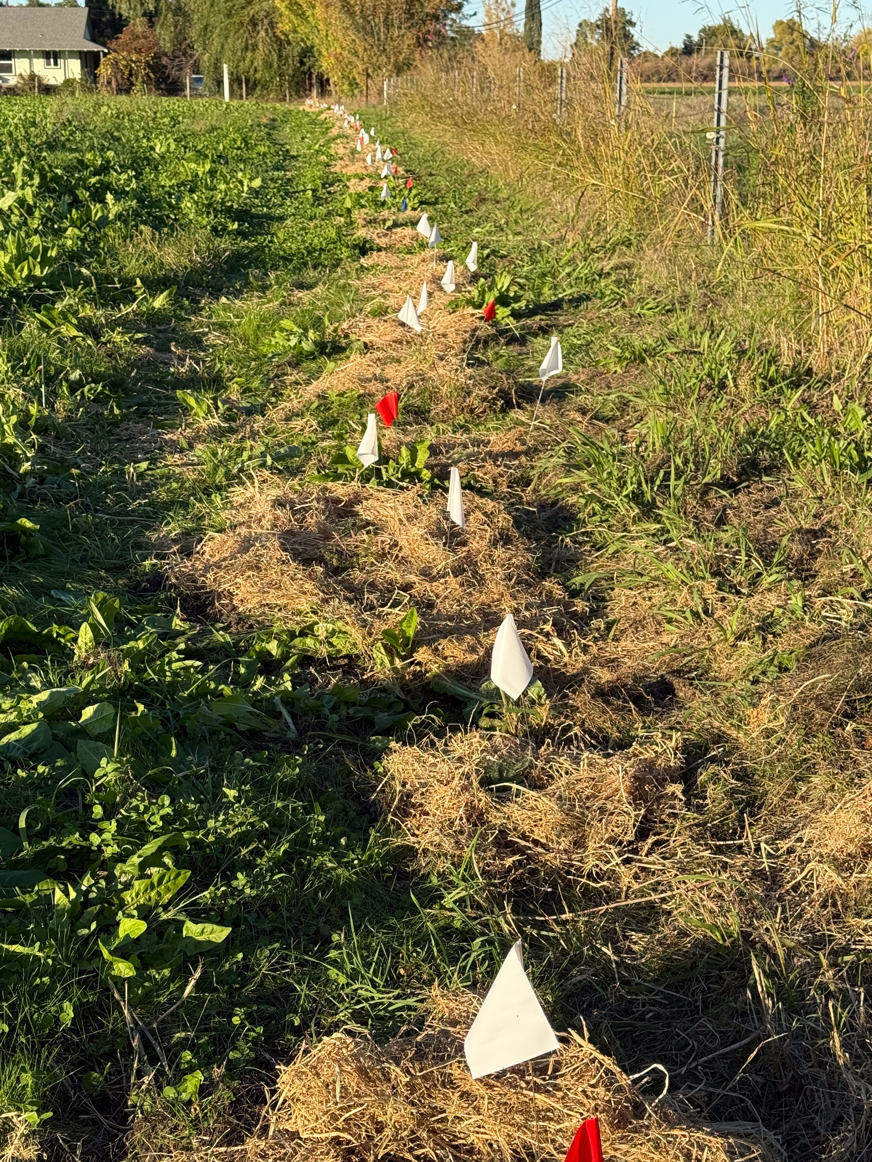
The hedgerow was to be planted inside the east fence of the pasture. RCD experts had come the day before with most of the plants. We placed them approximately where we thought they should be planted and marked them with flags. Some are small and if we hadn’t flagged them it would have been like an Easter egg hunt to find them all.
After a foggy start to Thursday we had warned everyone to wear rubber boots. Friday was sunny and dry! The first task was to clear space where each plant was to go in the ground. The biggest impediment to getting a good start will be the amount of competition and shading from all the other vigorously growing plants. Even a plant we like (clover for example) will be considered undesirable in the root zone of the new plants. I remember from somewhere, “A weed is a plant out of place.”
This was quite an undertaking. We planted 80 California natives in the 250′ row.
The plants include three to five each of Coyote Bush, Oregon Grape, CA Lilac, Western Redbud, Golden Current, Deergrass, St. Catherine’s Lace, Toyon, White Sage, CA Fuchsia,and 50 Yarrow.
The pasture has been growing well, the soil looks healthy, and everywhere you dig there are earthworms. We have had recent rain so it’s moist, but we will have to make sure that we irrigate these new plants. That’s a project for a couple of days later.
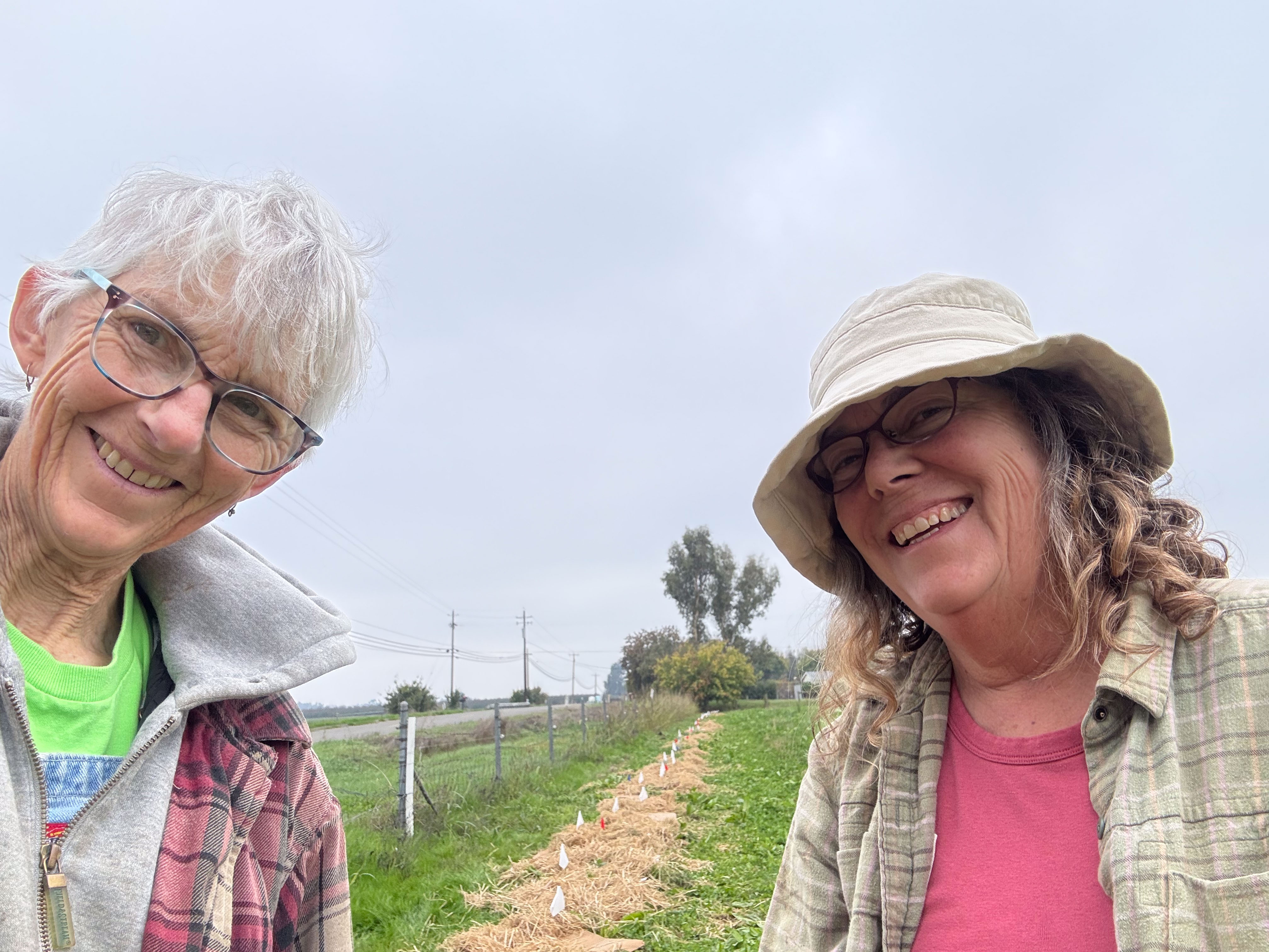
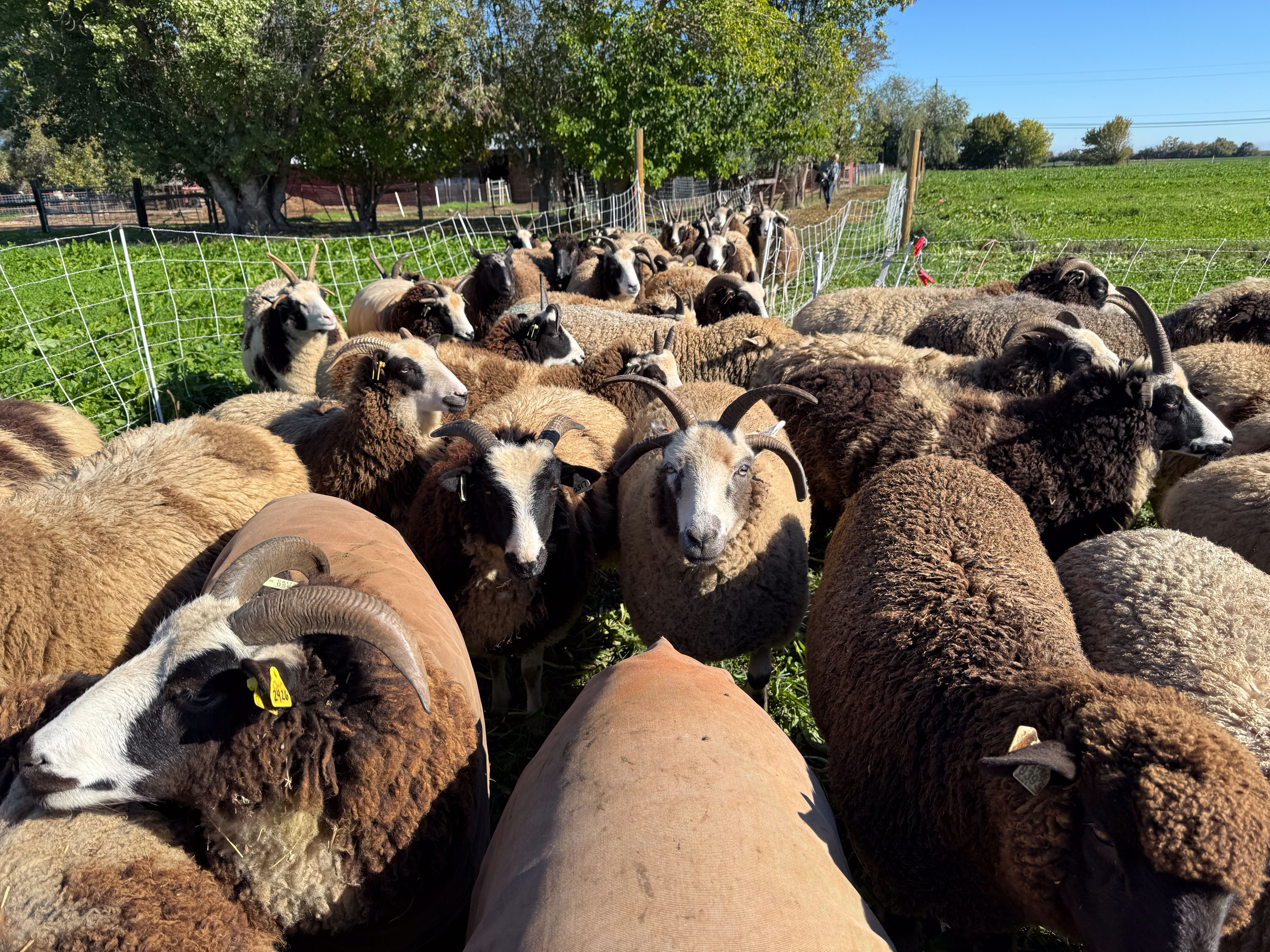
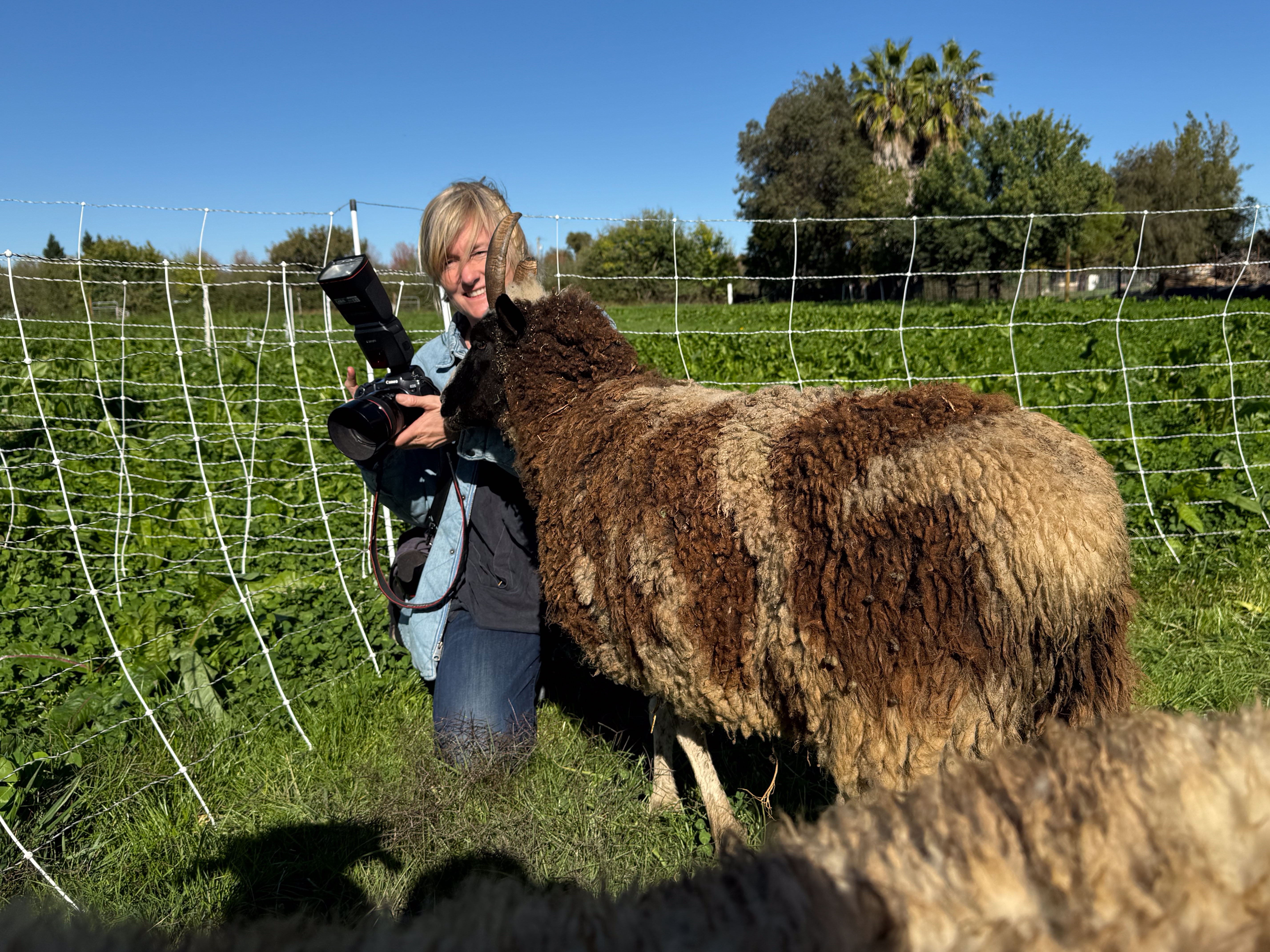
The photographer who has been with Fibershed since the beginning, Paige Green, and I wandered out to visit the sheep and take photos.
Jade provided Paige with the perfect cover for getting photos of sheep that might otherwise be wary of an unfamiliar person.
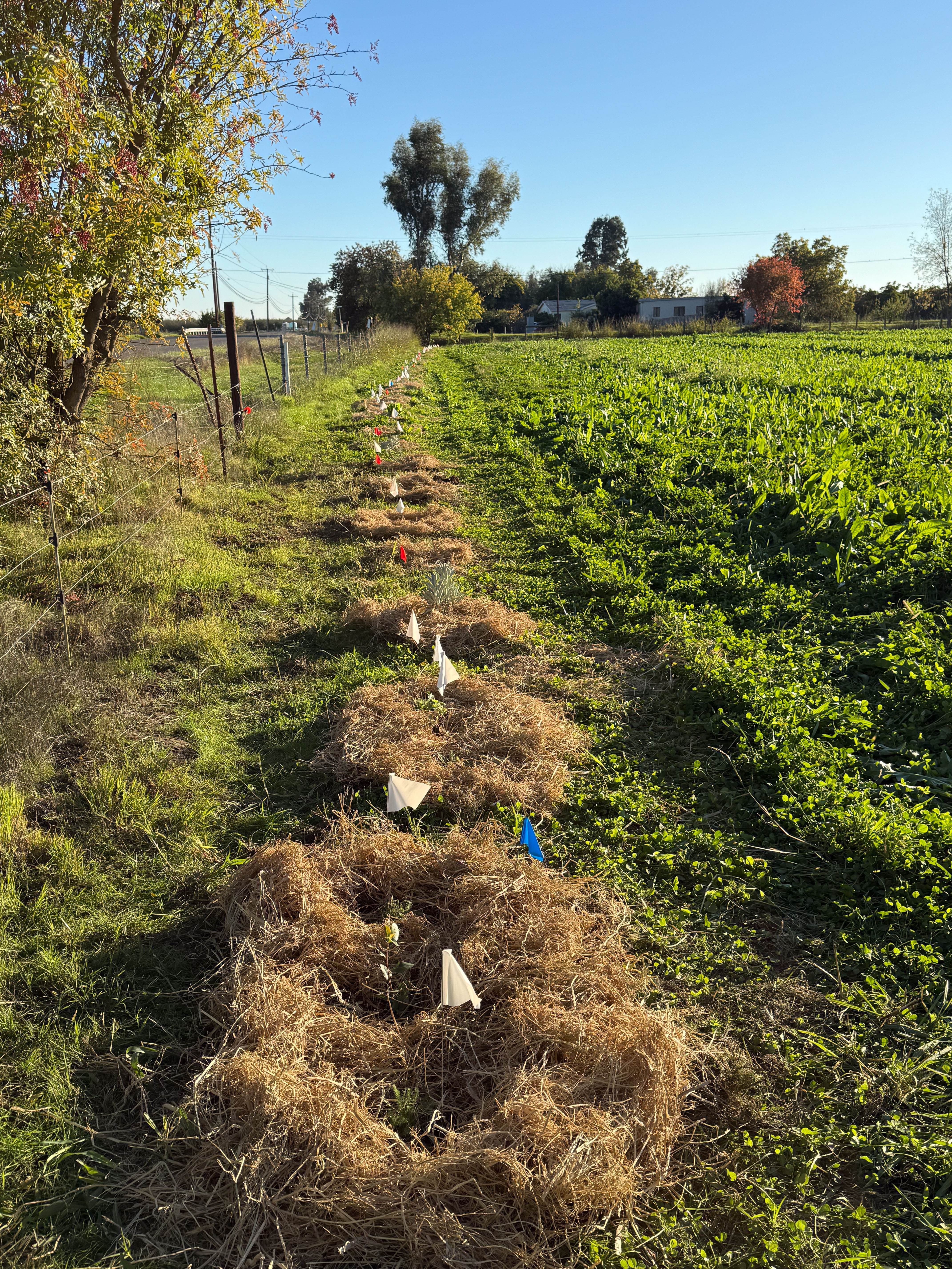
Back to the hedgerow. View to the south when we were finished.
View to the north. Each plant was surrounded by rice straw to provide mulch with the intent to prevent weed growth. There is more to that story…to be continued in the next post.
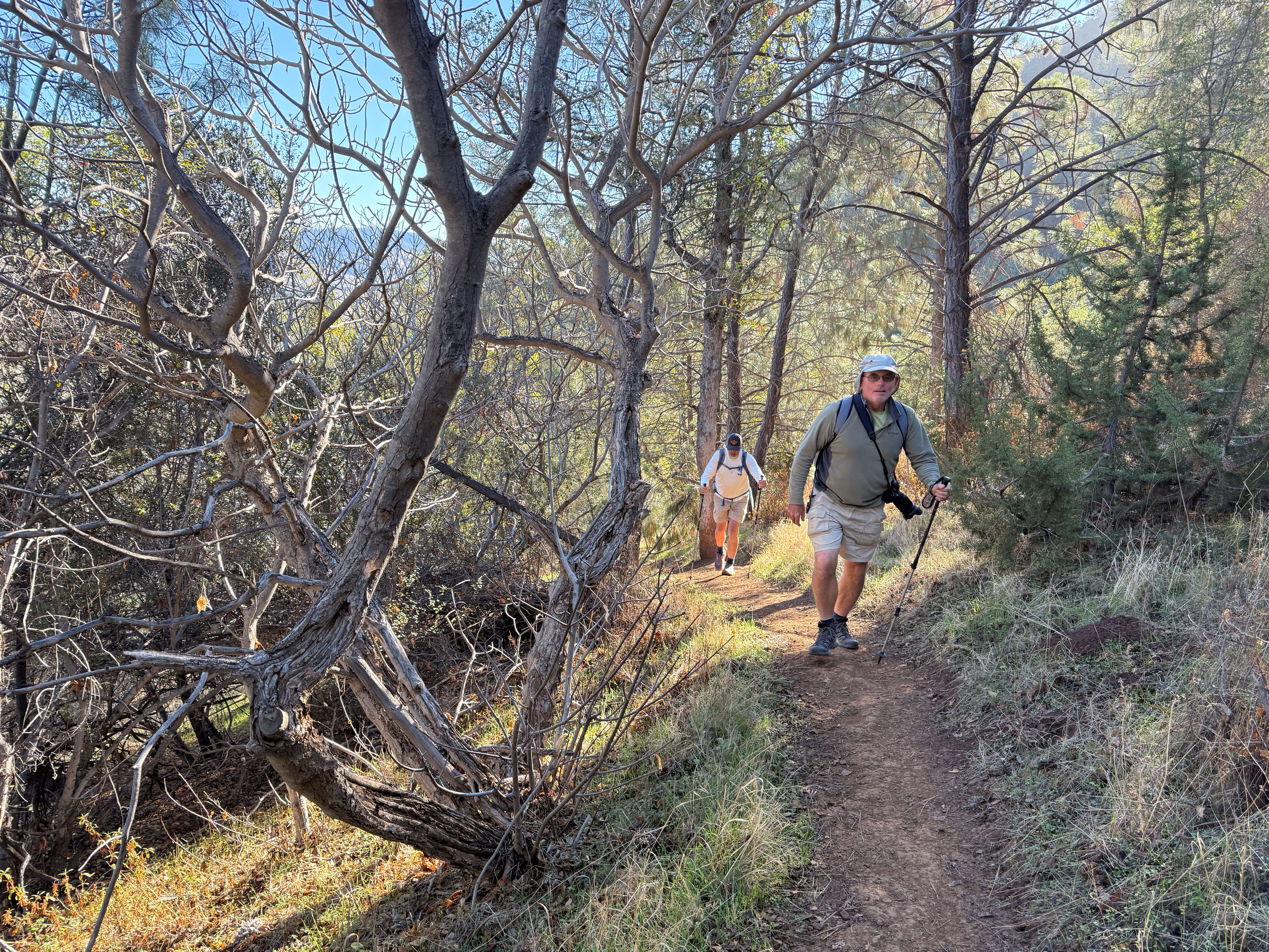
I always see Mt. Diablo when I walk Across the Road (unless there is too much haze or fog). I feel a sort of weird connection to it because of the road we live on, which prompted the name of our farm, Meridian Jacobs. I wanted to DO something on my birthday and fortunately the weather was perfect for a hike. We picked up my brother on the way and arrived at Mt. Diablo State Park a little after 8 a.m.
Wikipedia says: “The Mount Diablo Meridian, established in 1851, is a principal meridian extending north and south from its initial point atop Mount Diablo in California.”
I took a lot of photos but I have to narrow it down for a blog post. There are probably more in this post than there should be. It’s hard to portray the true essence of the hike in my photos.
I wanted to get to the summit. Not long after we started we spoke to someone who said the direction we were headed was very steep and suggested a different route.
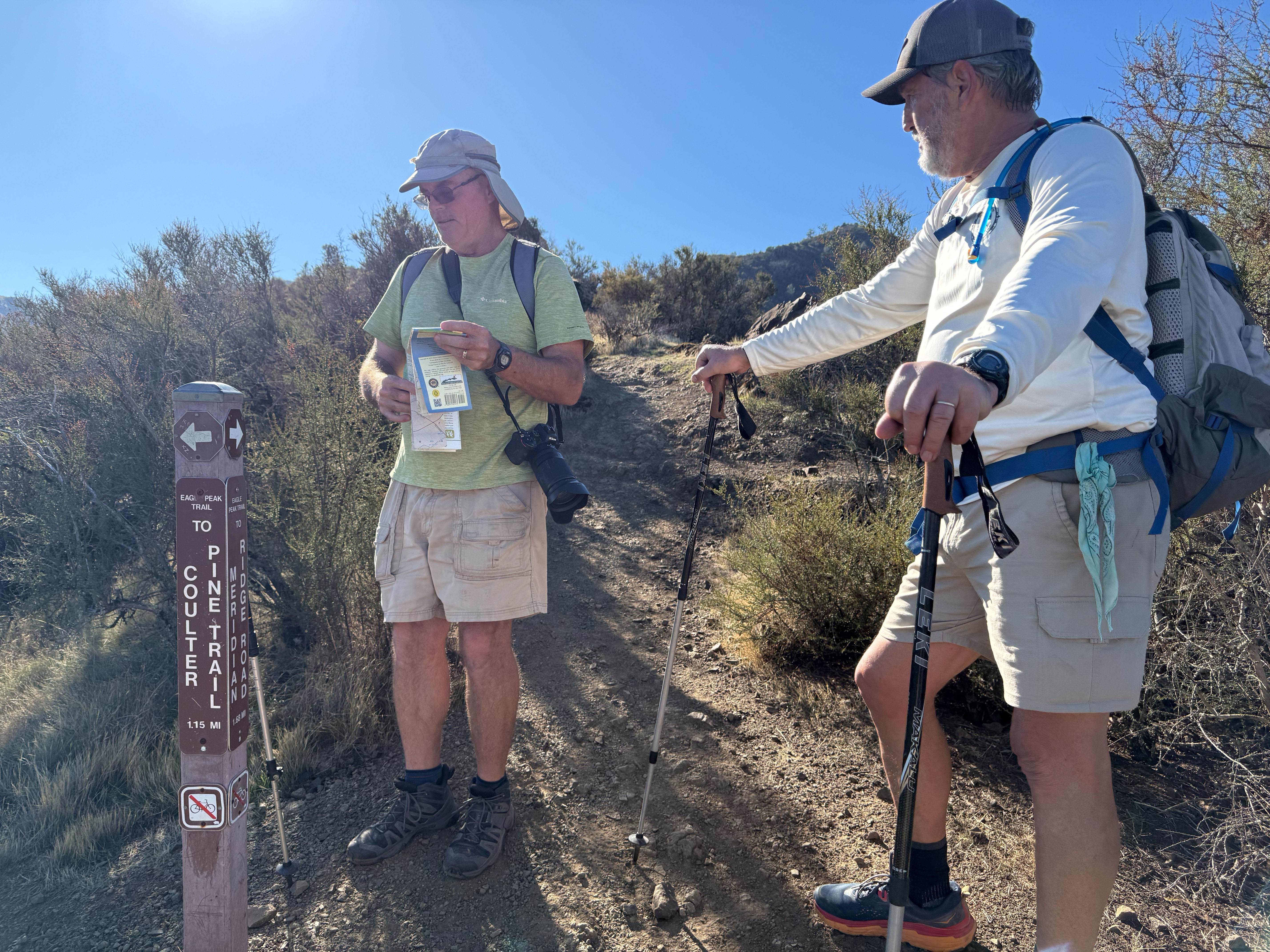
We had a map that showed all the trails and decided to start on a different one than what we’d planned.
Double checking the location.
We’re still smiling!
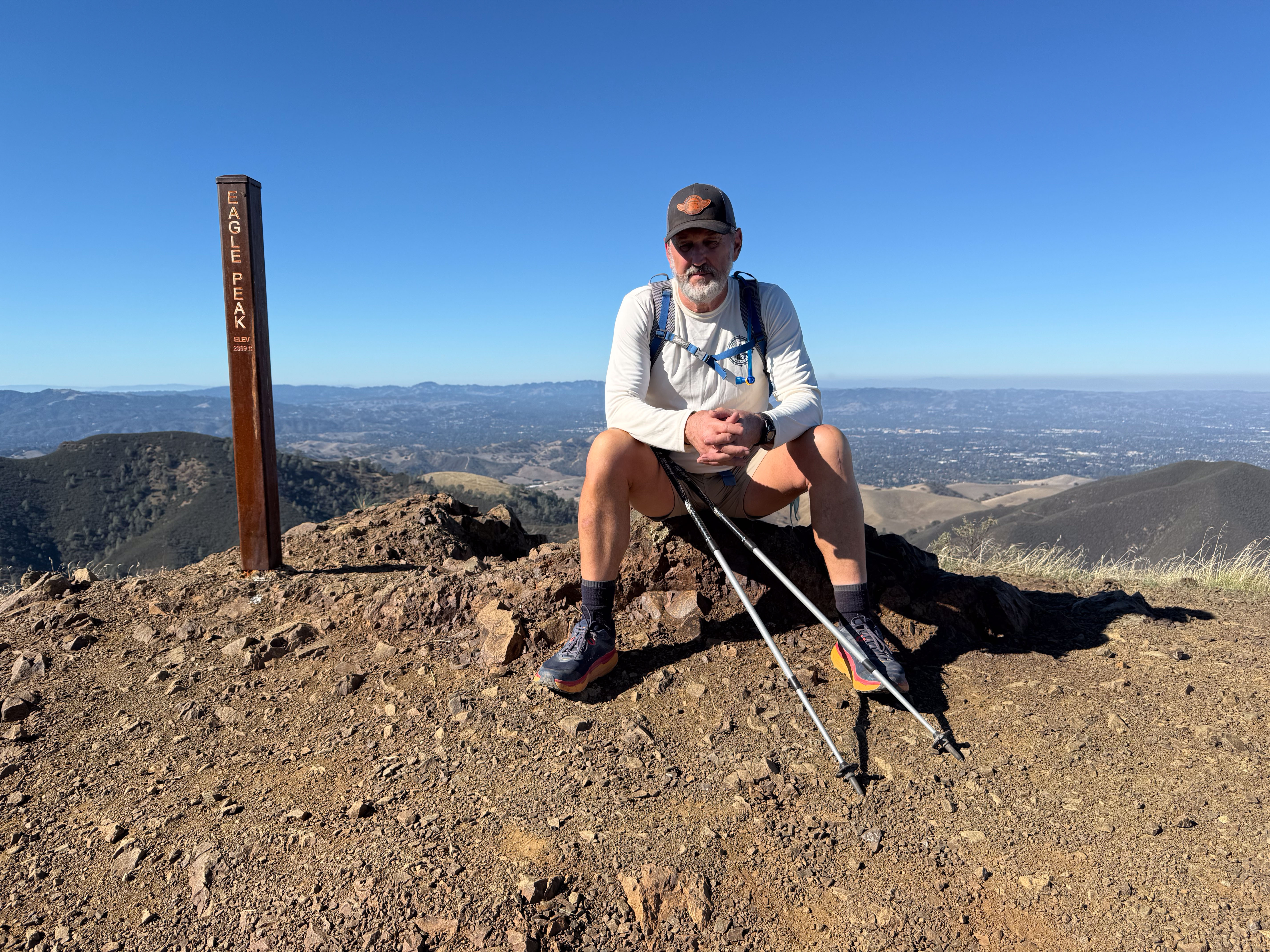
One of several peaks on the way to our goal. The sign say elevation 2369. I thought about adding a 1 in front of the 2. That’s sort of how it felt since we live in the flatland and lately all the walking has been flat. This was about 10:30.
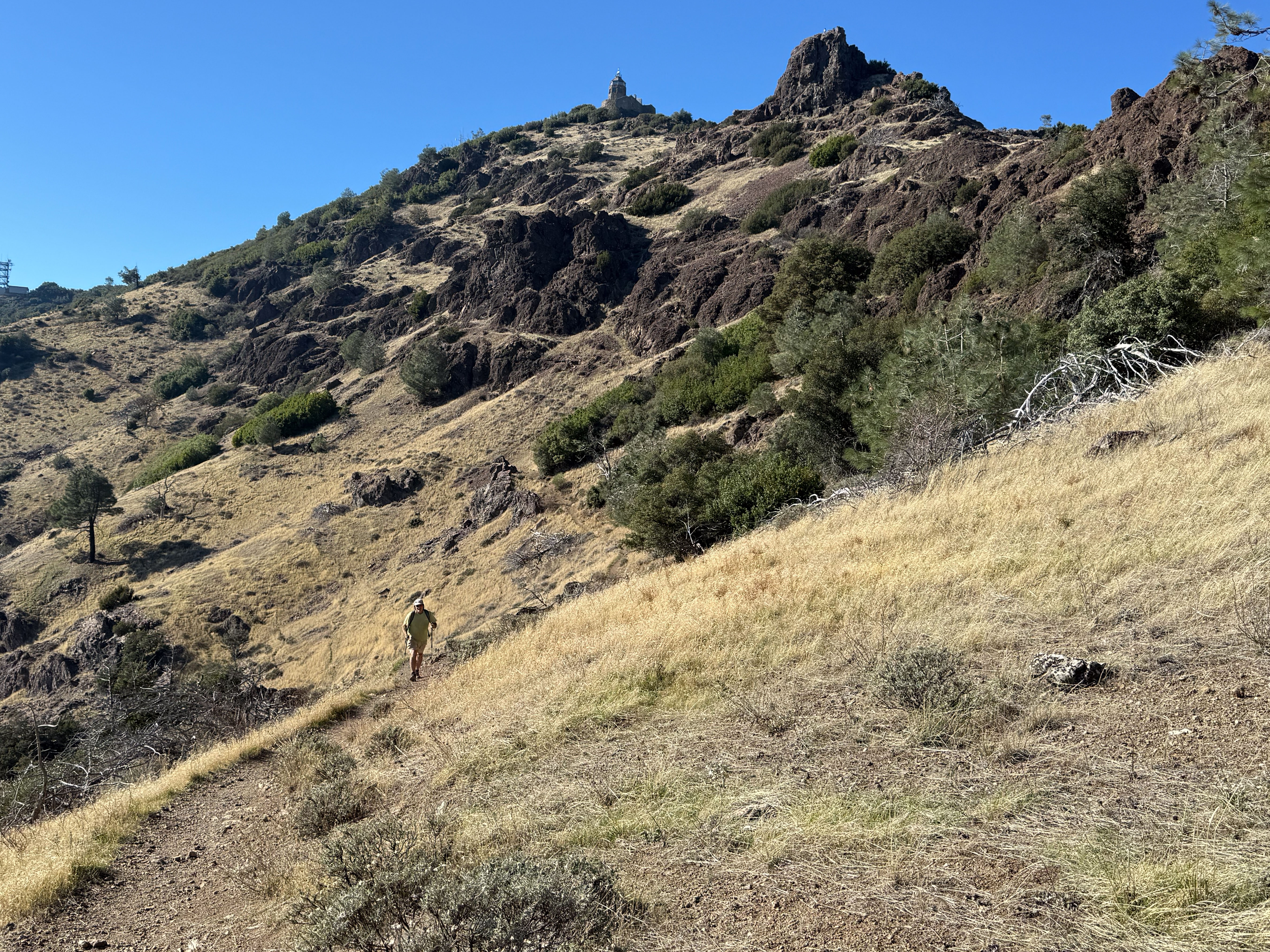
I took this photo around noon. That point on the mountain is our goal and Dave thought that we should get there by 1 p.m. to make sure we had plenty of time to get back before dark.
This is where that arrow points.
Pipestem Clematis
Not many flowers yet, but things are greening up and showing promise of a beautiful spring. We did see a lot of this vine that I recognize from other oak-woodland hikes.
There was a point where we had a choice to take a one-mile “short-cut” to the top (steep, we were warned by someone coming down) or another two miles with ups and downs. We split up here. Dan took a different route that Dave and I would follow later back down the mountain. Dave and I went to the top.
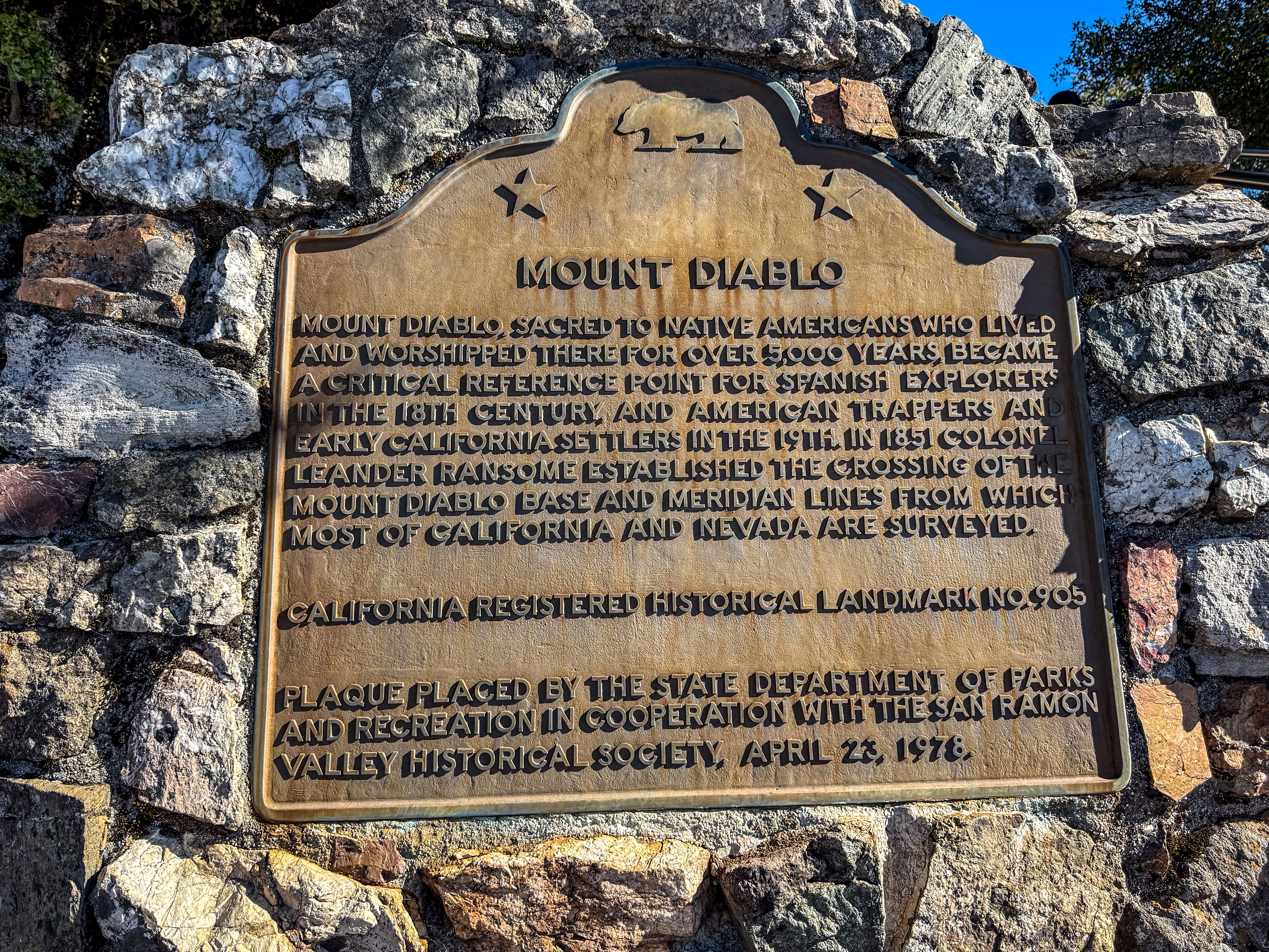
Since you may not be able to read the sign I’ll repeat it here: “Mount Diablo, sacred to Native Americans who lived and worshipped there for over 5000 years, became a critical reference point for Spanish explorers in the 18th century, and American trappers and early California settlers in the 19th. In 1851 Colonel Leander Ransome established the crossing of the Mount Diablo base and meridian lines from which most of California and Nevada are surveyed.”
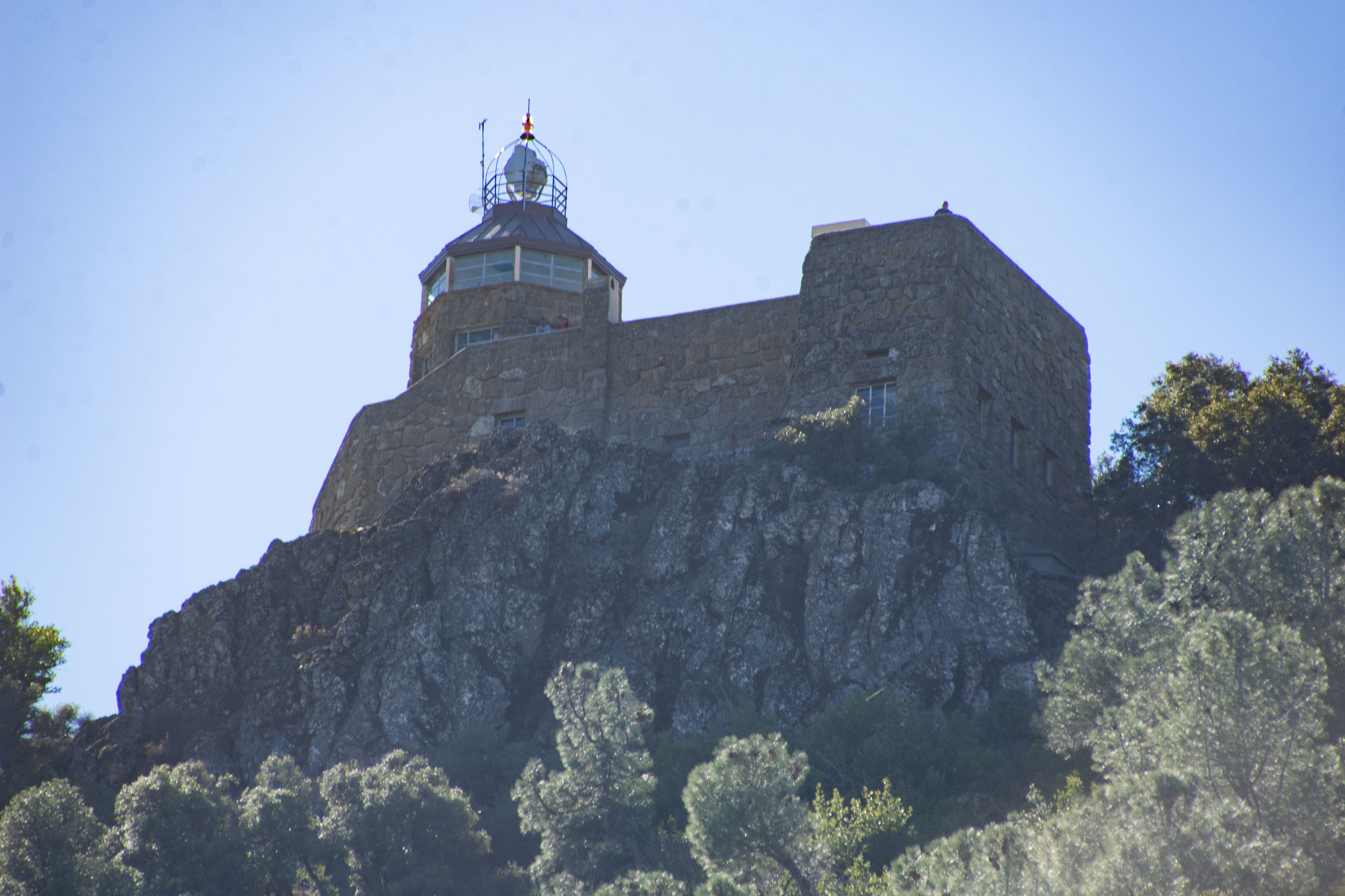
In the days before electronic navigation the light on top of the rotunda (once on a 75-foot tower) served as a crucial route-finding aid. It was turned off after the attack on Pearl Harbor amid fears that it could guide the enemy to an attack on the mainland. It is now dark except when it is lit on December 7 as a memorial to those who died at Pearl Harbor.
This is inside the rotunda.
View north-northwest.
View to the north. If I can see this mountain from where I live it seems as though I should be able to see my house from the mountain. I guess not. It’s out there somewhere. You can make out the windmills that are south east of our farm and we think what you can barely see left of center under the horizon is Travis AFB.
This is the view of the rotunda on our way down the mountain.
View to the east.
We saw a little bit of fall color. I took few photos on the hike back down. It was the most challenging part of the day. We followed a dirt road that is used to access communication towers on another mountain top. Downhill and a road. Sounds easy, right? It was so steep in parts that if I hadn’t had a walking stick to brace against I would have been slipping the whole time on those parts. Even with the stick it seemed treacherous. I hadn’t thought to bring walking sticks, but Dan and Dave had. On the way down Dan had left one of his with me. Once I started hiking this road I realized that his trip would have been extra challenging with his new knee joint and using only one stick.
We got back to the car before dark.
I had turned on my Map My Walk app before starting (blue dot). Somehow it turned off not long after we started and only started up again when we were sitting on the top eating lunch. So these stats are only half of the hike. We think our hike was 13 to14 miles. A good day.
When I wrote a newsletter yesterday I referred to the series of blog posts about the pasture that I wrote over the last year. You can find any of these by searching Pasture and Irrigation Renovation (14 posts) and Grazing and Irrigation (7 posts).
Tonight’s post will follow up on this Grazing and Irrigation post (#7) written in June about May grazing. The pasture looks much different now than it did then.
The ryegrass is gone and you see mostly clover.
Next most prominent is birdsfoot trefoil, and more recently the chicory has taken a foothold. Those are the three broadleaf plants that were in our seed mixture. All of the paddocks in the south pasture look like this now. Back in the spring we started topping the ryegrass with the mower before grazing and mowed again after grazing. This prevented the ryegrass from being flattened over the clover and becoming a mulch layer.
The smaller field on the north is different. We didn’t graze early enough and this is where the annual ryegrass had such a head start on the clover and overwhelmed it in places. I took this photo while irrigating two weeks ago. While the pasture was flooded, some of the ryegrass “mulch” floated and I was able to rake a lot of it into piles thinking that I’d be able to move it out with the tractor.
A few days later I realized that I didn’t want to wait until the field dried out enough to use the tractor. I was ready to graze again but the lane was still too muddy. I realized that I could use all that straw to cover up the mud. So I used the wheelbarrow.
I used at least a dozen big loads of ryegrass straw to fill in the lane.
This is Sparky in that north field. Hopefully over the course of winter these bare spots will fill in now the they aren’t covered with mulch.
I left off in the last post when we arrived at Bryce Canyon and secured the last tent campsite in the park.
After looking over the landscape from the rim that evening Dan studied the park map and planned a hike. We started at the Queen’s Garden Trail, so called because of one of the hoodoos that looks like a statue of Queen Victoria.
We followed the trail down, which gave a different perspective than the view from the rim.
We came across a sign that explained the Hike the Hoodoos Challenge. If you photograph yourself with three of the benchmarks along these trails you get a prize! We found four. The prize is a sticker from the visitor center.
I took over 175 photos on this day and that’s one reason it’s taken me so long to write this post. I try to keep my blog posts to ten photos or fewer and that means a lot of sorting and decisions. I still didn’t meet that goal.
Two perspectives of the same formation (photo above and below).
The Queen’s Garden Trail led to the Peek-A-Boo Trail which connected with the Navajo Loop, part of which is what they have named Wall Street (below).
Its difficult to show how amazing this formation is.
This view is looking back towards the path with the stairs, through that slot and past the tree growing in the slot. There were a lot of people on this part of the trail. Look at what I just learned how to do:
I use Lightroom to edit photos and I was just able to remove all the people from this photo. That’s a great thing for ending up with pleasing photos, but it does make me realize that you can’t believe everything you see in print (or online).
A non-edited photo in which you get a feel for the scale of this place because I did not remove the people. .
View from the top after we finished the hike. You can see some of the trails–along a ridge in the center, and just below center on the left.
We hiked about 7 miles. That was significant because this is the first time Dan has hiked in a year and a half, after a knee injury in 2023. He’s had a new knee for just under four months!
Two other thoughts: 1. We stayed on the trails. I found myself wondering how many other formations there are like that slot canyon called Wall Street. 2. In this photo, what looks like clouds, is smoke, probably from the fire burning at the Grand Canyon. I’ve been following the progress of the fires because my kids’ involvement in wild land fire fighting.
We left home Tuesday morning and I shared photos in this post. It was getting late in the day when we got gas in Ely, Nevada and we took time to look at the map. We found a place to camp in the Ward Mountain Recreation Area a few miles out of town.
Here is the campsite in the morning. Dan was still in the tent.
I went for a walk as the sun was coming up.
We packed up and got to Utah about 9:30.
We got off the main highway to drive the original road through the mining town of Pioche. This sign describes the tramway, the remnants of which are still here on the east side of the road.
This is the tramway that facilitated movement of ore from higher up the mountain (behind us) to the valley below.
This is a closer view showing the cogs that held the chain or cable that carried the buckets. The structure that is on the horizon towards the left of the photo is one of the buckets still on the cable.
Our first stop where we planned to spend some time was Cedar Breaks National Monument. We checked out the visitor center first and then went for a hike.
All the views of the breaks are incredible. Do you notice that light spot just right of center on the bottom of the photo. It sure looked like a rock for the longest time.
Then I saw it for what it was – a hole through that wall. I still see it as a boulder part of the time.
Closer up view showing the colors in the rock walls.
Marmot along the trail.
View of the ridge where we had been walking.
We left Cedar Breaks to get to Bryce Canyon before night. Flock of sheep and their herder along the road.
It’s not easy to leave when you have animals to care for. I am fortunate that there are long-time Farm Club members who have become good friends, and they are willing and able to spend a few days at the farm. Three friends organized the dates to suit their schedules so I know the animals are in good hands.
Anytime Dan and I will both be gone I spend at least a day getting organized. I needed to get the pasture set up to make it easier to graze. This has been “on the list” whether I was leaving or not. So Farm Club members came Saturday to help with that project and I shared that here.
This is on the list of things to fix, but there was no time to do it right before we left. This is the ram pen shelter and they have been enlarging the holes in the plywood. There is a 2×6 board on the inside so I haven’t been worried about the rams getting out, but do I want to take a chance when I’m gone? So I tied a metal panel to the outside.
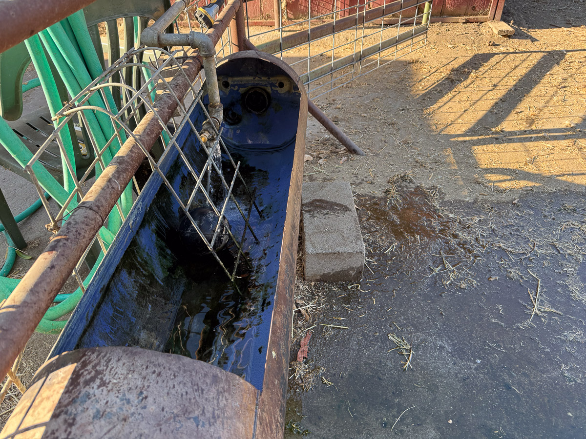
The water trough needs cleaning at least weekly in the summer because it gets full of algae.
I needed to finish a proposal for an article for one of next year’s Handwoven magazines. That was due August 1. This is a photo to accompany that proposal.
After photographing the cosmos flowers I harvested this batch to dry. I pick them every few days so they will continue to bloom and to save them for dyeing later. The pink flowers are dahlias.
We were down to only six bales of alfalfa in the barn. Although the ewes would be on the pasture while we were gone, all the rams need to be fed hay. Since Dan’s knee replacement we have bought hay by the stack so it would be delivered. This is the first batch of ten bales that Dan has loaded himself since the surgery.
This job was not a priority but I continue to be distracted by gardening chores. I know this is not the time of year to prune roses, but I was tired of being attacked by rose branches every time I walked on that path or the deck at the Weaving House.
The lamb page of the website has not been updated for quite awhile and I needed current photos. The last photos are from mid-May and those lambs have changed a lot since then. I took these photos a couple of days before our trip but have not yet updated the site. Maybe by the time you read this post I will have added some of these. I will need to take more photos when I’m home.
A couple of days before leaving I was at the Artery to remove all of my pieces there. The Artery will be closed for two weeks while the floors are completely refinished. The old carpet and tile will be removed and the floor will be refinished. We found that there would have to be the added job of asbestos removal. The Artery will reopen August 11 so I’ll be returning my pieces the day before.
I got my Timm Ranch wool back from the mill right before we left. I had time only to open the boxes. I will list it on the website when I’m back.
Stay tuned for photos of our trip. We camped the first couple of nights but I’m in a hotel room right now and finally got my computer out. Now to try and make some updates to the sheep pages. Or maybe I should review 5 days of emails…
Way back in January I wrote the 14th Pasture and Irrigation Renovation post. I like my posts to be in order, but now I have skipped some important updates. Too many photos. Too confusing. Too much other stuff going on–lambing, teaching, deadlines, etc. The whole point of this renovation was to feed sheep and make it easier and more efficient to do so. If you look back at that linked post you’ll see plants growing, but they are small and there is a lot of bare ground. Fast forward past winter rain, warming temps, and 3 months. I’ll change the name of this series to Grazing and Irrigation.
The original plan when we applied for funding was that we might not be grazing for a year. It was evident by April that the pasture needed to be grazed NOW. I was committed to a teaching gig at the end of April and was going to put off grazing until I got back. Dan was not able to work on this only two weeks after a knee replacement. My brother, Dave, knowing how important it was to get started with this, offered to help set up the grazing before I left and handle it while I was gone.
A major problem was that all the permanent interior fencing had been removed at the beginning of this project. We would have to rely on electric net fencing. We gathered all the lengths of net fence that were stored in the barn.
We spread these out to figure out what we had and in what condition it was.
Dave made a plan and laid out fence, beginning in the northwest pasture, the one we call the Horse Pasture. Grazing started April 20.
This gives an idea of how thick the grass was. The seed mix we used had three forbs (clover, birdsfoot trefoil, and chicory) and three perennial grasses. There is a lot of clover and a moderate amount of trefoil. I don’t identify any chicory and all the visible grass is annual rye.The seed already in the soil completely overwhelmed any perennial grasses that might have started to grow and was covering the clover as well. This is one reason we needed to get going on the grazing.
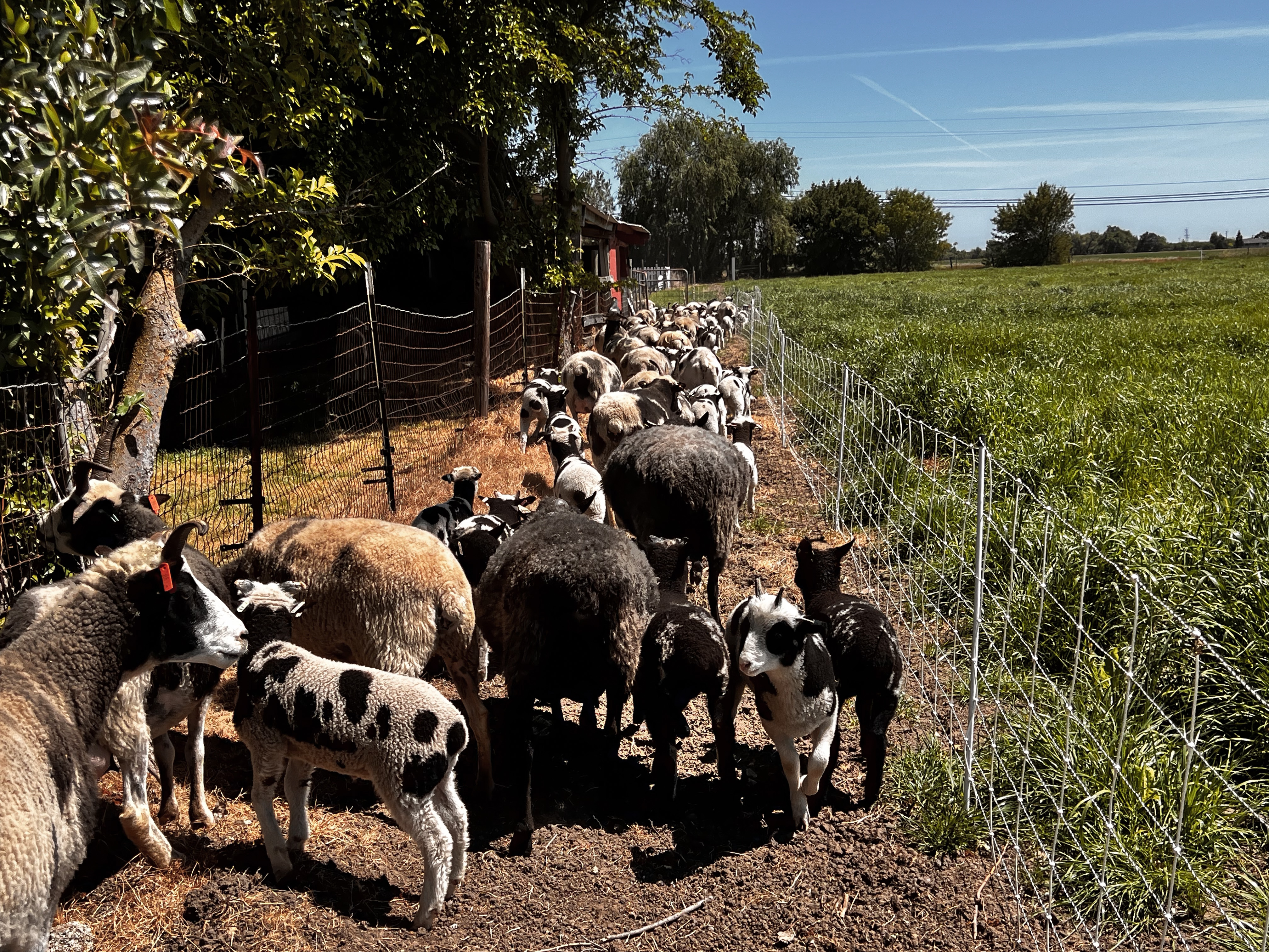
Dave made strips going north-south and we blocked the sheep into a portion of the first strip. The idea is to get them to eat one area down more thoroughly before moving them to the next.
With no fences left in the pasture Dave had to create a lane to direct the sheep from the barn to where we wanted them.
You can see in this photo how the tall grass is trampled more than eaten.
This ewe may have not got the message about eating the grass instead of wearing it.
There is no drinking water in the pasture so at some point the sheep go back to the barn for water. This is something we have to work on.